
10e - ENTREPÔT
Arrondissements
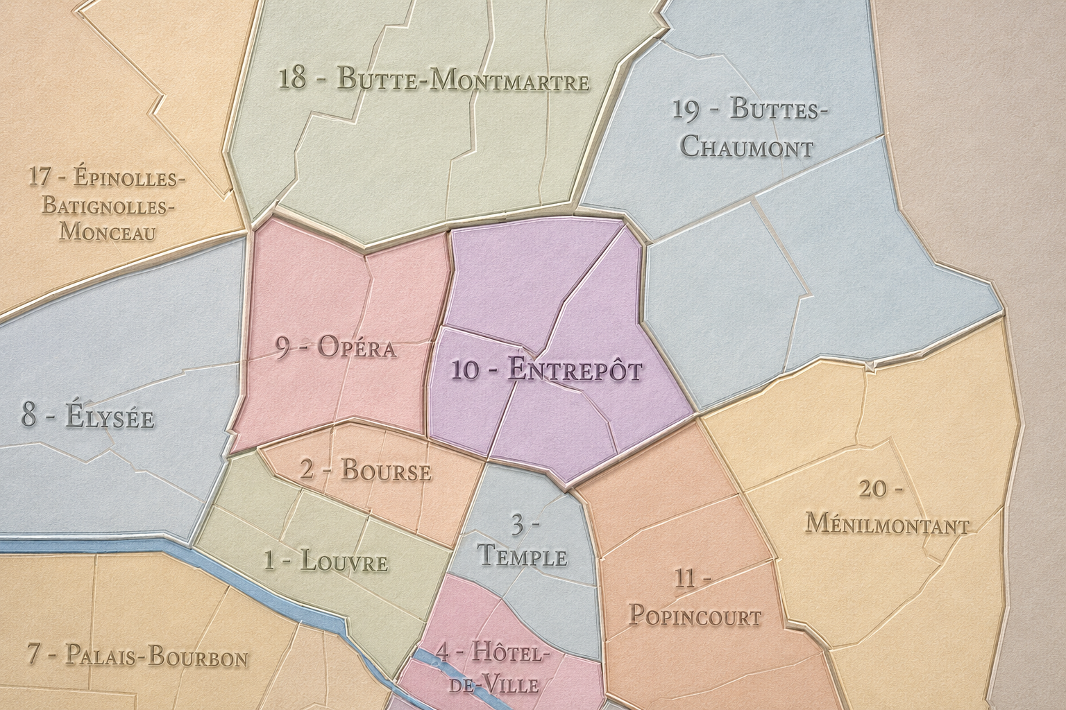
Part of an ongoing project to walk and photograph every neighborhood in Paris, this page explores the 10th Arrondissement: Entrepôt through maps, district identity, history, and photography.



The Map
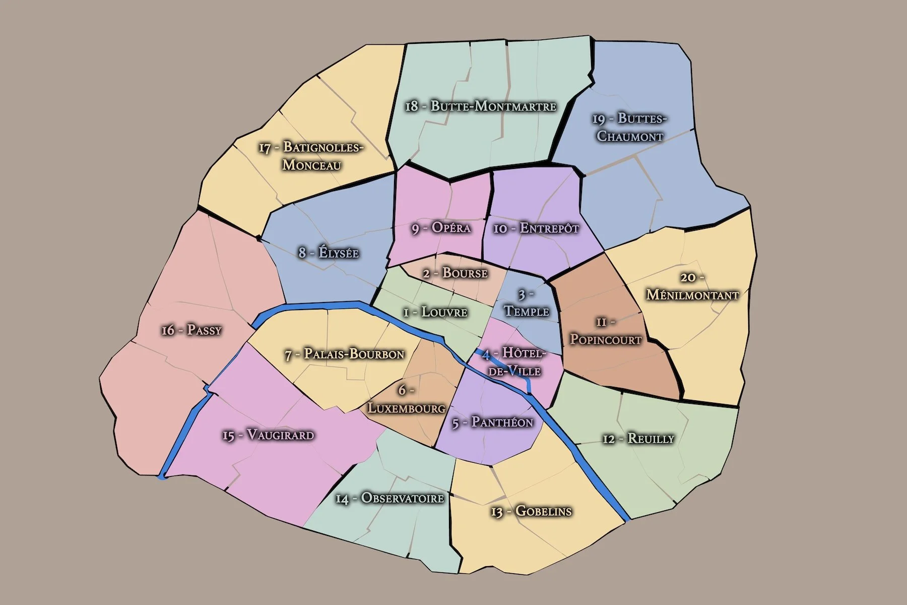
Download the Paris Arrondissements Map
Geographic Setting
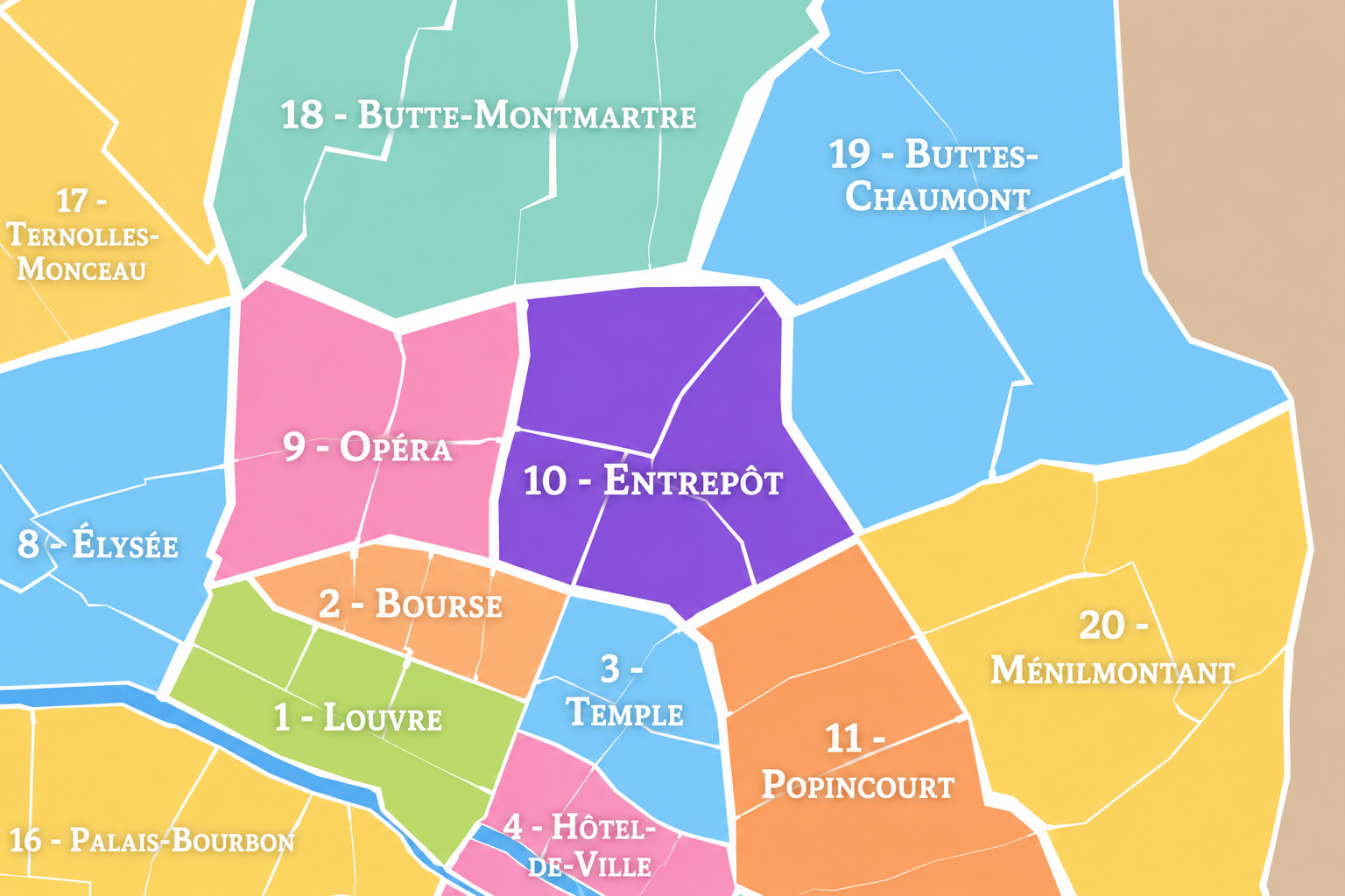
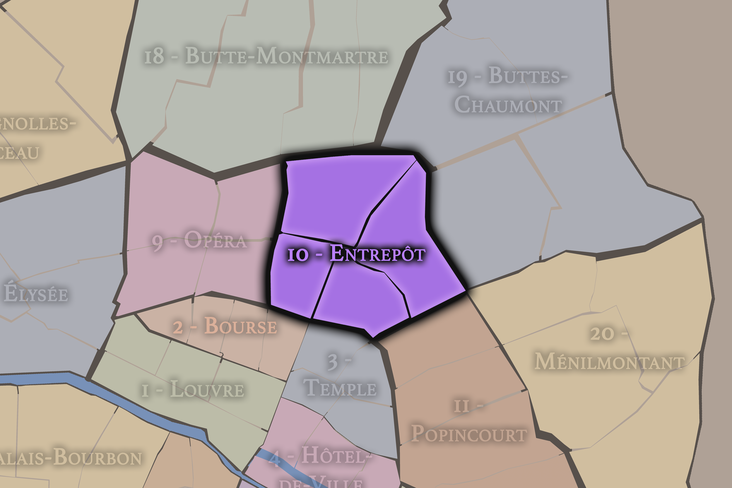
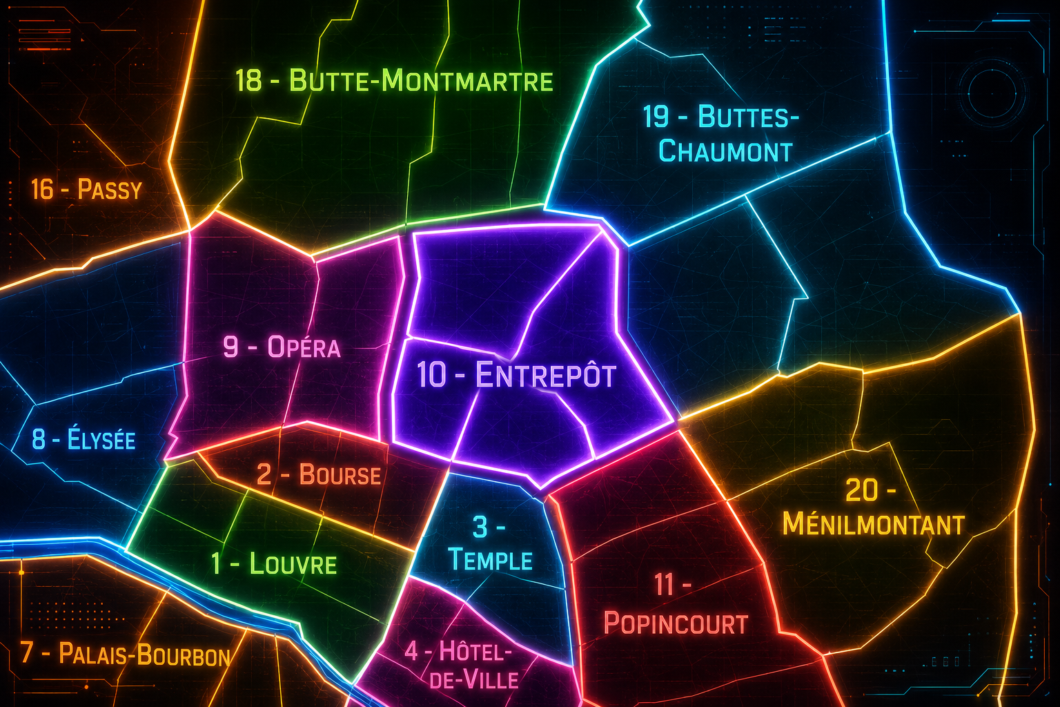
The 10e arrondissement occupies a dynamic position on the Right Bank of Paris, northeast of the historic center and between several of the city’s most important corridors of movement. It is bordered by the 9e arrondissement to the west, the 11e to the south, the 18e and 19e to the north, and the 3e and 2e farther southwest through the older central districts. Its geography is defined less by royal monuments or ceremonial axes than by stations, canals, boulevards, working streets, immigrant communities, and the movement of people and goods.
The arrondissement is one of Paris’s great arrival districts. It contains two of the city’s major railway stations, Gare du Nord and Gare de l’Est, whose tracks, approaches, and surrounding streets connect Paris to northern France, eastern France, Belgium, Germany, the Netherlands, and beyond. It also contains the Canal Saint-Martin, whose locks, bridges, quays, and warehouses give the arrondissement one of its most distinctive urban landscapes.
The 10e arrondissement is divided into four administrative quarters: Saint-Vincent-de-Paul, Porte-Saint-Denis, Porte-Saint-Martin, and Hôpital-Saint-Louis. Together, they form a district of thresholds: railway arrival, former city gates, canal infrastructure, hospital grounds, working-class streets, theaters, immigrant corridors, cafés, workshops, and increasingly fashionable residential and nightlife areas. The 10e is a Paris of passage and exchange — a district where the city is entered, crossed, supplied, and continually transformed.
Arrondissement Identity
Etymology and Origins
The arrondissement’s administrative name, Entrepôt, means warehouse or depot, and it points directly to the district’s historical relationship with storage, transport, goods, and infrastructure. Unlike names such as Louvre, Panthéon, or Opéra, which identify the arrondissement through a famous monument, Entrepôt identifies the 10e through function. It is a name rooted in circulation: where materials are received, held, transferred, and redistributed.
This name fits the arrondissement’s geography. The Canal Saint-Martin, opened in the 19th century, made the district an important corridor for goods and waterborne transport. The railway stations added another scale of movement, turning the arrondissement into one of the great arrival points of modern Paris. Streets, warehouses, workshops, markets, hospitals, hotels, cafés, and immigrant businesses developed around these networks.
The origins of the district, however, are older than the canal and railways. The future 10e grew beyond the older city walls along roads leading north and east. The names Porte-Saint-Denis and Porte-Saint-Martin recall former gates and approaches into Paris, while the surrounding faubourgs developed as working and transitional districts beyond the medieval and early modern center. The name Entrepôt captures the arrondissement’s modern identity, but its deeper origins lie in gates, roads, outskirts, labor, and movement.
The 10e arrondissement is one of the twenty municipal arrondissements of Paris and remains a distinct local civic unit with its own mairie. It is not part of Paris Centre, which includes only the 1er, 2e, 3e, and 4e arrondissements. Its civic identity is shaped by its role as a dense residential district, a transportation hub, a canal district, and a historically working-class part of northeastern Paris.
The arrondissement’s four administrative quarters — Saint-Vincent-de-Paul, Porte-Saint-Denis, Porte-Saint-Martin, and Hôpital-Saint-Louis — provide its official internal structure. These quarters are especially useful because the 10e is often described through specific landmarks or moods: Gare du Nord, Gare de l’Est, Canal Saint-Martin, Strasbourg-Saint-Denis, République, or the theater district near the old gates. The official quarters help reveal the arrondissement’s broader internal geography.
For this project, the 10e is treated as both an official geographic layer and a cultural-historical district. Its civic framework helps distinguish the arrondissement from adjacent identities such as the 9e’s Opéra and boulevard culture, the 11e’s revolutionary and nightlife geography, the 18e’s Montmartre and northern faubourgs, and the 19e’s canal and park landscapes. The 10e is the connecting district among them: a place of arrivals, infrastructure, transition, and cultural mixture.
Civic Framework
Parisian Identity
The 10e arrondissement holds a distinctive place in Paris as one of the city’s great districts of movement and encounter. It is not the Paris of monumental stillness, but the Paris of stations, canals, boulevards, cafés, immigrant storefronts, hotels, commuters, travelers, workers, students, artists, and residents moving through layered urban corridors.
Its Parisian identity is closely tied to arrival. Gare du Nord and Gare de l’Est bring the world into Paris with a force that few other districts experience. The streets around them carry the intensity of travel: luggage, taxis, metro entrances, cafés, fast meals, hotels, waiting, departure, return. The Canal Saint-Martin gives the arrondissement another rhythm: slower, water-bound, reflective, and social, with bridges and quays that have become among the most recognizable public spaces in contemporary Paris.
The 10e also represents a multicultural and working Paris. Its history includes labor, warehousing, transport, hospitals, theaters, printing, small commerce, immigration, and neighborhood adaptation. In the Parisian imagination, it can feel gritty, lively, youthful, diverse, crowded, restless, and increasingly fashionable. Its identity lies in the tension between edge and center: it is deeply connected to the heart of Paris, yet shaped by the energies of the city’s northeastern thresholds.
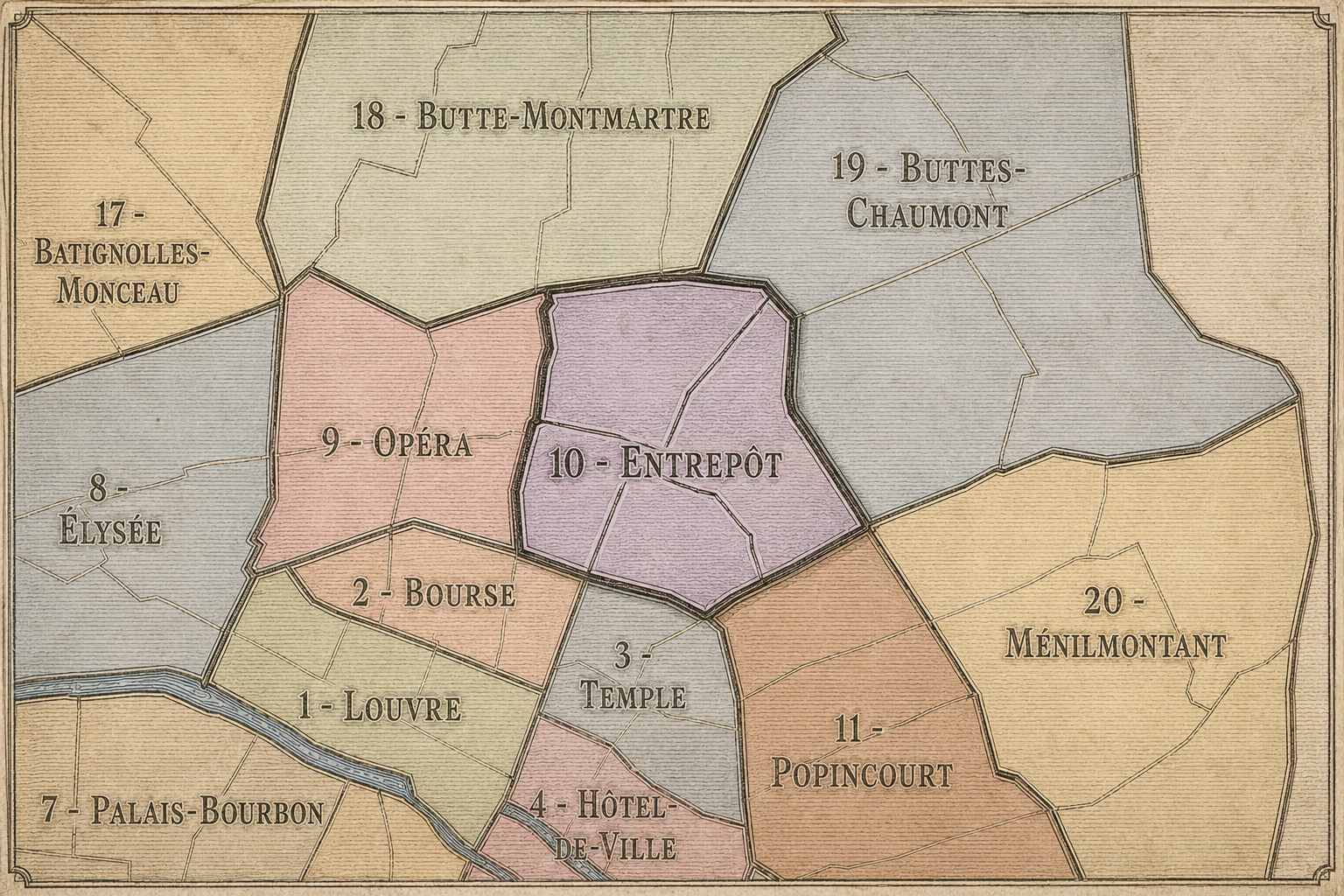
The 10e arrondissement is distinguished by its infrastructure and permeability. Many arrondissements are defined by monuments, gardens, or residential identity; the 10e is defined by flows. Trains, canals, boulevards, former gates, metro lines, migrant routes, commercial streets, and pedestrian corridors all cross through it. It is one of the places where Paris feels most connected to elsewhere.
Its four administrative quarters express this range. Saint-Vincent-de-Paul contains the great railway stations and the institutions and streets around them. Porte-Saint-Denis is tied to old city gates, boulevards, theaters, dense commerce, and the corridor toward Strasbourg-Saint-Denis. Porte-Saint-Martin connects the old gate and theater landscape with the Canal Saint-Martin and the approaches toward République. Hôpital-Saint-Louis gives the arrondissement a more residential, medical, and canal-adjacent identity, centered on the historic hospital and the streets leading toward the 11e and 19e.
The arrondissement’s distinction also comes from its social complexity. It can feel chaotic near the stations, elegant and theatrical near the old gates, relaxed and stylish along the canal, densely residential around Hôpital-Saint-Louis, and intensely urban around Boulevard de Strasbourg, Rue du Faubourg-Saint-Denis, and Rue du Château-d’Eau. The 10e is not a district of one image. It is a district of crossings, and its character changes block by block.
Neighborhood Distinction
Les Quartiers Administratifs
Administrative Quarters
The Four Administrative Quarters
Each Paris arrondissement is divided into four official administrative quarters. These smaller districts reveal older place-names, local histories, civic boundaries, and neighborhood identities.
-
Saint-Vincent-de-Paul
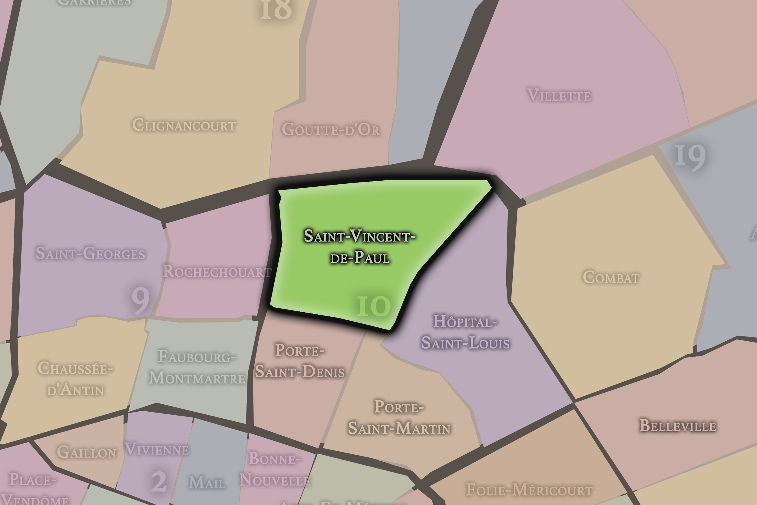
Saint-Vincent-de-Paul occupies the northern and northwestern portion of the 10e arrondissement and contains two of Paris’s major railway stations: Gare du Nord and Gare de l’Est. Its name comes from the church of Saint-Vincent-de-Paul, whose elevated position and broad steps give the quarter one of its major landmarks.
This quarter gives the 10e its strongest identity as an arrival district. Around the stations, the arrondissement becomes a landscape of travel, hotels, cafés, transport infrastructure, commuters, visitors, workers, and international movement. Saint-Vincent-de-Paul is one of the places where Paris is most visibly connected to other regions and countries. Its streets carry the tension of transit: constant movement, density, impatience, welcome, departure, and return.
-
Porte-Saint-Denis
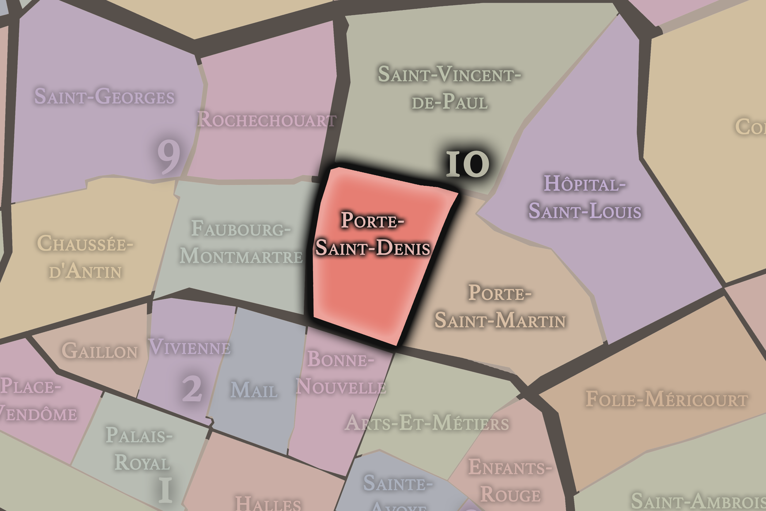
Porte-Saint-Denis occupies the southwestern portion of the 10e arrondissement and takes its name from the monumental gateway on the Boulevard Saint-Denis. The gate recalls the former city boundary and the old road leading north toward Saint-Denis. Around it, the quarter developed into a dense urban corridor of boulevards, theaters, shops, restaurants, hotels, and commercial streets.
This quarter gives the 10e one of its strongest connections to the old boulevard culture of Paris. It is theatrical, commercial, and transitional, shaped by the movement between the older center and the northern faubourgs. Porte-Saint-Denis also carries the contemporary energy of Strasbourg-Saint-Denis, where nightlife, restaurants, immigrant businesses, fashion, and street culture have made the quarter one of the most vivid crossroads of central-northeastern Paris.
-
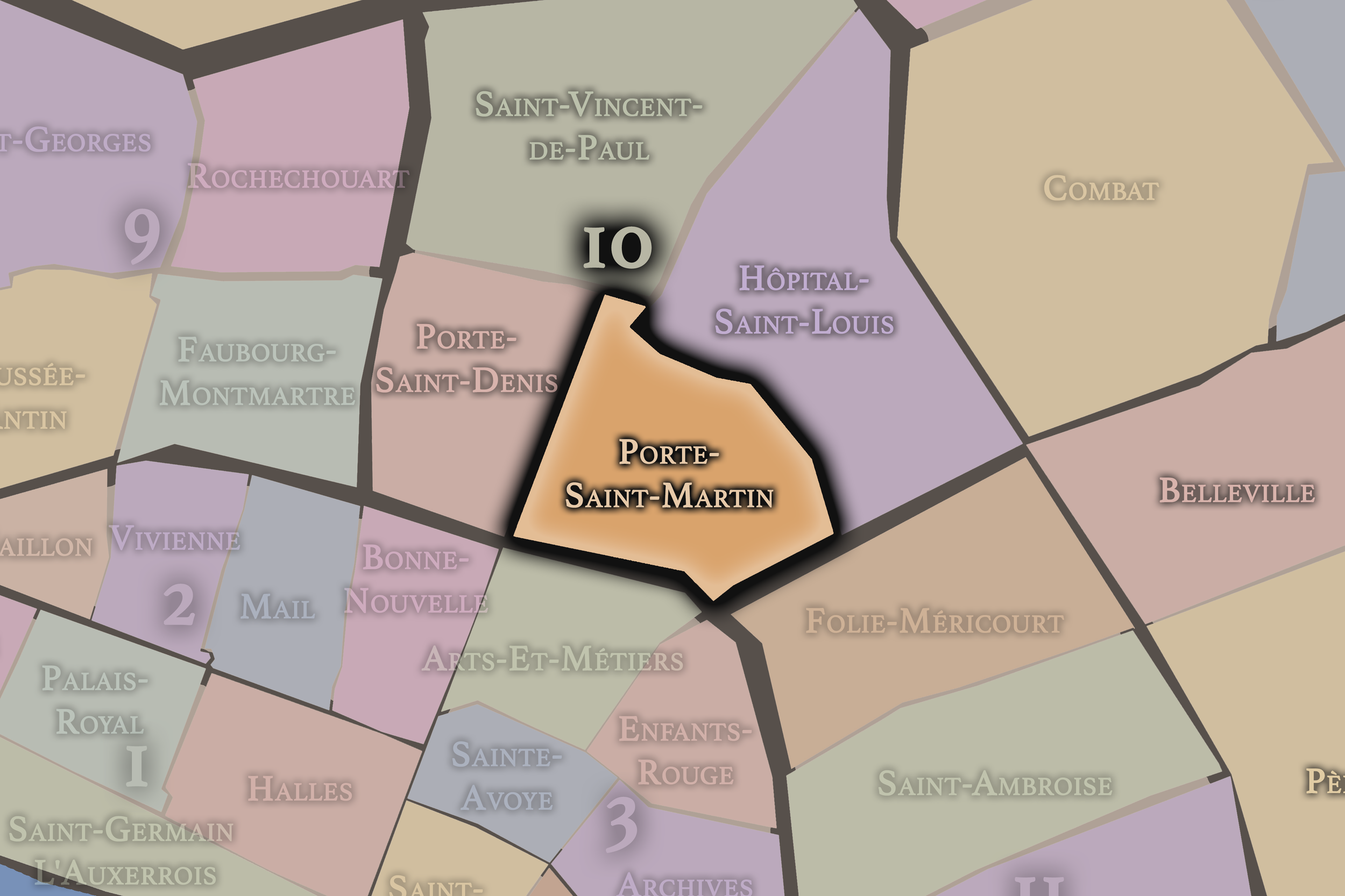
Porte-Saint-Martin
Porte-Saint-Martin occupies the southeastern portion of the 10e arrondissement, around the monumental Porte Saint-Martin and the streets leading toward République and the Canal Saint-Martin. Like Porte-Saint-Denis, its name recalls a former gate and a historic route out of the city. The quarter’s identity is shaped by theaters, boulevards, old approaches, canal edges, and the transition between central Paris and the eastern districts.
This quarter gives the arrondissement a strong sense of layered passage. It belongs to the old gate landscape, the theatrical boulevard tradition, and the canal city all at once. Porte-Saint-Martin is where the 10e’s infrastructure begins to soften into public space: bridges, quays, cafés, theaters, and neighborhood streets create a mixed environment of movement, leisure, and urban memory.
-
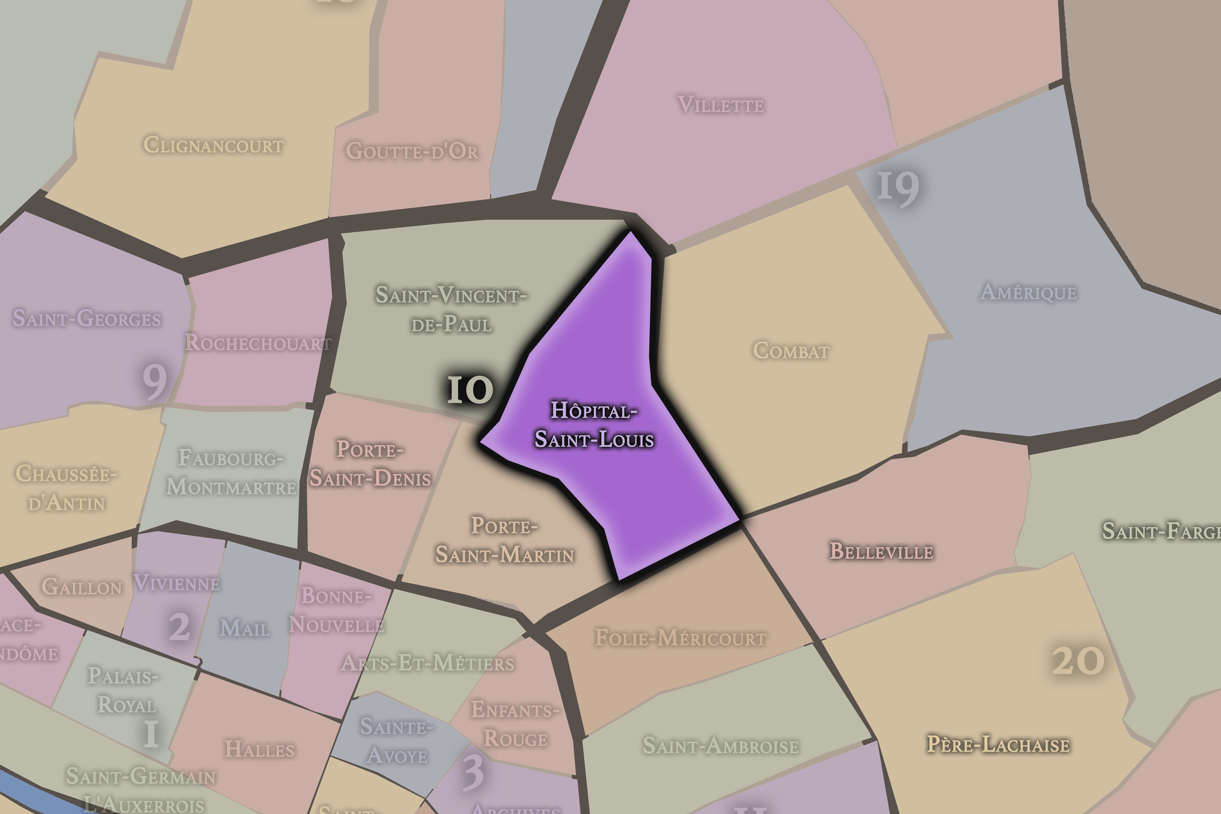
Hôpital-Saint-Louis
Hôpital-Saint-Louis occupies the northeastern portion of the 10e arrondissement and takes its name from the historic hospital founded in the early 17th century. The hospital’s enclosed grounds, brick architecture, and institutional presence give the quarter a distinct identity within the arrondissement. It is less defined by the railway intensity of Saint-Vincent-de-Paul or the boulevard life of the old gates, and more by medical history, residential streets, and proximity to the Canal Saint-Martin.
This quarter gives the 10e a calmer but deeply important layer. Hôpital-Saint-Louis connects the arrondissement to public health, care, and long institutional continuity. Around the hospital and the canal, the district becomes more residential, neighborhood-scaled, and increasingly associated with cafés, shops, design, nightlife, and the contemporary appeal of the Canal Saint-Martin area. It is one of the places where the arrondissement’s working and institutional past has been most visibly reinterpreted in the present.
The History
The origins of the 10e arrondissement lie in the northern and northeastern expansion of Paris beyond the older Right Bank core. Before it became a district of railway stations, canals, warehouses, and boulevards, this area was shaped by routes leading out of the city, land near former fortifications, religious institutions, scattered settlements, and the early development of faubourgs.
The names Porte-Saint-Denis and Porte-Saint-Martin preserve the memory of gateways and approaches. These were not merely points on a map; they were thresholds between the enclosed city and the roads beyond it. The future arrondissement grew from this condition of passage. It was a place where people, goods, and roads moved between Paris and the outside world.
This origin as a threshold would remain central to the district’s identity. The 10e began not as a ceremonial center or a wealthy residential quarter, but as an edge zone — practical, transitional, and connected to the routes that supplied and extended the city.
Origins
16th–17th Century
During the 16th and 17th centuries, the future 10e arrondissement became more closely integrated into the expanding urban life of Paris. The areas around the northern and eastern approaches developed through faubourgs, workshops, religious communities, hospitals, and roads leading beyond the city.
The founding of Hôpital Saint-Louis in the early 17th century gave the district one of its most enduring institutions. Built outside the densest parts of the city, the hospital reflected concerns with public health, containment, and care. Its placement in this part of Paris speaks to the district’s historical role as a practical edge of the city: close enough to serve Paris, but outside the most crowded center.
The old gateways and roads continued to structure movement through the area. By the end of the 17th century, the future 10e had become a district of approaches, institutions, and early faubourg growth, setting the stage for later transformations by boulevard, canal, warehouse, and rail.
In the 18th century, the future 10e arrondissement continued to develop along the northern and eastern routes out of Paris. The transformation of former defensive edges into boulevards gave the district new importance as a place of circulation, public sociability, and commercial activity. The Porte-Saint-Denis and Porte-Saint-Martin areas became part of the broader boulevard landscape that connected the older city to its expanding faubourgs.
The district remained more practical than aristocratic. Its streets and outskirts supported trades, small industries, inns, workshops, markets, religious sites, and institutions serving the growing capital. It was a place of work and passage rather than courtly residence or monumental display.
By the end of the 18th century, the future 10e was positioned for the infrastructure revolutions of the 19th century. Its existing role as an edge and corridor made it well suited to receive canals, warehouses, new roads, railways, and the industrial and commercial functions that would define its modern identity.
18th Century
19th Century
The 19th century transformed the 10e arrondissement more dramatically than any earlier period. The Canal Saint-Martin, opened in the early 19th century, gave the district a new infrastructure of water, locks, basins, warehouses, and commercial movement. It helped link the Seine to the Canal de l’Ourcq and supported the movement of goods through northeastern Paris.
The arrival of the railway stations further intensified the arrondissement’s role as a gateway. Gare de l’Est and Gare du Nord became major points of arrival and departure, reshaping the surrounding streets with hotels, cafés, transport services, offices, and dense pedestrian movement. Rail gave the 10e a new scale of connection, tying Paris to national and international routes.
The old gate and boulevard landscapes also continued to matter. Porte-Saint-Denis and Porte-Saint-Martin remained monuments to former boundaries while the surrounding boulevards supported theaters, commerce, and public life. The arrondissement became a layered district of old gates, new stations, canal infrastructure, warehouses, and working streets.
By the end of the 19th century, the 10e had become one of Paris’s central districts of infrastructure and urban modernity. It was not monumental in the ceremonial sense, but it was essential to how the city moved, worked, received, and supplied itself.
In the early and mid 20th century, the 10e arrondissement remained closely tied to transport, labor, immigration, and working urban life. Gare du Nord and Gare de l’Est continued to shape the district as a point of arrival, while the canal, workshops, small businesses, hotels, and warehouses sustained its practical identity.
The arrondissement also became increasingly associated with diverse populations and movement between Paris and elsewhere. The railway stations and surrounding streets brought travelers, migrants, workers, and temporary residents into close contact. This gave the 10e a social mixture different from more residential or elite districts to the west.
The Canal Saint-Martin area, while still tied to practical infrastructure, also developed a strong neighborhood presence. Its bridges, locks, and quays shaped daily life, even when the canal’s industrial importance began to shift. The district’s identity during this period remained grounded in work, arrival, and adaptation.
The 10e’s early and mid 20th-century history was also marked by the wider upheavals of war, occupation, reconstruction, and economic change. Through those pressures, the arrondissement retained its character as a dense, mixed, resilient district of everyday Paris.
Early–Mid 20th Century
Late 20th Century
The late 20th century brought significant social and cultural transformation to the 10e arrondissement. As industrial and warehouse functions declined or changed, older infrastructure landscapes began to be reinterpreted. The Canal Saint-Martin, once strongly associated with transport and work, became increasingly valued as a neighborhood amenity, public space, and cultural landscape.
The areas around the stations remained dense and complex, continuing to absorb migration, tourism, commuting, hotels, commerce, and social tension. Gare du Nord in particular reinforced the arrondissement’s international identity, connecting Paris to northern Europe and making the surrounding streets some of the city’s most diverse and heavily used.
The boulevard and gate areas also evolved. Strasbourg-Saint-Denis, Château-d’Eau, and the streets around Porte-Saint-Denis and Porte-Saint-Martin became associated with immigrant businesses, wholesale activity, restaurants, nightlife, and changing patterns of urban culture. The arrondissement’s reputation remained mixed: lively, difficult, creative, diverse, and rapidly changing.
By the end of the 20th century, the 10e had begun to acquire a new identity layered onto its older working and infrastructural history. It was becoming a district where industrial memory, multicultural commerce, nightlife, and neighborhood reinvention coexisted.
In the 21st century, the 10e arrondissement has become one of the most visibly changing districts in central Paris. The Canal Saint-Martin has emerged as a major social and cultural landscape, associated with cafés, restaurants, design shops, bookstores, nightlife, and public gathering along the water. Its bridges and quays have become defining images of contemporary northeastern Paris.
At the same time, the arrondissement remains shaped by intense infrastructure. Gare du Nord and Gare de l’Est continue to bring enormous flows of passengers, commuters, tourists, and international travelers into the district. The areas around the stations face ongoing challenges and debates around crowding, public space, security, homelessness, commerce, and redevelopment, even as they remain essential to the life of the city.
The 10e also continues to be one of Paris’s important multicultural districts. Its streets hold layers of South Asian, African, Turkish, Kurdish, Middle Eastern, and other immigrant histories and businesses, alongside newer restaurants, boutiques, creative offices, and residential reinvestment. This mixture gives the arrondissement its contemporary energy, but also places it at the center of debates about gentrification, displacement, and the changing meaning of neighborhood life.
Today, the 10e is both fashionable and unsettled, historic and provisional, local and international. It remains a district of arrival — not only by train, but by culture, identity, and reinvention.
21st Century
Spirit and Legacy
The 10e arrondissement is Paris as passage. Its legacy lies in movement: gates, roads, canals, railways, boulevards, stations, quays, hotels, markets, and streets that have carried people and goods into, out of, and across the city.
It is not the Paris of royal stillness or monumental order. It is the Paris of thresholds: the station platform, the canal bridge, the old gate, the crowded boulevard, the immigrant storefront, the hotel street, the neighborhood café, the lock opening to water. Its identity has always depended on connection.
The name Entrepôt captures more than warehousing. It captures a way of being urban. The 10e receives, stores, transforms, and redistributes the energies of the city. Its streets have absorbed labor, migration, infrastructure, commerce, nightlife, and cultural reinvention. To understand the 10e is to understand Paris as a living system — restless, connected, diverse, and always in motion.
The Photography
The arrondissements do not share a single visual identity. Instead, they organize Paris into twenty broad visual fields, each gathering its own combination of landmarks, streetscapes, institutions, residential districts, commercial corridors, parks, rail stations, markets, cemeteries, and riverfront edges.
Some arrondissements are defined by monumental scale: royal palaces, ceremonial avenues, government buildings, museums, formal gardens, and internationally recognized landmarks. Others are shaped by hills, canals, rail gateways, apartment-lined boulevards, neighborhood markets, former village streets, industrial remnants, parks, or the quieter rhythms of residential Paris. The arrondissement system gives these varied landscapes a civic frame, allowing the city to be read not as one visual language, but as a sequence of overlapping Parisian atmospheres.

Visual Identity
Through The Lens
Photographing the arrondissements means moving between the official map and the street-level experience. The camera does not treat each arrondissement as visually uniform. Instead, it looks for the recurring forms, textures, transitions, and contrasts that make each district legible: the geometry of boulevards, the shade of plane trees, the repetition of balconies, the rise of stairways, the curve of canals, the presence of rail stations, the opening of parks, the weight of monuments, and the intimacy of side streets.
On CityNeighborhoods, the arrondissement provides the frame, but the photograph comes from the encounter between map, movement, light, and observation. As the Paris photography is processed, this section will connect each arrondissement more directly to the project’s Photographic Lexicon: the visual strategies, recurring motifs, and compositional patterns that shape how the city is seen through the lens.

If you visit Paris, these ideas can help inspire your own photography.



Paris: J’Espere, Je Rêve, Je Vive
Paris Photo Gallery
Paris Field Notes
-
Field Note: August 18, 2025 | 07:58 AM
Conditions: 73°F | Humidity: 72%.
Within the park's interior, the glacial kettle ponds acted as humidity traps, creating a soft, hazy light that filtered through the old-growth oaks. The transition from the park's dense shade to the sun-drenched edges of Oakland Gardens highlighted the day's exceptional "picture-perfect" clarity.
There is a fleeting window in Queens where the humidity of August hasn't yet heavy-set, and the morning sun hits the canopy of Alley Pond Park at a perfect oblique angle. Arriving just before 8:00 AM, I watched the light break through the oaks and tulip trees, casting long, dramatic shadows across the wet grass. It’s in these quiet, golden moments that the park feels less like a city escape and more like the ancient glacial valley it actually is.
Other neighborhoods visited:











































































































Explore Paris
-

The twenty arrondissements form the civic spiral of Paris, organizing the city into its broad local districts of government, identity, and daily life.
-

Each arrondissement is divided into four official administrative quarters, giving Paris a more precise civic and geographic framework.
-

The conseils de quartier bring participation to street level, giving residents a voice in neighborhood needs, public space, and local civic life.
-

Les Deux Rives trace Paris through the Seine’s two banks, revealing how the Rive Droite and Rive Gauche shaped the city’s civic power, commerce, learning, art, and cultural identity.
-

Cultural neighborhoods reveal the Paris people recognize through history, cafés, architecture, memory, atmosphere, and local belonging.