
12e - REUILLY
Arrondissements
Part of an ongoing project to walk and photograph every neighborhood in Paris, this page explores the 12th Arrondissement: Reuilly through maps, district identity, history, and photography.



The Map
Download the Paris Arrondissements Map
Geographic Setting
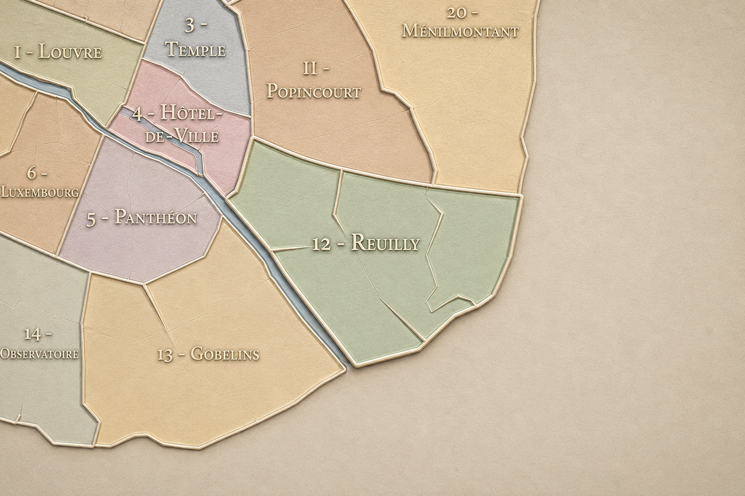
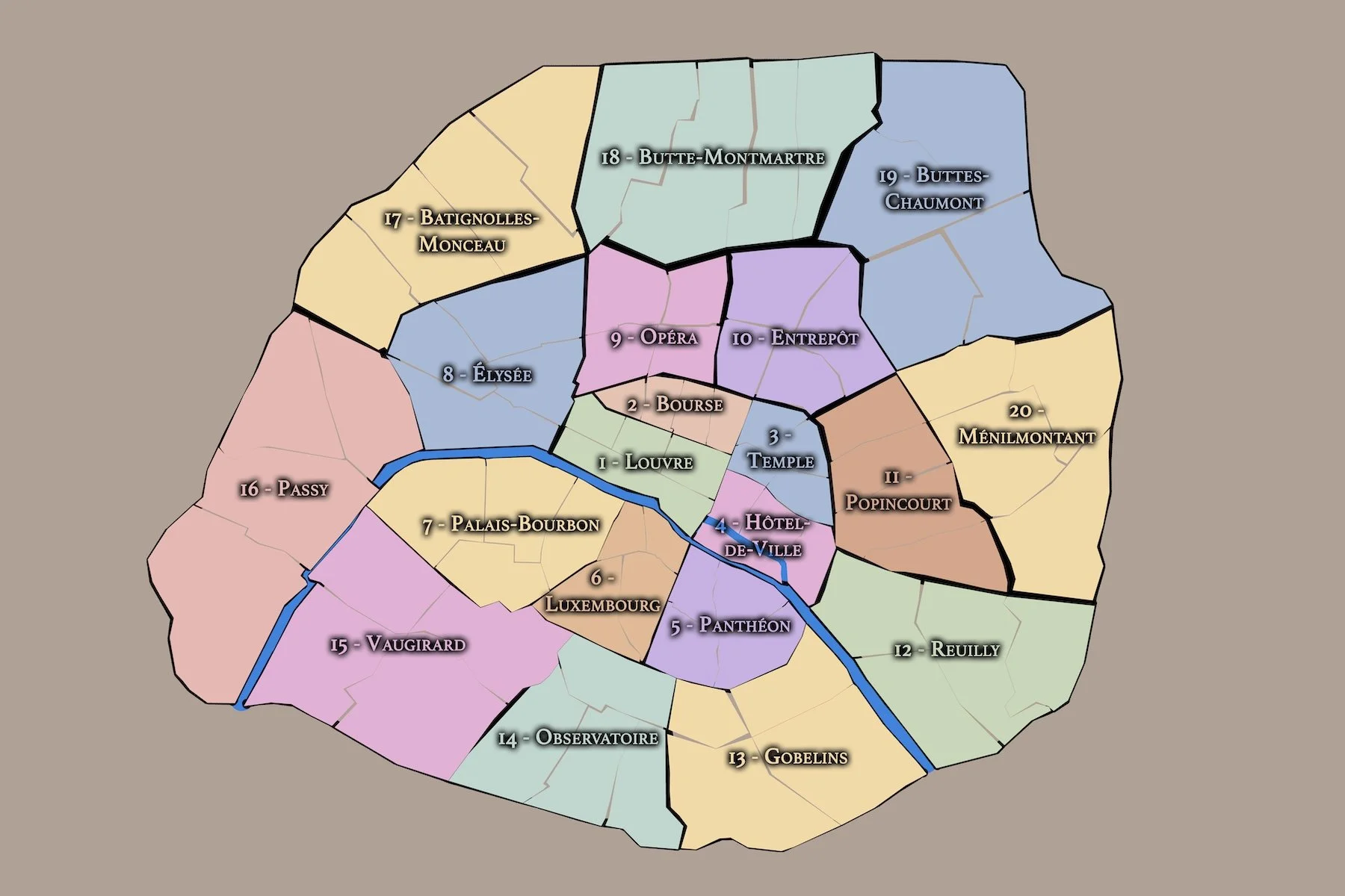
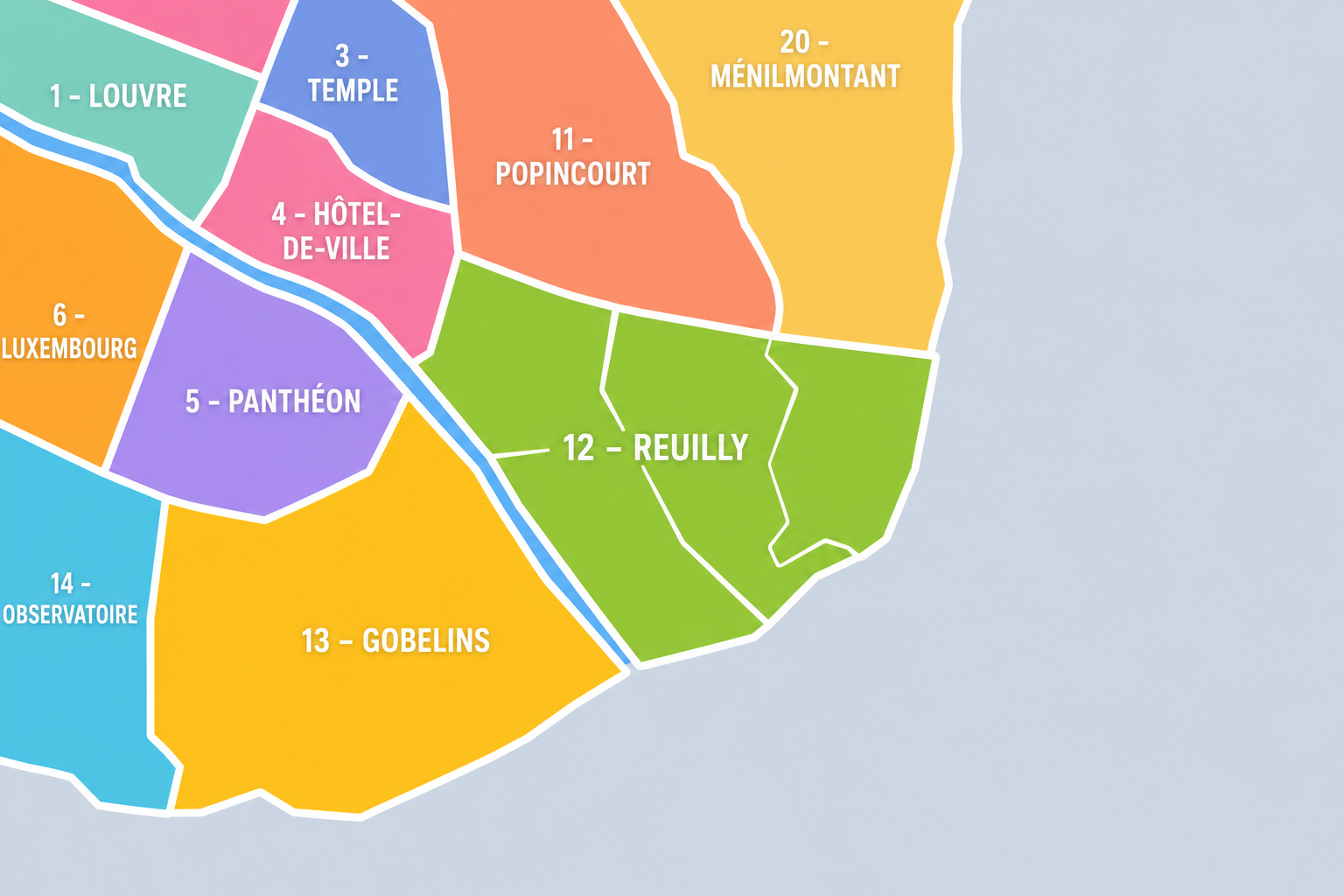
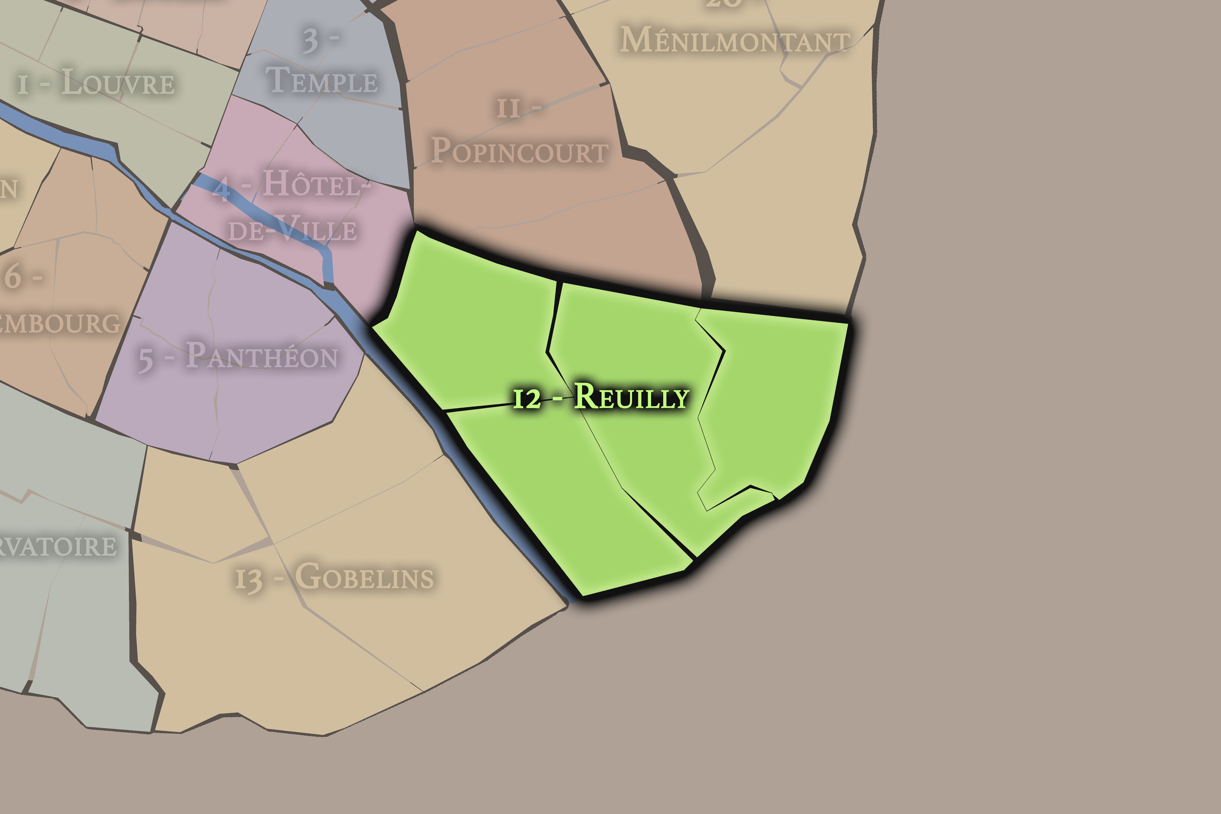
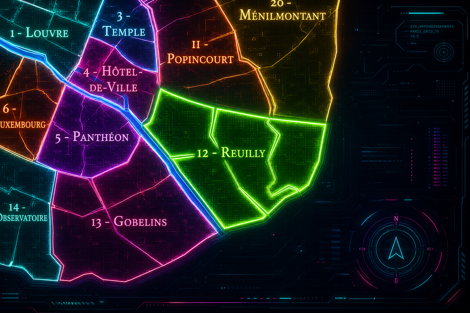
The 12e arrondissement occupies the southeastern edge of Paris, where the dense historic city opens toward the Seine, the Bois de Vincennes, and the routes leading out toward the eastern suburbs. It is bordered by the 11e to the north, the 20e to the northeast, the 4e near the Bastille edge, and the 13e across the Seine. To the east, it extends dramatically into the Bois de Vincennes, giving the arrondissement one of the largest green landscapes within the administrative boundaries of Paris.
Its geography is defined by movement and transition. The arrondissement stretches from the Bastille and Gare de Lyon area through the Faubourg Saint-Antoine, Quinze-Vingts, Reuilly, Picpus, Daumesnil, Bel-Air, Bercy, and the Bois de Vincennes. It includes major railway infrastructure, old artisan streets, former wine warehouses, hospital and religious institutions, residential boulevards, parks, riverfront redevelopment, and one of the city’s most important eastern green corridors.
The 12e arrondissement is divided into four administrative quarters: Bel-Air, Picpus, Bercy, and Quinze-Vingts. Together, they form a district of remarkable range. Quinze-Vingts connects the arrondissement to Bastille, Gare de Lyon, and the old artisan world of the Faubourg Saint-Antoine. Bercy links it to the Seine, former wine trade, warehouse landscapes, and modern redevelopment. Picpus carries religious, residential, and revolutionary memory. Bel-Air extends toward Daumesnil, the eastern residential city, and the Bois de Vincennes.
The 12e is therefore a threshold arrondissement: between old Paris and the eastern suburbs, between artisan faubourg and modern transport hub, between river industry and parkland, between dense neighborhoods and the expansive green of the Bois de Vincennes.
Arrondissement Identity
Etymology and Origins
The arrondissement’s administrative name, Reuilly, comes from an old local place-name associated with the eastern side of Paris. Reuilly recalls a former settlement and estate landscape that predated the modern arrondissement, preserving the memory of an older suburban and semi-rural geography beyond the dense medieval city.
Unlike names such as Louvre, Opéra, or Panthéon, Reuilly does not identify the arrondissement through a single globally famous monument. Instead, it points to the older eastern terrain out of which the arrondissement developed: roads, villages, religious properties, estates, fields, routes toward Vincennes, and eventually the expanding urban fabric of southeastern Paris. The name carries the memory of a Paris that grew outward through faubourgs and localities before being absorbed into the modern city.
The deeper origins of the arrondissement are tied to the movement east from the Bastille and the old city gates. The Faubourg Saint-Antoine, the route toward Vincennes, the lands around Picpus and Reuilly, and the riverfront at Bercy all shaped the district long before the 12e existed as an administrative unit. Its identity developed from work, transport, agriculture, religious life, royal routes, and the gradual incorporation of eastern lands into Paris.
The 12e arrondissement is one of the twenty municipal arrondissements of Paris and remains a distinct local civic unit with its own mairie. It is not part of Paris Centre, which groups only the 1er, 2e, 3e, and 4e arrondissements. Its civic identity is shaped by its unusual size, its residential population, its transportation infrastructure, its Seine edge, and its administrative inclusion of the Bois de Vincennes.
The arrondissement’s four administrative quarters — Bel-Air, Picpus, Bercy, and Quinze-Vingts — provide its official internal structure. These quarters are especially useful because the 12e is often understood through separate identities: Bastille, Gare de Lyon, Bercy, Daumesnil, Picpus, Reuilly, the Promenade Plantée, or the Bois de Vincennes. The official quarters help organize this complexity into a clearer civic geography.
For this project, the 12e is treated as both an official geographic layer and a cultural-historical district. Its civic framework helps distinguish the arrondissement from the artisan and nightlife identity of the 11e, the hill and cemetery landscapes of the 20e, the Left Bank redevelopment of the 13e, and the old central core to the west. The 12e is the eastern gateway of Right Bank Paris: residential, infrastructural, green, and deeply shaped by movement.
Civic Framework
Parisian Identity
The 12e arrondissement holds a distinctive place in Paris as one of the city’s great districts of transition, infrastructure, and everyday life. It is less mythologized than the central arrondissements and less internationally symbolic than the 7e or 8e, yet it contains several essential forms of Parisian identity: artisan history, railway movement, river commerce, residential boulevards, public parks, and large-scale urban reinvention.
Its Parisian identity is tied to the eastward movement of the city. The route from Bastille through the Faubourg Saint-Antoine and toward Vincennes connected old Paris to working districts, craft production, military and royal roads, and the eastern suburbs. Gare de Lyon brought national and international movement into the arrondissement, while Bercy carried the memory of wine warehouses, river trade, and later cultural redevelopment. The Promenade Plantée transformed obsolete rail infrastructure into one of Paris’s most influential green corridors.
The 12e also represents a quieter, more residential Paris. Around Daumesnil, Bel-Air, Picpus, and Reuilly, the arrondissement becomes a landscape of apartment buildings, schools, markets, churches, parks, and ordinary neighborhood life. Its identity is not built around one iconic image, but around the way Paris extends, adapts, and breathes: through stations, parks, elevated walks, riverfronts, and residential streets.
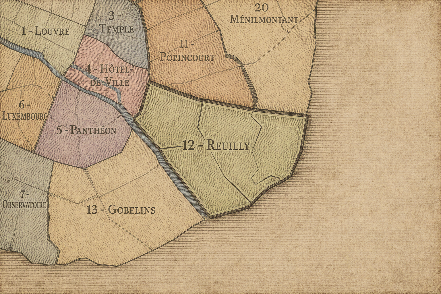
The 12e arrondissement is distinguished by its range. It contains some of the densest transport infrastructure in eastern Paris, but also one of the city’s largest green spaces. It contains old artisan corridors near Bastille, but also modern riverfront redevelopment at Bercy. It contains memorial and religious sites around Picpus, residential calm around Bel-Air, and the major arrival landscape of Gare de Lyon.
Its four administrative quarters express this variety. Quinze-Vingts connects the arrondissement to Bastille, Gare de Lyon, the Faubourg Saint-Antoine, and the western edge of the 12e. Bercy gives the arrondissement its Seine-facing and warehouse identity, later transformed through parks, cultural venues, offices, and new urban development. Picpus carries a quieter and more historical residential identity, linked to religious institutions, revolutionary memory, and the eastern expansion of Paris. Bel-Air extends toward Daumesnil and the Bois de Vincennes, giving the arrondissement its broadest residential and green identity.
The arrondissement’s distinction also lies in its relationship to edges. The 12e is an arrondissement of borders: city and suburb, river and park, rail and street, old faubourg and modern boulevard, dense city and open green. Its character is not concentrated in one symbolic center. It is a sequence of thresholds, each revealing a different way Paris has grown eastward.
Neighborhood Distinction
Les Quartiers Administratifs
Administrative Quarters
The Four Administrative Quarters
Each Paris arrondissement is divided into four official administrative quarters. These smaller districts reveal older place-names, local histories, civic boundaries, and neighborhood identities.
-
Bel-Air
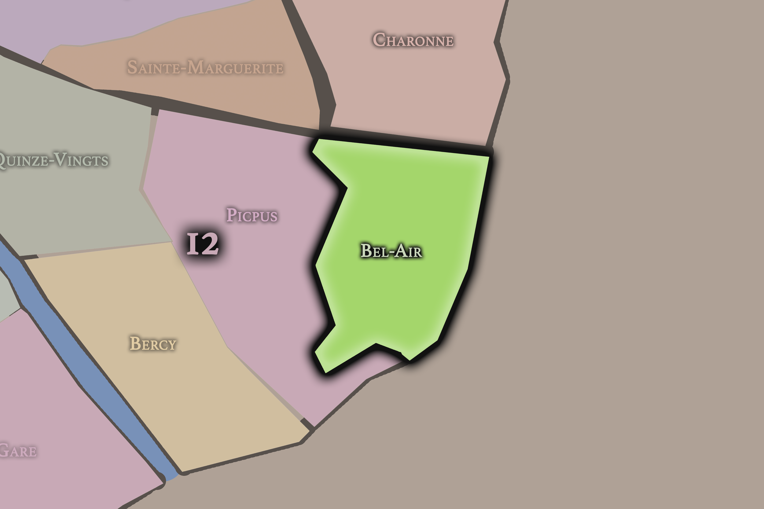
Bel-Air occupies the eastern portion of the 12e arrondissement and extends toward the Bois de Vincennes. It is one of the arrondissement’s broadest and most residential quarters, shaped by the avenues around Daumesnil, the eastern edge of the built city, and the transition into parkland. Its name suggests openness and elevation, and its identity is tied to the calmer eastern reaches of the arrondissement.
This quarter gives the 12e much of its residential and green character. Around Bel-Air, the arrondissement feels less like the dense central city and more like a planned eastern residential district connected to schools, parks, broad streets, and the Bois de Vincennes. It is one of the clearest places where Paris begins to loosen into space, trees, and neighborhood calm.
-
Bercy
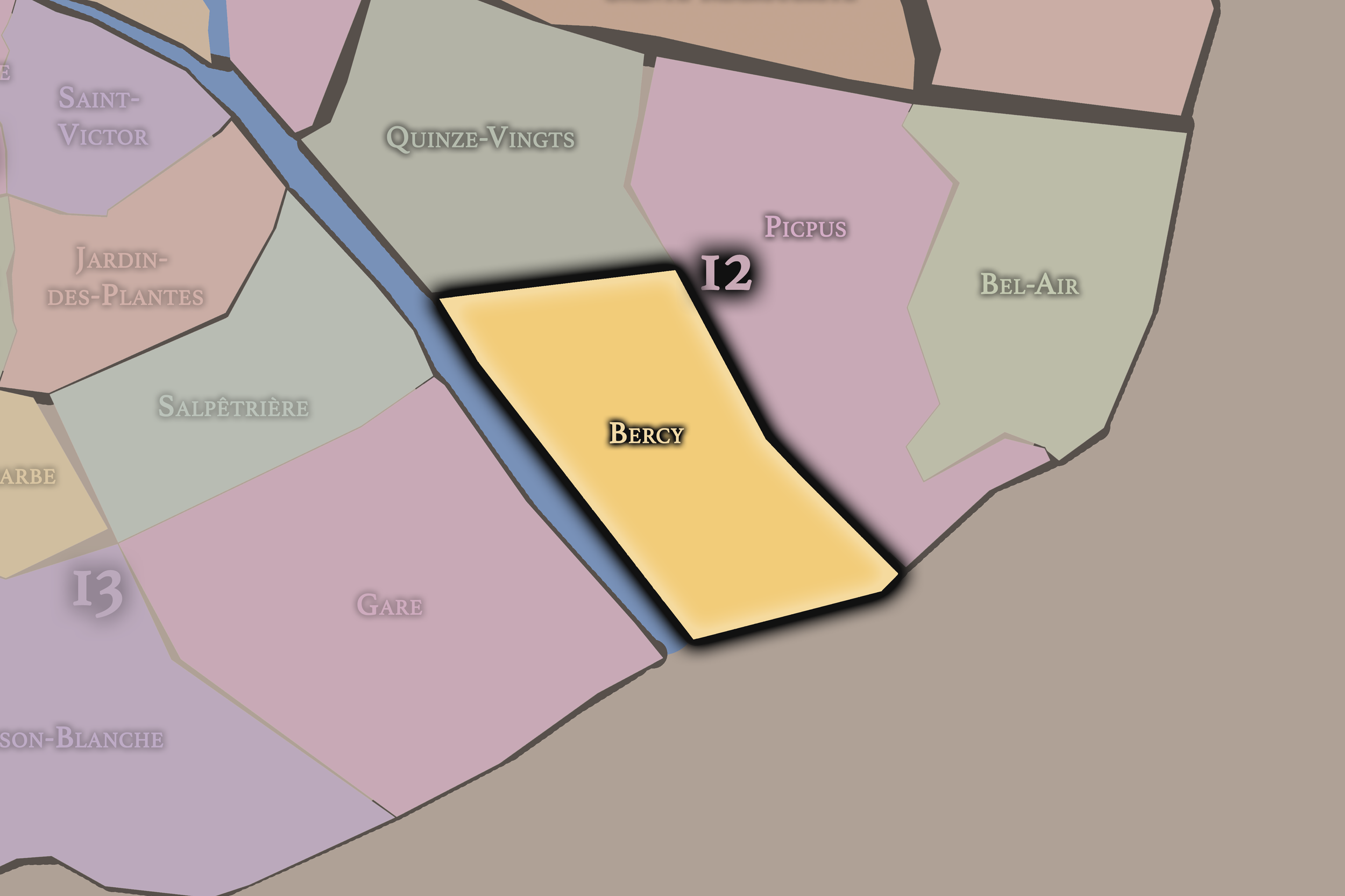
Bercy occupies the southern and southeastern portion of the arrondissement along the Seine. Its identity is strongly tied to the river and to the former wine warehouses that once made the district one of the great logistical landscapes of Paris. The name Bercy recalls a village and later a commercial district that developed along the river, where barrels, warehouses, rail, and water transport shaped the area’s form.
This quarter gives the 12e its strongest connection to commerce, redevelopment, and the Seine. The former warehouse landscape was transformed into parks, offices, cultural venues, entertainment spaces, and new residential and commercial districts. Bercy shows one of the 12e’s central themes: the reinvention of working infrastructure into public, cultural, and urban space.
-
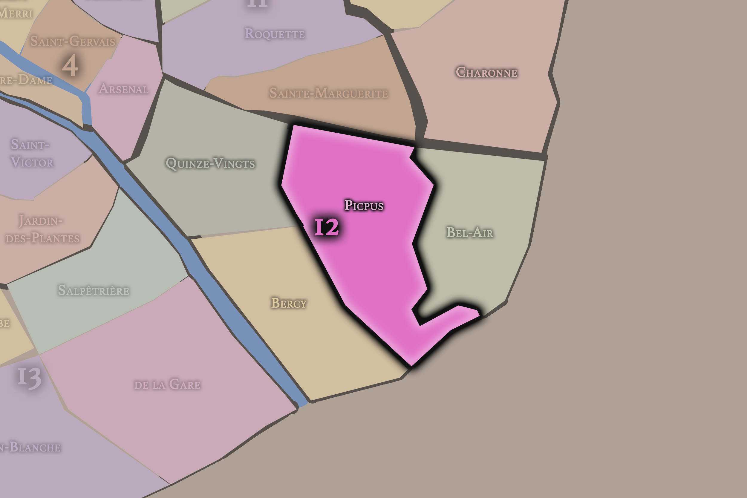
Picpus
Picpus occupies the central and northern portion of the 12e arrondissement and carries one of the district’s deepest historical names. It is associated with religious institutions, residential streets, and revolutionary memory, especially through the Picpus Cemetery and the communities connected to the area’s older religious landscape.
This quarter gives the arrondissement a quieter but historically resonant identity. Picpus is less defined by monumental spectacle than by memory, residence, and continuity. It helps anchor the 12e as more than a transportation or redevelopment district, preserving a sense of older eastern Paris through churches, schools, cemeteries, conventual memory, and neighborhood streets.
-
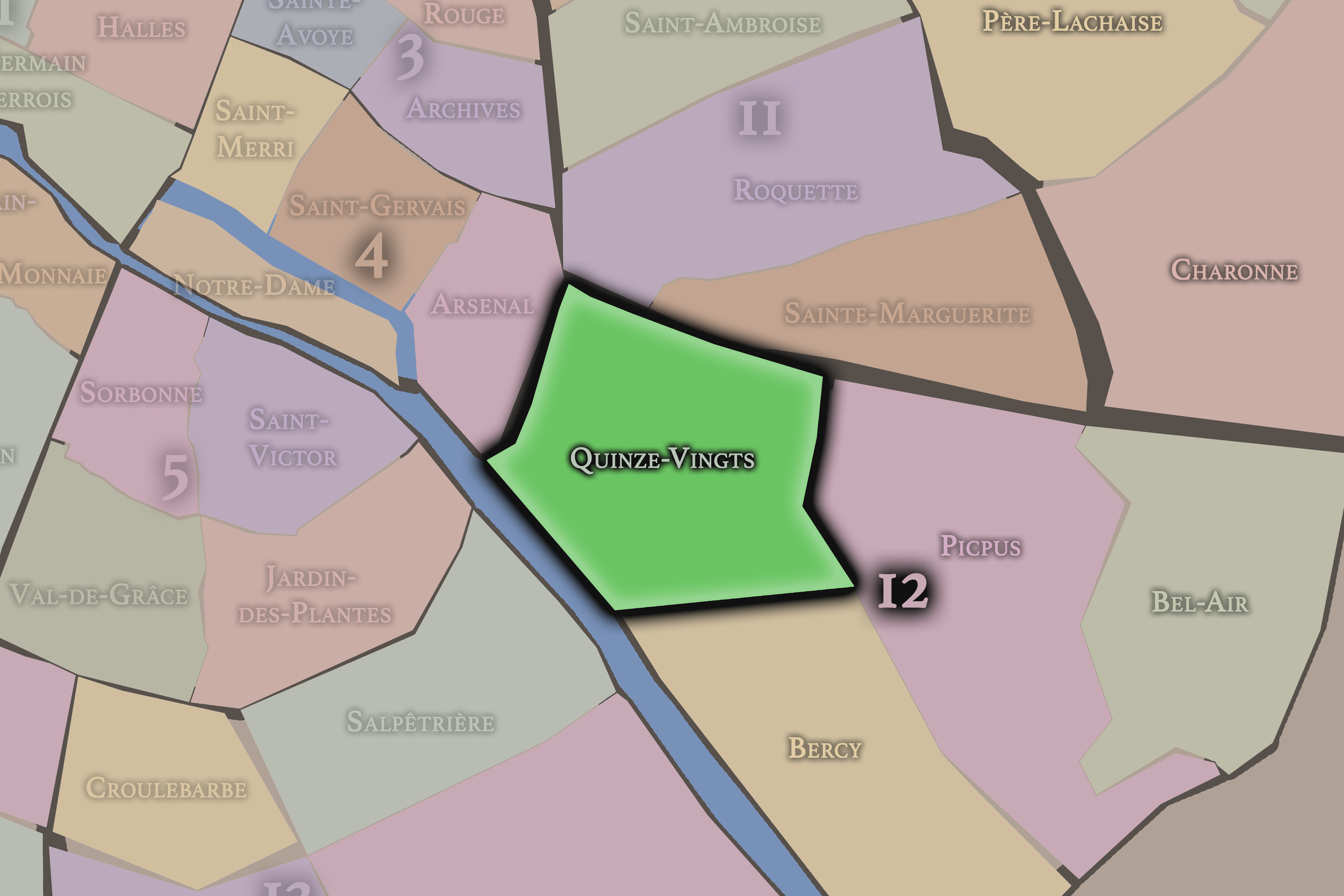
Quinze-Vingts
Quinze-Vingts occupies the western portion of the arrondissement, near Bastille, Gare de Lyon, and the Faubourg Saint-Antoine. Its name comes from the historic hospice for the blind, the Quinze-Vingts, whose institutional memory remains embedded in the quarter’s identity. This area forms one of the most important western gateways into the 12e.
This quarter gives the arrondissement a strong connection to old Paris and to movement. Around Bastille and Gare de Lyon, Quinze-Vingts is shaped by transit, artisan history, hospital institutions, restaurants, hotels, shops, and the dense urban fabric that links the 12e to the 11e and 4e. It is where the arrondissement feels most central, most connected, and most immediately tied to the city’s older eastern faubourg identity.
The History
The origins of the 12e arrondissement lie in the eastern expansion of Paris beyond the historic center. Before it became a dense urban district, much of this area consisted of roads, fields, estates, religious properties, scattered settlements, and routes leading toward Vincennes and the countryside east of the city.
The western edge of the future arrondissement developed through its connection to the Faubourg Saint-Antoine, one of the great working and artisan corridors of Paris. Farther east and south, Reuilly, Picpus, and Bercy retained more suburban, rural, or river-oriented identities for longer periods. The Seine shaped the southern edge, while the road to Vincennes and the lands around the Bois de Vincennes gave the district a strong eastward orientation.
The future 12e therefore began as a territory of passage and extension. It was not part of the oldest dense core of Paris, but it became essential to the city’s growth through roads, craft production, river commerce, religious institutions, and the gradual absorption of eastern localities into the expanding capital.
Origins
16th–17th Century
During the 16th and 17th centuries, the future 12e arrondissement remained largely outside the densest parts of Paris, but its connection to the city grew stronger. The Faubourg Saint-Antoine became increasingly important as an artisan district, particularly for furniture-making and related trades. This workshop culture shaped the western edge of the future arrondissement and tied it to the laboring identity of eastern Paris.
The lands farther east, including Reuilly, Picpus, and the routes toward Vincennes, retained a more open and semi-rural character. Religious communities, estates, gardens, roads, and small settlements gave the area a mixed landscape of work, devotion, and suburban retreat. The proximity of Vincennes and the eastern royal routes also gave the district a relationship to movement beyond Paris.
By the end of the 17th century, the foundations of the 12e’s identity were already visible: artisan labor near the city, religious and institutional life in the eastern approaches, river activity at Bercy, and a strong connection to the roads and lands beyond the urban boundary.
In the 18th century, the future 12e arrondissement continued to develop as a territory of eastern expansion. The Faubourg Saint-Antoine remained one of the most important artisan districts in Paris, with workshops, courtyards, and skilled trades shaping the physical and social landscape near the arrondissement’s western edge.
Bercy became increasingly tied to river commerce and storage, especially as the Seine remained essential for moving goods into and around Paris. The area’s relative openness and river access made it well suited to warehouses, depots, and commercial activity. This practical landscape foreshadowed the later infrastructural identity of the 12e.
The district also retained religious and residential layers around Picpus and Reuilly. These areas were not yet fully urban in the modern sense, but they were increasingly connected to Paris through roads, institutions, and economic activity. By the end of the 18th century, the future arrondissement had become a zone of growing importance: eastern faubourg, river warehouse edge, religious landscape, and suburban approach all at once.
18th Century
19th Century
The 19th century transformed the 12e arrondissement into a major district of transport, industry, and urban expansion. The arrival and growth of Gare de Lyon gave the western part of the arrondissement a powerful new role as a gateway to southeastern France and beyond. Around the station, streets filled with hotels, cafés, services, workers, travelers, and railway infrastructure.
Bercy developed into one of the great warehouse and wine-trade districts of Paris. Its river access, storage capacity, and logistical position made it essential to the movement of goods, especially wine, into the capital. The district’s identity became strongly tied to barrels, warehouses, rail connections, quays, and commercial handling.
The 19th century also brought the formal incorporation of surrounding territories into Paris and the creation of the modern arrondissement structure. Residential development expanded across Reuilly, Picpus, Daumesnil, and Bel-Air, while the Bois de Vincennes became increasingly important as a major public green space at the eastern edge of the city.
By the end of the century, the 12e had become one of Paris’s key southeastern districts: part railway gateway, part warehouse zone, part residential expansion, part artisan inheritance, and part green frontier.
In the early and mid 20th century, the 12e arrondissement remained closely tied to transport, labor, commerce, and residential life. Gare de Lyon continued to define the western portion of the arrondissement as a major arrival and departure point, while Bercy retained its role as a warehouse and wine district. These functions gave the 12e a practical, working identity distinct from more ceremonial parts of central Paris.
The residential districts of Picpus, Reuilly, Daumesnil, and Bel-Air continued to grow and stabilize. Apartment buildings, schools, churches, shops, markets, and local streets gave the arrondissement a strong neighborhood character. The 12e became a place where Parisian daily life unfolded alongside major infrastructure.
The Bois de Vincennes also played an important role in the arrondissement’s broader identity. As a vast eastern green space, it gave residents and visitors access to lakes, paths, sports grounds, gardens, and recreational landscapes beyond the dense built city. The 12e’s identity during this period therefore rested on a balance of infrastructure and livability: station, warehouse, boulevard, apartment, and park.
Early–Mid 20th Century
Late 20th Century
The late 20th century brought major transformation to the 12e arrondissement, especially in Bercy and along former rail and warehouse corridors. As older industrial and storage functions declined, large areas became available for redevelopment. Bercy’s former wine warehouses and logistical landscapes were gradually reimagined through parks, cultural venues, offices, housing, and commercial spaces.
One of the arrondissement’s most influential transformations was the creation of the Promenade Plantée, later widely known as the Coulée verte René-Dumont. Built along a former elevated railway line, it converted obsolete infrastructure into a linear garden and walking route. This project became one of Paris’s most important examples of adaptive reuse and helped define the 12e as a district of urban reinvention.
The Viaduc des Arts below the elevated promenade also reinterpreted older infrastructure for contemporary craft, design, and commercial use. This transformation connected the arrondissement’s artisan inheritance with a new cultural and urban identity.
By the end of the 20th century, the 12e had become a district where working landscapes were being converted into public, cultural, and residential spaces. The arrondissement’s older identity as a zone of transport and storage remained visible, but it had begun to shift toward parks, redevelopment, and new forms of urban life.
In the 21st century, the 12e arrondissement stands as one of Paris’s clearest examples of eastern urban reinvention. Bercy has become a major cultural, residential, commercial, and recreational district, with the Parc de Bercy, Bercy Village, entertainment venues, offices, and riverfront spaces redefining an area once dominated by warehouses and trade.
The Promenade Plantée and Viaduc des Arts remain central to the arrondissement’s contemporary identity. Together, they show how the 12e has transformed infrastructure into public experience. Elevated greenery, craft spaces, adapted arches, and long pedestrian routes give the district a distinctive relationship to walking, reuse, and urban ecology.
Gare de Lyon continues to anchor the arrondissement as a transportation hub, while the residential quarters around Reuilly, Picpus, Daumesnil, and Bel-Air sustain a quieter neighborhood identity. The Bois de Vincennes gives the arrondissement a scale of green space unmatched by most central districts, reinforcing the 12e’s role as a transition between dense Paris and the open landscapes at the city’s edge.
Contemporary pressures are also present: redevelopment, rising housing costs, tourism around Bastille and Bercy, infrastructure demands, and the challenge of balancing local residential life with major citywide functions. Still, the 12e retains a strong identity as a practical, livable, and adaptive arrondissement — one that has repeatedly turned movement and infrastructure into new urban forms.
21st Century
Spirit and Legacy
The 12e arrondissement is Paris as passage, labor, and renewal. Its history is written in roads to Vincennes, workshops near the Faubourg Saint-Antoine, railway platforms at Gare de Lyon, wine warehouses at Bercy, religious memory at Picpus, residential streets at Reuilly and Bel-Air, and the vast green breathing space of the Bois de Vincennes.
Its legacy is not built around a single monumental image. It is built around transformation. A warehouse district becomes a park and cultural quarter. A rail viaduct becomes an elevated garden. Artisan courtyards become workshops, shops, and studios. Eastern approaches become neighborhoods. The city’s edge becomes one of its places of reinvention.
The name Reuilly preserves the memory of an older locality, but the arrondissement’s deeper spirit lies in its ability to adapt. The 12e is a district where Paris moves outward, works, stores, travels, grows, and then reimagines itself. It is one of the places where the city shows its capacity to turn infrastructure into landscape, labor into memory, and edges into livable urban life.
The Photography
The arrondissements do not share a single visual identity. Instead, they organize Paris into twenty broad visual fields, each gathering its own combination of landmarks, streetscapes, institutions, residential districts, commercial corridors, parks, rail stations, markets, cemeteries, and riverfront edges.
Some arrondissements are defined by monumental scale: royal palaces, ceremonial avenues, government buildings, museums, formal gardens, and internationally recognized landmarks. Others are shaped by hills, canals, rail gateways, apartment-lined boulevards, neighborhood markets, former village streets, industrial remnants, parks, or the quieter rhythms of residential Paris. The arrondissement system gives these varied landscapes a civic frame, allowing the city to be read not as one visual language, but as a sequence of overlapping Parisian atmospheres.

Visual Identity
Through The Lens
Photographing the arrondissements means moving between the official map and the street-level experience. The camera does not treat each arrondissement as visually uniform. Instead, it looks for the recurring forms, textures, transitions, and contrasts that make each district legible: the geometry of boulevards, the shade of plane trees, the repetition of balconies, the rise of stairways, the curve of canals, the presence of rail stations, the opening of parks, the weight of monuments, and the intimacy of side streets.
On CityNeighborhoods, the arrondissement provides the frame, but the photograph comes from the encounter between map, movement, light, and observation. As the Paris photography is processed, this section will connect each arrondissement more directly to the project’s Photographic Lexicon: the visual strategies, recurring motifs, and compositional patterns that shape how the city is seen through the lens.

If you visit Paris, these ideas can help inspire your own photography.



Paris: J’Espere, Je Rêve, Je Vive
Paris Photo Gallery
Paris Field Notes
-
Field Note: August 18, 2025 | 07:58 AM
Conditions: 73°F | Humidity: 72%.
Within the park's interior, the glacial kettle ponds acted as humidity traps, creating a soft, hazy light that filtered through the old-growth oaks. The transition from the park's dense shade to the sun-drenched edges of Oakland Gardens highlighted the day's exceptional "picture-perfect" clarity.
There is a fleeting window in Queens where the humidity of August hasn't yet heavy-set, and the morning sun hits the canopy of Alley Pond Park at a perfect oblique angle. Arriving just before 8:00 AM, I watched the light break through the oaks and tulip trees, casting long, dramatic shadows across the wet grass. It’s in these quiet, golden moments that the park feels less like a city escape and more like the ancient glacial valley it actually is.
Other neighborhoods visited:











































































































Explore Paris
-

The twenty arrondissements form the civic spiral of Paris, organizing the city into its broad local districts of government, identity, and daily life.
-

Each arrondissement is divided into four official administrative quarters, giving Paris a more precise civic and geographic framework.
-

The conseils de quartier bring participation to street level, giving residents a voice in neighborhood needs, public space, and local civic life.
-

Les Deux Rives trace Paris through the Seine’s two banks, revealing how the Rive Droite and Rive Gauche shaped the city’s civic power, commerce, learning, art, and cultural identity.
-

Cultural neighborhoods reveal the Paris people recognize through history, cafés, architecture, memory, atmosphere, and local belonging.