
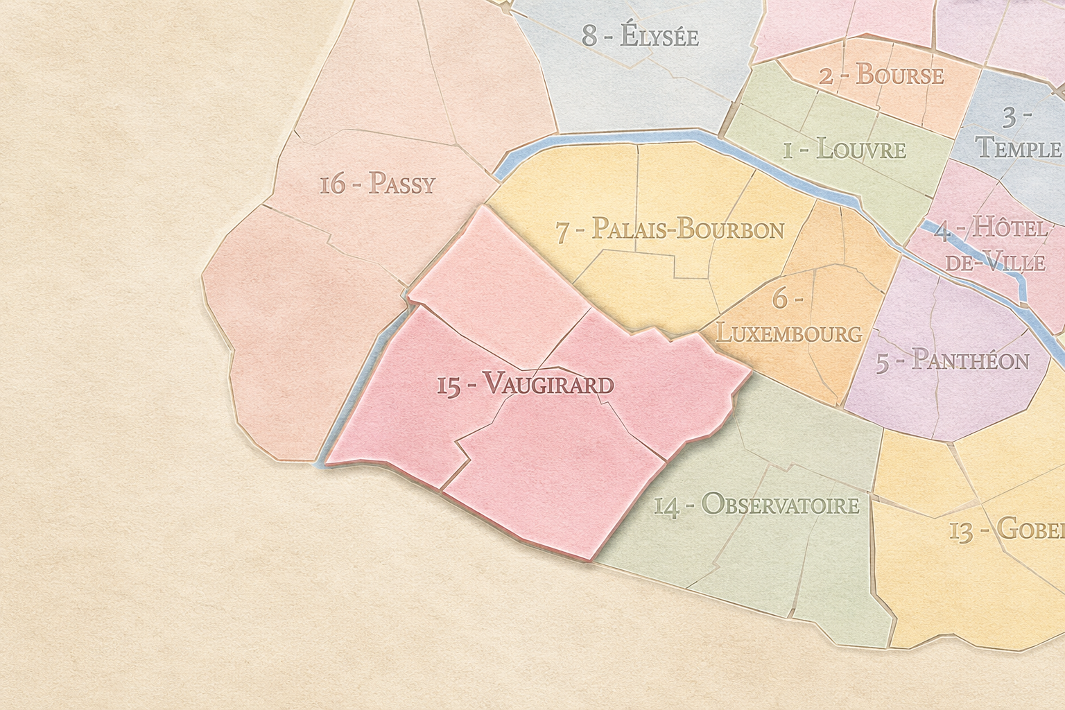
15e - VAUGIRARD
Arrondissements
Part of an ongoing project to walk and photograph every neighborhood in Paris, this page explores the 15th Arrondissement: Vaugirard through maps, district identity, history, and photography.
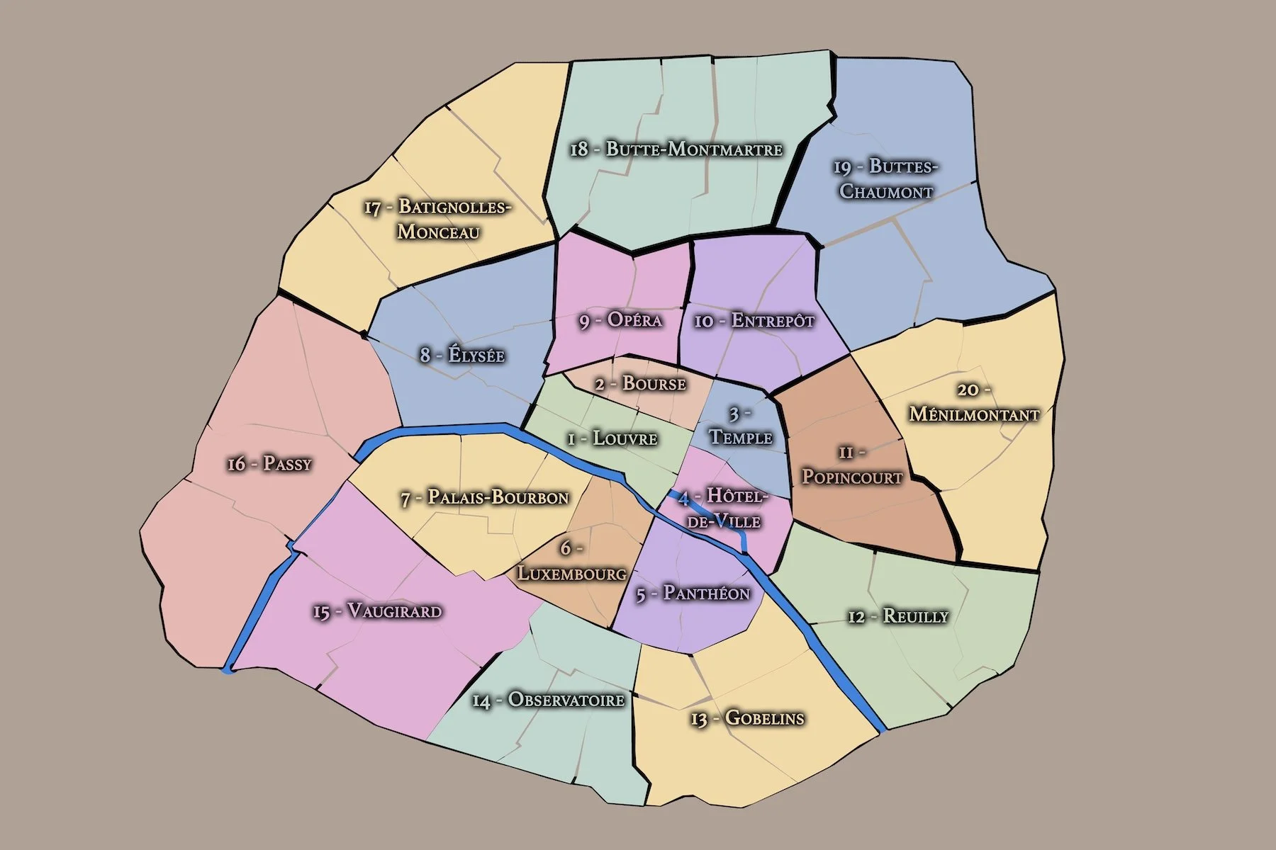



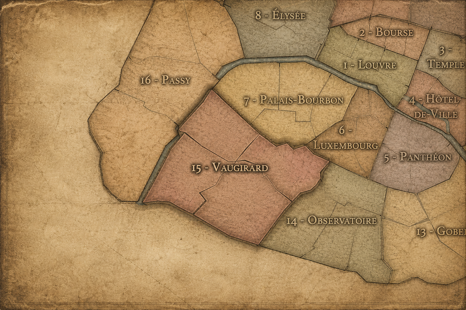
The Map
Download the Paris Arrondissements Map
Geographic Setting
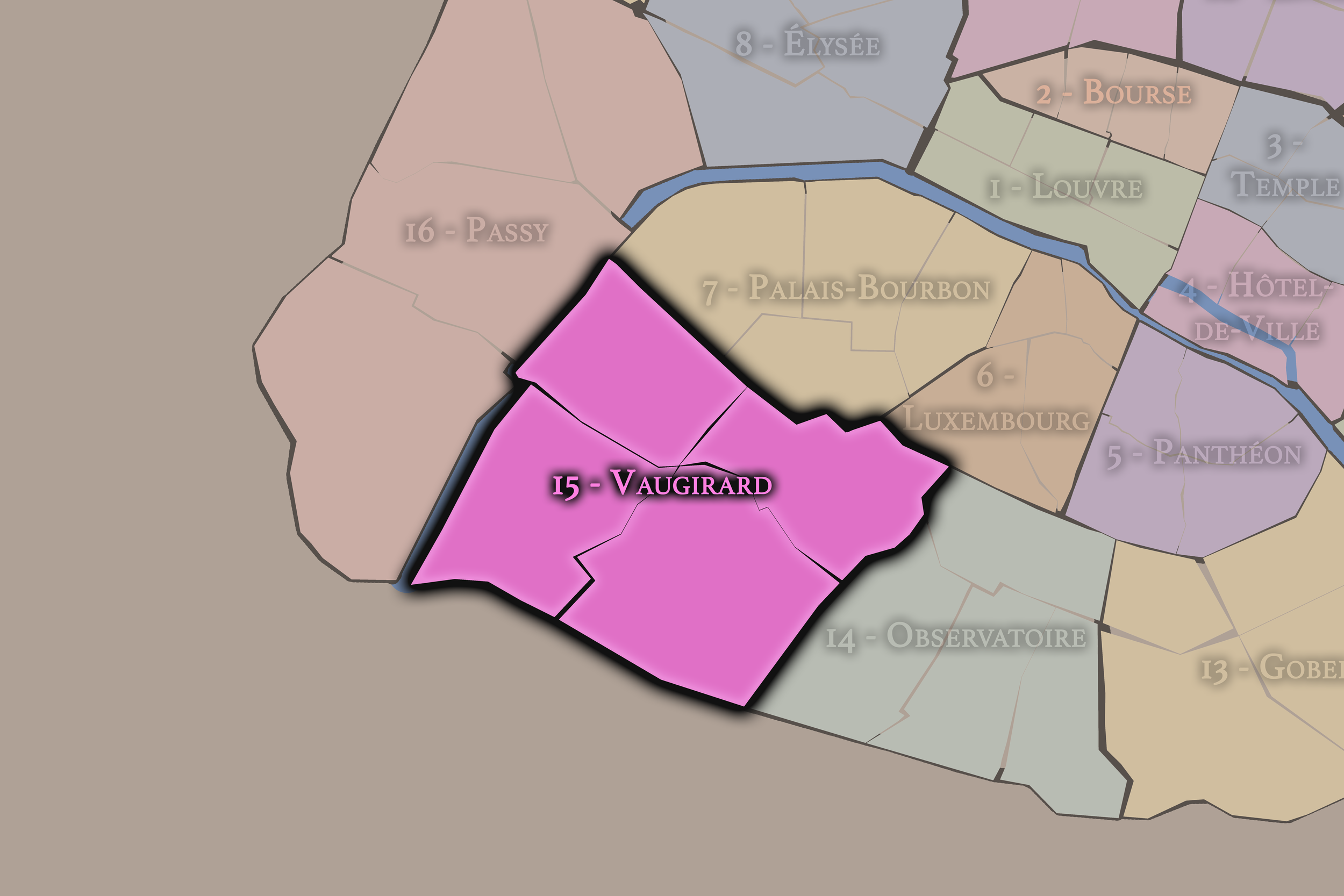
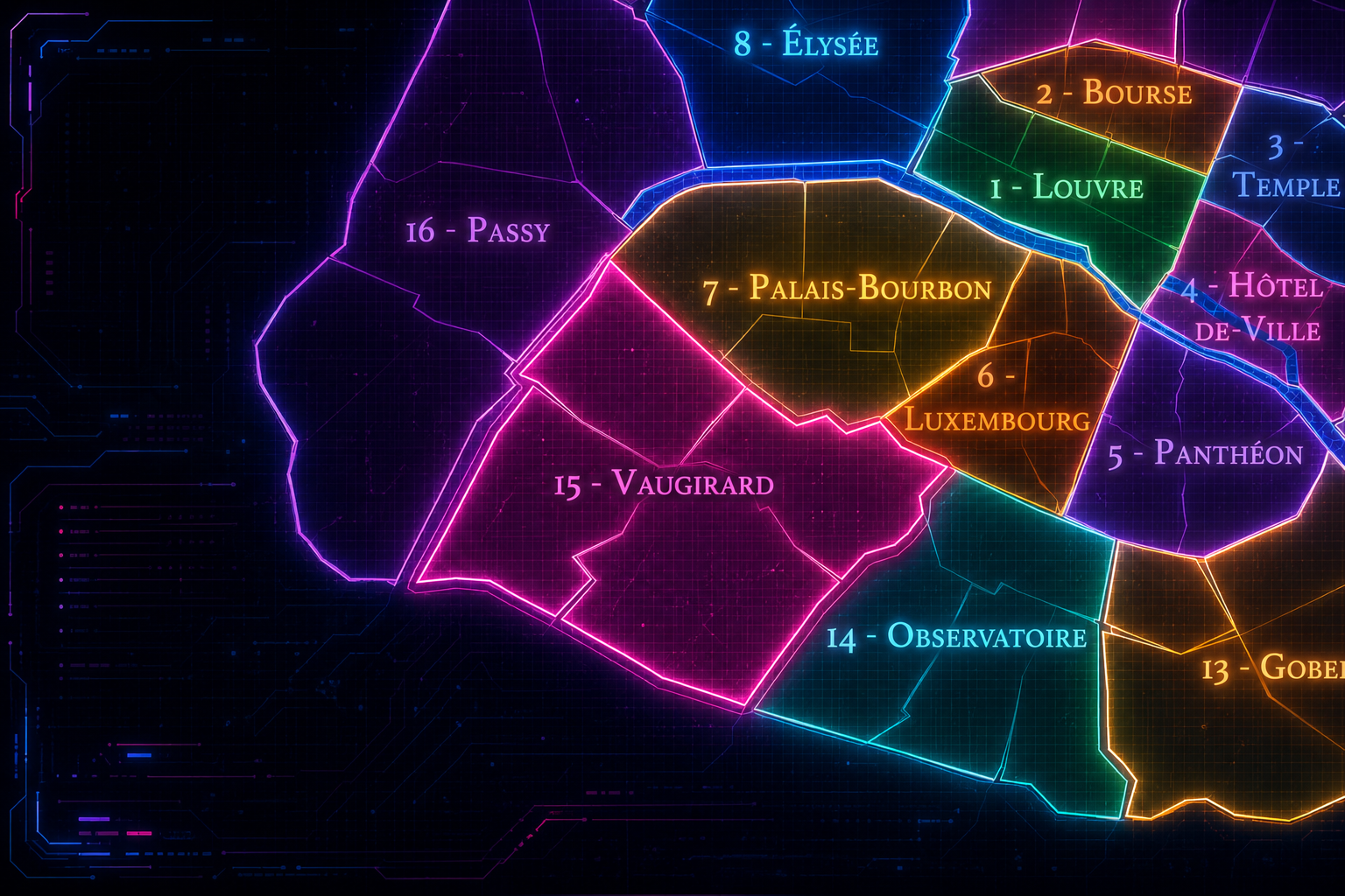
The 15e arrondissement occupies the southwestern portion of Paris on the Left Bank, forming one of the city’s largest and most populous arrondissements. It stretches from the Seine in the northwest and west toward the southern edge of the city, bordered by the 7e arrondissement to the north, the 6e and 14e to the east, and the suburban communes of Issy-les-Moulineaux and Vanves beyond the périphérique. Its geography places it between the monumental landscapes of the western Left Bank, the residential fabric of southern Paris, and the modern riverfront developments along the Seine.
Unlike the central arrondissements defined by a single monument, historic island, or ceremonial axis, the 15e is defined by scale, residence, and everyday continuity. It contains broad avenues, apartment blocks, schools, markets, hospitals, parks, office districts, former industrial lands, quiet side streets, and some of the city’s most substantial residential neighborhoods. Around Grenelle and the Seine, it connects to modern development, towers, bridges, and river infrastructure. Around Vaugirard, Convention, Commerce, and Saint-Lambert, it feels more like a dense residential city within the city.
The 15e arrondissement is divided into four administrative quarters: Saint-Lambert, Necker, Grenelle, and Javel. Together, they form an arrondissement of considerable internal variety. Saint-Lambert carries the memory of old Vaugirard and the southern village landscape absorbed into Paris. Necker links the arrondissement to medicine, rail, Montparnasse, and institutional life. Grenelle preserves the history of another former village and later industrial-residential expansion near the Seine. Javel gives the arrondissement its strongest association with riverside industry, modernity, and large-scale 20th-century transformation.
The 15e is therefore a district of incorporation and growth. It is the Paris of former villages, residential expansion, industry turned urban fabric, hospitals, markets, schools, and family life. Its identity is less theatrical than the 9e, less symbolic than the 7e, and less bohemian than the 14e, but it is one of the clearest expressions of Paris as a lived residential city.
Arrondissement Identity
Etymology and Origins
The arrondissement’s administrative name, Vaugirard, comes from the former village of Vaugirard, whose territory was incorporated into Paris in the 19th century. The name is generally associated with an older form derived from “Val Gérard” or a similar medieval place-name, preserving the memory of a local settlement before its absorption into the modern capital. In the city’s geography, Vaugirard survives through the arrondissement name, Rue de Vaugirard, and the broader identity of southwestern Paris.
The name matters because the 15e is one of the arrondissements where the memory of former villages is especially important. Unlike districts formed around royal palaces or medieval churches in the historic center, the 15e grew from local settlements, agricultural land, roads, parish life, and suburban expansion. Vaugirard was not originally a central Parisian neighborhood; it became Paris through annexation, urbanization, and the outward growth of the city.
The deeper origins of the arrondissement also include Grenelle and Javel, each with its own local identity. Grenelle developed as a village and later as a planned and industrializing district near the Seine. Javel became associated with riverside manufacturing and, later, major industrial modernity. The name Vaugirard gives the arrondissement its administrative identity, but the 15e as a whole is built from several absorbed local histories brought together within the southwestern edge of Paris.
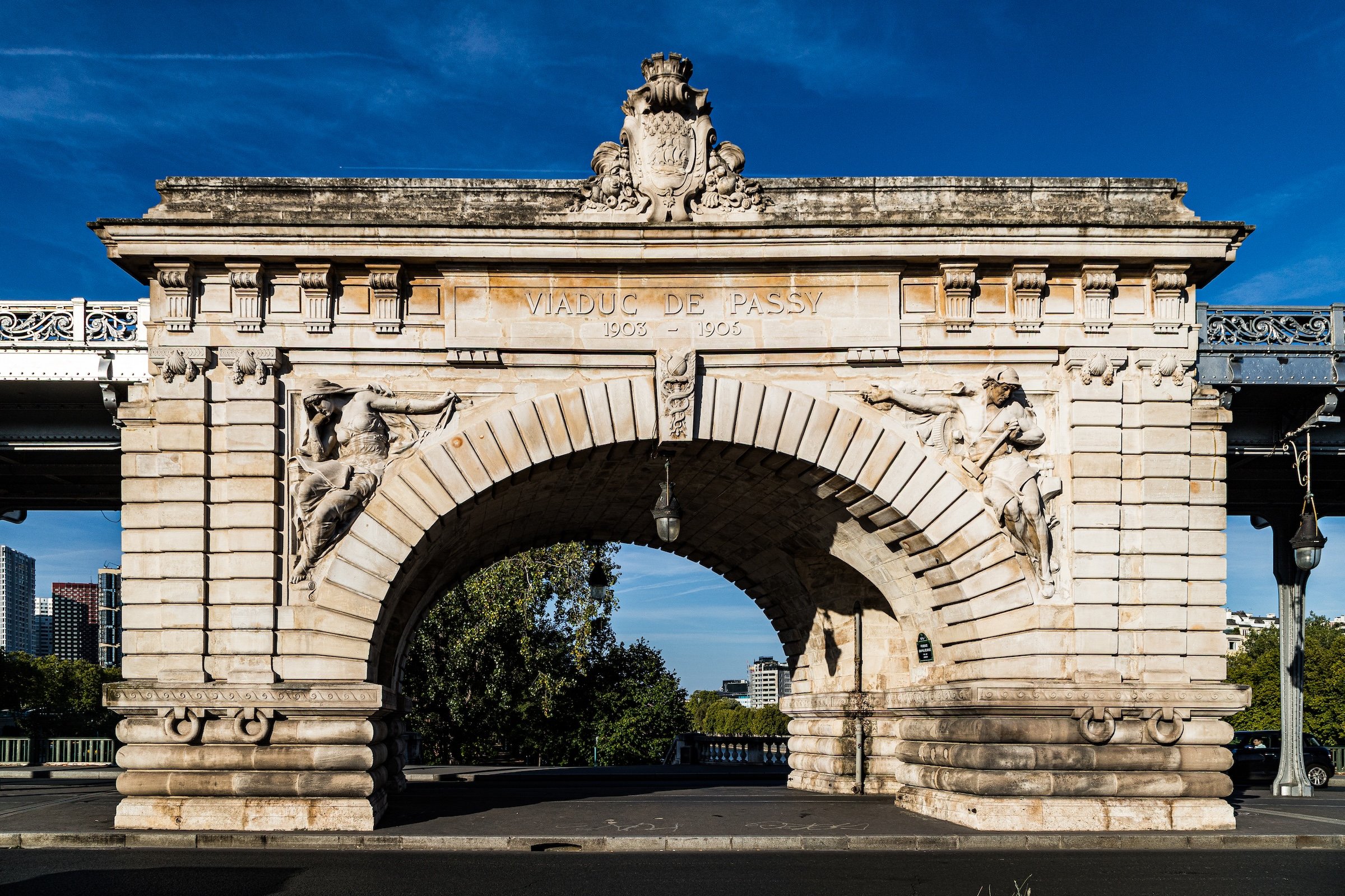
The 15e arrondissement is one of the twenty municipal arrondissements of Paris and remains a distinct local civic unit with its own mairie. It is not part of Paris Centre, which includes only the 1er, 2e, 3e, and 4e arrondissements. Its civic identity is shaped by its size, residential population, neighborhood services, schools, hospitals, parks, markets, and the practical demands of everyday urban life.
The arrondissement’s four administrative quarters — Saint-Lambert, Necker, Grenelle, and Javel — provide its official internal structure. These quarters are especially important because the 15e is often perceived as a broad residential zone rather than as a district with a single strong public image. The official quarters reveal a more layered geography: old Vaugirard in Saint-Lambert, medical and rail-adjacent Paris in Necker, village and river expansion in Grenelle, and industrial-modern transformation in Javel.
For this project, the 15e is treated as both an official geographic layer and a cultural-historical district. Its civic framework helps distinguish the arrondissement from the monumental 7e to the north, the Montparnasse and southern-edge identity of the 14e to the east, and the suburban territories beyond the périphérique. The 15e is southwestern Paris as lived city: large, residential, practical, historically local, and shaped by the gradual transformation of villages into urban neighborhoods.
Civic Framework
Parisian Identity
The 15e arrondissement holds a distinctive place in Paris because it represents the city at its most residential and everyday. It is not usually the first arrondissement invoked in tourist images of Paris, but it is one of the places where the ordinary life of the capital is most visible: apartment buildings, schools, markets, parks, families, hospitals, offices, neighborhood restaurants, transit corridors, and long residential avenues.
Its Parisian identity is tied to scale and livability. The 15e is large enough to contain many different moods: the dense commercial activity around Convention and Rue du Commerce, the quieter residential streets of Saint-Lambert and Vaugirard, the high-rise and riverfront landscapes around Front de Seine and Beaugrenelle, the hospital and institutional presence around Necker, and the former industrial memory of Javel. It is a district of daily rhythms rather than grand gestures.
Yet the 15e is not without symbolic importance. The Seine edge, the proximity to the Eiffel Tower, the modern towers of Front de Seine, the Parc André-Citroën, the history of aviation and industry, and the old village names embedded in its streets all give the arrondissement a rich but less obvious identity. It represents Paris not as spectacle, but as continuity: the city where people live, work, shop, study, commute, raise families, and occupy the modern metropolis beyond the historic core.
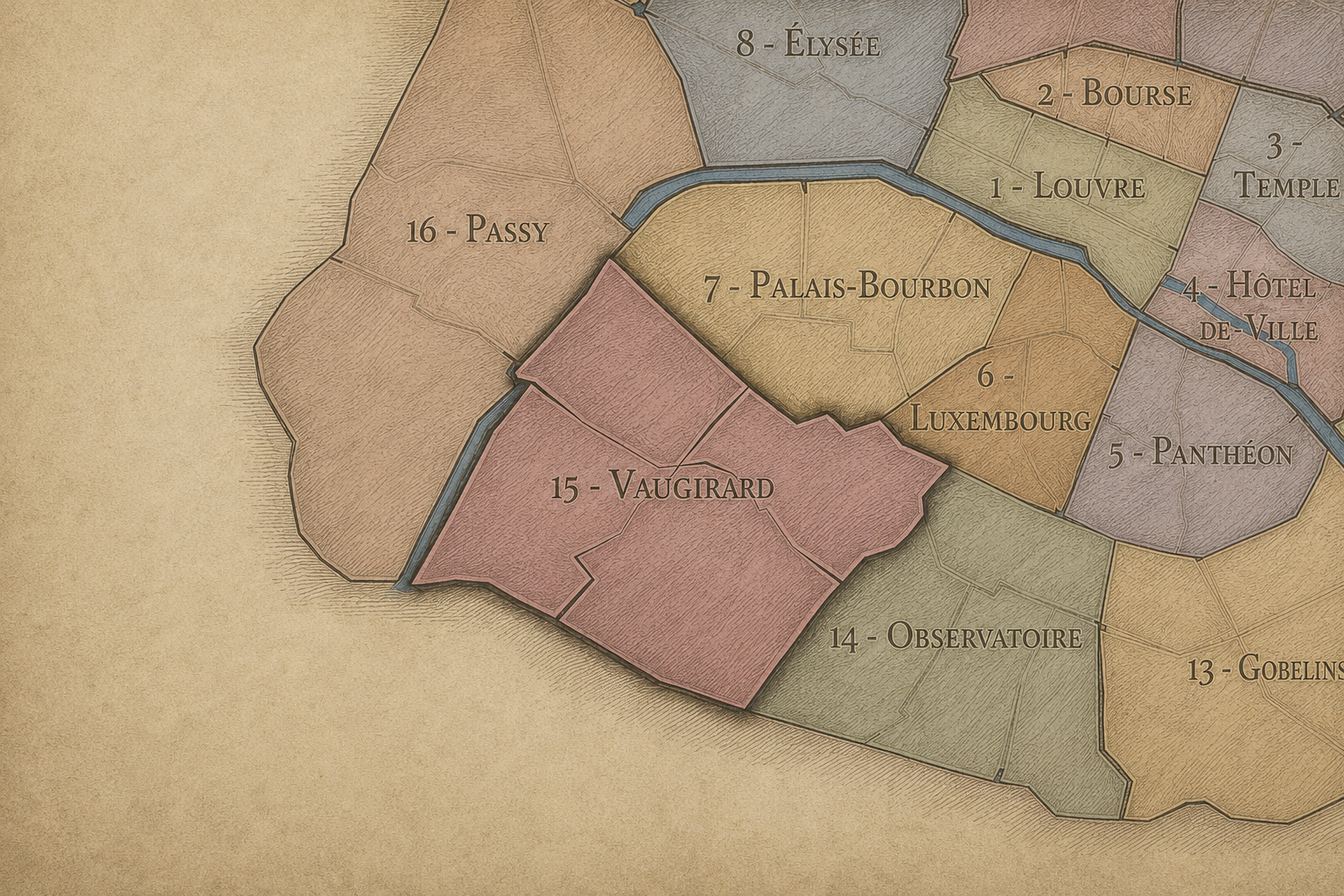
The 15e arrondissement is distinguished by its size, residential depth, and relatively understated identity. It is not defined by one central monument, one famous square, or one theatrical corridor. Instead, it is a mosaic of former villages, residential neighborhoods, institutional sites, commercial streets, riverfront redevelopment, and modern urban planning.
Its four administrative quarters express this range. Saint-Lambert gives the arrondissement its strongest connection to old Vaugirard and to the southern residential heart of the 15e. Necker connects the district to medicine, Montparnasse, rail corridors, and institutional life. Grenelle preserves the identity of a former village and later urban district near the Seine, with strong links to commerce, residence, and modern towers. Javel gives the arrondissement its industrial and riverfront identity, especially through manufacturing history and the later transformation of former industrial land into parks, offices, housing, and contemporary urban space.
The arrondissement’s distinction also lies in its lack of theatrical self-display. The 15e is not trying to announce itself in the way the 8e or 9e does. It is a district of accumulation: street markets, apartment courtyards, schools, squares, hospitals, riverfront towers, older village streets, modern parks, and neighborhood shopping streets. Its identity rewards close observation rather than quick recognition.
Neighborhood Distinction
Les Quartiers Administratifs
Administrative Quarters
The Four Administrative Quarters
Each Paris arrondissement is divided into four official administrative quarters. These smaller districts reveal older place-names, local histories, civic boundaries, and neighborhood identities.
-
Grenelle
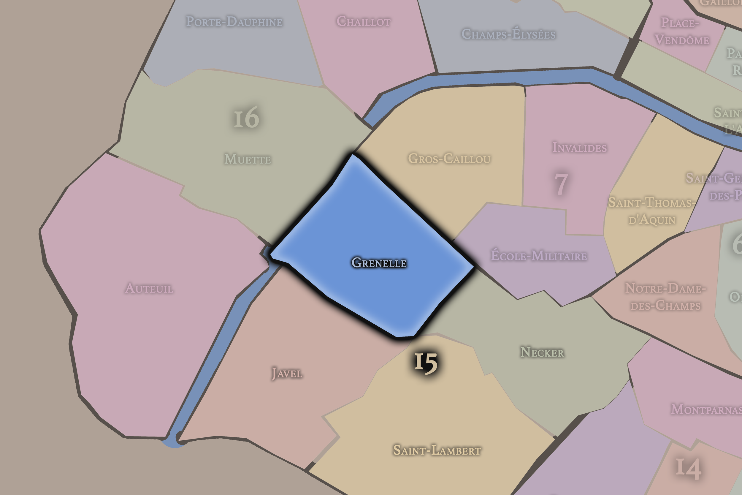
Grenelle occupies the northwestern portion of the 15e arrondissement, near the Seine and the boundary with the 7e. Its name recalls the former village and plain of Grenelle, which developed into a distinct settlement before becoming part of Paris. The quarter includes some of the arrondissement’s most recognizable modern landscapes, including the Beaugrenelle area and the high-rise development of Front de Seine.
This quarter gives the 15e a strong identity of expansion, commerce, and modern urban form. Around Rue du Commerce, La Motte-Picquet, Beaugrenelle, and the Seine, Grenelle links older village memory with modern shopping, apartment towers, offices, bridges, and riverfront infrastructure. It is one of the quarters where the 15e most visibly shifts from traditional residential Paris into the vertical and commercial modern city.
-
Javel
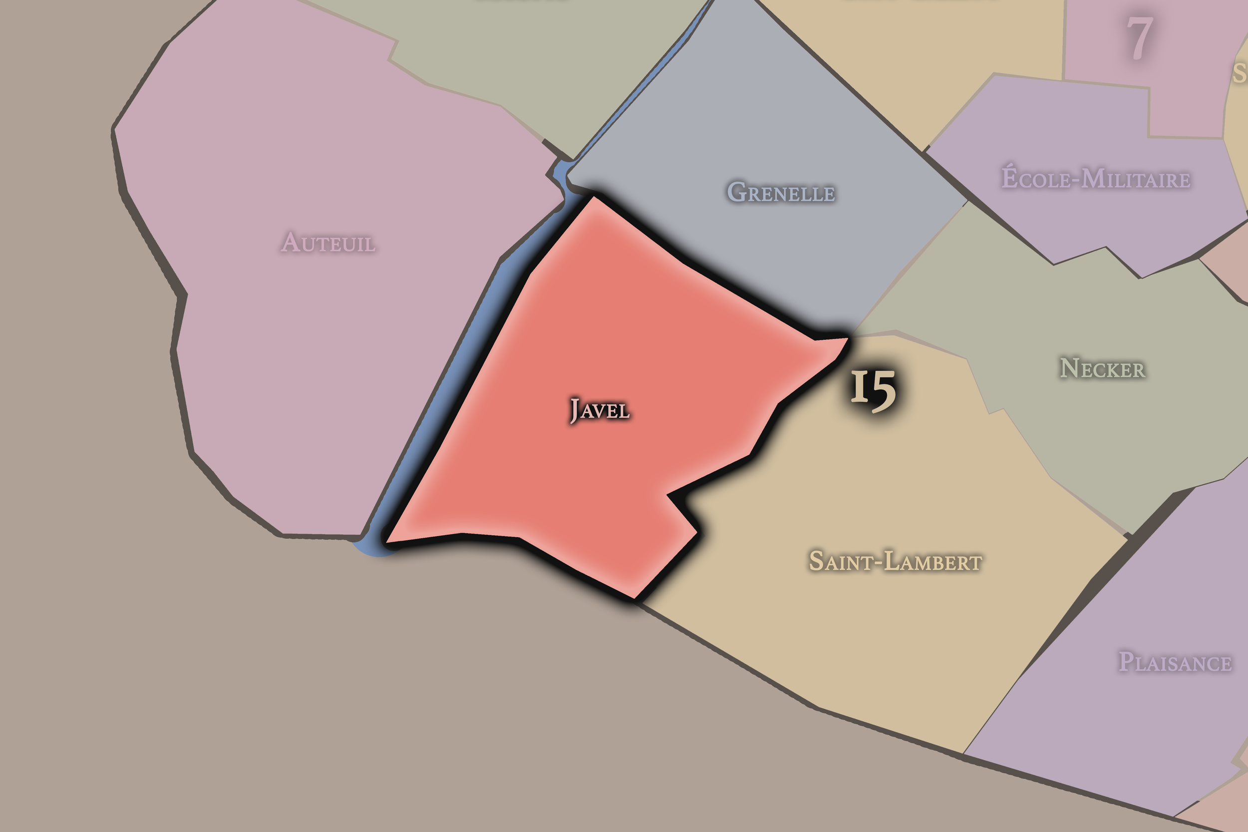
Javel occupies the southwestern portion of the arrondissement along the Seine and toward the edge of Paris. Its name is associated with the former village or locality of Javel and later with major industrial development, especially along the river. The quarter became strongly linked to manufacturing, chemical production, and automobile industry, most famously through the Citroën works that once occupied a large riverside site.
This quarter gives the 15e its strongest industrial and redevelopment identity. The transformation of former factory and industrial lands into Parc André-Citroën, offices, housing, and contemporary riverfront spaces reflects one of the arrondissement’s most important modern changes. Javel shows the 15e as a district where industry, river infrastructure, and modern planning reshaped the southwestern edge of Paris.
-
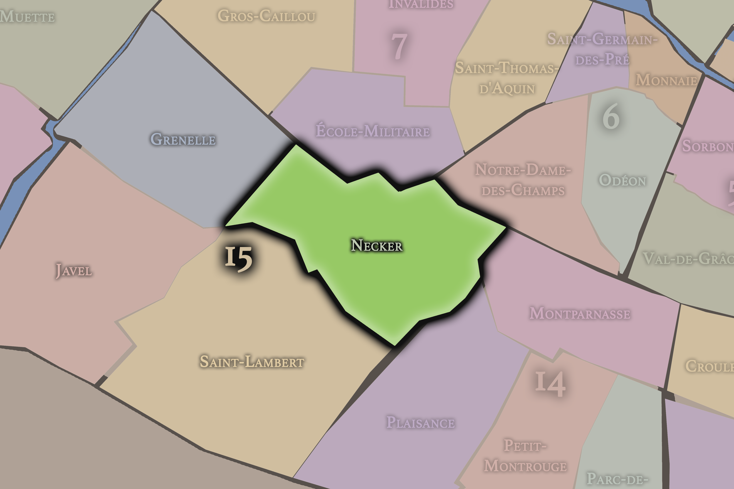
Necker
Necker occupies the northeastern portion of the 15e arrondissement, near Montparnasse, the 6e and 14e arrondissements, and the institutional landscapes around major hospitals and rail corridors. Its name comes from the Necker hospital, one of the defining institutions of the quarter and a major presence in the medical geography of Paris.
This quarter gives the arrondissement a strong institutional and transitional identity. Necker sits between the residential 15e and the cultural, railway, and commercial landscapes of Montparnasse. It includes hospitals, schools, apartment buildings, offices, transport routes, and streets that connect the arrondissement to the central Left Bank. It is one of the places where the 15e feels closest to the older urban core while retaining its own residential and institutional character.
-
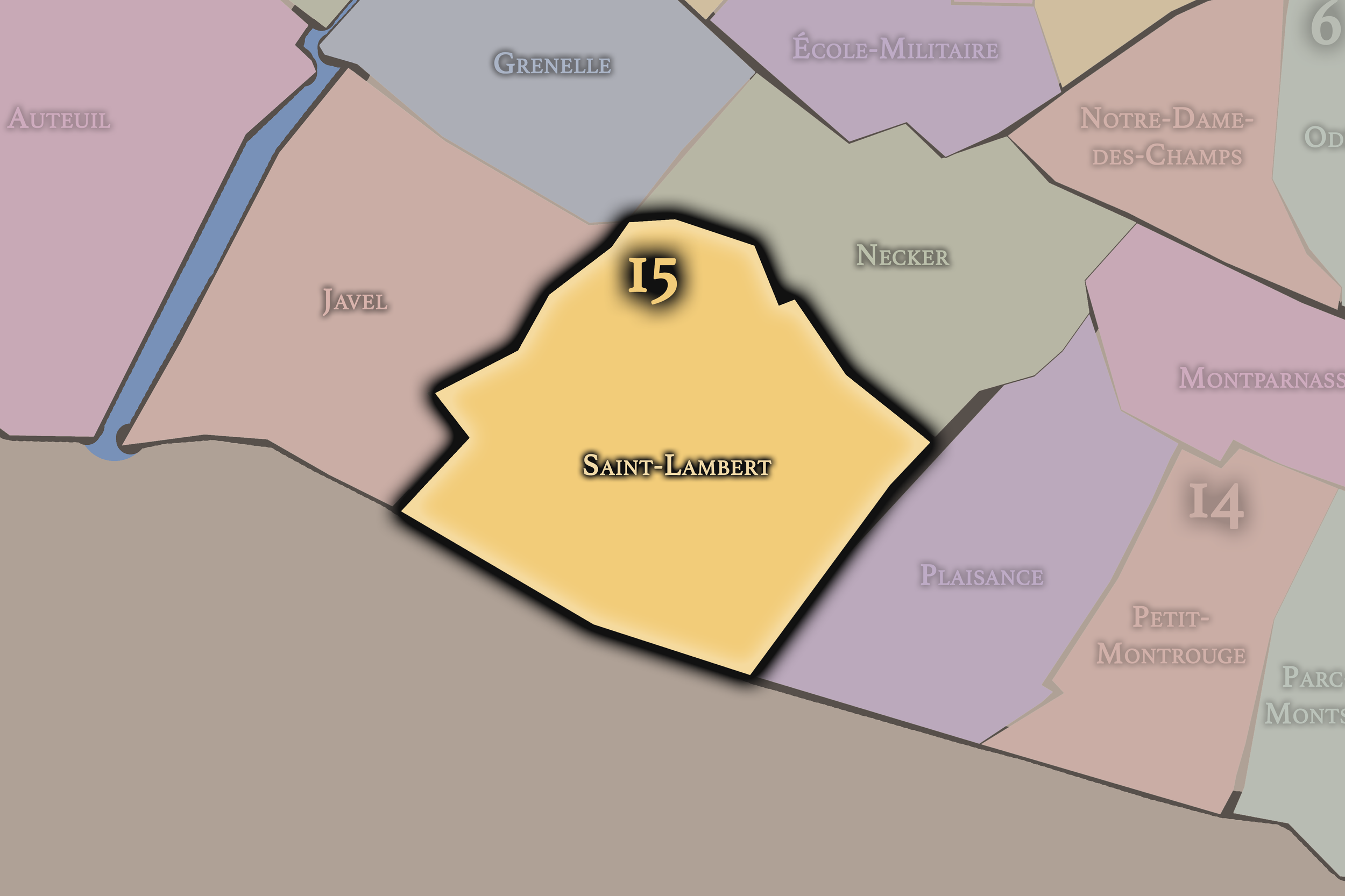
Saint-Lambert
Saint-Lambert occupies the southern and central portion of the 15e arrondissement and carries the strongest memory of the former village of Vaugirard. Its name comes from the church of Saint-Lambert de Vaugirard, which anchors the quarter’s older parish identity and helps preserve the memory of the village absorbed into Paris.
This quarter gives the 15e much of its neighborhood-centered character. Around Vaugirard, Convention, and the surrounding residential streets, Saint-Lambert feels like one of the clearest examples of everyday Paris: apartment buildings, schools, markets, shops, churches, squares, and local routines. It is less monumental than the northern Left Bank and less visibly modern than Javel or Front de Seine, but it is essential to the arrondissement’s identity as a lived residential district.
The History
The origins of the 15e arrondissement lie in the former villages, fields, roads, and riverfront lands southwest of the old Parisian core. For much of its history, this area was outside the dense city, shaped by agricultural land, local settlements, religious properties, roads toward the southwest, and the Seine’s role as a boundary and transport corridor.
Vaugirard, Grenelle, and Javel were not originally simply neighborhoods within Paris. They were local places with their own histories, social structures, churches, lands, and relationships to the expanding city. Their later incorporation into Paris did not erase those identities; it layered them beneath the modern arrondissement.
This origin as absorbed village territory is central to the 15e. Unlike the ancient 5e or the ceremonial 8e, the 15e began as an edge landscape gradually urbanized through population growth, industrial development, transit, annexation, and residential expansion. Its history is the history of Paris becoming larger.
Origins
16th–17th Century
During the 16th and 17th centuries, the future 15e arrondissement remained largely outside the built-up center of Paris. The area was shaped by rural land, parish life, small settlements, roads, religious institutions, and estates. Vaugirard and Grenelle retained local identities connected to the agricultural and suburban landscapes beyond the city.
The Seine played an important role along the western edge, supporting movement and practical uses while separating the area from the more monumental development across and along the river. Inland, roads and paths connected the settlements to Paris and to the surrounding countryside. The future arrondissement was not yet an urban district, but a collection of places connected to the capital by proximity and dependence.
By the end of the 17th century, the foundations of the 15e’s later identity were visible in its village structure, parish geography, and position beyond the dense city. It remained peripheral, but that peripheral character would later make it available for expansion, industry, and large-scale residential growth.
In the 18th century, the future 15e arrondissement continued to develop as a suburban and semi-rural landscape beyond central Paris. Vaugirard and Grenelle grew as settlements connected to the capital but not yet fully absorbed into it. Agriculture, gardens, local commerce, religious life, roads, and modest residences shaped the area’s character.
The proximity to Paris encouraged gradual growth. As the city expanded, land outside the center became increasingly valuable for settlement, production, and transportation. The villages and localities that would later form the 15e began to develop stronger economic and social connections with the city, while still retaining their own identities.
By the end of the 18th century, the future arrondissement was positioned for major change. It had not yet become the dense residential district known today, but the growth of Paris was moving steadily toward it. Its open land, roads, river edge, and village structure would soon support industrialization, annexation, and urban expansion.
18th Century
19th Century
The 19th century transformed the future 15e arrondissement more decisively than any earlier period. The annexation of surrounding communes and territories into Paris brought Vaugirard, Grenelle, and Javel fully into the city’s administrative structure. The modern arrondissement was created from these formerly separate or semi-separate local identities, turning village and suburban landscapes into official Parisian neighborhoods.
Industrial and residential development expanded rapidly. Grenelle and Javel became increasingly urbanized, with factories, workshops, warehouses, river-related industries, and new housing. The Seine edge supported manufacturing and transport, while inland streets filled with apartment buildings, shops, schools, and local services. Vaugirard became more densely residential, gradually losing its village character while preserving its name and parish memory.
The century also brought stronger connections to the rest of Paris through new streets, transportation, and urban planning. The 15e became part of the growing metropolis, not as a ceremonial center, but as a practical district of population, work, industry, and daily life.
By the end of the 19th century, the arrondissement had taken on much of the identity that still shapes it: large, residential, mixed, increasingly urban, and rooted in former village territories absorbed by the expanding capital.
In the early and mid 20th century, the 15e arrondissement became one of the major residential and industrial districts of Paris. Its population grew, apartment buildings expanded, and neighborhood commercial streets became central to daily life. The arrondissement’s size and relatively modern urban fabric allowed it to absorb substantial residential growth.
Javel became one of the most important industrial landscapes in the arrondissement. The Citroën factories along the Seine gave the quarter a strong association with automobile manufacturing, labor, modern production, and the industrial identity of 20th-century Paris. This industrial presence distinguished the 15e from the more literary, institutional, or monumental identities of nearby Left Bank districts.
At the same time, the arrondissement remained deeply residential. Saint-Lambert, Vaugirard, Grenelle, and Necker contained schools, markets, churches, hospitals, shops, and apartment streets that supported a large local population. The 15e became a district where modern Parisian family and neighborhood life took shape on a large scale.
The early and mid 20th century therefore confirmed the 15e as one of the city’s great everyday arrondissements: industrial at the river, institutional near Necker, residential throughout, and increasingly woven into the modern transportation and commercial networks of Paris.
Early–Mid 20th Century
Late 20th Century
The late 20th century brought major transformation to the 15e arrondissement, especially along the Seine and in former industrial zones. As manufacturing declined or moved out of central Paris, large sites in Javel and along the river became available for redevelopment. The closing and transformation of former industrial lands changed the identity of the southwestern arrondissement.
The creation of Parc André-Citroën on the former Citroën factory site became one of the most important symbols of this shift. Industrial land was converted into a major public park, reflecting a broader transition from manufacturing to leisure, offices, housing, and contemporary urban design. This transformation gave the 15e a new relationship to green space and to the Seine.
Grenelle and Front de Seine also became associated with high-rise development and modern planning. Towers, commercial centers, and large residential complexes introduced a vertical and more modernist image into the arrondissement. These landscapes contrasted with the older village-derived and residential streets elsewhere in the 15e, creating one of the arrondissement’s defining late 20th-century juxtapositions.
By the end of the 20th century, the 15e had become a district of both continuity and reinvention: still deeply residential, but increasingly shaped by the redevelopment of industry, modern housing forms, office districts, and public parks.
In the 21st century, the 15e arrondissement remains one of the most residential and populous districts of Paris. Its identity is defined by the scale of everyday life: families, schools, markets, shops, parks, hospitals, offices, transit corridors, apartment buildings, and local streets. It is less dependent on tourism than many central arrondissements, which gives it a distinctly lived-in character.
The arrondissement also continues to carry important modern and contemporary identities. Beaugrenelle, Front de Seine, Parc André-Citroën, Javel, and the riverfront areas show the legacy of late 20th-century and contemporary urban planning. Necker remains important in the medical landscape of Paris. Grenelle and Commerce retain strong shopping and neighborhood identities. Saint-Lambert and Vaugirard preserve the arrondissement’s residential core.
Contemporary pressures include housing costs, redevelopment, traffic, the need for green space, aging building stock, and the challenge of maintaining neighborhood identity in such a large arrondissement. Yet the 15e’s strength lies in its stability. It is not the most mythologized district of Paris, but it is one of the places where the city functions as home.
Today, the 15e is Paris at residential scale: less spectacle, more continuity; less monument, more neighborhood; less symbolic display, more daily life. Its importance lies precisely in how much ordinary Paris it contains.
21st Century
Spirit and Legacy
The 15e arrondissement is Paris as home, growth, and incorporation. Its legacy is rooted in former villages, industrial riverfronts, residential expansion, schools, hospitals, markets, parks, and the steady transformation of suburban territory into urban Paris.
The name Vaugirard preserves the memory of a village absorbed by the capital, but the arrondissement’s identity is broader than that one name. Grenelle, Javel, Necker, Saint-Lambert, Commerce, Convention, Beaugrenelle, and Parc André-Citroën all reveal different ways the district has been shaped: by settlement, industry, medicine, modern planning, and everyday neighborhood life.
The 15e is not Paris as monument, but Paris as continuity. It is where the city lives at scale — in apartment blocks and market streets, in school commutes and hospital corridors, in parks built on former factories, in old village names still carried by modern streets. Its spirit is practical, residential, and quietly expansive: a reminder that Paris is not only a city to visit, but a city to inhabit.
The Photography
The arrondissements do not share a single visual identity. Instead, they organize Paris into twenty broad visual fields, each gathering its own combination of landmarks, streetscapes, institutions, residential districts, commercial corridors, parks, rail stations, markets, cemeteries, and riverfront edges.
Some arrondissements are defined by monumental scale: royal palaces, ceremonial avenues, government buildings, museums, formal gardens, and internationally recognized landmarks. Others are shaped by hills, canals, rail gateways, apartment-lined boulevards, neighborhood markets, former village streets, industrial remnants, parks, or the quieter rhythms of residential Paris. The arrondissement system gives these varied landscapes a civic frame, allowing the city to be read not as one visual language, but as a sequence of overlapping Parisian atmospheres.

Visual Identity
Through The Lens
Photographing the arrondissements means moving between the official map and the street-level experience. The camera does not treat each arrondissement as visually uniform. Instead, it looks for the recurring forms, textures, transitions, and contrasts that make each district legible: the geometry of boulevards, the shade of plane trees, the repetition of balconies, the rise of stairways, the curve of canals, the presence of rail stations, the opening of parks, the weight of monuments, and the intimacy of side streets.
On CityNeighborhoods, the arrondissement provides the frame, but the photograph comes from the encounter between map, movement, light, and observation. As the Paris photography is processed, this section will connect each arrondissement more directly to the project’s Photographic Lexicon: the visual strategies, recurring motifs, and compositional patterns that shape how the city is seen through the lens.

If you visit Paris, these ideas can help inspire your own photography.



Paris: J’Espere, Je Rêve, Je Vive
Paris Photo Gallery
Paris Field Notes
-
Field Note: August 18, 2025 | 07:58 AM
Conditions: 73°F | Humidity: 72%.
Within the park's interior, the glacial kettle ponds acted as humidity traps, creating a soft, hazy light that filtered through the old-growth oaks. The transition from the park's dense shade to the sun-drenched edges of Oakland Gardens highlighted the day's exceptional "picture-perfect" clarity.
There is a fleeting window in Queens where the humidity of August hasn't yet heavy-set, and the morning sun hits the canopy of Alley Pond Park at a perfect oblique angle. Arriving just before 8:00 AM, I watched the light break through the oaks and tulip trees, casting long, dramatic shadows across the wet grass. It’s in these quiet, golden moments that the park feels less like a city escape and more like the ancient glacial valley it actually is.
Other neighborhoods visited:











































































































Explore Paris
-

The twenty arrondissements form the civic spiral of Paris, organizing the city into its broad local districts of government, identity, and daily life.
-

Each arrondissement is divided into four official administrative quarters, giving Paris a more precise civic and geographic framework.
-

The conseils de quartier bring participation to street level, giving residents a voice in neighborhood needs, public space, and local civic life.
-

Les Deux Rives trace Paris through the Seine’s two banks, revealing how the Rive Droite and Rive Gauche shaped the city’s civic power, commerce, learning, art, and cultural identity.
-

Cultural neighborhoods reveal the Paris people recognize through history, cafés, architecture, memory, atmosphere, and local belonging.