
18e - BUTTE-MONTMARTRE
Arrondissements
Part of an ongoing project to walk and photograph every neighborhood in Paris, this page explores the 18th Arrondissement: Butte-Montmartre through maps, district identity, history, and photography.



The Map
Download the Paris Arrondissements Map
Geographic Setting
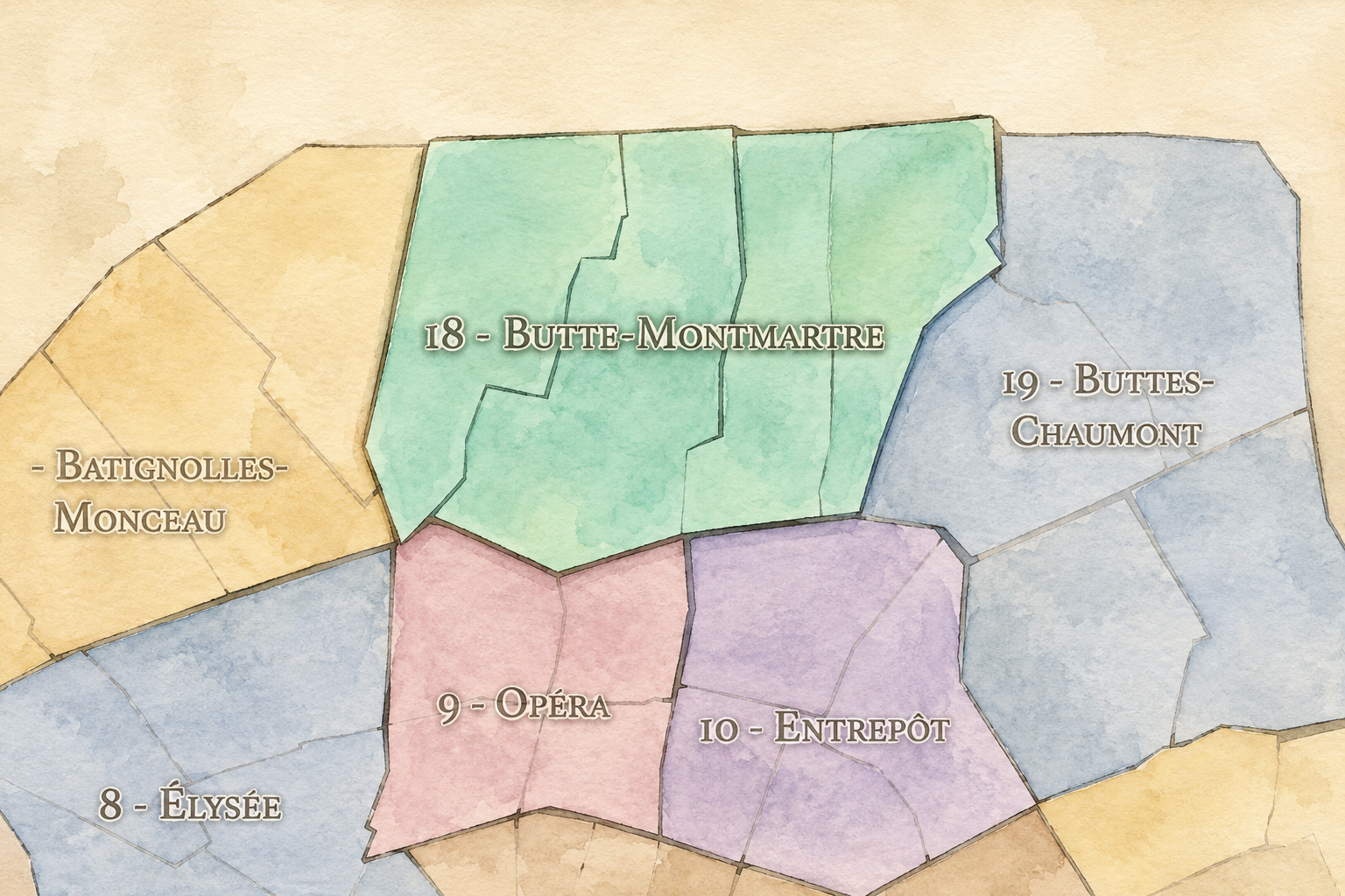
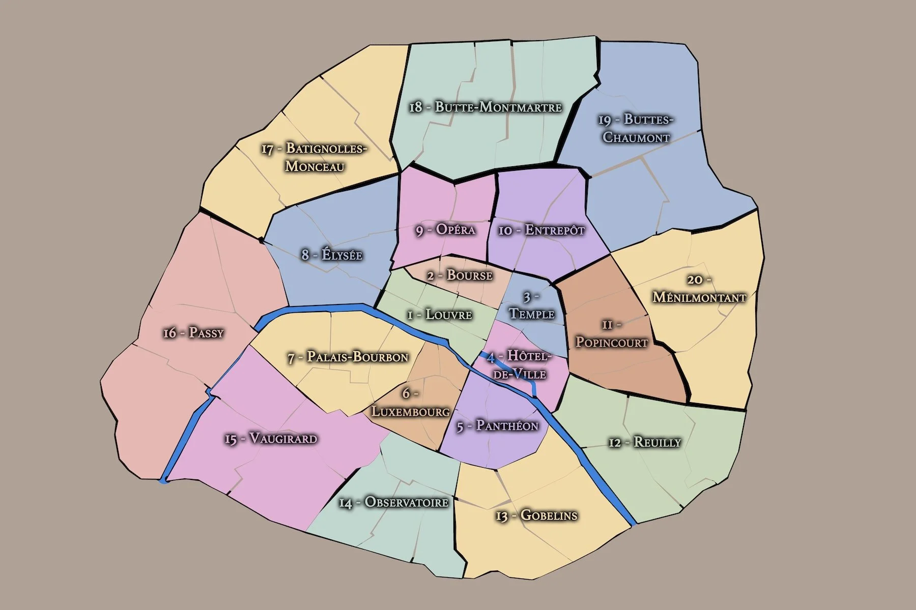
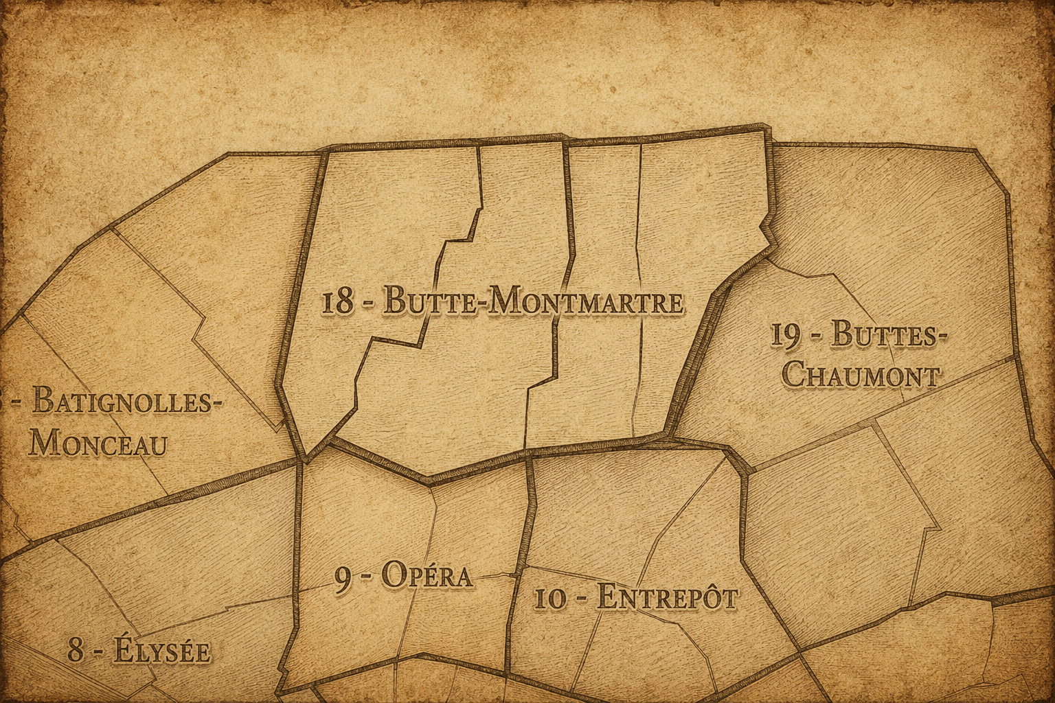
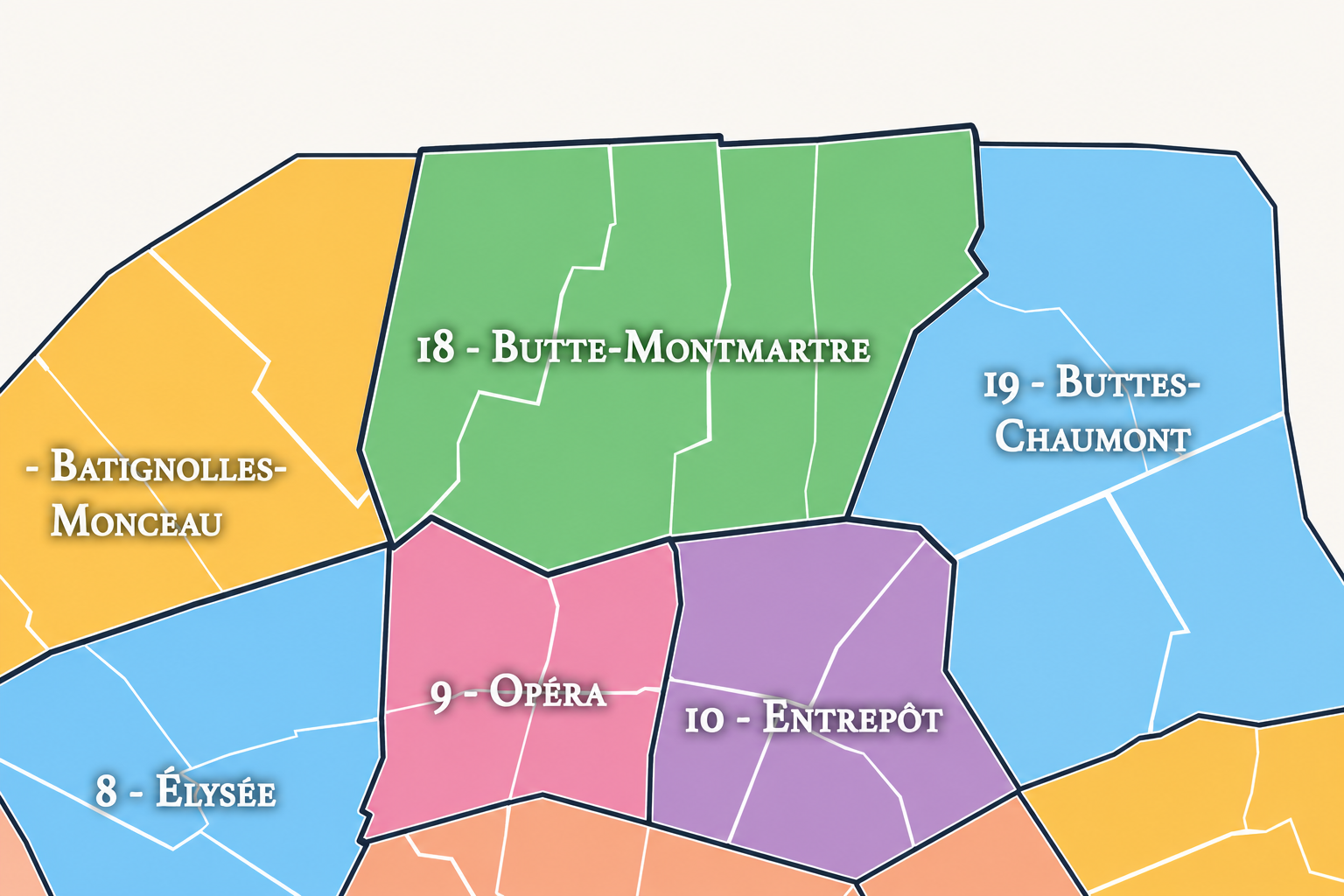
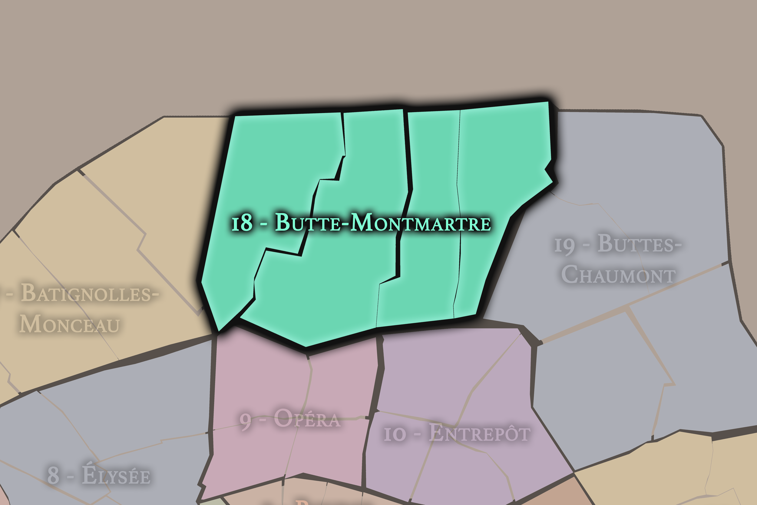
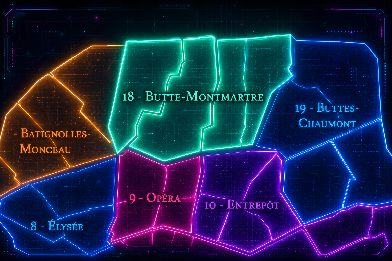
The 18e arrondissement occupies the northern edge of Paris, where the city rises toward the heights of Montmartre and stretches outward toward the former faubourgs and suburban boundaries of Saint-Ouen and Aubervilliers. It is bordered by the 17e arrondissement to the west, the 9e and 10e to the south, the 19e to the east, and the communes beyond the périphérique to the north. Its geography is defined by elevation, contrast, and threshold: hilltop village, working-class faubourg, railway edges, immigrant corridors, markets, cemeteries, nightlife, and some of the most recognizable views in the city.
The arrondissement’s most famous landscape is the Butte Montmartre, crowned by the Basilica of Sacré-Cœur and surrounded by streets, stairways, squares, terraces, windmill memories, artists’ studios, cabarets, cafés, and village-like lanes. But the 18e is much larger and more complex than Montmartre alone. It also includes the Goutte d’Or, La Chapelle, Clignancourt, Jules Joffrin, Château Rouge, Barbès, Marx Dormoy, and the northern edge of Paris near Porte de Clignancourt and Porte de la Chapelle.
The 18e arrondissement is divided into four administrative quarters: Grandes-Carrières, Clignancourt, Goutte-d’Or, and La Chapelle. Together, they form one of the most socially, visually, and historically varied districts in Paris. Grandes-Carrières preserves the western slope and quarry memory of Montmartre. Clignancourt contains the hilltop, Sacré-Cœur, the northern village fabric, and the approach toward the city’s flea-market edge. Goutte-d’Or carries one of Paris’s most important immigrant and working-class identities. La Chapelle connects the arrondissement to railway infrastructure, northern routes, industrial memory, and the city’s boundary with the suburbs.
The 18e is therefore a district of vertical and social contrast. It is at once one of the most mythologized places in Paris and one of the most intensely lived. Its hilltop can feel like a postcard; its lower streets can feel crowded, commercial, multicultural, and restless. Its identity depends on both realities.
Arrondissement Identity
Etymology and Origins
The arrondissement’s administrative name, Butte-Montmartre, comes from the hill of Montmartre, one of the most famous topographical features in Paris. “Butte” refers to the hill itself, while “Montmartre” is traditionally associated with the “Mount of Martyrs,” a name linked to the martyrdom of Saint Denis and his companions in early Christian tradition. Other interpretations have connected the name to older sacred or Roman associations, but in Parisian memory Montmartre has long been understood as a hill of religious, artistic, and popular significance.
The name is fitting because the hill defines the arrondissement’s symbolic identity. Montmartre rises physically above Paris and has long stood somewhat apart from it: village, pilgrimage site, quarry landscape, wine-growing slope, artistic refuge, revolutionary stronghold, tourist icon, and neighborhood. Its elevation has shaped both its views and its mythology. To reach Montmartre is often to climb — through streets, stairs, terraces, and layers of history.
Yet the arrondissement’s deeper identity extends beyond the butte. The 18e also includes former villages, faubourgs, working districts, immigrant neighborhoods, railway lands, and northern gateways. The name Butte-Montmartre foregrounds the arrondissement’s most famous hill, but the district’s full history includes the lower slopes and outer edges that made northern Paris one of the city’s most socially and culturally complex territories.
The 18e arrondissement is one of the twenty municipal arrondissements of Paris and remains a distinct local civic unit with its own mairie. It is not part of Paris Centre, which includes only the 1er, 2e, 3e, and 4e arrondissements. Its civic identity is shaped by its large and diverse population, its northern boundary position, its major tourist landscapes, its immigrant and working-class histories, and its role as one of the most visible arrondissements of everyday urban complexity in Paris.
The arrondissement’s four administrative quarters — Grandes-Carrières, Clignancourt, Goutte-d’Or, and La Chapelle — provide its official internal structure. These quarters are especially important because the 18e is often reduced to Montmartre alone. The official geography makes clear that the arrondissement also includes Barbès, Château Rouge, La Chapelle, Marx Dormoy, Clignancourt, and the northern routes that connect Paris to its suburbs.
For this project, the 18e is treated as both an official geographic layer and a cultural-historical district. Its civic framework helps distinguish the arrondissement from the 9e’s entertainment and Opéra landscapes to the south, the 17e’s transitional northwestern residential fabric to the west, the 10e’s stations and canal corridors to the southeast, and the 19e’s park, canal, and northeastern edge to the east. The 18e is northern Paris in its most famous and most complex form: scenic, crowded, symbolic, working, immigrant, artistic, and deeply contested.
Civic Framework
Parisian Identity
The 18e arrondissement holds one of the most powerful and contradictory places in the Parisian imagination. Montmartre is among the city’s most mythologized landscapes: the Sacré-Cœur silhouette, artists in Place du Tertre, stairways climbing between old houses, views over Paris, cabaret posters, windmills, vineyards, and the memory of painters, poets, singers, and bohemians. It is Paris as romantic hilltop.
But the arrondissement is also Paris as northern edge: Barbès, Château Rouge, Goutte d’Or, La Chapelle, Clignancourt, markets, railways, immigrant shops, street vendors, social housing, religious diversity, working-class histories, and the pressures of density and inequality. These landscapes are just as essential to the 18e as Montmartre’s postcard image. They give the arrondissement its present-day vitality and complexity.
The Parisian identity of the 18e therefore lies in tension. It is sacred and secular, touristic and local, artistic and working-class, village-like and metropolitan, romanticized and stigmatized, elevated and crowded. Few arrondissements reveal so clearly the difference between the image of Paris and the life of Paris. The 18e contains both, and its power comes from the fact that neither can fully explain it without the other.
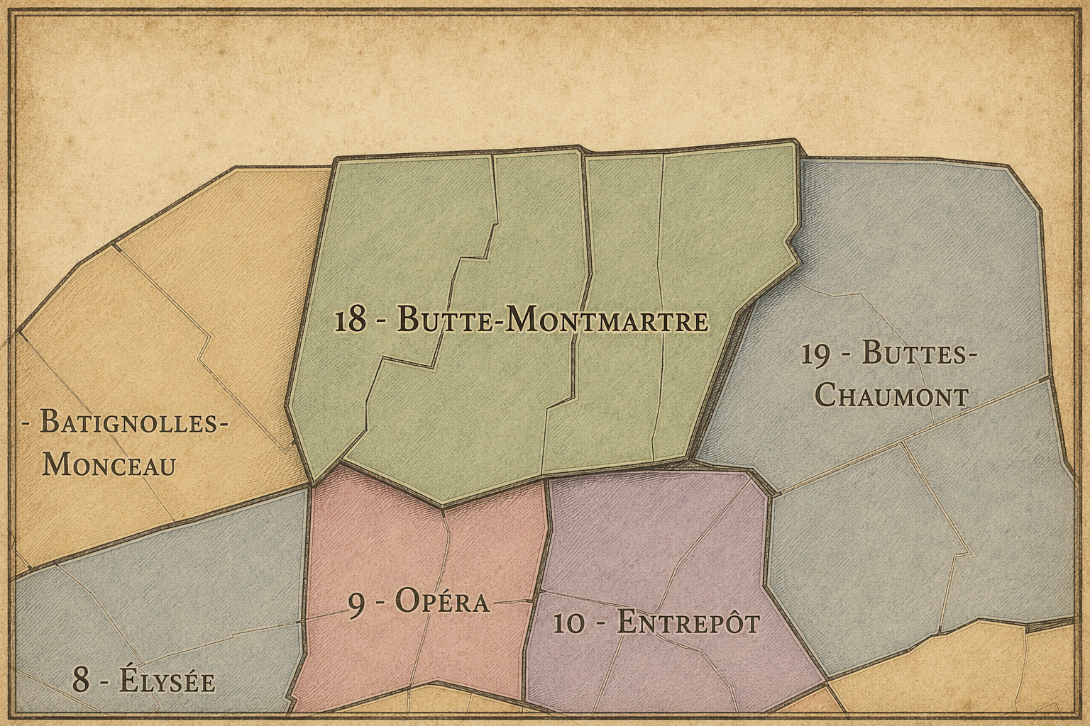
The 18e arrondissement is distinguished by its topography, diversity, and layered mythology. It is one of the few Parisian arrondissements where geography alone creates such a strong experience: the climb to Montmartre, the views from the butte, the descent toward Pigalle, Barbès, or La Chapelle, and the transition from hilltop streets to dense northern corridors all shape the feeling of the place.
Its four administrative quarters express the arrondissement’s range. Grandes-Carrières carries the memory of the quarries that shaped the western and northern slopes of Montmartre, along with residential streets and the cemetery landscape. Clignancourt contains much of the Montmartre hilltop identity, as well as the northern approaches toward Porte de Clignancourt and the city’s flea-market edge. Goutte-d’Or gives the arrondissement one of its strongest working-class and immigrant identities, especially around Barbès, Château Rouge, and the African and North African commercial landscapes of the area. La Chapelle connects the district to railway infrastructure, former industrial zones, migrant communities, religious institutions, and the routes toward the northern suburbs.
The arrondissement’s distinction also lies in how sharply it changes within short distances. A tourist may experience the 18e through Sacré-Cœur and Place du Tertre; a resident may know it through markets, schools, metro stations, courtyards, cafés, mosques, churches, shops, community associations, and everyday street life. The 18e is not one neighborhood. It is a set of overlapping northern Paris worlds, joined by elevation, movement, and memory.
Neighborhood Distinction
Les Quartiers Administratifs
Administrative Quarters
The Four Administrative Quarters
Each Paris arrondissement is divided into four official administrative quarters. These smaller districts reveal older place-names, local histories, civic boundaries, and neighborhood identities.
-
Chapelle
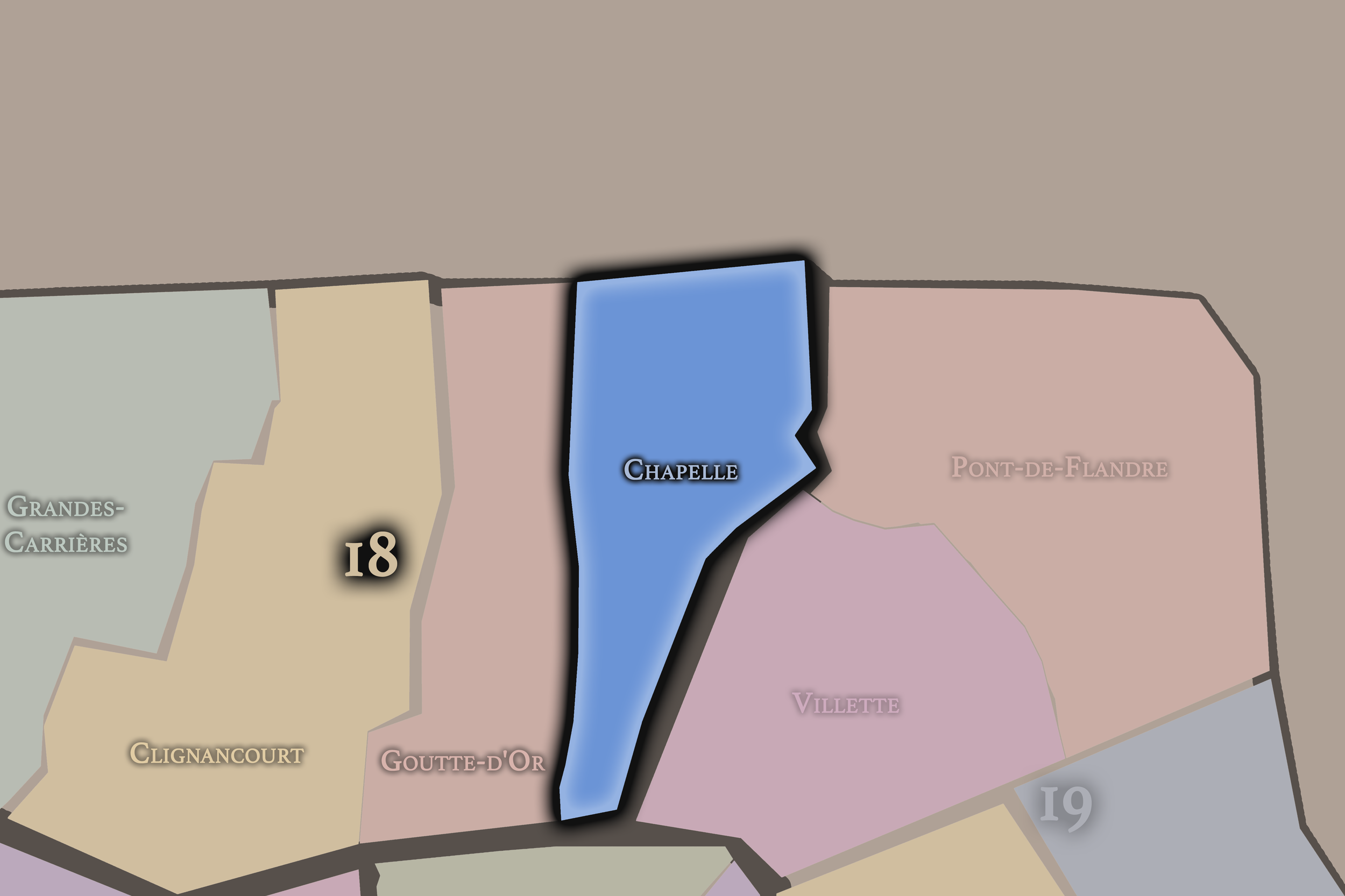
Chapelle occupies the northeastern portion of the 18e arrondissement, near the boundary with the 10e, 19e, and the northern suburbs. Its name comes from the former village of Chapelle, once located along the historic routes leading north from Paris. The quarter’s modern identity is shaped by railways, warehouses, working-class housing, migrant communities, religious institutions, and the city’s northern infrastructure.
This quarter gives the 18e one of its strongest threshold identities. Chapelle is a place of passage between Paris and the suburbs, between old village memory and modern infrastructure, between railway corridors and residential streets. Its history includes industry, labor, immigration, and urban change, while contemporary redevelopment and social pressures continue to reshape the area. Chapelle shows the 18e not as scenic hilltop, but as northern gateway.
-
Clignancourt
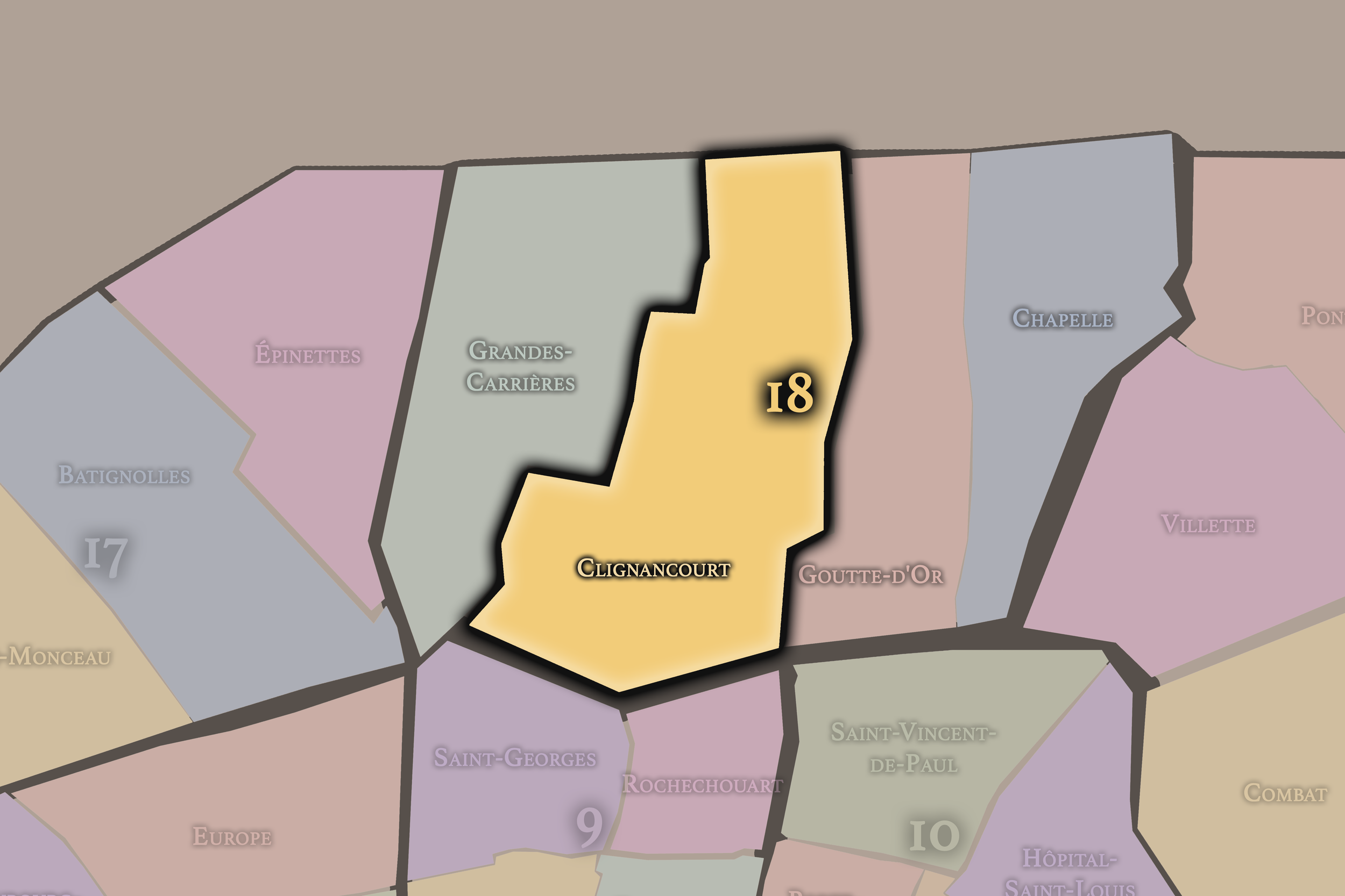
Clignancourt occupies the northern and central portion of the 18e arrondissement and includes much of the Montmartre hilltop and its northern approaches. Its name recalls an older village and locality absorbed into Paris, and the quarter now carries many of the arrondissement’s most famous sites: Sacré-Cœur, Place du Tertre, old streets, stairways, tourist routes, and the slopes descending toward the northern edge.
This quarter gives the 18e its strongest public mythology. Clignancourt is where Montmartre becomes image: white basilica, cobblestones, painters, terraces, views, and village atmosphere. Yet it also extends toward Porte de Clignancourt and the city’s boundary, linking the hilltop’s romantic identity to markets, transit, residential streets, and the edge of Paris. Clignancourt is therefore both iconic and transitional: the postcard and the northern gate.
-
Goutte-d’Or
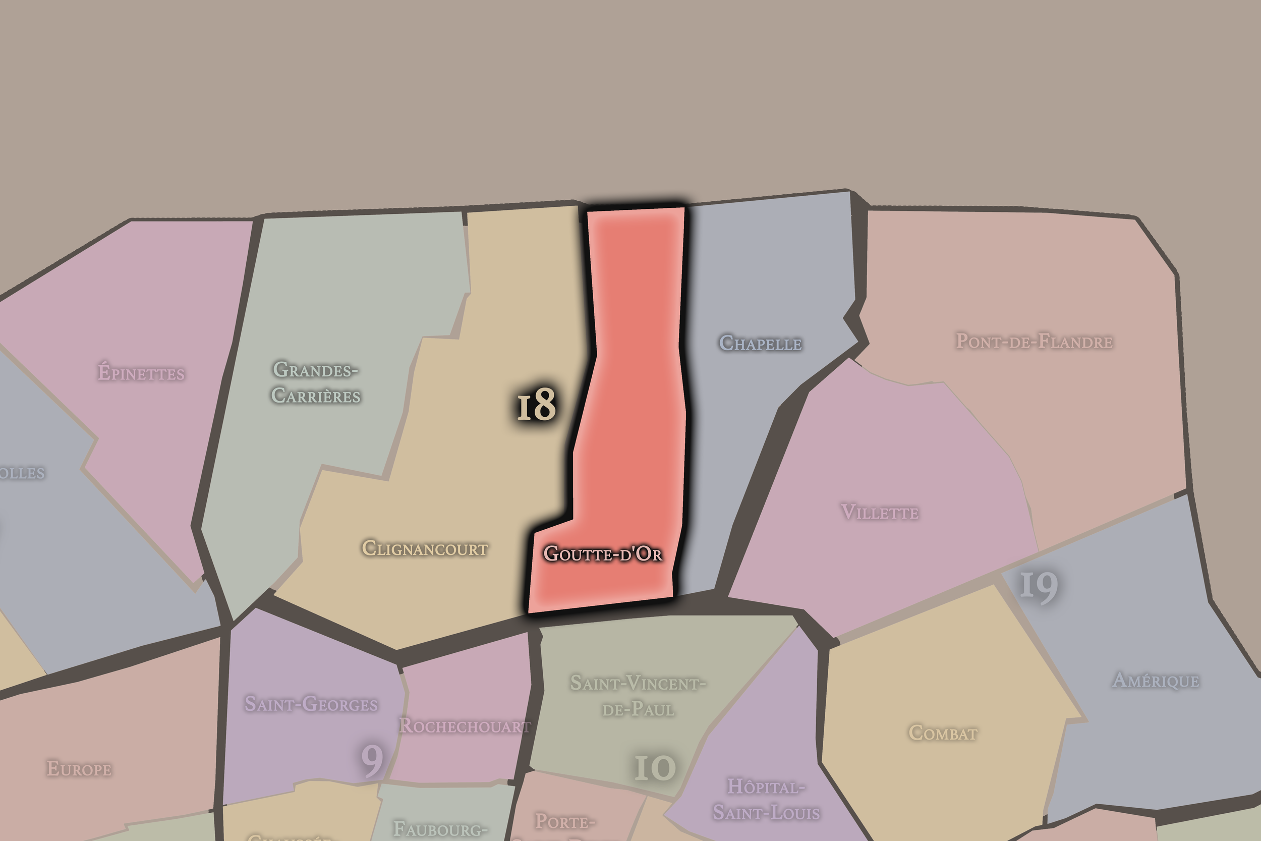
Goutte-d’Or occupies the southeastern portion of the 18e arrondissement, around Barbès, Château Rouge, and the slopes below Montmartre. Its name, meaning “drop of gold,” is associated with older local references, including vineyards and the color or quality of wine once produced in the area. In modern Paris, however, the quarter is most strongly associated with working-class history, immigration, African and North African commerce, and dense street life.
This quarter gives the 18e much of its contemporary social and cultural vitality. Around Château Rouge, Rue Dejean, Barbès, and surrounding streets, the city becomes intensely multicultural, commercial, and crowded. Food shops, textile stores, hair salons, markets, restaurants, religious communities, and street vendors create one of Paris’s most vivid immigrant urban landscapes. Goutte-d’Or is essential to understanding the 18e beyond Montmartre: it is Paris as migration, labor, commerce, and everyday resilience.
-
Grandes-Carrières
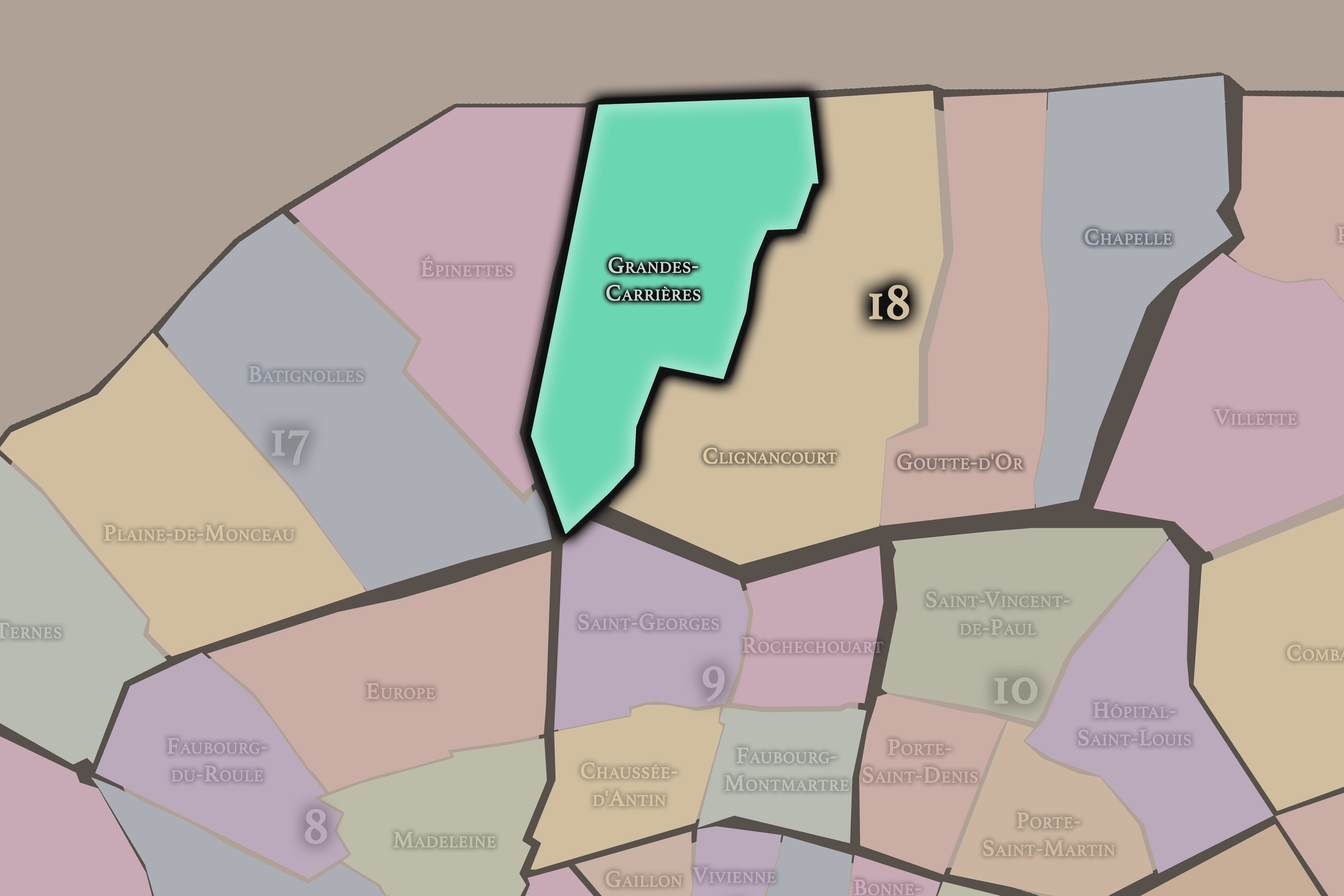
Grandes-Carrières occupies the western portion of the 18e arrondissement and takes its name from the large quarries that once marked this part of Montmartre. Before the hill became primarily known for artists, cafés, and tourism, its stone and gypsum were extracted for construction and plaster, giving the area a working and material history embedded in the landscape itself.
This quarter gives the 18e a strong connection to the physical making of Paris. The quarry memory reminds us that Montmartre was not only a picturesque hill, but also a worked landscape. Grandes-Carrières also includes residential streets and the area around the Montmartre Cemetery, where burial, stone, slope, and urban memory come together. It is one of the places where the arrondissement’s romantic image meets its geological and laboring past.
The History
The origins of the 18e arrondissement lie in the former villages and northern landscapes beyond old Paris. Montmartre, Clignancourt, and La Chapelle were not originally neighborhoods within the capital. They were separate settlements and territories outside the dense city, shaped by hills, roads, religious sites, vineyards, quarries, fields, and routes leading north.
Montmartre’s hill gave it a special role from an early period. Its elevation made it visible from the city and gave it religious and strategic meaning. The association with Saint Denis and early Christian martyrdom gave the hill a sacred memory, while later religious communities and pilgrimage routes reinforced its spiritual identity.
At the same time, the future arrondissement’s lower areas developed through more practical geographies: roads, agriculture, trade, quarrying, village settlement, and movement between Paris and the northern countryside. The 18e’s origins therefore combine sacred hill and working edge, village and route, stone and vine, devotion and labor.
Origins
16th–17th Century
During the 16th and 17th centuries, the future 18e arrondissement remained outside the urban center of Paris, but Montmartre and the surrounding villages were closely tied to the capital’s religious, agricultural, and economic life. The hill remained associated with abbeys, pilgrimage, vineyards, windmills, and rural settlement, while quarrying and agricultural uses shaped its slopes.
La Chapelle and Clignancourt continued to function as local settlements along northern routes. These were places connected to Paris, but not yet absorbed by it. Their economies and identities depended on proximity to the city while retaining village and suburban characteristics.
By the end of the 17th century, the future arrondissement still stood beyond the dense built fabric of Paris. Yet its defining ingredients were already present: Montmartre’s sacred and topographical identity, quarry and agricultural labor, villages along northern roads, and a sense of separation that would later feed both the hill’s mythology and the arrondissement’s social complexity.
In the 18th century, the future 18e arrondissement remained a landscape of villages, slopes, quarries, vineyards, and northern approaches. Montmartre continued to hold a semi-rural and religious character, with mills, gardens, and views over Paris. Its relative distance from the city helped preserve a distinct local identity even as Paris expanded around it.
The lower areas, including La Chapelle and the Goutte-d’Or, were increasingly affected by the growth of the capital. Roads, commerce, workshops, and settlement expanded along the approaches to Paris. The district’s position outside the old center made it attractive for activities and populations that did not fit easily within the more regulated or expensive inner city.
By the end of the 18th century, the future 18e was poised between village and city. It had not yet become the dense northern arrondissement known today, but the pressures of urban growth, labor, migration, and suburban expansion were already reshaping its relationship to Paris.
18th Century
19th Century
The 19th century transformed the future 18e arrondissement dramatically. The annexation of surrounding communes and territories brought Montmartre, La Chapelle, and nearby areas into Paris, creating the modern arrondissement and incorporating former villages into the city’s administrative structure.
Montmartre became increasingly urban while retaining its village mythology. Its low rents, hilltop atmosphere, cafés, cabarets, studios, and distance from bourgeois central Paris attracted artists, writers, performers, and bohemians. The district became associated with avant-garde life, popular entertainment, and the edge between poverty and creativity.
The Paris Commune of 1871 gave Montmartre and the 18e a powerful political memory. The hill became one of the symbolic starting points of the uprising, linking the arrondissement to revolutionary and popular resistance. Later in the century, the construction of Sacré-Cœur on the summit reshaped the hill’s religious and political meaning, making it one of the most visible monuments in Paris.
At the same time, the lower quarters of the 18e grew denser and more working-class. Railways, industry, housing, markets, and northern routes shaped La Chapelle, Goutte-d’Or, and Clignancourt. By the end of the 19th century, the arrondissement had become one of Paris’s great districts of contrast: sacred monument and cabaret, artist colony and working-class street, village hill and urban edge.
In the early and mid 20th century, the 18e arrondissement became one of the great symbolic landscapes of artistic Paris. Montmartre’s cabarets, studios, cafés, dance halls, streets, and squares entered the mythology of modern art and popular entertainment. Painters, poets, singers, and performers helped transform the hill into an international image of bohemian Paris.
The arrondissement also remained deeply working-class. The lower slopes and northern quarters were shaped by crowded housing, workshops, markets, immigrant communities, rail infrastructure, and everyday labor. The contrast between the romantic image of Montmartre and the social realities of the wider arrondissement was already pronounced.
Sacré-Cœur became an increasingly dominant visual presence on the hill, while Place du Tertre and the surrounding streets became more strongly associated with tourism and artistic memory. At the same time, Barbès, Goutte-d’Or, La Chapelle, and Clignancourt developed as dense, mixed, and often difficult urban districts tied to migration, commerce, and working life.
During the wars, occupation, and reconstruction years, the 18e experienced the broader pressures of Paris while retaining its distinct northern character. It remained a district of art, labor, poverty, resilience, and urban intensity.
Early–Mid 20th Century
Late 20th Century
The late 20th century brought major shifts in the 18e arrondissement’s social and cultural identity. Montmartre became increasingly shaped by tourism, heritage, souvenir commerce, and the global circulation of its artistic mythology. The hilltop’s village atmosphere remained powerful, but it was increasingly curated, photographed, and consumed as an image of Paris.
At the same time, Goutte-d’Or, Barbès, and La Chapelle became increasingly important landscapes of immigrant Paris. North African, West African, and other migrant communities shaped the commercial and social life of the lower 18e. Shops, markets, restaurants, religious institutions, community networks, and street economies made these quarters some of the most culturally distinctive in the city.
The arrondissement also faced challenges associated with poverty, housing pressure, urban renewal, policing, tourism, and social tension. These challenges were unevenly distributed, reinforcing the contrast between the highly visited hilltop and the less romanticized lower quarters.
By the end of the 20th century, the 18e had become one of the clearest examples of Paris’s dual identity: a city of myth and beauty, but also a city of migration, inequality, labor, and contested public space.
In the 21st century, the 18e arrondissement remains one of the most vivid and complex districts in Paris. Montmartre continues to attract visitors from around the world, drawn by Sacré-Cœur, Place du Tertre, stairways, cafés, views, and the memory of bohemian art. Its image remains one of the strongest symbols of Parisian romance.
Beyond Montmartre, the arrondissement continues to be shaped by diversity, density, and change. Goutte-d’Or and Château Rouge remain major centers of African and North African commerce and community life. La Chapelle continues to experience the pressures and possibilities of migration, redevelopment, infrastructure, and social services. Clignancourt and the northern edge connect Paris to flea-market culture, suburban movement, and the ongoing transformation of the city’s boundary.
The 18e also faces contemporary pressures around gentrification, tourism, public space, housing affordability, commercial change, policing, and the relationship between local residents and global visitors. Some areas have become increasingly fashionable, while others remain marked by precarity and social struggle. This unevenness is central to the arrondissement’s present-day identity.
Today, the 18e is one of the places where Paris most openly reveals its contradictions. It is beautiful and difficult, romantic and practical, celebrated and neglected, intensely local and globally visited. Its strength lies in the fact that it cannot be reduced to one Parisian story.
21st Century
Spirit and Legacy
The 18e arrondissement is Paris as hill, threshold, and contradiction. Its legacy is written in Montmartre’s slopes, Sacré-Cœur’s white dome, the quarry memory of Grandes-Carrières, the village streets of Clignancourt, the immigrant markets of Goutte-d’Or, and the railway edges of La Chapelle.
It is one of the arrondissements where mythology and reality sit closest together. Montmartre gives Paris one of its most beloved images: artists, stairways, cafés, windmills, cabarets, and views over the city. But the wider 18e gives Paris something equally important: the living, working, multilingual, contested northern city that continues to change beneath the postcard.
The name Butte-Montmartre honors the hill, but the arrondissement’s full spirit is larger. It is the place where Paris climbs and descends, where sacred memory meets popular culture, where village myth meets immigrant street life, where tourism meets residence, and where the city’s beauty is inseparable from its social complexity. The 18e is not simply the Paris people dream of. It is also the Paris people live, fight for, arrive in, and remake.
The Photography
The arrondissements do not share a single visual identity. Instead, they organize Paris into twenty broad visual fields, each gathering its own combination of landmarks, streetscapes, institutions, residential districts, commercial corridors, parks, rail stations, markets, cemeteries, and riverfront edges.
Some arrondissements are defined by monumental scale: royal palaces, ceremonial avenues, government buildings, museums, formal gardens, and internationally recognized landmarks. Others are shaped by hills, canals, rail gateways, apartment-lined boulevards, neighborhood markets, former village streets, industrial remnants, parks, or the quieter rhythms of residential Paris. The arrondissement system gives these varied landscapes a civic frame, allowing the city to be read not as one visual language, but as a sequence of overlapping Parisian atmospheres.

Visual Identity
Through The Lens
Photographing the arrondissements means moving between the official map and the street-level experience. The camera does not treat each arrondissement as visually uniform. Instead, it looks for the recurring forms, textures, transitions, and contrasts that make each district legible: the geometry of boulevards, the shade of plane trees, the repetition of balconies, the rise of stairways, the curve of canals, the presence of rail stations, the opening of parks, the weight of monuments, and the intimacy of side streets.
On CityNeighborhoods, the arrondissement provides the frame, but the photograph comes from the encounter between map, movement, light, and observation. As the Paris photography is processed, this section will connect each arrondissement more directly to the project’s Photographic Lexicon: the visual strategies, recurring motifs, and compositional patterns that shape how the city is seen through the lens.

If you visit Paris, these ideas can help inspire your own photography.



Paris: J’Espere, Je Rêve, Je Vive
Paris Photo Gallery
Paris Field Notes
-
Field Note: August 18, 2025 | 07:58 AM
Conditions: 73°F | Humidity: 72%.
Within the park's interior, the glacial kettle ponds acted as humidity traps, creating a soft, hazy light that filtered through the old-growth oaks. The transition from the park's dense shade to the sun-drenched edges of Oakland Gardens highlighted the day's exceptional "picture-perfect" clarity.
There is a fleeting window in Queens where the humidity of August hasn't yet heavy-set, and the morning sun hits the canopy of Alley Pond Park at a perfect oblique angle. Arriving just before 8:00 AM, I watched the light break through the oaks and tulip trees, casting long, dramatic shadows across the wet grass. It’s in these quiet, golden moments that the park feels less like a city escape and more like the ancient glacial valley it actually is.
Other neighborhoods visited:











































































































Explore Paris
-

The twenty arrondissements form the civic spiral of Paris, organizing the city into its broad local districts of government, identity, and daily life.
-

Each arrondissement is divided into four official administrative quarters, giving Paris a more precise civic and geographic framework.
-

The conseils de quartier bring participation to street level, giving residents a voice in neighborhood needs, public space, and local civic life.
-

Les Deux Rives trace Paris through the Seine’s two banks, revealing how the Rive Droite and Rive Gauche shaped the city’s civic power, commerce, learning, art, and cultural identity.
-

Cultural neighborhoods reveal the Paris people recognize through history, cafés, architecture, memory, atmosphere, and local belonging.