
19e - BUTTE-CHAUMONT
Arrondissements
Part of an ongoing project to walk and photograph every neighborhood in Paris, this page explores the 19th Arrondissement: Buttes-Chaumont through maps, district identity, history, and photography.



The Map
Download the Paris Arrondissements Map
Geographic Setting
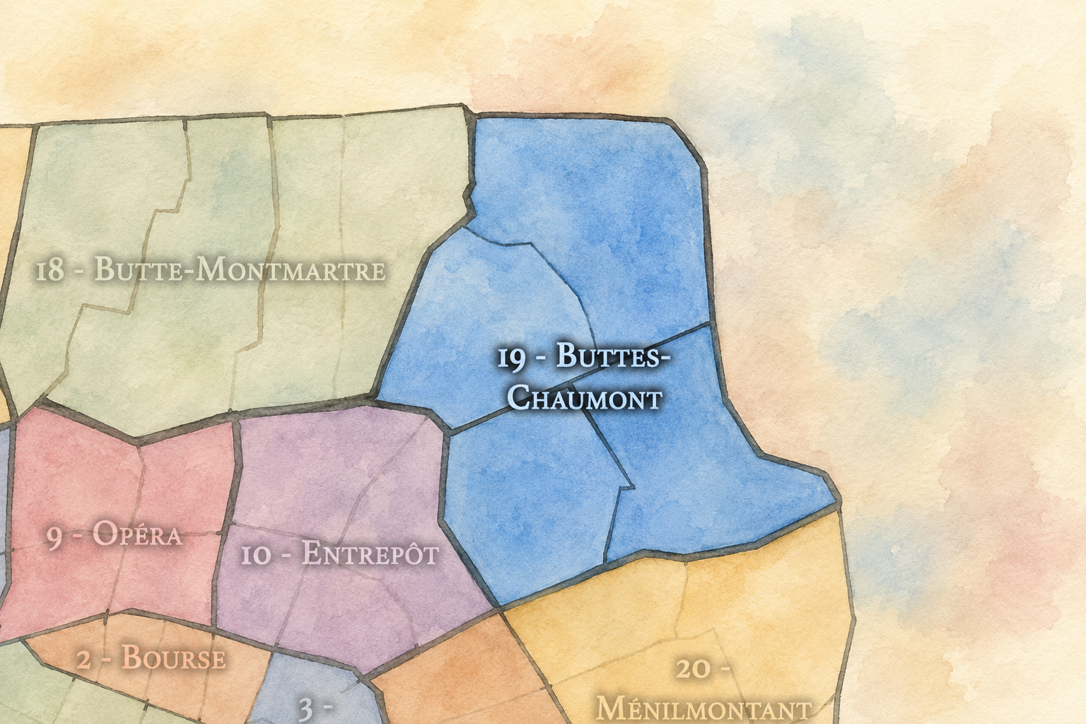
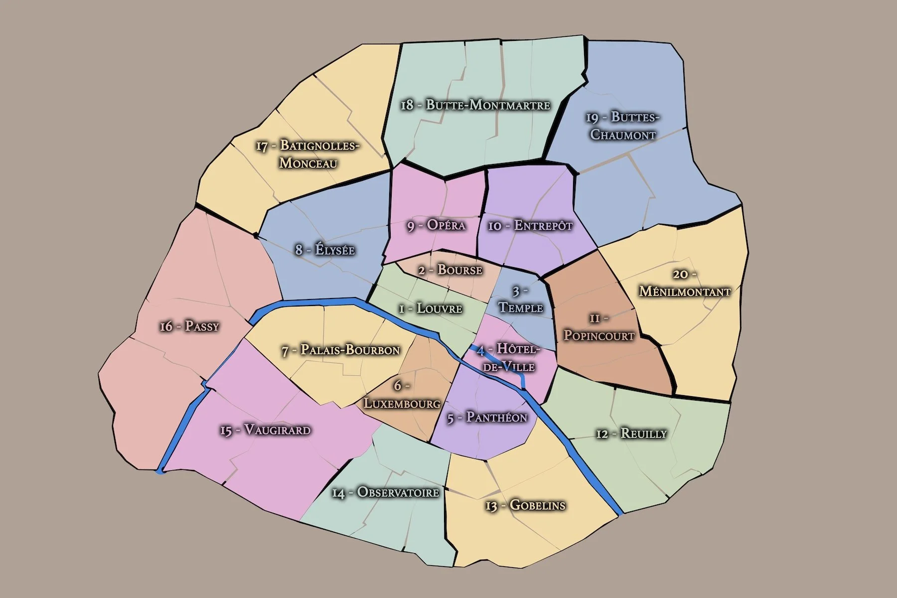
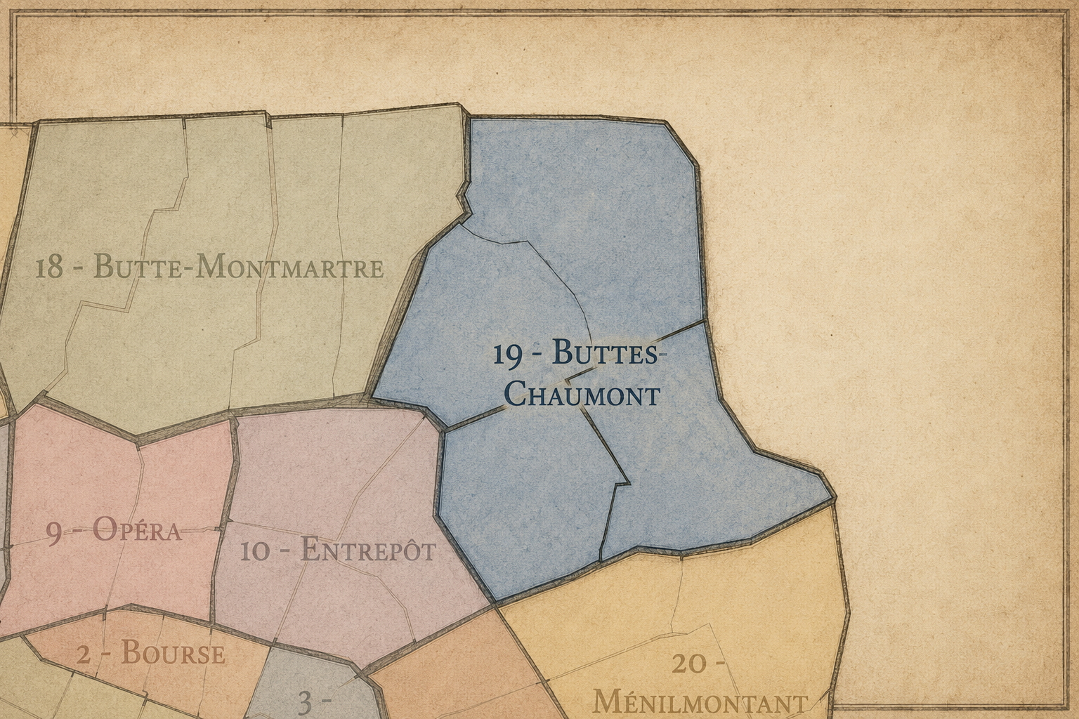
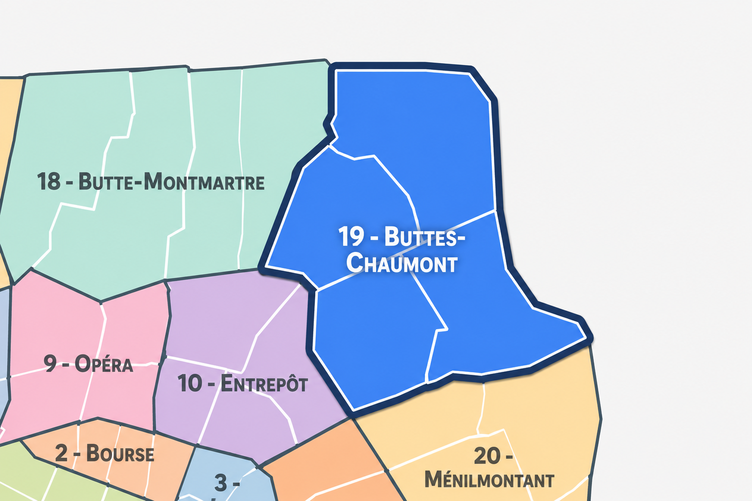
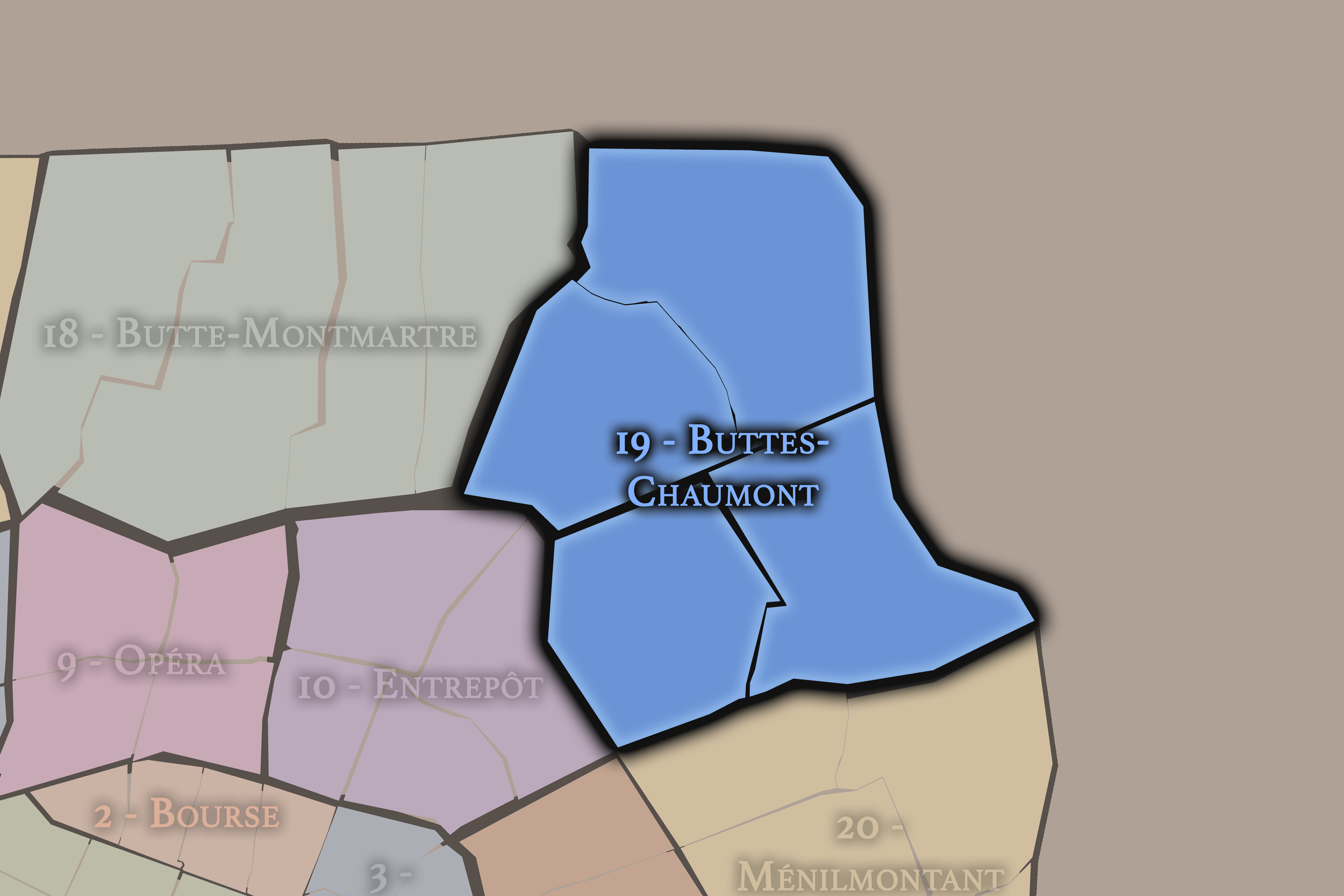
The 19e arrondissement occupies the northeastern edge of Paris, where the city rises, opens, and folds around canals, parks, slopes, reservoirs, working streets, and the boundary with the suburbs. It is bordered by the 18e arrondissement to the west, the 10e and 11e to the southwest, the 20e to the south, and the communes of Aubervilliers, Pantin, Le Pré-Saint-Gervais, and Les Lilas beyond the city’s northeastern limits. Its geography places it between central Paris and the wider northeastern metropolitan landscape.
The arrondissement is defined by topography and water. The Parc des Buttes-Chaumont gives the district one of the most dramatic landscapes in Paris, with cliffs, slopes, bridges, paths, and views shaped from former quarry land. Farther east, the Parc de la Villette opens the arrondissement toward the Canal de l’Ourcq, cultural institutions, music, science, and large-scale public space. The Canal Saint-Denis and Canal de l’Ourcq, along with the Bassin de la Villette, give the 19e a strong identity of water, industry, movement, and redevelopment.
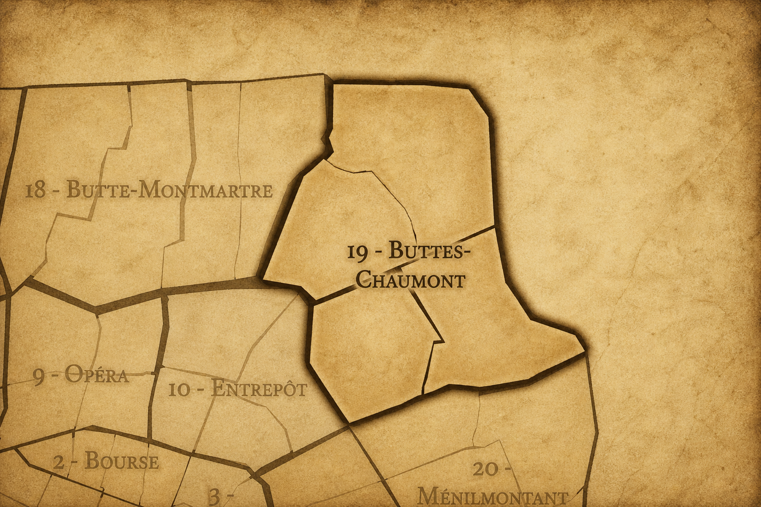
The 19e arrondissement is divided into four administrative quarters: Villette, Pont-de-Flandre, Amérique, and Combat. Together, they form one of the most distinctive urban landscapes in Paris. Villette and Pont-de-Flandre carry the memory of canals, slaughterhouses, warehouses, railways, industry, and later cultural reinvention. Amérique preserves the quarry and hillside identity of the district’s eastern heights. Combat connects the arrondissement to Buttes-Chaumont, the older northern edge of Belleville, and the social history of working-class Paris.
The 19e is therefore an arrondissement of edges transformed: quarries into parks, industrial canals into cultural corridors, slaughterhouse grounds into music and science institutions, working-class streets into diverse residential districts, and boundary landscapes into some of the most important public spaces of contemporary northeastern Paris.
Arrondissement Identity
Etymology and Origins
The arrondissement’s administrative name, Buttes-Chaumont, comes from the Parc des Buttes-Chaumont, one of the most dramatic and beloved parks in Paris. “Buttes” refers to the hills or rises of the landscape, while “Chaumont” is generally associated with an older local place-name connected to the area’s elevated and formerly rural terrain. The name points not to a palace, church, or civic institution, but to landform — to the hill itself, reshaped by the city into public landscape.
This makes the name especially fitting. The 19e is one of the arrondissements most strongly defined by topography. Former quarry slopes, elevated streets, reservoirs, rail cuts, canal basins, and parklands create a cityscape very different from the flatter ceremonial landscapes of central and western Paris. The Buttes-Chaumont name captures the district’s physical drama: the sense of Paris rising, dipping, cutting, and opening toward the northeast.
Yet the origins of the arrondissement extend beyond the park. The future 19e developed from former villages, industrial edges, quarries, canals, slaughterhouses, working-class settlements, and roads leading toward the northeastern suburbs. La Villette, Belleville, Combat, and the surrounding heights were not originally central Parisian neighborhoods. They were places beyond the old city, gradually absorbed into Paris through annexation, infrastructure, labor, and urban expansion. The name Buttes-Chaumont gives the arrondissement its landscape emblem, but its deeper identity belongs equally to water, stone, work, and the northeastern boundary of the city.
The 19e arrondissement is one of the twenty municipal arrondissements of Paris and remains a distinct local civic unit with its own mairie. It is not part of Paris Centre, which includes only the 1er, 2e, 3e, and 4e arrondissements. Its civic identity is shaped by its northeastern boundary position, its large residential population, its parks and canals, its cultural institutions, and its role as one of the city’s most socially and urbanistically varied outer arrondissements.
The arrondissement’s four administrative quarters — Villette, Pont-de-Flandre, Amérique, and Combat — provide its official internal structure. These quarters are especially important because the 19e is often understood through several strong but separate identities: Buttes-Chaumont, La Villette, the Canal de l’Ourcq, the Bassin de la Villette, Jaurès, Crimée, Ourcq, Danube, Place des Fêtes, and the edges of Belleville. The official quarters help organize these overlapping geographies into a coherent civic frame.
For this project, the 19e is treated as both an official geographic layer and a cultural-historical district. Its civic framework helps distinguish the arrondissement from the Montmartre and Goutte-d’Or identities of the 18e, the station and canal landscapes of the 10e, the Belleville and Ménilmontant identities of the 20e, and the suburban communes beyond the périphérique. The 19e is northeastern Paris as landscape and infrastructure: hilly, watery, working, multicultural, green, and continually remade.
Civic Framework
Parisian Identity
The 19e arrondissement holds a distinctive place in Paris because it represents the city as terrain, infrastructure, and reinvention. It is not one of the classic postcard arrondissements, yet it contains some of the most visually powerful public landscapes in the city: the cliffs and views of Parc des Buttes-Chaumont, the long waterline of the Bassin de la Villette, the canals of northeastern Paris, and the vast cultural grounds of Parc de la Villette.
Its Parisian identity is strongly tied to the transformation of working landscapes into public and cultural space. Former quarries became Buttes-Chaumont. Former slaughterhouses and industrial lands became La Villette. Canals once used for water supply, transport, and commerce became places of walking, leisure, nightlife, and cultural activity. The 19e repeatedly shows Paris converting necessary but marginal infrastructure into civic experience.
The arrondissement also represents a diverse and residential Paris. Its neighborhoods include long-standing working-class communities, immigrant families, public housing, newer creative and professional residents, students, cultural institutions, and families drawn to its parks and relative openness. The 19e is not polished in the manner of western Paris. Its identity is more rugged, practical, social, and landscape-driven. It is Paris as slope, canal, park, housing block, market street, and edge.
The 19e arrondissement is distinguished by its dramatic physical character and by the way its public spaces were carved out of former working terrain. Few arrondissements change so dramatically from one section to another. Around Buttes-Chaumont, the city becomes steep, scenic, and almost theatrical. Around La Villette, it opens into broad lawns, canals, performance halls, museums, and cultural infrastructure. Around Ourcq and the Bassin de la Villette, water structures neighborhood life. Around Danube, Amérique, and the eastern heights, the arrondissement becomes more residential, topographical, and closely tied to the boundary with the suburbs.
Its four administrative quarters express this range. Villette gives the arrondissement its canal, basin, and older village identity. Pont-de-Flandre carries the great transformation of slaughterhouse and industrial land into Parc de la Villette, cultural institutions, and large-scale public space. Amérique preserves the memory of quarry landscapes and the elevated eastern part of the arrondissement. Combat gives the district its connection to Buttes-Chaumont, Belleville’s northern edge, and the working-class history of the northeastern heights.
The arrondissement’s distinction also lies in its scale of reinvention. The 19e is not simply old Paris preserved. It is Paris rebuilt from rough ground: stone pits, canals, rail edges, slaughterhouses, reservoirs, working streets, and boundary neighborhoods turned into a district of parks, culture, residence, and urban experimentation.
Neighborhood Distinction
Les Quartiers Administratifs
Administrative Quarters
-
Amérique
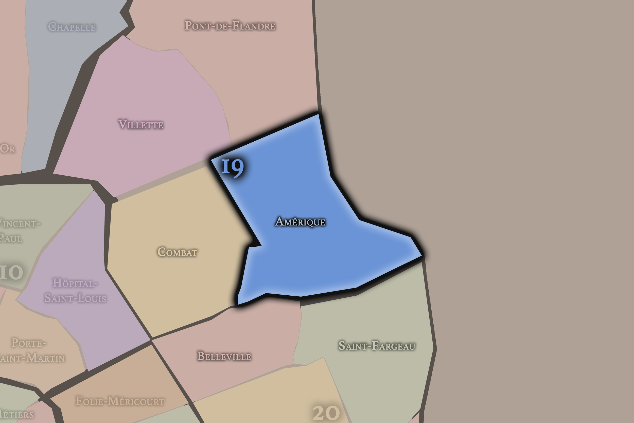
Amérique occupies the southeastern and eastern portion of the 19e arrondissement, on the elevated ground near Danube, Place des Fêtes, and the slopes toward the city’s edge. Its name is associated with the former quarry district; one tradition links the name to gypsum or stone said to have been exported for use abroad, though the quarter’s deeper identity is clearly tied to quarrying, elevation, and the eastern heights of Paris.
This quarter gives the 19e a strong topographical and residential identity. Amérique is a district of slopes, stairs, housing, local streets, public spaces, and views shaped by the uneven terrain of northeastern Paris. It is less famous than Buttes-Chaumont or La Villette, but it is essential to the arrondissement’s character as a place where the city rises, breaks, and reforms around former quarry land and edge neighborhoods.
-
Combat
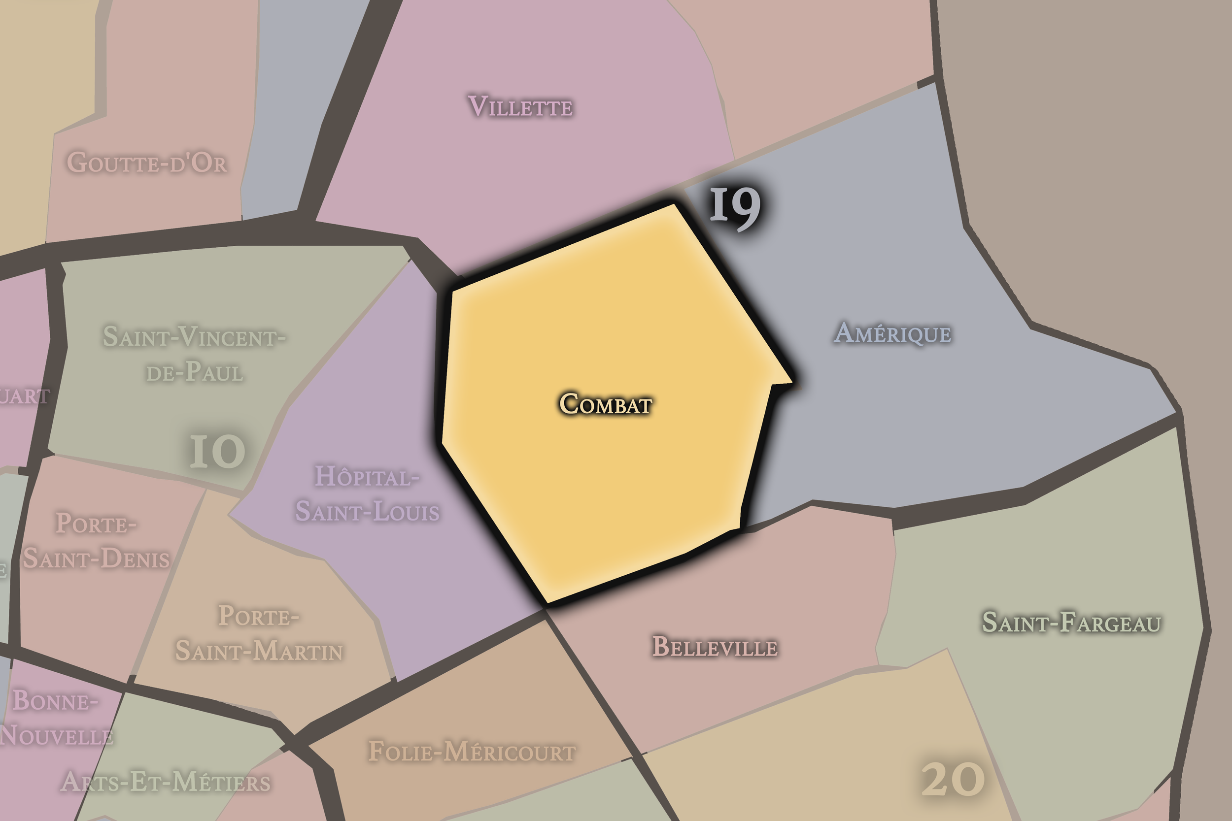
Combat occupies the southwestern portion of the 19e arrondissement and includes the Parc des Buttes-Chaumont and the areas leading toward Belleville and the 10e. Its name recalls older local history, including the former Place du Combat, associated with animal fights before the creation of the modern park and urban landscape. The quarter’s identity is now inseparable from Buttes-Chaumont, one of the great parks of Paris.
This quarter gives the arrondissement its most iconic landscape. The park’s cliffs, lake, bridges, temple, paths, and dramatic views transformed a former quarry and rough terrain into one of the city’s most imaginative public spaces. Combat also connects the 19e to the working-class and popular histories of Belleville’s northern edge. It is a quarter where the arrondissement’s rough ground and public beauty meet most powerfully.
-
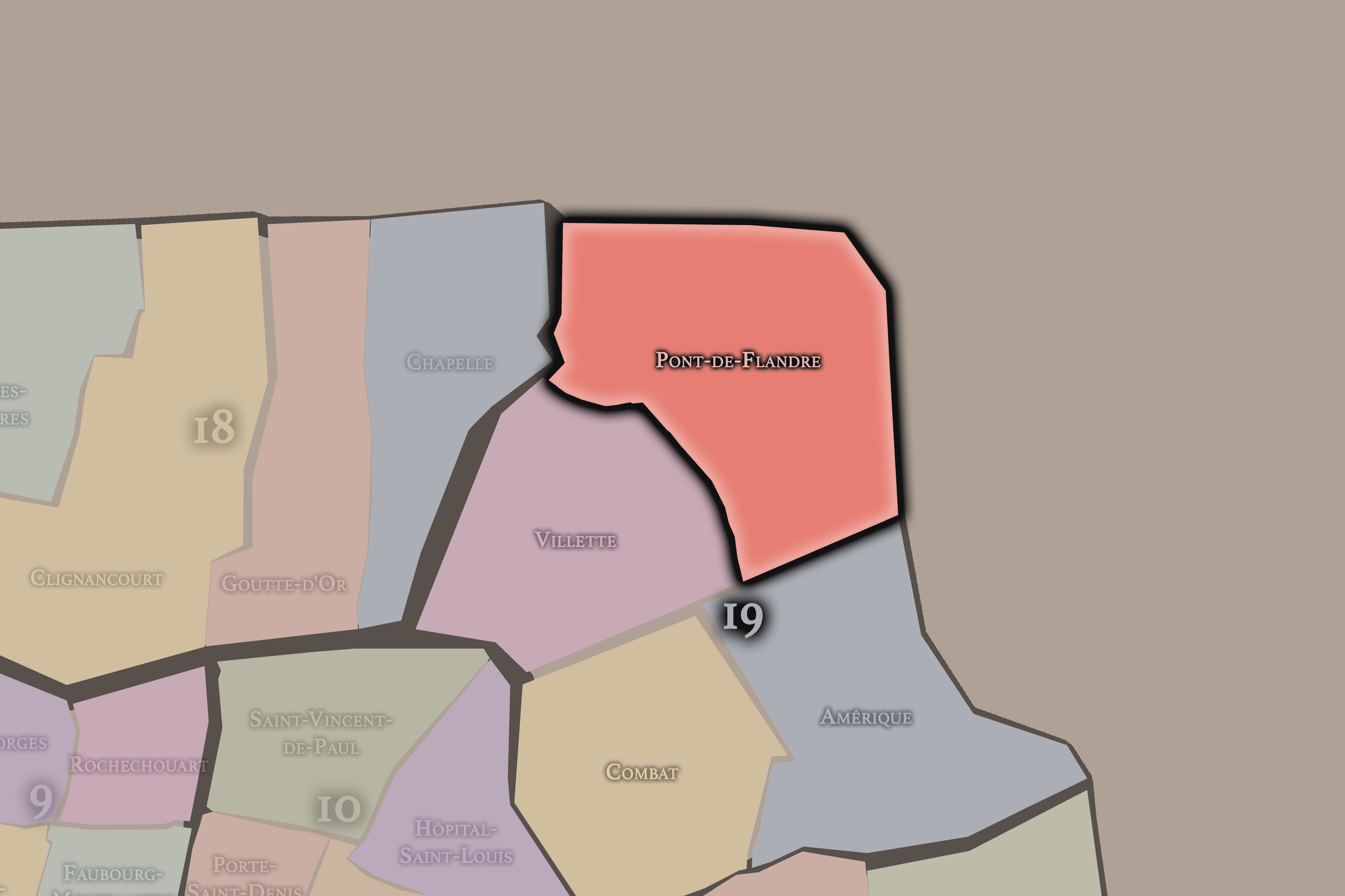
Pont-de-Flandre
Pont-de-Flandre occupies the northeastern portion of the arrondissement and is closely associated with the Parc de la Villette and the former slaughterhouse and industrial landscapes of northeastern Paris. Its name recalls the routes and crossings toward Flanders and the northern approaches to the city, giving the quarter a strong relationship to movement beyond Paris.
This quarter gives the 19e one of its most dramatic examples of urban transformation. The old industrial and slaughterhouse grounds of La Villette were reimagined into a major cultural park, with music venues, science institutions, performance spaces, lawns, canals, and architectural landmarks. Pont-de-Flandre is where the arrondissement’s working and logistical past becomes a contemporary cultural landscape, open to the city and the wider metropolis.
-
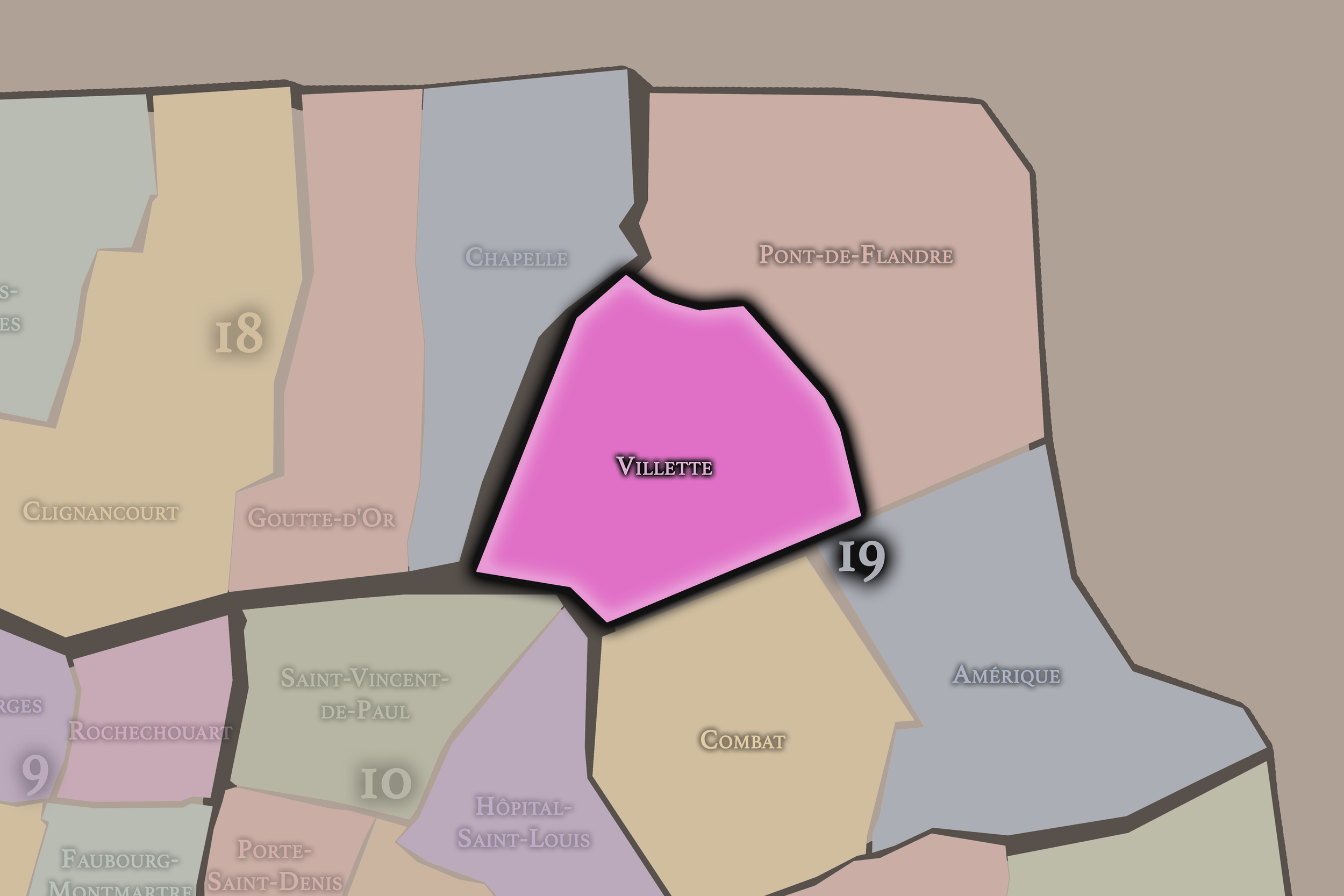
Villette
Villette occupies the western and northwestern portion of the 19e arrondissement, around the Bassin de la Villette and the canal landscapes that connect the district to the 10e and the northeastern edge of Paris. Its name preserves the memory of the former commune of La Villette, which was absorbed into Paris in the 19th century. The quarter’s identity is strongly tied to water, transport, warehouses, working-class settlement, and the city’s expansion beyond its older limits.
This quarter gives the 19e one of its strongest infrastructural identities. Around the Bassin de la Villette, the arrondissement becomes a district of canals, bridges, quays, cinemas, cafés, housing, and public gathering. The water that once supported movement and supply now also supports leisure and neighborhood life. Villette shows the 19e as a place where the practical systems of Paris have become part of the city’s contemporary social landscape.
The History
The origins of the 19e arrondissement lie in the northeastern lands beyond old Paris, including the former territories of La Villette and parts of Belleville. Before incorporation into the city, this area contained villages, roads, quarries, fields, religious lands, mills, water infrastructure, and routes leading toward the northern and eastern suburbs.
The terrain was central to its development. The hills and slopes of the future arrondissement provided stone, gypsum, and other materials used in construction and industry. Quarrying shaped the land physically, leaving scars, pits, and irregular topography that later became part of the district’s park landscapes. The ground itself was worked before it was beautified.
Water also shaped the arrondissement’s origins. The northeastern edge of Paris required systems for supply, transport, and drainage, and the later canals would build upon this geography of movement and utility. Before the 19e became known for parks and cultural institutions, it was a practical edge of the city: land to quarry, cross, cultivate, and connect.
Origins
16th–17th Century
During the 16th and 17th centuries, the future 19e arrondissement remained outside the dense core of Paris. The area was shaped by villages such as La Villette and Belleville, by routes leading toward the northeast, and by land uses that served the city without being fully part of it. Agriculture, quarrying, mills, and scattered settlement defined much of the landscape.
The district’s distance from the center made it useful. Activities requiring space, water, stone, or separation from dense urban life could take place in these outer territories. This was not a district of royal display or aristocratic elegance. It was a productive and peripheral landscape that supported the city from its edge.
By the end of the 17th century, the future 19e had acquired several of its enduring characteristics: uneven terrain, village identity, working land, northern and eastern routes, and a practical relationship to the expanding capital. It remained beyond Paris, but its resources and roads already tied it to the city’s growth.
In the 18th century, the future 19e arrondissement continued to function as a northeastern edge of Paris. La Villette and the surrounding areas were increasingly drawn into the capital’s economic and infrastructural orbit, while still retaining village and semi-rural features. Quarries, fields, roads, small industries, and working settlements shaped the district.
The need to supply Paris with water, materials, and food gave the area growing importance. Its location on the approach to the city made it useful for movement, storage, and activities that would later be formalized through canal and industrial development. The district’s future as a landscape of infrastructure was already implied by its geography.
By the end of the 18th century, the future 19e was positioned for transformation. It was still partly outside the city in form and feeling, but Paris was expanding toward it. The roughness and utility of the land — slopes, quarries, routes, and open space — would soon be reorganized through canals, annexation, parks, slaughterhouses, and new urban districts.
18th Century
19th Century
The 19th century transformed the future 19e arrondissement into a major district of infrastructure, industry, and public landscape. The annexation of surrounding territories brought La Villette and parts of Belleville into Paris, creating the modern arrondissement and incorporating former villages and edge landscapes into the capital.
The canal system reshaped the area. The Canal de l’Ourcq, the Bassin de la Villette, and related waterways made the district essential to water supply, transport, and the movement of goods. Around the canals, warehouses, factories, workshops, and working-class housing developed, giving the 19e a strong industrial and logistical identity.
The creation of Parc des Buttes-Chaumont was one of the century’s great transformations. Former quarry land and rough terrain were remade into a dramatic public park, with cliffs, water, bridges, paths, and carefully staged views. This conversion of worked land into scenic public space became one of the defining acts of the arrondissement’s history.
La Villette also became a major site of slaughterhouses and markets, tying the district to food supply, labor, and industrial-scale urban systems. By the end of the 19th century, the 19e had become one of the clearest examples of Paris turning its edge into infrastructure and then into urban form: canals, parks, industry, housing, and working neighborhoods all developed together.
In the early and mid 20th century, the 19e arrondissement remained strongly tied to working-class Paris, industry, canals, slaughterhouses, rail infrastructure, and dense residential life. La Villette continued to function as one of the city’s important logistical and food-supply districts, while the canals and surrounding streets supported warehouses, workshops, and labor.
The Buttes-Chaumont park provided a powerful contrast to these working landscapes. It offered green space, views, leisure, and public gathering in a part of Paris often associated with industry and density. The park became a major local and citywide resource, giving the arrondissement one of its most beloved public spaces.
The arrondissement also developed as a socially mixed and often modest residential district. Public housing, apartment buildings, local commerce, schools, and neighborhood streets shaped daily life. The 19e was not the Paris of luxury or monumentality, but a district where practical urban life unfolded around infrastructure, labor, parks, and community.
During the wars, occupation, and reconstruction years, the 19e absorbed the pressures of modern Paris while retaining its identity as a northeastern working district. Its canals, factories, markets, and housing landscapes connected it to the material systems of the city.
Early–Mid 20th Century
Late 20th Century
The late 20th century brought major change to the 19e arrondissement, especially around La Villette. The decline or removal of older slaughterhouse and industrial functions opened the way for one of the most significant cultural transformations in Paris. The Parc de la Villette, the Cité des Sciences et de l’Industrie, music venues, performance spaces, and new public landscapes redefined the northeastern edge of the arrondissement.
The canals also began to acquire a new identity. Once primarily associated with infrastructure, transport, and industry, the Canal de l’Ourcq and the Bassin de la Villette became increasingly valued as public, recreational, and cultural corridors. Walking, cycling, cafés, cinemas, and waterside gathering gradually changed the meaning of the canal landscape.
At the same time, the arrondissement remained socially complex. Public housing, immigration, working-class communities, and urban renewal projects shaped many neighborhoods. The eastern and northeastern edges of Paris continued to face economic and social challenges, even as cultural investment and new public spaces brought increased visibility.
By the end of the 20th century, the 19e had become a district of layered reinvention: still working-class and residential, still marked by infrastructure, but increasingly known for parks, culture, canals, and new forms of public urban life.
In the 21st century, the 19e arrondissement stands as one of the most dynamic districts of northeastern Paris. Parc des Buttes-Chaumont remains one of the city’s most beloved parks, while Parc de la Villette has become a major cultural landscape of music, science, architecture, festivals, public events, and metropolitan gathering. The canals and Bassin de la Villette continue to attract residents, visitors, students, families, and creative communities.
The arrondissement’s residential identity remains strong and varied. It includes public housing, older working-class streets, newer developments, immigrant communities, families, artists, students, and professionals drawn by relative affordability, parks, and canal life. The 19e has become increasingly desirable in some areas, while still retaining social diversity and facing challenges of inequality, housing pressure, and uneven redevelopment.
Contemporary 19e is also deeply connected to the larger Grand Paris landscape. Its northeastern position links it to Pantin, Aubervilliers, La Villette, the Canal de l’Ourcq corridor, and wider metropolitan transformations beyond the périphérique. The arrondissement increasingly feels like both Paris and gateway to the larger urban region.
Today, the 19e is a district of public space and social mixture. Its parks and canals give it openness; its slopes and housing give it texture; its institutions give it cultural weight; its communities give it life. It is one of the places where Paris most visibly continues to expand its definition of itself.
21st Century
Spirit and Legacy
The 19e arrondissement is Paris as terrain transformed. Its legacy is written in quarries turned into cliffs and gardens, canals turned into promenades, slaughterhouse grounds turned into cultural parks, working streets turned into diverse neighborhoods, and boundary landscapes turned into public space.
The name Buttes-Chaumont captures one of the arrondissement’s great truths: this is a district shaped by the ground itself. Hills, cuts, slopes, reservoirs, quarries, canals, and basins all give the 19e a physical drama unlike much of central Paris. The city here is not flat or purely architectural; it is carved, lifted, bridged, and opened.
Its spirit lies in reinvention without erasure. The 19e still carries the memory of labor, stone, water, industry, and the northeastern edge. But it also offers some of the most generous public landscapes in Paris: parks where people gather, canals where neighborhoods meet, cultural institutions where old industrial ground becomes a place of music, science, and imagination. The 19e is Paris remade from its margins — a district where rough ground becomes civic beauty.
The Photography
The arrondissements do not share a single visual identity. Instead, they organize Paris into twenty broad visual fields, each gathering its own combination of landmarks, streetscapes, institutions, residential districts, commercial corridors, parks, rail stations, markets, cemeteries, and riverfront edges.
Some arrondissements are defined by monumental scale: royal palaces, ceremonial avenues, government buildings, museums, formal gardens, and internationally recognized landmarks. Others are shaped by hills, canals, rail gateways, apartment-lined boulevards, neighborhood markets, former village streets, industrial remnants, parks, or the quieter rhythms of residential Paris. The arrondissement system gives these varied landscapes a civic frame, allowing the city to be read not as one visual language, but as a sequence of overlapping Parisian atmospheres.

Visual Identity
Through The Lens
Photographing the arrondissements means moving between the official map and the street-level experience. The camera does not treat each arrondissement as visually uniform. Instead, it looks for the recurring forms, textures, transitions, and contrasts that make each district legible: the geometry of boulevards, the shade of plane trees, the repetition of balconies, the rise of stairways, the curve of canals, the presence of rail stations, the opening of parks, the weight of monuments, and the intimacy of side streets.
On CityNeighborhoods, the arrondissement provides the frame, but the photograph comes from the encounter between map, movement, light, and observation. As the Paris photography is processed, this section will connect each arrondissement more directly to the project’s Photographic Lexicon: the visual strategies, recurring motifs, and compositional patterns that shape how the city is seen through the lens.

If you visit Paris, these ideas can help inspire your own photography.



Paris: J’Espere, Je Rêve, Je Vive
Paris Photo Gallery
Paris Field Notes
-
Field Note: August 18, 2025 | 07:58 AM
Conditions: 73°F | Humidity: 72%.
Within the park's interior, the glacial kettle ponds acted as humidity traps, creating a soft, hazy light that filtered through the old-growth oaks. The transition from the park's dense shade to the sun-drenched edges of Oakland Gardens highlighted the day's exceptional "picture-perfect" clarity.
There is a fleeting window in Queens where the humidity of August hasn't yet heavy-set, and the morning sun hits the canopy of Alley Pond Park at a perfect oblique angle. Arriving just before 8:00 AM, I watched the light break through the oaks and tulip trees, casting long, dramatic shadows across the wet grass. It’s in these quiet, golden moments that the park feels less like a city escape and more like the ancient glacial valley it actually is.
Other neighborhoods visited:











































































































Explore Paris
-

The twenty arrondissements form the civic spiral of Paris, organizing the city into its broad local districts of government, identity, and daily life.
-

Each arrondissement is divided into four official administrative quarters, giving Paris a more precise civic and geographic framework.
-

The conseils de quartier bring participation to street level, giving residents a voice in neighborhood needs, public space, and local civic life.
-

Les Deux Rives trace Paris through the Seine’s two banks, revealing how the Rive Droite and Rive Gauche shaped the city’s civic power, commerce, learning, art, and cultural identity.
-

Cultural neighborhoods reveal the Paris people recognize through history, cafés, architecture, memory, atmosphere, and local belonging.