
1er - LOUVRE
Arrondissements
Part of an ongoing project to walk and photograph every neighborhood in Paris, this page explores the 1st Arrondissement: Louvre through maps, district identity, history, and photography.



The Map
Download the Paris Arrondissements Map
Geographic Setting
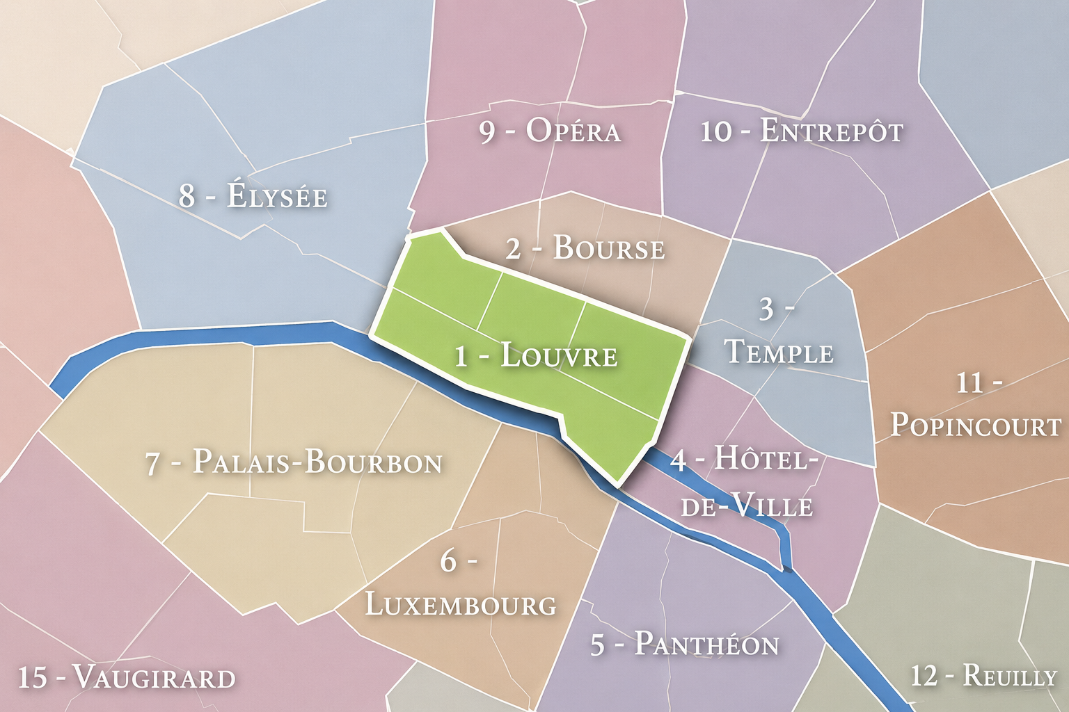
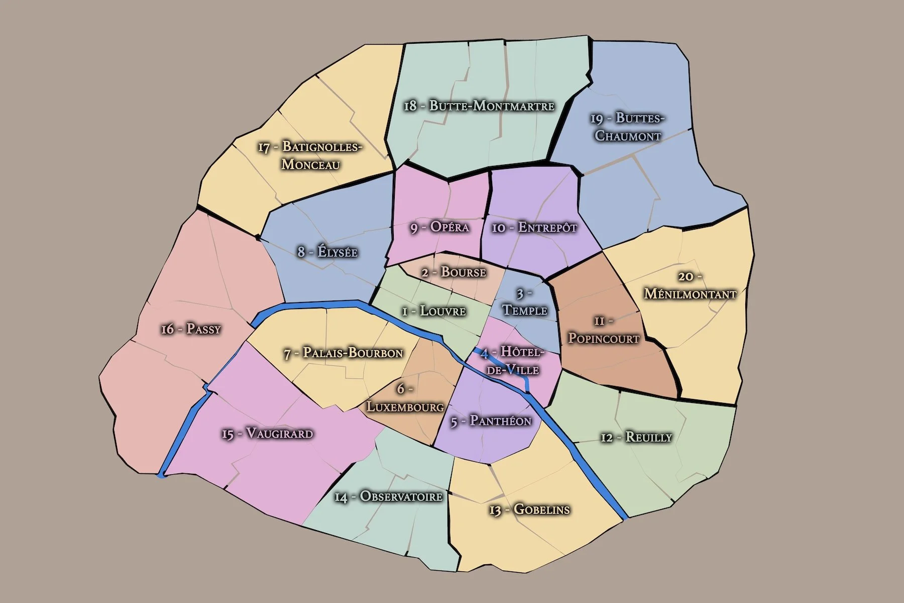
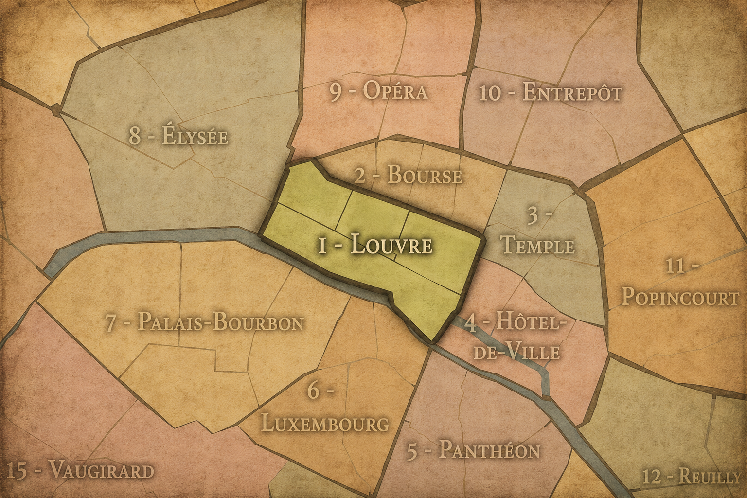
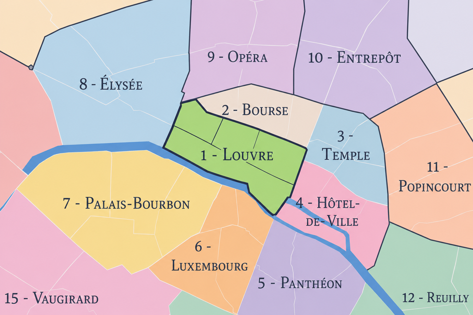
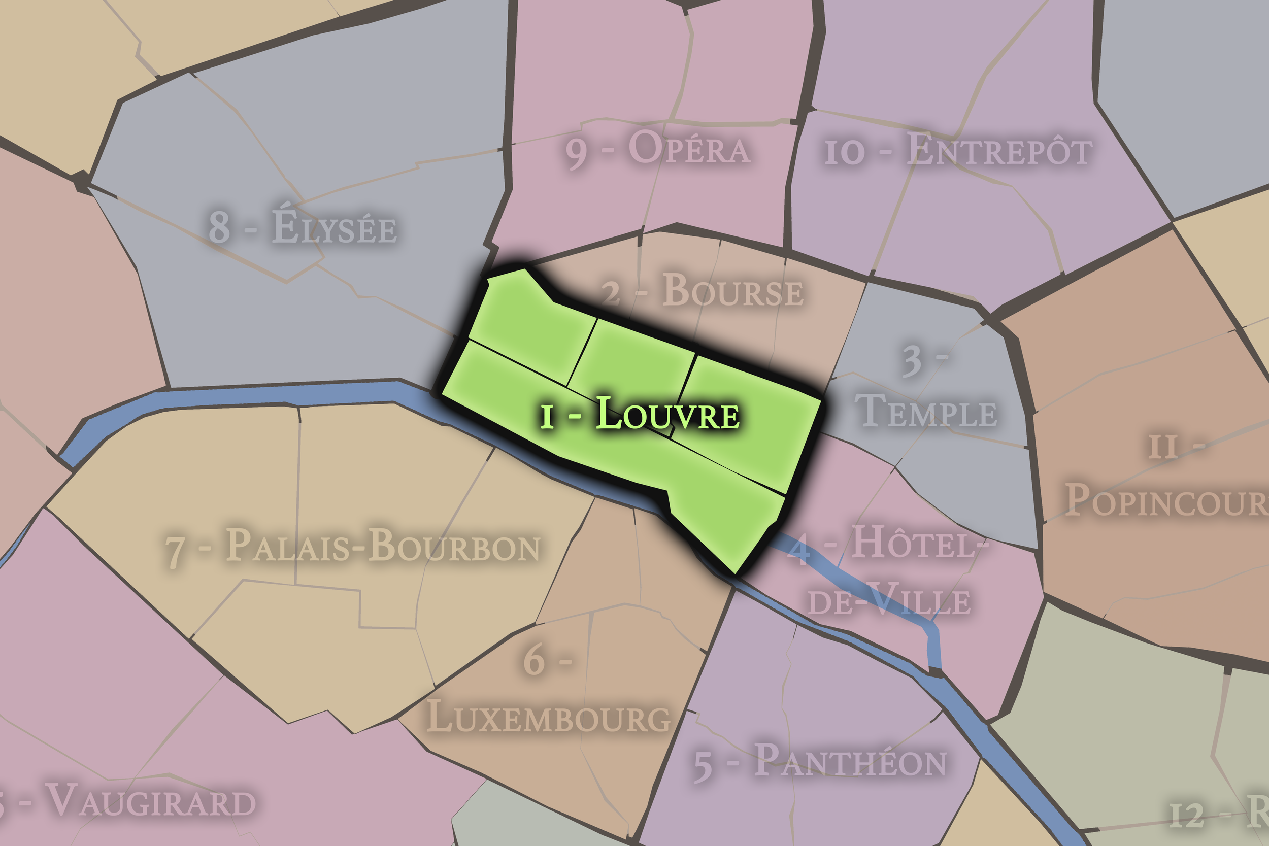
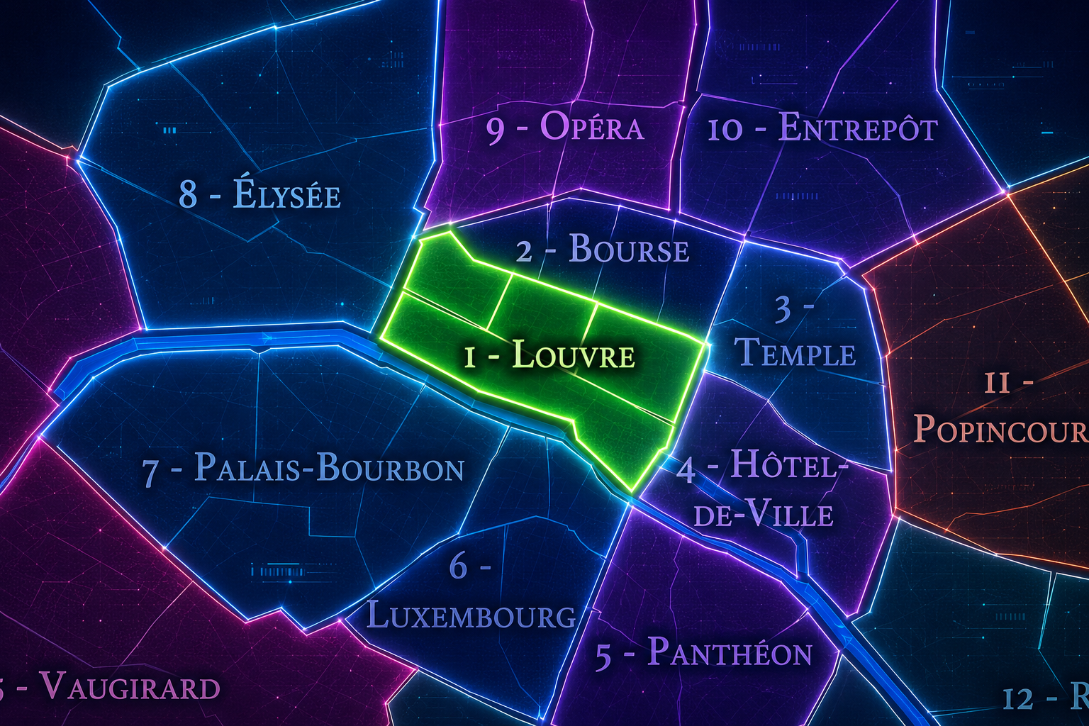
The 1er arrondissement occupies a central position on the Right Bank of the Seine, with a small but historically significant extension onto the western end of the Île de la Cité. It sits between the Seine to the south, the 2e arrondissement to the north, the 8e to the west, and the 3e and 4e to the east. Its western edge opens toward Place de la Concorde and the grand axis of western Paris, while its eastern side turns toward Les Halles, the Marais, and the older commercial heart of the city.
Although compact, the arrondissement contains several of Paris’s most important spatial sequences. Along the Seine, the Louvre and the Tuileries form a monumental riverfront landscape. Farther north, Rue de Rivoli, Rue Saint-Honoré, Avenue de l’Opéra, and the streets surrounding Les Halles reveal the arrondissement’s more commercial and urban character. On the Île de la Cité, the western tip of the island connects the arrondissement to the city’s earliest civic and judicial core.
The 1er arrondissement is divided into four official administrative quarters: Saint-Germain-l’Auxerrois, Les Halles, Palais-Royal, and Place-Vendôme. These are not merely convenient subdivisions; together, they express the arrondissement’s range — riverfront monarchy and museum space, market streets and transit, enclosed palace gardens, luxury squares, government buildings, and fragments of medieval Paris. INSEE identifies the 1er arrondissement under the official geographic code 75101.
Arrondissement Identity
Etymology and Origins
The 1er arrondissement is commonly associated with the name Louvre, after the palace and museum that dominate its southern riverfront. The Louvre itself began not as a museum, but as a medieval fortress. Under King Philippe Auguste, a defensive castle was built around 1190 on the Right Bank near the Seine, outside the older heart of Paris, to help protect the city. Over the centuries, this fortress was transformed into a royal palace and eventually into the museum that now anchors the arrondissement’s identity.
The arrondissement’s formal identity, however, is larger than the Louvre alone. Its name evokes the museum, but its history extends through Les Halles, the Palais-Royal, Place Vendôme, the Tuileries, the Seine quays, and the western end of the Île de la Cité. The result is a district whose identity is not singular, but cumulative: fortress, palace, garden, market, square, court, museum, and central urban crossroads.
As an arrondissement, the 1er belongs to Paris’s municipal structure, but since 2020 it has also been part of the larger Paris Centre sector, which combines the 1er, 2e, 3e, and 4e arrondissements under a shared local administration. Even with that administrative change, the 1er remains a distinct historic and geographic unit, especially through its four administrative quarters and its long association with the Louvre, Les Halles, the Palais-Royal, and Place Vendôme.
The arrondissement’s civic landscape is unusually dense. It contains institutions of national, judicial, cultural, and administrative significance, including the Louvre, the Palais de Justice complex on the Île de la Cité, the Conseil d’État and Conseil constitutionnel at the Palais-Royal, and major public spaces such as the Tuileries Garden and Place Vendôme. The arrondissement therefore functions less like a conventional residential district and more like a symbolic center of the capital — a place where the architecture of the state, the city, and the public realm all press closely together.
Civic Framework
Parisian Identity
The 1er arrondissement carries an almost impossible burden of representation. To many visitors, it is one of the first mental images of Paris: the glass pyramid of the Louvre, the arcades of Rue de Rivoli, the long plane of the Tuileries, the jewelry houses of Place Vendôme, the bustle of Les Halles, the Pont Neuf, the Seine, and the old stones of the Île de la Cité. Yet these images are not simply decorative. They are the visible remains of successive versions of Paris layered into the same ground.
This is the arrondissement of royal Paris, but also of public Paris. The Louvre moved from fortress to palace to museum. The Tuileries shifted from royal garden to public landscape; the Louvre notes that the garden was created during the Renaissance for Catherine de’ Medici and is now managed as part of the Louvre domain. Les Halles, once the city’s central food market, became a modern transit and commercial node after the wholesale market moved out of central Paris in the 20th century. Britannica describes Les Halles as Paris’s central market from 1183 to 1969, with the Forum des Halles opening in 1979.
Because of this, the 1er can feel both monumental and restless. It is grand, but rarely quiet. It is historic, but not frozen. It is shaped by museums, courts, ministries, shops, trains, gardens, tourists, luxury commerce, and ordinary pedestrian movement. Its identity lies in that tension: the ceremonial center of Paris remains one of the city’s most active crossroads.
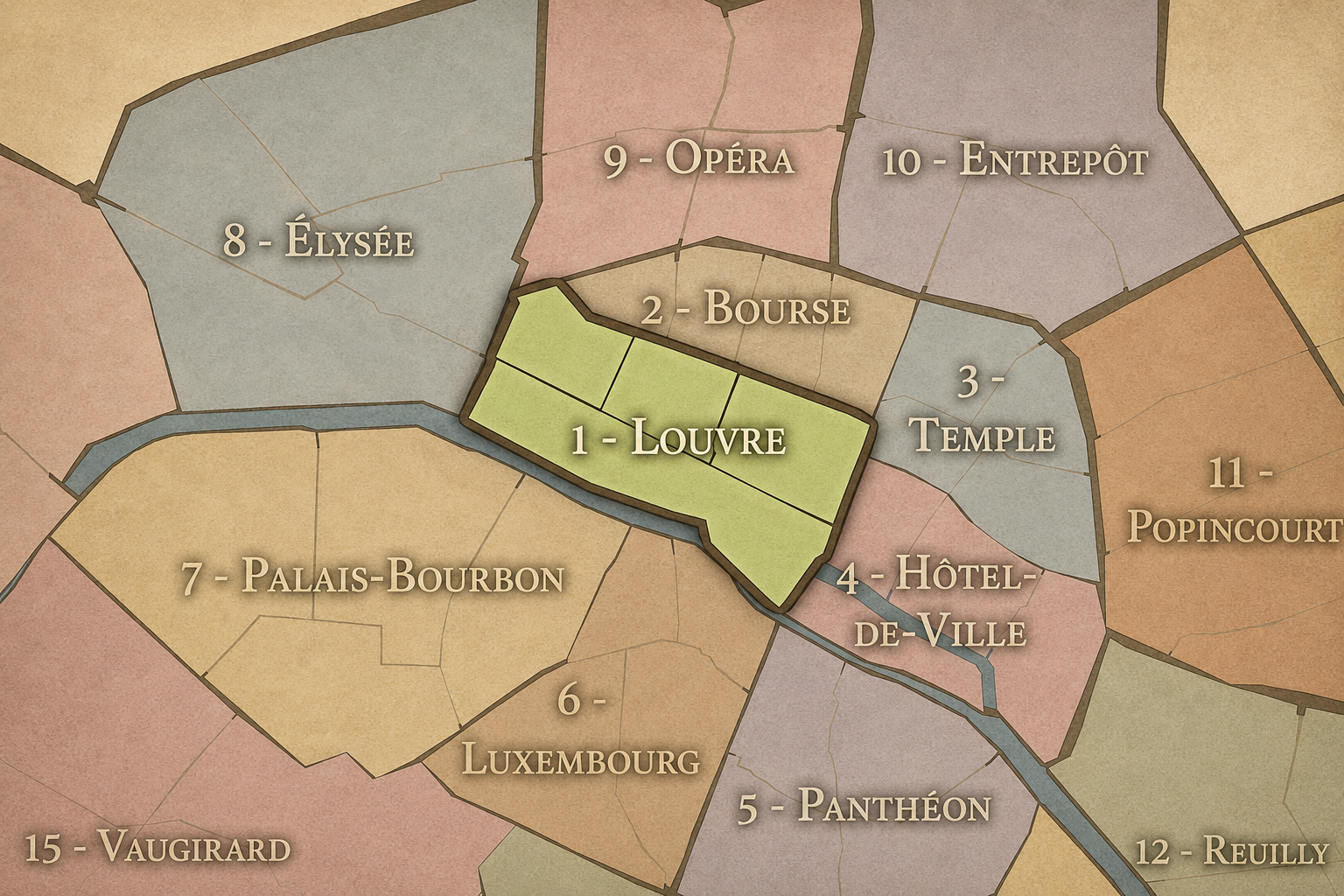
The 1er arrondissement differs from a neighborhood in the familiar sense. It is not defined by one single village-like center or one dominant residential personality. Instead, it is a civic and historical frame containing several highly distinct urban worlds.
Saint-Germain-l’Auxerrois faces the Seine and gathers the Louvre, the Tuileries, and the western Île de la Cité into a landscape of monarchy, museum space, and judicial memory. Les Halles is denser, more commercial, and more transit-oriented, still carrying the legacy of the old central market. Palais-Royal is more enclosed and formal, shaped by arcades, gardens, theaters, and institutions. Place-Vendôme is ceremonial and luxurious, organized around one of Paris’s most elegant royal squares.
This internal variety is essential to the arrondissement’s character. The 1er is not only “the Louvre arrondissement.” It is a district of transitions: from river to market, from palace to passage, from royal square to shopping street, from medieval island to modern transit hub.
Neighborhood Distinction
Les Quartiers Administratifs
Administrative Quarters
The Four Administrative Quarters
Each Paris arrondissement is divided into four official administrative quarters. These smaller districts reveal older place-names, local histories, civic boundaries, and neighborhood identities.
-
Saint-Germain-l’Auxerrois
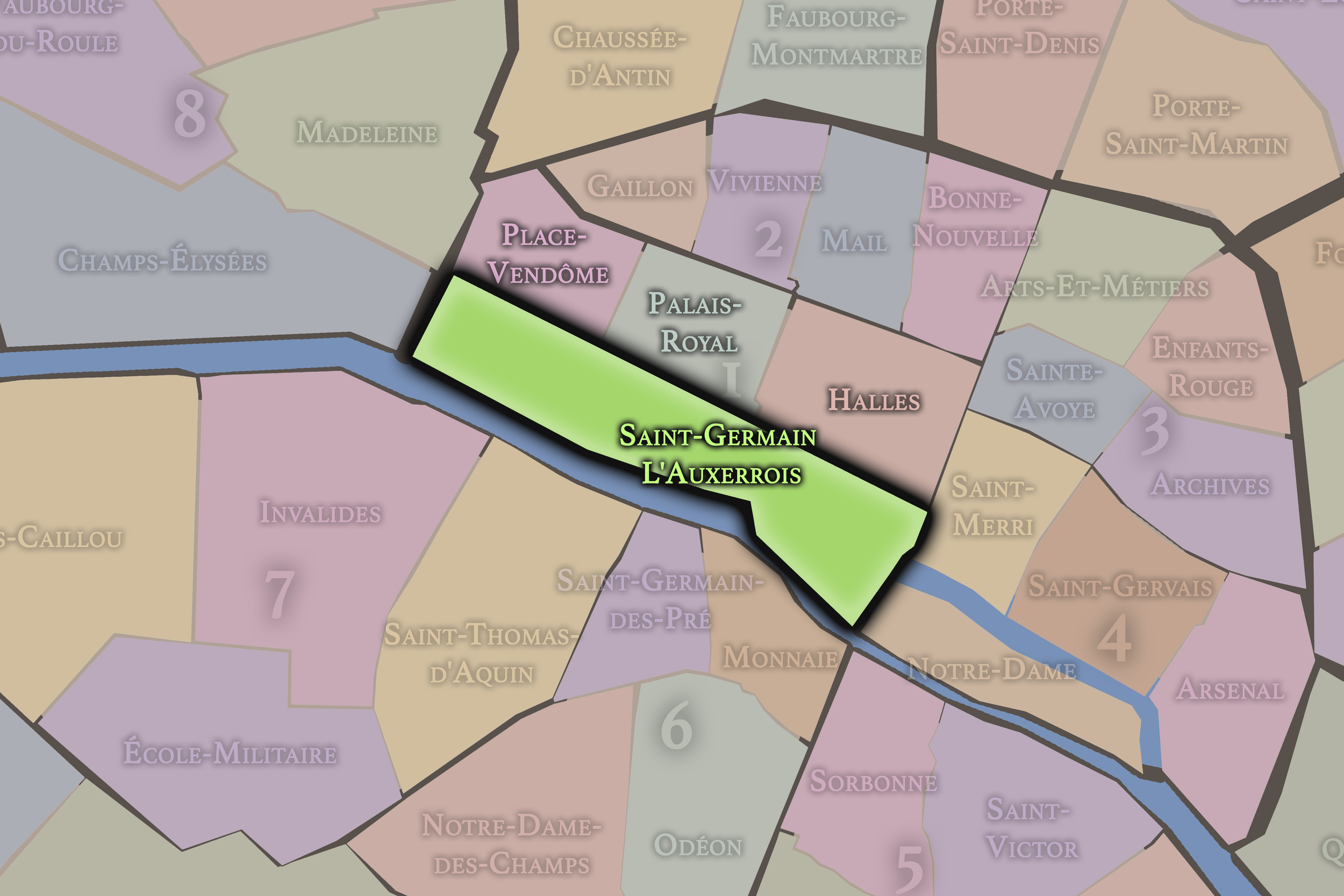
Saint-Germain-l’Auxerrois forms the southern and southwestern portion of the arrondissement. It includes the Louvre, the Tuileries Garden, the Carrousel, the Seine riverfront, and the western portion of the Île de la Cité. Its name comes from the church of Saint-Germain-l’Auxerrois, historically associated with the royal parish of the Louvre.
This quarter carries the deepest ceremonial weight of the arrondissement. It is where the Louvre’s long transformation — fortress, palace, museum — is most visible. It is also where the arrondissement touches the oldest core of Paris through the Île de la Cité, Pont Neuf, Place Dauphine, and the judicial landscape around the Palais de Justice.
-
Les Halles
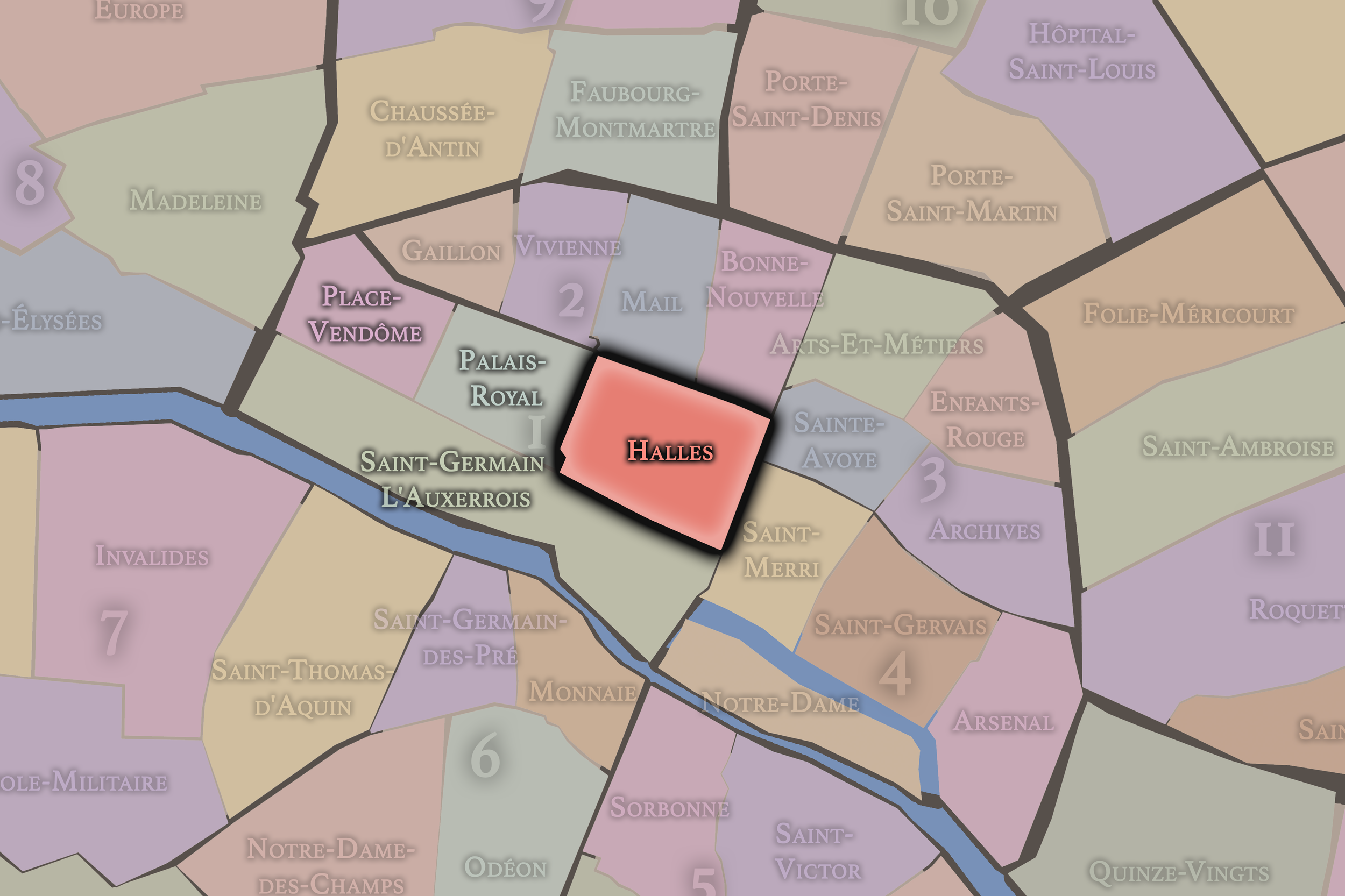
Les Halles occupies the eastern and northeastern portion of the arrondissement. For centuries, this area was tied to food, trade, labor, and the provisioning of Paris. Its name comes from the market halls that once made the quarter famous as the central marketplace of the city.
The disappearance of the old wholesale market and the later construction of the Forum des Halles changed the physical character of the quarter, but not its role as a place of movement and exchange. Today Les Halles remains one of the most intensively used parts of central Paris, shaped by transit, shopping, pedestrian streets, restaurants, and the continuing presence of Saint-Eustache and the Bourse de Commerce.
-
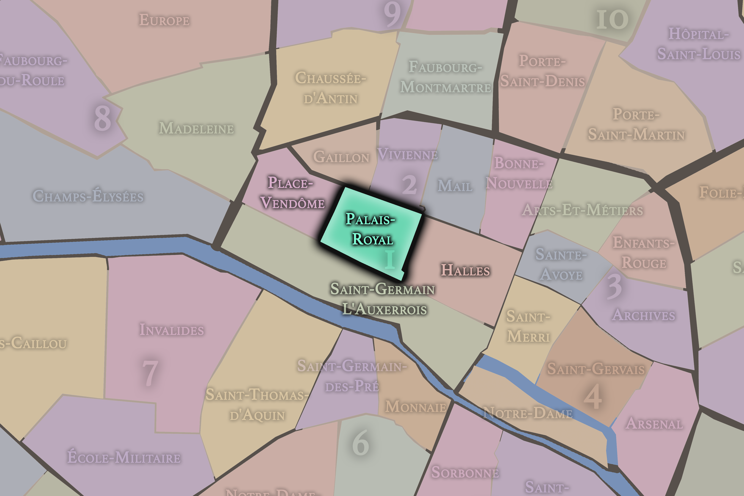
Palais-Royal
Palais-Royal lies north of the Louvre and south of the 2e arrondissement. It is organized around the former royal palace, its garden, arcades, theaters, and surrounding institutional buildings. The Palais-Royal originated as the Palais-Cardinal, associated with Cardinal Richelieu, before becoming connected to the royal family. The Conseil d’État’s history of the site emphasizes Richelieu’s role in developing the palace and its later royal associations.
This quarter has a more inward-facing character than the great open spaces of the Louvre and Tuileries. Its arcades, courtyards, and gardens create a composed urban interior — a place where political history, theater, literary life, and architectural form have long overlapped.
-
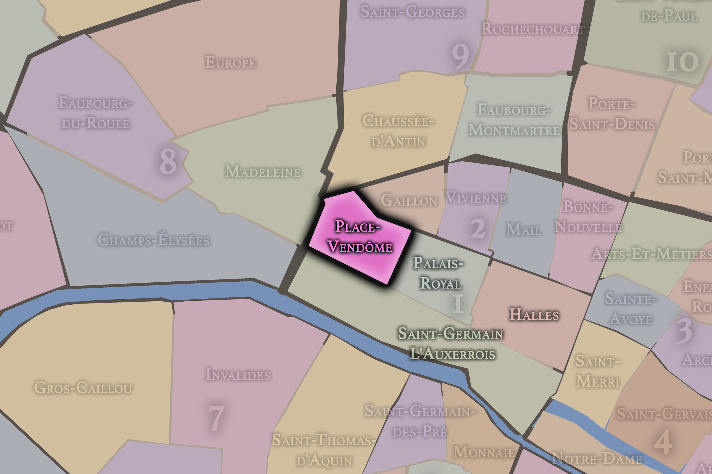
Place-Vendôme
Place-Vendôme occupies the northwestern portion of the arrondissement, around the square from which it takes its name. It is one of Paris’s most refined ceremonial spaces, associated with royal urbanism, luxury commerce, grand hotels, jewelry houses, and the monumental language of the late 17th century.
The square’s architectural identity is closely associated with Jules Hardouin-Mansart’s designs of 1698, which Britannica describes as the basis for the octagonal place that has remained little changed in form. The quarter’s identity is therefore different from the marketplace energy of Les Halles or the museum landscape of the Louvre. It is Paris as controlled composition: stone façades, axial order, luxury, and royal geometry.
The History
The oldest layer of the 1er arrondissement is tied to the earliest geography of Paris itself. The western end of the Île de la Cité connects the arrondissement to the ancient and medieval heart of the city, while the Right Bank areas that now contain the Louvre and Les Halles developed as Paris expanded beyond its island core.
In the medieval period, this part of the Right Bank was defined by defense, trade, and proximity to royal power. The Louvre began as a fortress under Philippe Auguste around 1190, built to help defend the city near the Seine. Les Halles, meanwhile, emerged as the central market district of Paris. Britannica identifies the Halles quarter as the city’s central market from 1183 to 1969, giving the area a commercial identity that lasted for nearly eight centuries.
From the beginning, then, the territory of the 1er was shaped by two forces that would define much of Parisian history: the protection and display of power, and the daily systems that fed and supplied the city.
Origins
16th–17th Century
The Renaissance and early modern periods transformed the 1er from a defensive and commercial edge into a major landscape of royal ambition. The Louvre’s medieval fortress was gradually reshaped into a palace, while the Tuileries were established to the west. Catherine de’ Medici created the Tuileries Palace and garden in the 16th century, extending royal presence along the Right Bank and helping to form one of Paris’s most important monumental landscapes.
In the 17th century, the Palais-Royal added another layer of power and prestige. Built in association with Cardinal Richelieu and later tied to the royal family, the palace became one of the great aristocratic and political sites near the Louvre. Its gardens and galleries also helped establish a more enclosed and theatrical form of Parisian public life, distinct from the open grandeur of the Louvre and Tuileries.
The 1er’s identity during this period was therefore increasingly architectural and ceremonial. It was no longer only a defensive edge or market district. It was becoming a stage on which royal, ministerial, and aristocratic Paris presented itself.
By the 18th century, the arrondissement’s western and northern portions were increasingly shaped by formal urban design, elite residence, and public sociability. Place Vendôme, designed in the orbit of Louis XIV’s royal urbanism, expressed a highly controlled architectural order. Its façades, proportions, and monumental character helped establish the quarter as one of the most elegant spaces in Paris.
At the same time, Les Halles continued to function as the practical stomach of the city. While the royal and aristocratic spaces of the 1er projected order, hierarchy, and prestige, the market district sustained a more crowded and working urban life. This contrast between ceremonial Paris and provisioning Paris is one of the arrondissement’s defining historical tensions.
The Palais-Royal also became an important place of sociability, commerce, theater, and political discussion. Its arcades and gardens helped blur the boundary between elite space and public space, foreshadowing the political and social upheavals that would reshape Paris at the end of the century.
18th Century
19th Century
The 19th century brought enormous change to the 1er arrondissement. The Louvre and Tuileries remained central symbols of state power, but revolution, empire, restoration, and republic repeatedly altered the meaning of those spaces. The Tuileries Palace, long associated with royal and imperial residence, was burned during the Paris Commune in 1871; the Louvre notes this as a defining rupture in the history of the palace-and-garden complex.
The arrondissement was also reshaped by modern urban planning. New streets, clearer axes, and changing traffic patterns tied the 1er more tightly to the transformed capital. Rue de Rivoli became one of the great east-west corridors of central Paris, while the area around Les Halles remained essential to the city’s food supply.
The 19th century therefore intensified the arrondissement’s dual identity. It was a district of national monuments and state symbolism, but also a district of markets, labor, and modern circulation. Few parts of Paris held the official and the everyday so closely together.
In the early and mid 20th century, the 1er arrondissement continued to serve as one of the symbolic centers of Paris, while its practical functions began to strain against the demands of the modern city. The Louvre’s identity as a museum deepened, the Tuileries remained a major public garden, and Place Vendôme became increasingly associated with luxury, jewelry, and prestigious hotels.
Les Halles, however, faced a different future. The old central market, once indispensable to Paris, became increasingly difficult to reconcile with modern logistics, traffic, sanitation, and wholesale distribution. Its historic role remained powerful, but the conditions that had made a central food market viable were changing.
This period preserved much of the arrondissement’s visual and institutional prestige while preparing the way for one of its most dramatic modern transformations: the removal of the wholesale market from Les Halles.
Early–Mid 20th Century
Late 20th Century
The late 20th century remade the eastern portion of the arrondissement. In 1969, the wholesale market of Les Halles moved out of central Paris to Rungis. The old market halls were demolished, and the area was redeveloped with the Forum des Halles, which opened in 1979. This change marked the end of Les Halles as the physical “belly of Paris” and the beginning of its new life as a commercial and transit-centered district.
At the Louvre, the late 20th century also brought major transformation. The Grand Louvre project reorganized the museum and its public spaces, most visibly through the glass pyramid in the Cour Napoléon. While controversial at first, the pyramid became one of the defining modern images of the museum and of the arrondissement itself.
The late 20th century thus brought a new layer to the 1er: not simply preservation, but reinvention. The district’s oldest institutions and spaces were adapted for new patterns of tourism, transit, commerce, and cultural consumption.
In the 21st century, the 1er arrondissement remains one of the most visited and symbolically loaded parts of Paris. The Louvre, Tuileries, Palais-Royal, Place Vendôme, Les Halles, and the Seine riverfront continue to draw immense public attention, while the arrondissement’s residential population remains relatively small compared with its civic and visitor functions.
The creation of Paris Centre as a shared administrative sector for the 1er, 2e, 3e, and 4e arrondissements reflects a broader shift in how the historic center is governed. Yet the 1er retains its own identity because its geography and symbolism remain so distinct. It is the arrondissement of the Louvre, but also of the old market, the royal square, the palace garden, the judicial island, and the public museum.
Today, the arrondissement’s central challenge is balance. It must absorb tourism while remaining part of the lived city. It must preserve monuments without becoming a museum district in the narrow sense. It must accommodate commerce, transit, security, public space, and heritage within some of the most historically sensitive ground in Paris.
21st Century
Spirit and Legacy
The 1er arrondissement is the ceremonial threshold of Paris. It is where the city presents itself most confidently to the world, but also where its transformations are easiest to read. Fortress becomes palace. Palace becomes museum. Royal garden becomes public space. Market becomes transit hub. Aristocratic square becomes luxury address. Island law court remains beside the river where the city began.
Its legacy is not only grandeur. It is conversion. The 1er shows Paris repeatedly remaking inherited spaces without fully erasing what came before. The result is a district where nearly every street carries more than one identity: medieval and modern, royal and republican, monumental and commercial, public and private, local and global.
To walk through the 1er is to move through the condensed memory of Paris itself. It is not the whole city, but it is one of the places where the city’s many histories most visibly converge.
The Photography
The arrondissements do not share a single visual identity. Instead, they organize Paris into twenty broad visual fields, each gathering its own combination of landmarks, streetscapes, institutions, residential districts, commercial corridors, parks, rail stations, markets, cemeteries, and riverfront edges.
Some arrondissements are defined by monumental scale: royal palaces, ceremonial avenues, government buildings, museums, formal gardens, and internationally recognized landmarks. Others are shaped by hills, canals, rail gateways, apartment-lined boulevards, neighborhood markets, former village streets, industrial remnants, parks, or the quieter rhythms of residential Paris. The arrondissement system gives these varied landscapes a civic frame, allowing the city to be read not as one visual language, but as a sequence of overlapping Parisian atmospheres.

Visual Identity
Through The Lens
Photographing the arrondissements means moving between the official map and the street-level experience. The camera does not treat each arrondissement as visually uniform. Instead, it looks for the recurring forms, textures, transitions, and contrasts that make each district legible: the geometry of boulevards, the shade of plane trees, the repetition of balconies, the rise of stairways, the curve of canals, the presence of rail stations, the opening of parks, the weight of monuments, and the intimacy of side streets.
On CityNeighborhoods, the arrondissement provides the frame, but the photograph comes from the encounter between map, movement, light, and observation. As the Paris photography is processed, this section will connect each arrondissement more directly to the project’s Photographic Lexicon: the visual strategies, recurring motifs, and compositional patterns that shape how the city is seen through the lens.

If you visit Paris, these ideas can help inspire your own photography.



Paris: J’Espere, Je Rêve, Je Vive
Paris Photo Gallery
Paris Field Notes
-
Field Note: August 18, 2025 | 07:58 AM
Conditions: 73°F | Humidity: 72%.
Within the park's interior, the glacial kettle ponds acted as humidity traps, creating a soft, hazy light that filtered through the old-growth oaks. The transition from the park's dense shade to the sun-drenched edges of Oakland Gardens highlighted the day's exceptional "picture-perfect" clarity.
There is a fleeting window in Queens where the humidity of August hasn't yet heavy-set, and the morning sun hits the canopy of Alley Pond Park at a perfect oblique angle. Arriving just before 8:00 AM, I watched the light break through the oaks and tulip trees, casting long, dramatic shadows across the wet grass. It’s in these quiet, golden moments that the park feels less like a city escape and more like the ancient glacial valley it actually is.
Other neighborhoods visited:











































































































Explore Paris
-

The twenty arrondissements form the civic spiral of Paris, organizing the city into its broad local districts of government, identity, and daily life.
-

Each arrondissement is divided into four official administrative quarters, giving Paris a more precise civic and geographic framework.
-

The conseils de quartier bring participation to street level, giving residents a voice in neighborhood needs, public space, and local civic life.
-

Les Deux Rives trace Paris through the Seine’s two banks, revealing how the Rive Droite and Rive Gauche shaped the city’s civic power, commerce, learning, art, and cultural identity.
-

Cultural neighborhoods reveal the Paris people recognize through history, cafés, architecture, memory, atmosphere, and local belonging.