
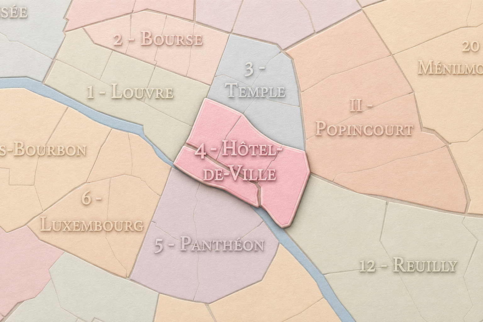
4e - HÔTEL-DE-VILLE
Arrondissements
Part of an ongoing project to walk and photograph every neighborhood in Paris, this page explores the 4th Arrondissement: Hôtel-de-Ville through maps, district identity, history, and photography.
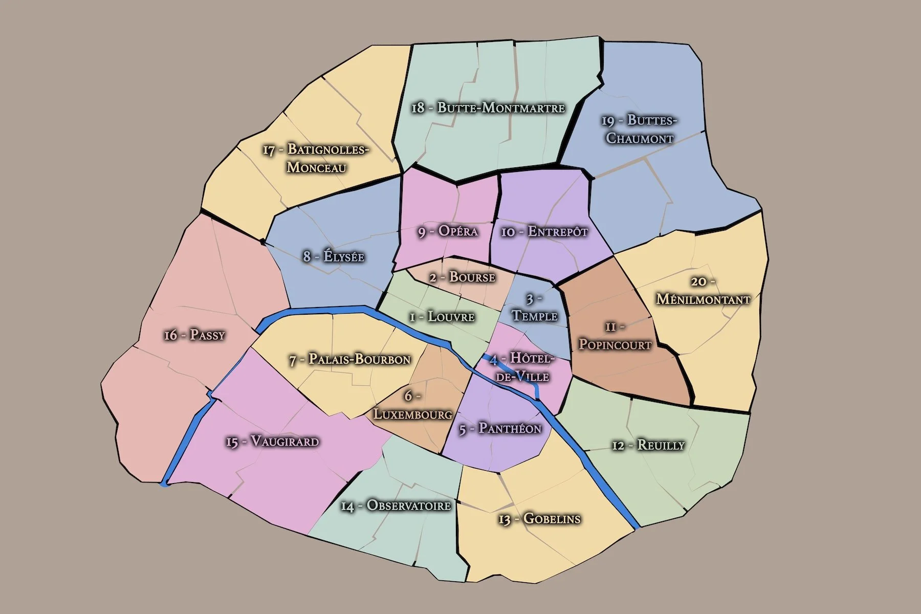



The Map
Download the Paris Arrondissements Map
Geographic Setting
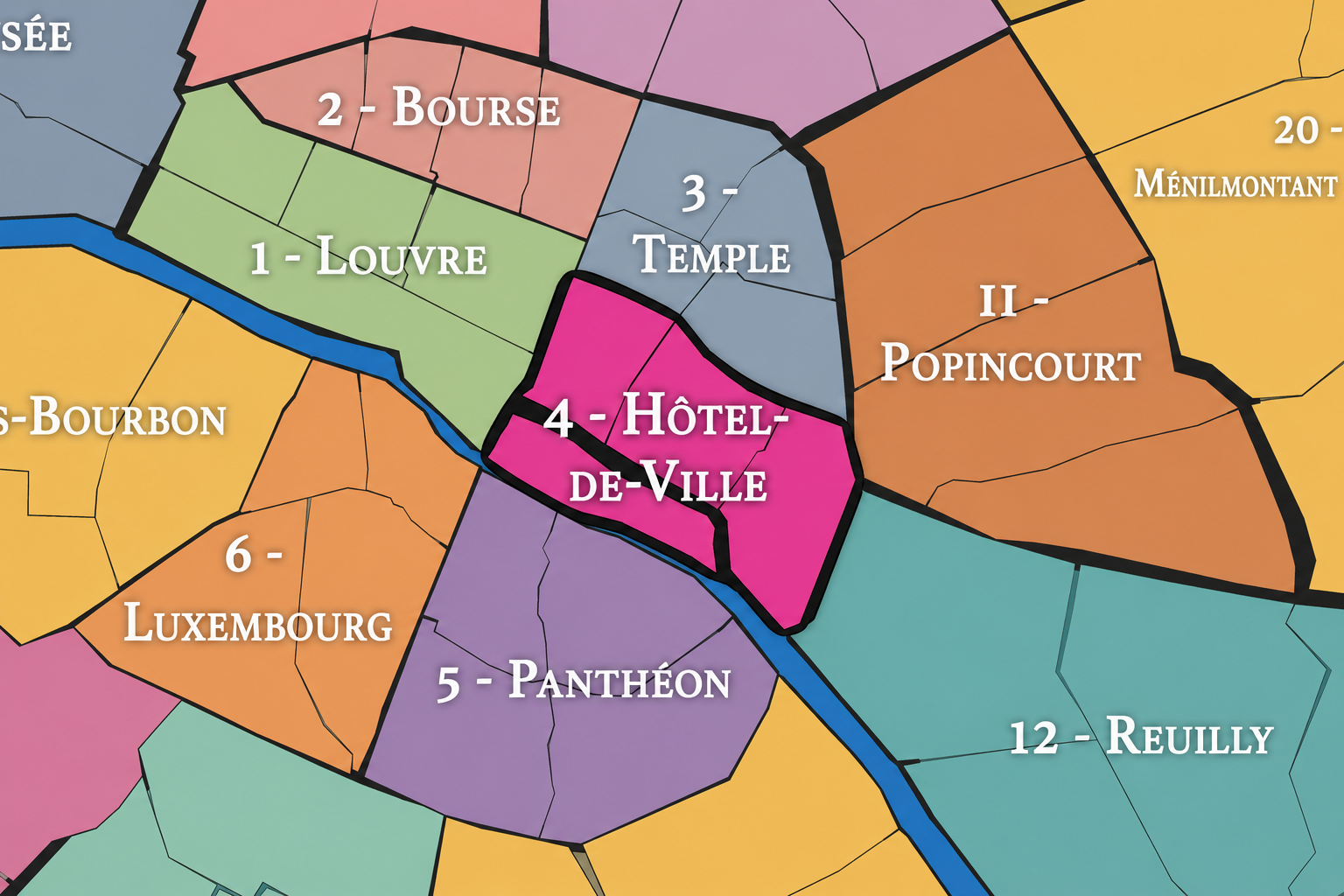
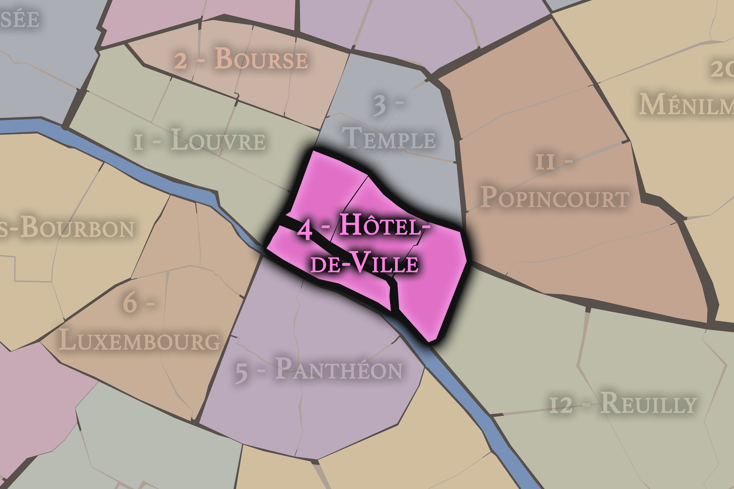
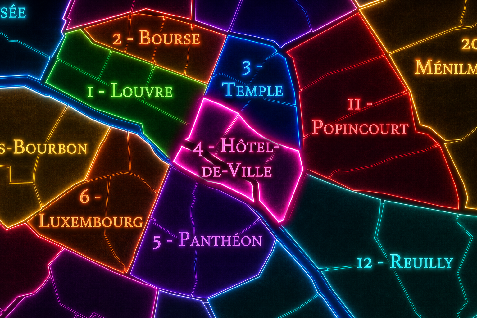
The 4e arrondissement occupies one of the most historically charged positions in Paris. It sits on the Right Bank of the Seine, east of the 1er arrondissement and south of the 3e, with the 11e and 12e extending farther east. It also includes the eastern portion of the Île de la Cité and the Île Saint-Louis, tying the arrondissement directly to the river islands where the earliest city took shape.
This geography gives the 4e an unusual dual identity. On the Right Bank, it contains the southern Marais, the area around the Hôtel de Ville, the streets leading toward Beaubourg, and the historic corridors around Rue Saint-Antoine and Place des Vosges. On the islands, it reaches into some of the oldest and most symbolic ground in Paris: Notre-Dame, the eastern Île de la Cité, and the quieter, residential fabric of the Île Saint-Louis.
The arrondissement is divided into four administrative quarters: Saint-Merri, Saint-Gervais, Arsenal, and Notre-Dame. Together, they form one of the most layered urban landscapes in the city: civic Paris around the Hôtel de Ville, medieval and religious Paris around Notre-Dame, aristocratic and residential Paris in the southern Marais, island Paris along the Seine, and revolutionary and infrastructural Paris near the Arsenal and Bastille edge.
The 4e is therefore not simply a central arrondissement. It is a hinge between Paris’s origins and its civic present, between the river islands and the Right Bank, between medieval streets and grand public institutions, between religious memory and municipal authority.
Arrondissement Identity
Etymology and Origins
The arrondissement’s administrative name, Hôtel-de-Ville, comes from the Paris City Hall, the seat of municipal government. The name identifies the arrondissement with civic authority and with the long history of Paris as a self-governing urban community. The Hôtel de Ville stands on the Place de l’Hôtel-de-Ville, formerly known as the Place de Grève, a site historically associated with labor, gathering, ceremony, punishment, and public assembly.
The name is especially fitting because the 4e arrondissement contains some of the city’s most important civic and symbolic spaces. It includes not only the Hôtel de Ville, but also Notre-Dame, the Île Saint-Louis, Place des Vosges, Saint-Gervais, Saint-Merri, and the eastern edges of the old city. Its identity is therefore civic, religious, residential, aristocratic, and popular all at once.
The deeper origins of the arrondissement reach back to the earliest geography of Paris. The Île de la Cité was the ancient core of the city, while the Right Bank developed through river crossings, churches, markets, streets, religious houses, and later aristocratic residences. The 4e’s name points to municipal power, but its origins are far older than the Hôtel de Ville itself. It is one of the places where Paris’s earliest island settlement, medieval expansion, royal urbanism, and modern civic identity converge.
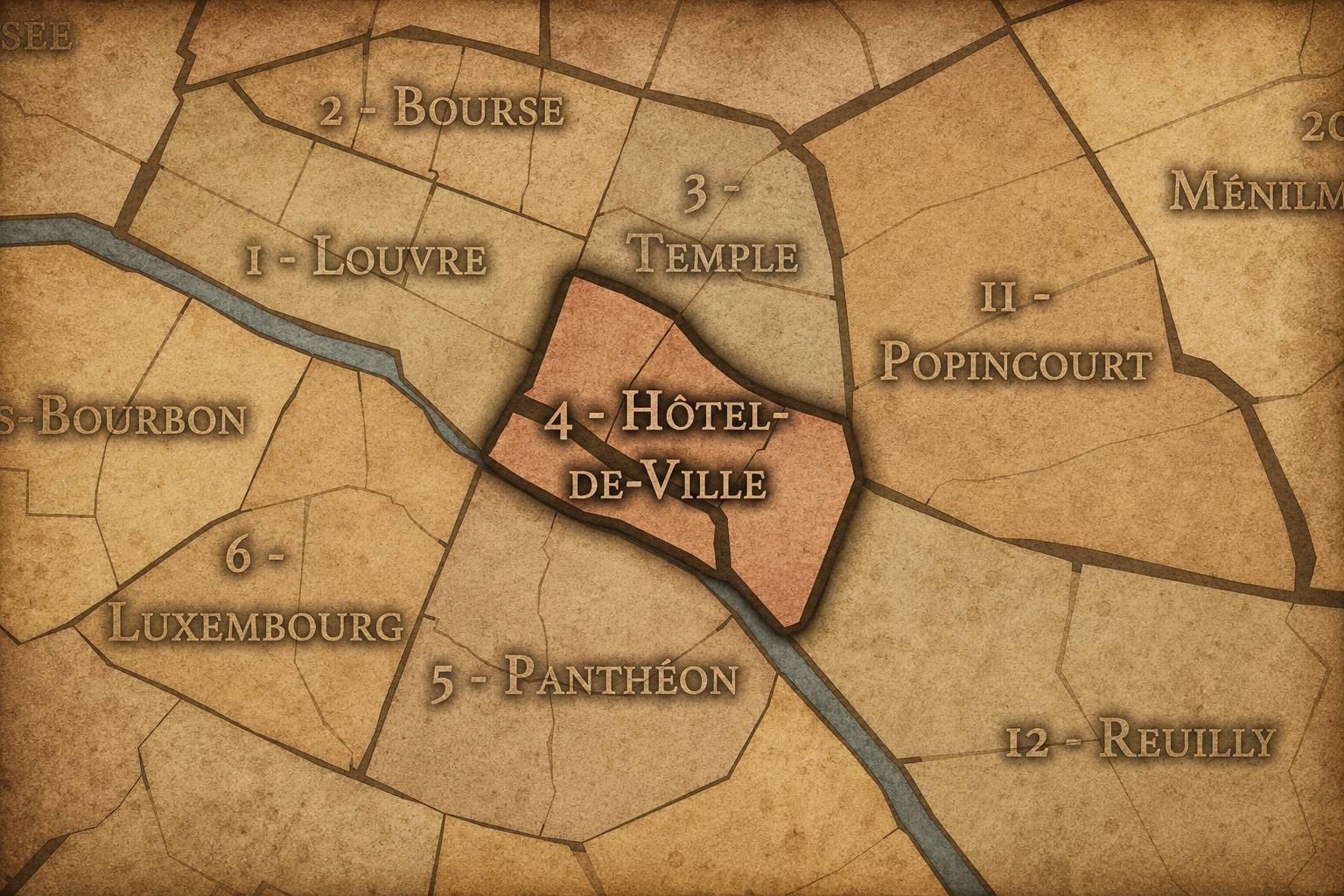
The 4e arrondissement is part of Paris Centre, the administrative sector created in 2020 that combines the 1er, 2e, 3e, and 4e arrondissements under a shared local mairie. Although the traditional arrondissement names and boundaries remain important for geography, history, culture, and navigation, the local civic administration of these four central arrondissements is now organized through the mairie of Paris Centre.
Within that modern framework, the 4e remains a distinct historical and geographic unit. Its name, Hôtel-de-Ville, continues to express its civic significance, while its four administrative quarters — Saint-Merri, Saint-Gervais, Arsenal, and Notre-Dame — preserve the arrondissement’s internal structure. These quarters help distinguish the 4e from the broader idea of “the Marais,” which overlaps the 3e and 4e but does not fully describe either arrondissement.
For this project, the 4e is treated as both an official geographic layer and a cultural-historical district. Its civic framework explains its role within contemporary Paris administration, while its older churches, islands, squares, streets, and institutions preserve one of the deepest historical landscapes in the city.
Civic Framework
Parisian Identity
The 4e arrondissement holds a central place in the Parisian imagination. It contains Notre-Dame, the Hôtel de Ville, the Seine islands, the southern Marais, Place des Vosges, Rue Saint-Antoine, and the approaches toward Bastille. Few arrondissements gather so many symbolic versions of Paris into such a compact area.
It is Paris as origin and Paris as civic stage. On the Île de la Cité, the city’s ancient and medieval memory remains visible in the presence of Notre-Dame and the river crossings around it. At the Hôtel de Ville, Paris presents itself as a municipal capital, a place of public gathering, political symbolism, and urban governance. In the Marais and around Place des Vosges, the arrondissement carries the memory of aristocratic residence, religious institutions, Jewish history, LGBTQ+ visibility, galleries, cafés, boutiques, and preserved streets that continue to shape the contemporary city.
The 4e is also one of Paris’s great districts of public movement. Tourists, residents, workers, worshippers, students, shoppers, activists, and pedestrians all move through its streets and squares. Its identity is not quiet or singular. It is layered, ceremonial, crowded, intimate, sacred, secular, local, and global. In the 4e, Paris is both the city of origins and the city of continual reinvention.
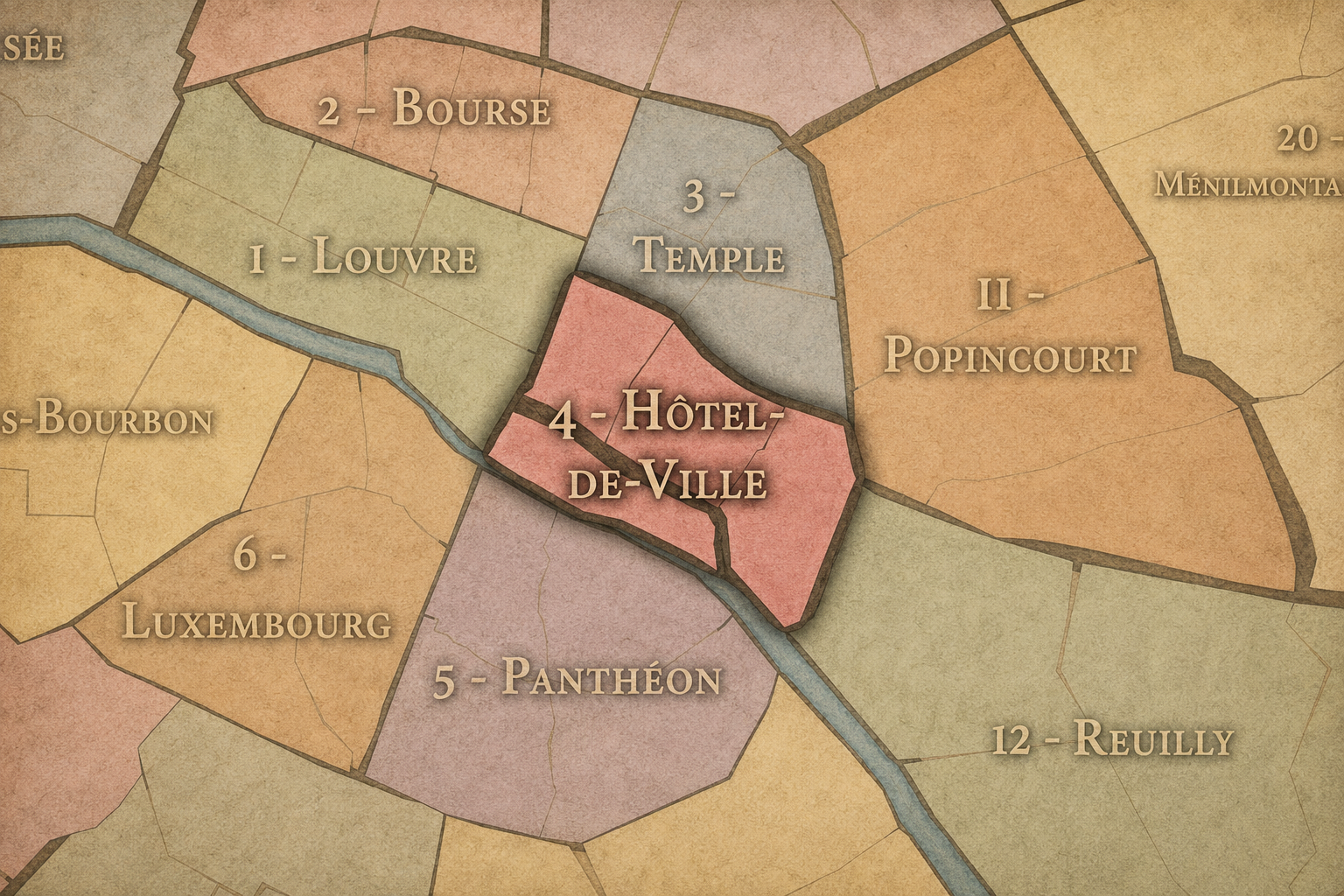
The 4e arrondissement is distinguished by the intensity of its layers. It is smaller than many outer arrondissements, but it contains several of the most recognizable historical landscapes in Paris: the islands of the Seine, the southern Marais, the civic center around the Hôtel de Ville, the religious presence of Notre-Dame, and the eastern axis toward Bastille.
Its distinction also comes from contrast. The Île Saint-Louis feels contained, residential, and river-bound. The eastern Île de la Cité carries sacred, institutional, and touristic weight. Saint-Merri and the Beaubourg edge connect the arrondissement to contemporary cultural life and dense pedestrian activity. Saint-Gervais preserves one of the deepest layers of the Marais, with churches, old streets, and a long history of Jewish, religious, and residential life. Arsenal points toward Bastille, old fortifications, river infrastructure, and the eastern edge of central Paris.
The arrondissement is therefore not one neighborhood in the simple sense. It is a composition of historic zones that touch and overlap: island Paris, civic Paris, Marais Paris, river Paris, and revolutionary Paris. Its character lies in how closely those identities sit together.
Neighborhood Distinction
Les Quartiers Administratifs
Administrative Quarters
The Four Administrative Quarters
Each Paris arrondissement is divided into four official administrative quarters. These smaller districts reveal older place-names, local histories, civic boundaries, and neighborhood identities.
-
Arsenal
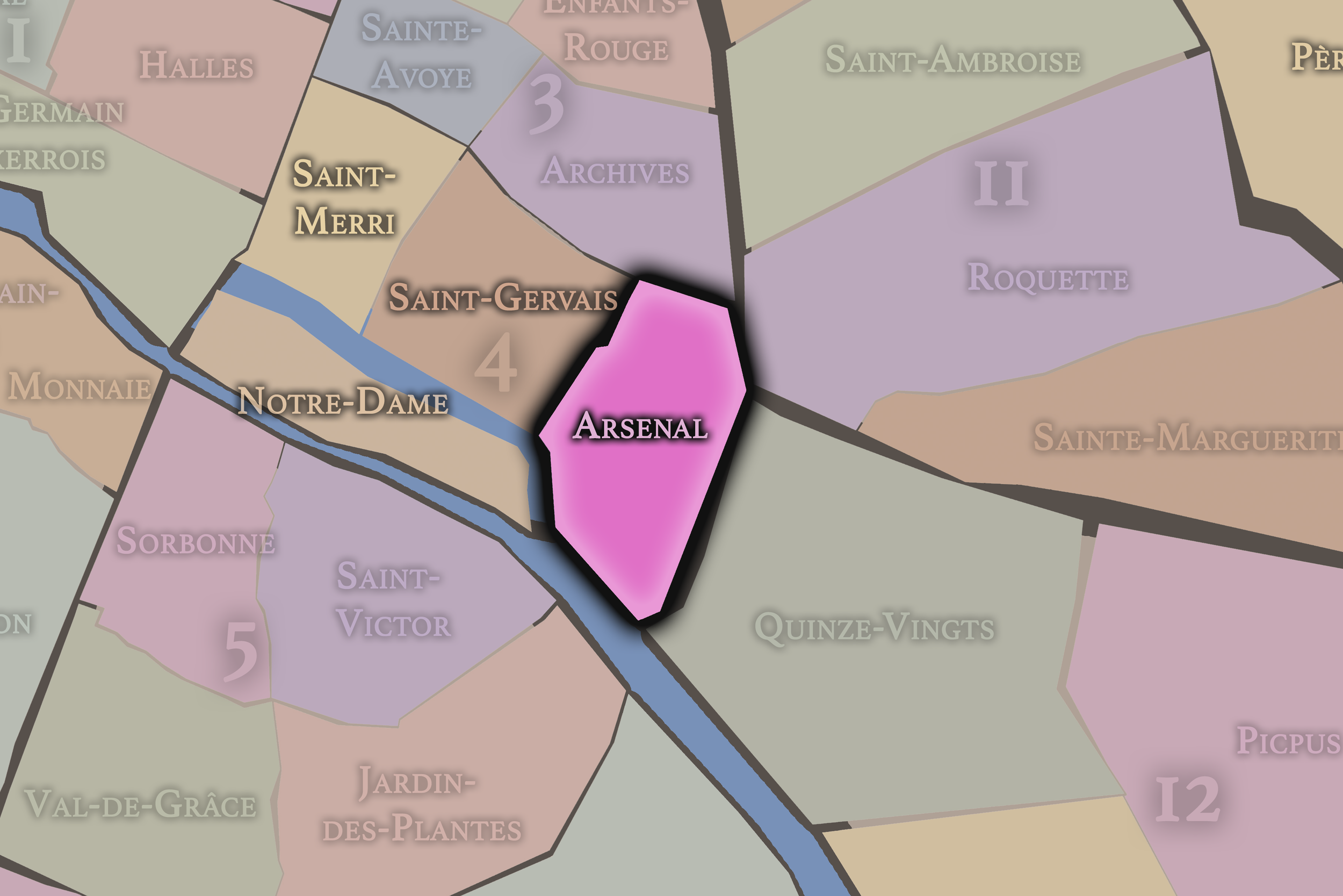
Arsenal occupies the southeastern portion of the 4e arrondissement, near the Bassin de l’Arsenal and the approach to Place de la Bastille. Its name recalls the royal arsenal that once stood in this part of Paris, giving the quarter a strong association with military storage, state power, fortification, and the eastern edge of the old central city.
This quarter connects the 4e to Bastille, the Seine, and the infrastructure of eastern Paris. Its identity differs from the island and Hôtel de Ville portions of the arrondissement. Arsenal is more transitional and edge-like, shaped by water, roads, former military functions, and the movement between the historic center and the eastern arrondissements. It adds a practical and infrastructural layer to the 4e’s otherwise civic, religious, and Marais-centered identity.
-
Notre-Dame
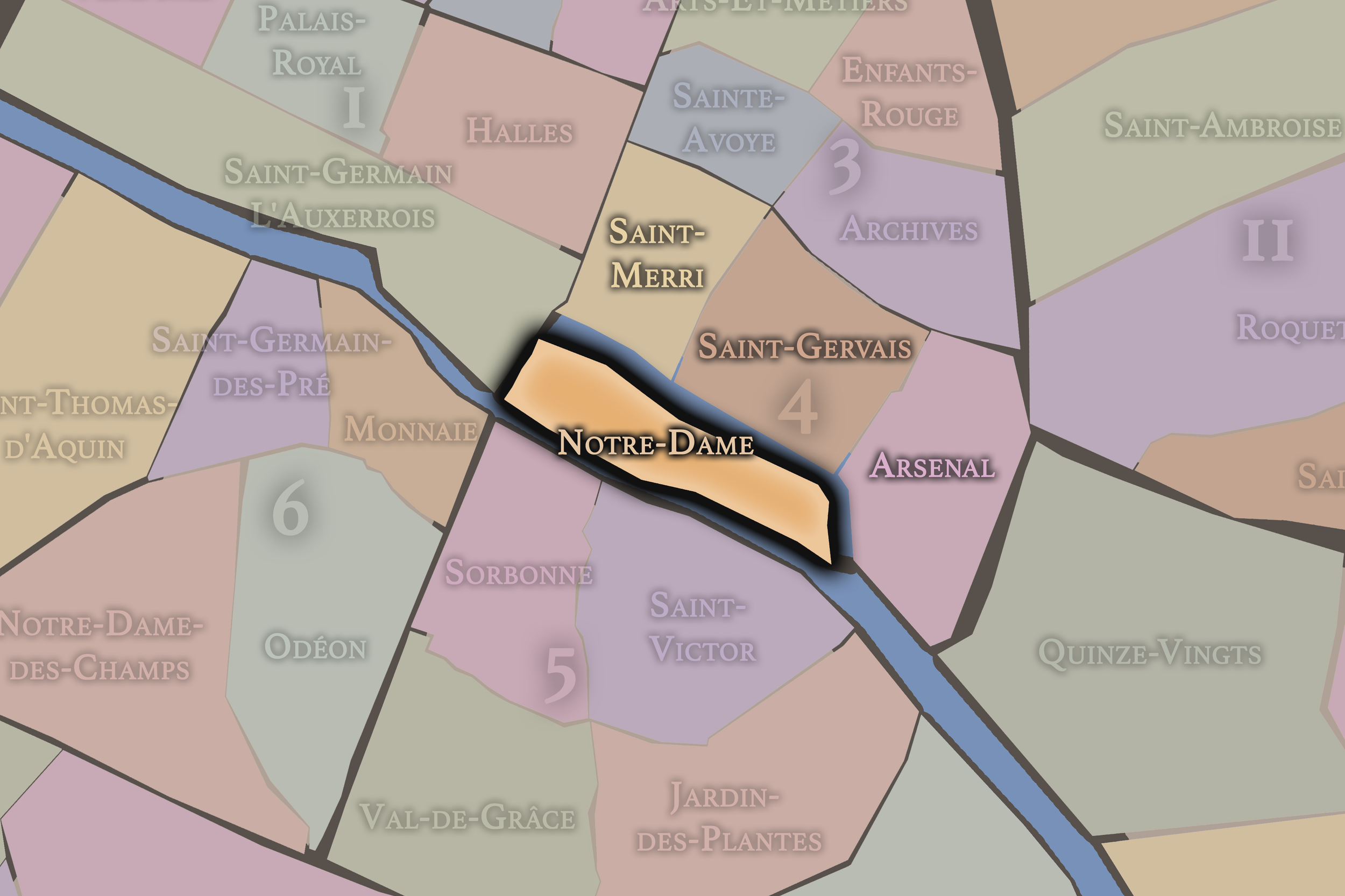
Notre-Dame includes the eastern portion of the Île de la Cité and the Île Saint-Louis. It is one of the most historically and symbolically important quarters in Paris. Its name comes from Notre-Dame Cathedral, whose presence links the arrondissement to the medieval, religious, architectural, and cultural history of the city.
This quarter gives the 4e its deepest connection to the origins of Paris. The Île de la Cité belongs to the ancient heart of the city, while the Île Saint-Louis offers a more residential and river-bound urban identity, with quays, hôtels particuliers, narrow streets, and views across the Seine. Notre-Dame is therefore both monumental and intimate: a quarter of cathedral stone, island streets, bridges, riverbanks, and some of the city’s most enduring symbolic landscapes.
-
Saint-Gervais
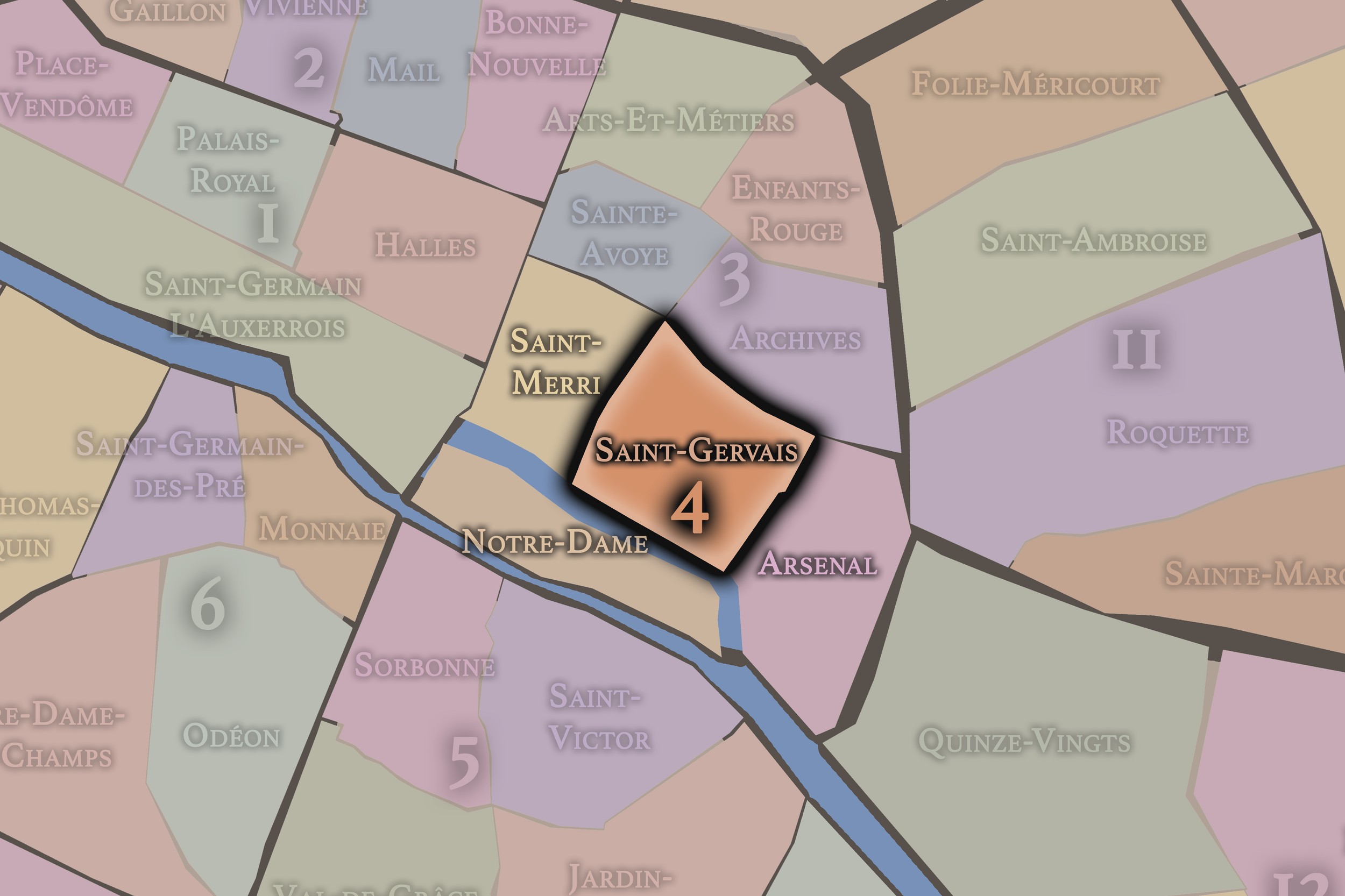
Saint-Gervais lies in the central and northeastern portion of the 4e arrondissement and takes its name from the church of Saint-Gervais-Saint-Protais. This quarter is one of the strongest expressions of the southern Marais, with a dense network of old streets, historic buildings, religious sites, shops, residences, and traces of Jewish and community life.
Saint-Gervais carries a deeply layered neighborhood identity. It is less defined by one single monument than by the accumulation of urban texture: old façades, narrow streets, courtyards, synagogues, churches, schools, boutiques, cafés, and the everyday life of the Marais. It is one of the quarters where the 4e feels most intimate, even while standing close to some of the city’s busiest visitor routes.
-
Saint-Merri
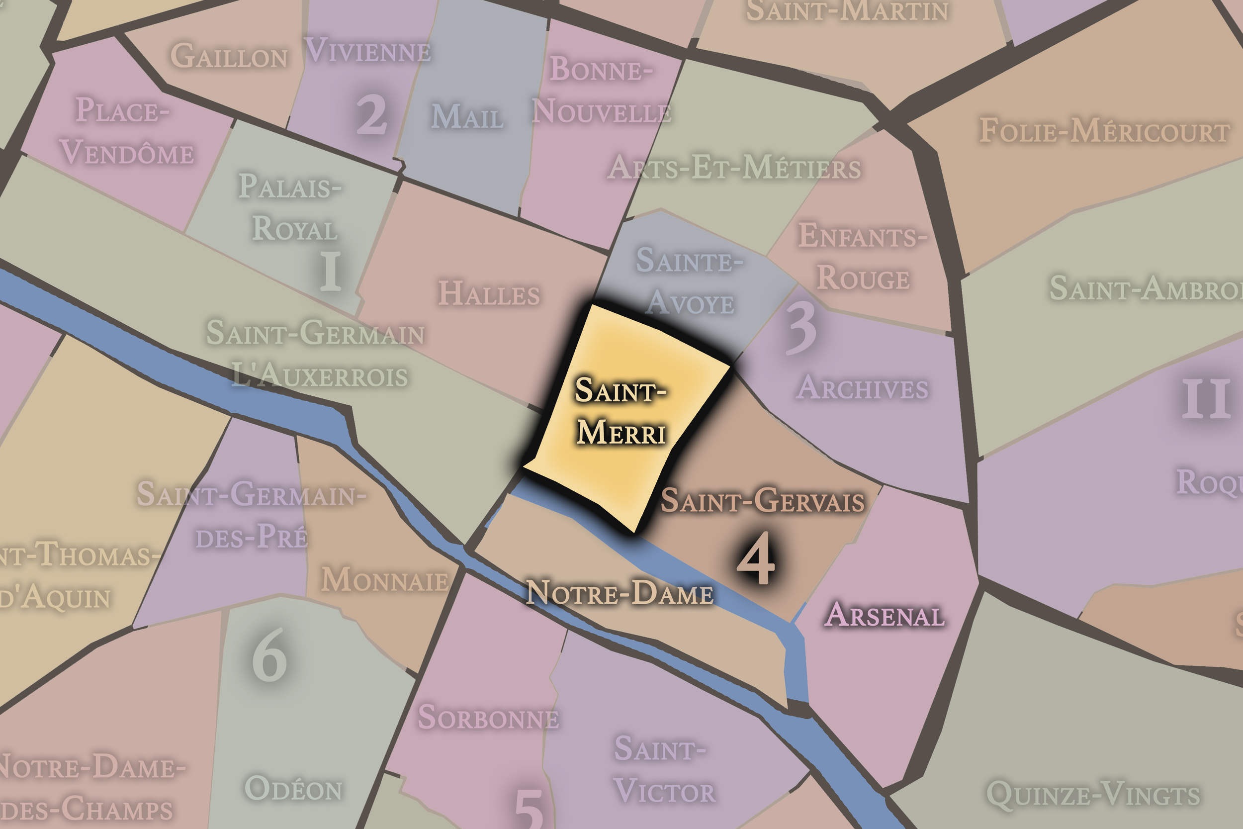
Saint-Merri occupies the northwestern portion of the 4e arrondissement, near the Hôtel de Ville, Beaubourg, and the southern edge of the Centre Pompidou area. Its name comes from the church of Saint-Merri, a Gothic church whose presence anchors the quarter’s older religious and neighborhood history.
This quarter gives the arrondissement much of its civic and cultural energy. It sits close to the Hôtel de Ville and to one of the busiest pedestrian zones of central Paris, where medieval streets, modern cultural institutions, shops, cafés, and public squares converge. Saint-Merri is a transitional quarter: between the Marais and Beaubourg, between city hall and cultural Paris, between old parish streets and contemporary urban movement.
The History
The origins of the 4e arrondissement are inseparable from the origins of Paris itself. The eastern portion of the Île de la Cité lies within the ancient island core from which the city developed. This river island provided defense, access to crossings, and a strategic position within the Seine, making it central to the earliest settlement and later to the medieval city.
As Paris expanded beyond the island, the Right Bank areas that now form the 4e grew through churches, streets, river landings, markets, religious communities, and early urban neighborhoods. The Seine connected the district to trade and movement, while the crossings linked the islands to the growing city on both banks.
The future arrondissement therefore began as a layered geography of island and bank: sacred ground on the Île de la Cité, residential and commercial growth on the Right Bank, and gradually urbanized river islands and quays. Before the 4e was associated with the Hôtel de Ville, the Marais, or Place des Vosges, it was part of the earliest physical and symbolic structure of Paris.
Origins
16th–17th Century
During the 16th and 17th centuries, the future 4e arrondissement became increasingly central to the aristocratic, civic, and religious life of Paris. The Marais developed as one of the city’s most prestigious residential quarters, attracting nobles, officials, and religious communities. Hôtels particuliers, convents, churches, and formal squares helped transform the district into one of the most refined urban landscapes of early modern Paris.
The creation of Place Royale, now Place des Vosges, at the beginning of the 17th century marked a major moment in Parisian urban design. Its regular façades, arcades, and enclosed square helped establish a new model of planned aristocratic space. Around it, the southern Marais became closely associated with elite residence, courtly society, and architectural prestige.
At the same time, the Hôtel de Ville and the Place de Grève remained central to civic life. The area around city hall was a place of gathering, labor, ceremony, and public authority. The future 4e therefore held several forms of power at once: religious authority on the islands, municipal authority at the Hôtel de Ville, aristocratic authority in the Marais, and commercial life along streets and quays.
In the 18th century, the 4e arrondissement’s future territory remained one of the dense historic centers of Paris. The Marais continued to contain aristocratic residences, religious houses, and older urban streets, even as other fashionable districts began to draw elite attention westward. The quarter’s buildings and institutions remained important, but its social geography was beginning to change.
The islands retained their symbolic and residential importance. Notre-Dame continued to anchor the religious identity of the Île de la Cité, while the Île Saint-Louis remained a distinctive residential landscape of quays, townhouses, and enclosed urban calm. These island spaces gave the future arrondissement a sense of deep continuity even as the broader city modernized around them.
The 18th century also prepared the district for revolutionary transformation. Civic spaces, churches, aristocratic residences, and public squares would all be reinterpreted under the pressures of political change. By the end of the century, the future 4e contained many of the institutions and symbolic sites that would be transformed by revolution, secularization, and the reorganization of urban authority.
18th Century
19th Century
The 19th century reshaped the 4e arrondissement in dramatic ways. The Hôtel de Ville became an even stronger symbol of municipal Paris, though the building itself was destroyed during the Paris Commune in 1871 and later reconstructed. This destruction and rebuilding made the site a powerful emblem of rupture, civic memory, and republican renewal.
The century also brought major urban modernization. New streets, widened corridors, and changing patterns of circulation affected the old fabric of the district. While parts of the Marais preserved their narrow medieval and early modern texture, other areas were altered by the broader transformation of Paris under modern planning, infrastructure, and traffic needs.
Notre-Dame also underwent a major 19th-century restoration, helping recast the cathedral as a national monument as well as a religious site. The cathedral’s medieval identity was renewed and reimagined in an age deeply invested in heritage, restoration, and the symbolic power of the Gothic past.
The 19th century therefore intensified the arrondissement’s central paradox: preservation and transformation occurred together. Medieval streets survived near modernized routes. Old aristocratic houses were adapted to new uses. Civic buildings were destroyed and rebuilt. The 4e became a district where Paris’s historical memory was not merely preserved, but repeatedly reconstructed.
In the early and mid 20th century, the 4e arrondissement remained a dense, mixed, and historically layered part of central Paris. The Marais contained old residences, workshops, religious sites, small shops, Jewish institutions, schools, and community life, while the islands continued to draw religious, residential, and visitor attention.
During this period, parts of the Marais suffered from overcrowding, neglect, and deterioration. Many historic buildings remained standing, but they were not always understood or protected as heritage in the way they would be later. The district was lived, worked, and inhabited before it became widely celebrated as one of Paris’s most carefully preserved historic quarters.
The arrondissement also carried the burdens of 20th-century history. Jewish life in the Marais made the area especially significant before, during, and after the Second World War. The violence and deportations of the occupation years left lasting scars on the district’s memory, visible in memorial plaques, schools, synagogues, and the continued importance of remembrance in the neighborhood’s public landscape.
Early–Mid 20th Century
Late 20th Century
The late 20th century brought a major transformation in how the 4e arrondissement was valued, restored, and experienced. The Marais became one of Paris’s most important preservation districts, with renewed attention given to its hôtels particuliers, historic streets, courtyards, religious buildings, and older urban fabric. What had once been seen in some places as aging or neglected came to be understood as architectural and historical treasure.
The arrondissement also became more strongly associated with culture, tourism, galleries, fashion, restaurants, and nightlife. The broader Marais developed into one of the most visible LGBTQ+ districts in Paris, while also retaining important Jewish history and institutions. This layered identity gave the 4e a contemporary cultural significance that built upon, rather than erased, its older histories.
At the same time, the area around the Hôtel de Ville and Beaubourg became increasingly central to public life, pedestrian movement, and cultural activity. The 4e’s late 20th-century identity was therefore shaped by preservation and reinvention: historic architecture restored, old streets revalued, communities made visible, and central Paris reimagined as both heritage district and contemporary urban stage.
In the 21st century, the 4e arrondissement remains one of the most visited and symbolically charged districts in Paris. Notre-Dame, the Hôtel de Ville, the Île Saint-Louis, Place des Vosges, the Marais, and the Seine quays all draw intense public attention, while the arrondissement also remains a place of residents, schools, shops, religious institutions, restaurants, galleries, and civic life.
The fire at Notre-Dame in 2019 added a new layer to the arrondissement’s contemporary history. The cathedral’s restoration has reinforced the quarter’s global symbolic importance while also reminding Paris and the world that even the city’s most enduring monuments are vulnerable, material, and constantly renewed through care.
The 4e also continues to navigate the pressures of centrality: tourism, rising costs, preservation demands, commercial change, public gatherings, and the challenge of maintaining neighborhood life in one of the city’s most iconic areas. Its civic role remains strong through the Hôtel de Ville and Paris Centre, while its cultural role extends through the Marais, the islands, and the public spaces along the Seine.
Today, the 4e is both historic core and contemporary stage. It is a district where Paris performs itself for the world, but also where older layers of residence, worship, commerce, memory, and community continue to endure.
21st Century
Spirit and Legacy
The 4e arrondissement is one of the great symbolic hearts of Paris. It contains the city’s island origins, its cathedral memory, its municipal authority, its aristocratic Marais, its revolutionary edges, and its modern civic stage. Few districts hold so many versions of Paris so closely together.
Its legacy is one of convergence. Notre-Dame and the Hôtel de Ville speak to sacred and civic authority. The Île Saint-Louis speaks to river-bound residential elegance. Place des Vosges speaks to royal urbanism and aristocratic Paris. The Marais speaks to preservation, Jewish memory, LGBTQ+ visibility, galleries, cafés, and the reinvention of old streets for contemporary life.
The 4e is not only a place of monuments. It is a district of thresholds: island to bank, medieval to modern, religious to secular, aristocratic to democratic, local to global. To walk through it is to move through the oldest and most public layers of Paris at once — a city continually restored, contested, inhabited, and remembered.
The Photography
The arrondissements do not share a single visual identity. Instead, they organize Paris into twenty broad visual fields, each gathering its own combination of landmarks, streetscapes, institutions, residential districts, commercial corridors, parks, rail stations, markets, cemeteries, and riverfront edges.
Some arrondissements are defined by monumental scale: royal palaces, ceremonial avenues, government buildings, museums, formal gardens, and internationally recognized landmarks. Others are shaped by hills, canals, rail gateways, apartment-lined boulevards, neighborhood markets, former village streets, industrial remnants, parks, or the quieter rhythms of residential Paris. The arrondissement system gives these varied landscapes a civic frame, allowing the city to be read not as one visual language, but as a sequence of overlapping Parisian atmospheres.

Visual Identity
Through The Lens
Photographing the arrondissements means moving between the official map and the street-level experience. The camera does not treat each arrondissement as visually uniform. Instead, it looks for the recurring forms, textures, transitions, and contrasts that make each district legible: the geometry of boulevards, the shade of plane trees, the repetition of balconies, the rise of stairways, the curve of canals, the presence of rail stations, the opening of parks, the weight of monuments, and the intimacy of side streets.
On CityNeighborhoods, the arrondissement provides the frame, but the photograph comes from the encounter between map, movement, light, and observation. As the Paris photography is processed, this section will connect each arrondissement more directly to the project’s Photographic Lexicon: the visual strategies, recurring motifs, and compositional patterns that shape how the city is seen through the lens.

If you visit Paris, these ideas can help inspire your own photography.



Paris: J’Espere, Je Rêve, Je Vive
Paris Photo Gallery
Paris Field Notes
-
Field Note: August 18, 2025 | 07:58 AM
Conditions: 73°F | Humidity: 72%.
Within the park's interior, the glacial kettle ponds acted as humidity traps, creating a soft, hazy light that filtered through the old-growth oaks. The transition from the park's dense shade to the sun-drenched edges of Oakland Gardens highlighted the day's exceptional "picture-perfect" clarity.
There is a fleeting window in Queens where the humidity of August hasn't yet heavy-set, and the morning sun hits the canopy of Alley Pond Park at a perfect oblique angle. Arriving just before 8:00 AM, I watched the light break through the oaks and tulip trees, casting long, dramatic shadows across the wet grass. It’s in these quiet, golden moments that the park feels less like a city escape and more like the ancient glacial valley it actually is.
Other neighborhoods visited:











































































































Explore Paris
-

The twenty arrondissements form the civic spiral of Paris, organizing the city into its broad local districts of government, identity, and daily life.
-

Each arrondissement is divided into four official administrative quarters, giving Paris a more precise civic and geographic framework.
-

The conseils de quartier bring participation to street level, giving residents a voice in neighborhood needs, public space, and local civic life.
-

Les Deux Rives trace Paris through the Seine’s two banks, revealing how the Rive Droite and Rive Gauche shaped the city’s civic power, commerce, learning, art, and cultural identity.
-

Cultural neighborhoods reveal the Paris people recognize through history, cafés, architecture, memory, atmosphere, and local belonging.