
10e - ENTREPÔT
Les Conseils de Quartier
Explore This Page


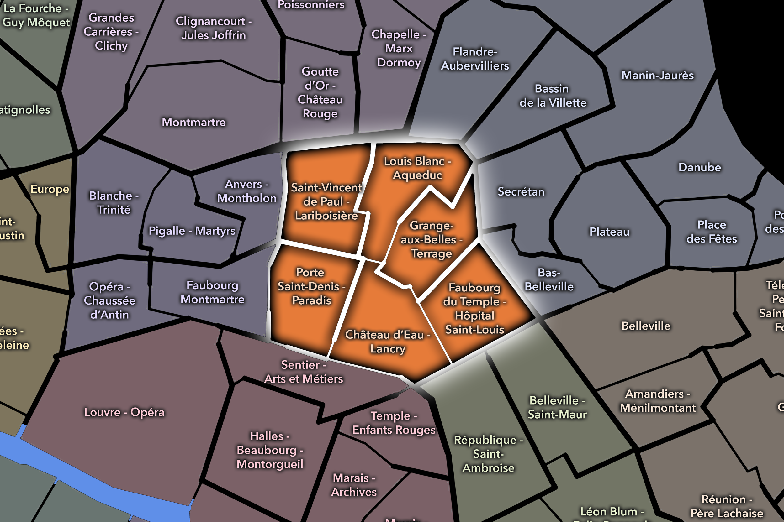
Explore the Conseils de Quartier of the 10e — Entrepôt.
Overview
Download the Paris Conseil de Quartier Map
Geographic Setting
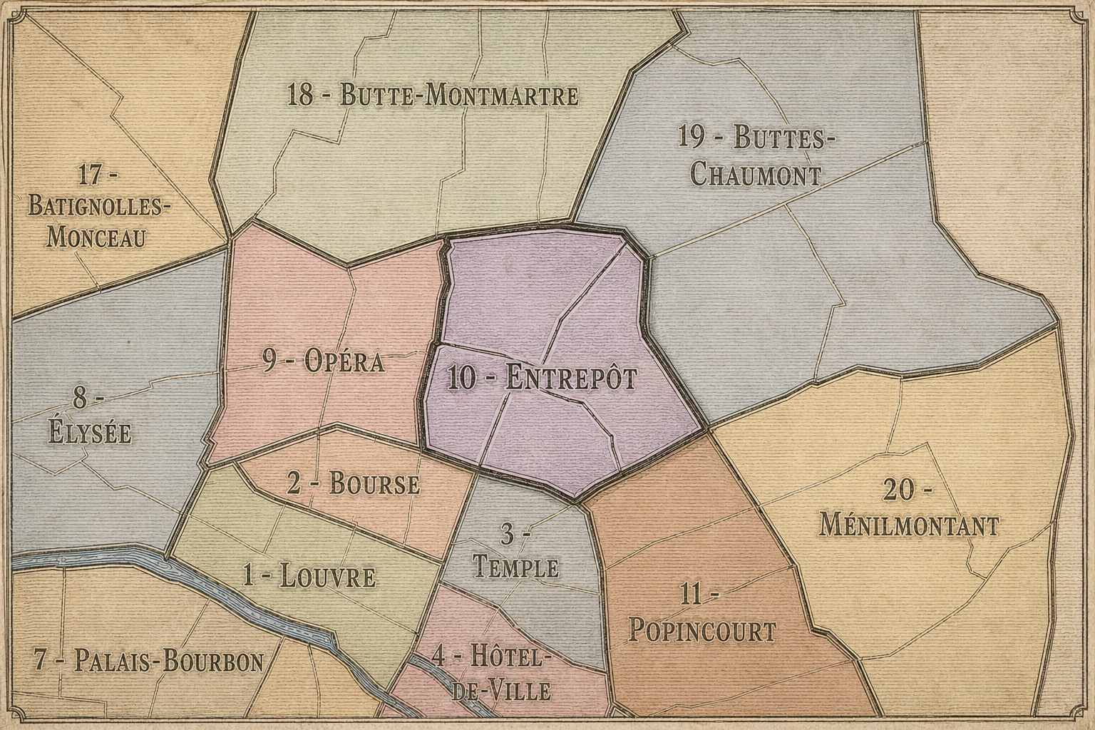
The Conseils de Quartier of the 10e organize local civic life across one of Paris’s most active crossroads of movement, arrival, commerce, and neighborhood density. Set on the Right Bank between the Grands Boulevards, the Canal Saint-Martin, the railway landscapes of Gare du Nord and Gare de l’Est, and the eastern corridors toward Belleville and République, the 10e is shaped by transit, water, hospitals, markets, immigrant histories, dense residential blocks, commercial streets, and public spaces that are often intensely used throughout the day.
The arrondissement’s six Conseils de Quartier divide this varied landscape into civic territories that follow the 10e’s major urban structures: the station and hospital environment of Saint-Vincent de Paul - Lariboisière; the canal- and railway-adjacent streets of Louis Blanc - Aqueduc; the older commercial and passage-like intensity of Porte Saint-Denis - Paradis; the dense street life of Château d’Eau - Lancry; the quieter but highly local fabric of Grange-aux-Belles - Terrage; and the eastern neighborhood corridor of Faubourg du Temple - Hôpital Saint-Louis. Together, they reveal the 10e as a district of thresholds: between central Paris and the northeast, between railway arrival and residential life, between canal leisure and working-city infrastructure.
Unlike arrondissements where the Conseils de Quartier simply echo the four official Administrative Quarters, the 10e’s CdQ structure gives the arrondissement a more fine-grained civic map. This is especially useful in a district where a few blocks can shift the atmosphere dramatically: from a station forecourt to a quiet canal edge, from a dense commercial street to a hospital wall, from a boulevard gateway to a residential side street. The CdQ layer helps make those smaller civic geographies visible.
Civic Framework
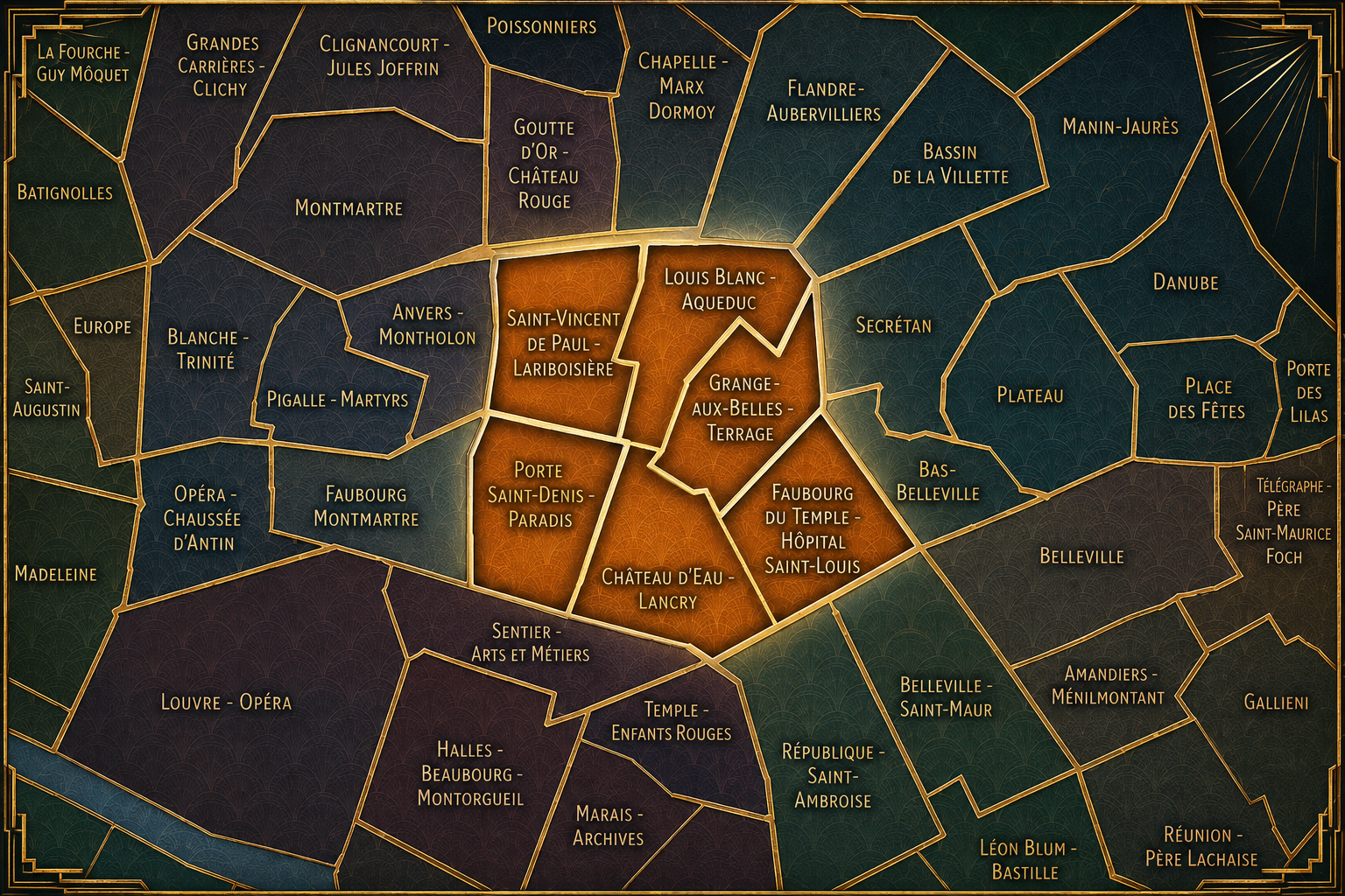
The 10e’s Conseils de Quartier provide a neighborhood-level civic structure for an arrondissement defined by movement and everyday intensity. This is a district of railway stations, canal banks, hospitals, schools, markets, cafés, immigrant commercial corridors, nightlife, hotels, local associations, and dense apartment blocks. The CdQs give residents, workers, shopkeepers, visitors, institutions, and neighborhood users a more precise scale for discussing local concerns than the arrondissement as a whole.
The six-council structure appears especially responsive to the 10e’s internal complexity. Saint-Vincent de Paul - Lariboisière reflects the civic weight of Gare du Nord, Gare de l’Est, and the surrounding hospital and transit environment. Louis Blanc - Aqueduc and Grange-aux-Belles - Terrage help distinguish the canal-side and residential-infrastructural fabric north and east of the Canal Saint-Martin. Château d’Eau - Lancry and Porte Saint-Denis - Paradis bring focus to dense commercial, pedestrian, and historic gateway streets, while Faubourg du Temple - Hôpital Saint-Louis connects the arrondissement to the eastern faubourg tradition and the institutional presence of the hospital.
As a civic framework, the 10e’s CdQs help organize some of the most practical questions of urban life in Paris: station-area circulation, pedestrian safety, public-space maintenance, commercial vitality, nightlife pressure, canal use, cleanliness, accessibility, housing and residential quality of life, and the relationship between local communities and citywide flows. The CdQ layer is particularly valuable here because the 10e is not experienced as one unified image, but as a set of highly active local environments woven together by transit, water, streets, and daily movement.
Local Expression
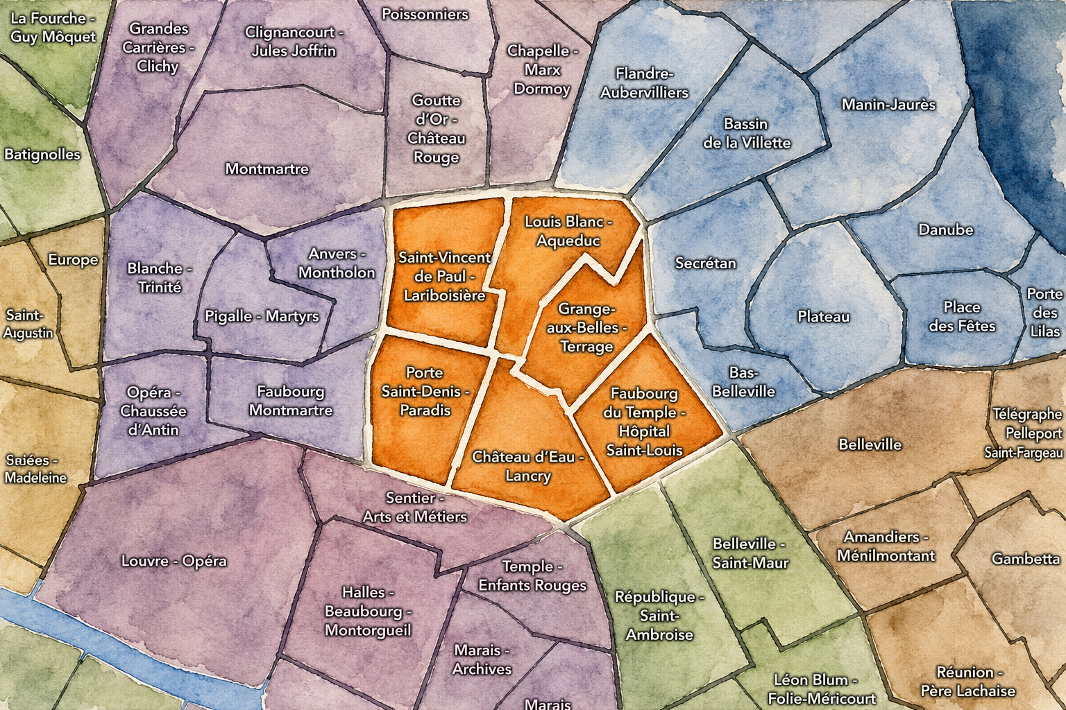
Viewed through its Conseils de Quartier, the 10e becomes a mosaic of working central Paris rather than a single district identity. Saint-Vincent de Paul - Lariboisière expresses the arrondissement’s role as a place of arrival, shaped by major stations, hospital infrastructure, hotels, commuters, travelers, and the dense street life surrounding Gare du Nord and Gare de l’Est. Louis Blanc - Aqueduc and Grange-aux-Belles - Terrage reveal a different 10e: canal-adjacent, residential, infrastructural, and neighborhood-oriented, where schools, bridges, local streets, and everyday public spaces define the civic rhythm.
Porte Saint-Denis - Paradis and Château d’Eau - Lancry carry the arrondissement toward the older Right Bank city of passages, gateways, wholesale histories, busy sidewalks, restaurants, hair salons, shops, and boulevard movement. Faubourg du Temple - Hôpital Saint-Louis, meanwhile, brings the 10e into contact with the eastern faubourg landscape: hospitals, cafés, mixed residential streets, nightlife edges, and the approach toward République and Belleville.
The value of the CdQ layer in the 10e is that it captures a Paris of use rather than display. Through its six councils, the arrondissement can be read at the scale of the station entrance, the canal bridge, the hospital edge, the market street, the school block, the boulevard gateway, the café terrace, and the residential side street. These CdQs reveal a district where civic life is immediate, dense, and constantly negotiated — one of the clearest examples of Paris as a city in motion.
Les Conseils de Quartier
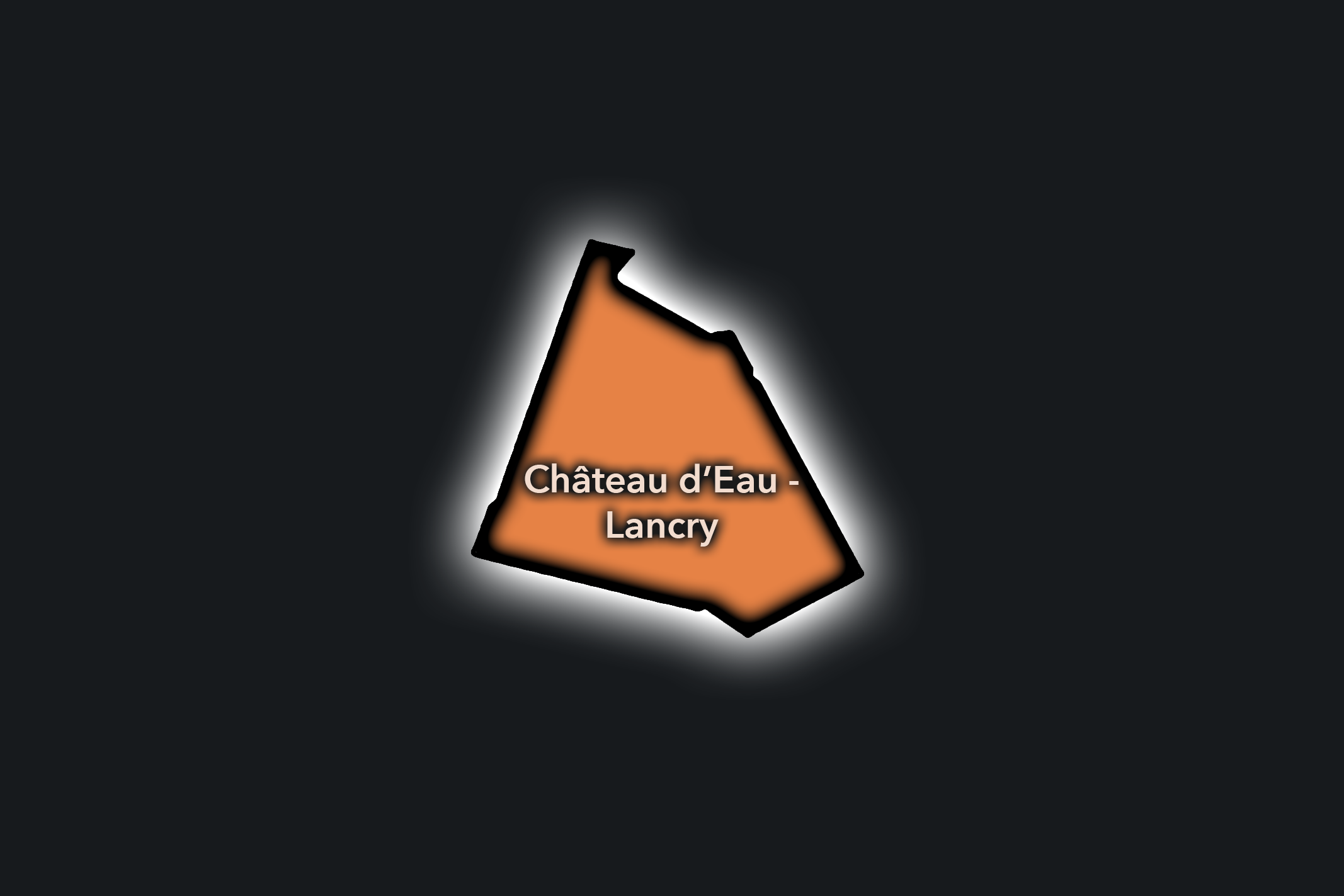
Château d’Eau - Lancry
Civic Profile
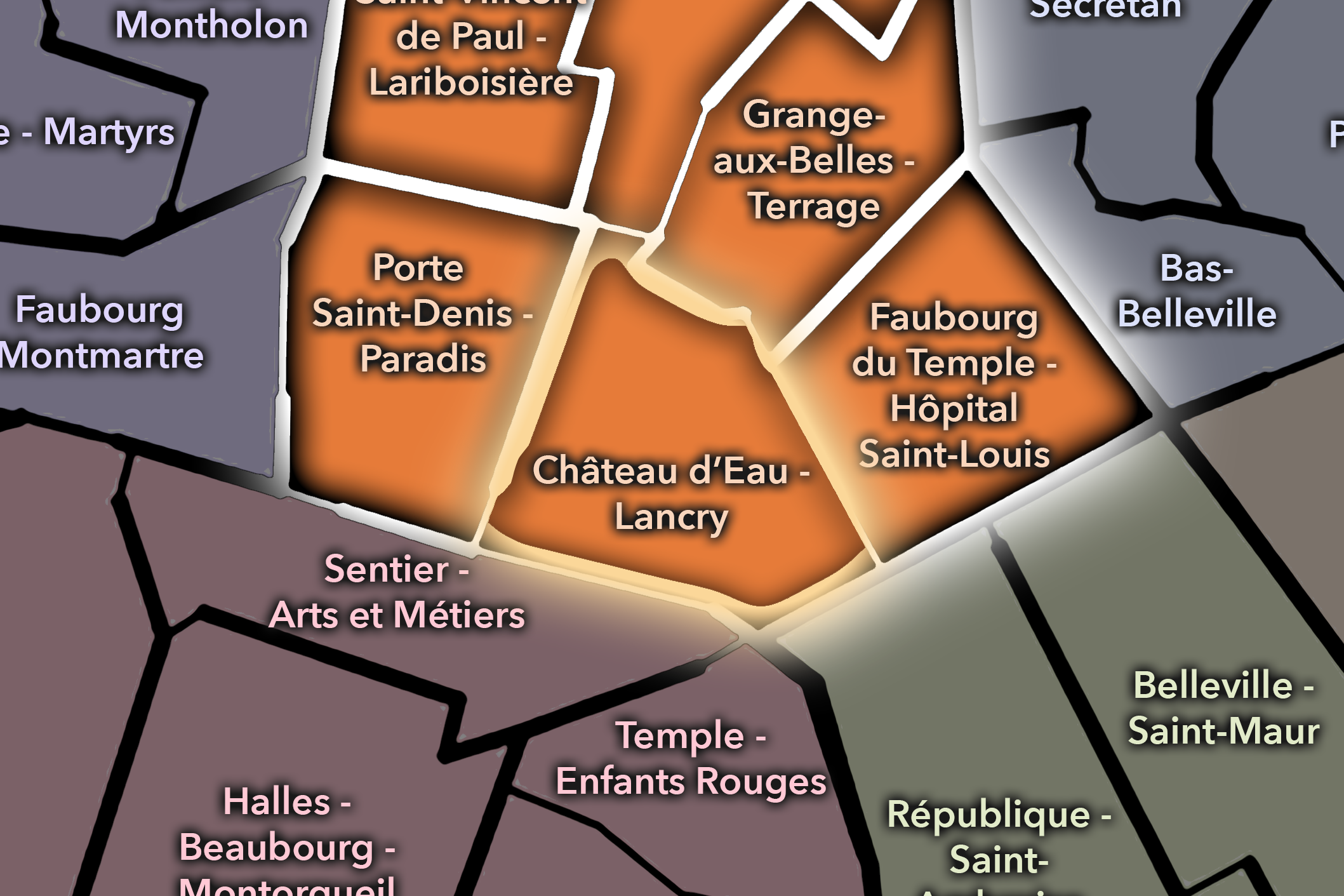
The Château d’Eau - Lancry Conseil de Quartier gives civic form to one of the 10e’s densest and most active interior districts, centered around the streets between Château d’Eau, Lancry, République, and the Canal Saint-Martin. Its geography is shaped by a strong mix of commercial streets, residential blocks, schools, cafés, hair salons, restaurants, hotels, transit access, and the constant pedestrian movement of the northeastern Right Bank. As a civic territory, it sits between the station-facing 10e, the boulevard corridors to the west, and the canal / République edge to the east.
On the ground, Château d’Eau - Lancry feels busy, diverse, and highly local. The area’s civic themes center on public-space pressure, sidewalk use, pedestrian comfort, commercial vitality, traffic, cleanliness, nightlife edges, and the balance between residential life and heavily used commercial streets. The CdQ layer is useful here because it gives local shape to a district that is not defined by one grand monument, but by the everyday intensity of shops, cafés, salons, schools, apartment buildings, and street-level movement.
Château d’Eau - Lancry: At a Glance
A curated list for you.
-

Major Streets
Boulevard de Strasbourg
Rue du Château d’Eau
Rue de Lancry
Rue du Faubourg Saint-Martin
Rue Lucien Sampaix
-

Public Spaces & Landmarks
Place de la République nearby
Canal Saint-Martin nearby
Théâtre Antoine nearby
Église Saint-Laurent nearby
Square Alban-Satragne nearby
-

Transit Access
Château d’Eau
Jacques Bonsergent
République
Strasbourg - Saint-Denis nearby
Gare de l’Est nearby
-

Shopping & Dining
Château d’Eau hair salon district
Rue du Château d’Eau cafés and shops
Rue du Faubourg Saint-Martin dining
Le Verre Volé nearby
Holybelly nearby
-

Hotels & Attractions
République approach corridor
Canal Saint-Martin walking route nearby
Château d’Eau commercial district
Gare de l’Est nearby
Porte Saint-Martin / boulevard gateway nearby
Faubourg du Temple - Hôpital Saint-Louis
Civic Profile
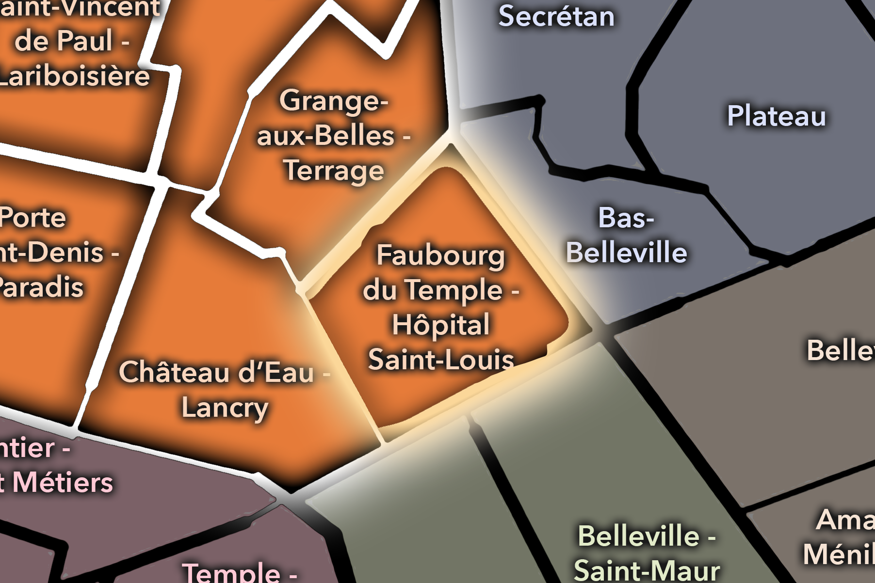
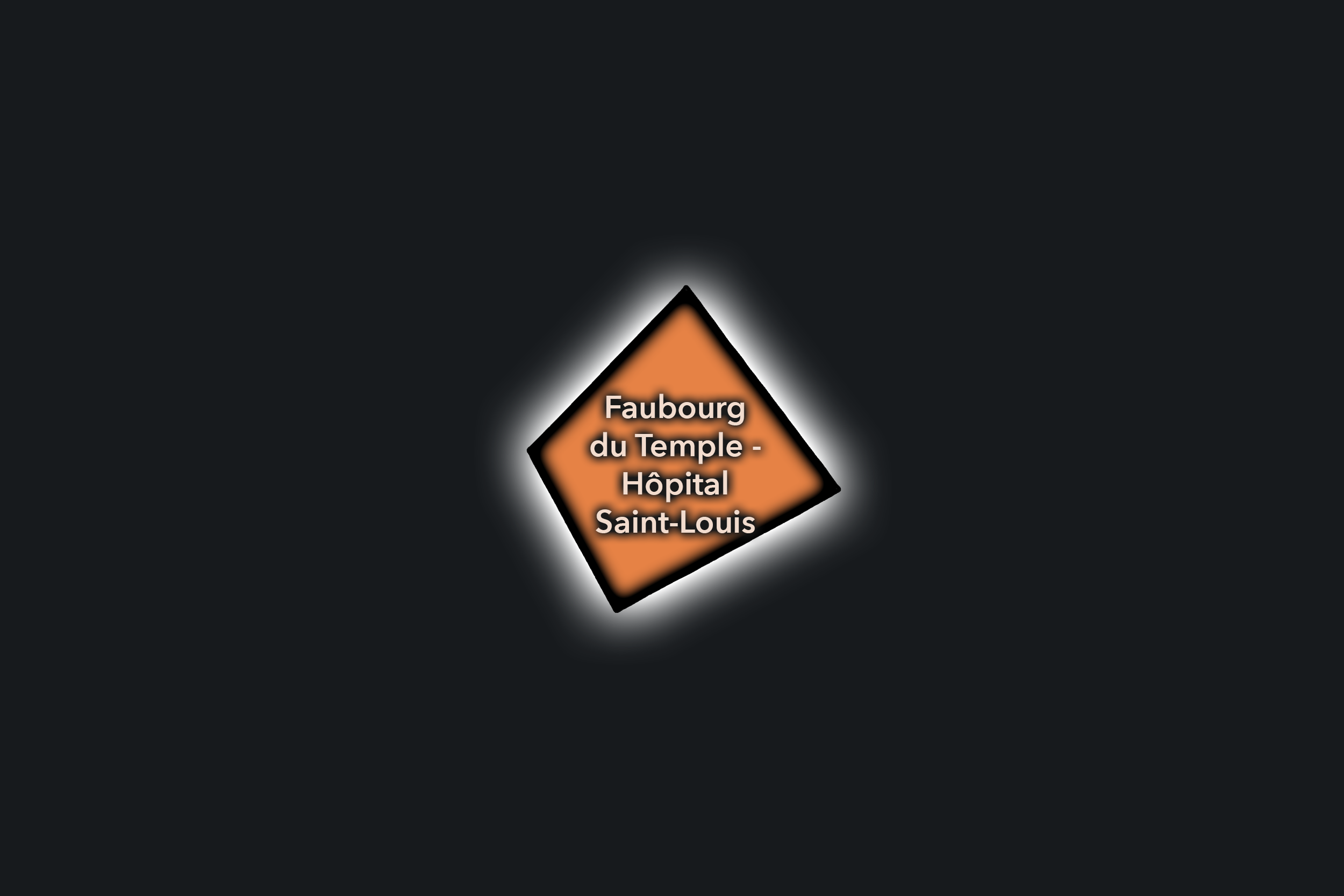
The Faubourg du Temple - Hôpital Saint-Louis Conseil de Quartier gives civic form to the eastern side of the 10e, where the arrondissement meets République, the Canal Saint-Martin, the Hôpital Saint-Louis, and the long faubourg corridor leading toward Belleville. Its geography is shaped by hospitals, cafés, nightlife, residential blocks, schools, small shops, canal edges, and some of the 10e’s strongest eastward connections. As a civic territory, it sits at the meeting point of institutional life, neighborhood life, and the lively commercial and social energy of the eastern Right Bank.
On the ground, Faubourg du Temple - Hôpital Saint-Louis feels mixed, active, and strongly urban. The hospital gives the district a major institutional anchor, while Rue du Faubourg du Temple, Rue Bichat, and the canal-side streets bring restaurants, bars, local shops, and steady pedestrian movement. Its civic themes center on hospital access, nightlife and noise, pedestrian comfort, public-space maintenance, canal use, residential livability, and the balance between a busy destination corridor and the daily needs of the people who live around it.
Faubourg du Temple - Hôpital Saint-Louis: At a Glance
A curated list for you.
-
Major Streets
Rue du Faubourg du Temple
Rue Bichat
Avenue Richerand
Rue Alibert
Quai de Jemmapes
-
Public Spaces & Landmarks
Hôpital Saint-Louis
Canal Saint-Martin
Place de la République nearby
Jardin Villemin nearby
Passerelles du Canal Saint-Martin
-
Transit Access
République
Goncourt
Jacques Bonsergent
Colonel Fabien nearby
Belleville nearby
-
Shopping & Dining
Rue du Faubourg du Temple dining
Canal Saint-Martin cafés and bars
Le Comptoir Général
Chez Prune nearby
Du Pain et des Idées nearby
-
Hotels & Attractions
Canal Saint-Martin visitor route
Hôpital Saint-Louis historic-institutional anchor
République / Belleville approach
Canal bridges and quays
Eastern faubourg walking corridor
Grange-aux-Belles - Terrage
Civic Profile
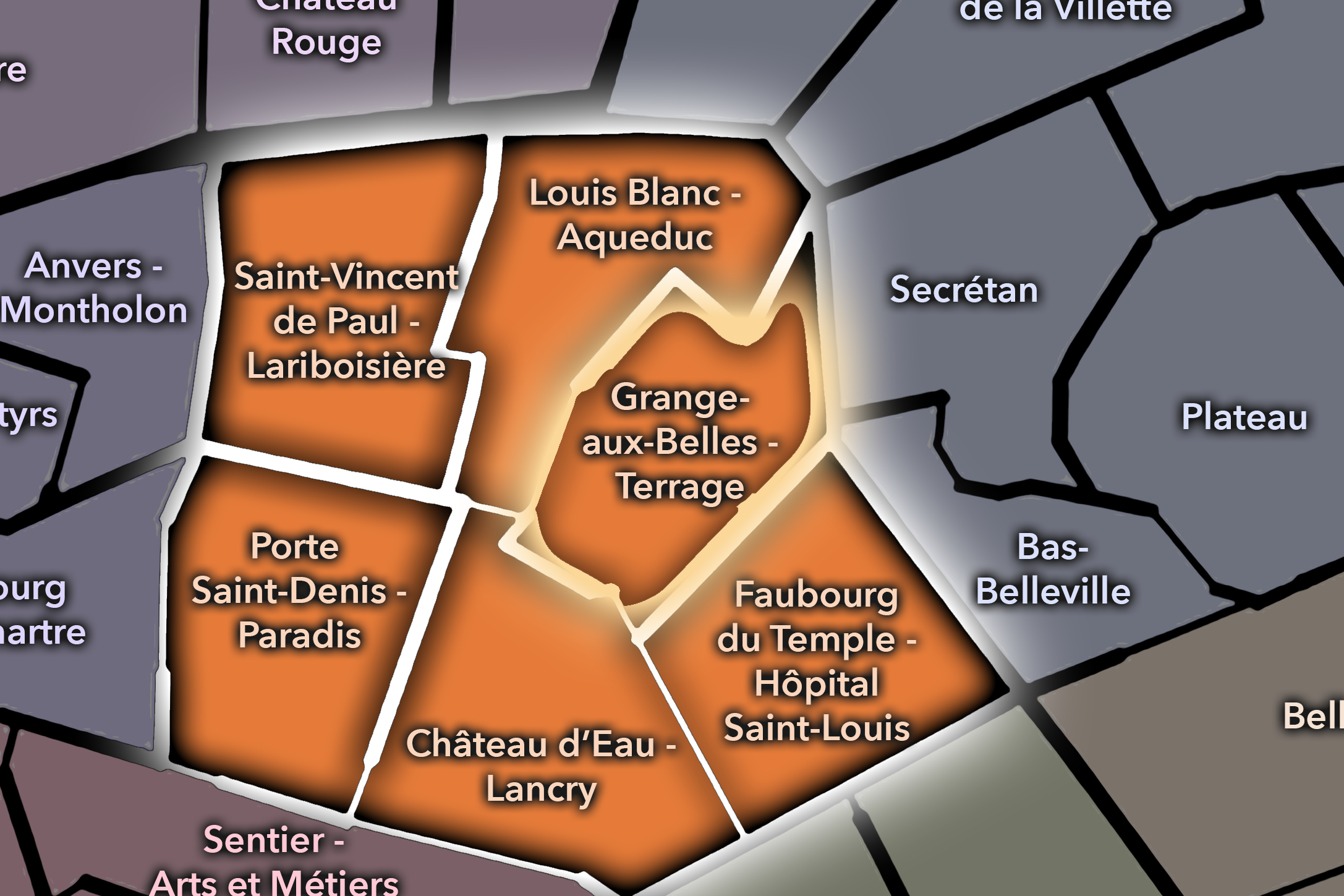
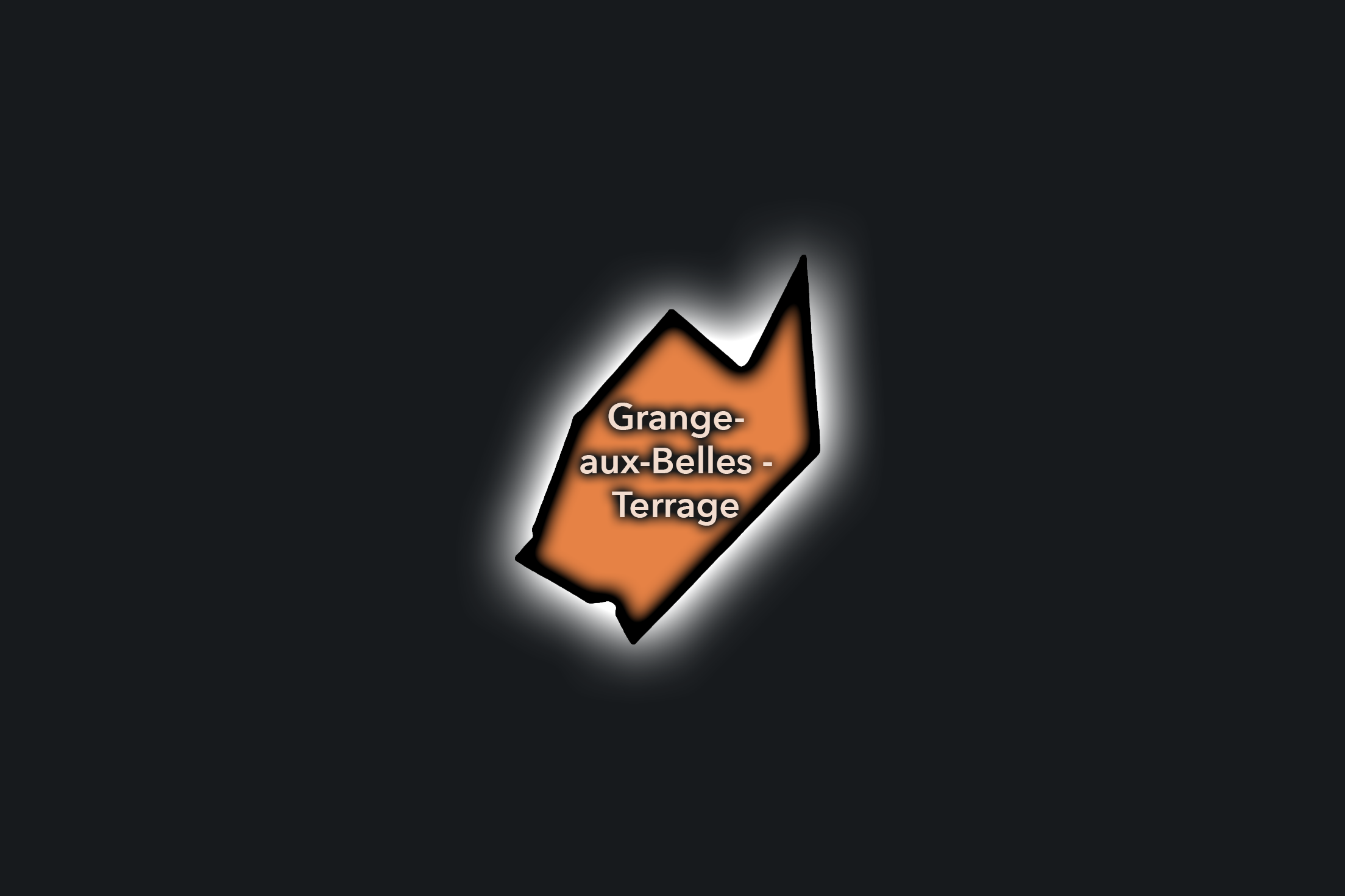
The Grange-aux-Belles - Terrage Conseil de Quartier organizes a quieter but deeply useful portion of the 10e, where residential streets, schools, social infrastructure, canal approaches, local commerce, and railway-adjacent urban fabric meet. Positioned between the Canal Saint-Martin, Rue du Faubourg Saint-Martin, Louis Blanc, and the eastern side of the arrondissement, this CdQ gives civic shape to a district that often feels less destination-driven than its neighbors, but strongly rooted in everyday use.
On the ground, Grange-aux-Belles - Terrage feels local, residential, and infrastructural. It is shaped by school streets, neighborhood cafés, apartment blocks, community facilities, and the practical routes between the canal, Gare de l’Est, Louis Blanc, and the 19e. Its civic themes center on residential quality of life, pedestrian safety, greening, school access, public-space maintenance, traffic near rail and canal corridors, and the need to keep a dense working neighborhood comfortable and connected.
Grange-aux-Belles - Terrage: At a Glance
A curated list for you.
-
Major Streets
Rue de la Grange-aux-Belles
Rue du Terrage
Rue du Faubourg Saint-Martin
Quai de Valmy
Rue des Écluses Saint-Martin
-
Public Spaces & Landmarks
Canal Saint-Martin
Square Eugène-Varlin
Hôpital Saint-Louis nearby
Jardin Villemin nearby
Écluses du Canal Saint-Martin
-
Transit Access
Jacques Bonsergent
Louis Blanc
Gare de l’Est nearby
Château-Landon nearby
République nearby
-
Shopping & Dining
Canal Saint-Martin cafés
Rue du Faubourg Saint-Martin dining
Le Verre Volé nearby
Du Pain et des Idées nearby
Local cafés around Grange-aux-Belles
-
Hotels & Attractions
Canal Saint-Martin walking route
Jardin Villemin nearby
Gare de l’Est nearby
République approach corridor
Écluses and canal bridges
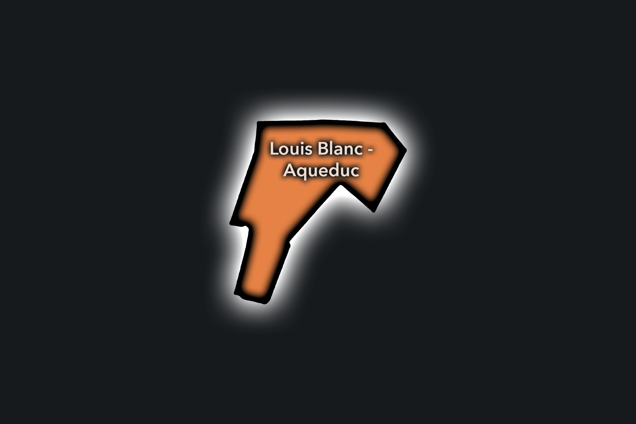
Louis Blanc - Aqueduc
Civic Profile
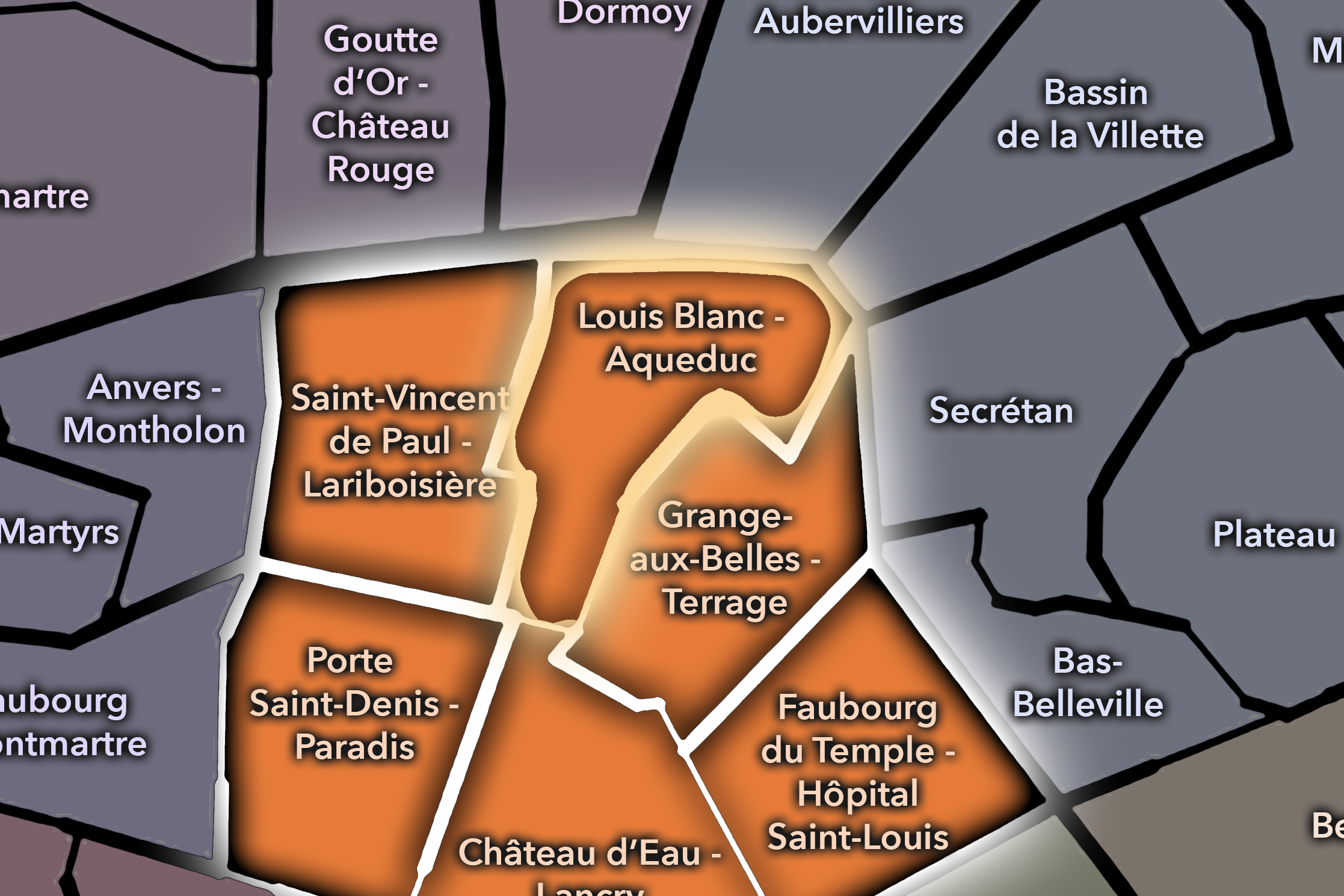
The Louis Blanc - Aqueduc Conseil de Quartier organizes the northern and canal-adjacent side of the 10e, where residential streets, rail infrastructure, schools, bridges, local shops, the Canal Saint-Martin / Canal de l’Ourcq approach, and the streets around Louis Blanc create a practical neighborhood landscape. Unlike the more station-dominated Saint-Vincent de Paul - Lariboisière or the boulevard intensity of Porte Saint-Denis - Paradis, this CdQ reads as a local civic territory shaped by edges: canal edges, railway edges, residential blocks, and the transition toward the 19e.
On the ground, Louis Blanc - Aqueduc feels residential, infrastructural, and quietly connected. Its public life is less theatrical than the Grands Boulevards and less monumental than central Paris, but its civic concerns are immediate: pedestrian comfort around rail and canal crossings, neighborhood commerce, school access, greening, cleanliness, traffic, and the maintenance of usable public space in a dense urban fabric. The CdQ helps distinguish a part of the 10e where everyday local movement matters as much as destination activity.
Louis Blanc - Aqueduc: At a Glance
A curated list for you.
-
Major Streets
Rue Louis Blanc
Rue La Fayette
Rue du Château-Landon
Quai de Valmy
Rue de l’Aqueduc
-
Public Spaces & Landmarks
Canal Saint-Martin
Square Eugène-Varlin nearby
Marché Saint-Quentin nearby
Église Saint-Joseph-Artisan
Railway viaduct / canal-edge streets
-
Transit Access
Louis Blanc
Château-Landon
Jaurès nearby
Gare de l’Est nearby
Stalingrad nearby
-
Shopping & Dining
Rue Louis Blanc cafés and shops
Quai de Valmy cafés
Marché Saint-Quentin nearby
Point Éphémère nearby
Canal-side dining near Jaurès
-
Hotels & Attractions
Canal Saint-Martin walking route
Louis Blanc / Château-Landon neighborhood streets
Gare de l’Est nearby
Bassin de la Villette nearby
Canal-to-rail urban landscape
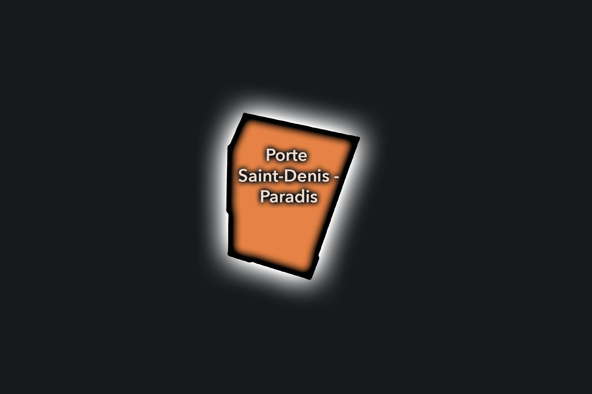
Porte Saint-Denis - Paradis
Civic Profile
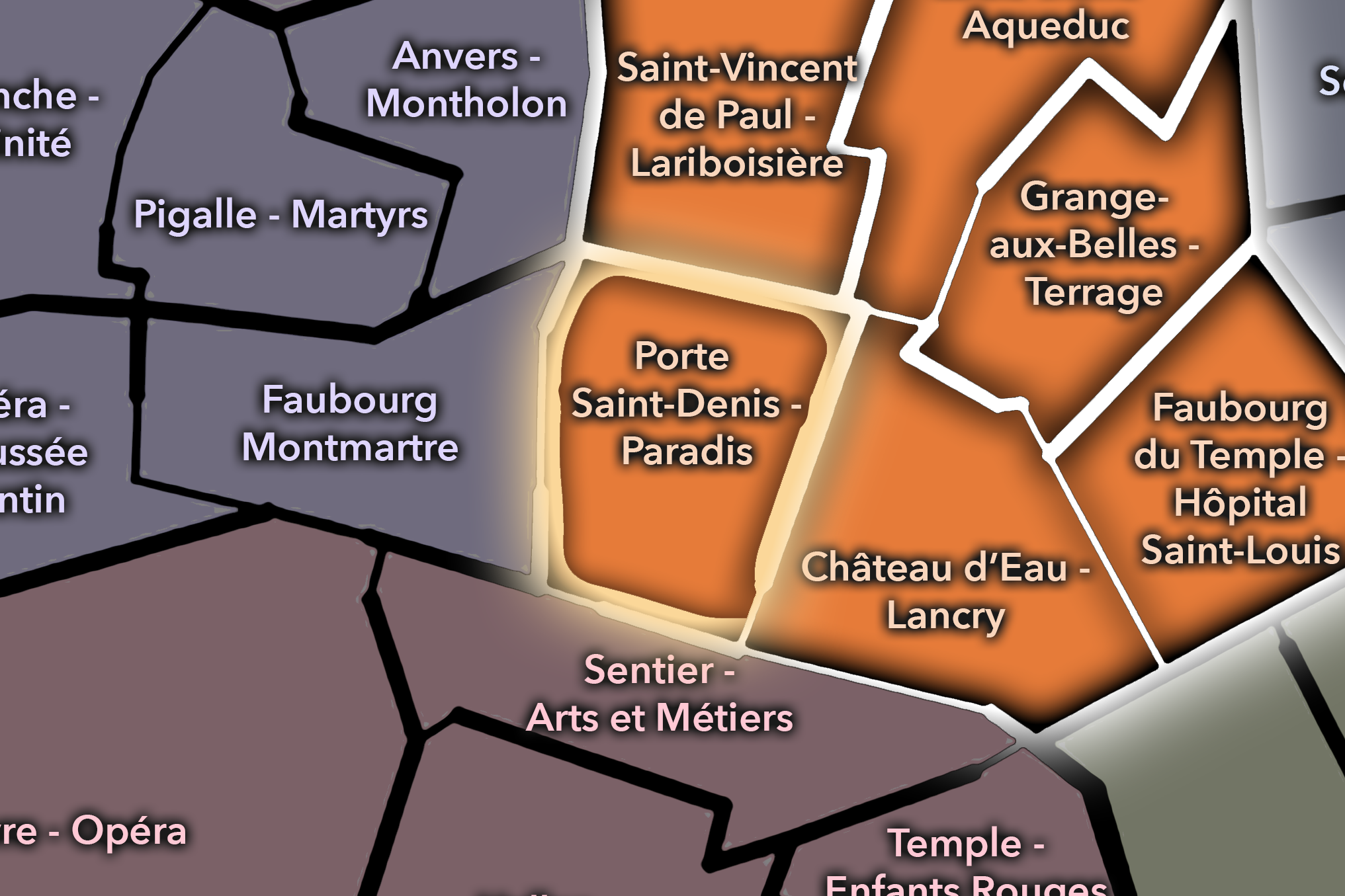
The Porte Saint-Denis - Paradis Conseil de Quartier gives civic form to one of the 10e’s most historic and animated gateway districts, where the old city-edge monument of Porte Saint-Denis meets Rue du Faubourg Saint-Denis, Rue de Paradis, Boulevard de Strasbourg, covered-passage life, restaurants, theaters, hotels, offices, and dense pedestrian movement. As a civic territory, it connects the Grands Boulevards to the working, commercial, and multicultural street life of the northern Right Bank.
On the ground, Porte Saint-Denis - Paradis feels lively, layered, and intensely urban. Its civic themes center on managing sidewalks and pedestrian movement, supporting small commerce and restaurants, maintaining public space around historic gateways and busy boulevards, balancing nightlife and residential life, and preserving the district’s mix of passage culture, immigrant dining, hotel use, and everyday neighborhood activity. Passage Brady, long associated with Indian and Pakistani restaurants and shops, is one of the clearest examples of the district’s distinctive commercial identity.
Porte Saint-Denis - Paradis: At a Glance
A curated list for you.
-
Major Streets
Rue du Faubourg Saint-Denis
Rue de Paradis
Boulevard de Strasbourg
Boulevard Saint-Denis
Rue d’Enghien
-
Public Spaces & Landmarks
Porte Saint-Denis
Passage Brady
Théâtre Antoine nearby
Théâtre du Gymnase nearby
Cour des Petites Écuries nearby
-
Transit Access
Strasbourg - Saint-Denis
Château d’Eau
Bonne Nouvelle nearby
Gare de l’Est nearby
Jacques Bonsergent nearby
-
Shopping & Dining
Passage Brady restaurants
Rue du Faubourg Saint-Denis dining
Brasserie Flo
Bouillon Julien
Urfa Dürüm
-
Hotels & Attractions
Porte Saint-Denis gateway monument
Passage Brady / Little India route
Grands Boulevards theater corridor
Faubourg Saint-Denis food street
Gare de l’Est nearby
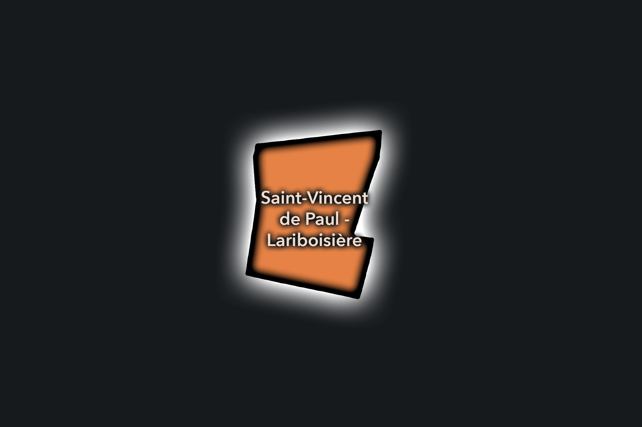
Saint-Vincent de Paul - Lariboisière
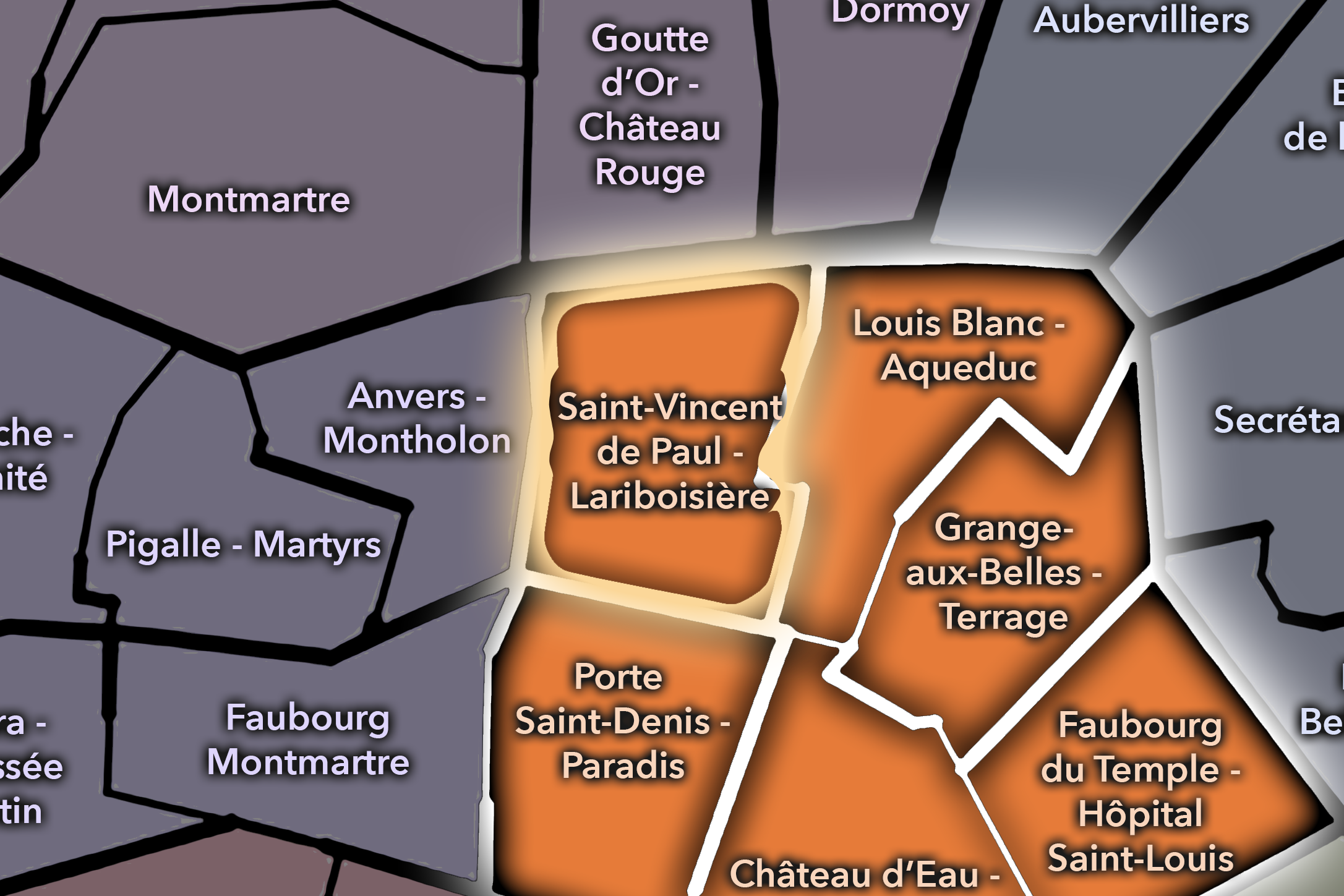
The Saint-Vincent de Paul - Lariboisière Conseil de Quartier gives civic form to one of the 10e’s most intense arrival landscapes, where Gare du Nord, Gare de l’Est, hospital infrastructure, hotels, cafés, commuters, travelers, schools, and dense residential streets meet. As a civic territory, it is shaped by movement at a metropolitan scale: railway stations, bus corridors, sidewalks under pressure, station forecourts, and the everyday needs of people who live beside one of Paris’s busiest transit environments.
On the ground, Saint-Vincent de Paul - Lariboisière feels busy, practical, and constantly in motion. Its civic themes center on station-area circulation, pedestrian safety, cleanliness, public-space management, hospital access, hotel activity, local commerce, and the challenge of maintaining neighborhood livability in a district that many people experience first as a point of arrival or transfer. The CdQ layer is useful here because it gives local shape to an area where citywide mobility and everyday residential life are tightly intertwined.
Civic Profile
Saint-Vincent de Paul - Lariboisière: At a Glance
A curated list for you.
-
Major Streets
Boulevard de Magenta
Rue La Fayette
Rue de Dunkerque
Rue du Faubourg Saint-Denis
Rue du 8 Mai 1945
-
Public Spaces & Landmarks
Gare du Nord
Gare de l’Est
Hôpital Lariboisière
Église Saint-Vincent-de-Paul
Square Alban-Satragne
-
Transit Access
Gare du Nord
Gare de l’Est
Magenta
Château-Landon
Poissonnière nearby
-
Shopping & Dining
Bouillon Chartier Gare de l’Est
Brasserie Bellanger
Terminus Nord
Rue du Faubourg Saint-Denis dining
Gare de l’Est station dining
-
Hotels & Attractions
Gare du Nord arrival district
Gare de l’Est arrival district
Saint-Vincent-de-Paul church and hillside streets
Canal Saint-Martin nearby
Magenta / station hotel corridor
Neighborhood Connections
Every Conseil de Quartier belongs to a wider Parisian fabric.
-
10e — Entrepôt
-
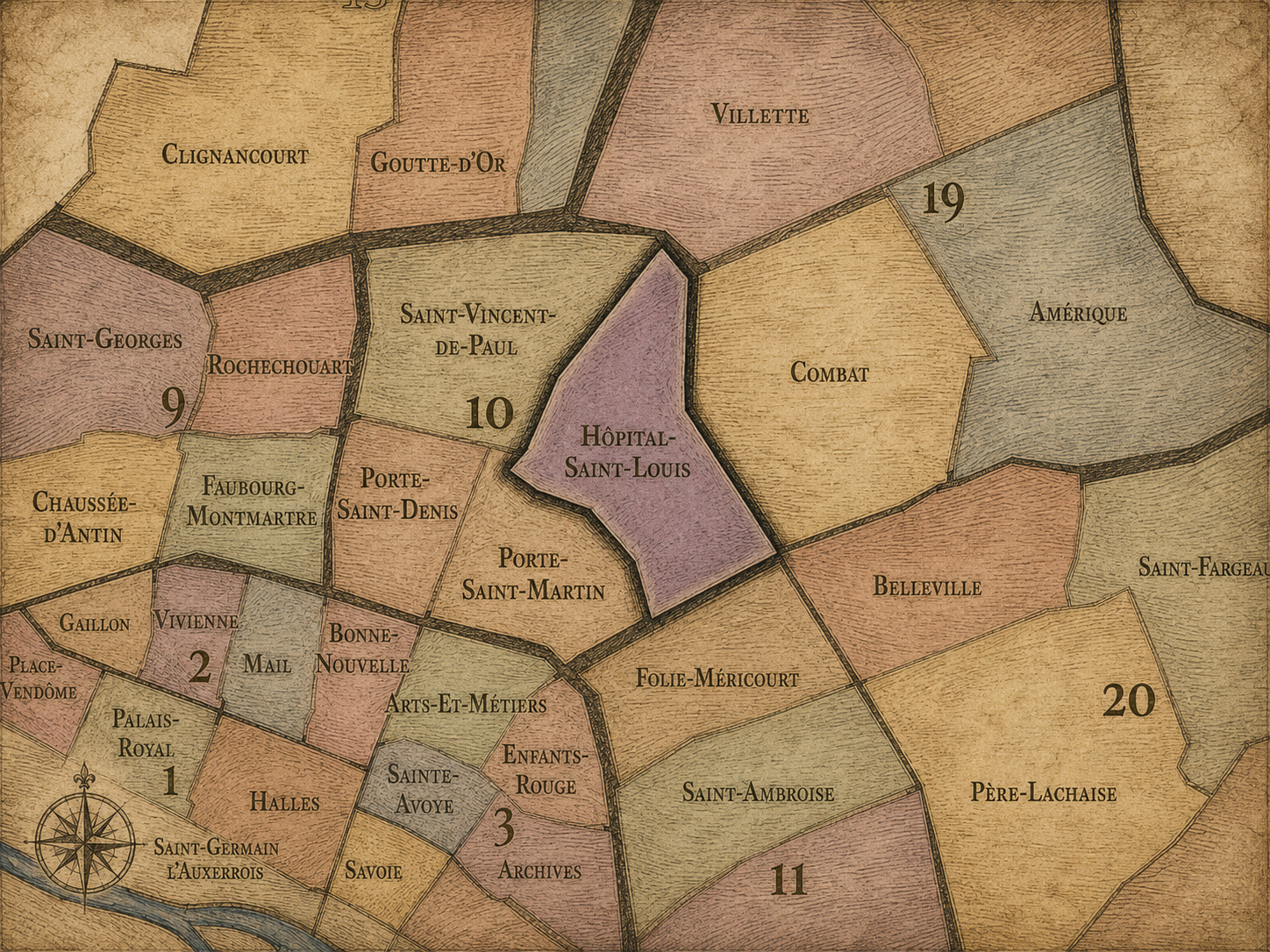
Hôpital-Saint-Louis
-
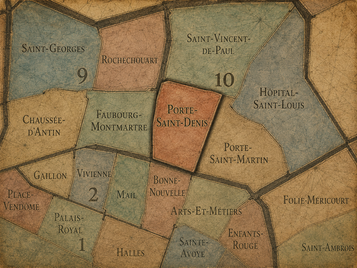
Porte-Saint-Denis
-
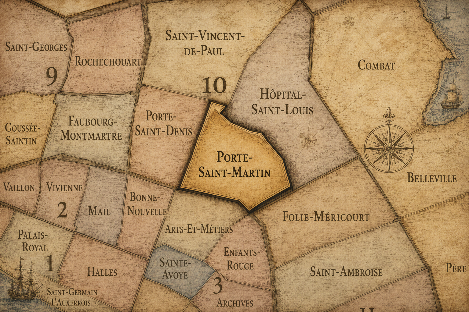
Porte-Saint-Martin
-
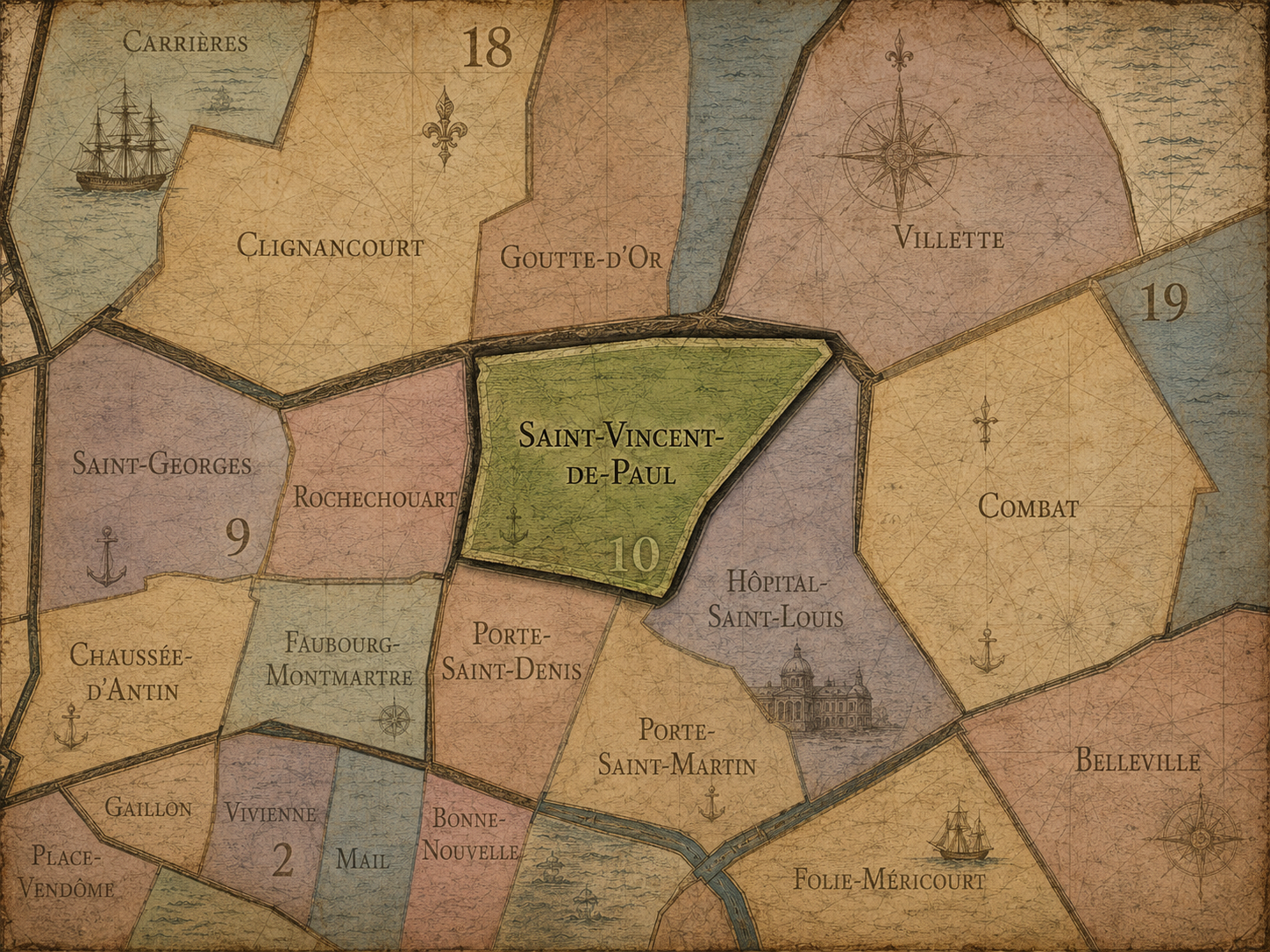
Saint-Vincent-de-Paul
The Photography
Visual Identity

The arrondissements do not share a single visual identity. Instead, they organize Paris into twenty broad visual fields, each gathering its own combination of landmarks, streetscapes, institutions, residential districts, commercial corridors, parks, rail stations, markets, cemeteries, and riverfront edges.
Some arrondissements are defined by monumental scale: royal palaces, ceremonial avenues, government buildings, museums, formal gardens, and internationally recognized landmarks. Others are shaped by hills, canals, rail gateways, apartment-lined boulevards, neighborhood markets, former village streets, industrial remnants, parks, or the quieter rhythms of residential Paris. The arrondissement system gives these varied landscapes a civic frame, allowing the city to be read not as one visual language, but as a sequence of overlapping Parisian atmospheres.
Through The Lens

Photographing the arrondissements means moving between the official map and the street-level experience. The camera does not treat each arrondissement as visually uniform. Instead, it looks for the recurring forms, textures, transitions, and contrasts that make each district legible: the geometry of boulevards, the shade of plane trees, the repetition of balconies, the rise of stairways, the curve of canals, the presence of rail stations, the opening of parks, the weight of monuments, and the intimacy of side streets.
On CityNeighborhoods, the arrondissement provides the frame, but the photograph comes from the encounter between map, movement, light, and observation. As the Paris photography is processed, this section will connect each arrondissement more directly to the project’s Photographic Lexicon: the visual strategies, recurring motifs, and compositional patterns that shape how the city is seen through the lens.
If you visit Paris, these ideas can help inspire your own photography.



Paris: J’Espere, Je Rêve, Je Vive
Paris Photo Gallery
Paris Field Notes
-
Field Note: August 18, 2025 | 07:58 AM
Conditions: 73°F | Humidity: 72%.
Within the park's interior, the glacial kettle ponds acted as humidity traps, creating a soft, hazy light that filtered through the old-growth oaks. The transition from the park's dense shade to the sun-drenched edges of Oakland Gardens highlighted the day's exceptional "picture-perfect" clarity.
There is a fleeting window in Queens where the humidity of August hasn't yet heavy-set, and the morning sun hits the canopy of Alley Pond Park at a perfect oblique angle. Arriving just before 8:00 AM, I watched the light break through the oaks and tulip trees, casting long, dramatic shadows across the wet grass. It’s in these quiet, golden moments that the park feels less like a city escape and more like the ancient glacial valley it actually is.
Other neighborhoods visited:











































































































Explore Paris
-

The twenty arrondissements form the civic spiral of Paris, organizing the city into its broad local districts of government, identity, and daily life.
-

Each arrondissement is divided into four official administrative quarters, giving Paris a more precise civic and geographic framework.
-

The conseils de quartier bring participation to street level, giving residents a voice in neighborhood needs, public space, and local civic life.
-

Les Deux Rives trace Paris through the Seine’s two banks, revealing how the Rive Droite and Rive Gauche shaped the city’s civic power, commerce, learning, art, and cultural identity.
-

Cultural neighborhoods reveal the Paris people recognize through history, cafés, architecture, memory, atmosphere, and local belonging.