
11e - REUILLY
Les Conseils de Quartier
Explore This Page


Explore the Conseils de Quartier of the 12e — Reuilly.

Overview
Download the Paris Conseil de Quartier Map
Geographic Setting
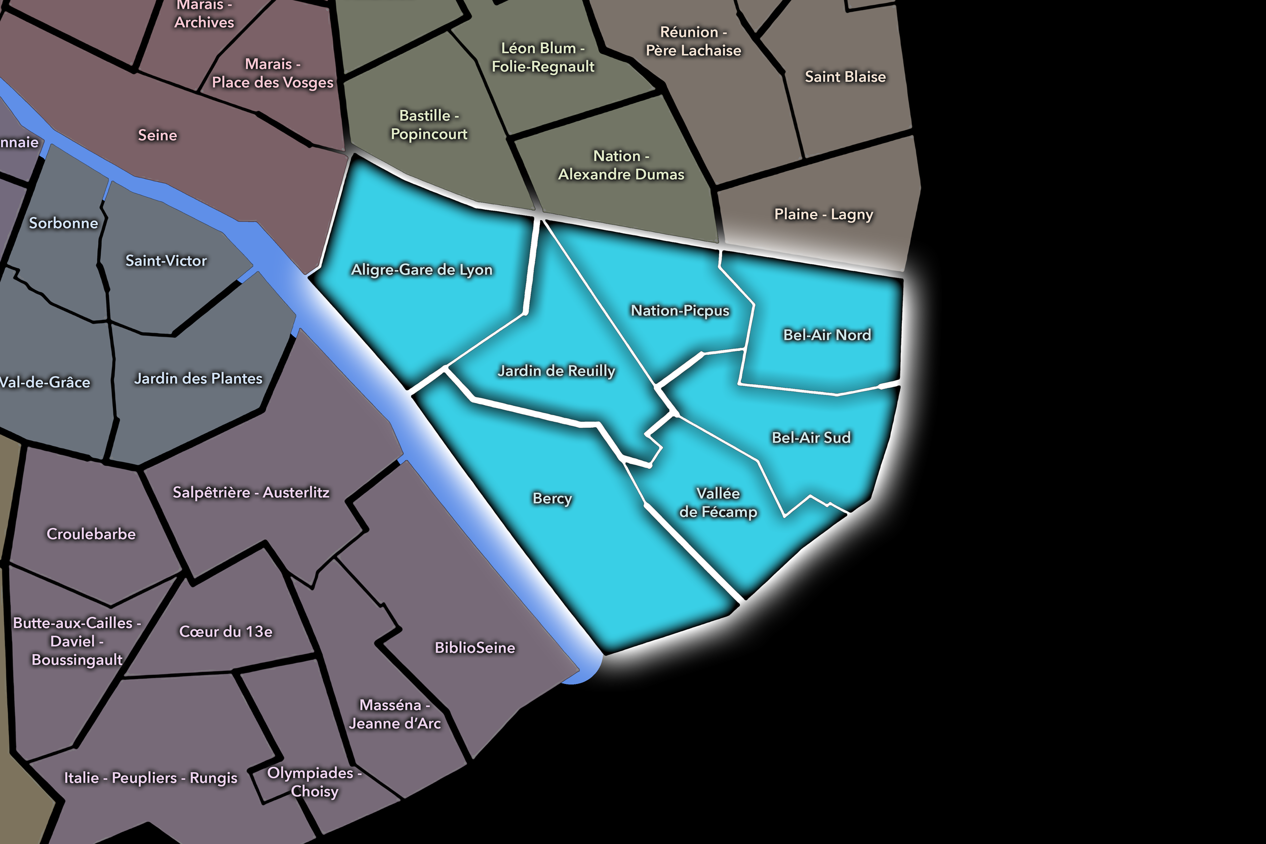
The Conseils de Quartier of the 12e organize local civic life across one of eastern Paris’s most expansive and varied arrondissements. Stretching from the Bastille / Gare de Lyon edge toward the Bois de Vincennes and the city’s southeastern gateways, the 12e brings together dense residential streets, railway corridors, former industrial and warehouse districts, market life, park landscapes, institutional zones, broad avenues, and some of the city’s most important green spaces. Its geography is defined by movement and transition: from the centrality of Aligre and Gare de Lyon to the residential interiors of Picpus and Bel-Air, from the redeveloped Seine-side landscapes of Bercy to the long green line of the Coulée Verte René-Dumont.
The 12e’s Conseil de Quartier structure divides this broad eastern landscape into seven civic territories: Aligre-Gare de Lyon, Bel-Air Nord, Bel-Air Sud, Bercy, Jardin de Reuilly, Nation-Picpus, and Vallée de Fécamp. This seven-council structure gives the arrondissement a more granular participatory map than the four official Administrative Quarters alone. It distinguishes between several local urban conditions: the dense market-and-station environment around Aligre and Gare de Lyon; the residential and institutional fabric around Nation-Picpus; the green corridor and neighborhood center of Jardin de Reuilly; the large-scale redevelopment and cultural landscapes of Bercy; and the quieter eastern residential districts of Bel-Air Nord, Bel-Air Sud, and Vallée de Fécamp.
Together, these seven CdQs reveal the 12e as an arrondissement of linked passages: railway passages, park passages, residential passages, and gateways toward the eastern edge of the city. Few Paris arrondissements move so clearly between central urban intensity and spacious public landscape. The CdQ layer helps make that movement legible, showing how the 12e is not a single eastern residential district, but a sequence of local civic environments organized around stations, markets, gardens, avenues, schools, parks, and neighborhood-scale public life.
Civic Framework
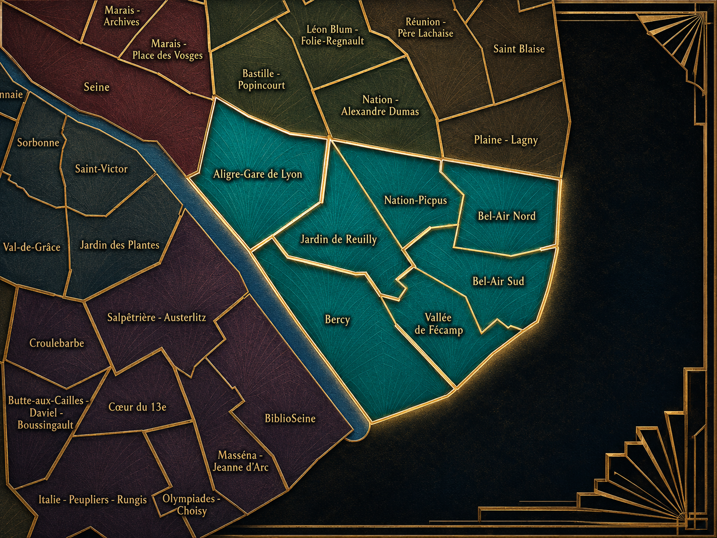
The 12e’s Conseils de Quartier provide a neighborhood-level civic structure for an arrondissement whose scale and internal variety require more than one broad identity. The district includes major transport infrastructure, residential neighborhoods, public gardens, the Coulée Verte, the Seine-side Bercy landscape, the Bois de Vincennes edge, schools, markets, hospitals, offices, cultural venues, and local shopping streets. Its CdQs give residents, workers, shopkeepers, commuters, visitors, families, and local institutions a more precise scale for discussing the practical conditions of daily life.
The seven-council framework appears especially responsive to the arrondissement’s physical geography. Aligre-Gare de Lyon gathers the pressures of a major railway station, market streets, hotels, restaurants, commuters, and dense residential life. Bercy gives civic shape to a district transformed by redevelopment, parkland, culture, offices, and Seine-side movement. Jardin de Reuilly centers the local landscape around one of the arrondissement’s most important neighborhood parks and the Coulée Verte. Nation-Picpus and the Bel-Air councils organize more residential, institutional, and family-oriented areas, while Vallée de Fécamp helps distinguish the southeast interior around local streets, schools, and the approach toward Porte Dorée and the city’s edge.
As a civic framework, the 12e’s CdQs help organize questions of mobility, public-space use, greening, station circulation, market vitality, residential quality of life, park access, redevelopment, accessibility, school streets, and the relationship between neighborhood life and large urban infrastructure. The CdQ layer is especially useful in the 12e because the arrondissement’s daily life is shaped not only by streets and buildings, but by corridors: rail lines, greenways, avenues, riverfront paths, and park edges that structure how people move through and inhabit the district.
Local Expression
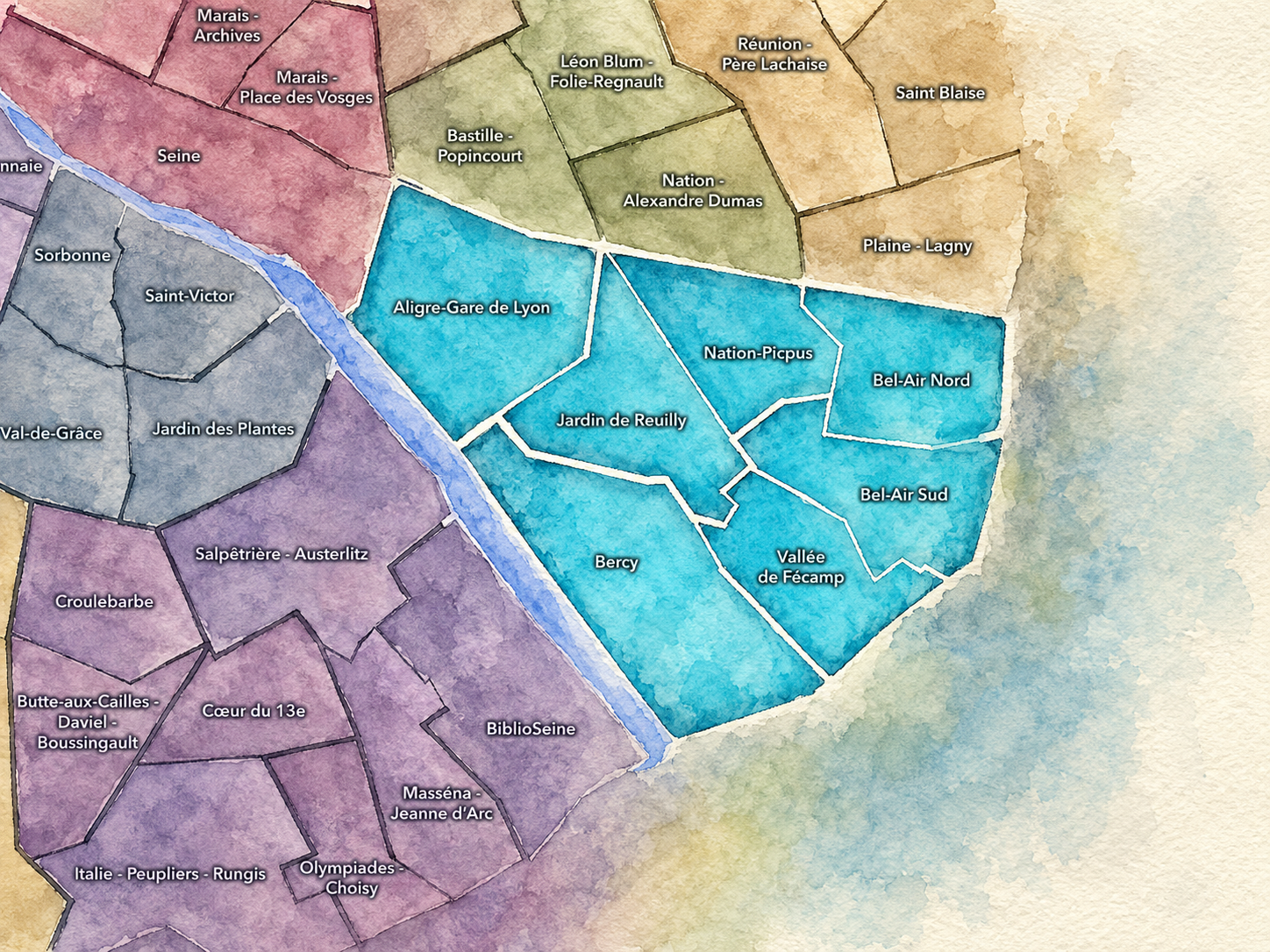
Viewed through its Conseils de Quartier, the 12e becomes a family of eastern Paris landscapes rather than a single residential arrondissement. Aligre-Gare de Lyon expresses the arrondissement’s central and kinetic side, where market life, railway movement, restaurants, hotels, commuters, and neighborhood routines overlap. Bercy brings a more contemporary and spacious expression, shaped by Parc de Bercy, cultural venues, office development, the Seine, and the memory of former wine warehouses and rail-linked industrial uses.
Jardin de Reuilly reveals the arrondissement’s softer local center, where the Coulée Verte, neighborhood parks, residential streets, and community life create a strong sense of everyday eastern Paris. Nation-Picpus connects the 12e to one of the city’s major squares while preserving a more residential and institutional rhythm. Bel-Air Nord, Bel-Air Sud, and Vallée de Fécamp draw the arrondissement toward its quieter eastern and southeastern edges, where broad avenues, schools, hospitals, apartment blocks, local shops, and access to the Bois de Vincennes shape a more domestic civic landscape.
The value of the CdQ layer in the 12e is that it makes visible the arrondissement’s balance between movement and neighborhood life. Through its seven councils, the 12e can be read at the scale of the market stall, the station entrance, the elevated greenway, the park gate, the school street, the residential avenue, the cinema district, the hospital edge, and the quiet routes leading toward the Bois de Vincennes. These CdQs reveal a Paris that is spacious, practical, green, infrastructural, and deeply lived.
Les Conseils de Quartier
Aligre-Gare de Lyon
Civic Profile
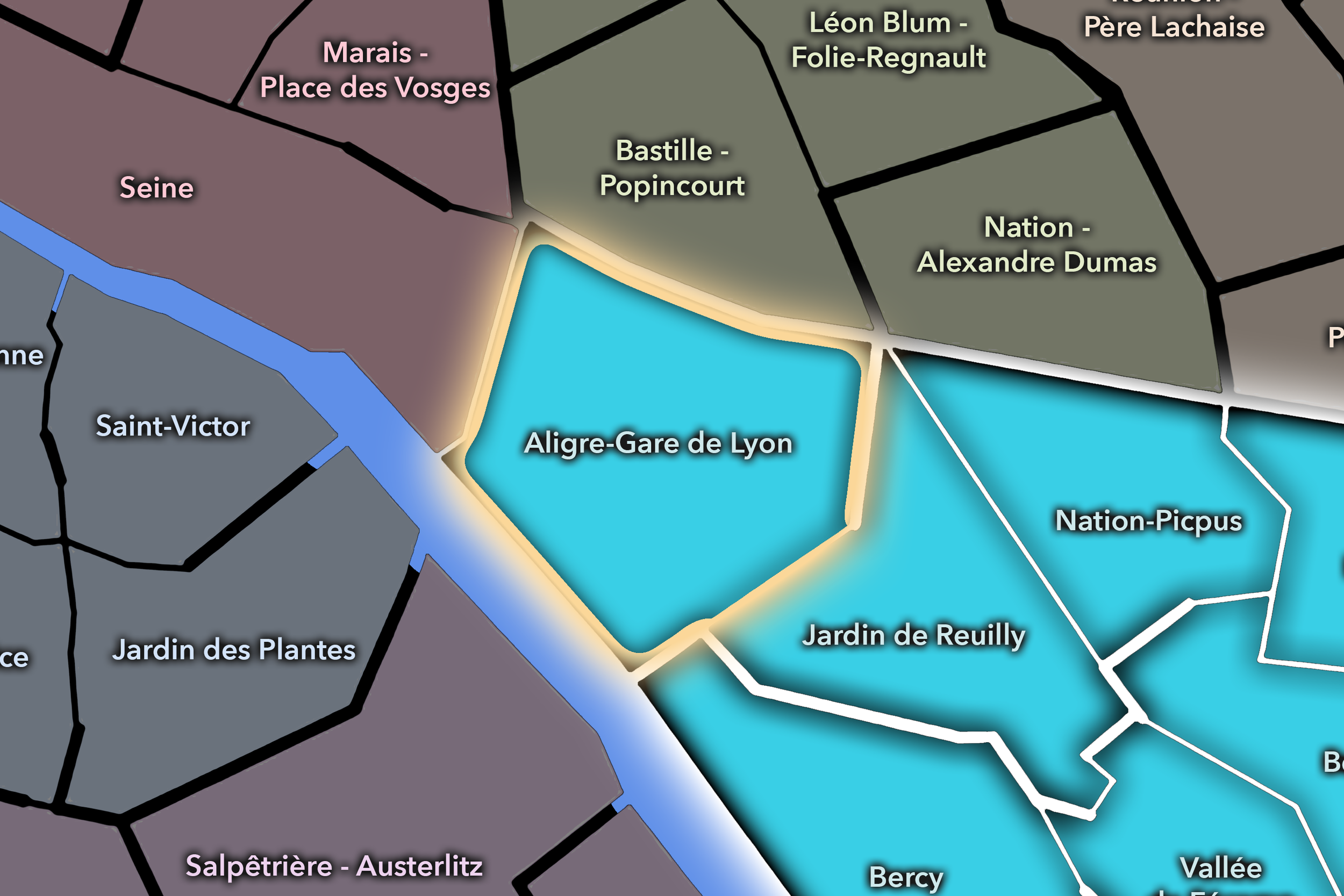
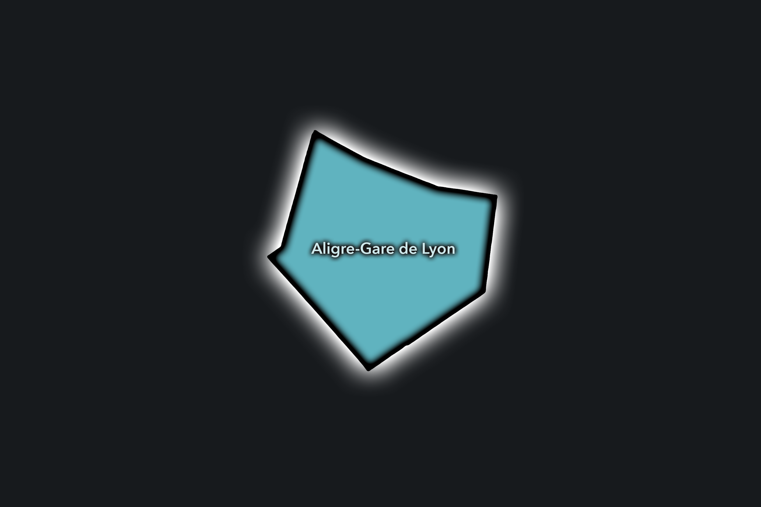
The Aligre-Gare de Lyon Conseil de Quartier gives civic form to one of the 12e’s most active western gateways, where market life, railway movement, hotel activity, residential streets, restaurants, and the old faubourg fabric around Avenue Daumesnil and Rue du Faubourg Saint-Antoine all meet. As a civic territory, it is shaped by two very different but closely linked forms of public life: the local, food-centered rhythm of Aligre and the metropolitan arrival landscape of Gare de Lyon.
On the ground, Aligre-Gare de Lyon feels busy, practical, and deeply Parisian. Marché d’Aligre and Marché Beauvau give the district a strong neighborhood identity, while Gare de Lyon brings commuters, visitors, hotels, restaurants, and constant movement. Its civic themes center on pedestrian circulation, market management, station-area pressure, residential livability, public-space maintenance, local commerce, and the challenge of keeping a heavily used arrival district connected to everyday neighborhood life.
Aligre-Gare de Lyon: At a Glance
A curated list for you.
-

Major Streets
Rue d’Aligre
Rue du Faubourg Saint-Antoine
Avenue Daumesnil
Boulevard Diderot
Avenue Ledru-Rollin
-

Public Spaces & Landmarks
Marché d’Aligre
Marché Beauvau
Gare de Lyon
Viaduc des Arts
Coulée Verte René-Dumont
-

Transit Access
Gare de Lyon
Ledru-Rollin
Faidherbe - Chaligny
Reuilly - Diderot
Quai de la Rapée nearby
-

Shopping & Dining
Marché d’Aligre food stalls
Le Baron Rouge
Le Train Bleu
Viaduc des Arts ateliers and cafés
Rue du Faubourg Saint-Antoine dining
-

Hotels & Attractions
Gare de Lyon arrival district
Coulée Verte René-Dumont
Viaduc des Arts
Aligre market circuit
Bastille nearby
Bel-Air Nord
Civic Profile
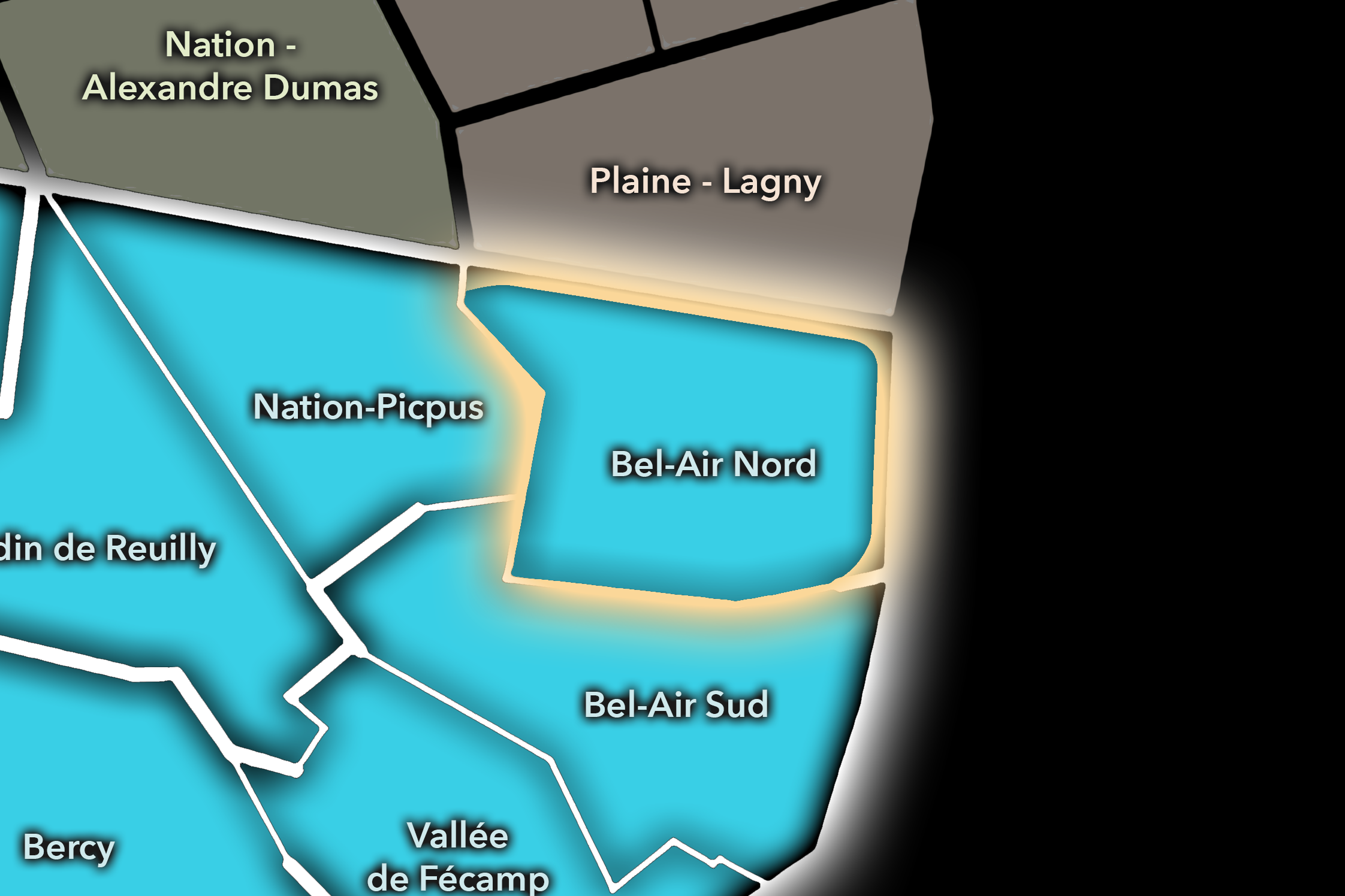
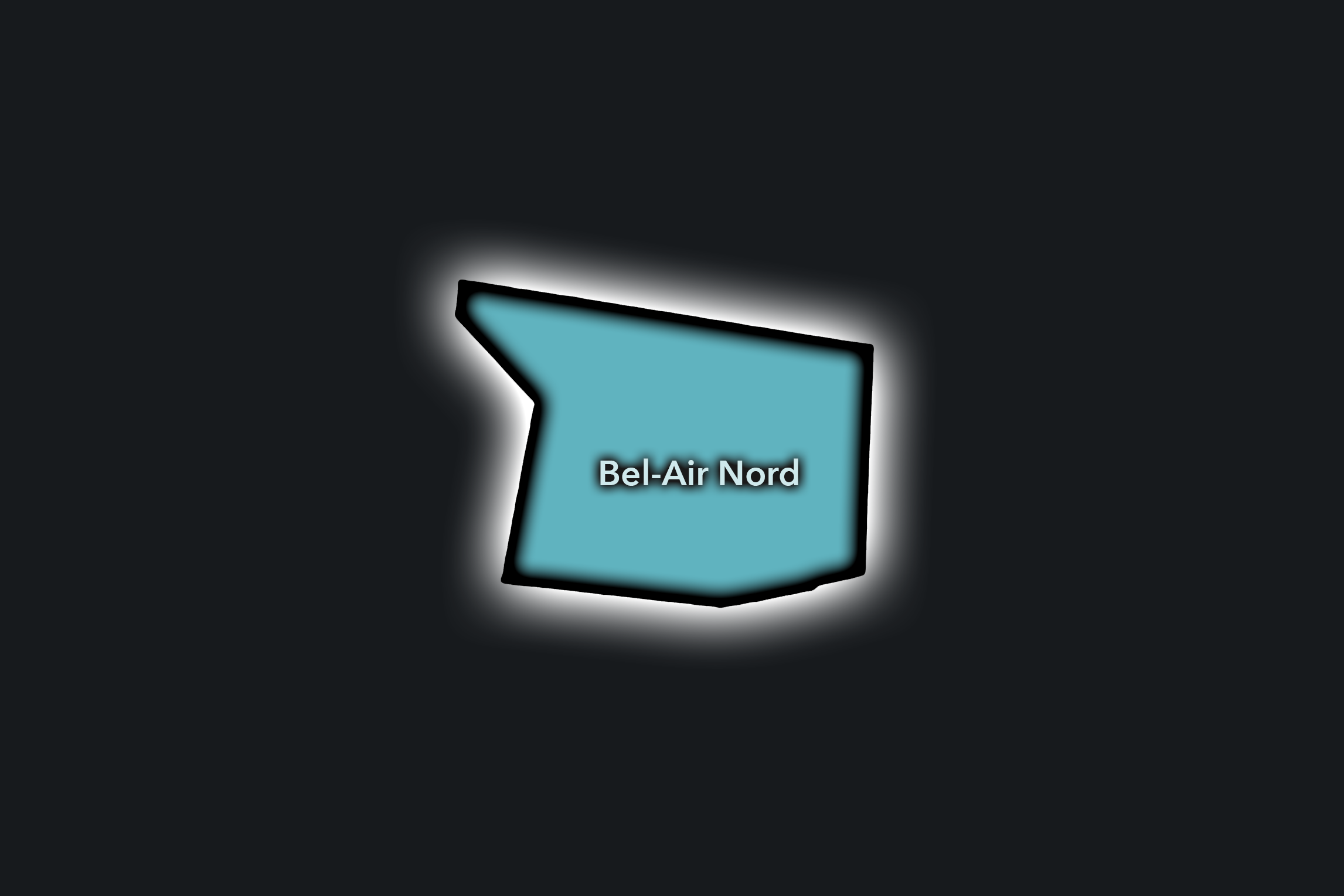
The Bel-Air Nord Conseil de Quartier organizes a residential and connective portion of the eastern 12e, where the arrondissement’s broad avenues, apartment blocks, schools, local shops, transit stops, and green corridors create a quieter civic landscape beyond the station and market intensity of the west. Its geography is shaped by the area around Daumesnil, Picpus, Michel Bizot, and the streets leading toward Nation, Bel-Air Sud, and the Bois de Vincennes edge.
On the ground, Bel-Air Nord feels local, residential, and family-oriented. It is not one of the 12e’s most visitor-facing territories, but that is part of its civic importance: this is the Paris of school routes, neighborhood cafés, local food shops, apartment courtyards, Metro entrances, and everyday public spaces. Its civic themes center on residential quality of life, pedestrian comfort, school access, greening, local commerce, transit convenience, and the maintenance of a calm but well-connected neighborhood fabric.
Bel-Air Nord: At a Glance
A curated list for you.
-
Major Streets
Avenue Daumesnil
Boulevard de Picpus
Rue de Picpus
Avenue du Général Michel Bizot
Avenue de Saint-Mandé
-
Public Spaces & Landmarks
Coulée Verte René-Dumont nearby
Square Charles-Péguy
Église du Saint-Esprit
Cimetière de Picpus nearby
Nation nearby
-
Transit Access
Daumesnil
Michel Bizot
Bel-Air
Picpus
Nation nearby
-
Shopping & Dining
Avenue Daumesnil local shops
Boulevard de Picpus cafés
Rue de Picpus food shops
Le Picotin
Neighborhood bakeries and cafés around Daumesnil
-
Hotels & Attractions
Coulée Verte access routes
Picpus / Daumesnil neighborhood walk
Nation transit hub nearby
Bois de Vincennes approach
Eastern 12e residential streets
Bel-Air Sud
Civic Profile
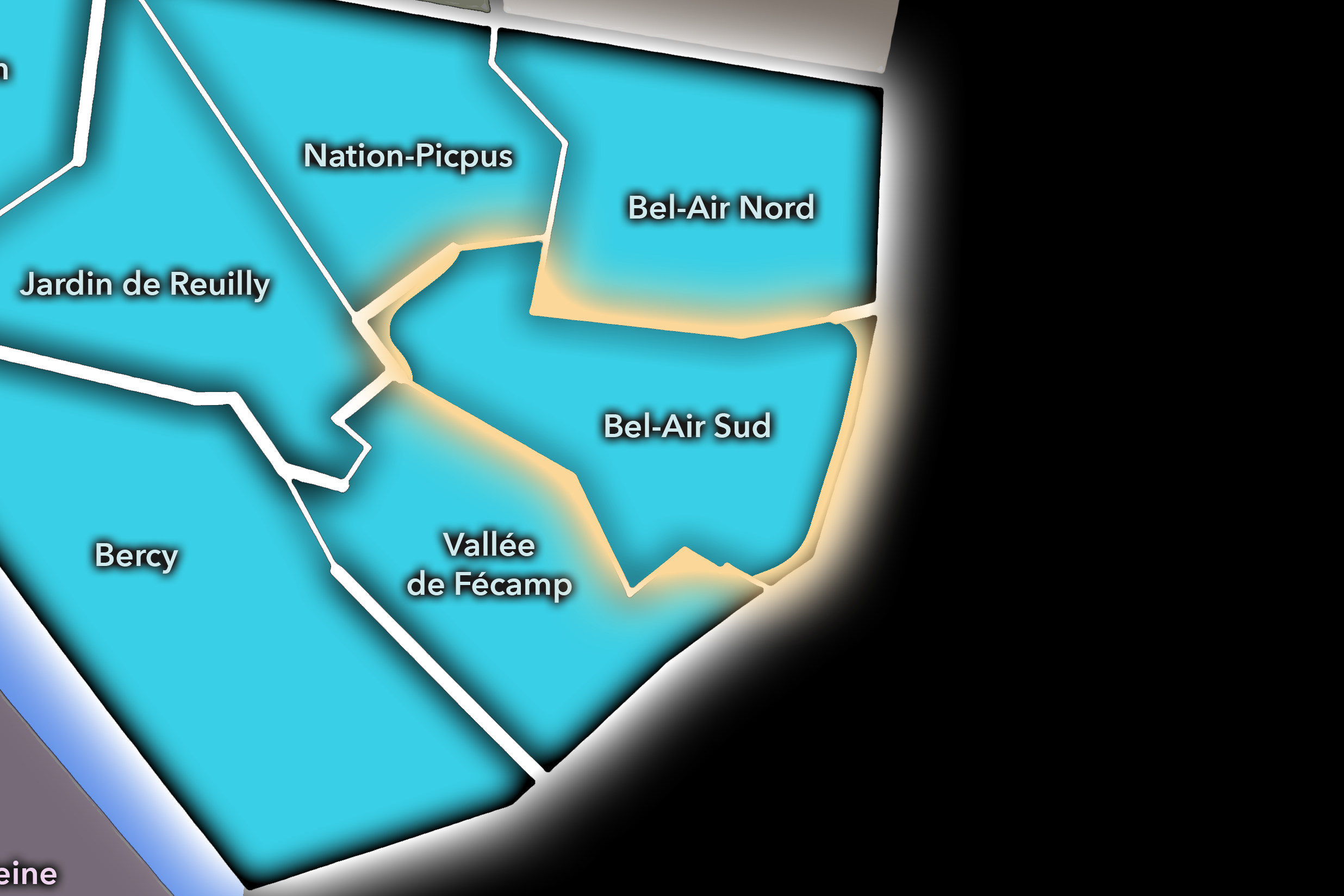
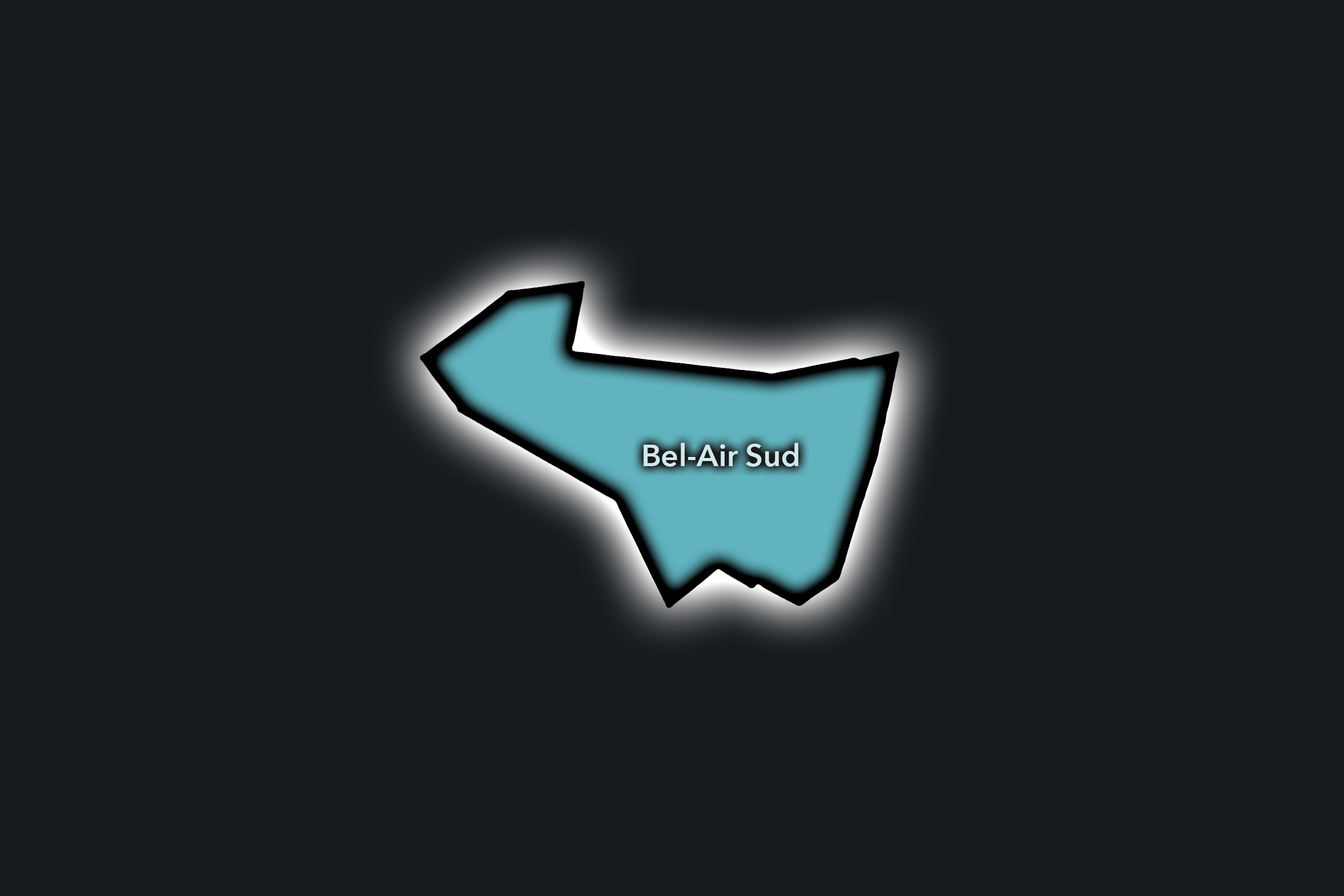
The Bel-Air Sud Conseil de Quartier gives civic shape to the southeastern side of the 12e, where residential Paris meets the Bois de Vincennes, Porte Dorée, broad boulevards, tramway corridors, schools, local commerce, and the city’s outer edge. As a civic territory, it is defined by the relationship between neighborhood life and large green space: apartment-lined streets, Metro access, the Porte Dorée district, and the park landscapes just beyond the formal city grid.
On the ground, Bel-Air Sud feels spacious, residential, and outward-facing. The district’s streets carry daily local routines, but they also lead toward some of eastern Paris’s major recreational and cultural anchors: the Bois de Vincennes, Lac Daumesnil, the Palais de la Porte Dorée, and the southeastern gateways of the capital. Its civic themes center on park access, pedestrian comfort, tram and Metro connections, school and family movement, traffic near the portes, local commerce, and the balance between residential calm and the visitor pull of nearby public landscapes.
Bel-Air Sud: At a Glance
A curated list for you.
-
Major Streets
Avenue Daumesnil
Avenue du Général Michel Bizot
Avenue de la Porte Dorée
Boulevard Soult
Boulevard Poniatowski
-
Public Spaces & Landmarks
Palais de la Porte Dorée
Bois de Vincennes
Lac Daumesnil
Porte Dorée
Square Charles-Péguy nearby
-
Transit Access
Porte Dorée
Michel Bizot
Porte de Charenton
Daumesnil nearby
Montempoivre tram stop
-
Shopping & Dining
Avenue Daumesnil local shops
Porte Dorée cafés
Michel Bizot neighborhood dining
Bois de Vincennes kiosks and cafés
Local bakeries around Avenue Daumesnil
-
Hotels & Attractions
Palais de la Porte Dorée
Aquarium Tropical
Bois de Vincennes walking routes
Lac Daumesnil
Parc Zoologique de Paris nearby
Bercy
Civic Profile
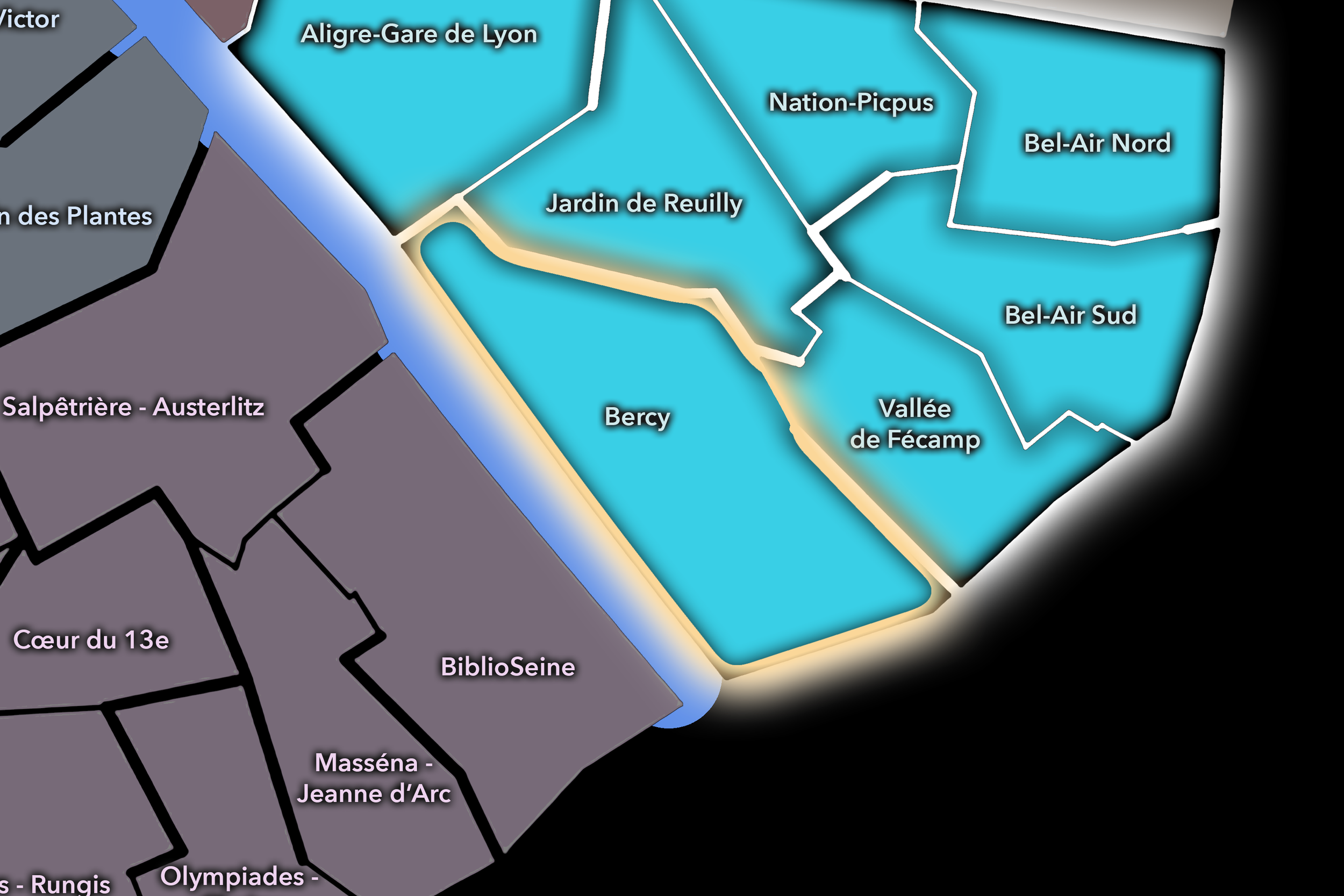
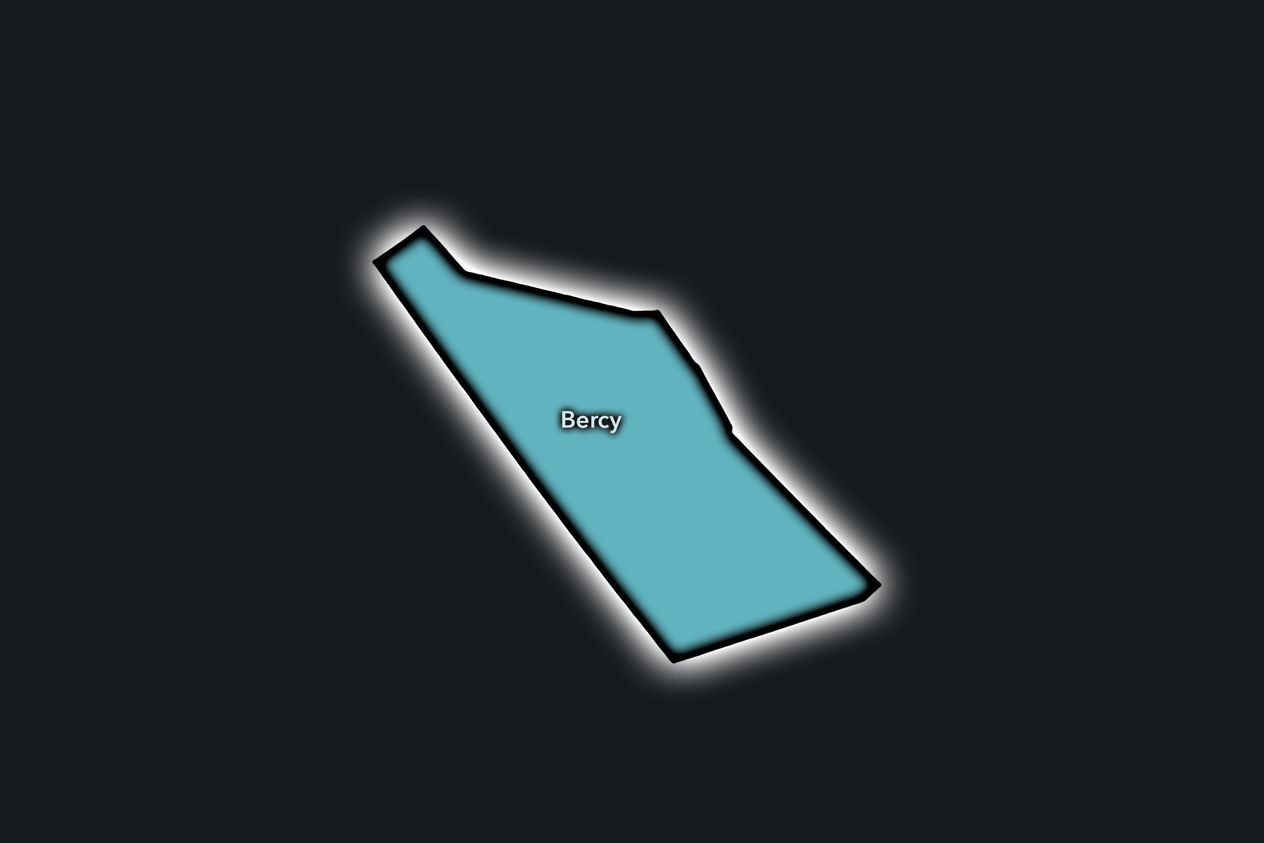
The Bercy Conseil de Quartier gives civic form to one of the 12e’s most transformed urban landscapes, where former wine warehouses, rail infrastructure, Seine-side redevelopment, parkland, cultural venues, offices, hotels, and residential streets have been reshaped into a contemporary eastern Paris district. Its geography is anchored by Parc de Bercy, Bercy Village, the Accor Arena, the Seine, and the corridors connecting Gare de Lyon, Cour Saint-Émilion, and the southeastern edge of the arrondissement.
On the ground, Bercy feels open, planned, and destination-oriented, but still tied to local use. Parc de Bercy gives the district a generous public landscape, while Bercy Village, the arena, cinemas, hotels, offices, and riverfront routes bring visitors, workers, concertgoers, residents, and families into the same civic territory. Its themes center on event circulation, park stewardship, redevelopment, commercial vitality, pedestrian connections, riverfront access, and the challenge of making a large-scale contemporary district feel connected to everyday neighborhood life.
Bercy: At a Glance
A curated list for you.
-
Major Streets
Rue de Bercy
Quai de Bercy
Boulevard de Bercy
Rue François-Truffaut
Cour Saint-Émilion
-
Public Spaces & Landmarks
Parc de Bercy
Bercy Village
Accor Arena
Cinémathèque Française
Passerelle Simone-de-Beauvoir nearby
-
Transit Access
Bercy
Cour Saint-Émilion
Dugommier
Gare de Bercy
Bibliothèque François-Mitterrand nearby
-
Shopping & Dining
Bercy Village
Cour Saint-Émilion restaurants
Chai 33
Frog at Bercy Village
Parc de Bercy cafés and kiosks
-
Hotels & Attractions
Accor Arena
Parc de Bercy
Cinémathèque Française
Bercy Village visitor district
Seine riverfront / Passerelle Simone-de-Beauvoir
Jardin de Reuilly
Civic Profile
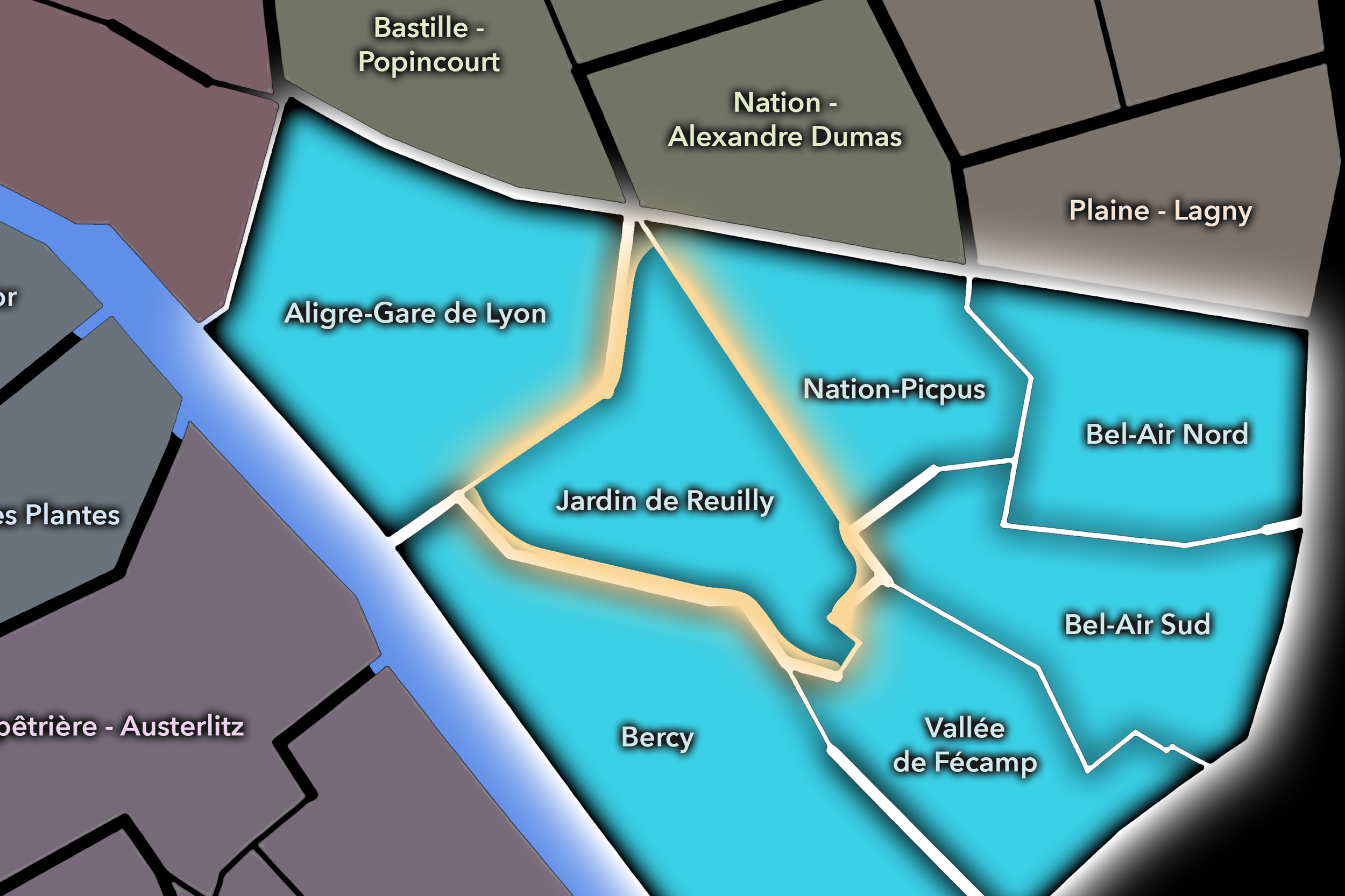
The Jardin de Reuilly Conseil de Quartier gives civic shape to one of the 12e’s most locally balanced landscapes, where the Coulée Verte René-Dumont, Jardin de Reuilly - Paul Pernin, Avenue Daumesnil, Rue de Charenton, schools, residential streets, and neighborhood commerce create a strong everyday civic rhythm. As a territory, it sits between the market-and-station intensity of western Reuilly and the broader residential interior of the arrondissement, using green space and pedestrian movement as defining features of local life.
On the ground, Jardin de Reuilly feels open, residential, and quietly active. The elevated promenade and garden give the district a distinctive softness, while nearby streets support cafés, bakeries, apartment blocks, local shops, and school routes. Its civic themes center on park stewardship, pedestrian comfort, family and school movement, greening, local commerce, accessibility, and the preservation of calm public spaces within a dense eastern Paris neighborhood.
Jardin de Reuilly: At a Glance
A curated list for you.
-
Major Streets
Avenue Daumesnil
Rue de Charenton
Rue de Reuilly
Rue Jacques Hillairet
Boulevard Diderot nearby
-
Public Spaces & Landmarks
Jardin de Reuilly - Paul Pernin
Coulée Verte René-Dumont
Viaduc des Arts nearby
Square Saint-Éloi nearby
Église Saint-Éloi nearby
-
Transit Access
Montgallet
Reuilly - Diderot
Dugommier nearby
Daumesnil nearby
Gare de Lyon nearby
-
Shopping & Dining
Avenue Daumesnil cafés and shops
Rue de Reuilly local commerce
Rue de Charenton dining
Viaduc des Arts cafés nearby
Neighborhood bakeries around Montgallet
-
Hotels & Attractions
Coulée Verte René-Dumont
Jardin de Reuilly
Viaduc des Arts walking route
Reuilly neighborhood streets
Gare de Lyon nearby
Nation-Picpus
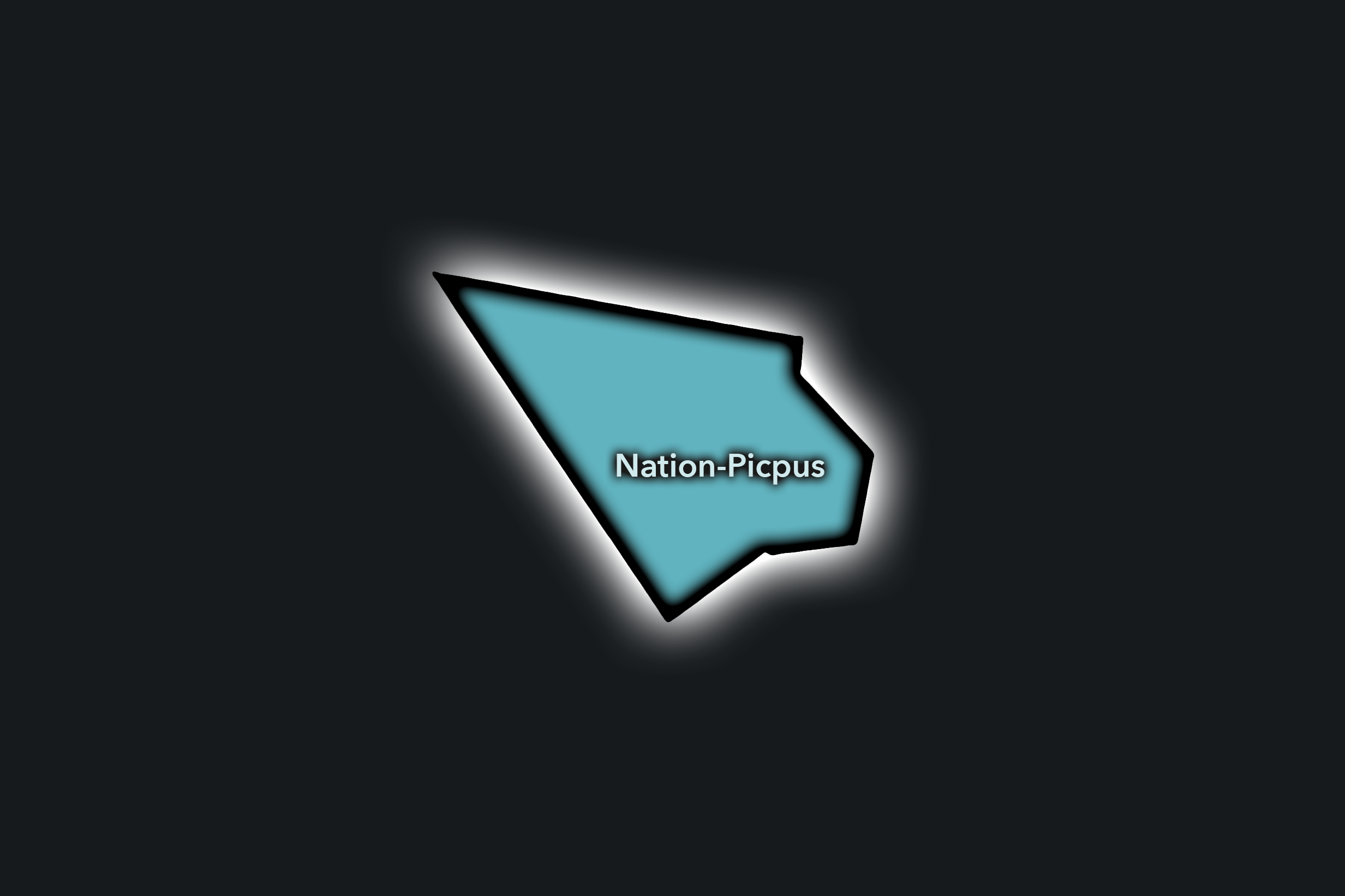
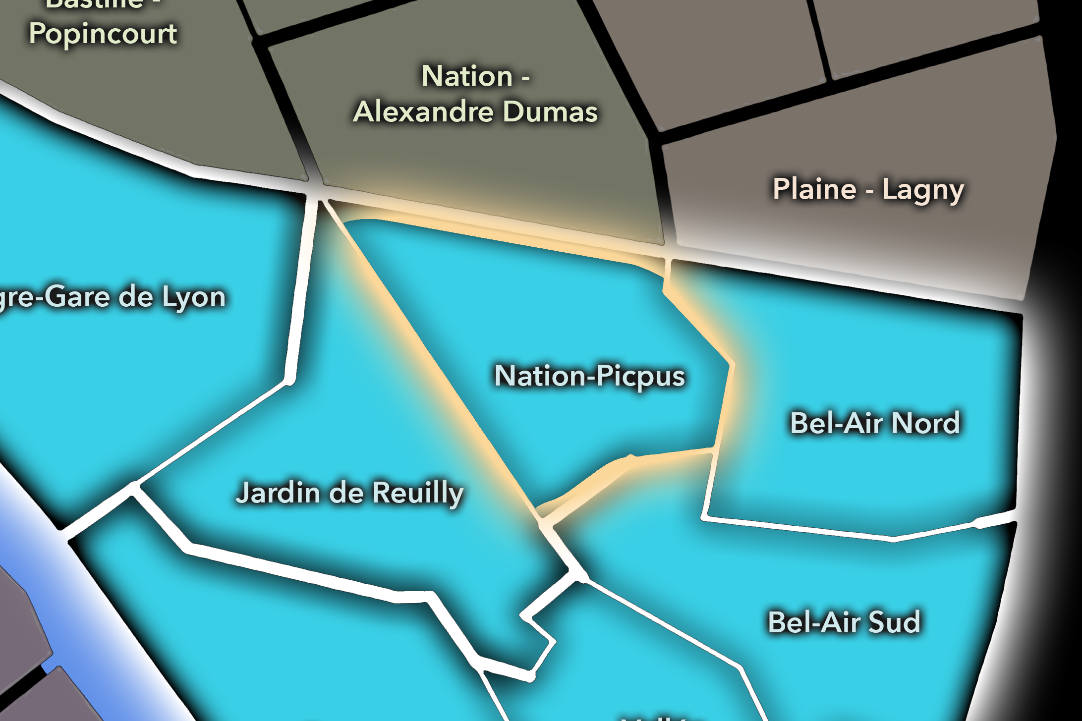
The Nation-Picpus Conseil de Quartier organizes a central-eastern portion of the 12e where Place de la Nation, Picpus, Avenue de Saint-Mandé, residential avenues, schools, religious institutions, transit, local shops, and apartment blocks converge. As a civic territory, it is shaped by the relationship between a major Parisian square and the quieter residential fabric surrounding it: broad movement at Nation, local routines around Picpus, and the gradual transition toward Bel-Air and the Bois de Vincennes side of the arrondissement.
On the ground, Nation-Picpus feels connected, residential, and civic-minded. Nation gives the area metropolitan intensity, while Picpus and the neighboring streets preserve a more local rhythm of schools, gardens, churches, shops, cafés, and apartment life. Its civic themes center on traffic and pedestrian circulation, transit access, residential quality of life, school streets, public-space comfort around major intersections, and the balance between one of eastern Paris’s great transport hubs and the neighborhood life around it.
Civic Profile
Nation-Picpus: At a Glance
A curated list for you.
-
Major Streets
Avenue de Saint-Mandé
Boulevard de Picpus
Rue de Picpus
Avenue du Trône
Cours de Vincennes
-
Public Spaces & Landmarks
Place de la Nation
Cimetière de Picpus
Église du Saint-Esprit nearby
Jardin de la Gare de Reuilly nearby
Square Courteline nearby
-
Transit Access
Nation
Picpus
Bel-Air nearby
Daumesnil nearby
Reuilly - Diderot nearby
-
Shopping & Dining
Cours de Vincennes shops
Avenue de Saint-Mandé cafés
Boulevard de Picpus local dining
Nation neighborhood brasseries
Local food shops around Picpus
-
Hotels & Attractions
Place de la Nation civic hub
Cimetière de Picpus
Picpus residential walking route
Bois de Vincennes approach
Eastern Paris transit connections
Vallée de Fécamp
Civic Profile
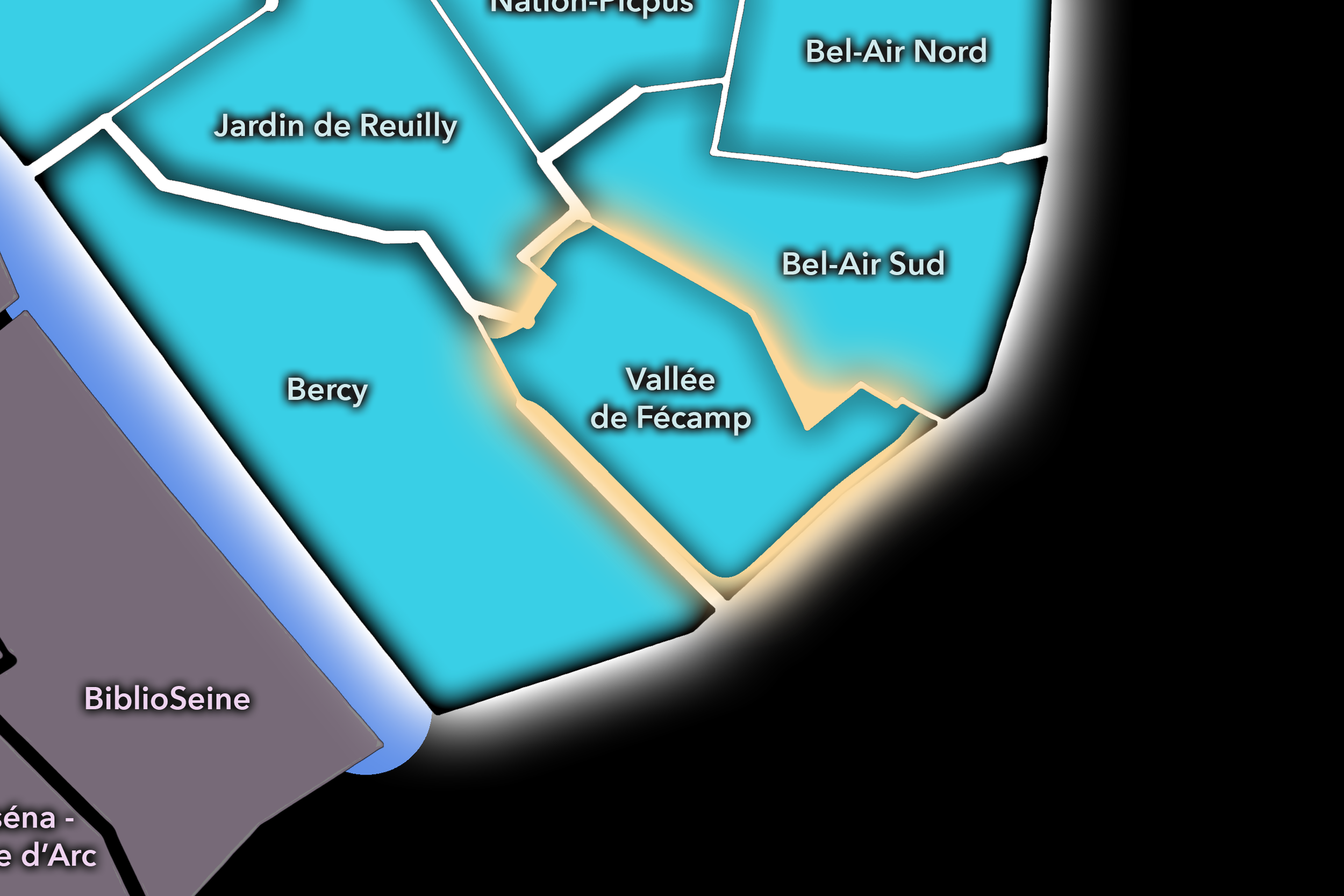
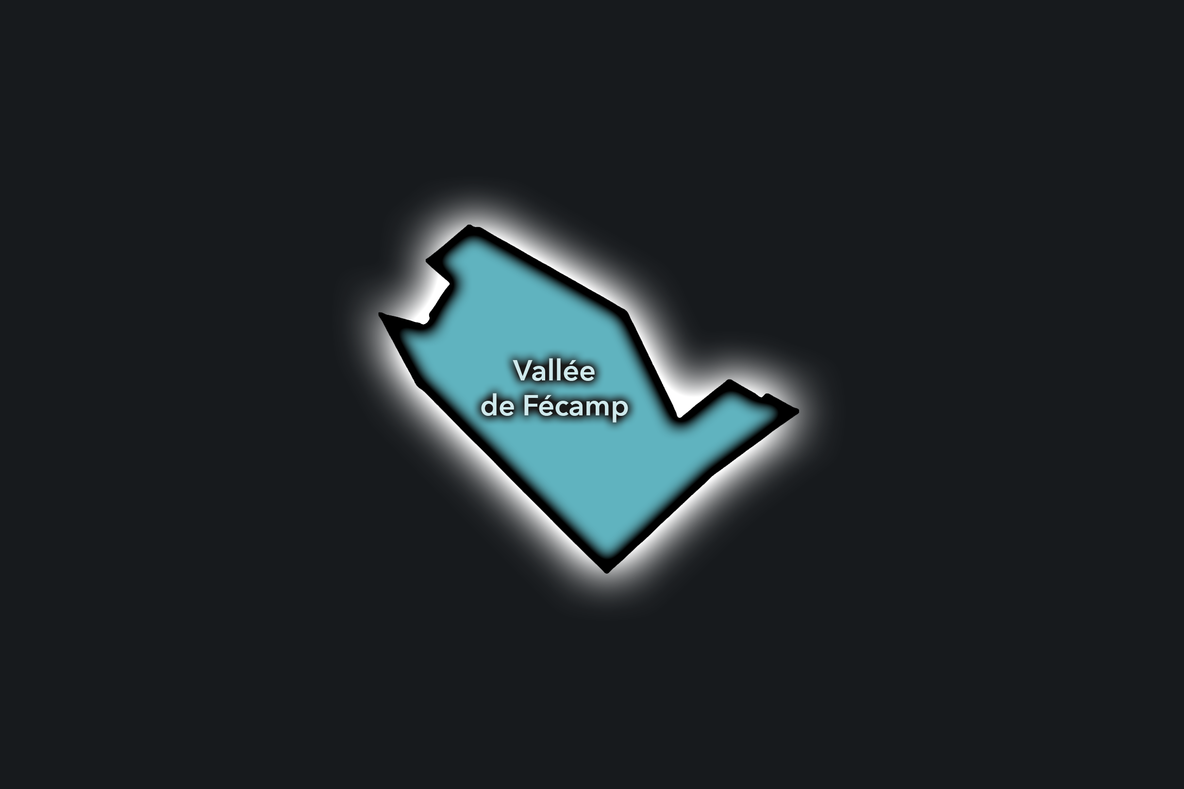
The Vallée de Fécamp Conseil de Quartier gives civic form to a southeastern interior of the 12e, where residential streets, schools, local shops, tramway and Metro access, public gardens, and the approaches toward Porte Dorée, Porte de Charenton, and the Bois de Vincennes create a quieter but important neighborhood landscape. As a civic territory, it is shaped less by major monuments than by everyday connectivity: routes to parks, schools, transit stops, apartment blocks, and the eastern edge of Paris.
On the ground, Vallée de Fécamp feels residential, practical, and gently outward-facing. It connects the interior of the 12e to the city’s southeastern thresholds, with local streets leading toward the Bois de Vincennes, the tramway, and the broader Porte Dorée / Charenton landscape. Its civic themes center on school and family movement, pedestrian comfort, greening, traffic around edge corridors, transit access, local commerce, and the quality of everyday public space in a part of the arrondissement defined by residential use and proximity to larger green and metropolitan routes.
Vallée de Fécamp: At a Glance
A curated list for you.
-
Major Streets
Rue de Fécamp
Avenue Daumesnil
Boulevard Poniatowski
Rue de Charenton
Avenue du Général Michel Bizot nearby
-
Public Spaces & Landmarks
Square Charles-Péguy nearby
Bois de Vincennes nearby
Porte de Charenton
Porte Dorée nearby
Pelouse de Reuilly nearby
-
Transit Access
Porte de Charenton
Michel Bizot nearby
Porte Dorée nearby
Tramway T3a access
Daumesnil nearby
-
Shopping & Dining
Avenue Daumesnil local shops
Rue de Charenton cafés and dining
Porte de Charenton neighborhood commerce
Michel Bizot local cafés nearby
Bois de Vincennes kiosks nearby
-
Hotels & Attractions
Bois de Vincennes access
Porte Dorée visitor district nearby
Pelouse de Reuilly / Foire du Trône area
Porte de Charenton gateway
Southeast 12e residential walking routes
Neighborhood Connections
Every Conseil de Quartier belongs to a wider Parisian fabric.
-
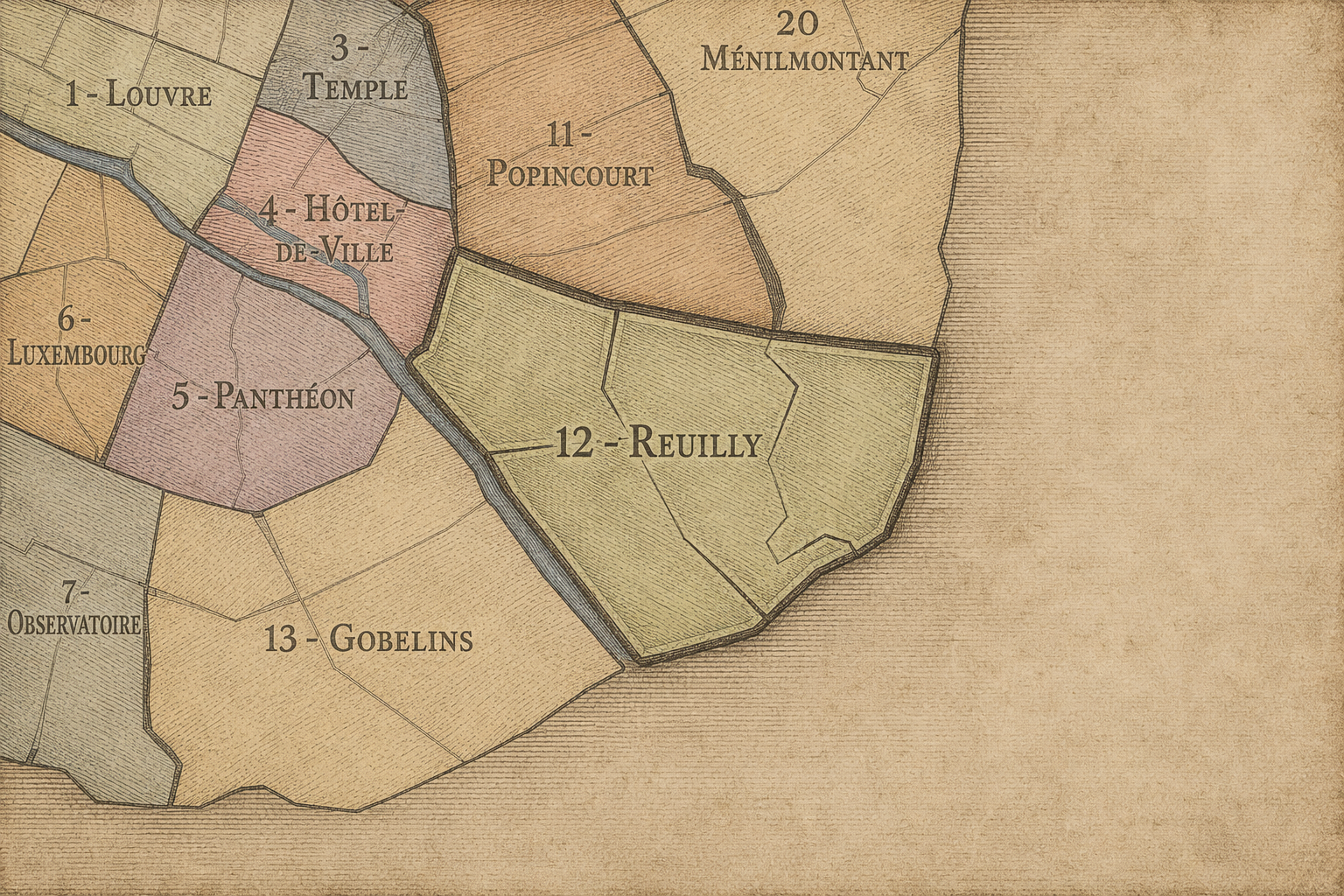
12e — Reuilly
-
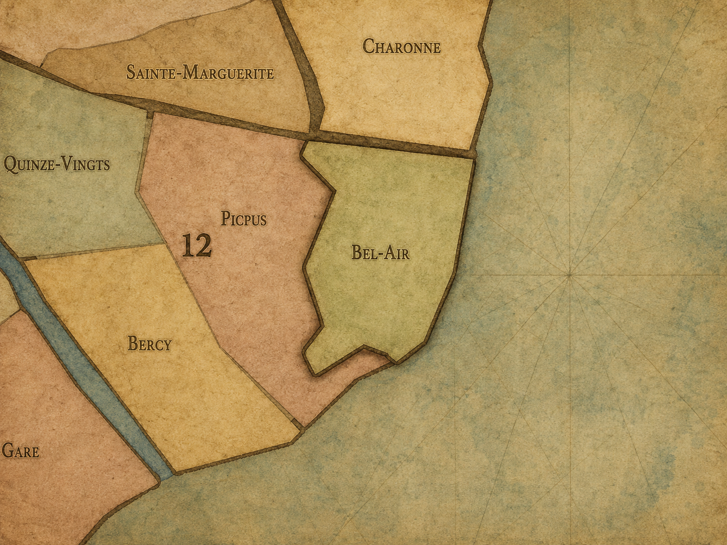
Bel-Air
-
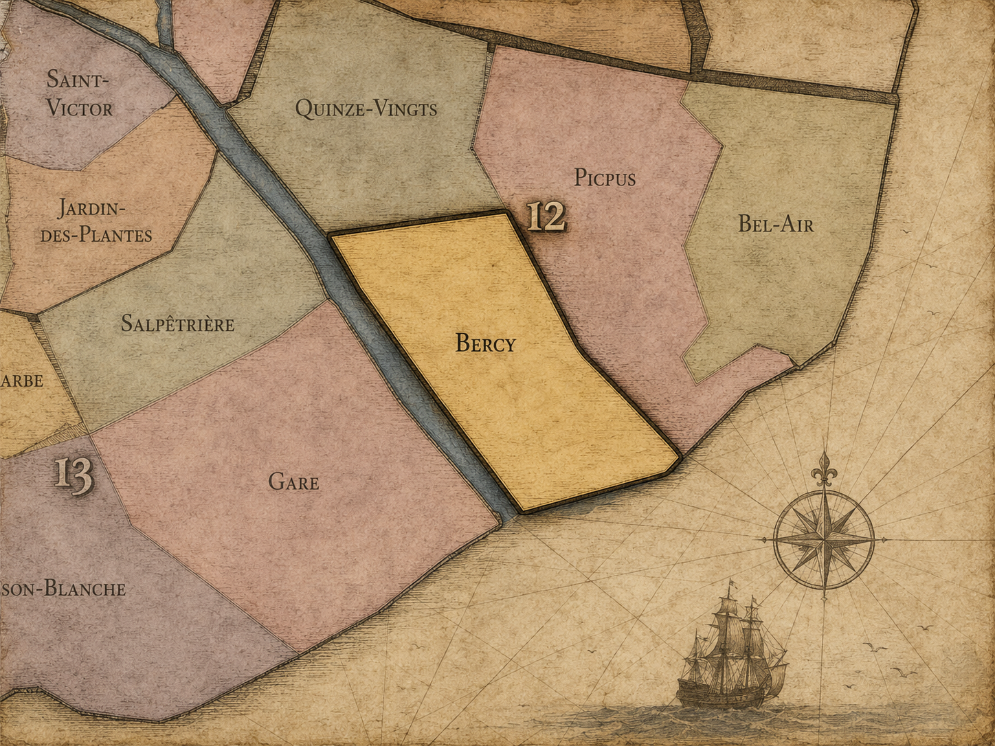
Bercy
-
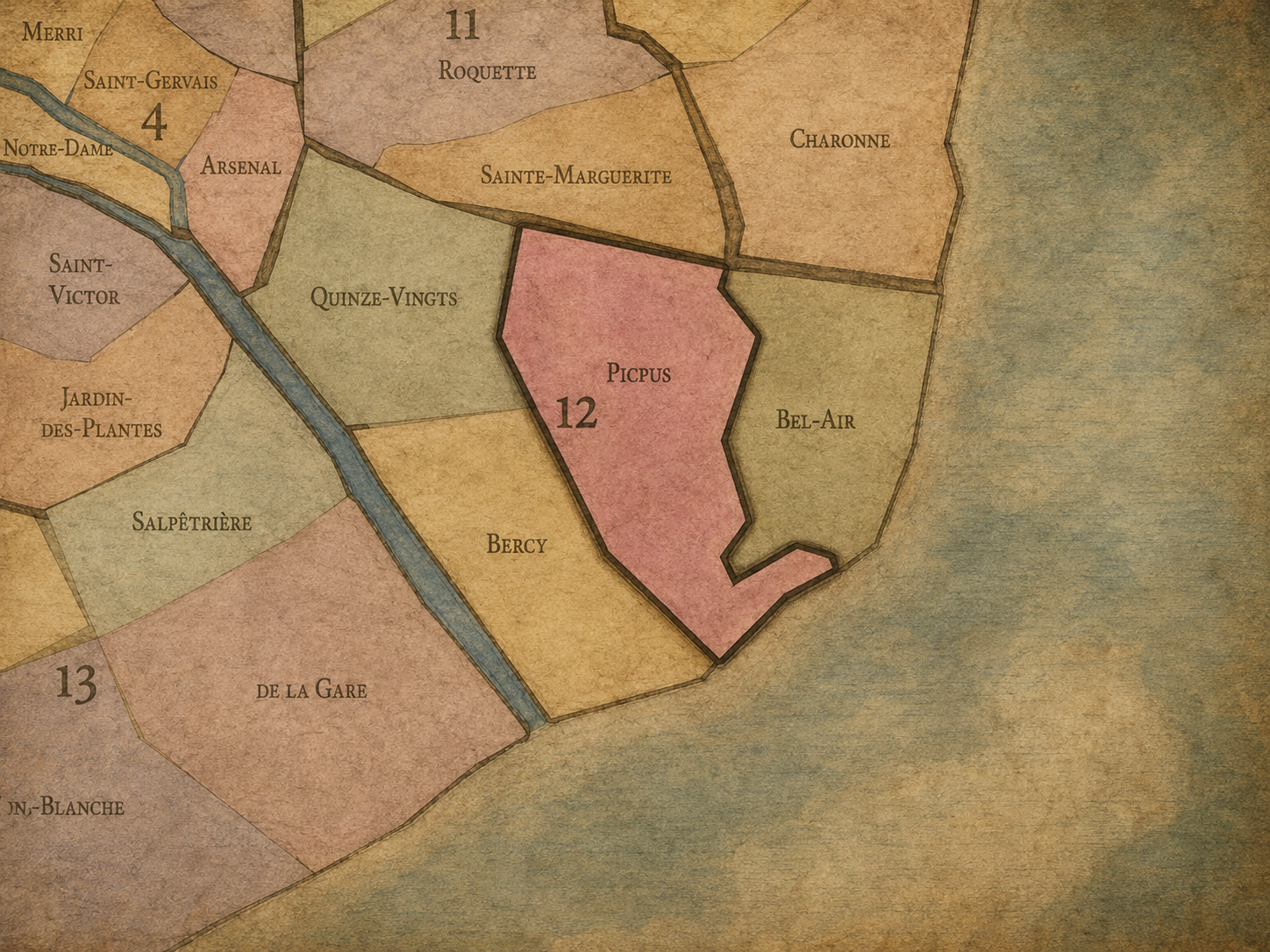
Picpus
-
Quinze-Vingts
The Photography
Visual Identity

The arrondissements do not share a single visual identity. Instead, they organize Paris into twenty broad visual fields, each gathering its own combination of landmarks, streetscapes, institutions, residential districts, commercial corridors, parks, rail stations, markets, cemeteries, and riverfront edges.
Some arrondissements are defined by monumental scale: royal palaces, ceremonial avenues, government buildings, museums, formal gardens, and internationally recognized landmarks. Others are shaped by hills, canals, rail gateways, apartment-lined boulevards, neighborhood markets, former village streets, industrial remnants, parks, or the quieter rhythms of residential Paris. The arrondissement system gives these varied landscapes a civic frame, allowing the city to be read not as one visual language, but as a sequence of overlapping Parisian atmospheres.
Through The Lens

Photographing the arrondissements means moving between the official map and the street-level experience. The camera does not treat each arrondissement as visually uniform. Instead, it looks for the recurring forms, textures, transitions, and contrasts that make each district legible: the geometry of boulevards, the shade of plane trees, the repetition of balconies, the rise of stairways, the curve of canals, the presence of rail stations, the opening of parks, the weight of monuments, and the intimacy of side streets.
On CityNeighborhoods, the arrondissement provides the frame, but the photograph comes from the encounter between map, movement, light, and observation. As the Paris photography is processed, this section will connect each arrondissement more directly to the project’s Photographic Lexicon: the visual strategies, recurring motifs, and compositional patterns that shape how the city is seen through the lens.
If you visit Paris, these ideas can help inspire your own photography.



Paris: J’Espere, Je Rêve, Je Vive
Paris Photo Gallery
Paris Field Notes
-
Field Note: August 18, 2025 | 07:58 AM
Conditions: 73°F | Humidity: 72%.
Within the park's interior, the glacial kettle ponds acted as humidity traps, creating a soft, hazy light that filtered through the old-growth oaks. The transition from the park's dense shade to the sun-drenched edges of Oakland Gardens highlighted the day's exceptional "picture-perfect" clarity.
There is a fleeting window in Queens where the humidity of August hasn't yet heavy-set, and the morning sun hits the canopy of Alley Pond Park at a perfect oblique angle. Arriving just before 8:00 AM, I watched the light break through the oaks and tulip trees, casting long, dramatic shadows across the wet grass. It’s in these quiet, golden moments that the park feels less like a city escape and more like the ancient glacial valley it actually is.
Other neighborhoods visited:











































































































Explore Paris
-

The twenty arrondissements form the civic spiral of Paris, organizing the city into its broad local districts of government, identity, and daily life.
-

Each arrondissement is divided into four official administrative quarters, giving Paris a more precise civic and geographic framework.
-

The conseils de quartier bring participation to street level, giving residents a voice in neighborhood needs, public space, and local civic life.
-

Les Deux Rives trace Paris through the Seine’s two banks, revealing how the Rive Droite and Rive Gauche shaped the city’s civic power, commerce, learning, art, and cultural identity.
-

Cultural neighborhoods reveal the Paris people recognize through history, cafés, architecture, memory, atmosphere, and local belonging.