
5e - PANTHÉON
Les Conseils de Quartier
Explore This Page


Explore the Conseils de Quartier of the 5e — Panthéon.


Overview
Download the Paris Conseil de Quartier Map
Geographic Setting
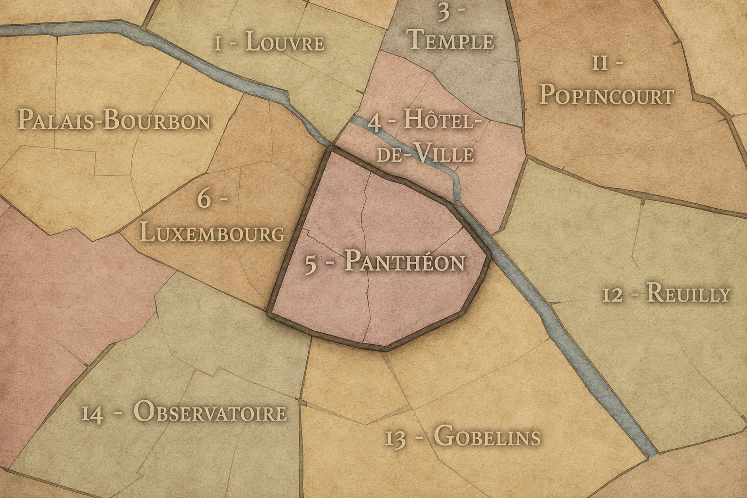
The Conseils de Quartier of the 5e organize local civic life across one of the oldest and most layered districts of Paris. Set on the Left Bank, the 5e stretches from the Seine and the eastern edge of the Latin Quarter toward the slopes of the Montagne Sainte-Geneviève, the institutional landscape of the Panthéon, the gardens and scientific campus of the Jardin des Plantes, and the quieter residential and academic streets around Val-de-Grâce. Its geography is compact but unusually dense, bringing together Roman traces, medieval streets, university life, religious foundations, schools, hospitals, gardens, markets, and neighborhood corridors within a small civic frame.
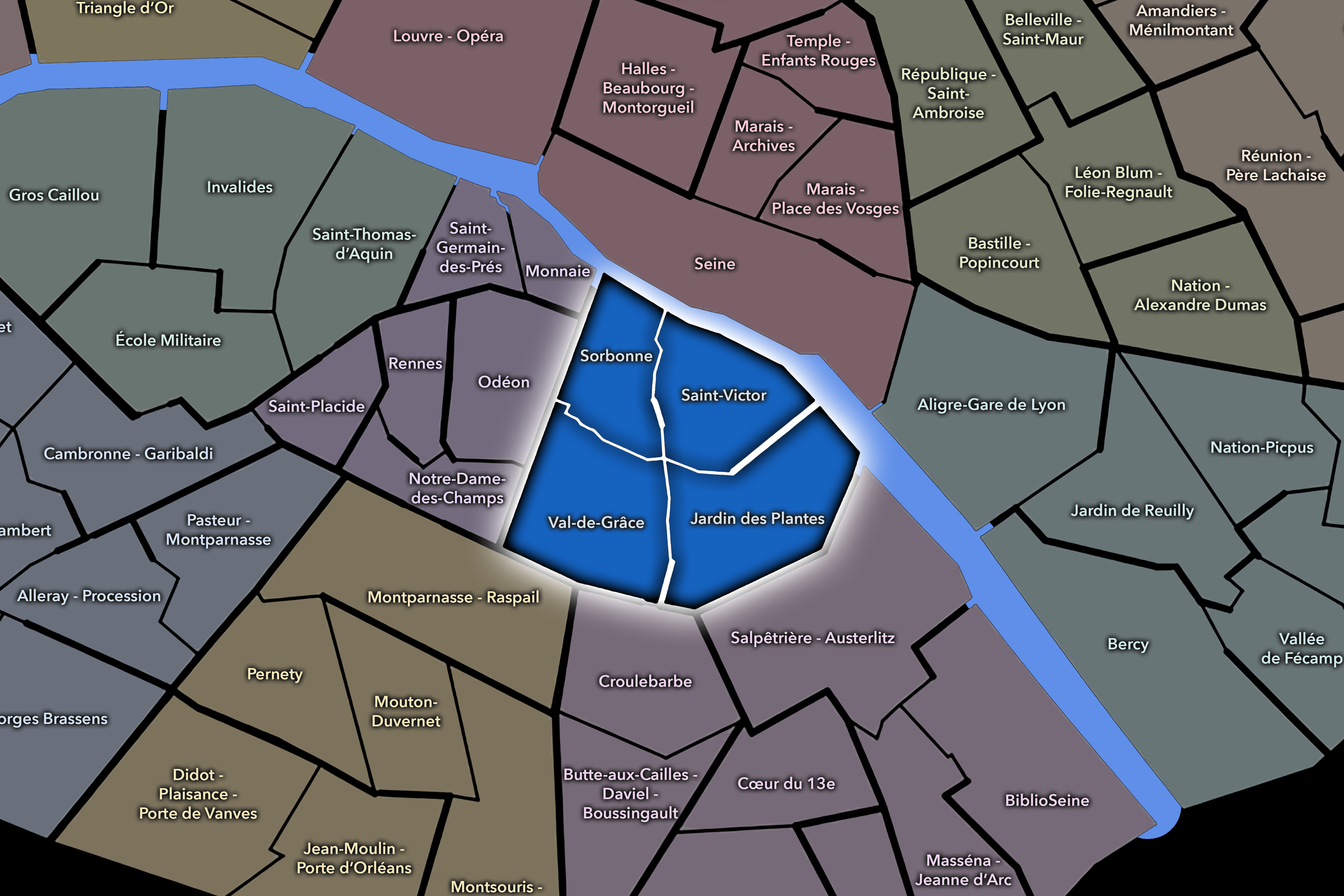
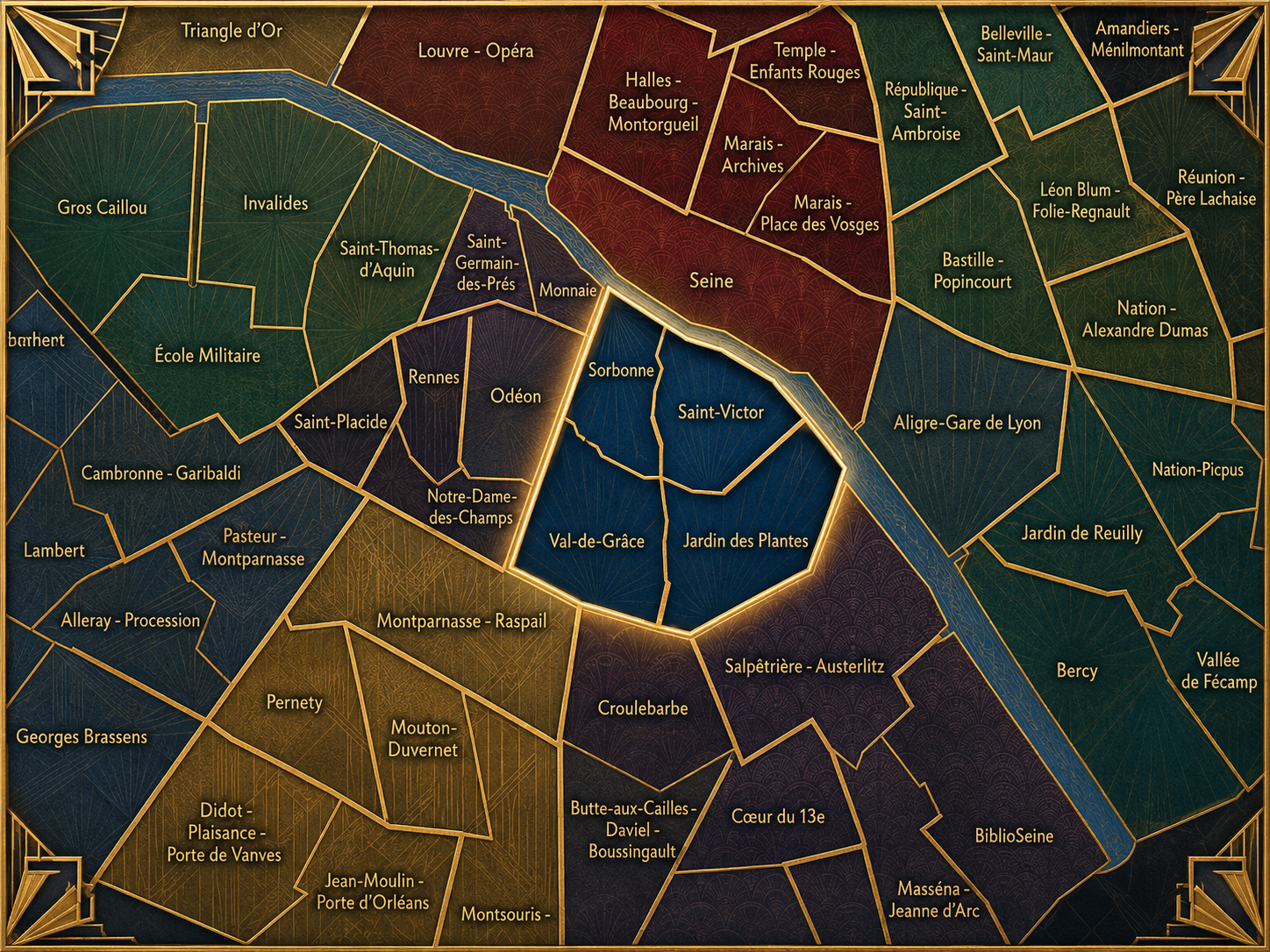
Unlike larger or more internally fragmented arrondissements, the 5e’s Conseil de Quartier structure is especially clear. The arrondissement’s four local councils correspond to its four official Administrative Quarters: Sorbonne, Saint-Victor, Val-de-Grâce, and Jardin des Plantes. This gives the 5e a rare alignment between the older administrative neighborhood grid and the contemporary participatory layer, allowing the CdQs to reinforce rather than redraw the arrondissement’s official local geography.
Together, these four CdQs divide the 5e into distinct but closely connected civic environments. Sorbonne gathers much of the historic academic core; Saint-Victor links the Seine-facing and eastern Latin Quarter landscape; Val-de-Grâce frames a more residential and institutional southern section; and Jardin des Plantes centers the arrondissement’s botanical, scientific, and riverside identity. The result is a CdQ map that is easy to read, but still rich in local contrast.
Civic Framework
The 5e’s Conseils de Quartier provide the arrondissement’s neighborhood-level framework for local participation. They give residents, students, workers, institutions, associations, and neighborhood users a more precise civic scale than the arrondissement as a whole, especially in a district where academic life, tourism, residential routines, public gardens, schools, hospitals, religious landmarks, and commercial streets often overlap within the same small areas.
Because the 5e’s CdQs correspond to the arrondissement’s four Administrative Quarters, their structure is less about creating a new micro-geography than translating the historic administrative grid into a contemporary civic tool. This makes the 5e different from arrondissements where the CdQ layer subdivides the official quarters into many smaller local councils. Here, the civic framework reinforces the four-part neighborhood logic already embedded in the arrondissement: Sorbonne, Saint-Victor, Val-de-Grâce, and Jardin des Plantes each become both an official quarter and a forum for local expression.
This alignment gives the 5e’s CdQ system a certain clarity. The councils can focus on the lived concerns of their established local areas: pedestrian flow in the Latin Quarter, student and visitor activity around major institutions, public-space management near historic streets and monuments, residential quality of life, school and university corridors, garden access, and the everyday balance between a globally recognized district and the people who use it daily.
Local Expression
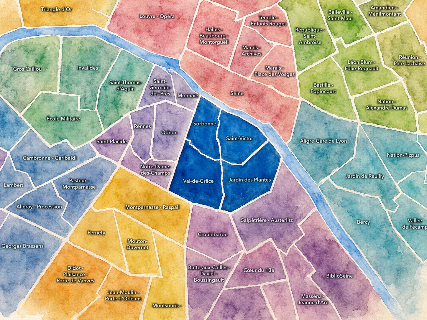
Viewed through its Conseils de Quartier, the 5e becomes less a single “Latin Quarter” identity and more a set of four local civic landscapes. Sorbonne expresses the arrondissement’s intellectual and academic heart, where universities, bookshops, churches, schools, and historic streets gather around one of Paris’s most enduring scholarly districts. Saint-Victor brings the 5e toward the Seine, the eastern Latin Quarter, and the transition between historic streets, cultural institutions, and riverfront movement.
Val-de-Grâce gives the arrondissement a quieter and more residential expression, shaped by hospitals, schools, religious architecture, and the southern slopes beyond the most heavily visited parts of the Latin Quarter. Jardin des Plantes, by contrast, opens the 5e toward science, nature, museums, the river, and the eastern edge of the Left Bank. Together, these four councils reveal how the 5e holds multiple versions of Paris at once: student Paris, scholarly Paris, garden Paris, institutional Paris, residential Paris, and the older city of narrow streets and long memory.
The value of the CdQ layer in the 5e is therefore not that it invents a new way to divide the arrondissement, but that it gives civic form to neighborhood distinctions that are already deeply present. Through its four councils, the 5e can be read at a scale closer to daily life: the square, the school street, the university corridor, the market block, the garden entrance, the hospital edge, the river crossing, and the local concerns that shape how one of Paris’s oldest districts continues to function as a lived neighborhood.
Les Conseils de Quartier
Jardin des Plantes
Civic Profile
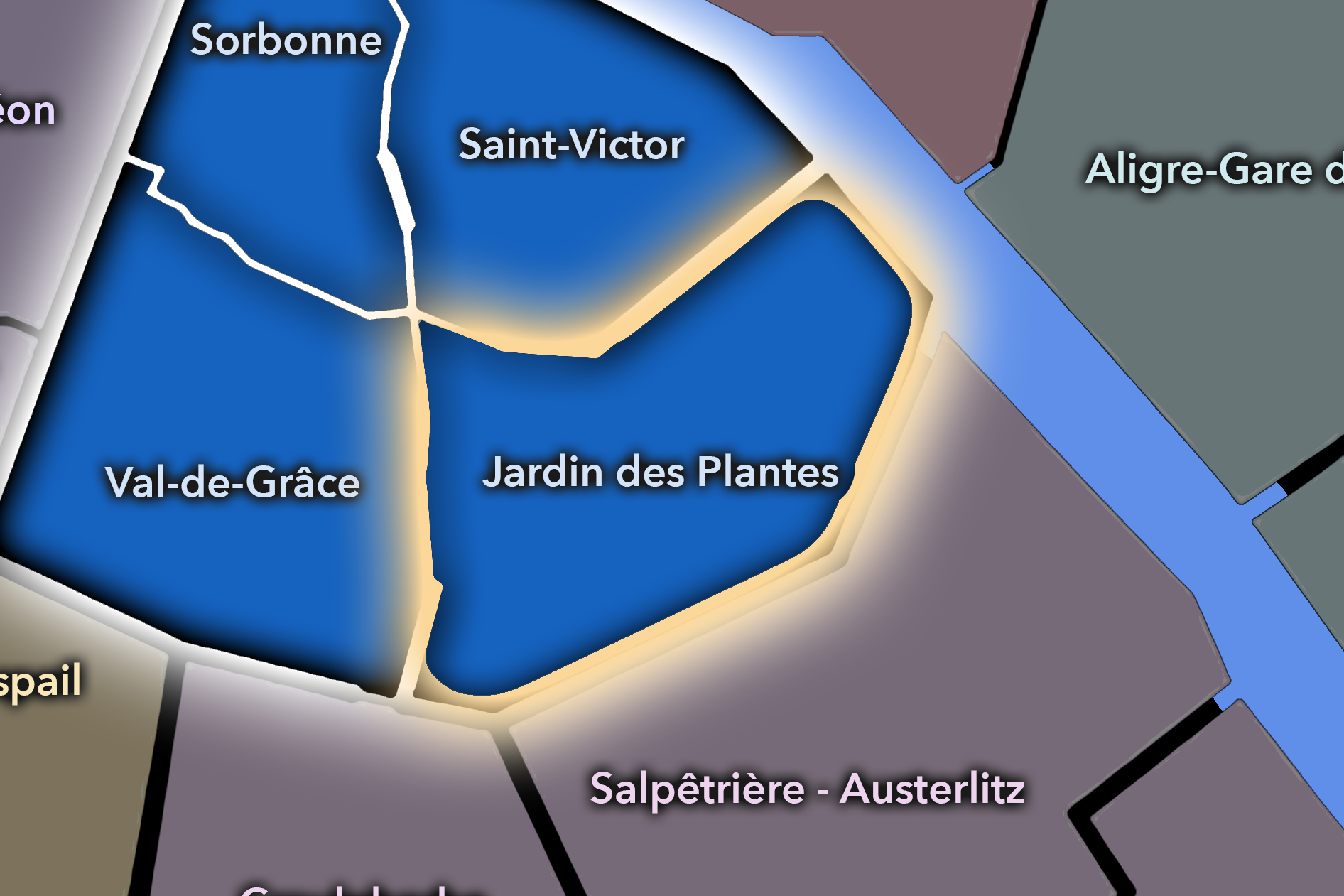
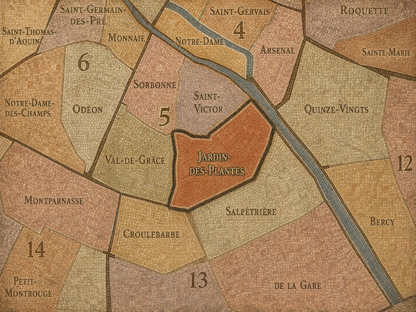
The Jardin des Plantes Conseil de Quartier anchors the southeastern 5e around one of Paris’s great scientific, botanical, and museum landscapes. Its civic geography is shaped by the Jardin des Plantes, the Muséum national d’Histoire naturelle, the Grande Mosquée de Paris, the Seine-facing edges near Austerlitz, residential streets, schools, hospitals, and the transition toward the 13e. The garden itself is the historic heart of the Museum and contains major listed buildings such as the Grande Galerie de l’Évolution and the Grandes Serres.
On the ground, Jardin des Plantes feels open, educational, and unusually green for central Paris. It is a district of museum visits, garden paths, school groups, hospital and station movement, mosque courtyards, residential side streets, and river access. Its civic themes center on garden stewardship, cultural and scientific access, public-space maintenance, pedestrian circulation around Austerlitz and Jussieu, biodiversity, school and family use, and the balance between a major visitor destination and a lived southeastern corner of the 5e.
Jardin des Plantes: At a Glance
A curated list for you.
-

Major Streets
Rue Cuvier
Rue Geoffroy-Saint-Hilaire
Rue Buffon
Boulevard de l’Hôpital
Quai Saint-Bernard
-

Public Spaces & Landmarks
Jardin des Plantes
Grande Galerie de l’Évolution
Ménagerie du Jardin des Plantes
Grande Mosquée de Paris
Muséum national d’Histoire naturelle
-

Transit Access
Gare d’Austerlitz
Jussieu
Place Monge
Censier - Daubenton
Saint-Marcel
-

Shopping & Dining
Grande Mosquée de Paris tearoom
La Baleine
Rue Geoffroy-Saint-Hilaire cafés
Rue Monge food shops
Jardin des Plantes seasonal kiosks
-

Hotels & Attractions
Jardin des Plantes museum circuit
Grande Galerie de l’Évolution
Ménagerie and Grandes Serres
Grande Mosquée de Paris
Austerlitz / Seine arrival route
Saint-Victor
Civic Profile
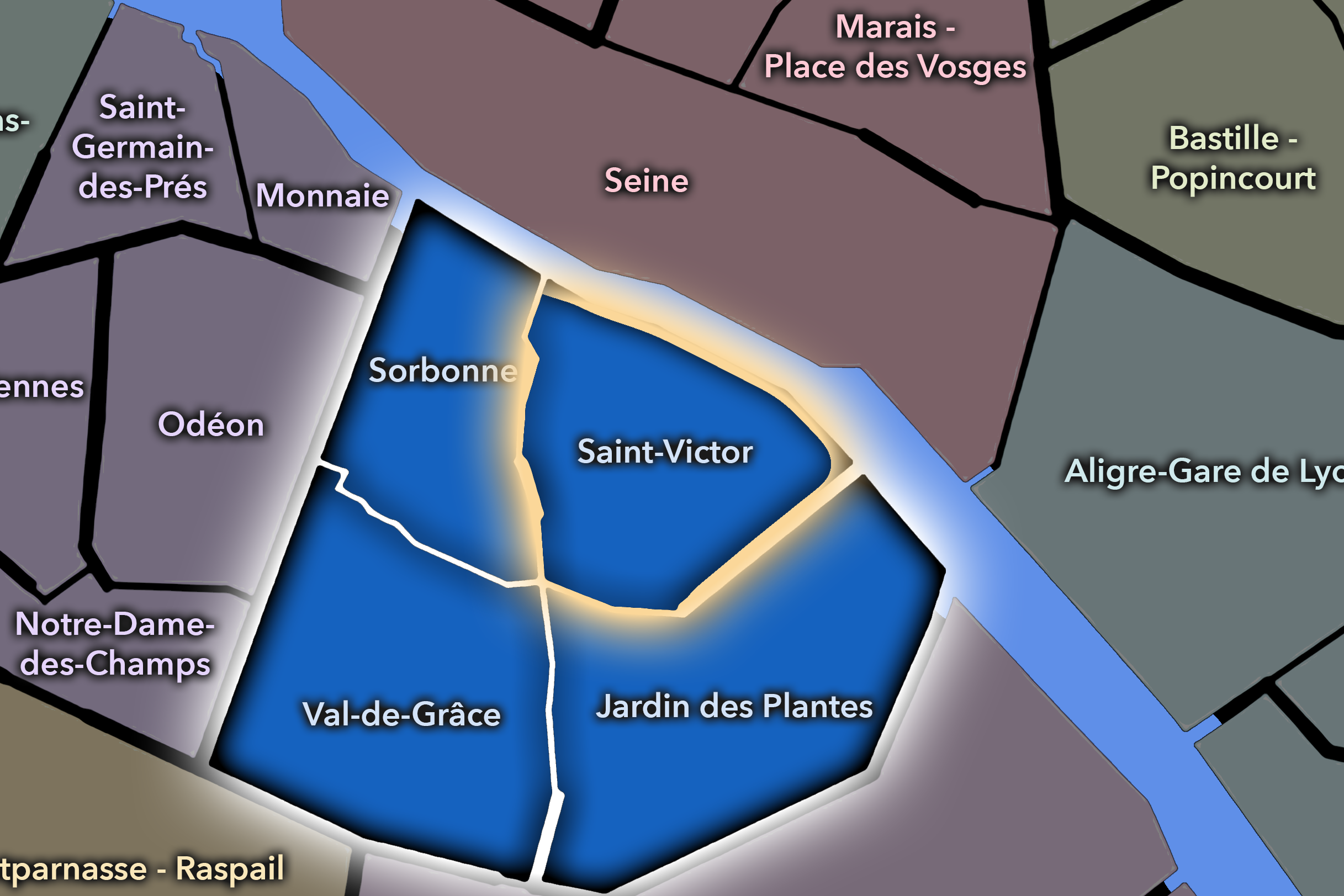
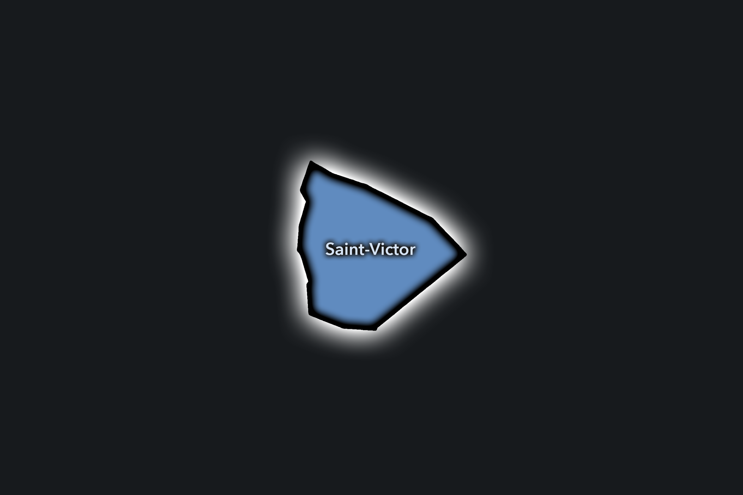
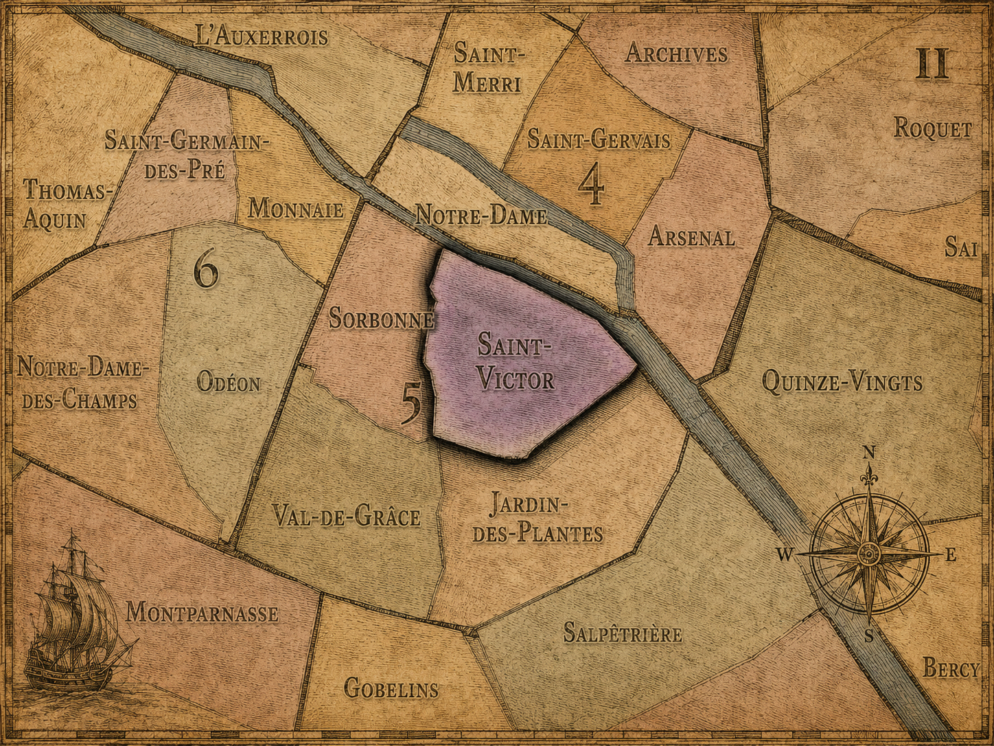
The Saint-Victor Conseil de Quartier occupies the northern and eastern Latin Quarter, where the 5e turns toward the Seine, the Jussieu campus, the Institut du Monde Arabe, historic school streets, and the older river-facing edge of the Left Bank. Its civic geography is shaped by the meeting of academic life, cultural institutions, riverfront movement, residential streets, and the long memory of medieval and early-modern Paris near the former Abbey of Saint-Victor.
On the ground, Saint-Victor feels like a hinge between the scholarly Latin Quarter and the river. It contains large institutional anchors, but also smaller residential streets, cafés, student routes, hidden historic fragments, and major pedestrian connections toward the Seine and the islands. Its civic themes include public-space management around universities and cultural institutions, pedestrian circulation along the river and school corridors, heritage preservation, and the everyday use of streets that serve students, residents, visitors, and cultural workers at once.
Saint-Victor: At a Glance
A curated list for you.
-
Major Streets
Rue des Écoles
Rue Jussieu
Rue Monge
Quai Saint-Bernard
Rue des Fossés Saint-Bernard
-
Public Spaces & Landmarks
Institut du Monde Arabe
Arènes de Lutèce
Collège des Bernardins
Sorbonne Université / Jussieu campus
Square Paul-Langevin
-
Transit Access
Jussieu
Cardinal Lemoine
Maubert - Mutualité
Sully - Morland nearby
Saint-Michel - Notre-Dame nearby
-
Shopping & Dining
Rue Monge cafés and food shops
Rue des Écoles student dining
Institut du Monde Arabe café / terrace
La Tour d’Argent
Le Petit Pontoise
-
Hotels & Attractions
Institut du Monde Arabe visitor route
Arènes de Lutèce historic site
Jussieu university district
Seine riverfront walks
Île Saint-Louis nearby
Sorbonne
Civic Profile
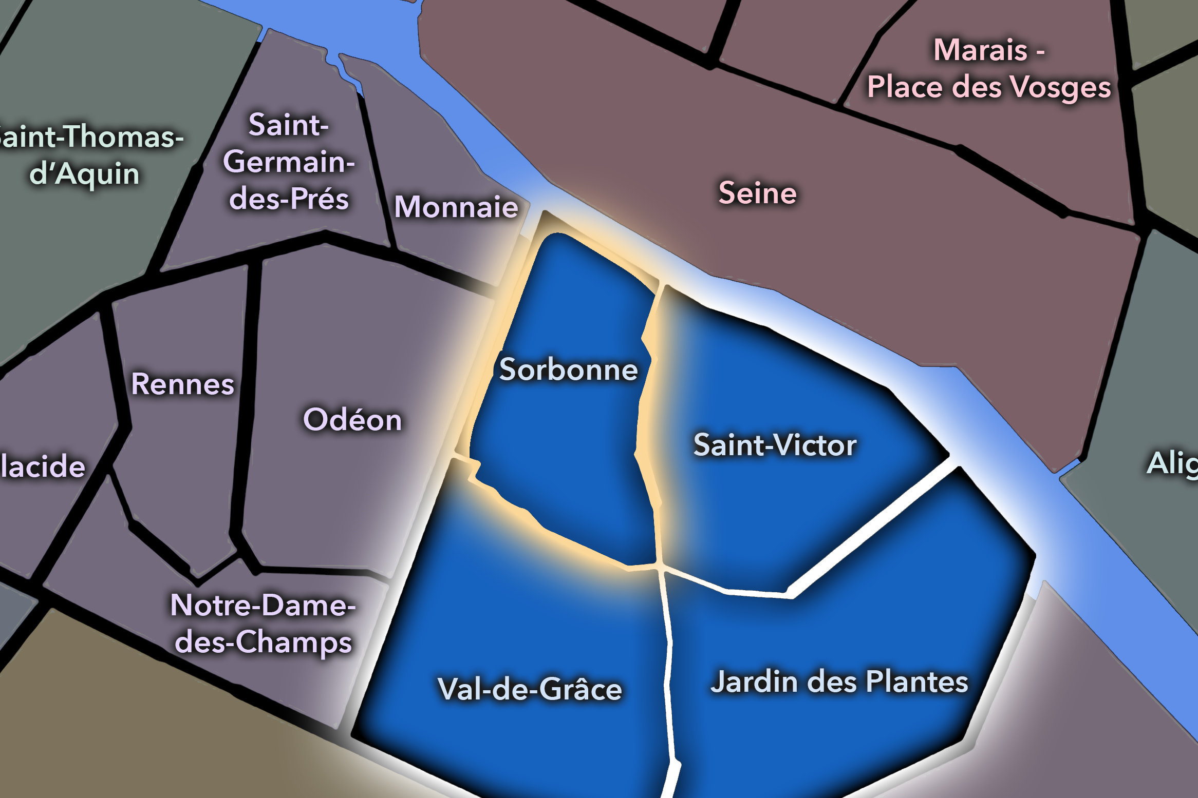
The Sorbonne Conseil de Quartier gives civic form to the intellectual and historic heart of the 5e, where the Latin Quarter’s academic institutions, religious landmarks, book streets, schools, cafés, and visitor routes gather around the Montagne Sainte-Geneviève. As a civic territory, it is shaped by the overlap of university life, student movement, heritage preservation, tourism, residential routines, and some of the most recognizable institutional landscapes on the Left Bank.
On the ground, Sorbonne feels dense, scholarly, and constantly in motion. Its narrow streets, lecture halls, libraries, churches, bookshops, and cafés create a district where Paris’s academic memory remains part of everyday urban life. Its civic themes center on pedestrian comfort, student and visitor circulation, preservation of historic streets, public-space use around major institutions, and the challenge of keeping a globally recognized academic district connected to local neighborhood life.
Sorbonne: At a Glance
A curated list for you.
-
Major Streets
Boulevard Saint-Michel
Rue Saint-Jacques
Rue Soufflot
Rue des Écoles
Rue de la Sorbonne
-
Public Spaces & Landmarks
La Sorbonne
Panthéon
Collège de France
Bibliothèque Sainte-Geneviève
Église Saint-Étienne-du-Mont
-
Transit Access
Cluny - La Sorbonne
Maubert - Mutualité
Luxembourg
Cardinal Lemoine
Saint-Michel - Notre-Dame nearby
-
Shopping & Dining
Place de la Sorbonne cafés
Boulevard Saint-Michel bookshops and cafés
Rue des Écoles student dining
Le Coupe-Chou
La Crêperie de Cluny
-
Hotels & Attractions
Panthéon visitor circuit
Sorbonne / Latin Quarter academic route
Saint-Étienne-du-Mont and Montagne Sainte-Geneviève
Musée de Cluny nearby
Luxembourg Garden nearby
Val-de-Grâce
Civic Profile
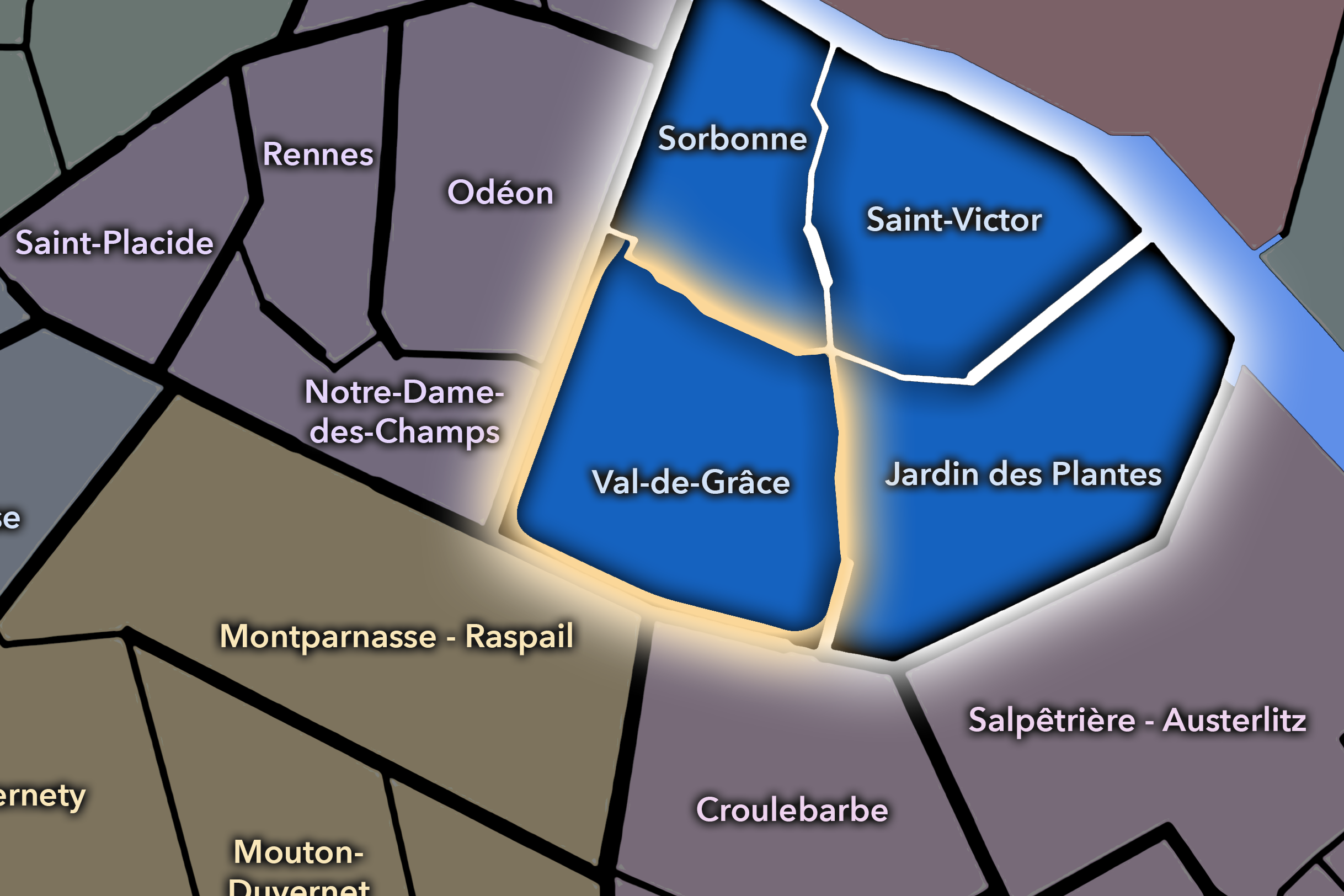
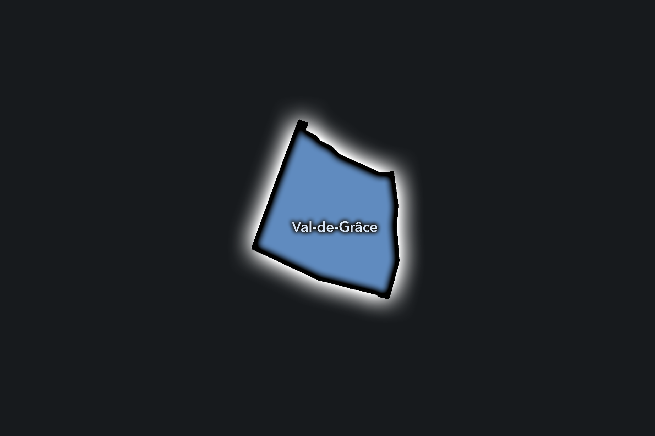
The Val-de-Grâce Conseil de Quartier gives civic shape to the southern and southwestern 5e, where the Latin Quarter becomes more residential, institutional, and neighborhood-scaled. Centered around the Val-de-Grâce, Port-Royal, Rue Mouffetard, and the slopes below the Panthéon, this CdQ brings together hospitals, schools, religious architecture, market streets, student life, apartment blocks, and some of the 5e’s strongest everyday neighborhood corridors.
On the ground, Val-de-Grâce feels less monumental than Sorbonne and less river-facing than Saint-Victor, but deeply local. Rue Mouffetard, Place de la Contrescarpe, school streets, hospital edges, small cafés, and residential blocks give it a lived-in rhythm that balances Latin Quarter history with daily Parisian routines. Its civic themes center on residential quality of life, market vitality, pedestrian comfort, school and hospital access, traffic on major corridors, and the preservation of local street life within a heavily visited Left Bank arrondissement.
Val-de-Grâce: At a Glance
A curated list for you.
-
Major Streets
Rue Mouffetard
Rue Saint-Jacques
Boulevard Port-Royal
Rue Gay-Lussac
Rue Claude-Bernard
-
Public Spaces & Landmarks
Val-de-Grâce
Place de la Contrescarpe
Église Saint-Médard
Square Marius-Constant
Panthéon nearby
-
Transit Access
Censier - Daubenton
Place Monge
Luxembourg
Port-Royal
Cardinal Lemoine nearby
-
Shopping & Dining
Rue Mouffetard market street
Place de la Contrescarpe cafés
Rue Monge food shops
La Maison d’Isabelle
Le Verre à Pied
-
Hotels & Attractions
Rue Mouffetard visitor route
Val-de-Grâce church and institutional landscape
Contrescarpe / Mouffetard walking
Panthéon and Luxembourg nearby
Latin Quarter hotel district
Neighborhood Connections
Every Conseil de Quartier belongs to a wider Parisian fabric.
-
5e — Panthéon
-
Jardin-des-Plantes
-
Saint-Victor
-
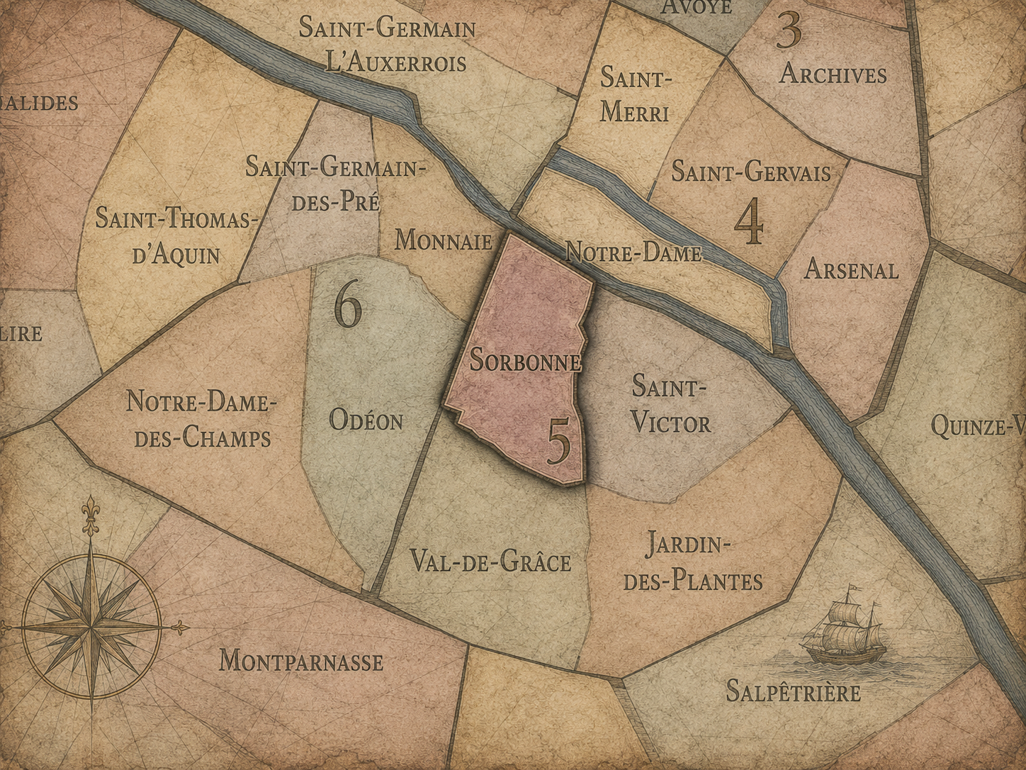
Sorbonne
-
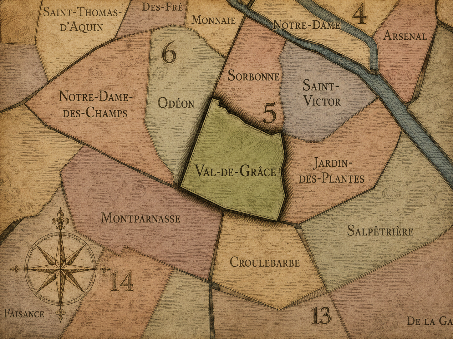
Val-de-Grâce
The Photography
Visual Identity

The arrondissements do not share a single visual identity. Instead, they organize Paris into twenty broad visual fields, each gathering its own combination of landmarks, streetscapes, institutions, residential districts, commercial corridors, parks, rail stations, markets, cemeteries, and riverfront edges.
Some arrondissements are defined by monumental scale: royal palaces, ceremonial avenues, government buildings, museums, formal gardens, and internationally recognized landmarks. Others are shaped by hills, canals, rail gateways, apartment-lined boulevards, neighborhood markets, former village streets, industrial remnants, parks, or the quieter rhythms of residential Paris. The arrondissement system gives these varied landscapes a civic frame, allowing the city to be read not as one visual language, but as a sequence of overlapping Parisian atmospheres.
Through The Lens

Photographing the arrondissements means moving between the official map and the street-level experience. The camera does not treat each arrondissement as visually uniform. Instead, it looks for the recurring forms, textures, transitions, and contrasts that make each district legible: the geometry of boulevards, the shade of plane trees, the repetition of balconies, the rise of stairways, the curve of canals, the presence of rail stations, the opening of parks, the weight of monuments, and the intimacy of side streets.
On CityNeighborhoods, the arrondissement provides the frame, but the photograph comes from the encounter between map, movement, light, and observation. As the Paris photography is processed, this section will connect each arrondissement more directly to the project’s Photographic Lexicon: the visual strategies, recurring motifs, and compositional patterns that shape how the city is seen through the lens.
If you visit Paris, these ideas can help inspire your own photography.



Paris: J’Espere, Je Rêve, Je Vive
Paris Photo Gallery
Paris Field Notes
-
Field Note: August 18, 2025 | 07:58 AM
Conditions: 73°F | Humidity: 72%.
Within the park's interior, the glacial kettle ponds acted as humidity traps, creating a soft, hazy light that filtered through the old-growth oaks. The transition from the park's dense shade to the sun-drenched edges of Oakland Gardens highlighted the day's exceptional "picture-perfect" clarity.
There is a fleeting window in Queens where the humidity of August hasn't yet heavy-set, and the morning sun hits the canopy of Alley Pond Park at a perfect oblique angle. Arriving just before 8:00 AM, I watched the light break through the oaks and tulip trees, casting long, dramatic shadows across the wet grass. It’s in these quiet, golden moments that the park feels less like a city escape and more like the ancient glacial valley it actually is.
Other neighborhoods visited:











































































































Explore Paris
-

The twenty arrondissements form the civic spiral of Paris, organizing the city into its broad local districts of government, identity, and daily life.
-

Each arrondissement is divided into four official administrative quarters, giving Paris a more precise civic and geographic framework.
-

The conseils de quartier bring participation to street level, giving residents a voice in neighborhood needs, public space, and local civic life.
-

Les Deux Rives trace Paris through the Seine’s two banks, revealing how the Rive Droite and Rive Gauche shaped the city’s civic power, commerce, learning, art, and cultural identity.
-

Cultural neighborhoods reveal the Paris people recognize through history, cafés, architecture, memory, atmosphere, and local belonging.