
7e - PALAIS-BOURBON
Les Conseils de Quartier
Explore This Page


Explore the Conseils de Quartier of the 7e — Palais-Bourbon.


Overview
Download the Paris Conseil de Quartier Map
Geographic Setting
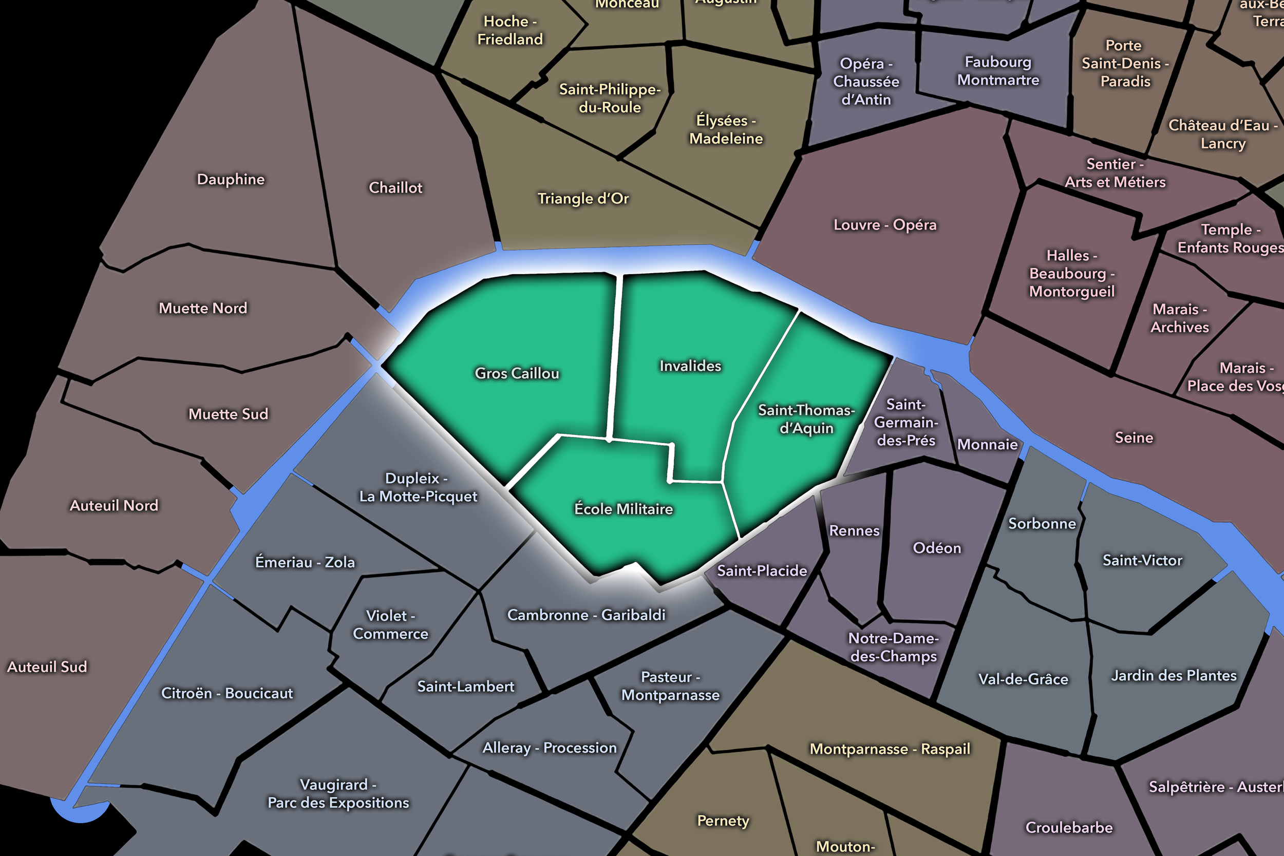
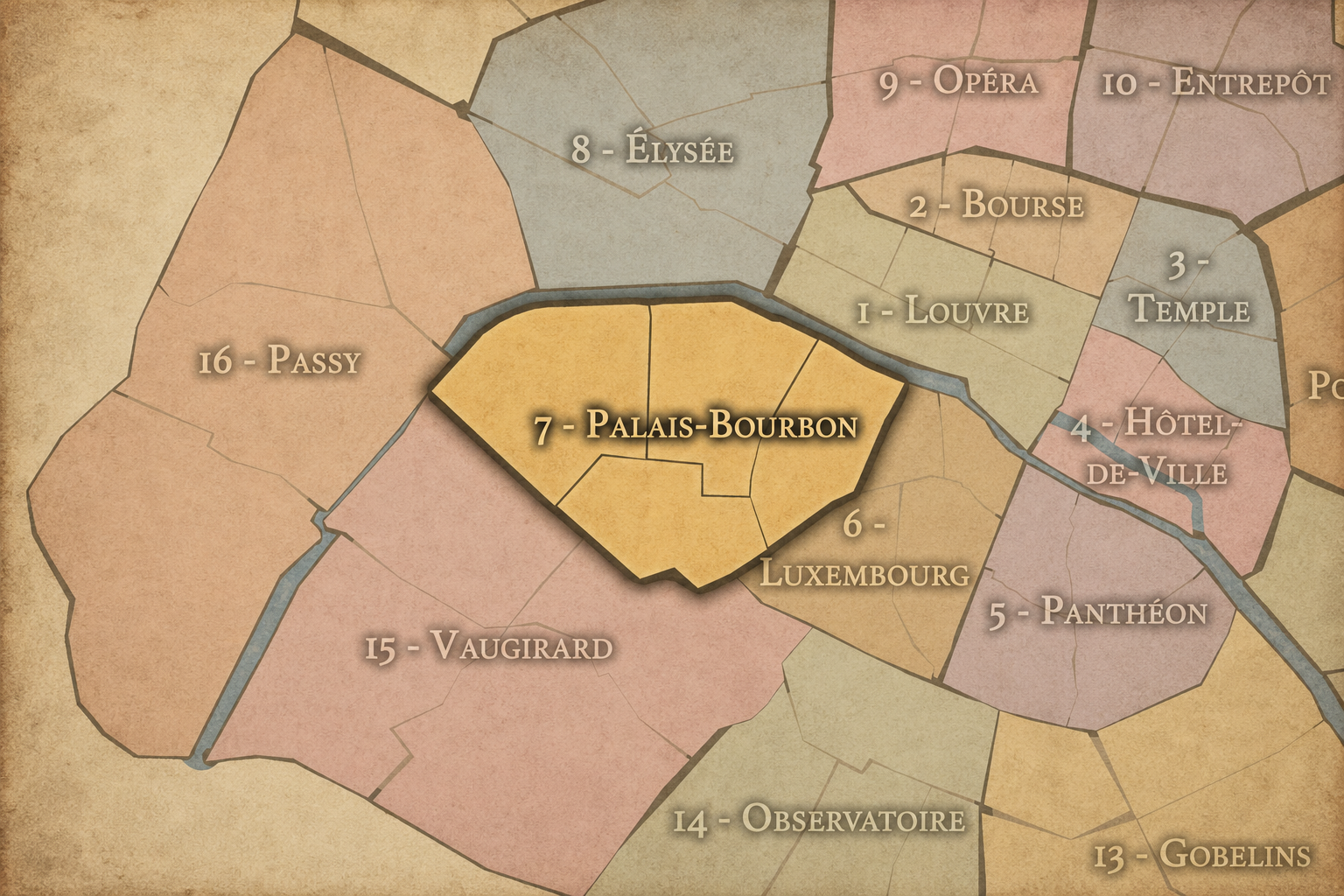
The Conseils de Quartier of the 7e organize local civic life across one of Paris’s most ceremonial and institutionally dense Left Bank districts. Stretching from the Seine to the southern avenues around École Militaire and Ségur, the 7e gathers together national monuments, ministries, embassies, museums, aristocratic streets, residential enclaves, religious institutions, schools, gardens, and some of the most visited public spaces in France. Its geography is broad and stately, but also highly varied: riverfront promenades, monumental lawns, quiet side streets, ministry corridors, museum districts, neighborhood shopping streets, and the village-like texture of Gros Caillou all sit within the same arrondissement.
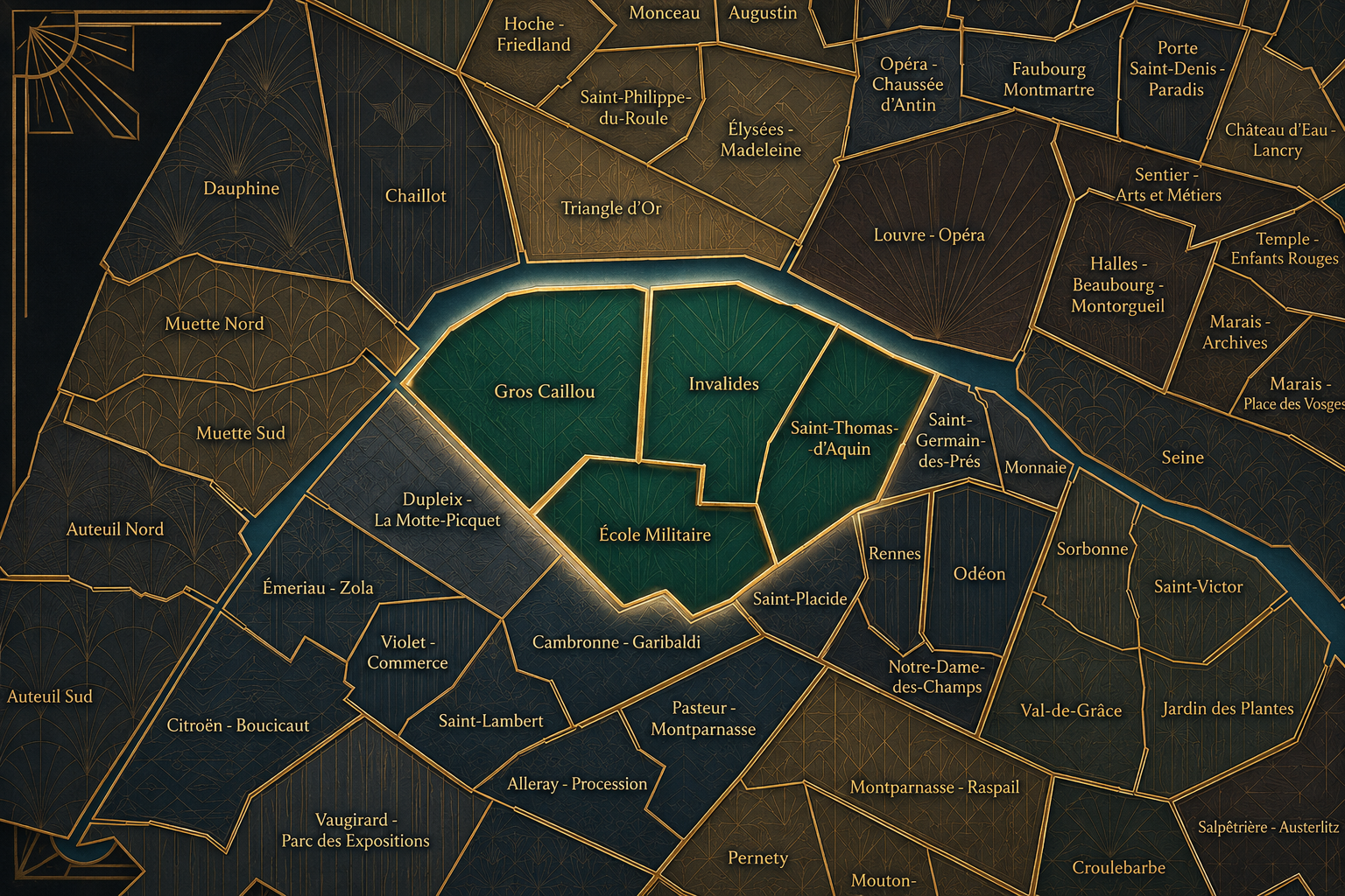
The 7e’s Conseil de Quartier structure divides this landscape into four local civic territories: Gros Caillou, Invalides, Saint Thomas d’Aquin, and École Militaire. These four councils correspond closely to the arrondissement’s four official Administrative Quarters, giving the 7e a clear relationship between its historic administrative geography and its contemporary participatory framework. Rather than multiplying the arrondissement into many smaller micro-districts, the CdQ structure reinforces the four-part logic already embedded in the 7e’s official neighborhood map.
Together, these four CdQs reveal the arrondissement’s internal contrasts. Gros Caillou gathers much of the Eiffel Tower / Champ de Mars landscape together with the residential streets and commercial life nearby. Invalides gives civic form to the monumental and institutional heart of the arrondissement, shaped by Les Invalides, ministries, museums, and broad public spaces. Saint Thomas d’Aquin frames the more aristocratic, religious, cultural, and residential western Saint-Germain edge, while École Militaire connects the southern side of the arrondissement to military history, neighborhood avenues, schools, transit corridors, and the quieter streets below the Champ de Mars.
Civic Framework
The 7e’s Conseils de Quartier provide a neighborhood-level civic structure for an arrondissement whose public identity often exceeds its local scale. The district is known internationally through the Eiffel Tower, Les Invalides, the Musée d’Orsay, the Assemblée nationale, the Champ de Mars, the Musée Rodin, and the riverfront, but its civic life also depends on residents, schools, local businesses, religious institutions, public gardens, markets, museums, ministries, and everyday street use. The CdQs help translate this monumental arrondissement into smaller civic territories where local concerns can be more precisely understood.
Because the 7e’s four CdQs closely mirror its four Administrative Quarters, the arrondissement’s participatory geography is especially legible. Gros Caillou, Invalides, Saint Thomas d’Aquin, and École Militaire each carry a distinct urban function, but together they form a stable civic framework rather than a heavily subdivided micro-geography. This makes the 7e closer to the 5e than to arrondissements such as the 6e or 19e, where the CdQ layer adds more granular divisions beyond the older administrative grid.
As a civic framework, the 7e’s CdQs help manage the tensions of a district where national symbolism, global tourism, diplomatic life, museum visitation, and residential routines intersect. Local civic concerns may gather around pedestrian circulation near major monuments, security and access around institutions, the upkeep of parks and squares, the balance between visitor flows and neighborhood livability, commercial activity near Rue Cler and other local corridors, and the preservation of a district whose built environment is both highly protected and continually used.
Local Expression
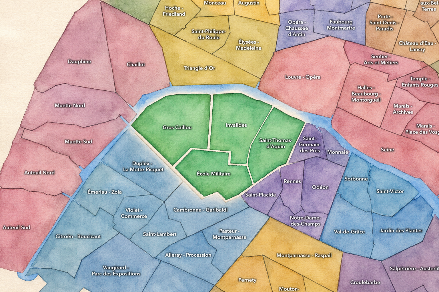
Viewed through its Conseils de Quartier, the 7e becomes less a single arrondissement of monuments and more a set of four local civic landscapes. Gros Caillou expresses the most visitor-facing and neighborhood-commercial side of the arrondissement, where the Eiffel Tower, Champ de Mars, Rue Saint-Dominique, Rue Cler, hotels, cafés, and residential streets create a dense overlap of tourism and daily life. Invalides carries the arrondissement’s ceremonial and institutional weight, linking military memory, museums, ministries, grand avenues, and public lawns into one of Paris’s most formal civic environments.
Saint Thomas d’Aquin gives the 7e a quieter and more refined expression, shaped by churches, museums, schools, embassies, aristocratic townhouses, galleries, and residential streets near the western edge of Saint-Germain-des-Prés. École Militaire, meanwhile, brings together military history, southern residential corridors, neighborhood services, broad avenues, and the more practical urban fabric around La Motte-Picquet, Ségur, and Cambronne-adjacent streets.
The value of the CdQ layer in the 7e is that it makes visible the local life beneath the arrondissement’s symbolic image. Through its four councils, the 7e can be read not only as the Paris of monuments and ministries, but as a lived civic territory: school streets, market blocks, museum entrances, security perimeters, garden paths, residential courtyards, restaurant corridors, and neighborhood concerns woven through one of the most recognizable urban landscapes in the world.
Les Conseils de Quartier
École Militaire
Civic Profile
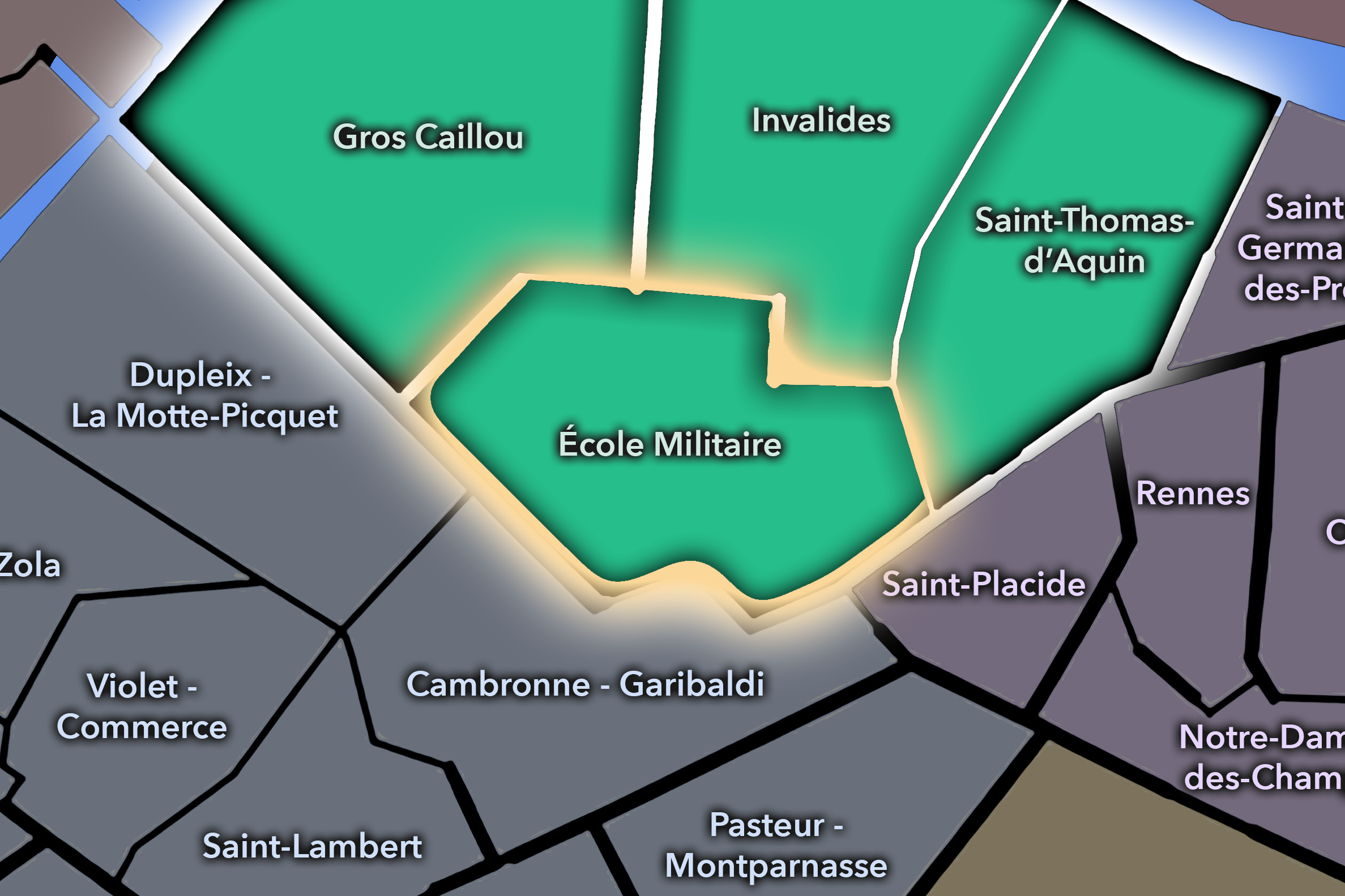
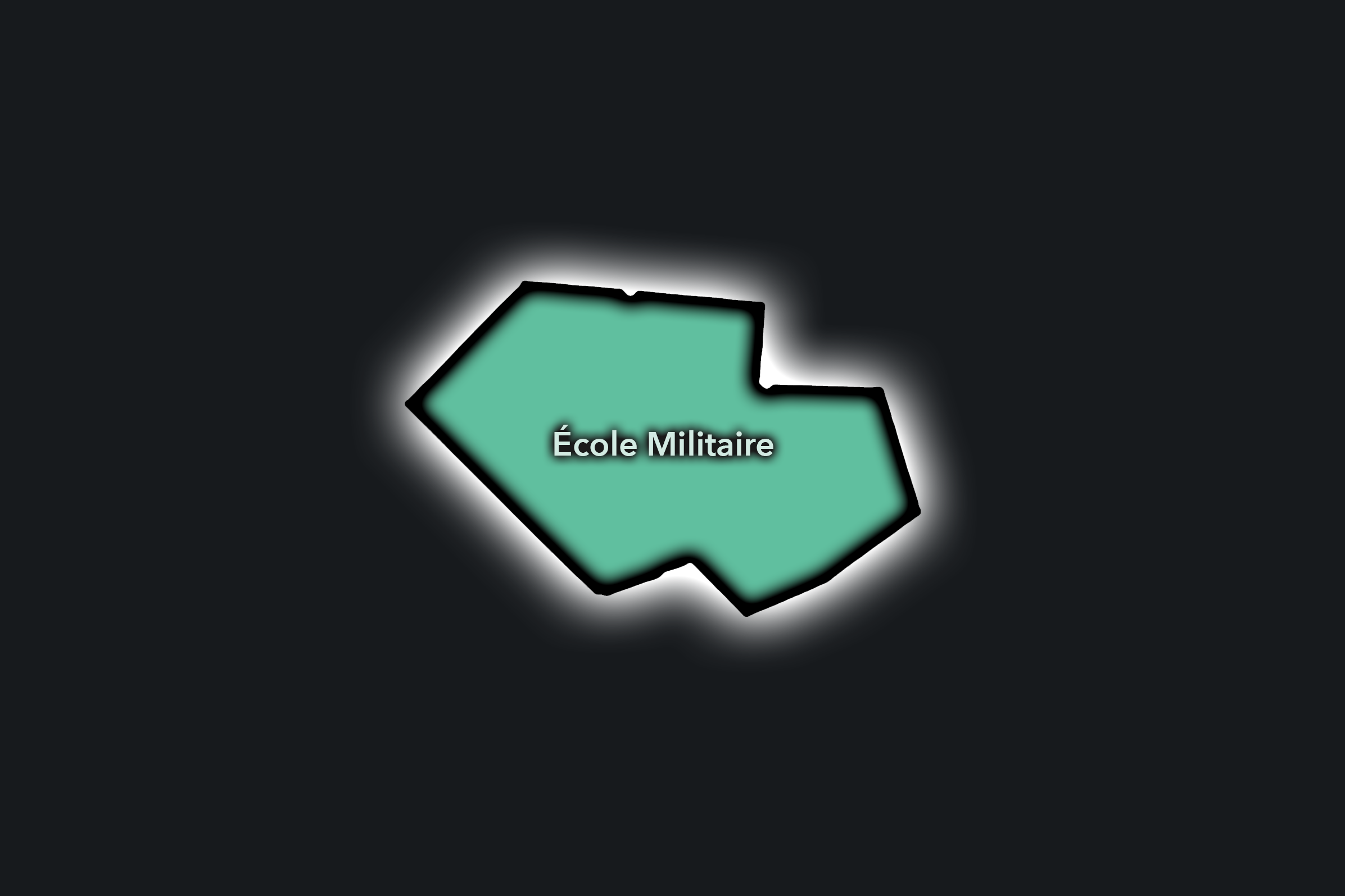
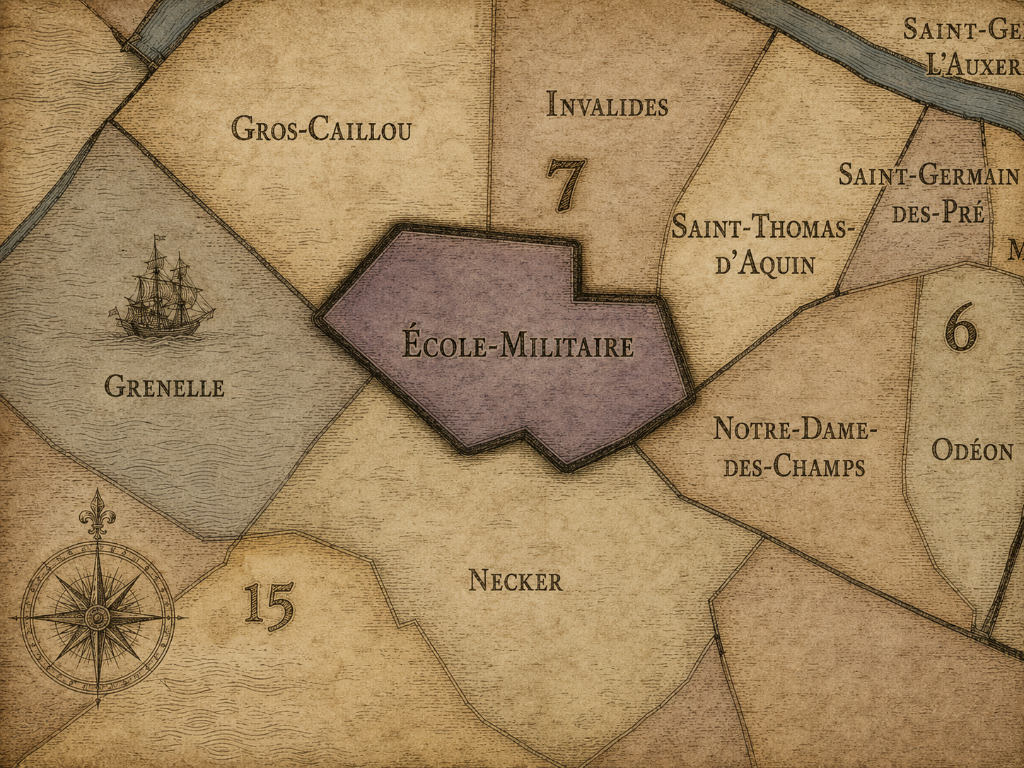
The École Militaire Conseil de Quartier organizes the southern side of the 7e, where the formal military landscape below the Champ de Mars meets UNESCO, broad avenues, residential streets, schools, cafés, and the transition toward Ségur, Duroc, and the edge of the 15e. The district takes its name from the École Militaire, founded under Louis XV, and sources commonly place the neighborhood at the southern end of the Champ de Mars, opposite the Eiffel Tower.
On the ground, École Militaire feels quieter and more residential than the Eiffel-facing north of Gros Caillou, but it remains strongly shaped by major institutions and formal urban space. The presence of the École Militaire, UNESCO, Avenue de Lowendal, Avenue de Ségur, schools, embassies, and residential side streets gives the area a civic rhythm of official buildings, family routines, local cafés, and broad avenues. Its civic themes center on institutional access, traffic and pedestrian comfort around large avenues, school and residential life, preservation of formal streetscapes, and the connection between neighborhood use and major public landscapes like the Champ de Mars.
École Militaire: At a Glance
A curated list for you.
-

Major Streets
Avenue de la Motte-Picquet
Avenue de Lowendal
Avenue de Ségur
Avenue de Suffren
Rue Cler nearby
-

Public Spaces & Landmarks
Champ de Mars southern edge
UNESCO Headquarters
Place de Fontenoy
Avenue de Breteuil nearby
-

Transit Access
Ségur
Cambronne nearby
Saint-François-Xavier nearby
La Motte-Picquet - Grenelle nearby
École Militaire
-

Shopping & Dining
Rue Cler nearby
Avenue de la Motte-Picquet cafés
Zia
Le Florimond
Kozy Bosquet nearby
-

Hotels & Attractions
UNESCO / Place de Fontenoy
Eiffel Tower walking approach
Avenue de Breteuil / Invalides vista nearby
7e / 15e border hotel corridors
Gros Caillou
Civic Profile
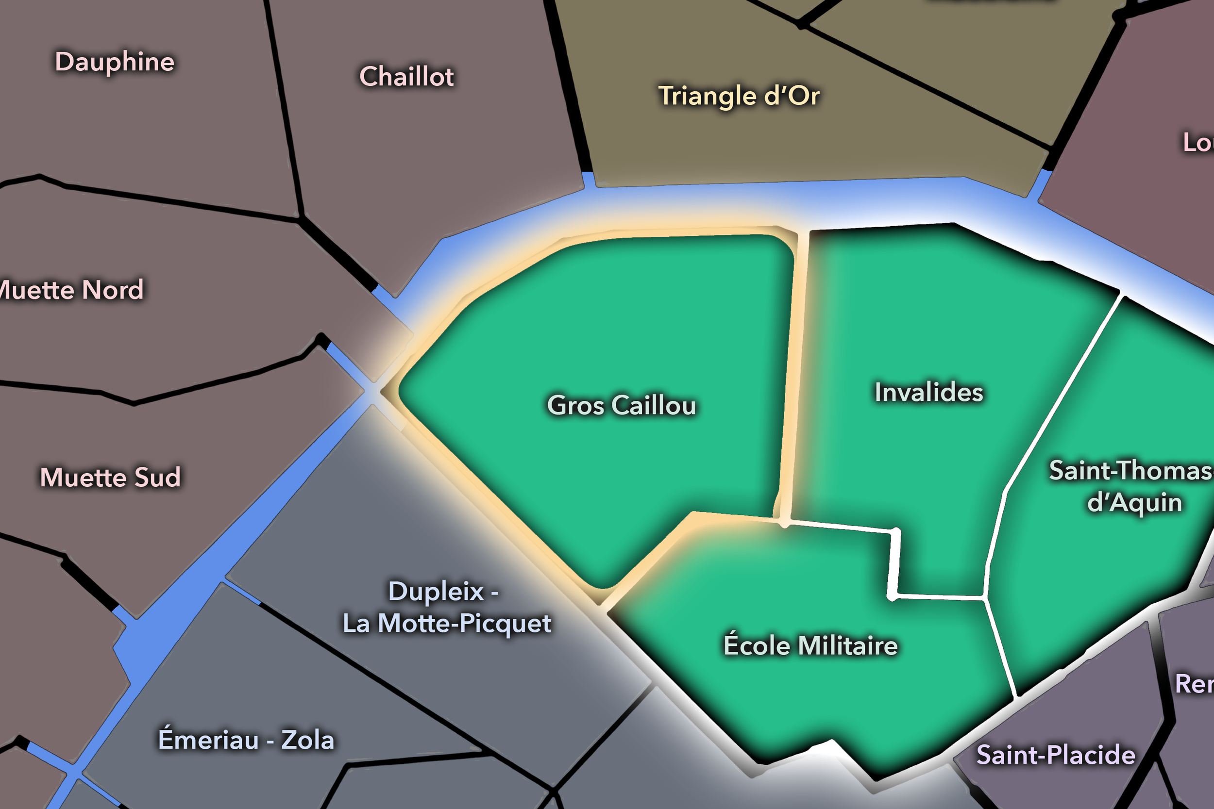
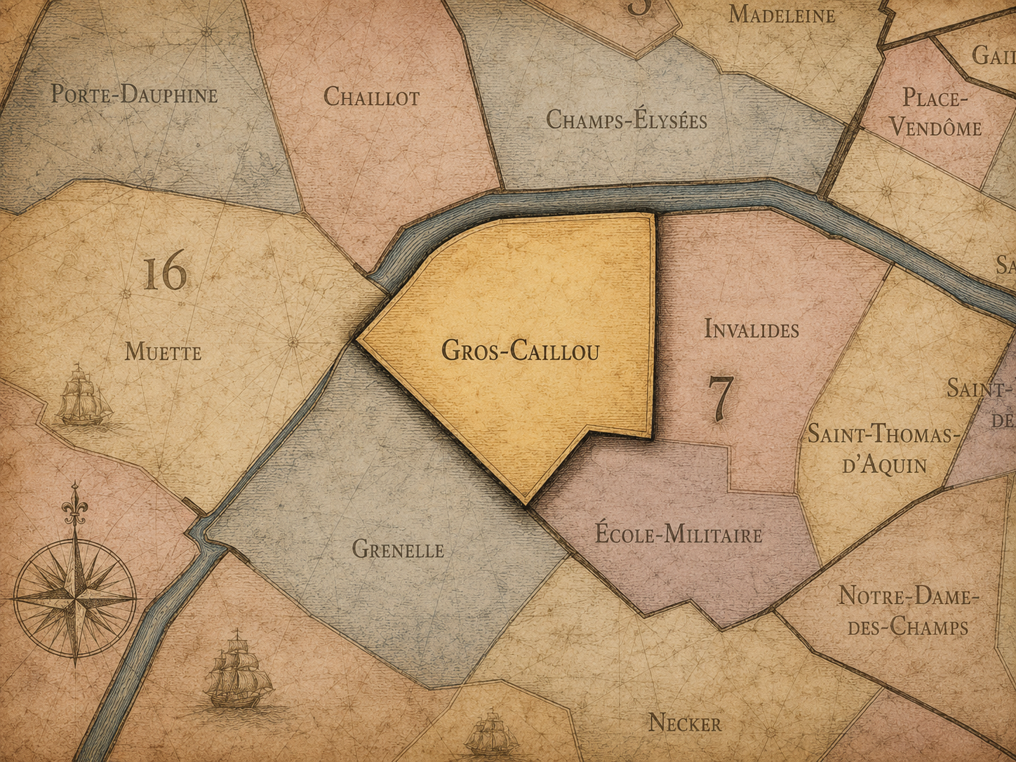
The Gros Caillou Conseil de Quartier gives civic form to the 7e’s most internationally visible neighborhood landscape, where the Eiffel Tower, Champ de Mars, Seine-facing streets, Rue Cler, and the residential-commercial fabric around Rue Saint-Dominique all overlap. As a civic territory, it must hold together two very different scales of Paris: the global symbolic presence of the tower and the local routines of schools, cafés, market streets, apartment blocks, hotels, libraries, and neighborhood services. Sources describing Gros Caillou often note its position between the Champ de Mars, Invalides, and the Seine, as well as the importance of Rue Cler and Rue de Grenelle as local market streets.
On the ground, Gros Caillou feels both monumental and village-like. The Eiffel Tower and Champ de Mars bring immense visitor pressure, while the surrounding streets retain a more residential Left Bank rhythm: bakeries, cafés, schools, small hotels, local food shops, and quieter side streets just beyond the main tourist paths. Its civic themes center on pedestrian circulation, public-space management around the tower and park, market-street vitality, security and crowding, residential livability, and the challenge of keeping one of the world’s most visited landscapes connected to everyday neighborhood life.
Gros Caillou: At a Glance
A curated list for you.
-
Major Streets
Rue Saint-Dominique
Rue Cler
Avenue de la Bourdonnais
Quai Branly
Avenue Bosquet
-
Public Spaces & Landmarks
Eiffel Tower
Champ de Mars
Église Saint-Pierre-du-Gros-Caillou
American Library in Paris
Seine riverfront
-
Transit Access
École Militaire
La Tour-Maubourg
Pont de l’Alma
Alma - Marceau nearby
Invalides nearby
-
Shopping & Dining
Rue Cler market street
Rue Saint-Dominique cafés and shops
La Fontaine de Mars
Les Cocottes Tour Eiffel
Café Constant
-
Hotels & Attractions
Eiffel Tower visitor district
Champ de Mars walking route
Musée du Quai Branly - Jacques Chirac nearby
Seine / Pont de l’Alma access
Rue Cler neighborhood hotel corridor
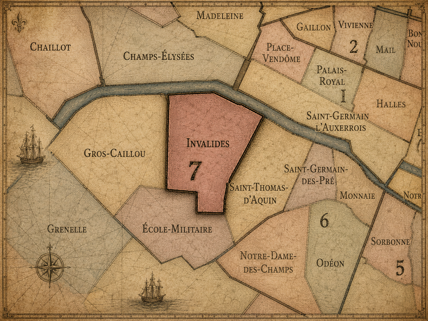
Invalides
Civic Profile
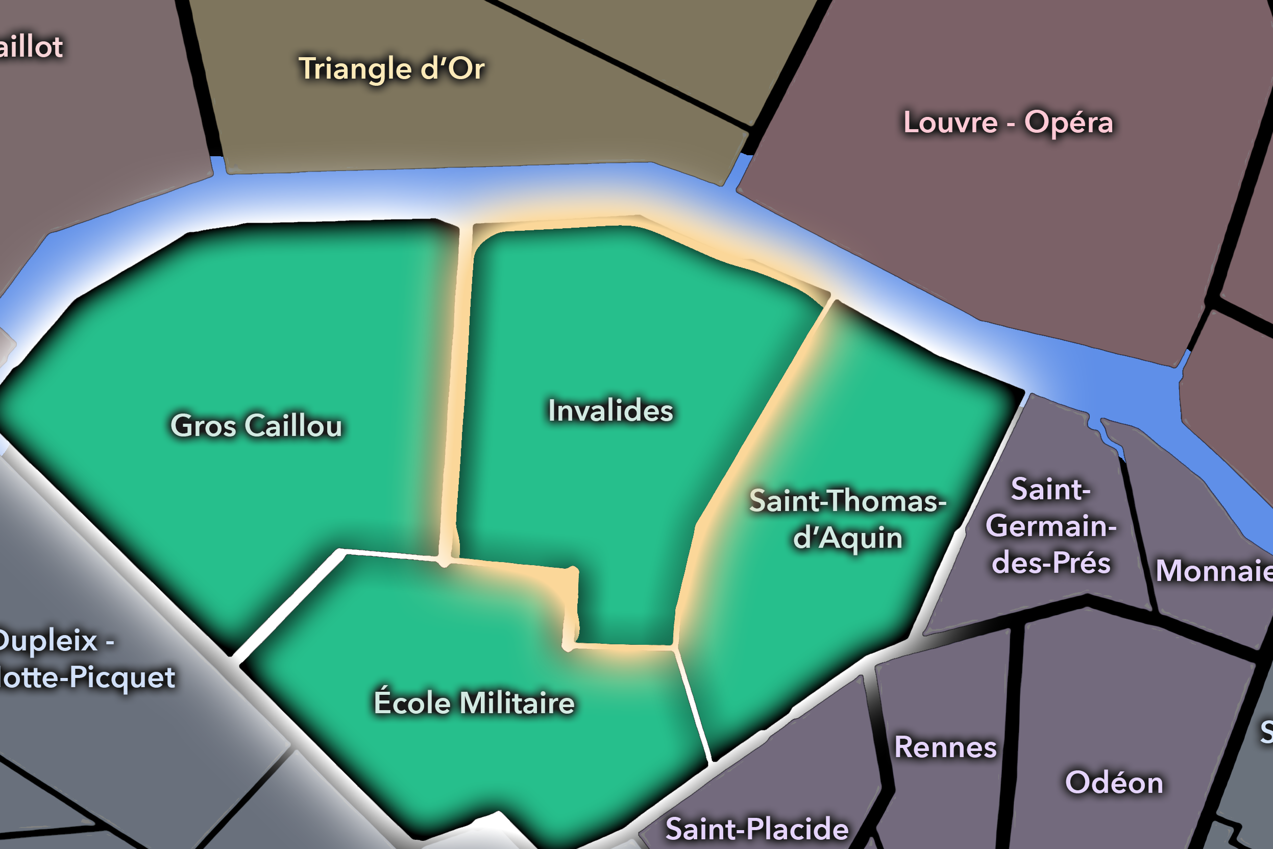
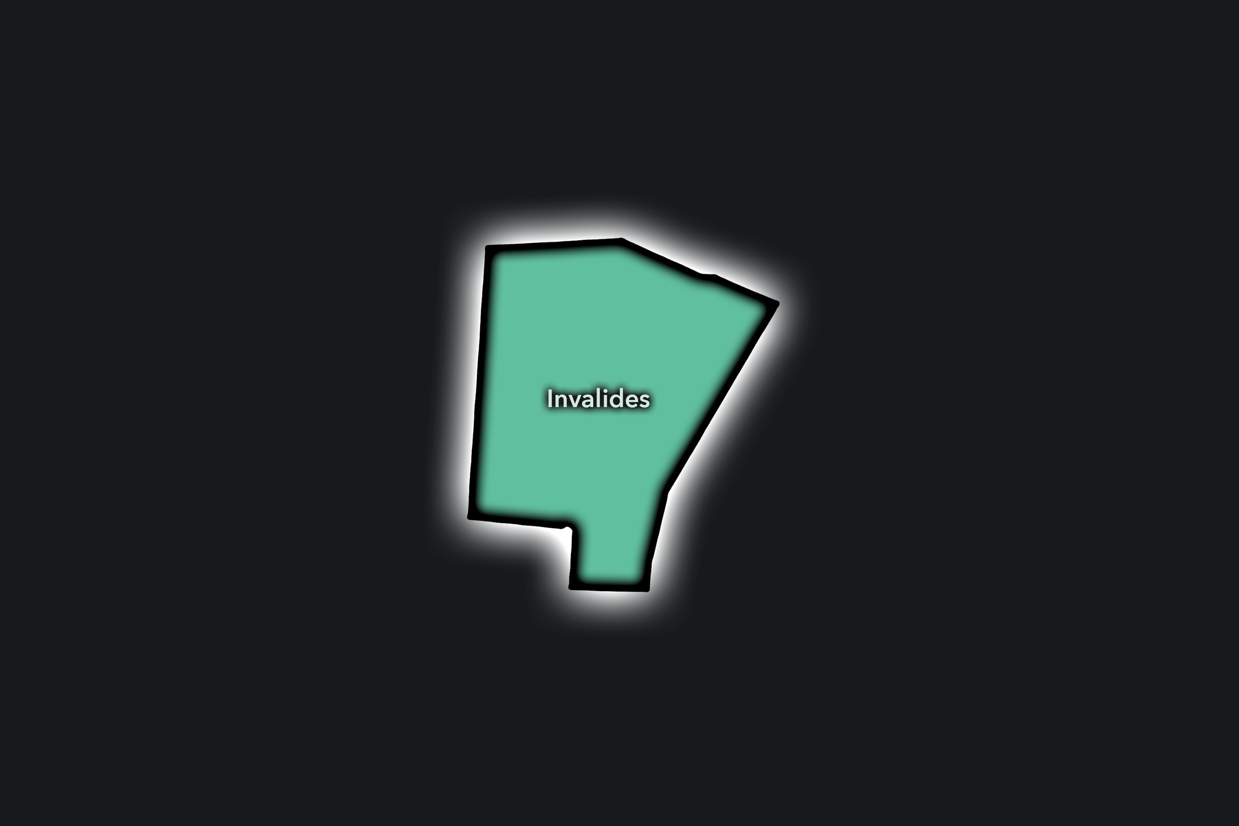
The Invalides Conseil de Quartier gathers the ceremonial and institutional heart of the 7e into a local civic frame. Centered around the Hôtel des Invalides, the Esplanade des Invalides, ministries, museums, broad avenues, formal lawns, and river-facing approaches, this CdQ is shaped by national memory and everyday use at the same time. The Invalides complex includes the Musée de l’Armée, military and memorial spaces, the Dôme des Invalides, and the tomb of Napoleon, making it one of the district’s most significant landmark environments.
On the ground, Invalides feels spacious, formal, and institutionally anchored. Its broad lawns and monumental buildings create a sense of ceremonial Paris, but the surrounding streets also contain schools, offices, residences, cafés, embassies, and practical routes between the Seine, Rue de Grenelle, Boulevard des Invalides, and the rest of the arrondissement. Its civic themes center on access to major public spaces, museum and ceremony traffic, security around official institutions, preservation of historic landscapes, pedestrian comfort, and the balance between national symbolism and local neighborhood use.
Invalides: At a Glance
A curated list for you.
-
Major Streets
Rue de Grenelle
Boulevard des Invalides
Avenue de Tourville
Rue de Varenne
Quai d’Orsay
-
Public Spaces & Landmarks
Hôtel des Invalides
Esplanade des Invalides
Musée de l’Armée
Dôme des Invalides
Musée Rodin nearby
-
Transit Access
Invalides
La Tour-Maubourg
Varenne
Saint-François-Xavier
Assemblée Nationale nearby
-
Shopping & Dining
Rue de Grenelle cafés and shops
Rue Saint-Dominique nearby
L’Arpège
Auguste
Le Recrutement Café nearby
-
Hotels & Attractions
Les Invalides visitor circuit
Musée Rodin gardens nearby
Esplanade des Invalides
Seine / Pont Alexandre III approach
Rue de Grenelle hotel and institution corridor
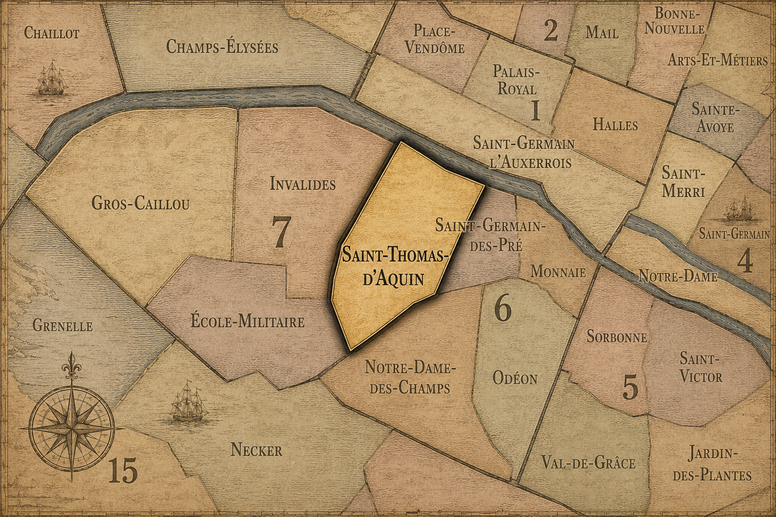
Saint Thomas d’Aquin
Civic Profile
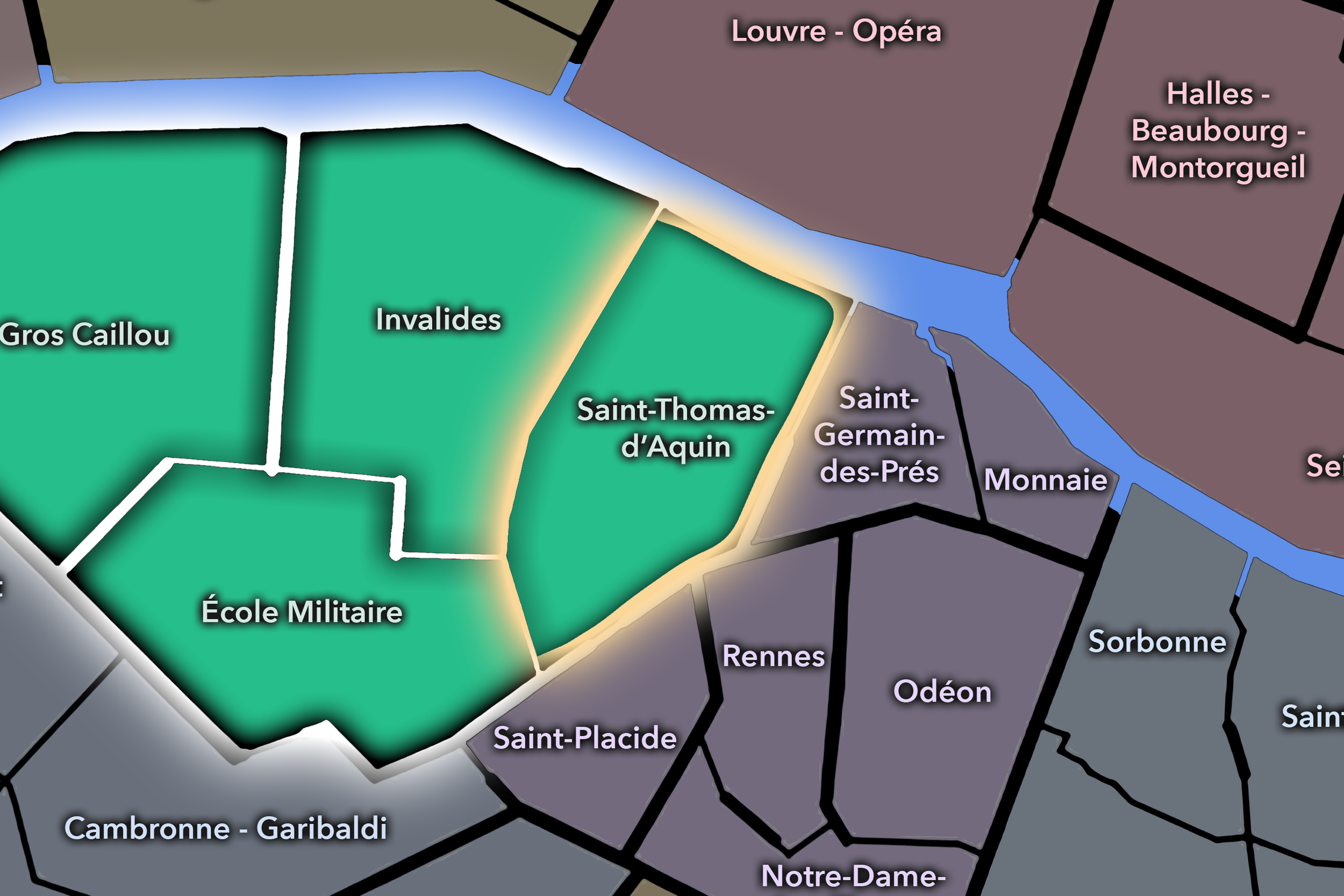
The Saint Thomas d’Aquin Conseil de Quartier gives civic shape to the 7e’s refined western Saint-Germain edge, where museums, ministries, churches, embassies, galleries, schools, residential streets, and major shopping routes converge. It is less dominated by one monumental public space than by an accumulation of institutions and elegant streets: Rue du Bac, Rue de Varenne, Boulevard Saint-Germain, Rue de Grenelle, and the cultural landscape around the Musée d’Orsay, Musée Maillol, and the Hôtel Matignon. As a civic territory, it reflects the quieter but highly influential side of the 7e: official, residential, cultural, and commercial at once.
On the ground, Saint Thomas d’Aquin feels polished, institutional, and deeply Left Bank. The district moves between art museums, religious buildings, government offices, luxury shops, cafés, schools, and residential courtyards, with Rue du Bac acting as one of its strongest local-commercial spines. Its civic themes center on preserving residential quality of life within a district of embassies and ministries, managing museum and shopping traffic, maintaining pedestrian comfort on historic streets, supporting neighborhood commerce, and balancing institutional security with public access.
Saint Thomas d’Aquin: At a Glance
A curated list for you.
-
Major Streets
Rue du Bac
Boulevard Saint-Germain
Rue de Varenne
Rue de Grenelle
Rue de Bellechasse
-
Public Spaces & Landmarks
Musée d’Orsay
Église Saint-Thomas-d’Aquin
Hôtel Matignon
Musée Maillol
Basilique Sainte-Clotilde nearby
-
Transit Access
Rue du Bac
Solférino
Sèvres - Babylone
Assemblée Nationale nearby
Musée d’Orsay RER
-
Shopping & Dining
Rue du Bac shops and cafés
La Grande Épicerie / Le Bon Marché nearby
Pâtisserie des Rêves / Rue du Bac sweets corridor
Les Antiquaires
Coutume Café nearby
-
Hotels & Attractions
Musée d’Orsay visitor district
Rue du Bac shopping route
Hôtel Matignon / official Paris setting
Saint-Germain-des-Prés nearby
Le Bon Marché / Sèvres-Babylone nearby
Neighborhood Connections
Every Conseil de Quartier belongs to a wider Parisian fabric.
-
7e — Palais-Bourbon
-
École-Militaire
-
Gros-Caillou
-
Invalides
-
Saint-Thomas-d’Aquin
The Photography
Visual Identity

The arrondissements do not share a single visual identity. Instead, they organize Paris into twenty broad visual fields, each gathering its own combination of landmarks, streetscapes, institutions, residential districts, commercial corridors, parks, rail stations, markets, cemeteries, and riverfront edges.
Some arrondissements are defined by monumental scale: royal palaces, ceremonial avenues, government buildings, museums, formal gardens, and internationally recognized landmarks. Others are shaped by hills, canals, rail gateways, apartment-lined boulevards, neighborhood markets, former village streets, industrial remnants, parks, or the quieter rhythms of residential Paris. The arrondissement system gives these varied landscapes a civic frame, allowing the city to be read not as one visual language, but as a sequence of overlapping Parisian atmospheres.
Through The Lens

Photographing the arrondissements means moving between the official map and the street-level experience. The camera does not treat each arrondissement as visually uniform. Instead, it looks for the recurring forms, textures, transitions, and contrasts that make each district legible: the geometry of boulevards, the shade of plane trees, the repetition of balconies, the rise of stairways, the curve of canals, the presence of rail stations, the opening of parks, the weight of monuments, and the intimacy of side streets.
On CityNeighborhoods, the arrondissement provides the frame, but the photograph comes from the encounter between map, movement, light, and observation. As the Paris photography is processed, this section will connect each arrondissement more directly to the project’s Photographic Lexicon: the visual strategies, recurring motifs, and compositional patterns that shape how the city is seen through the lens.
If you visit Paris, these ideas can help inspire your own photography.



Paris: J’Espere, Je Rêve, Je Vive
Paris Photo Gallery
Paris Field Notes
-
Field Note: August 18, 2025 | 07:58 AM
Conditions: 73°F | Humidity: 72%.
Within the park's interior, the glacial kettle ponds acted as humidity traps, creating a soft, hazy light that filtered through the old-growth oaks. The transition from the park's dense shade to the sun-drenched edges of Oakland Gardens highlighted the day's exceptional "picture-perfect" clarity.
There is a fleeting window in Queens where the humidity of August hasn't yet heavy-set, and the morning sun hits the canopy of Alley Pond Park at a perfect oblique angle. Arriving just before 8:00 AM, I watched the light break through the oaks and tulip trees, casting long, dramatic shadows across the wet grass. It’s in these quiet, golden moments that the park feels less like a city escape and more like the ancient glacial valley it actually is.
Other neighborhoods visited:











































































































Explore Paris
-

The twenty arrondissements form the civic spiral of Paris, organizing the city into its broad local districts of government, identity, and daily life.
-

Each arrondissement is divided into four official administrative quarters, giving Paris a more precise civic and geographic framework.
-

The conseils de quartier bring participation to street level, giving residents a voice in neighborhood needs, public space, and local civic life.
-

Les Deux Rives trace Paris through the Seine’s two banks, revealing how the Rive Droite and Rive Gauche shaped the city’s civic power, commerce, learning, art, and cultural identity.
-

Cultural neighborhoods reveal the Paris people recognize through history, cafés, architecture, memory, atmosphere, and local belonging.