
8e - ÉLYSÉE
Les Conseils de Quartier
Explore This Page
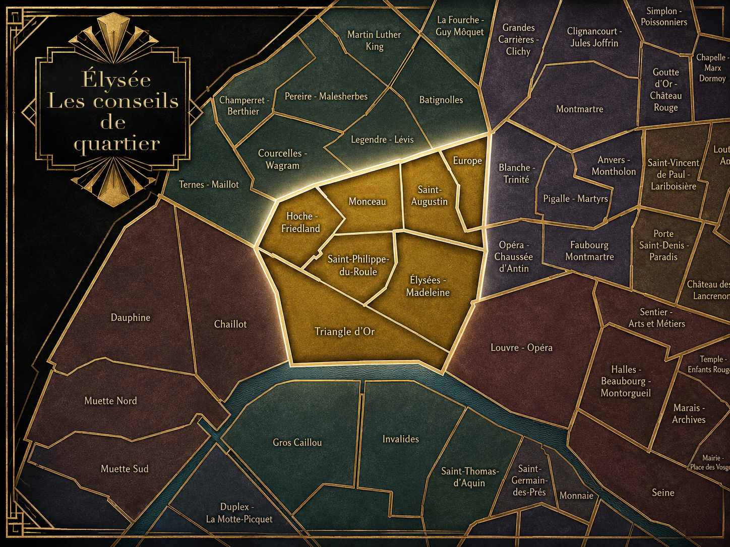


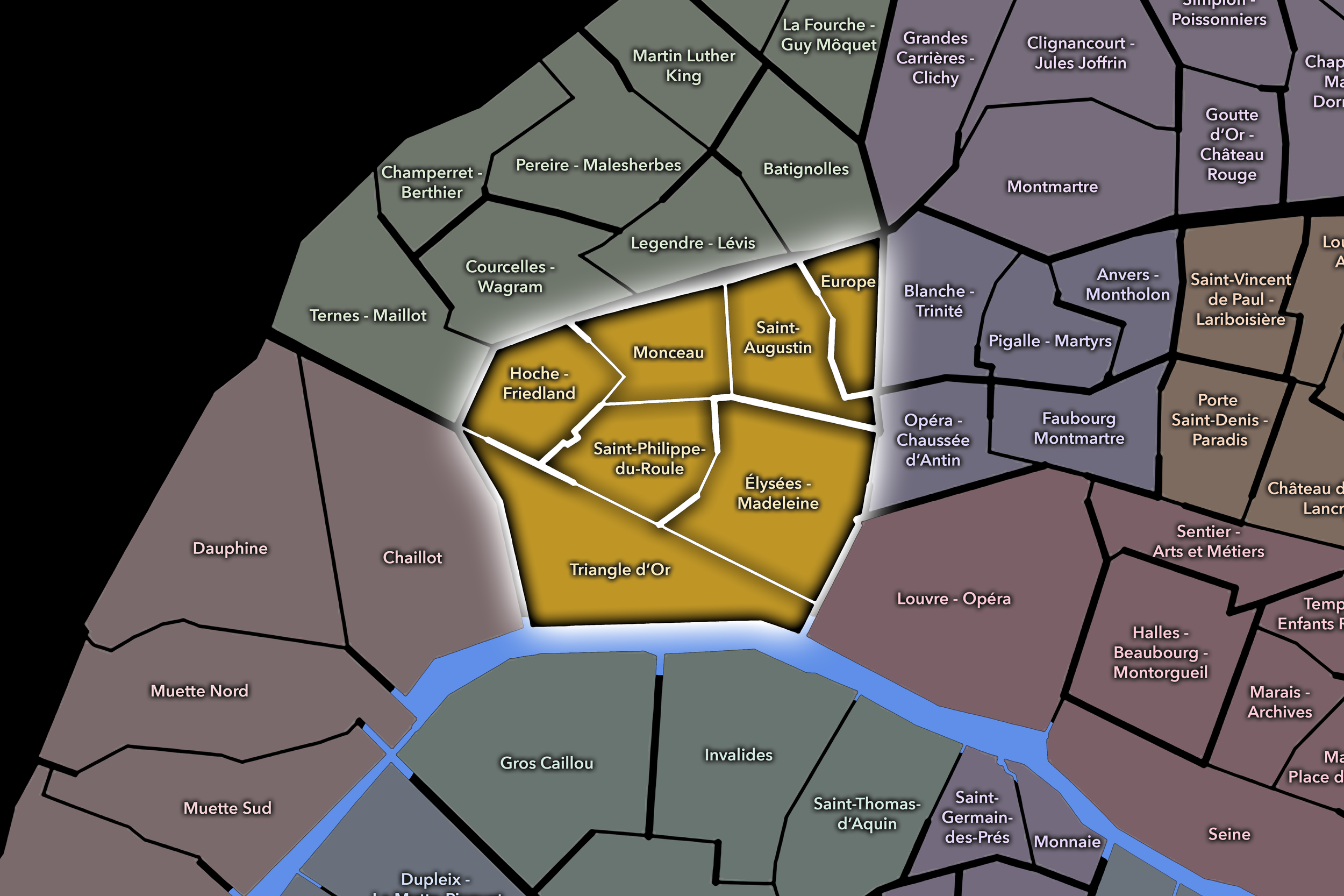
Explore the Conseils de Quartier of the 8e — Élysée.
Overview
Download the Paris Conseil de Quartier Map
Geographic Setting
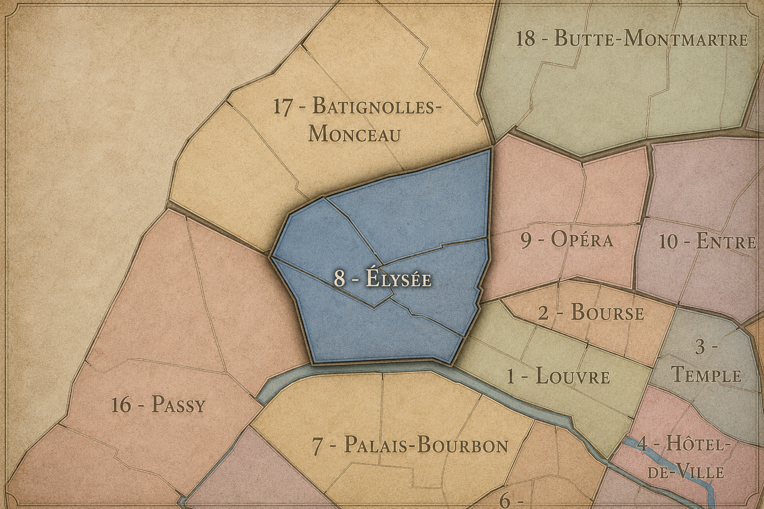
The Conseils de Quartier of the 8e organize local civic life across one of Paris’s most prominent western-central districts. Set on the Right Bank between the Seine, the Champs-Élysées, Parc Monceau, the Grands Boulevards, and the approaches toward the 17e, the arrondissement gathers some of the capital’s most visible urban landscapes: grand avenues, luxury shopping streets, diplomatic residences, major hotels, office corridors, ministries, churches, theaters, embassies, and formal public spaces. Yet beneath the grandeur, the 8e is also a district of smaller local geographies, where residential pockets, school streets, neighborhood services, gardens, and everyday movement sit beside some of the city’s most internationally recognized addresses.
The 8e’s Conseil de Quartier structure divides this landscape into seven civic territories: Hoche-Friedland, Europe, Saint-Philippe du Roule, Triangle d’Or, Saint-Augustin, Élysée-Madeleine, and Monceau. Unlike arrondissements where the CdQs closely mirror the four Administrative Quarters, the 8e uses a more finely divided participatory geography. This allows the arrondissement to distinguish between several very different urban conditions: the luxury and visitor intensity of the Triangle d’Or, the institutional and commercial weight of Élysée-Madeleine, the residential and park-adjacent identity of Monceau, the railway and office edges of Europe, and the grand avenue landscapes around Hoche-Friedland and Saint-Philippe du Roule.
Together, these seven CdQs reveal the 8e as more than a single district of prestige. They show an arrondissement organized by movement and contrast: from the Seine-facing ceremonial corridors to the quieter streets near Parc Monceau, from the Champs-Élysées to the Gare Saint-Lazare edge, from luxury retail to neighborhood markets, and from national symbolism to daily civic concerns. The CdQ map gives a more precise shape to a part of Paris that can otherwise be flattened into images of power, fashion, and tourism.
Civic Framework
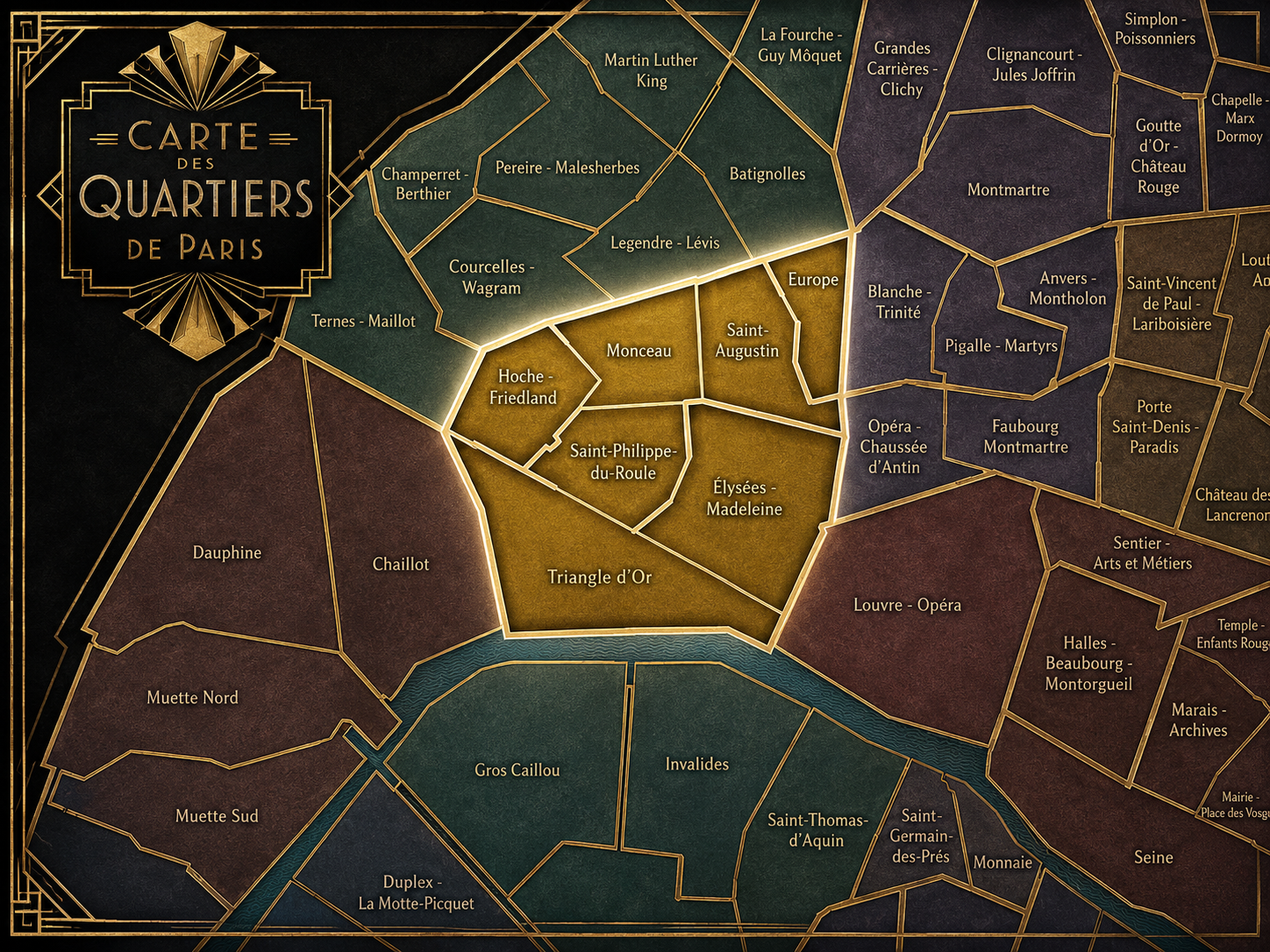
The 8e’s Conseils de Quartier provide a neighborhood-level civic structure for an arrondissement whose public identity is unusually shaped by institutions, visitors, commerce, and symbolic space. The district includes major avenues, government and diplomatic buildings, luxury retail streets, business areas, hotels, churches, theaters, museums, and parks, but its local life also depends on residents, workers, students, shopkeepers, cultural institutions, and the daily management of public space. The CdQs help translate this complex arrondissement into smaller civic territories where local concerns can be understood with more precision.
The seven-council structure suggests that the 8e requires a finer civic grain than its official Administrative Quarters alone can provide. Rather than grouping the arrondissement only into broad historical quarters, the CdQs respond to recognizable zones of use: Monceau’s residential and garden environment, Europe’s station-adjacent and office-oriented streets, Saint-Augustin’s institutional and neighborhood center, Élysée-Madeleine’s ceremonial and commercial corridors, Triangle d’Or’s luxury and tourism economy, Saint-Philippe du Roule’s commercial-residential spine, and Hoche-Friedland’s grand-avenue transition toward the northwest. This makes the CdQ layer especially useful in the 8e, where the character of the city can change dramatically from one avenue or square to the next.
As a civic framework, the 8e’s CdQs help organize practical questions that come with a highly visible but unevenly residential arrondissement: pedestrian flow around major attractions, security and access near institutions, hotel and office traffic, luxury retail pressure, park maintenance, local services, school routines, event circulation, and the preservation of livable streets within a district that many people experience primarily as a destination rather than a neighborhood.
Local Expression
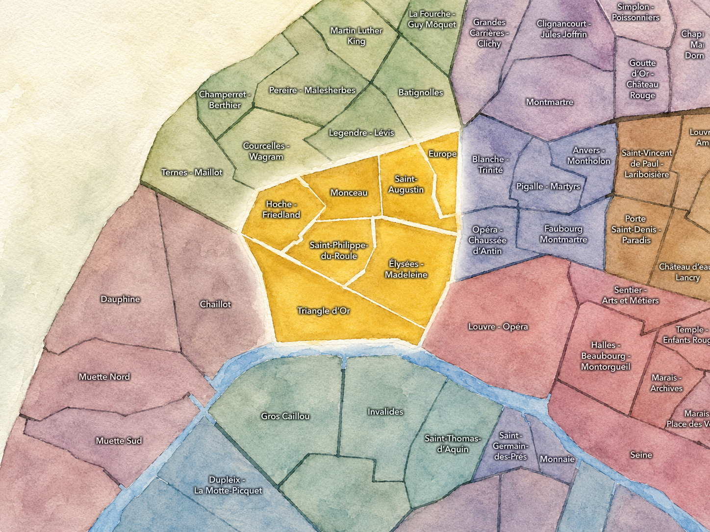
Viewed through its Conseils de Quartier, the 8e becomes a collection of distinct central Paris environments rather than a single image of elegance or power. Triangle d’Or expresses the arrondissement’s luxury, fashion, hotel, and visitor-facing identity, while Élysée-Madeleine gathers ceremonial streets, churches, embassies, offices, and major commercial axes into one of the city’s most polished civic landscapes. Saint-Augustin and Europe bring the arrondissement toward the practical movement of rail stations, office life, residential streets, schools, and neighborhood services.
Monceau gives the 8e a greener and more residential expression, shaped by Parc Monceau, Haussmannian streets, museums, schools, and family-oriented routines. Hoche-Friedland and Saint-Philippe du Roule reveal the district’s grand-avenue fabric, where office corridors, local commerce, institutional buildings, restaurants, and residential side streets interlock around the approaches to the Champs-Élysées, Faubourg Saint-Honoré, and the northwest of central Paris.
The value of the CdQ layer in the 8e is that it brings local distinction to a district often seen through broad symbols: the Champs-Élysées, luxury shopping, official Paris, and high-end tourism. Through its seven councils, the arrondissement can be read at the scale of the street, the school, the park gate, the office block, the hotel entrance, the church square, the shopping passage, and the everyday civic concerns that continue beneath one of Paris’s most globally recognized urban surfaces.
Les Conseils de Quartier
Élysée-Madeleine
Civic Profile
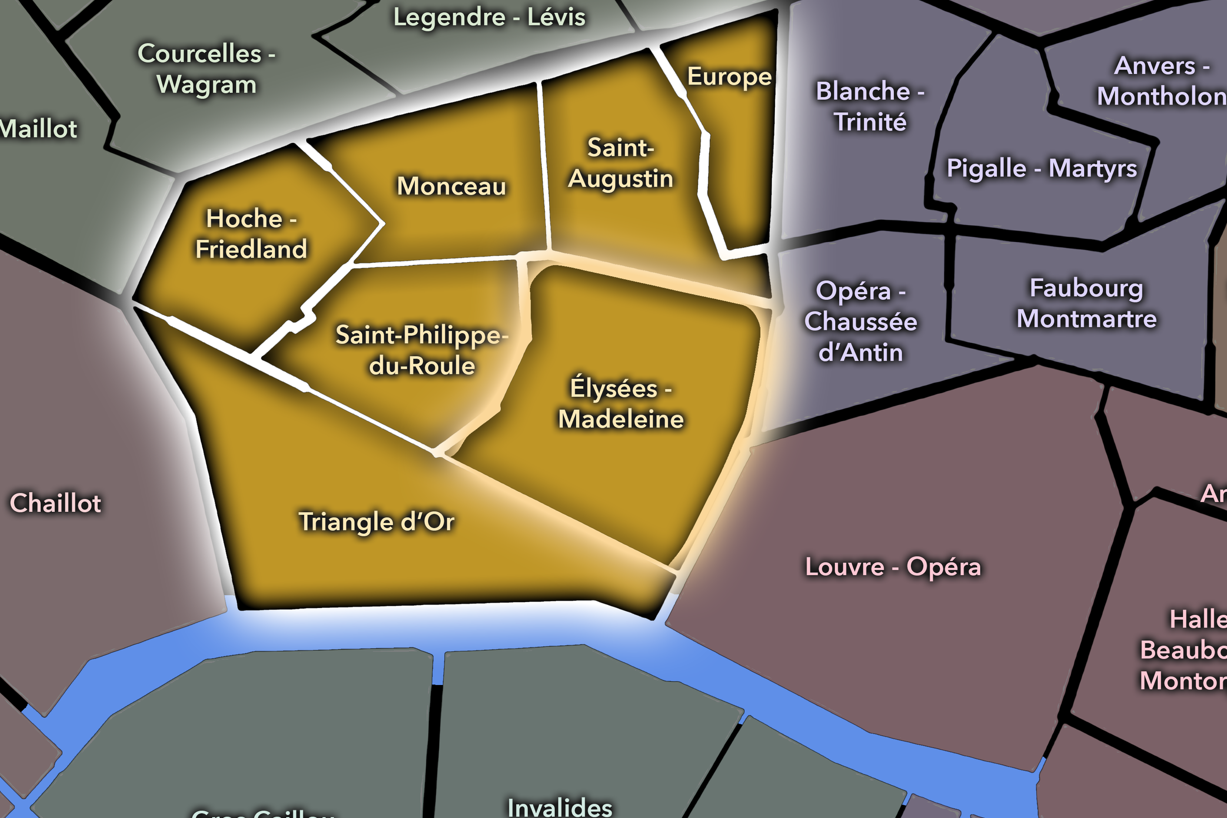
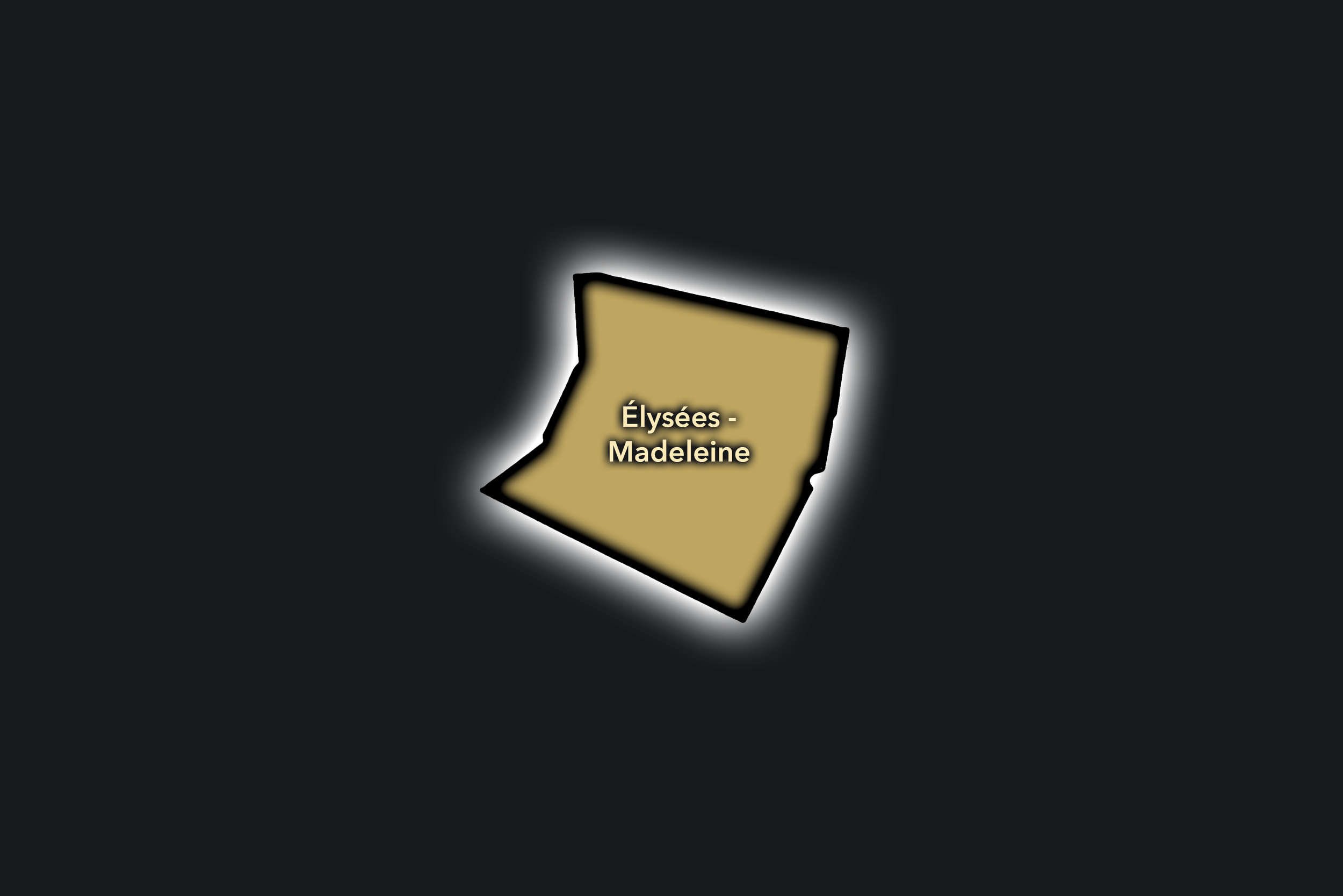
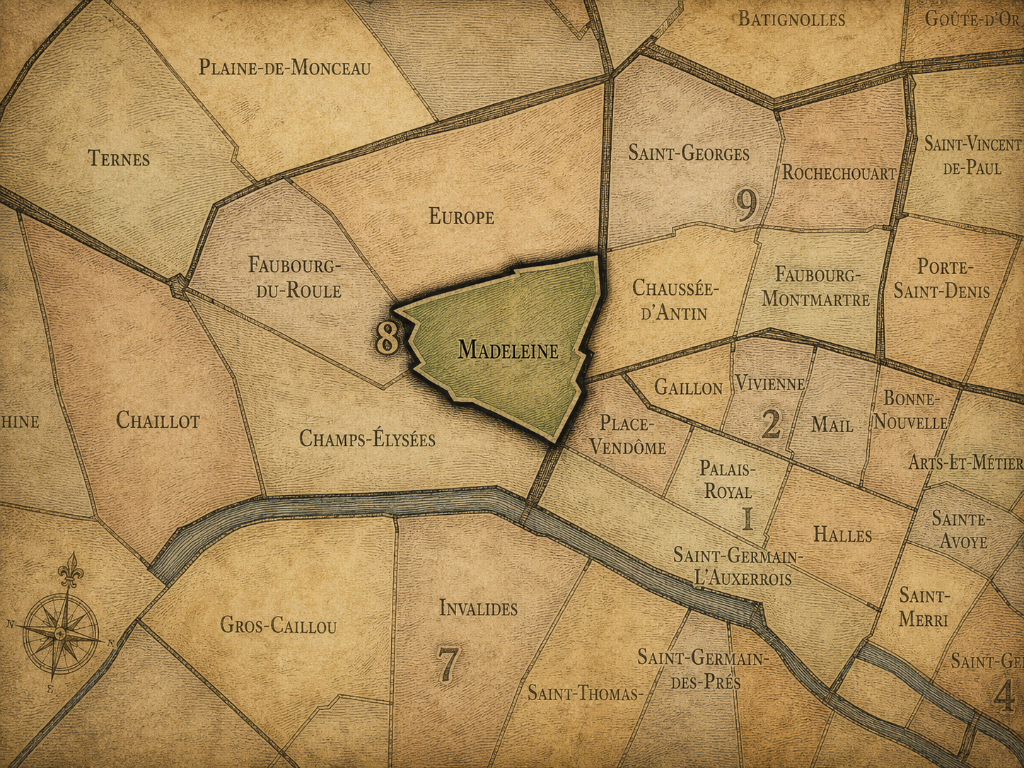
The Élysée-Madeleine Conseil de Quartier gathers one of the 8e’s most ceremonial and institutionally important landscapes into a local civic frame. Centered around the Madeleine, the Élysée Palace area, Rue du Faubourg Saint-Honoré, Place Beauvau, and the streets leading toward Concorde and Opéra, this CdQ is shaped by national institutions, luxury commerce, embassies, offices, hotels, churches, theaters, restaurants, and heavily managed public space. The Mairie du 8e identifies Élysée-Madeleine as one of the arrondissement’s current neighborhood councils.
On the ground, Élysée-Madeleine feels polished, official, and highly controlled, but also intensely used. Its streets carry shoppers, office workers, diplomats, security personnel, worshippers, hotel guests, diners, and visitors moving between Madeleine, Faubourg Saint-Honoré, Concorde, and the Opéra edge. Its civic themes center on security and access around official buildings, pedestrian flow near major squares and churches, commercial vitality, luxury retail pressure, hotel and office use, and the difficulty of maintaining local civic life in a district where symbolic national space and high-end destination commerce are constantly present.
Élysée-Madeleine: At a Glance
A curated list for you.
-
Major Streets
Rue du Faubourg Saint-Honoré
Boulevard de la Madeleine
Rue Royale
Rue Boissy d’Anglas
Rue d’Anjou
-

Public Spaces & Landmarks
Église de la Madeleine
Palais de l’Élysée
Place Beauvau
Place de la Madeleine
Place de la Concorde nearby
-

Transit Access
Madeleine
Concorde
Miromesnil
Saint-Augustin nearby
Opéra nearby
-

Shopping & Dining
Rue du Faubourg Saint-Honoré luxury corridor
Place de la Madeleine food shops
Fauchon / Madeleine gourmet district
Lucas Carton
Maison de la Truffe
-
Hotels & Attractions
Madeleine visitor district
Élysée / official Paris setting
Faubourg Saint-Honoré luxury route
Concorde and Tuileries nearby
Opéra / grands magasins approach
Europe
Civic Profile
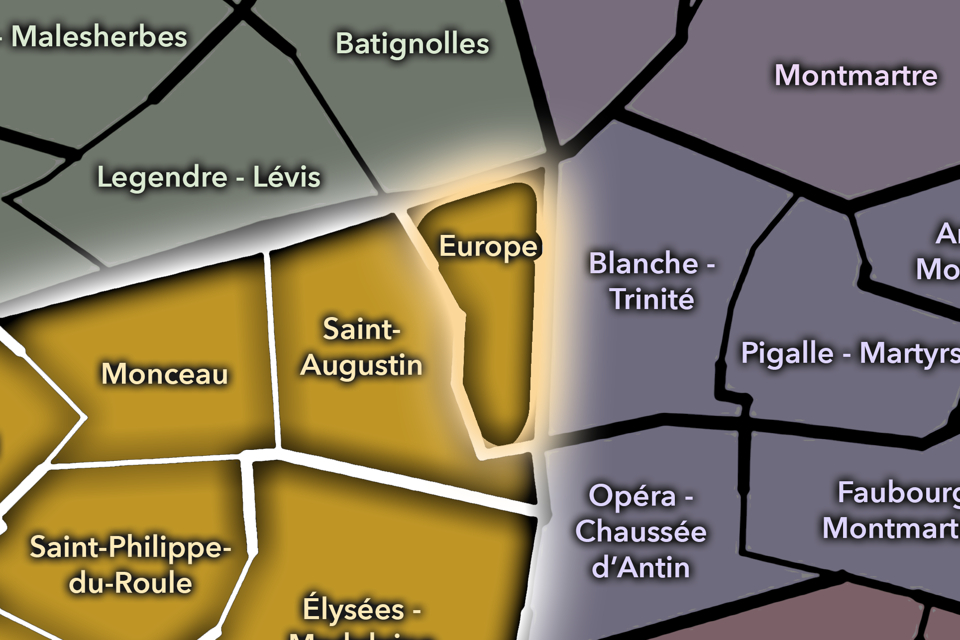
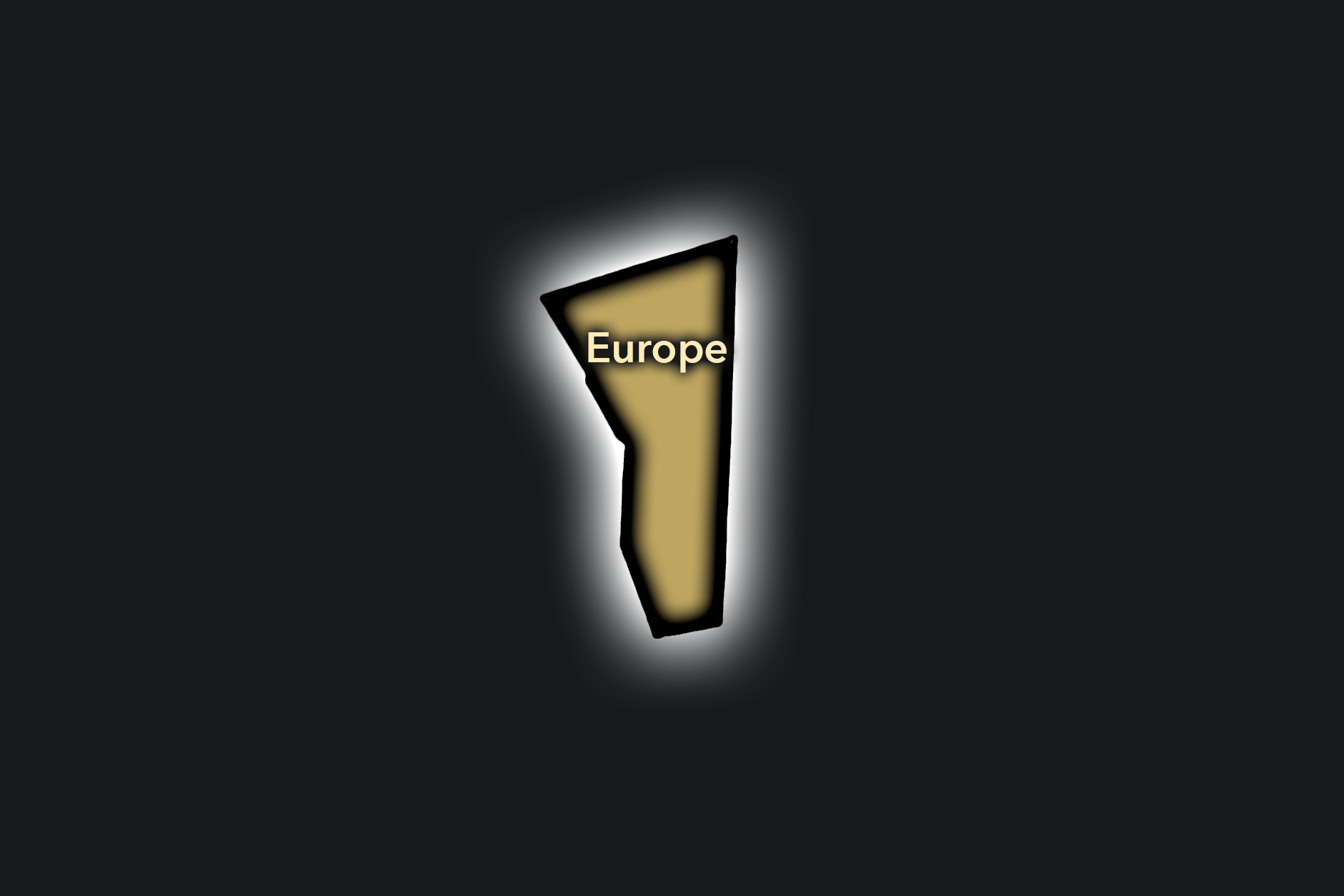
The Europe Conseil de Quartier organizes the 8e’s northeastern and station-adjacent landscape, where the arrondissement meets Gare Saint-Lazare, the rail-cut streets of the Europe district, office blocks, Haussmannian residences, schools, theaters, and the commercial edges of Saint-Augustin and the grands magasins. As a civic territory, Europe is less about monumentality than circulation: commuters, workers, residents, students, shoppers, and visitors all move through a compact district shaped by rail infrastructure and the practical rhythms of central Paris.
On the ground, Europe feels urban, transitional, and highly connected. Its streets have a distinctive geometry around the railway landscape, while nearby offices, hotels, shopping streets, churches, and schools give the area a strong weekday intensity. Its civic themes center on station-area movement, pedestrian comfort, traffic, office and hotel use, residential livability, school access, and the relationship between a major transit district and the quieter neighborhood streets around it.
Europe: At a Glance
A curated list for you.
-
Major Streets
Quai de la Seine
Quai de la Loire
Avenue Jean-Jaurès
Rue de Crimée
Boulevard de la Villette
-
Public Spaces & Landmarks
Bassin de la Villette
Pont de Crimée
Rotonde de la Villette nearby
MK2 Quai de Seine / Quai de Loire
Canal de l’Ourcq
-
Transit Access
Jaurès
Stalingrad
Laumière nearby
Riquet nearby
Crimée nearby
-
Shopping & Dining
Canal-side cafés and restaurants
Paname Brewing Company
Le Pavillon des Canaux
MK2 canal dining area
Jaurès / Laumière neighborhood cafés
-
Hotels & Attractions
Bassin de la Villette waterfront
Canal de l’Ourcq walking route
Pont de Crimée
MK2 canal cinemas
La Villette approach nearby
Hoche-Friedland
Civic Profile
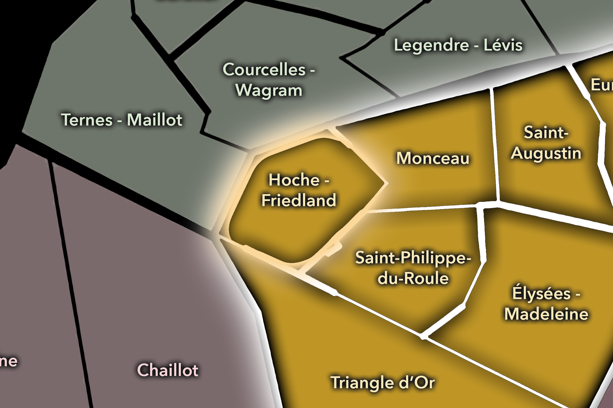
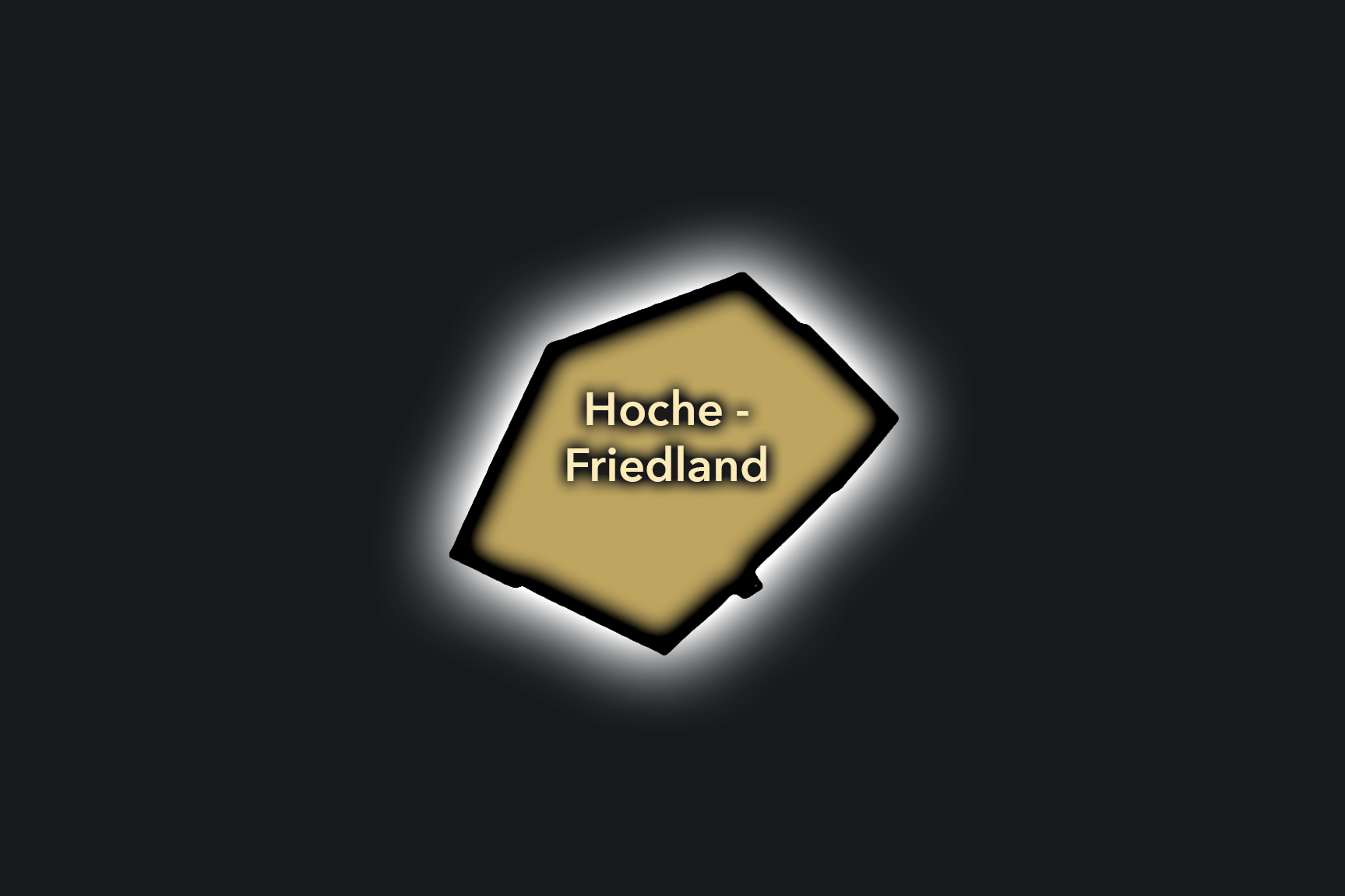
The Hoche-Friedland Conseil de Quartier gives civic shape to the northwestern grand-avenue landscape of the 8e, where Avenue Hoche, Avenue de Friedland, Parc Monceau’s southern approaches, the Arc de Triomphe edge, offices, hotels, embassies, and formal residential streets meet. The Mairie du 8e identifies the council’s perimeter as including portions of Rue du Faubourg Saint-Honoré and Square du Roule, placing it within a district where prestigious addresses and local streets overlap.
On the ground, Hoche-Friedland feels polished, spacious, and strongly institutional, but it is not only a district of prestige. Its civic function lies in managing the everyday uses of grand avenues and high-value urban space: traffic and pedestrian movement, hotel and office activity, residential quality of life, school and local-service access, and the transition between Parc Monceau, the Champs-Élysées area, and the Arc de Triomphe approach. It is a CdQ where monumental Paris, business Paris, and residential Paris share the same broad streets.
Hoche-Friedland: At a Glance
A curated list for you.
-
Major Streets
Rue de Crimée
Avenue Simon Bolivar
Rue Manin
Rue du Général-Brunet
Boulevard Sérurier
-
Public Spaces & Landmarks
Parc Monceau nearby
Square du Roule
Église Saint-Philippe-du-Roule nearby
Arc de Triomphe nearby
Salle Pleyel nearby
-
Transit Access
Charles de Gaulle - Étoile
Saint-Philippe du Roule
George V
Ternes nearby
Courcelles nearby
-
Shopping & Dining
Rue du Faubourg Saint-Honoré boutiques
Avenue de Friedland hotel dining
Salle Pleyel dining area
Le Taillevent
Citrus Étoile
-
Hotels & Attractions
Arc de Triomphe approach
Parc Monceau walking route
Champs-Élysées nearby
Salle Pleyel cultural anchor
Luxury hotel corridors near Étoile
Monceau
Civic Profile
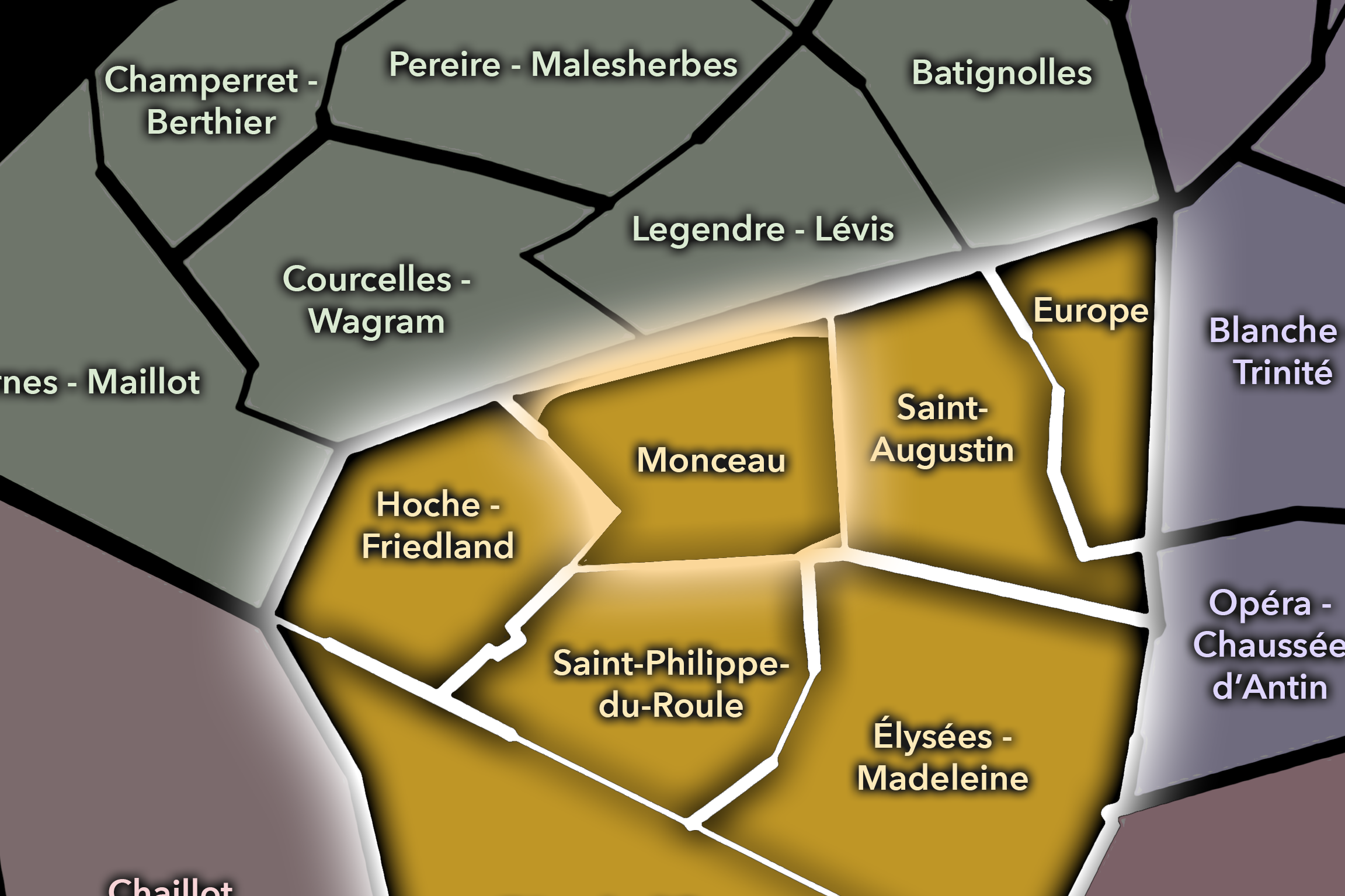
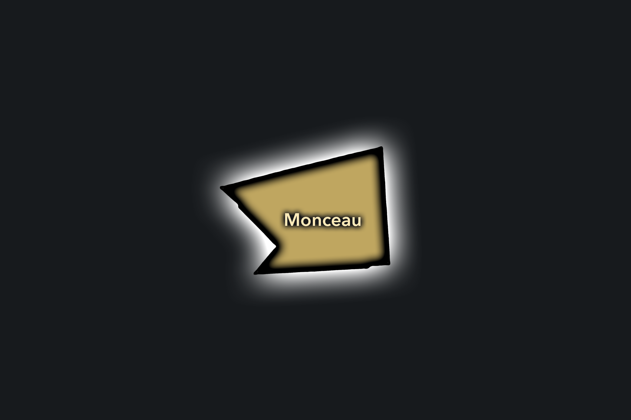
The Monceau Conseil de Quartier gives civic form to the greener, more residential northern edge of the 8e, centered around Parc Monceau and the elegant streets that connect the arrondissement to the 17e. Its local geography is shaped by Haussmannian residences, schools, museums, family routines, embassies, offices, local cafés, and one of western Paris’s most distinctive public gardens. The Mairie du 8e maintains Monceau as one of the arrondissement’s current Conseils de Quartier, and the Ville de Paris identifies Parc Monceau as a major city park with ongoing uses, events, and management needs.
On the ground, Monceau feels calmer and more residential than the Champs-Élysées or Madeleine districts, though it remains closely tied to prestige, culture, and visitor movement. The park is the civic anchor: it structures walking routes, family life, school activity, museum visits, neighborhood routines, and the public-space concerns of a district where greenery is central to local identity. Its civic themes center on park access and maintenance, school and family movement, residential quality of life, traffic around broad avenues, museum visitation, dog access and event use in the park, and the balance between neighborhood quiet and the visibility of one of Paris’s most elegant green spaces.
Monceau: At a Glance
A curated list for you.
-
Major Streets
Boulevard de Courcelles
Avenue de Messine
Rue de Monceau
Rue de Prony
Rue de Courcelles
-
Public Spaces & Landmarks
Parc Monceau
Musée Cernuschi
Musée Nissim de Camondo
Église Saint-Augustin nearby
Rotonde de Chartres / Parc Monceau entrance
-
Transit Access
Monceau
Courcelles
Malesherbes nearby
Villiers nearby
Saint-Augustin nearby
-
Shopping & Dining
Boulevard de Courcelles cafés
Rue de Courcelles shops and restaurants
Parc Monceau neighborhood cafés
Le Camondo
Le Valois
-
Hotels & Attractions
Parc Monceau walking circuit
Musée Nissim de Camondo
Musée Cernuschi
Plaine Monceau mansion district
8e / 17e residential-edge visitor route
Saint-Augustin
Civic Profile
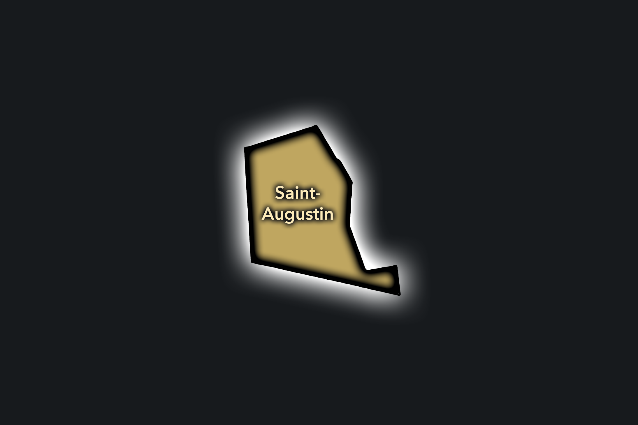
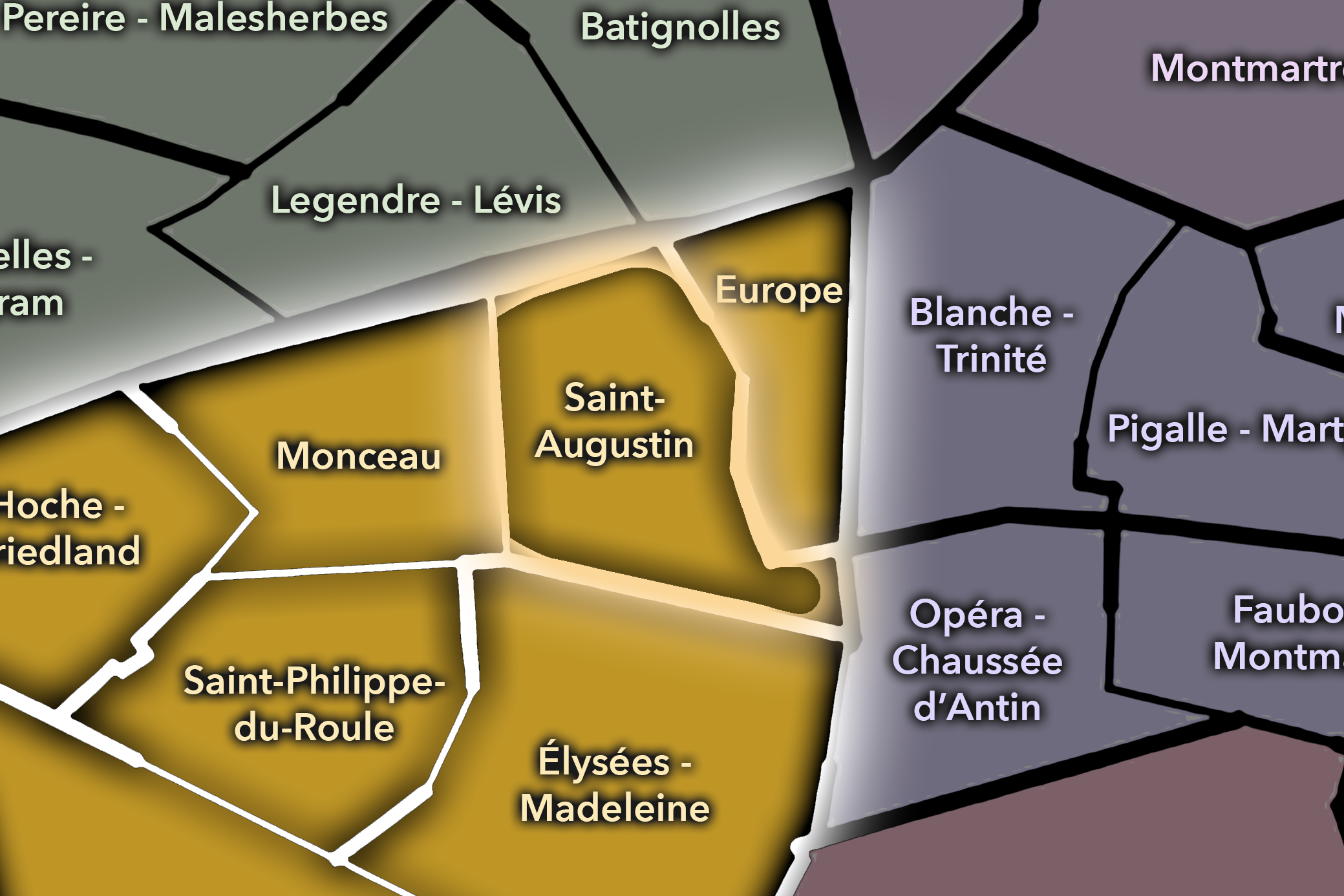
The Saint-Augustin Conseil de Quartier gives civic shape to the eastern-central 8e around the church of Saint-Augustin, the mairie area, Boulevard Malesherbes, Boulevard Haussmann, and the approaches to Gare Saint-Lazare and Madeleine. Its geography is strongly urban and institutional: offices, hotels, schools, churches, broad avenues, residential side streets, transit movement, and major commercial corridors all meet within a compact central district. The Mairie du 8e maintains Saint-Augustin as one of the arrondissement’s current Conseils de Quartier, replacing the older “Mairie” wording that sometimes appears in page slugs or older lists.
On the ground, Saint-Augustin feels like a working civic center rather than a purely visitor-facing district. It is formal and busy, with weekday office movement, mairie functions, church and school activity, hotel use, and the constant pull of Saint-Lazare, Haussmann, and Madeleine nearby. Its civic themes center on pedestrian comfort, traffic around major intersections, station-adjacent circulation, public-space improvements near Saint-Augustin, access to local services, and the challenge of sustaining neighborhood life inside a district heavily shaped by offices, institutions, and transit. The mairie’s own project materials include work around the parvis Saint-Augustin, which underscores how public-space management is a practical local concern here.
Saint-Augustin: At a Glance
A curated list for you.
-
Major Streets
Boulevard Malesherbes
Boulevard Haussmann
Rue de la Boétie
Rue de Rome
Rue de Laborde
-
Public Spaces & Landmarks
Église Saint-Augustin
Mairie du 8e arrondissement
Place Saint-Augustin
Square Marcel-Pagnol
Gare Saint-Lazare nearby
-
Transit Access
Saint-Augustin
Miromesnil
Saint-Lazare
Europe nearby
Madeleine nearby
-
Shopping & Dining
Boulevard Haussmann shopping corridor
Rue de la Boétie cafés and restaurants
Saint-Lazare dining and shopping concourse
Mollard nearby
Lazare Paris nearby
-
Hotels & Attractions
Église Saint-Augustin visitor anchor
Mairie du 8e civic district
Saint-Lazare arrival district
Boulevard Haussmann department stores nearby
Madeleine / Opéra approach corridor
Saint-Philippe du Roule
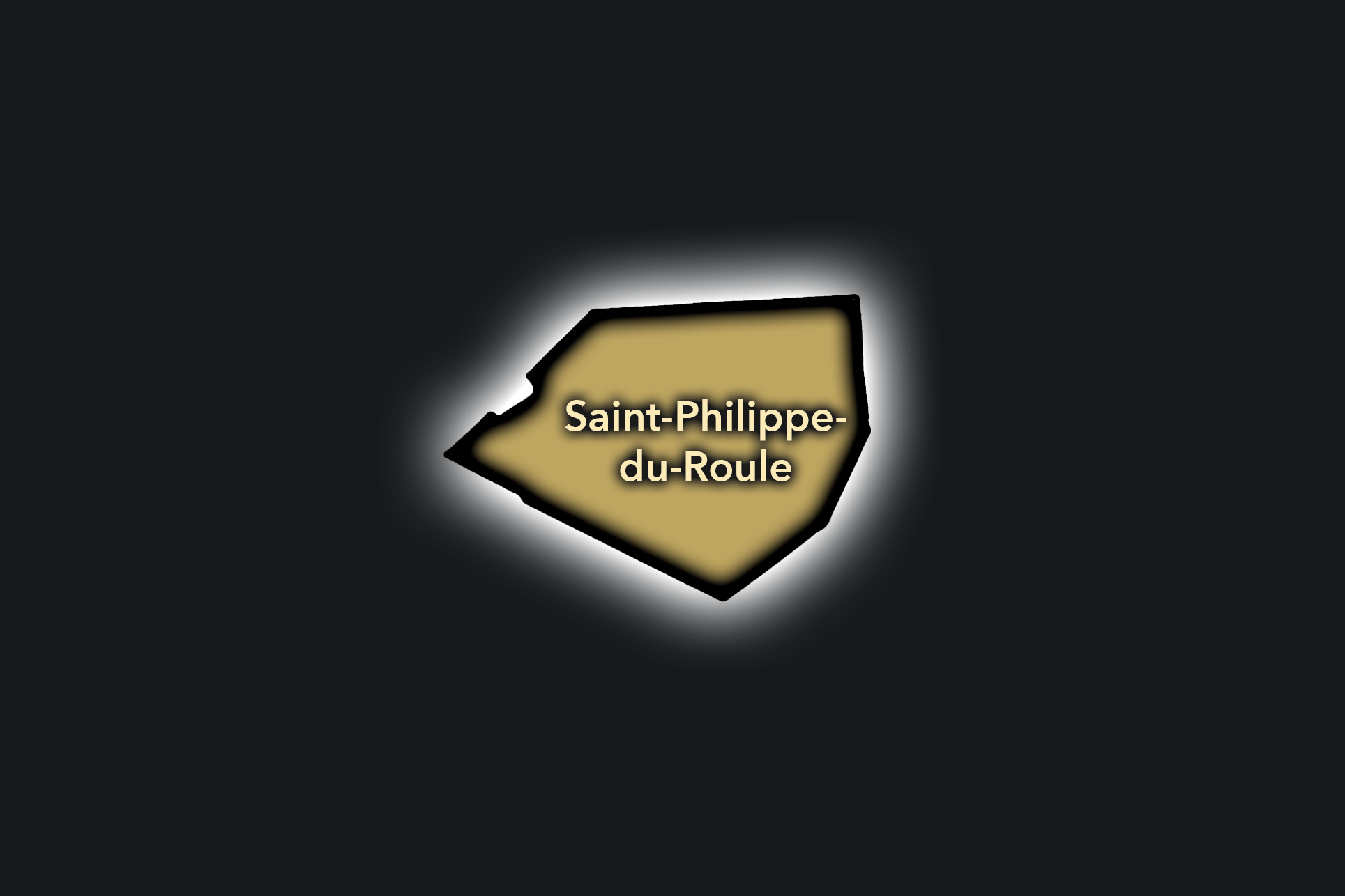
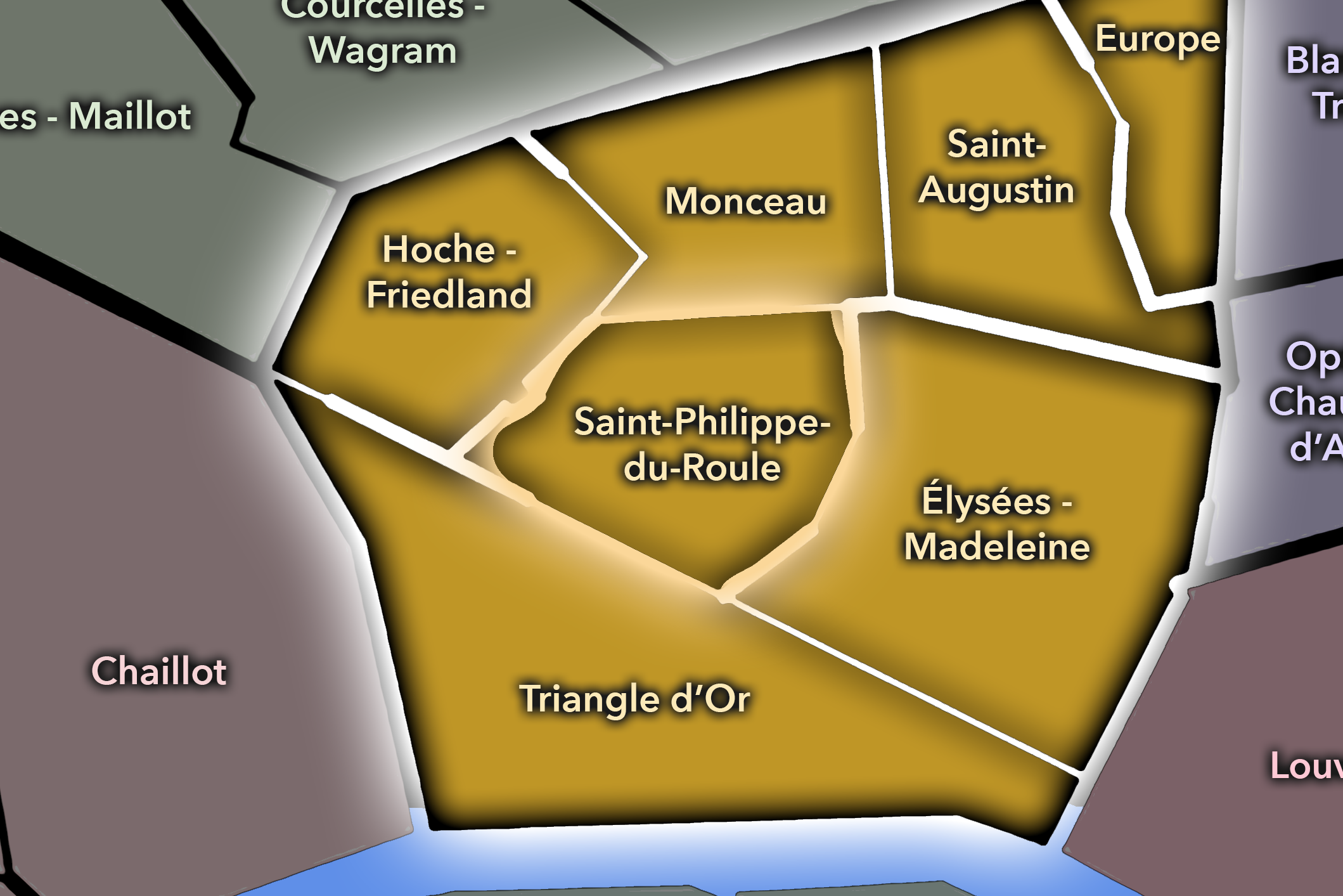
The Saint-Philippe du Roule Conseil de Quartier gives civic form to the central-western 8e between the Champs-Élysées, Rue du Faubourg Saint-Honoré, Rue La Boétie, and the residential-commercial streets around the church of Saint-Philippe-du-Roule. The Mairie du 8e maintains a dedicated council page for Saint-Philippe du Roule, and its listed materials include a presentation concerning the redevelopment of Rue de Ponthieu, underscoring the council’s practical focus on local street conditions.
On the ground, Saint-Philippe du Roule feels like a district of transitions: close to the luxury and visitor intensity of the Champs-Élysées, but also shaped by offices, restaurants, hotels, galleries, schools, apartment buildings, and neighborhood streets. Its civic themes center on commercial vitality, pedestrian comfort, traffic, public-space improvements, office and visitor pressure, and the preservation of livable local streets inside one of Paris’s most high-profile central arrondissements.
Civic Profile
Saint-Philippe du Roule: At a Glance
A curated list for you.
-
Major Streets
Rue du Faubourg Saint-Honoré
Rue La Boétie
Rue de Ponthieu
Rue du Colisée
Avenue Franklin D. Roosevelt
-
Public Spaces & Landmarks
Église Saint-Philippe-du-Roule
Rond-Point des Champs-Élysées nearby
Grand Palais nearby
Petit Palais nearby
Square Jean Perrin nearby
-
Transit Access
Saint-Philippe du Roule
Franklin D. Roosevelt
Miromesnil
Champs-Élysées - Clemenceau nearby
George V nearby
-
Shopping & Dining
Rue du Faubourg Saint-Honoré boutiques
Rue de Ponthieu restaurants
Rue du Colisée dining
Le Clarence
Matignon Paris
-
Hotels & Attractions
Champs-Élysées access
Grand Palais / Petit Palais route
Faubourg Saint-Honoré visitor corridor
Élysée / Madeleine nearby
8e luxury hotel district nearby
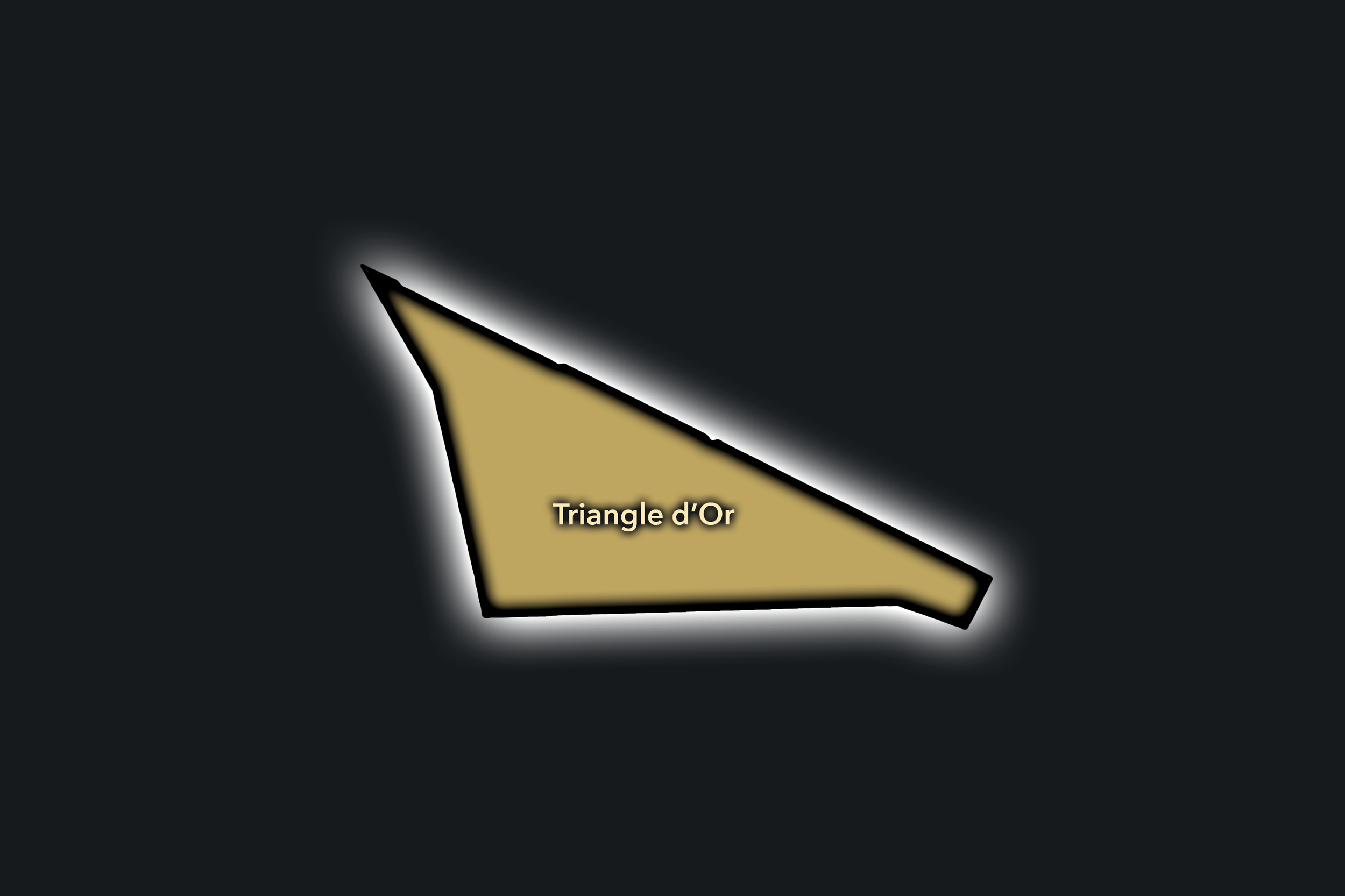
Triangle d’Or
Civic Profile
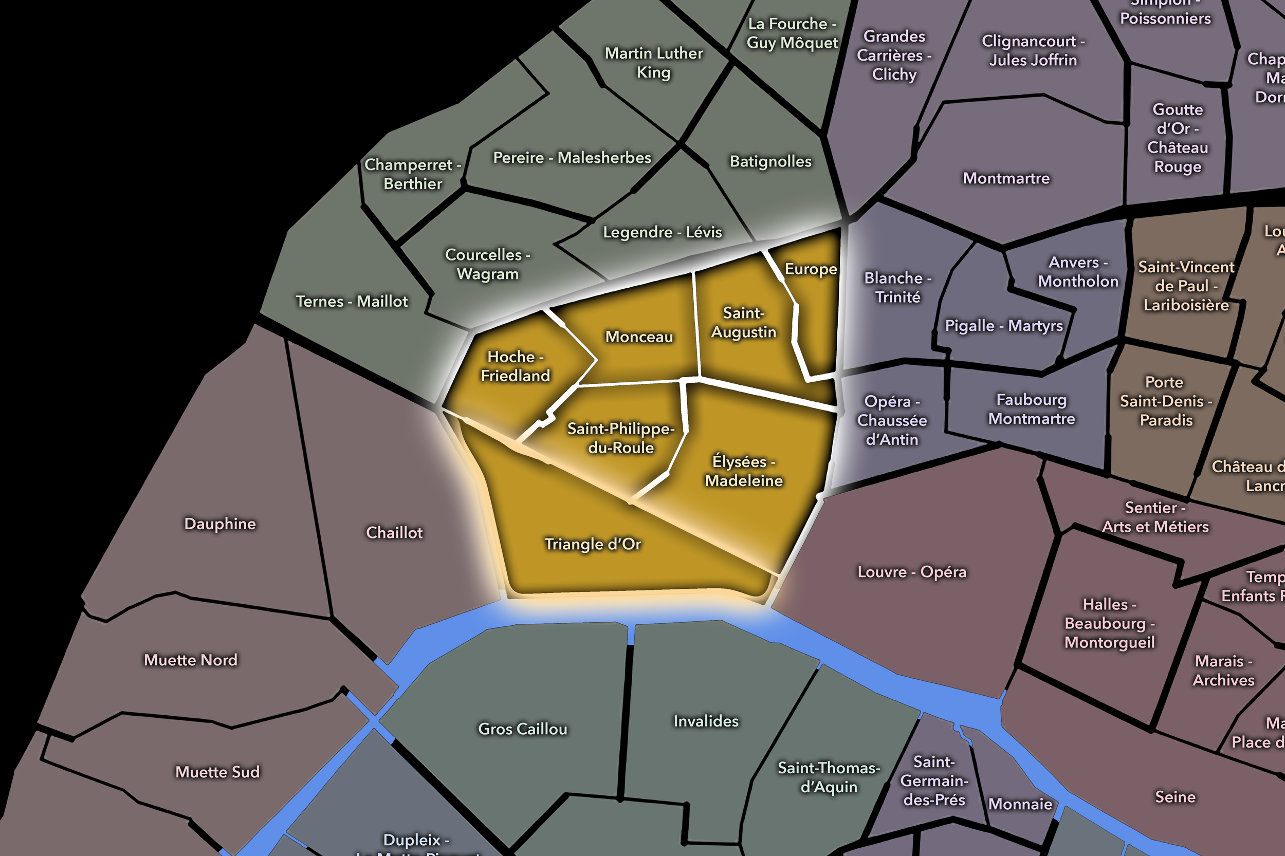
The Triangle d’Or Conseil de Quartier gives civic shape to one of the 8e’s most globally recognized urban landscapes, centered on the luxury triangle formed by Avenue Montaigne, Avenue George V, and the Champs-Élysées. The 8e mairie maintains a dedicated council page for Triangle d’Or, and the City of Paris has included the area in its “Embellir votre quartier” process, confirming its role as a practical local public-space territory as well as a symbol of luxury Paris.
On the ground, Triangle d’Or feels polished, international, and highly managed. Fashion houses, hotels, offices, embassies, restaurants, theaters, galleries, and visitor routes create a district where commercial prestige and public-space pressure are inseparable. Its civic themes are unusually sharp: pedestrian circulation, security, luxury retail activity, hotel and event traffic, residential decline, street-level vacancy, and the challenge of preserving local life in a district often experienced as an international destination more than a neighborhood. Recent reporting on the 8e has noted the arrondissement’s long-term loss of residents and the pressures affecting the Triangle d’Or in particular.
Triangle d’Or: At a Glance
A curated list for you.
-
Major Streets
Avenue Montaigne
Avenue George V
Avenue des Champs-Élysées
Rue François 1er
Rue Marbeuf
-
Public Spaces & Landmarks
Théâtre des Champs-Élysées
Plaza Athénée facade / Avenue Montaigne
Rond-Point des Champs-Élysées nearby
Seine / Pont de l’Alma nearby
Crazy Horse Paris nearby
-
Transit Access
Alma - Marceau
George V
Franklin D. Roosevelt
Champs-Élysées - Clemenceau nearby
Charles de Gaulle - Étoile nearby
-
Shopping & Dining
Avenue Montaigne luxury houses
Champs-Élysées flagship stores
Avenue George V dining and hotels
L’Avenue
Le Relais Plaza
-
Hotels & Attractions
Hôtel Plaza Athénée
Four Seasons Hotel George V
Prince de Galles
Théâtre des Champs-Élysées
Champs-Élysées / Golden Triangle visitor route
Neighborhood Connections
Every Conseil de Quartier belongs to a wider Parisian fabric.
-
8e — Élysée
-
Champs-Élysées
-
Europe
-
Faubourg-du-Roule
-
Madeleine
The Photography
Visual Identity

The arrondissements do not share a single visual identity. Instead, they organize Paris into twenty broad visual fields, each gathering its own combination of landmarks, streetscapes, institutions, residential districts, commercial corridors, parks, rail stations, markets, cemeteries, and riverfront edges.
Some arrondissements are defined by monumental scale: royal palaces, ceremonial avenues, government buildings, museums, formal gardens, and internationally recognized landmarks. Others are shaped by hills, canals, rail gateways, apartment-lined boulevards, neighborhood markets, former village streets, industrial remnants, parks, or the quieter rhythms of residential Paris. The arrondissement system gives these varied landscapes a civic frame, allowing the city to be read not as one visual language, but as a sequence of overlapping Parisian atmospheres.
Through The Lens

Photographing the arrondissements means moving between the official map and the street-level experience. The camera does not treat each arrondissement as visually uniform. Instead, it looks for the recurring forms, textures, transitions, and contrasts that make each district legible: the geometry of boulevards, the shade of plane trees, the repetition of balconies, the rise of stairways, the curve of canals, the presence of rail stations, the opening of parks, the weight of monuments, and the intimacy of side streets.
On CityNeighborhoods, the arrondissement provides the frame, but the photograph comes from the encounter between map, movement, light, and observation. As the Paris photography is processed, this section will connect each arrondissement more directly to the project’s Photographic Lexicon: the visual strategies, recurring motifs, and compositional patterns that shape how the city is seen through the lens.
If you visit Paris, these ideas can help inspire your own photography.



Paris: J’Espere, Je Rêve, Je Vive
Paris Photo Gallery
Paris Field Notes
-
Field Note: August 18, 2025 | 07:58 AM
Conditions: 73°F | Humidity: 72%.
Within the park's interior, the glacial kettle ponds acted as humidity traps, creating a soft, hazy light that filtered through the old-growth oaks. The transition from the park's dense shade to the sun-drenched edges of Oakland Gardens highlighted the day's exceptional "picture-perfect" clarity.
There is a fleeting window in Queens where the humidity of August hasn't yet heavy-set, and the morning sun hits the canopy of Alley Pond Park at a perfect oblique angle. Arriving just before 8:00 AM, I watched the light break through the oaks and tulip trees, casting long, dramatic shadows across the wet grass. It’s in these quiet, golden moments that the park feels less like a city escape and more like the ancient glacial valley it actually is.
Other neighborhoods visited:











































































































Explore Paris
-

The twenty arrondissements form the civic spiral of Paris, organizing the city into its broad local districts of government, identity, and daily life.
-

Each arrondissement is divided into four official administrative quarters, giving Paris a more precise civic and geographic framework.
-

The conseils de quartier bring participation to street level, giving residents a voice in neighborhood needs, public space, and local civic life.
-

Les Deux Rives trace Paris through the Seine’s two banks, revealing how the Rive Droite and Rive Gauche shaped the city’s civic power, commerce, learning, art, and cultural identity.
-

Cultural neighborhoods reveal the Paris people recognize through history, cafés, architecture, memory, atmosphere, and local belonging.