
PARIS CENTRE
Les Conseils de Quartier
Explore This Page


Explore Paris Centre’s Conseils de Quartier

Overview
Download the Paris Conseil de Quartier Map
Geographic Setting
The Conseils de Quartier of Paris Centre organize local civic life across the historic core of the capital. Formed from the merged civic sector of the former 1st, 2nd, 3rd, and 4th arrondissements, Paris Centre stretches from the Louvre and Palais-Royal to the Marais, from the Grands Boulevards and Sentier to the Seine, the Île de la Cité, and the Île Saint-Louis. It is one of the densest and most layered parts of Paris: royal, commercial, residential, institutional, religious, cultural, and riverine all at once.
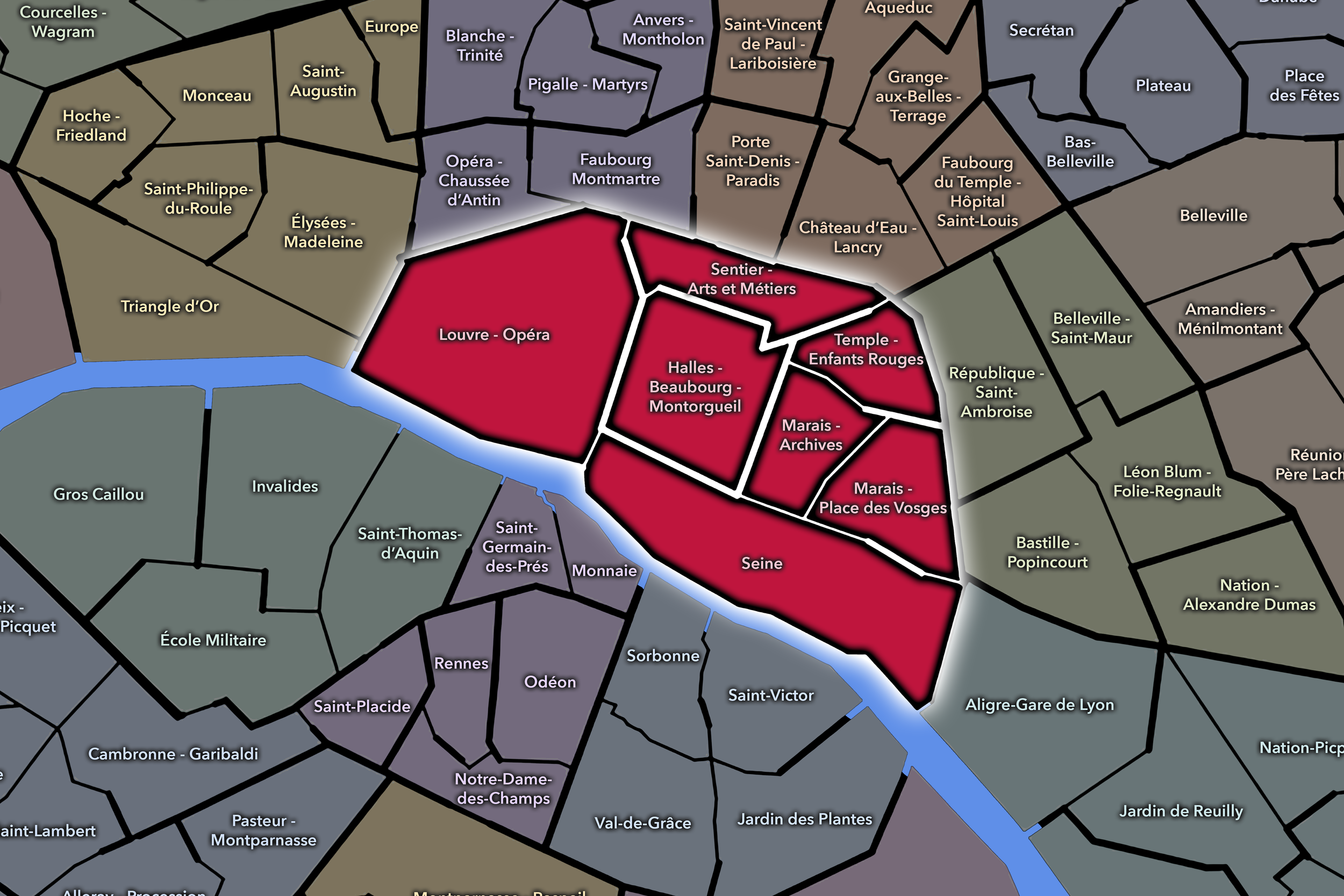
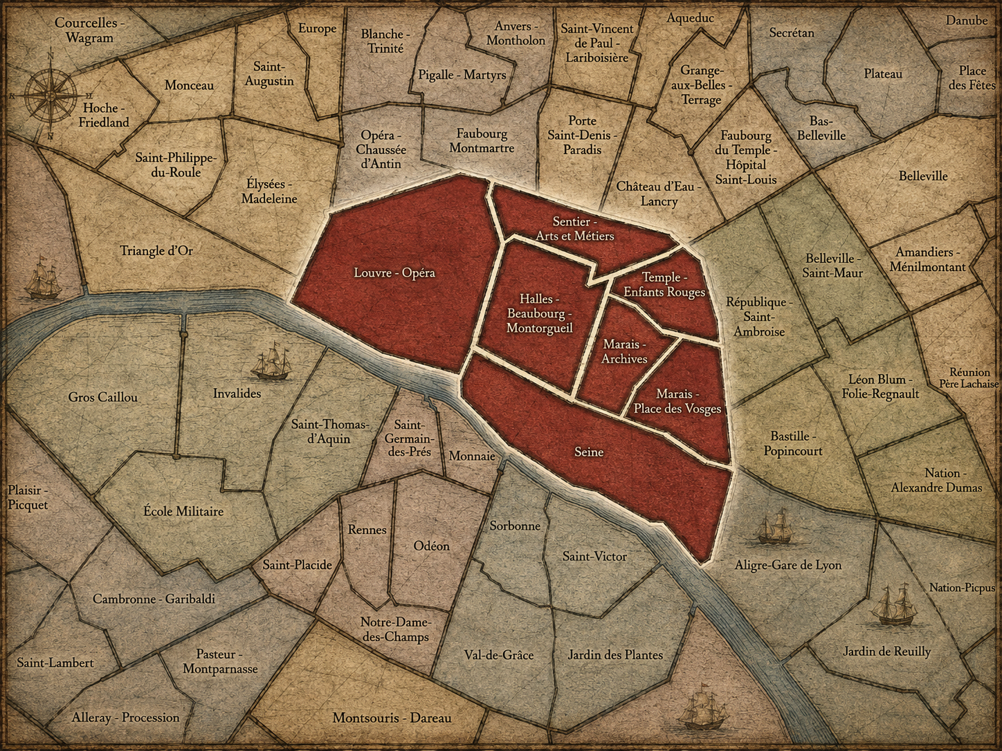
Its seven Conseils de Quartier divide this central landscape into smaller civic territories: Louvre - Opéra; Sentier - Arts et Métiers; Temple - Enfants Rouges; Halles - Beaubourg - Montorgueil; Marais - Archives; Marais - Place des Vosges; and Seine. The Mairie de Paris Centre presents these seven councils as the local neighborhood framework for the sector, with each one attached to a more precise geography within the wider central district.
Geographically, this CdQ family reveals Paris Centre as more than a single historic core. It is a constellation of local environments: museum corridors, market streets, covered passages, administrative buildings, dense residential blocks, river islands, monumental squares, commercial spines, and visitor-heavy public spaces. The Seine gives the sector its defining east-west axis, while the council territories help break the center into smaller places that can be understood, navigated, and discussed at a local scale.
Civic Framework
The Conseils de Quartier of Paris Centre serve as the sector’s neighborhood-level framework for civic participation. They provide a more local scale than Paris Centre as a whole, allowing residents, associations, workers, business owners, cultural institutions, and neighborhood users to engage with the public life of specific areas. In a district where tourism, commerce, heritage, transit, residential life, public space, and major institutions constantly overlap, this smaller civic scale is especially important.
The structure of Paris Centre’s CdQs also reflects the complexity created by the merger of the former 1st, 2nd, 3rd, and 4th arrondissements. Rather than simply preserving those older arrondissement divisions, the seven councils reorganize the central sector around more localized civic geographies. Some councils correspond to strongly recognizable place clusters, such as Louvre - Opéra, Halles - Beaubourg - Montorgueil, or the two Marais councils. Others, like Seine, gather the riverfront and island geography into a distinct civic frame. The result is a CdQ structure that does not merely repeat the older administrative map, but helps translate the historic center into a contemporary system of local participation.
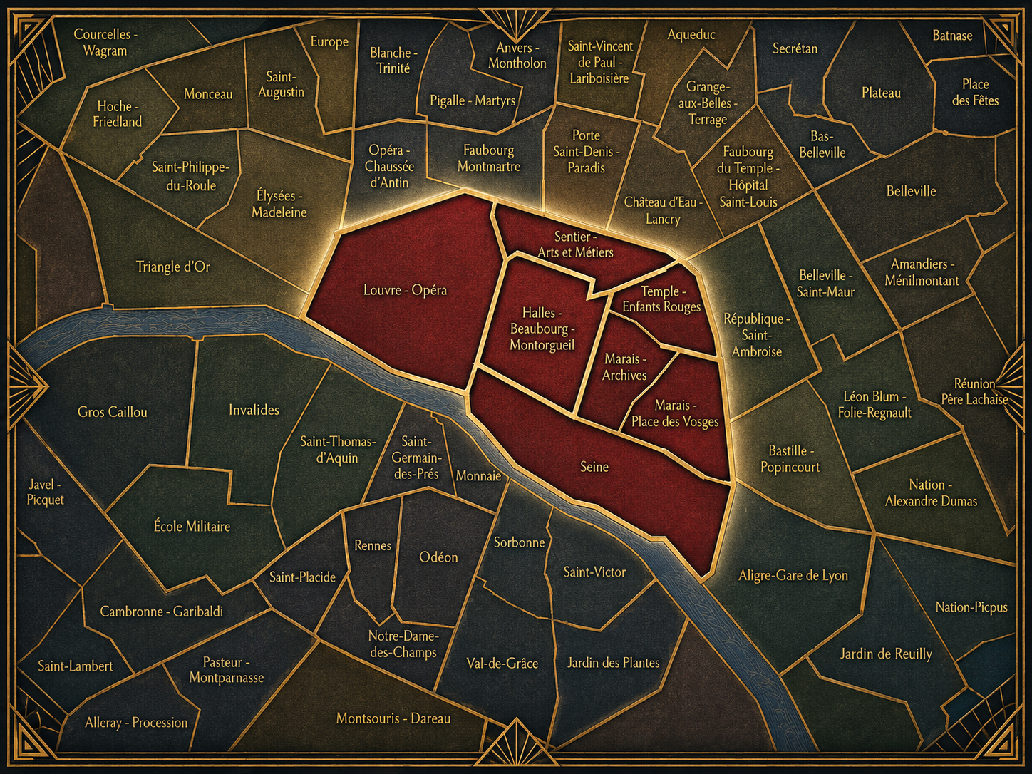
Viewed through its Conseils de Quartier, Paris Centre becomes less a single “heart of Paris” than a set of highly distinct local worlds. Louvre - Opéra expresses the ceremonial and cultural city; Sentier - Arts et Métiers carries the memory of workshops, commerce, and innovation; Temple - Enfants Rouges and the Marais councils reveal residential streets, markets, heritage buildings, museums, and neighborhood associations; Halles - Beaubourg - Montorgueil gathers some of the city’s most intense pedestrian, commercial, cultural, and transit activity; Seine gives civic shape to the river, the islands, and the public spaces that bind the center together.
This local expression matters because Paris Centre is often seen from the outside as a place of monuments, museums, shopping, and tourism. The Conseils de Quartier reveal something smaller and more practical: the lived central city. They make visible the streets where residents manage daily routines, the squares where public space is negotiated, the markets and commercial corridors that structure local movement, and the civic concerns that emerge when the oldest and most visited parts of Paris must also remain habitable neighborhoods.
Local Expression
Les Conseils de Quartier
Halles - Beaubourg - Montorgueil
Civic Profile
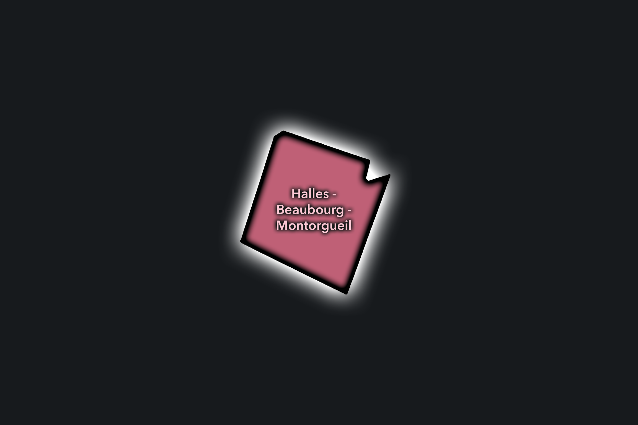
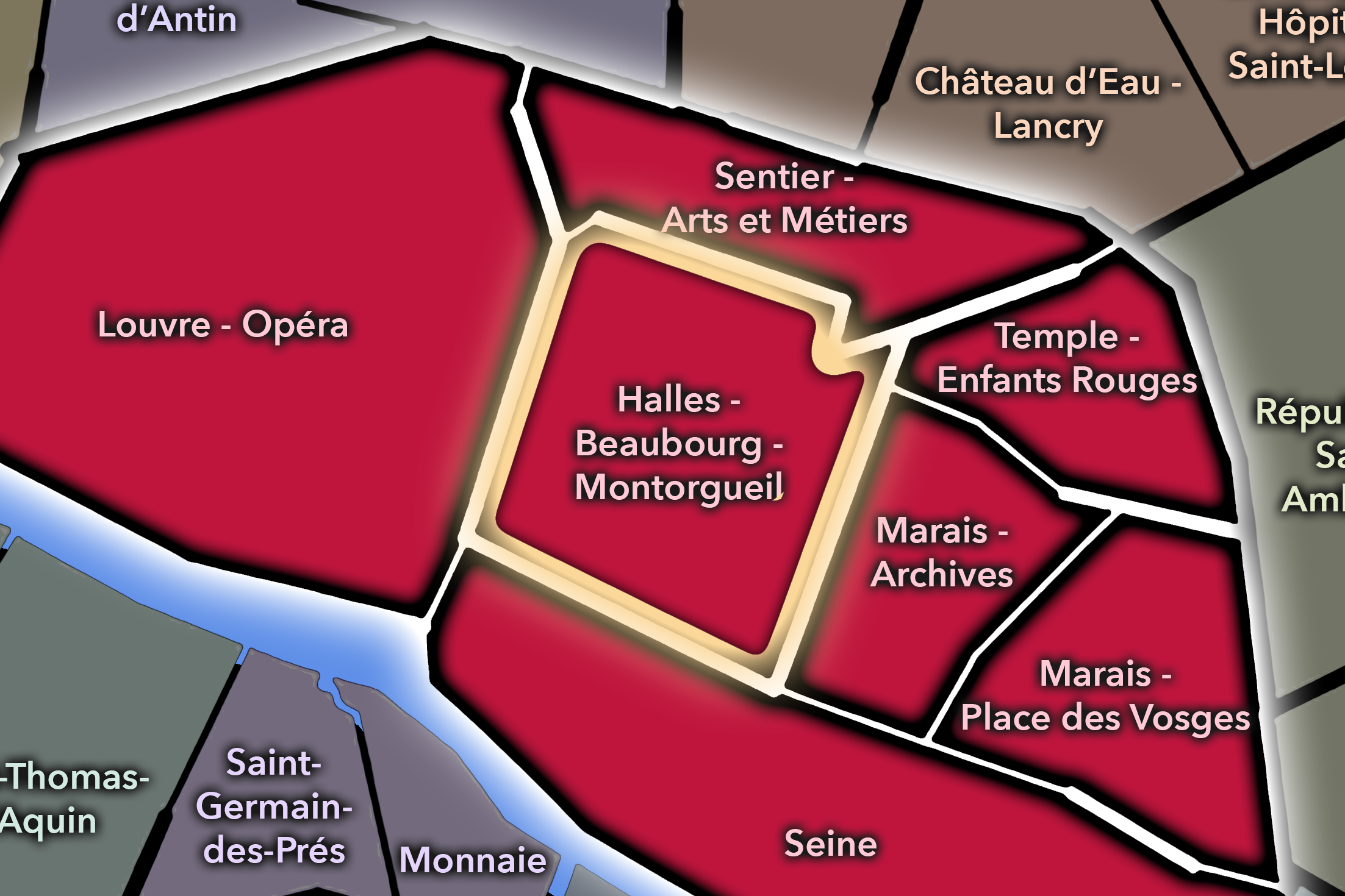
The Halles - Beaubourg - Montorgueil Conseil de Quartier is one of Paris Centre’s most active civic territories, organized around the meeting of market memory, commercial streets, cultural institutions, pedestrian movement, and major transit. Its official boundaries run roughly from the Renard/Beaubourg axis in the east to Rue du Louvre in the west, and from the Turbigo/Saint-Martin/Réaumur/Aboukir axis in the north to Rue de Rivoli in the south. Within that compact frame, the CdQ brings together Les Halles, Beaubourg, and Montorgueil as a central civic geography shaped by circulation, commerce, culture, and public space.
On the ground, Halles - Beaubourg - Montorgueil feels energetic, compressed, and constantly in motion. Les Halles carries the legacy of the city’s former central market into a contemporary landscape of shopping, transit, and pedestrian flow; Beaubourg gathers cultural life around the Centre Pompidou, even as the building moves through its long renovation period; and Rue Montorgueil preserves one of central Paris’s strongest market-street identities through food shops, cafés, restaurants, and everyday foot traffic. As a CdQ, its civic themes are practical and immediate: managing dense movement, maintaining public space, balancing resident life with visitor pressure, and keeping one of the city’s busiest central districts usable at the human scale.
Halles - Beaubourg - Montorgueil: At a Glance
A curated list for you.
-

Major Streets
Rue Montorgueil
Rue Rambuteau
Rue Étienne Marcel
Rue de Turbigo
Rue Saint-Martin
-

Public Spaces & Landmarks
Centre Pompidou
Forum des Halles / Canopée des Halles
Église Saint-Eustache
Place Joachim-du-Bellay
Fontaine des Innocents
-

Transit Access
Châtelet - Les Halles
Étienne Marcel
Rambuteau
Réaumur - Sébastopol
Les Halles
-

Shopping & Dining
Rue Montorgueil market street
Stohrer
Au Rocher de Cancale
G. Detou
Café Beaubourg
-

Hotels & Attractions
Centre Pompidou / Beaubourg cultural district
Les Halles visitor and shopping district
Rue Montorgueil food corridor
Saint-Eustache and historic market district
Châtelet - Les Halles central access hub
Louvre - Opéra
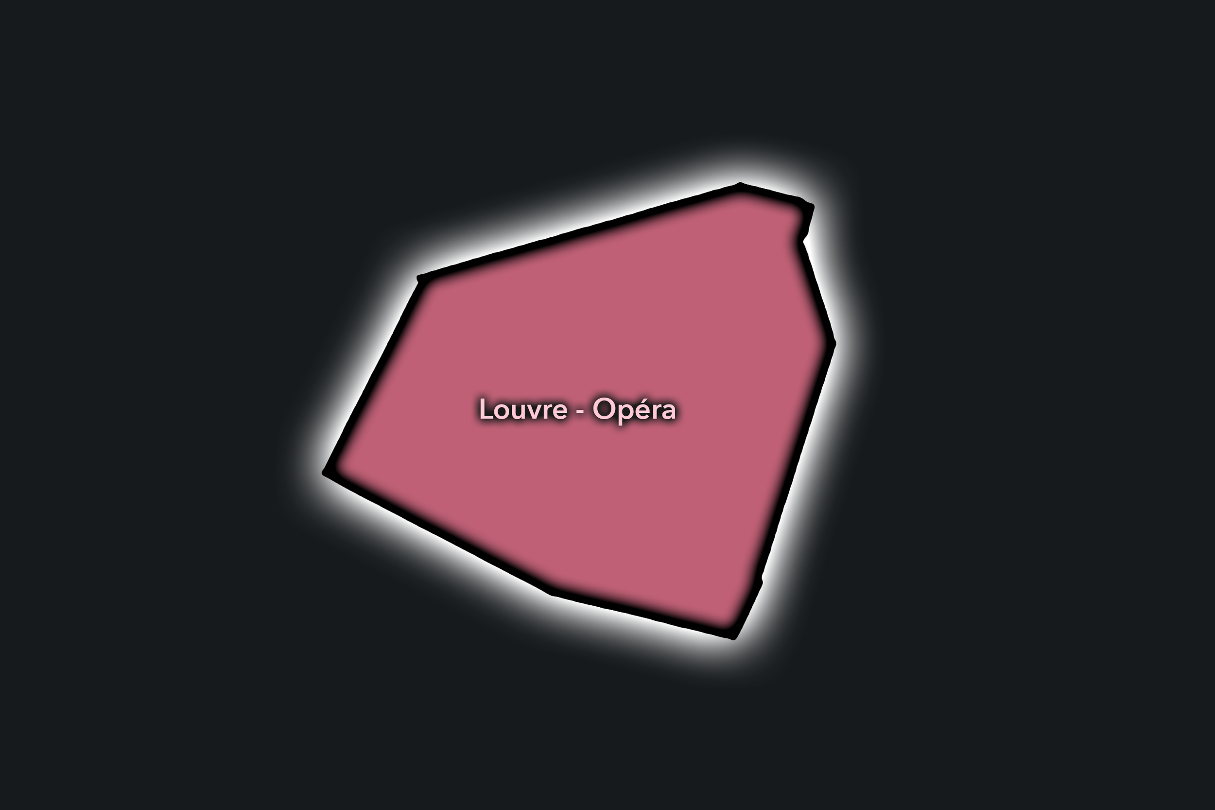
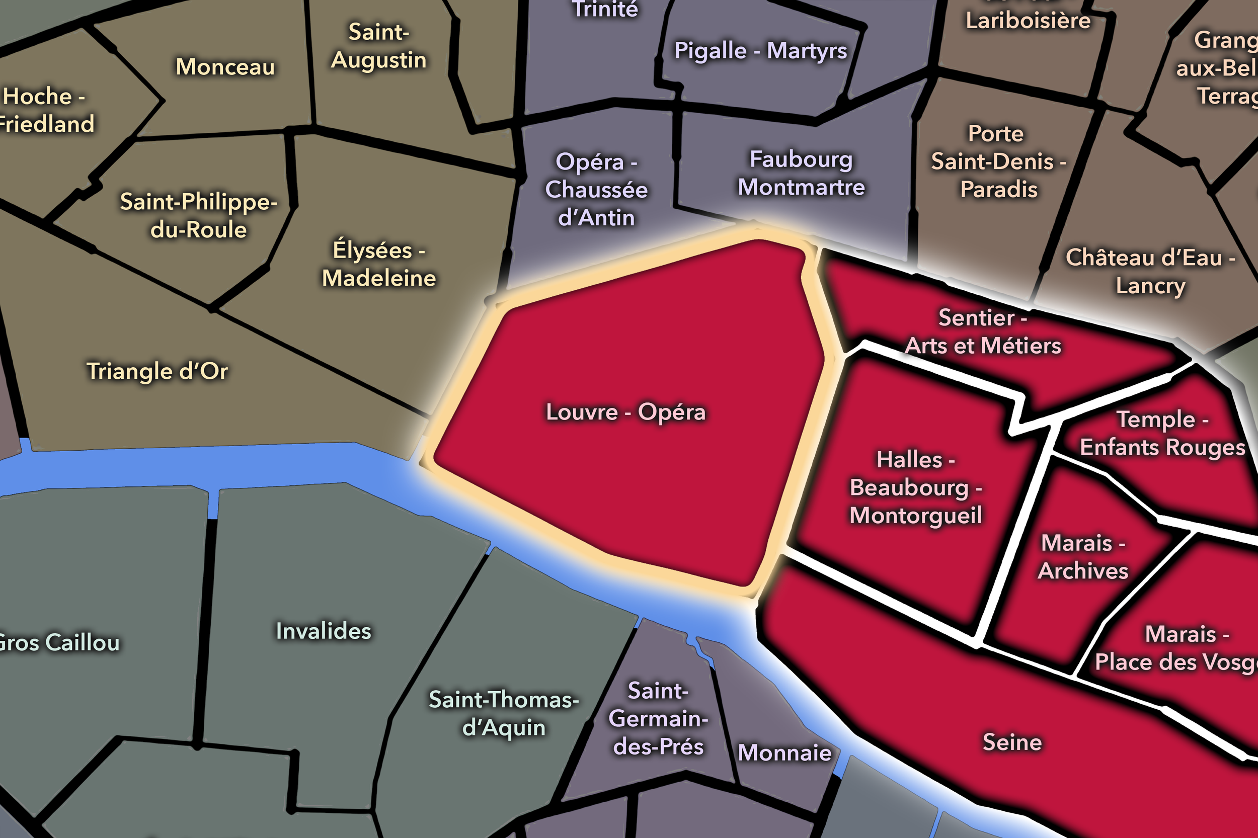
The Louvre - Opéra Conseil de Quartier is one of Paris Centre’s most internationally visible civic territories, bringing together the monumental landscape around the Louvre and Palais-Royal with the commercial and institutional corridors leading toward the Opéra district. Its local geography is shaped by the overlap of museum Paris, office Paris, shopping Paris, visitor Paris, and the remaining residential textures of the historic center. As a CdQ, it gives civic form to a district where public space, cultural access, pedestrian circulation, hotel and office activity, and tourism pressure all meet within a compact central area.
On the ground, Louvre - Opéra feels more metropolitan than domestic, moving between arcaded passages, formal squares, department-store approaches, restaurants, offices, hotels, and the dense pedestrian flows surrounding the Louvre. Yet quieter Parisian textures remain visible in the side streets near Palais-Royal, the covered galleries, small cafés, office courtyards, and everyday routines of workers, residents, students, visitors, and cultural employees sharing the same central streets. Its civic themes are therefore not simply historical or touristic, but practical: how to maintain local life, public access, commercial vitality, and livable streets in a district known around the world.
Civic Profile
Louvre - Opéra: At a Glance
A curated list for you.
-
Major Streets
Rue de Rivoli
Avenue de l’Opéra
Rue Saint-Honoré
Rue de Richelieu
Rue Sainte-Anne
-
Public Spaces & Landmarks
Musée du Louvre
Palais-Royal
Jardin du Palais-Royal
Comédie-Française
Place Vendôme
-
Transit Access
Palais Royal - Musée du Louvre
Louvre - Rivoli
Pyramides
Tuileries
Opéra
-
Shopping & Dining
Le Grand Véfour, Palais-Royal
Brasserie du Louvre, Place André Malraux
Café Palais Royal and Café Ruc
Rue Sainte-Anne Japanese/Korean dining
Rue Saint-Honoré shopping corridor
-
Hotels & Attractions
Louvre visitor corridor
Palais-Royal visitor circuit
Opéra approach corridor
Place Vendôme hotel district
Hôtel du Louvre / historic Louvre-facing hotel corridor
Marais - Archives
Civic Profile
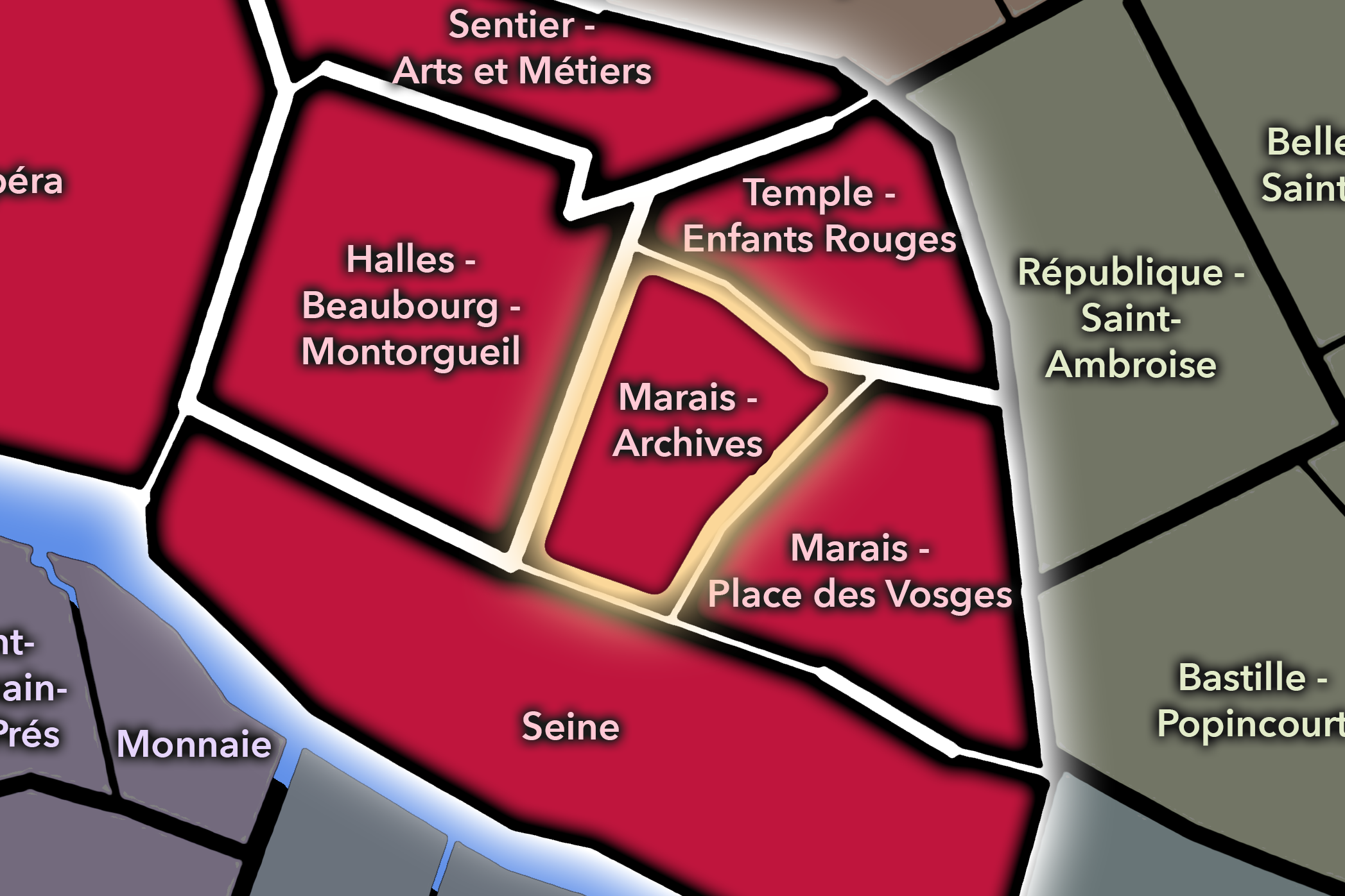
The Marais - Archives Conseil de Quartier sits in the western-central portion of the Marais, framed by Rue Vieille du Temple to the east, the Beaubourg/Renard axis to the west, the Poitou/Pastourelle/Gravilliers axis to the north, and Rue de Rivoli to the south. As a civic territory, it gathers one of Paris Centre’s densest mixtures of heritage streets, residential blocks, museums, archives, galleries, shops, schools, and public-space pressures into a compact local frame. Its civic geography is shaped by the overlap of historic preservation, everyday neighborhood life, cultural visitation, LGBTQ+ visibility, commercial activity, and the practical management of narrow streets in one of the city’s most closely watched central districts.
On the ground, Marais - Archives feels layered, walkable, and intensely textured: hôtels particuliers, courtyard museums, fashion streets, small cafés, galleries, religious and civic landmarks, and quieter residential passages sit beside some of the most active visitor routes in the Marais. The district’s civic themes are therefore less about a single monument than about balance: keeping local streets livable while maintaining access to cultural institutions, preserving historic fabric while supporting contemporary commerce, and allowing the Marais to remain both a neighborhood of daily routines and one of Paris’s most recognizable urban landscapes.
Marais - Archives: At a Glance
A curated list for you.
-
Major Streets
Rue des Archives
Rue Vieille du Temple
Rue des Francs-Bourgeois
Rue des Quatre-Fils
Rue de Rivoli
-
Public Spaces & Landmarks
Archives nationales / Hôtel de Soubise
Musée Carnavalet
Musée Cognacq-Jay
Musée Picasso Paris
Église Notre-Dame-des-Blancs-Manteaux
-
Transit Access
Hôtel de Ville
Rambuteau
Saint-Paul
Arts et Métiers
Châtelet nearby for broader central access
-
Shopping & Dining
Rue des Francs-Bourgeois shopping corridor
Rue Vieille du Temple cafés and galleries
Rue des Archives boutiques and dining
Breizh Café
-
Hotels & Attractions
Archives nationales visitor route
Marais museum circuit
Rue des Francs-Bourgeois visitor corridor
Hôtel de Soubise courtyard and exhibitions
Carnavalet / Picasso / Cognacq-Jay cultural cluster
Marais - Place Des Vosges
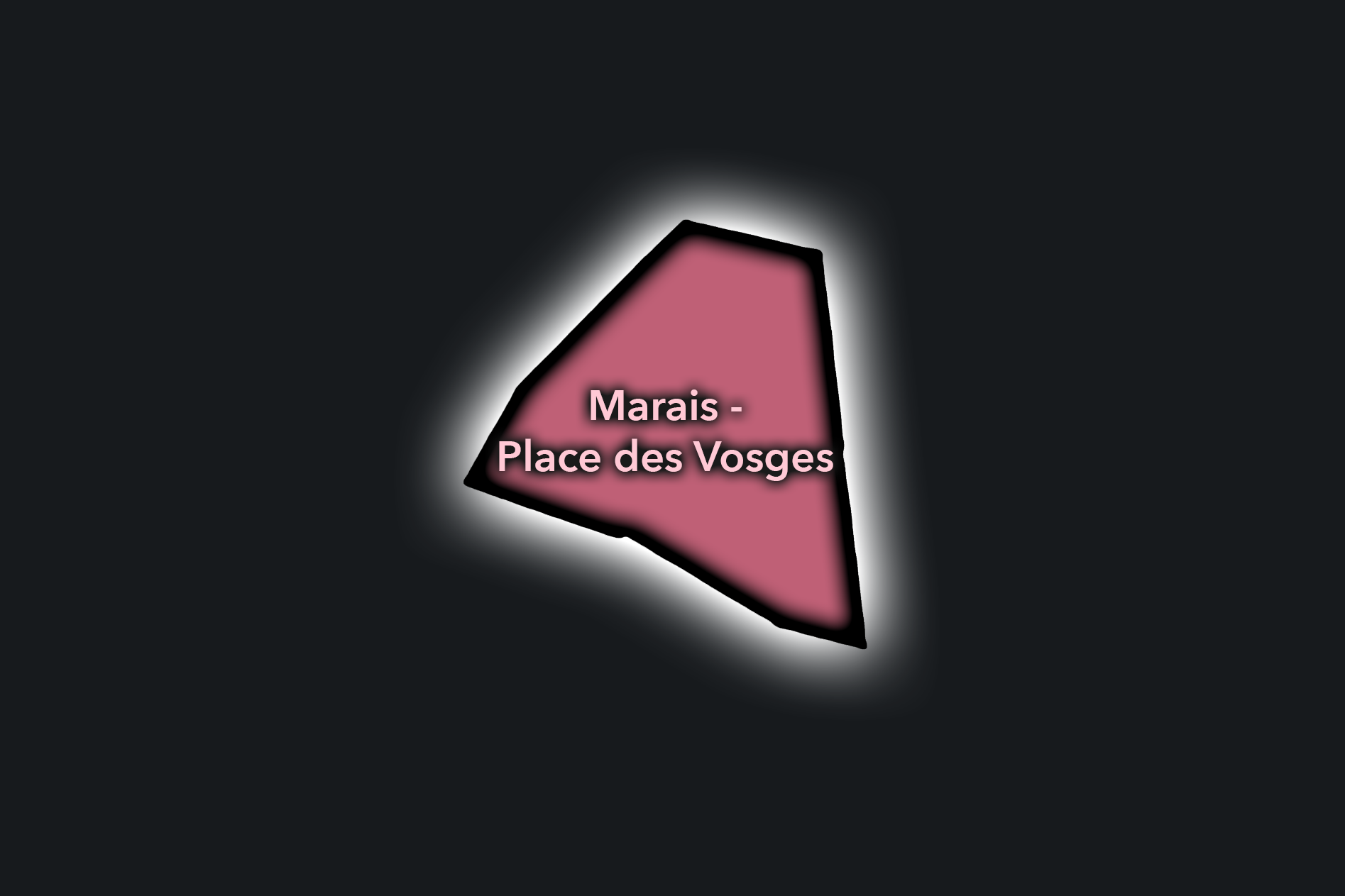
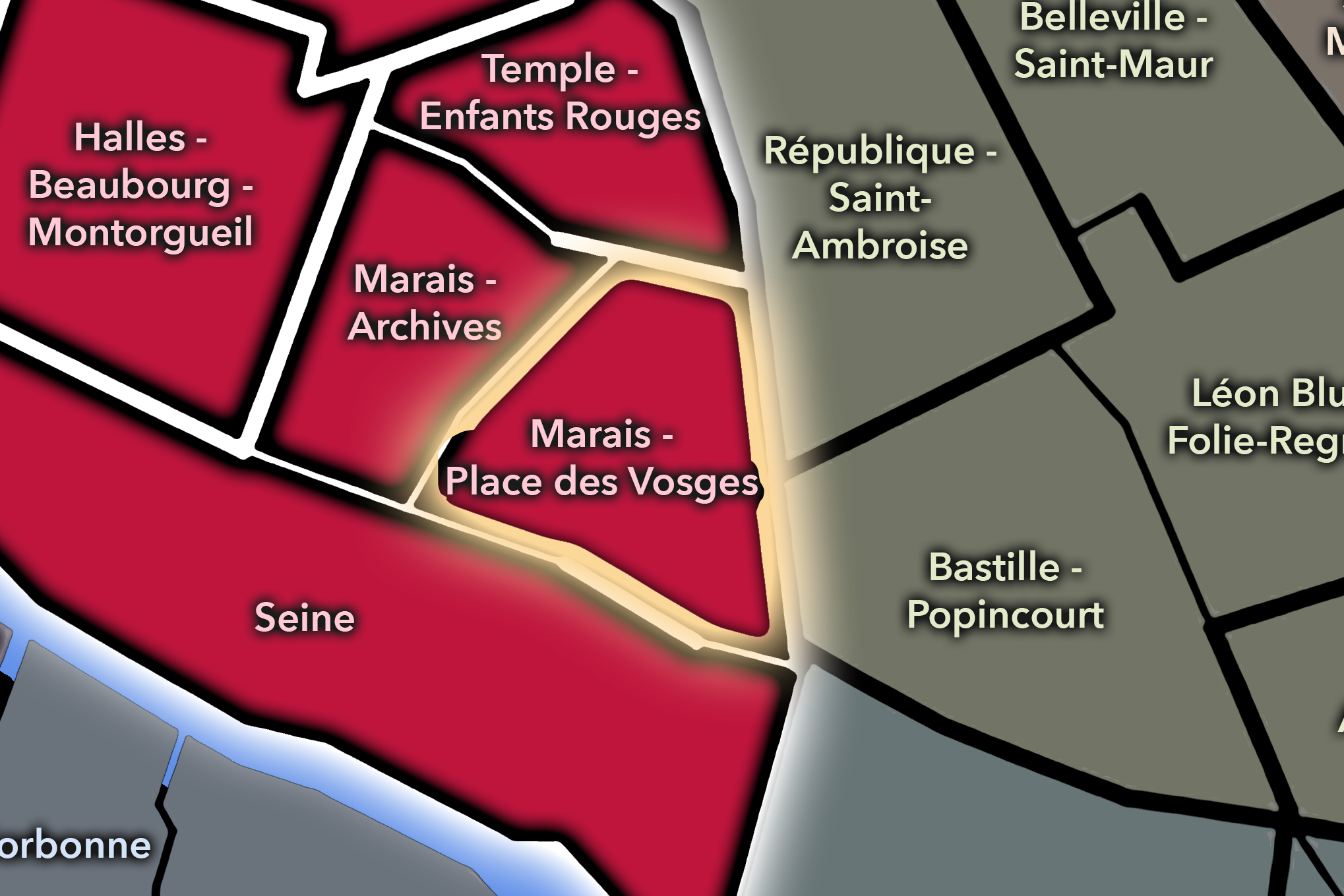
The Marais - Place des Vosges Conseil de Quartier occupies the eastern side of the Marais within Paris Centre, stretching between Boulevard Beaumarchais to the east and Rue Vieille du Temple to the west, with its northern edge around the Pont-aux-Choux / Rue de Poitou axis and its southern edge along the Saint-Antoine / Rivoli axis. As a civic geography, it gathers one of the Marais’s most recognizable historic landscapes into a local participatory frame: Place des Vosges, Rue Saint-Antoine, Village Saint-Paul, small garden squares, museums, residential streets, schools, cafés, shops, and visitor routes all pressed into a compact central district.
On the ground, Marais - Place des Vosges feels elegant, layered, and intensely lived-in. Its civic themes are shaped by the challenge of maintaining local life within a district of exceptional heritage visibility: preserving narrow streets and historic courtyards, managing visitor pressure around Place des Vosges and Rue Saint-Antoine, supporting small public gardens and neighborhood amenities, and balancing residential routines with commerce, culture, and tourism. The council’s own listed activities and investments — from neighborhood walks and local events to benches, bird boxes, tree grates, book boxes, and garden improvements — underscore how this CdQ functions at a very local scale: not only as a historic Marais landscape, but as a network of everyday public spaces and shared civic concerns.
Civic Profile
Place des Vosges: At a Glance
A curated list for you.
-
Major Streets
Rue Saint-Antoine
Rue de Turenne
Rue Vieille du Temple
Rue des Francs-Bourgeois
Boulevard Beaumarchais
-
Public Spaces & Landmarks
Place des Vosges
Hôtel de Sully
Maison de Victor Hugo
Jardin de l’Hôtel-Lamoignon - Mark Ashton
Square Saint-Gilles du Grand Veneur
-
Transit Access
Saint-Paul
Chemin Vert
Bastille
Bréguet - Sabin
Hôtel de Ville
-
Shopping & Dining
Rue Saint-Antoine shops and cafés
Rue des Francs-Bourgeois shopping route
Place des Vosges arcades
Carette Place des Vosges
L’Ange 20
-
Hotels & Attractions
Place des Vosges visitor circuit
Maison de Victor Hugo
Hôtel de Sully passage and courtyard
Village Saint-Paul / antiques and galleries
Pavillon de la Reine hotel anchor
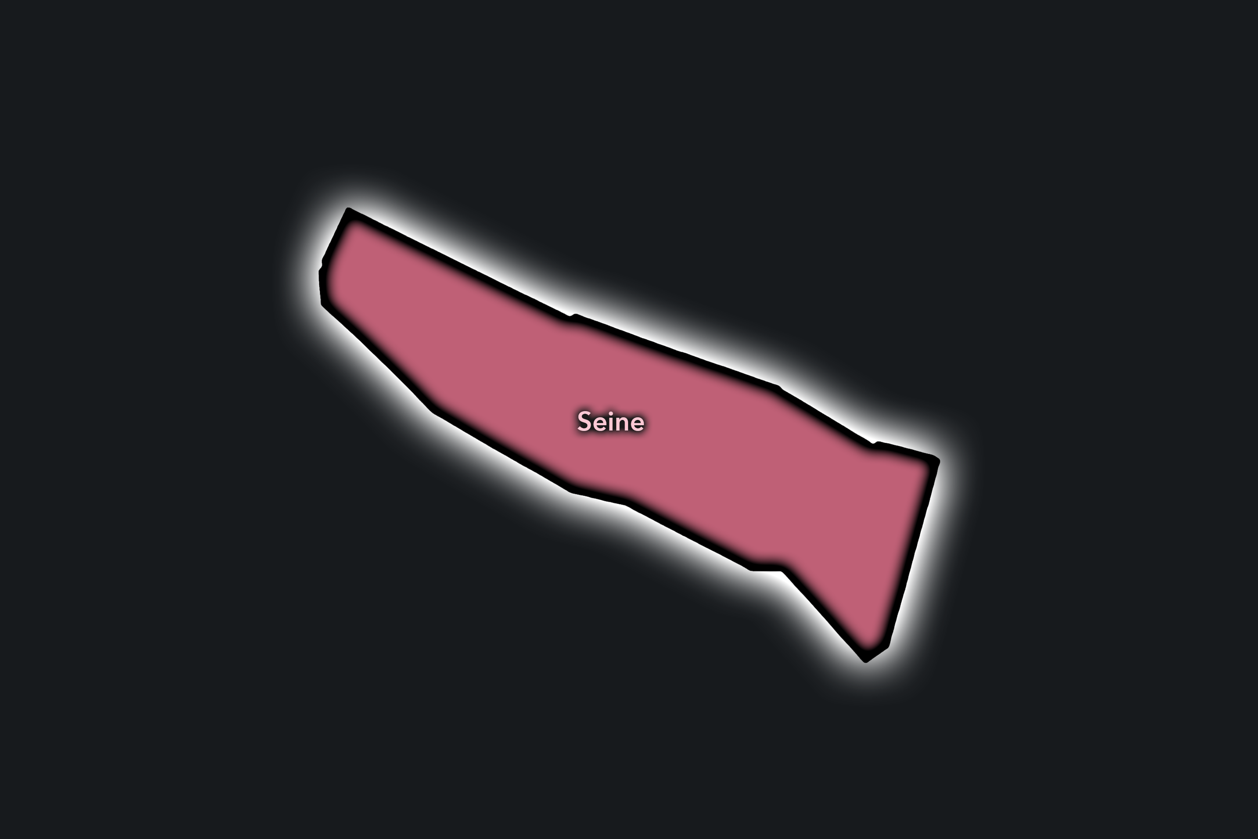
Seine
Civic Profile
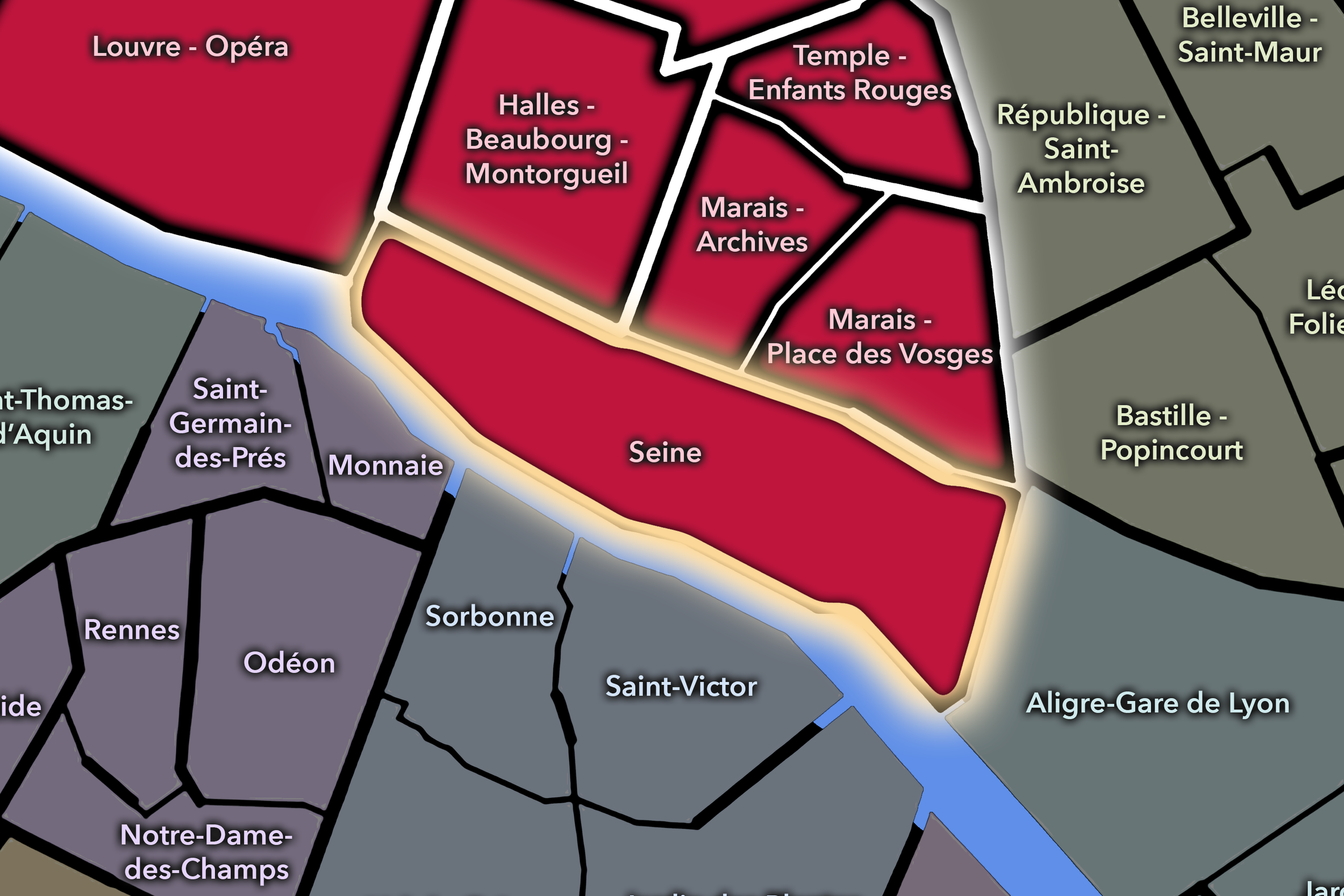
The Seine Conseil de Quartier gives Paris Centre its riverine civic spine, gathering the Seine-facing edges of the central sector together with the Île de la Cité and Île Saint-Louis. The Mairie de Paris Centre defines the sector between Rue de l’Amiral-de-Coligny and Boulevard Bourdon, and between the Rivoli / Saint-Antoine axis to the north and the two central islands to the south. In practice, this makes Seine one of the most symbolically important CdQs in Paris Centre: a civic territory shaped by river crossings, quays, bridges, cathedral space, island streets, major monuments, public gathering places, visitor movement, and the everyday logistics of keeping the historic riverfront usable.
On the ground, Seine feels less like a conventional neighborhood than a chain of thresholds: between Right Bank and Left Bank, island and mainland, monument and street, tourism and local routine. Its civic themes are therefore especially tied to public space and shared access — pedestrian circulation around Notre-Dame, the future of the Île de la Cité, riverfront use, climate and biodiversity planning, cleanliness, wayfinding, and the balance between global visibility and local habitability. The council’s own listed areas of participation include the PLU, Plan Climat, Plan propreté, the surroundings of Notre-Dame, Mission Île de la Cité, and Seine-related civic initiatives, which makes this CdQ one of the clearest examples of how local participation meets citywide symbolic space.
Seine: At a Glance
A curated list for you.
-
Major Streets
Rue de Rivoli
Rue Saint-Antoine
Quai de l’Hôtel de Ville
Quai aux Fleurs
Rue Saint-Louis-en-l’Île
-
Public Spaces & Landmarks
Cathédrale Notre-Dame de Paris
Île de la Cité
Île Saint-Louis
Place Dauphine
Square du Vert-Galant
-
Transit Access
Cité
Saint-Michel - Notre-Dame
Pont Marie
Hôtel de Ville
Châtelet nearby
-
Shopping & Dining
Rue Saint-Louis-en-l’Île
Berthillon
Île Saint-Louis cafés and boutiques
Rue d’Arcole visitor shops and cafés
Quai-side cafés near Hôtel de Ville
-
Hotels & Attractions
Notre-Dame visitor district
Sainte-Chapelle and Conciergerie circuit
Île Saint-Louis visitor route
Seine riverfront and bridge walks
Hôtel de Ville / central river access
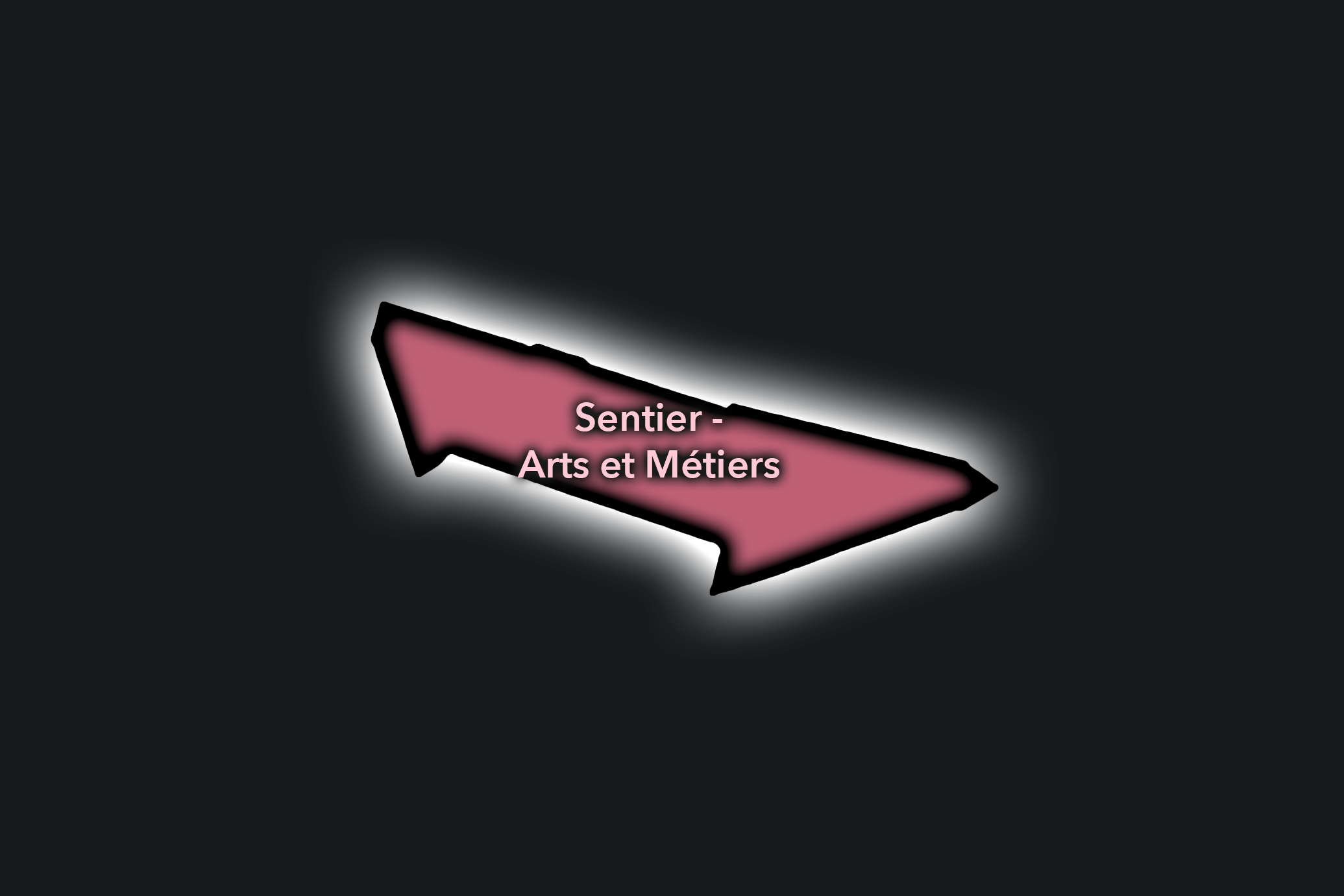
Sentier - Arts et Métiers
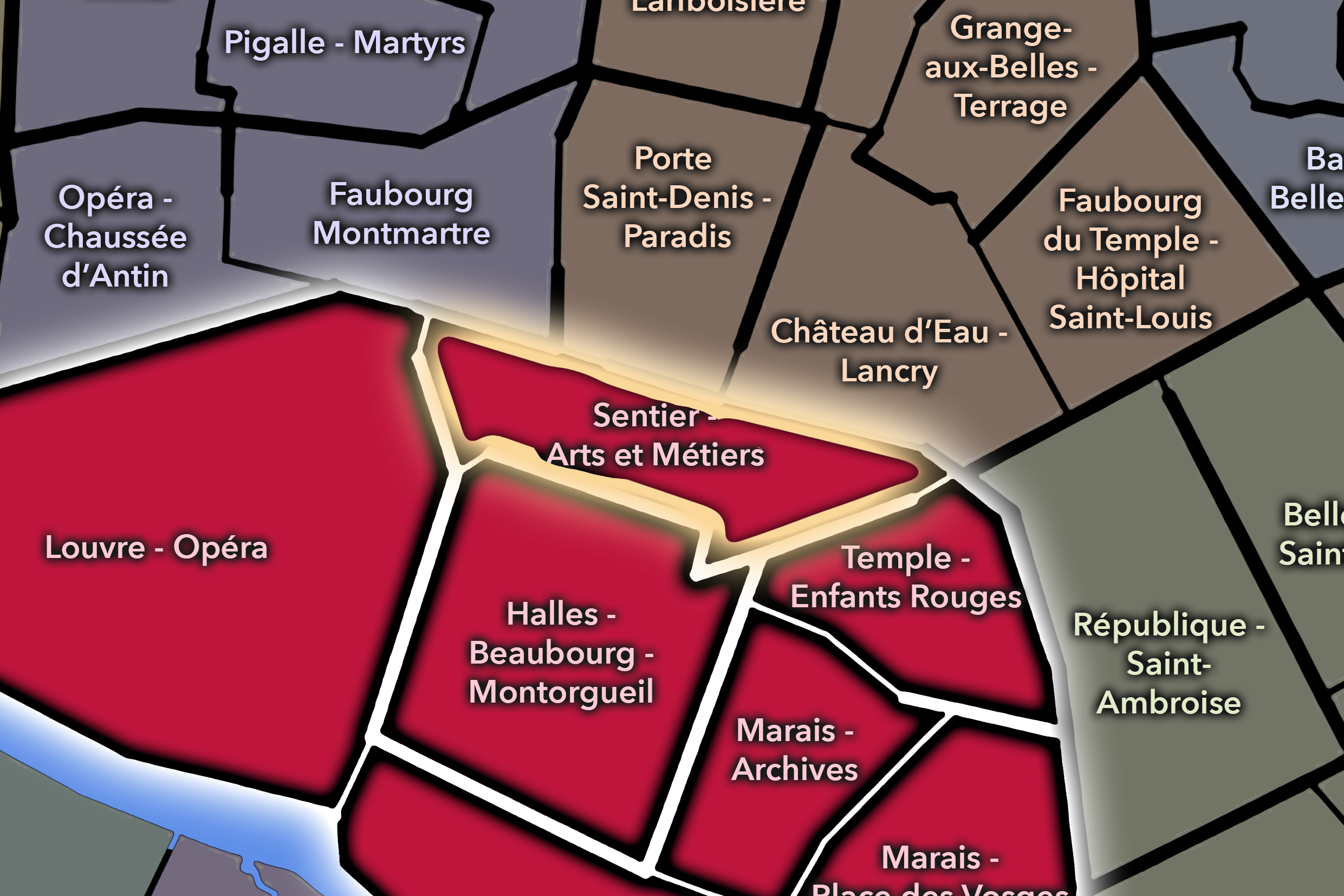
The Sentier - Arts et Métiers Conseil de Quartier occupies the northern-central portion of Paris Centre, linking the historic commercial fabric of the Sentier with the institutional and technical heritage around Arts et Métiers. Its civic geography is shaped by a dense mix of former textile and wholesale streets, startup and office activity, small restaurants, hotels, museums, schools, and major north-south/east-west corridors. Unlike the more monumental western core or the more residential eastern Marais, this CdQ reads as a working central district: compact, urban, commercial, and continually adapting to new forms of economic and cultural life. The Mairie de Paris Centre identifies Sentier - Arts et Métiers as one of the seven neighborhood councils of Paris Centre.
On the ground, Sentier - Arts et Métiers feels transitional in the best sense: part old commercial Paris, part contemporary food-and-office district, part museum-and-passage landscape. The Sentier’s narrow streets still carry traces of garment, textile, and wholesale activity, while Rue du Nil, Rue Réaumur, Rue Saint-Denis, and the Arts et Métiers area have taken on newer layers of dining, design, technology, and visitor interest. As a CdQ, its civic themes center on managing change within a dense historic grid: balancing commercial vitality with residential livability, maintaining pedestrian comfort on narrow streets, supporting small businesses, and keeping a rapidly evolving central district connected to its local memory as well as its contemporary uses.
Civic Profile
Sentier - Arts et Métiers: At a Glance
A curated list for you.
-
Major Streets
Rue Réaumur
Rue Saint-Denis
Rue du Caire
Rue Montorgueil / northern edge
Rue du Nil
-
Public Spaces & Landmarks
Musée des Arts et Métiers
Square Émile-Chautemps
Passage du Caire
Porte Saint-Denis nearby
Gaîté Lyrique nearby
-
Transit Access
Sentier
Arts et Métiers
Réaumur - Sébastopol
Strasbourg - Saint-Denis
Étienne Marcel nearby
-
Shopping & Dining
Frenchie / Rue du Nil dining cluster
Bambou
Passage du Caire textile and commercial legacy
Rue Montorgueil northern food corridor
Rue Réaumur shops and offices
-
Hotels & Attractions
Musée des Arts et Métiers visitor anchor
Sentier / Rue du Nil dining route
Passage du Caire historic passage
Porte Saint-Denis / Grands Boulevards edge
Arts et Métiers metro station and museum circuit
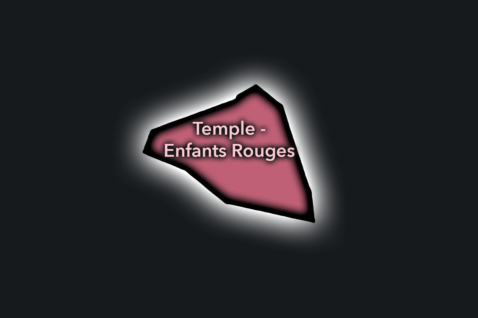
Temple - Enfants Rouges
Civic Profile
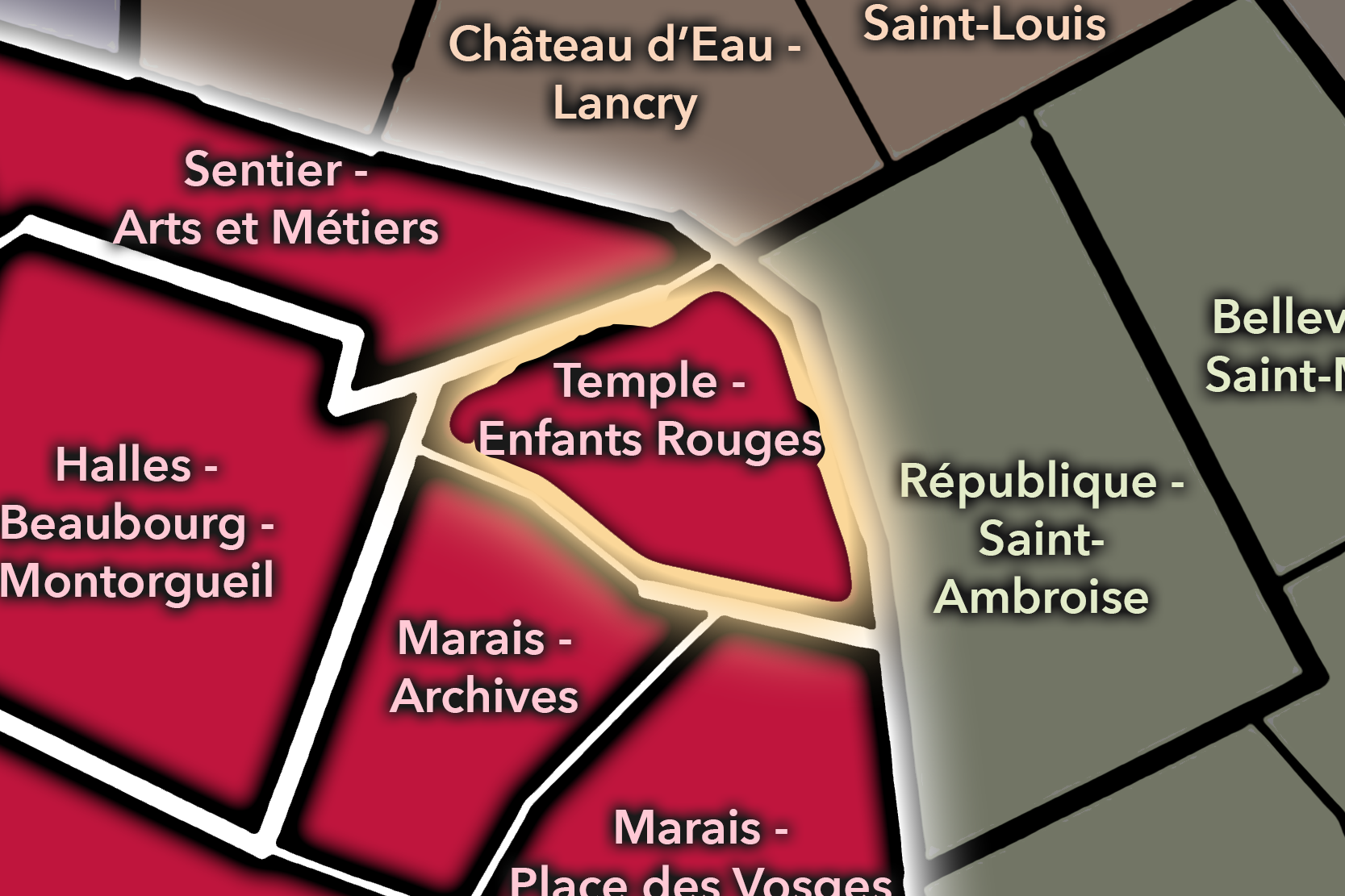
The Temple - Enfants Rouges Conseil de Quartier occupies the northern Marais and the area around the former Temple enclosure, linking the commercial life of Rue de Bretagne with the civic and cultural anchors of the Carreau du Temple, Square du Temple - Elie Wiesel, and the Mairie de Paris Centre. As a civic geography, it brings together one of Paris Centre’s most locally active central districts: market streets, schools, cafés, galleries, small shops, public gardens, historic streets, and neighborhood institutions gathered into a compact participatory territory. The Mairie de Paris Centre identifies Temple - Enfants Rouges as one of the seven Conseils de Quartier of Paris Centre.
On the ground, Temple - Enfants Rouges feels more neighborhood-centered than monumental. The Marché des Enfants Rouges, Rue de Bretagne, Square du Temple, and Carreau du Temple give the area a strong local rhythm, while the surrounding Marais streets bring fashion, dining, galleries, tourism, and residential life into close contact. Its civic themes center on the everyday management of a popular but lived-in district: keeping public space usable, supporting local commerce, balancing visitor activity with residential routines, maintaining family and school infrastructure, and preserving the social warmth of one of Paris Centre’s most recognizable neighborhood cores.
Temple - Enfants Rouges: At a Glance
A curated list for you.
-
Major Streets
Rue de Bretagne
Rue du Temple
Rue de Turenne
Rue Charlot
Rue Béranger
-
Public Spaces & Landmarks
Marché des Enfants Rouges
Carreau du Temple
Square du Temple - Elie Wiesel
Mairie de Paris Centre
Église Sainte-Élisabeth-de-Hongrie
-
Transit Access
Temple
Filles du Calvaire
République
Arts et Métiers
Saint-Sébastien - Froissart
-
Shopping & Dining
Marché des Enfants Rouges food stalls
Rue de Bretagne cafés and shops
Breizh Café
Chez Omar
Mmmozza
-
Hotels & Attractions
Carreau du Temple events
Marché des Enfants Rouges visitor route
Northern Marais shopping and gallery circuit
Square du Temple neighborhood garden
Mairie de Paris Centre civic anchor
Neighborhood Connections
Connected Arrondissements
-
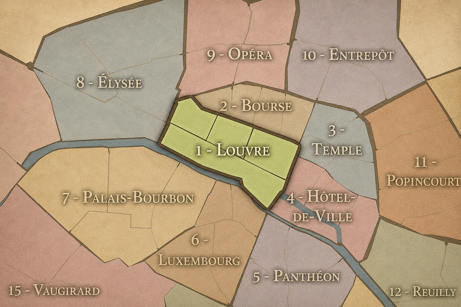
Louvre
-
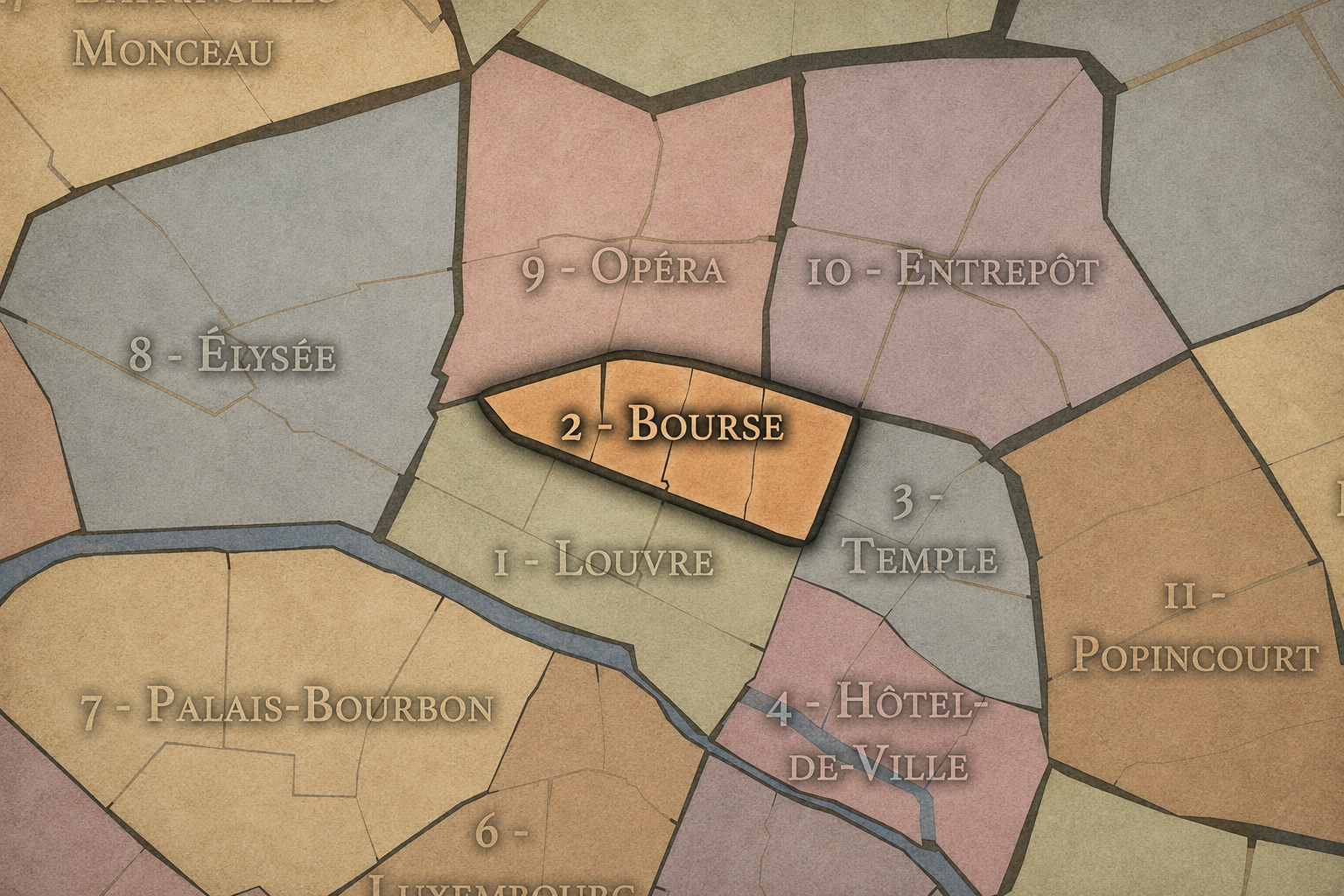
Bourse
-
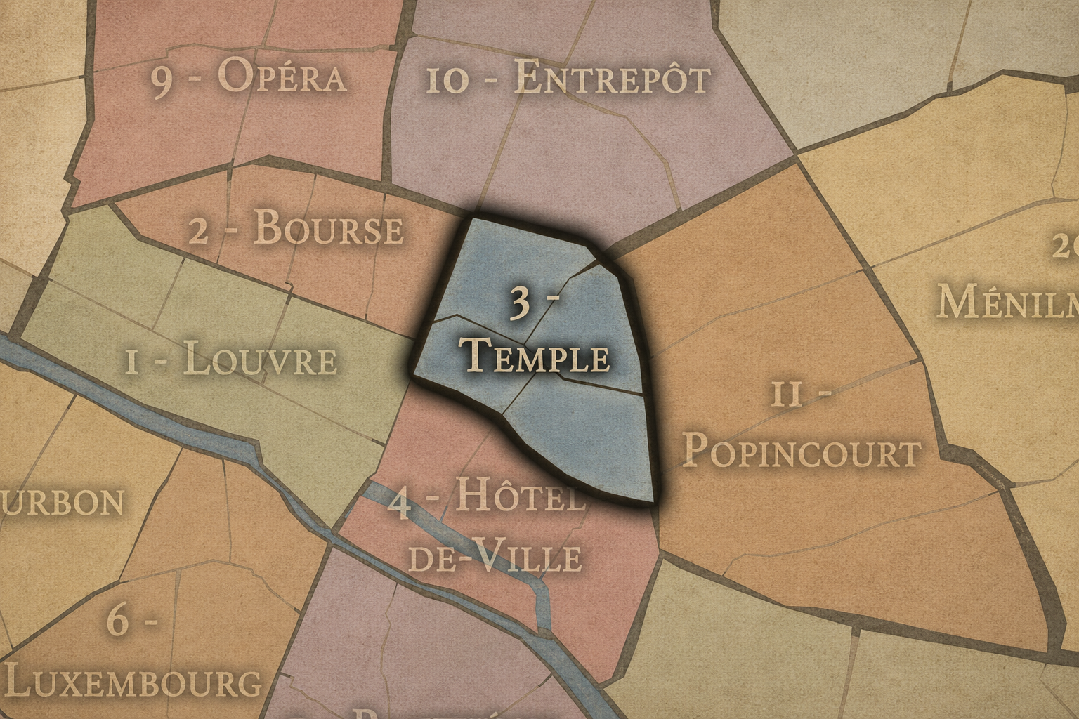
Temple
-
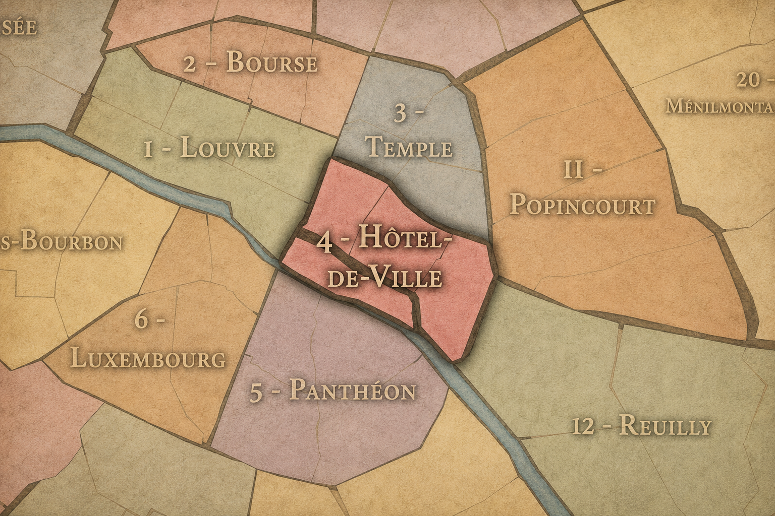
Hôtel-de-Ville
Connected Quartiers Administratifs
-
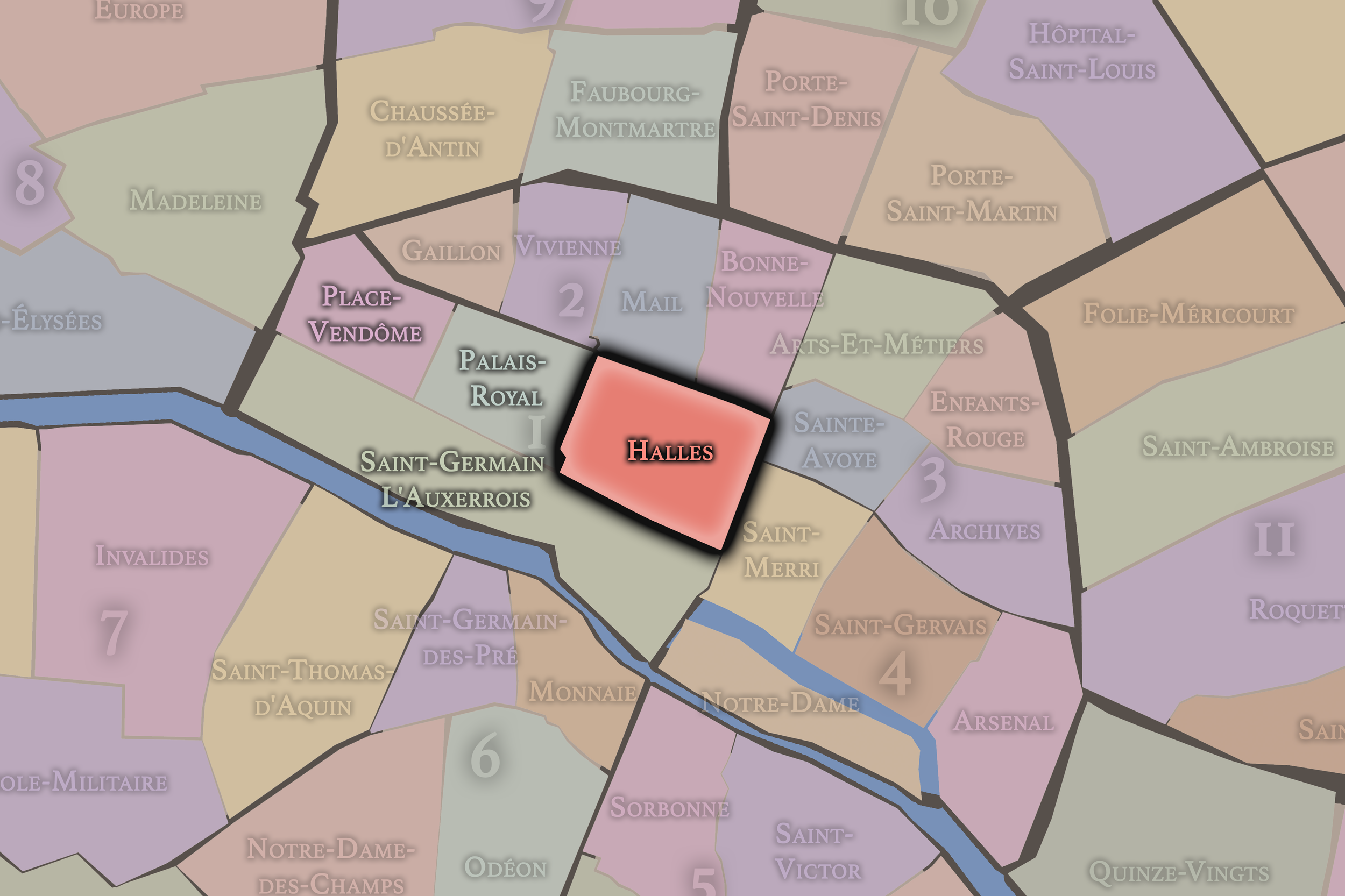
Halles
1er Arrondissement — Louvre
Once defined by the great central market of Paris, Halles remains a district of movement, commerce, underground passageways, church towers, shopping corridors, and the restless energy of the city’s historic crossroads.
-
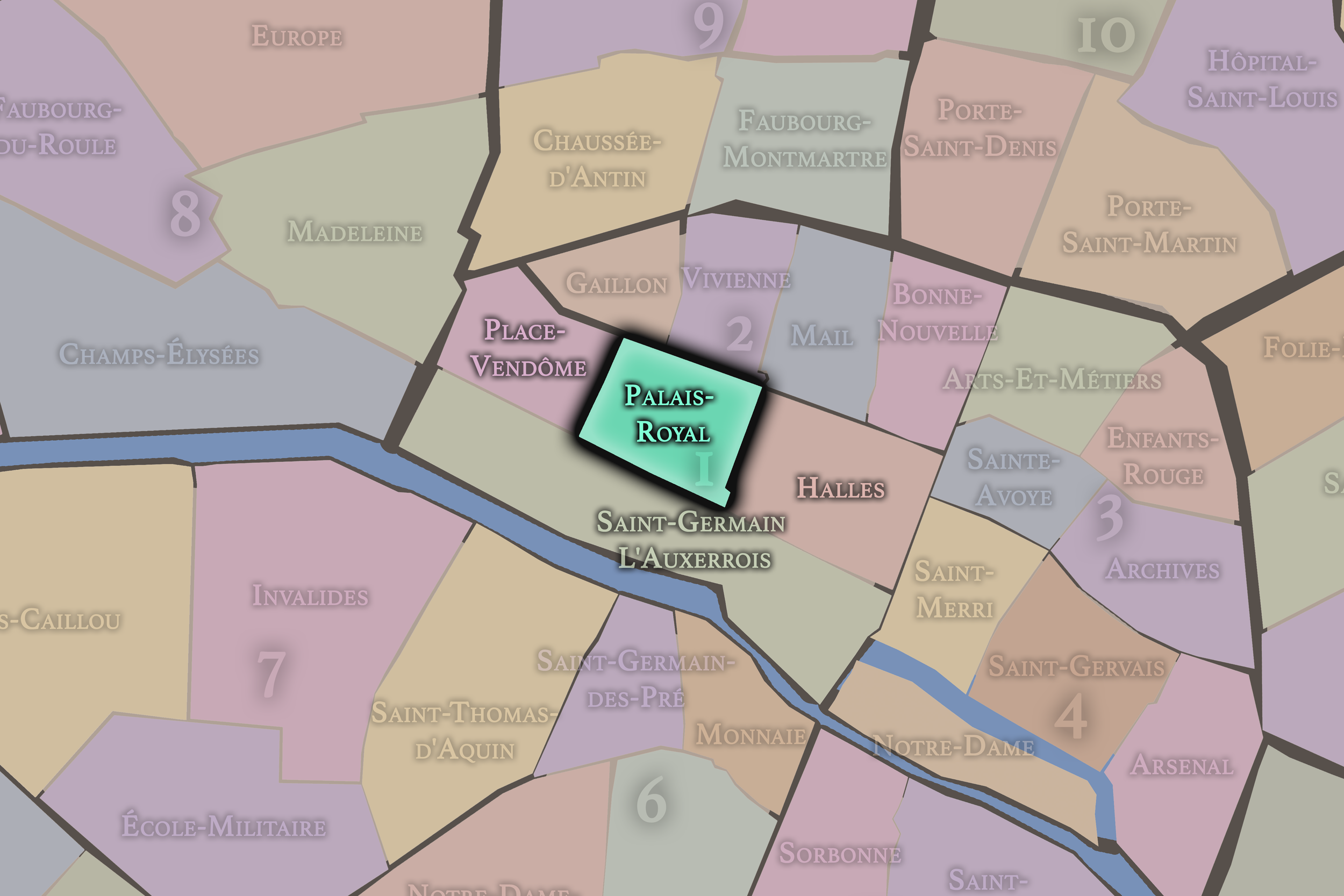
Palais-Royal
1er Arrondissement — Louvre
Centered on the arcades and gardens of the Palais-Royal, this quarter carries an elegant mixture of royal architecture, literary memory, covered passages, theaters, government buildings, and quiet interior courtyards.
-
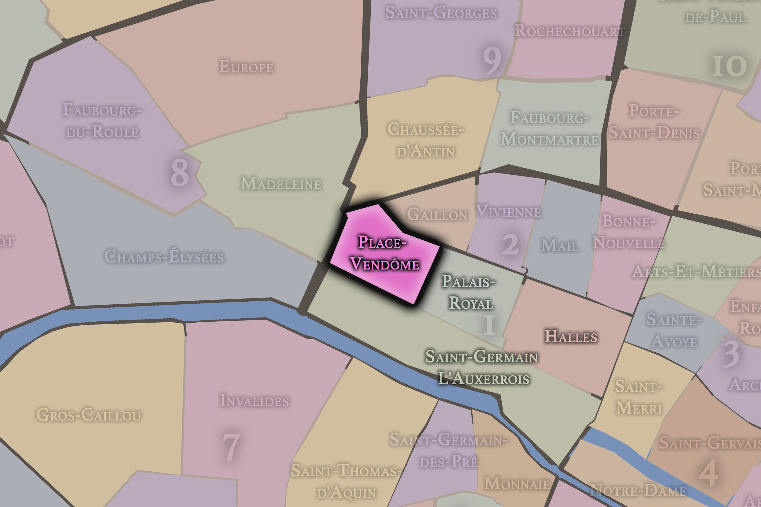
Place-Vendôme
1er Arrondissement — Louvre
Place-Vendôme is one of Paris’s most polished urban stages, associated with formal architecture, luxury houses, jewelry, grand hotels, and the carefully composed grandeur of the royal and imperial city.
-
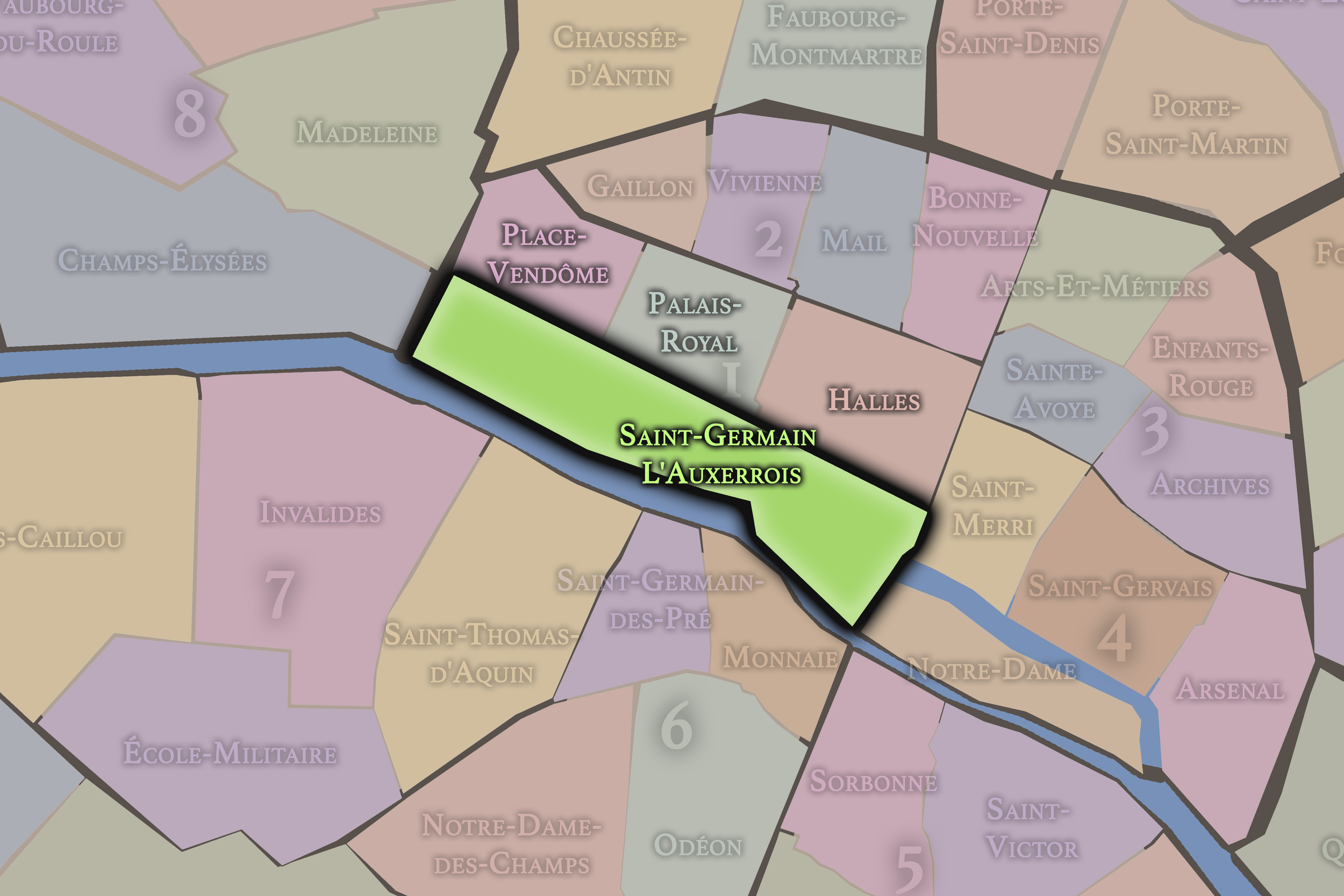
Saint-Germain-l’Auxerrois
1er Arrondissement — Louvre
At the ceremonial heart of Paris, Saint-Germain-l’Auxerrois gathers the Louvre, the Seine, the eastern edge of the Tuileries, and some of the city’s deepest royal, civic, and monumental memory.
-
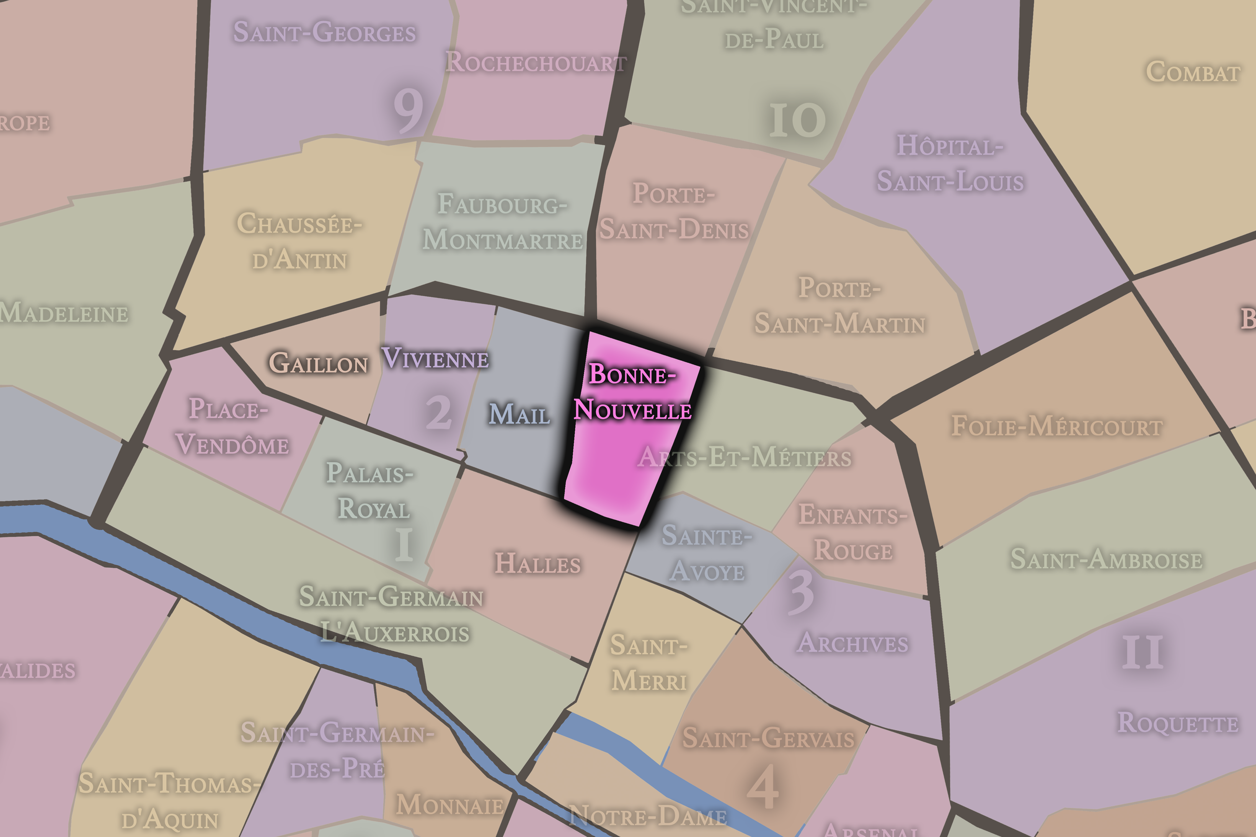
Bonne-Nouvelle
2e Arrondissement — Bourse
Bonne-Nouvelle sits along one of the city’s great boulevard thresholds, mixing theater, printing, commerce, immigrant enterprise, and the layered energy of streets that have long connected central Paris to its northern districts.
-
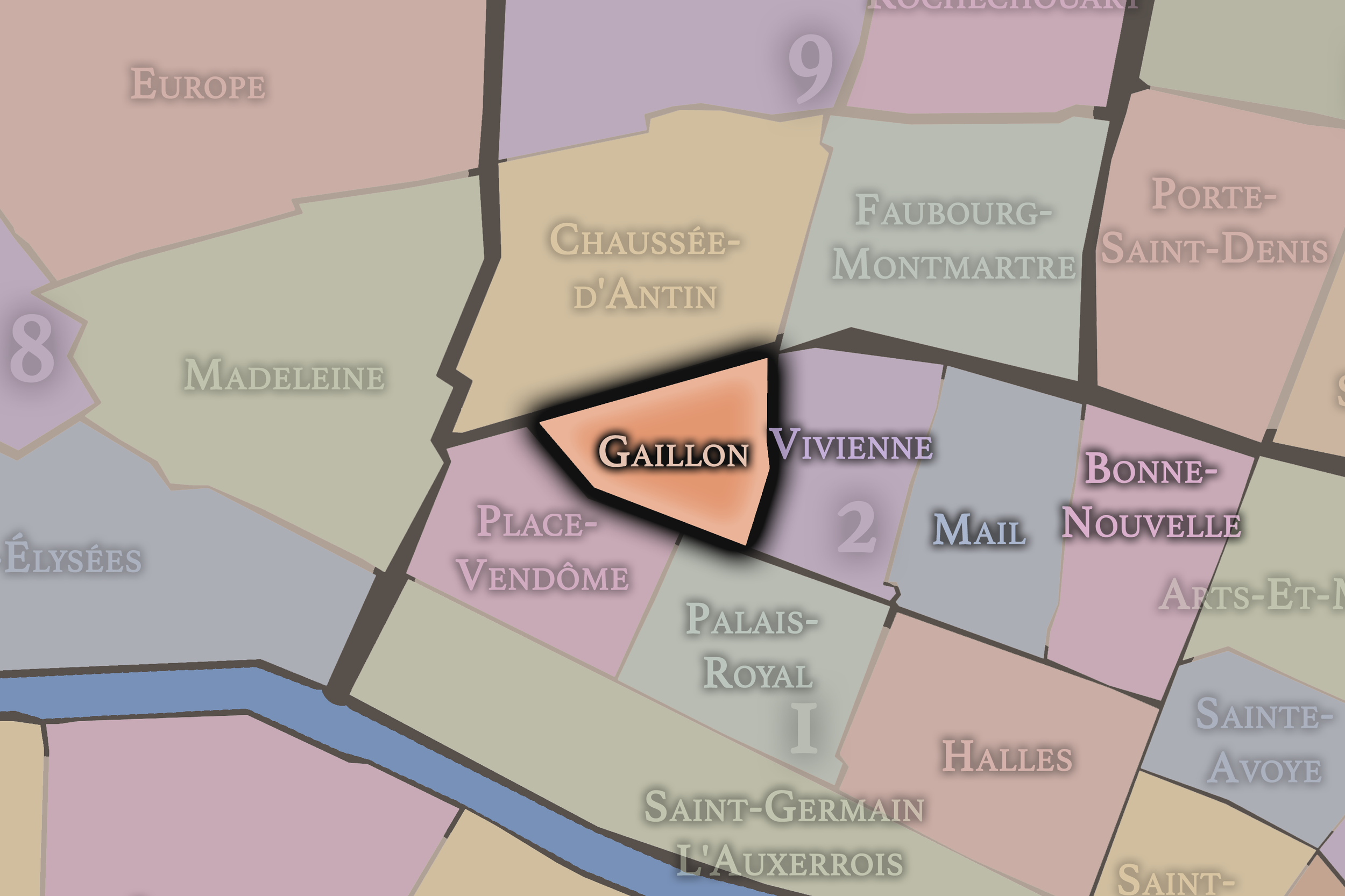
Gaillon
2e Arrondissement — Bourse
Gaillon is a compact Right Bank quarter shaped by theaters, offices, banking history, and the elegant streets that link the Opéra district to the commercial fabric of central Paris.
-
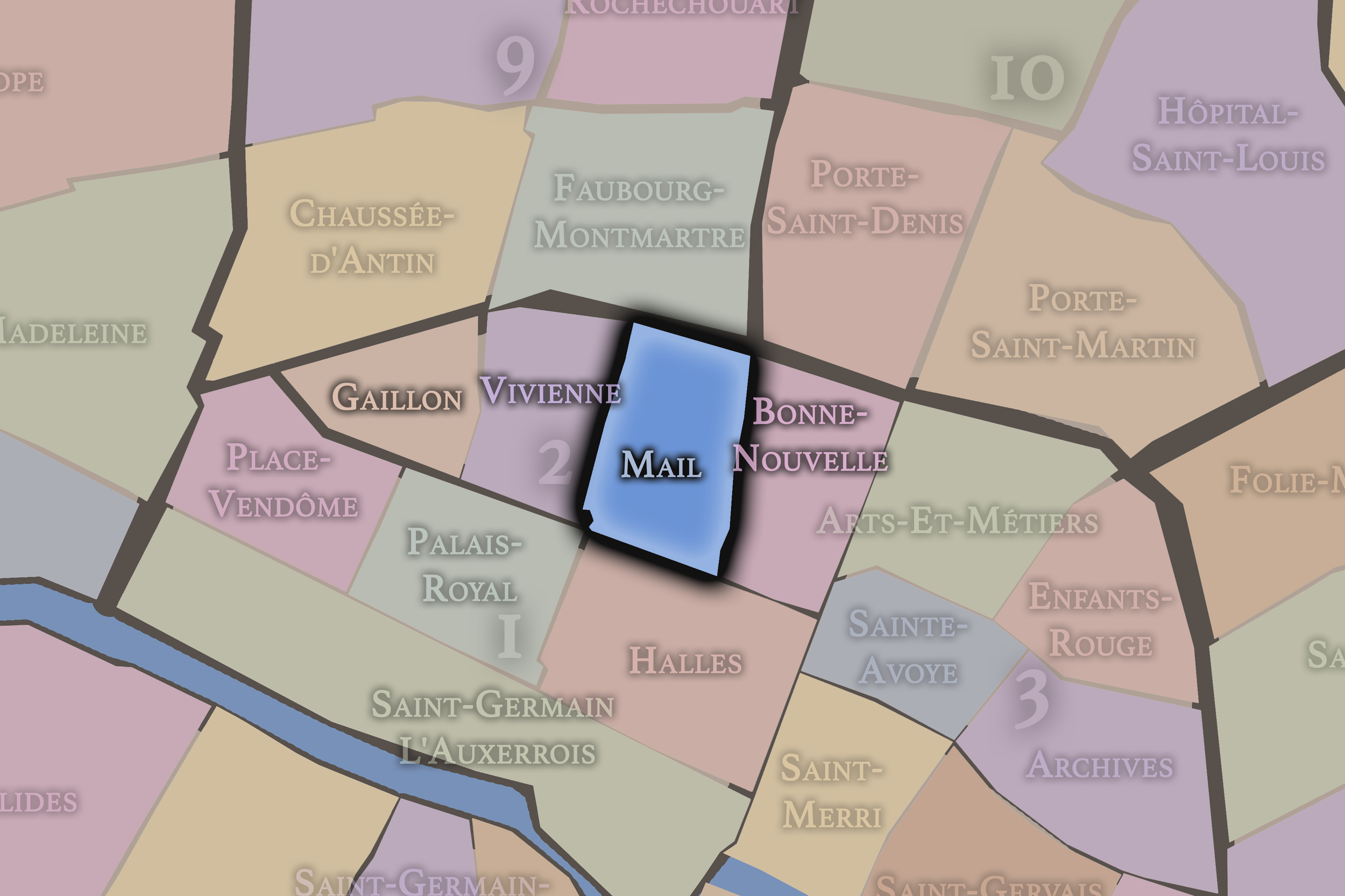
Mail
2e Arrondissement — Bourse
The Mail quarter preserves the texture of old commercial Paris, with narrow streets, textile history, passageways, and a dense urban fabric that reflects the working and mercantile life of the central city.
-
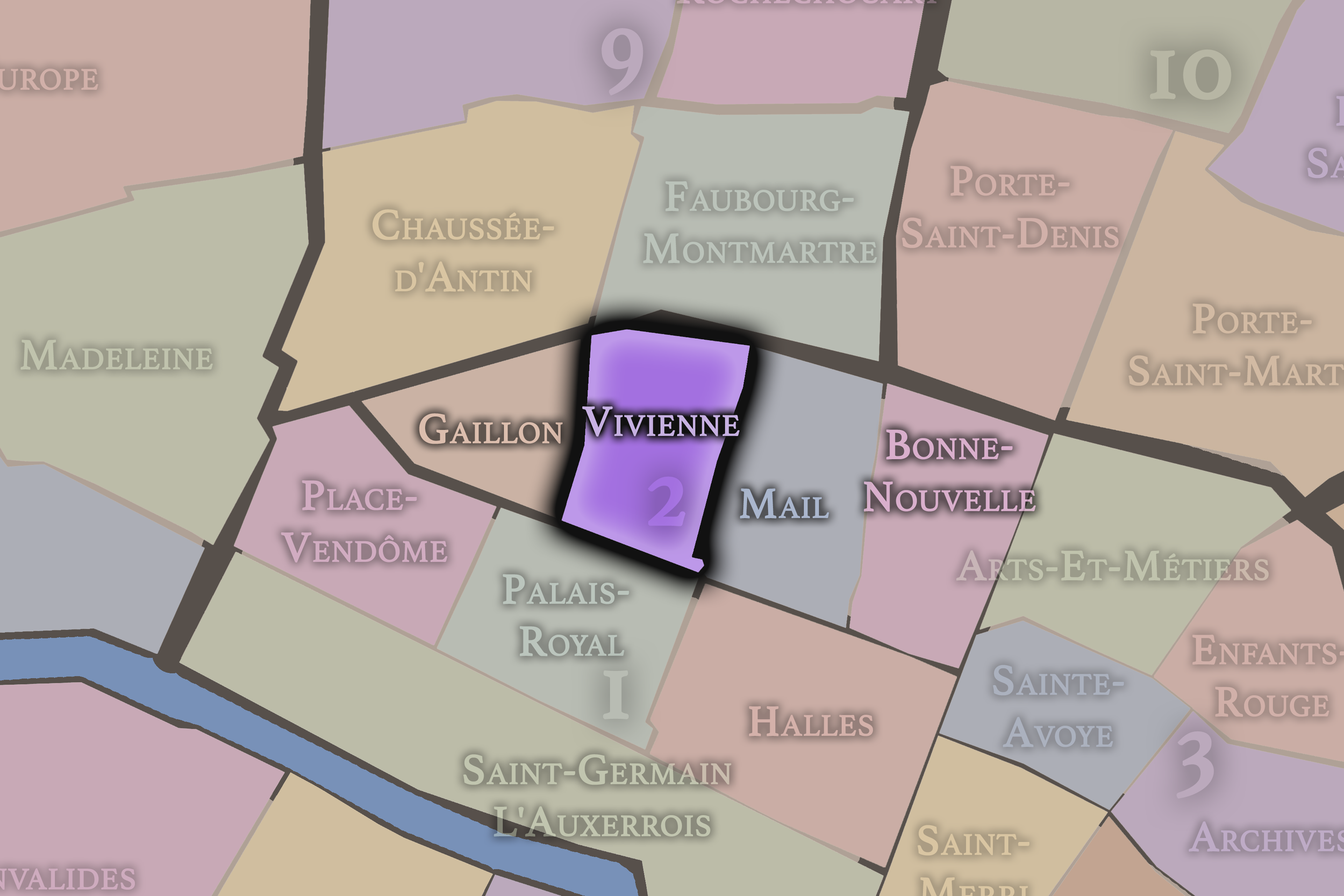
Vivienne
2e Arrondissement — Bourse
Vivienne is closely tied to the Bourse, the Bibliothèque nationale, and the covered passages, combining financial history, literary institutions, arcaded interiors, and the refined density of the 19th-century Right Bank.
-
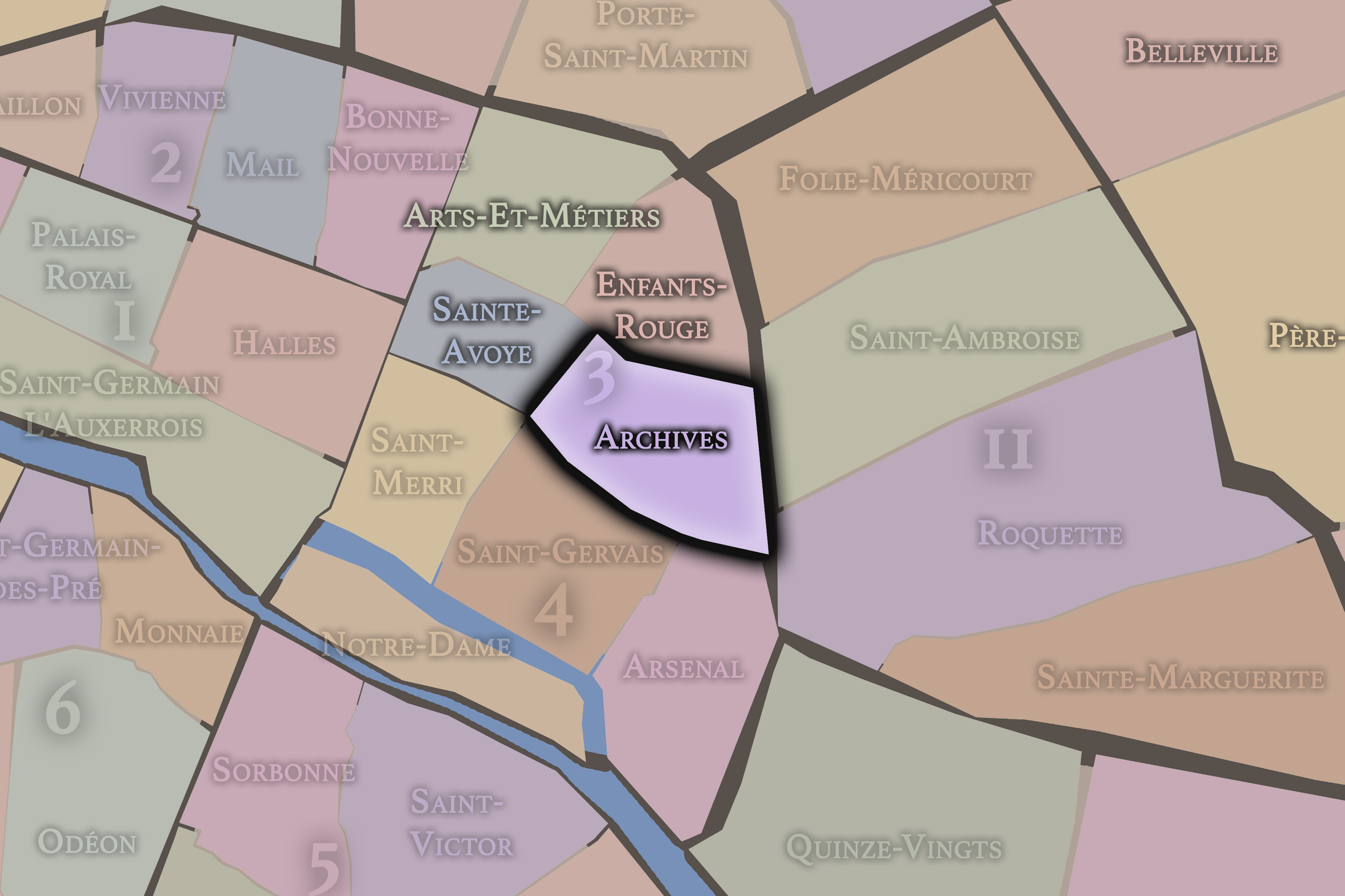
Archives
3e Arrondissement — Temple
The Archives quarter holds some of the Marais’s most important civic and aristocratic memory, with historic mansions, museums, garden courtyards, and institutions that preserve the documentary life of France.
-
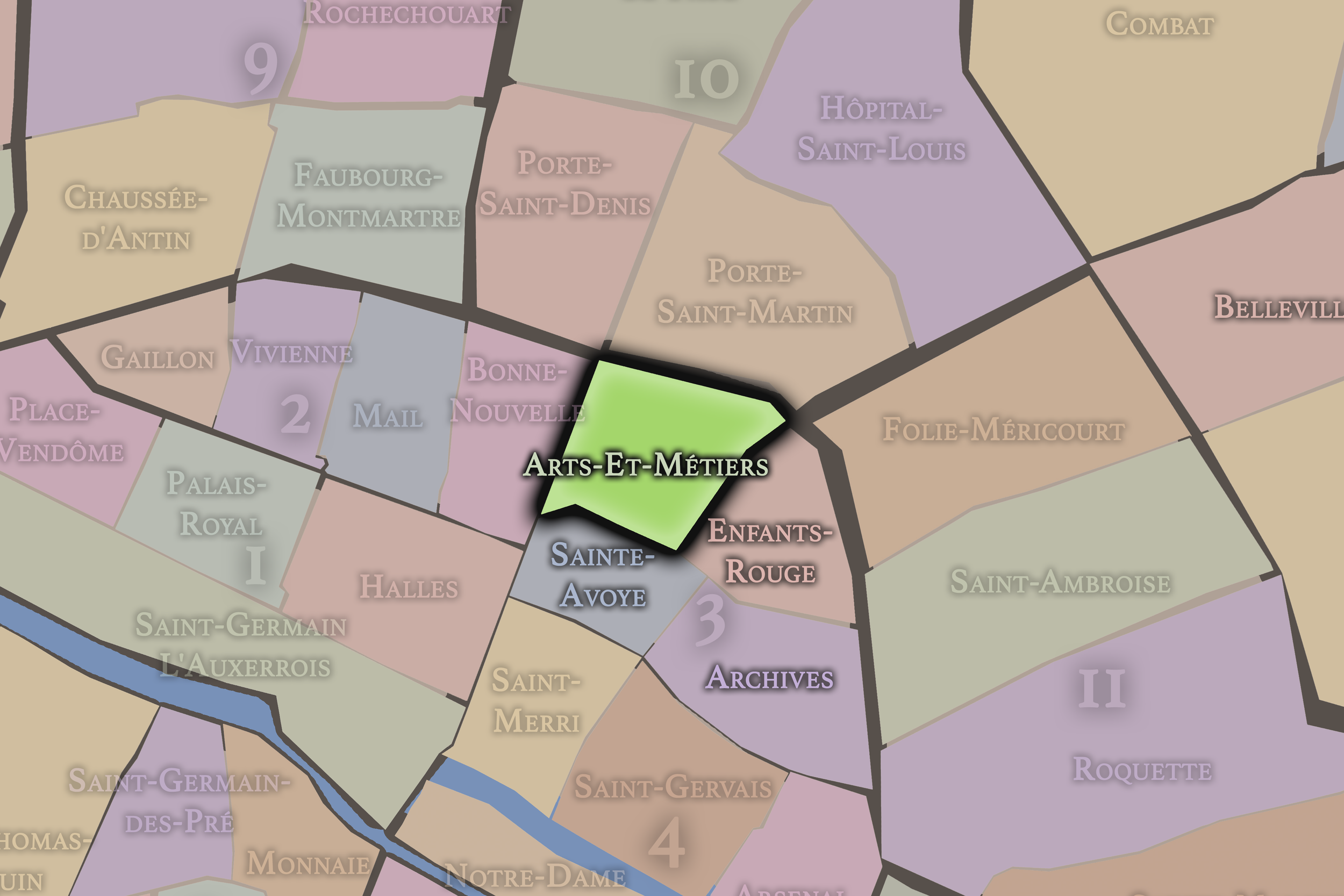
Arts-et-Métiers
3e Arrondissement — Temple
Arts-et-Métiers is shaped by invention, craft, and urban industry, anchored by the Conservatoire des Arts et Métiers and surrounded by streets that carry the memory of workshops, commerce, and technical imagination.
-
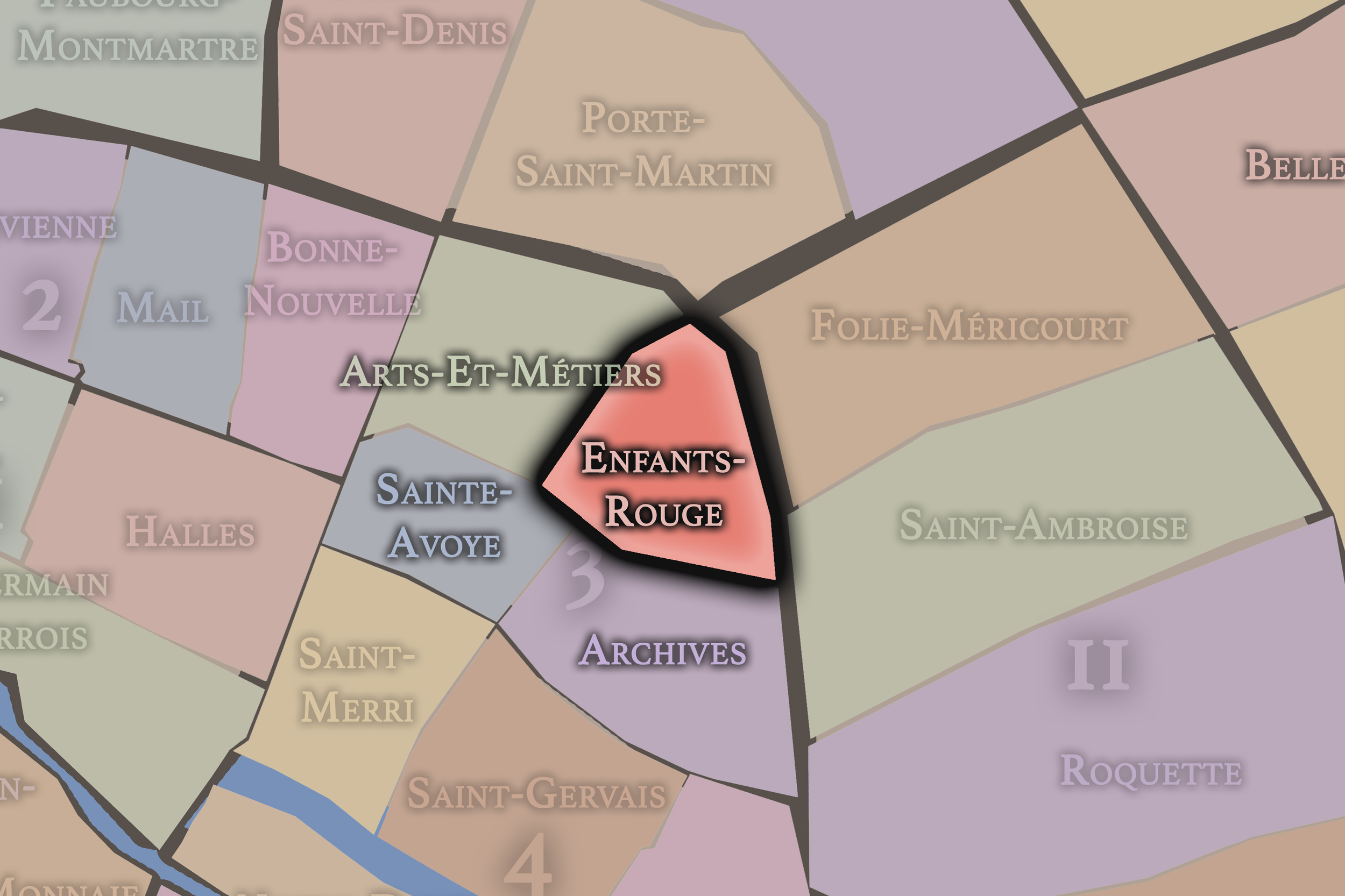
Enfants-Rouges
3e Arrondissement — Temple
Named for one of Paris’s oldest market traditions, Enfants-Rouges blends market life, northern Marais streets, galleries, cafés, historic hôtels particuliers, and a lived neighborhood energy that feels intimate and textured.
-
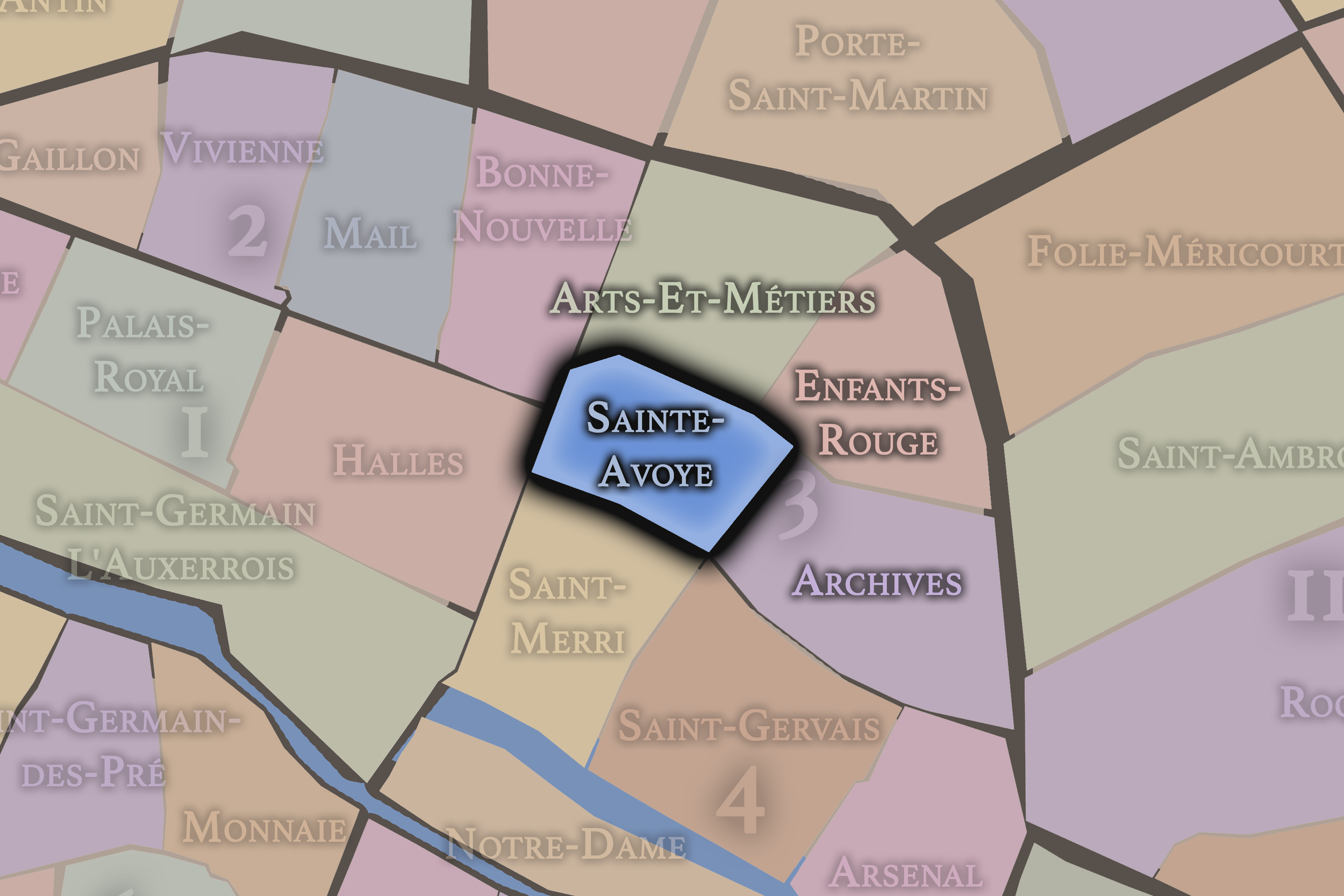
Sainte-Avoie
3e Arrondissement — Temple
Sainte-Avoye lies within a dense and historic Marais fabric, where medieval street patterns, religious memory, commercial corridors, and later layers of creative and urban life overlap within a compact central quarter.
-
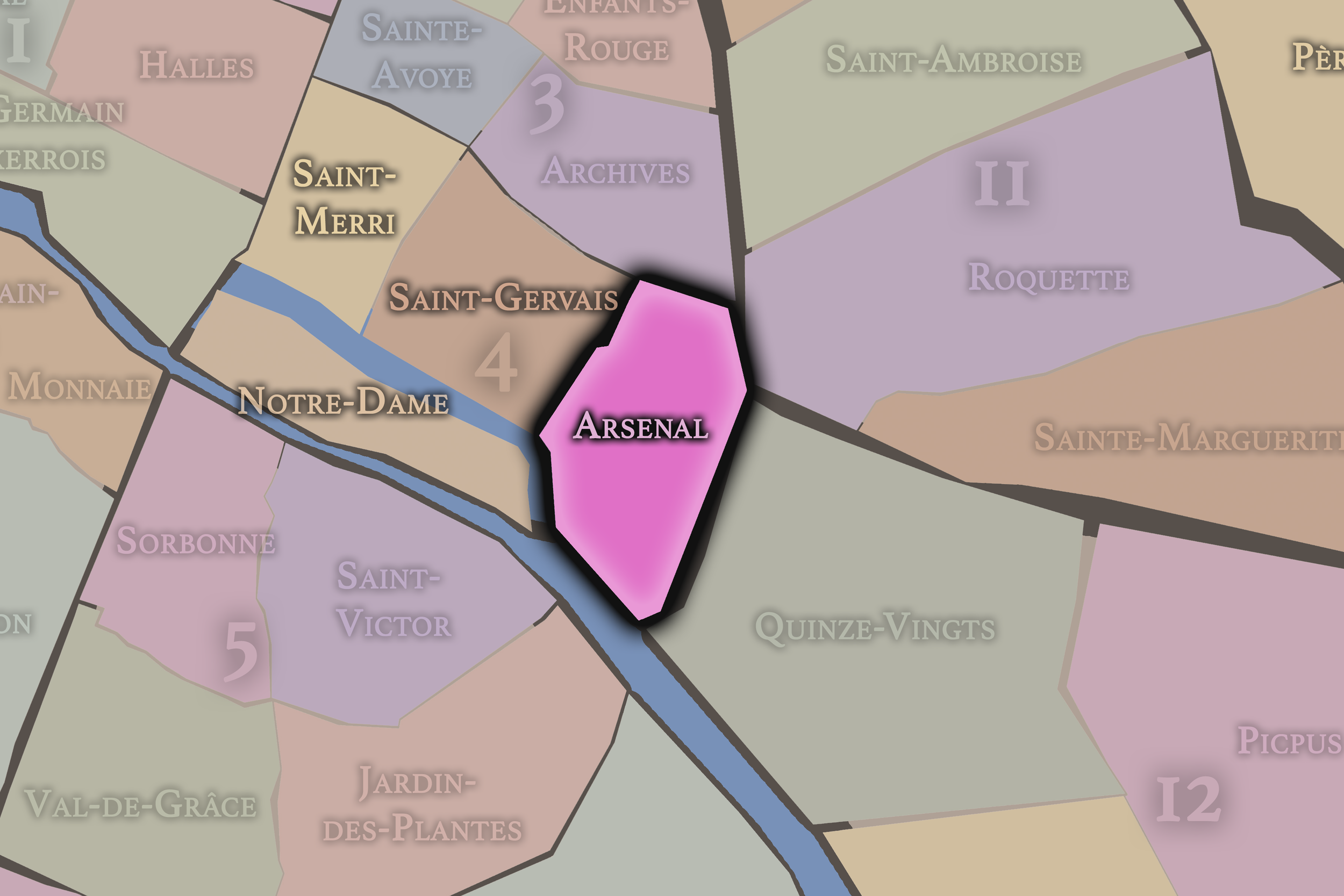
Arsenal
4e Arrondissement — Hôtel-de-Ville
Arsenal stretches toward the Bastille and the Bassin de l’Arsenal, carrying traces of royal storehouses, revolutionary memory, waterfront infrastructure, and the transition from the Marais to eastern Paris
-
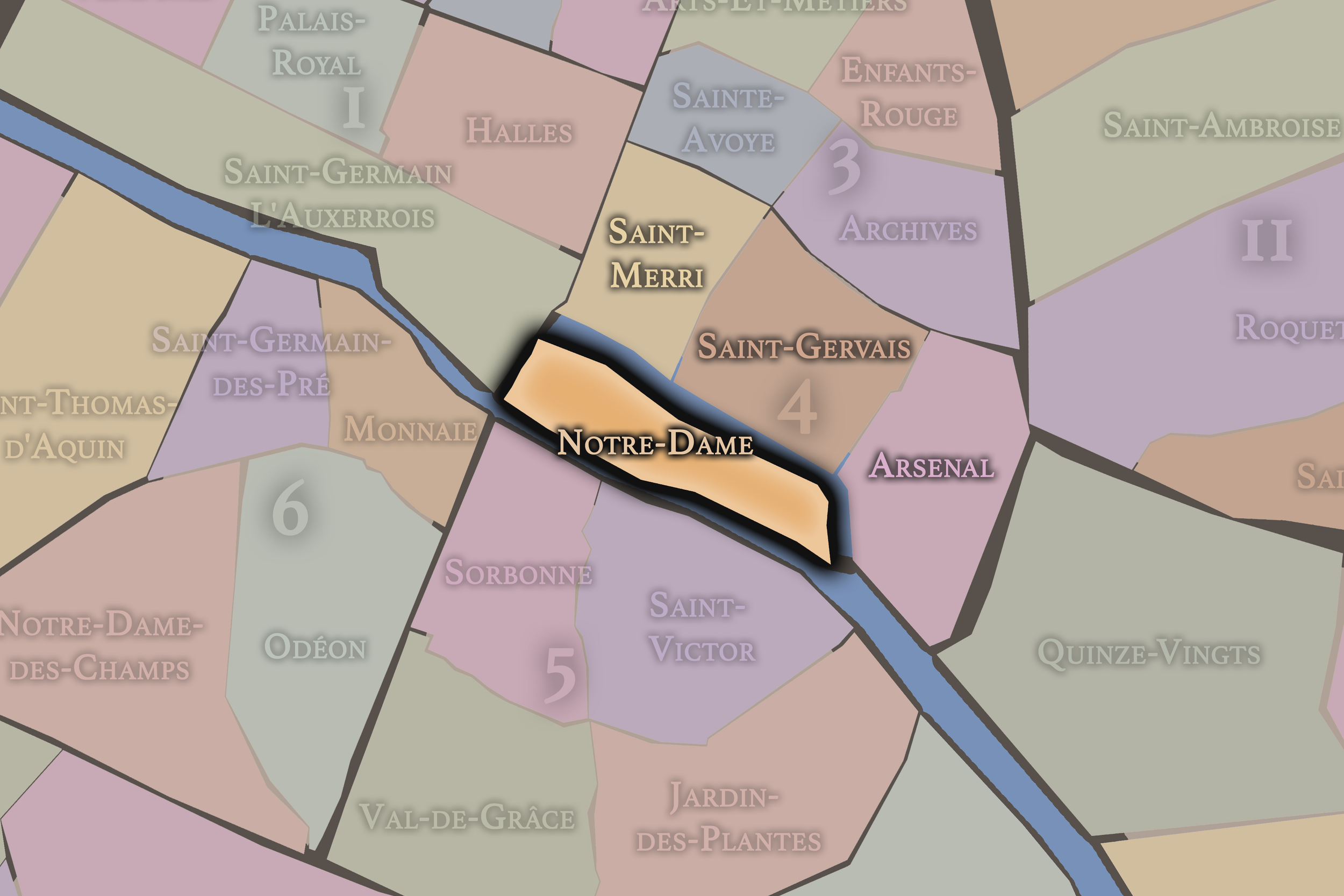
Notre-Dame
4e Arrondissement — Hôtel-de-Ville
Set across the Île de la Cité and Île Saint-Louis, Notre-Dame is among the most historically concentrated quarters in Paris, with cathedral, river, palace, judicial, and island geographies gathered into one civic landscape.
-
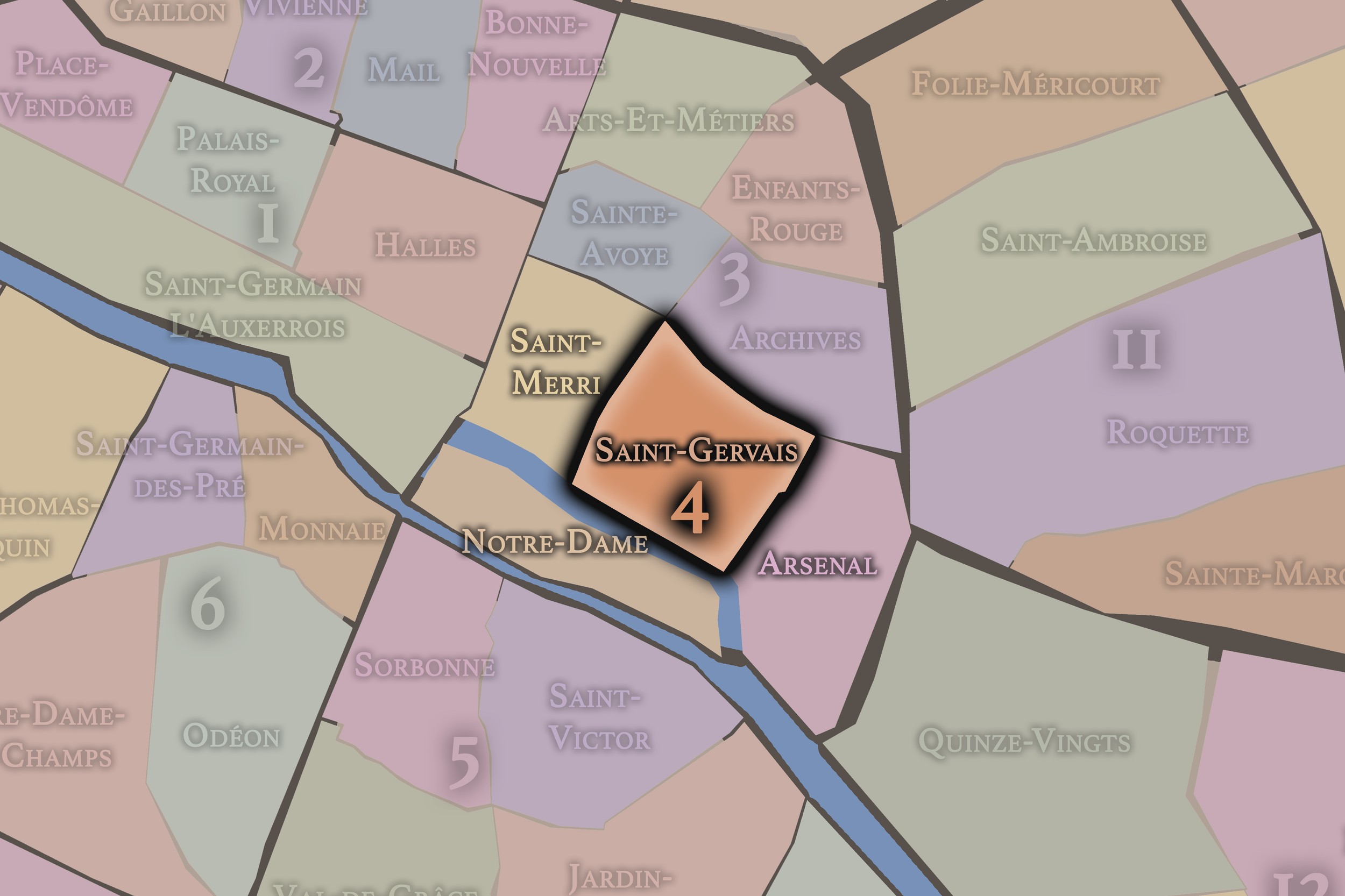
Saint-Gervais
4e Arrondissement — Hôtel-de-Ville
Saint-Gervais is one of the old heartlands of the Right Bank, shaped by parish history, Hôtel de Ville, narrow Marais streets, Jewish heritage, civic monuments, and the long memory of central Paris.
-
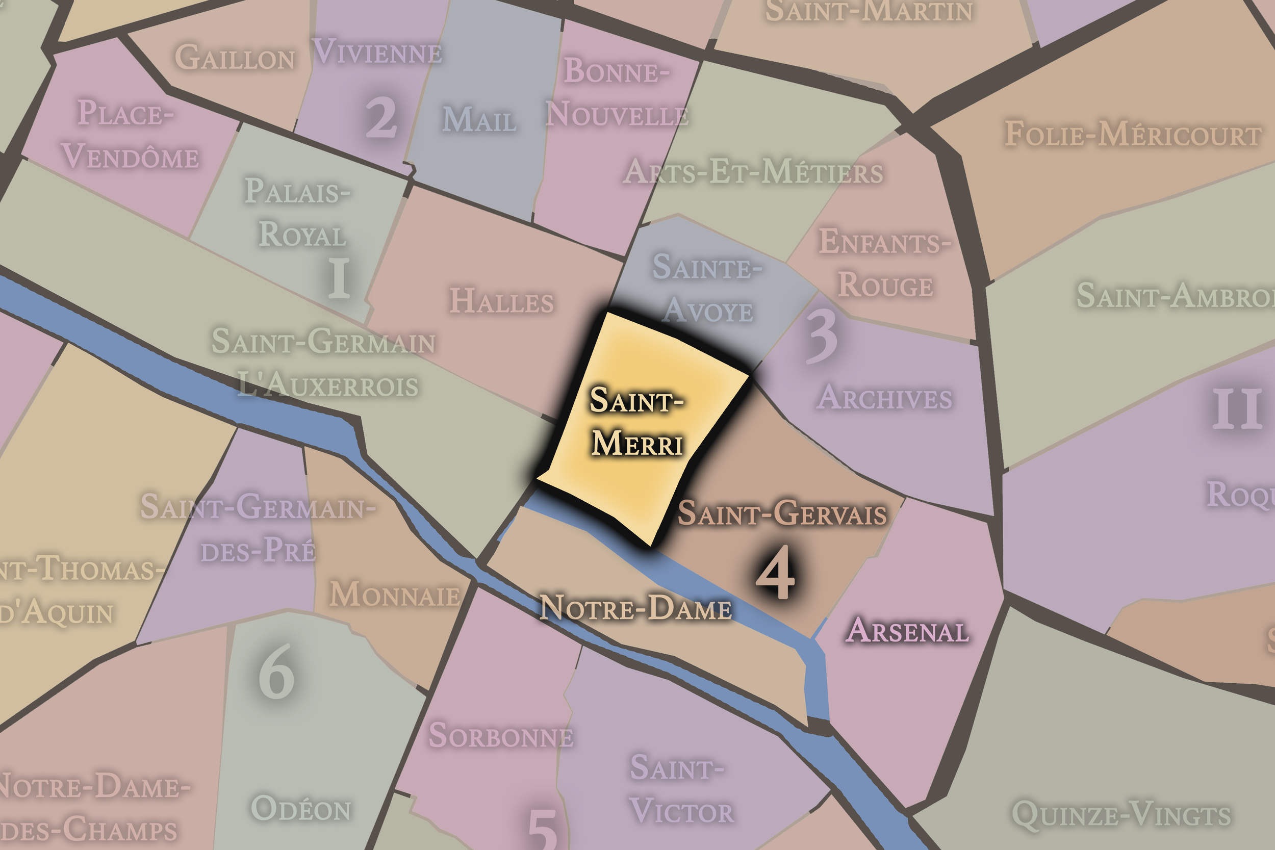
Saint-Merri
4e Arrondissement — Hôtel-de-Ville
Saint-Merri brings together the area around Beaubourg, the Centre Pompidou, medieval church streets, lively pedestrian corridors, and the creative edge where historic Paris meets modern cultural experimentation.
The Photography
The arrondissements do not share a single visual identity. Instead, they organize Paris into twenty broad visual fields, each gathering its own combination of landmarks, streetscapes, institutions, residential districts, commercial corridors, parks, rail stations, markets, cemeteries, and riverfront edges.
Some arrondissements are defined by monumental scale: royal palaces, ceremonial avenues, government buildings, museums, formal gardens, and internationally recognized landmarks. Others are shaped by hills, canals, rail gateways, apartment-lined boulevards, neighborhood markets, former village streets, industrial remnants, parks, or the quieter rhythms of residential Paris. The arrondissement system gives these varied landscapes a civic frame, allowing the city to be read not as one visual language, but as a sequence of overlapping Parisian atmospheres.

Visual Identity
Through The Lens
Photographing the arrondissements means moving between the official map and the street-level experience. The camera does not treat each arrondissement as visually uniform. Instead, it looks for the recurring forms, textures, transitions, and contrasts that make each district legible: the geometry of boulevards, the shade of plane trees, the repetition of balconies, the rise of stairways, the curve of canals, the presence of rail stations, the opening of parks, the weight of monuments, and the intimacy of side streets.
On CityNeighborhoods, the arrondissement provides the frame, but the photograph comes from the encounter between map, movement, light, and observation. As the Paris photography is processed, this section will connect each arrondissement more directly to the project’s Photographic Lexicon: the visual strategies, recurring motifs, and compositional patterns that shape how the city is seen through the lens.

If you visit Paris, these ideas can help inspire your own photography.



Paris: J’Espere, Je Rêve, Je Vive
Paris Photo Gallery
Paris Field Notes
-
Field Note: August 18, 2025 | 07:58 AM
Conditions: 73°F | Humidity: 72%.
Within the park's interior, the glacial kettle ponds acted as humidity traps, creating a soft, hazy light that filtered through the old-growth oaks. The transition from the park's dense shade to the sun-drenched edges of Oakland Gardens highlighted the day's exceptional "picture-perfect" clarity.
There is a fleeting window in Queens where the humidity of August hasn't yet heavy-set, and the morning sun hits the canopy of Alley Pond Park at a perfect oblique angle. Arriving just before 8:00 AM, I watched the light break through the oaks and tulip trees, casting long, dramatic shadows across the wet grass. It’s in these quiet, golden moments that the park feels less like a city escape and more like the ancient glacial valley it actually is.
Other neighborhoods visited:











































































































Explore Paris
-

The twenty arrondissements form the civic spiral of Paris, organizing the city into its broad local districts of government, identity, and daily life.
-

Each arrondissement is divided into four official administrative quarters, giving Paris a more precise civic and geographic framework.
-

The conseils de quartier bring participation to street level, giving residents a voice in neighborhood needs, public space, and local civic life.
-

Les Deux Rives trace Paris through the Seine’s two banks, revealing how the Rive Droite and Rive Gauche shaped the city’s civic power, commerce, learning, art, and cultural identity.
-

Cultural neighborhoods reveal the Paris people recognize through history, cafés, architecture, memory, atmosphere, and local belonging.