
10e - PORTE SAINT-MARTIN
Quartiers Administratifs
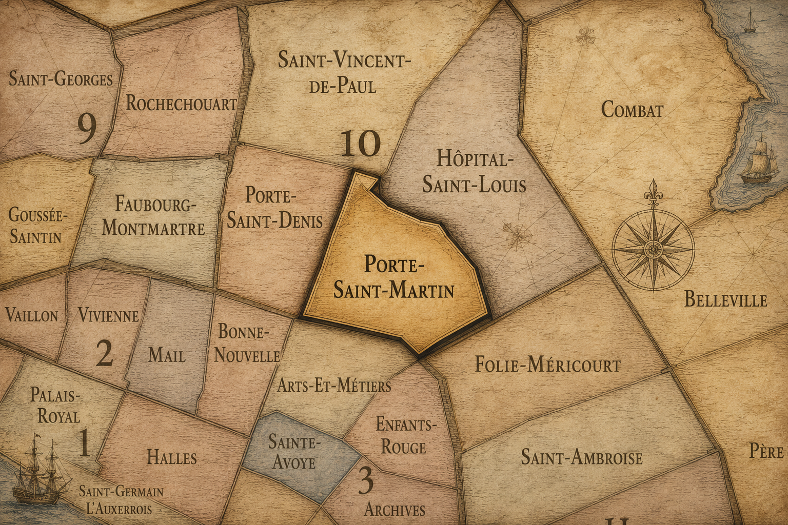
Part of an ongoing project to walk and photograph every neighborhood in Paris, this page explores the Administrative Quarter: 10e - Porte Saint-Martin through maps, district identity, history, and photography.




The Map
Download the Paris Arrondissements Map
Geographic Setting
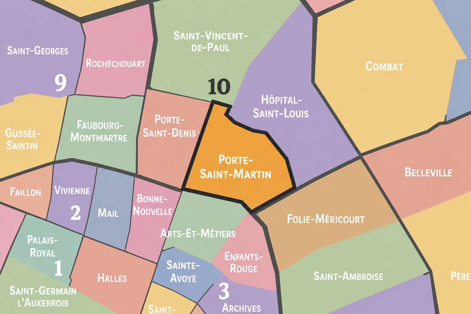
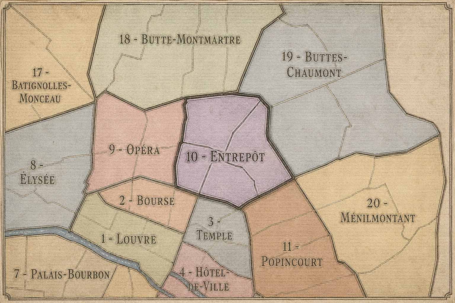
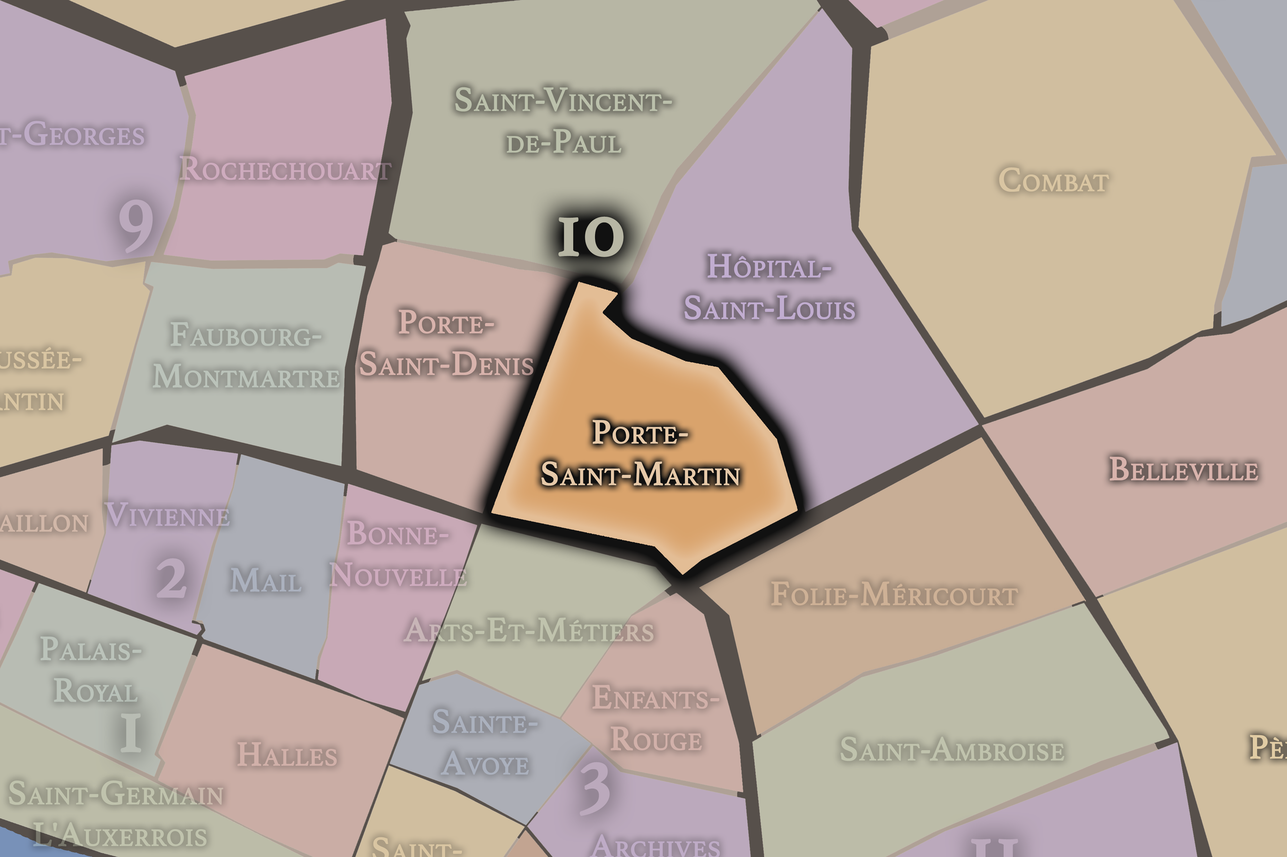
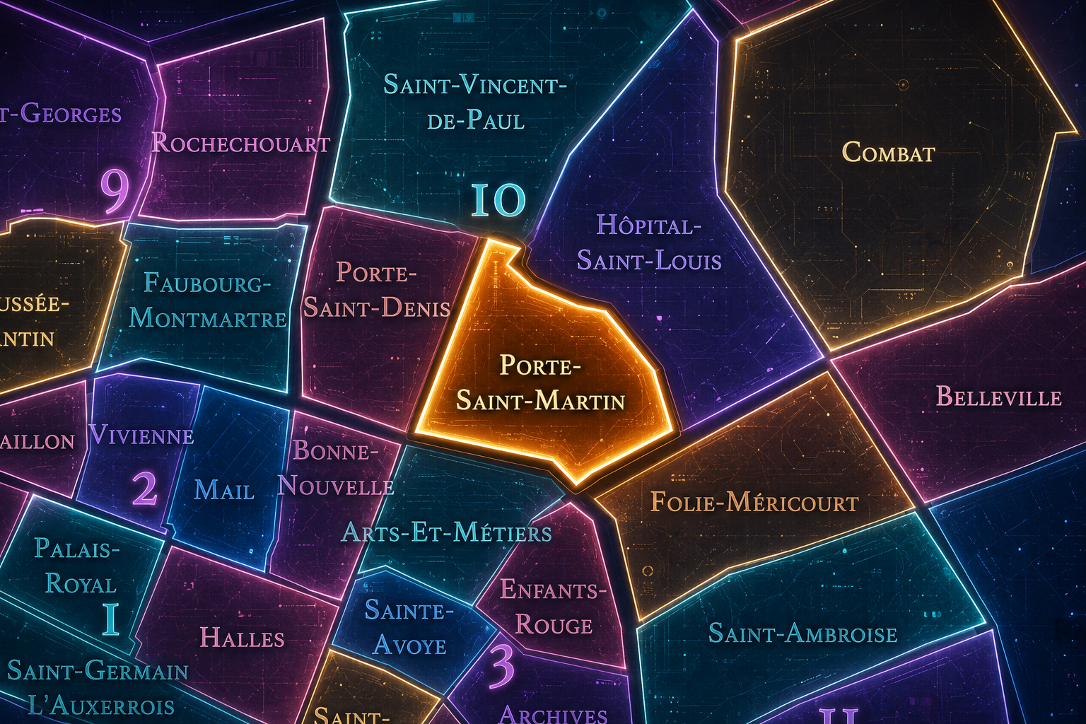
Porte Saint-Martin occupies the south-central portion of the 10th arrondissement, where the Grands Boulevards, the old northeastern approaches to Paris, the Faubourg Saint-Martin, République, and the Canal Saint-Martin corridor gather into one of the city’s great landscapes of passage. It lies east of Porte Saint-Denis, west of Hôpital-Saint-Louis, south of Saint-Vincent-de-Paul, and near the boundary with the 3rd arrondissement, forming a quarter shaped by gates, theaters, boulevards, former fortifications, popular commerce, and the restless movement between central Paris and the northeastern city.
The quarter is anchored by the Porte Saint-Martin itself, the triumphal arch standing along the boulevard line near Rue Saint-Martin and Rue du Faubourg-Saint-Martin. Around it extend Boulevard Saint-Martin, Boulevard de Strasbourg, Rue du Faubourg-Saint-Martin, Rue René-Boulanger, Rue de Lancry, Rue du Château-d’Eau, Rue Taylor, and the approaches toward République and the Canal Saint-Martin. This is a district of motion and compression: old gate, boulevard theater, dense street, canal edge, transit, restaurant, hotel, and neighborhood commerce layered tightly together.
Unlike Saint-Vincent-de-Paul, whose identity is shaped by the great railway stations, or Hôpital-Saint-Louis, whose gravity gathers around medical care and institutional enclosure, Porte Saint-Martin belongs to the open threshold of the city. It is closely related to Porte Saint-Denis, but its atmosphere looks slightly more eastward — toward République, the Faubourg du Temple, the canal, and the civic and popular landscapes that link central Paris to the working and residential districts beyond.
Administrative Quarter Identity
Etymology and Origins
The name Porte Saint-Martin comes from the historic gate on the road leading northward from Paris through the Saint-Martin corridor. “Porte” means gate, and “Saint-Martin” refers to Saint Martin of Tours, one of the most important saints in the Christian tradition of France. The name therefore preserves both a religious dedication and an urban function: this was a place of passage through the old boundary of the city.
The present Porte Saint-Martin is not simply an old defensive gate, but a 17th-century triumphal arch built under Louis XIV. Like nearby Porte Saint-Denis, it replaced the practical memory of city fortifications with the architectural language of royal victory. The gate became monument. The boundary became ceremony. The road became a stage for power.
As an administrative quarter name, Porte Saint-Martin carries the memory of a city that once had edges. Modern Paris has long since expanded beyond the arch, but the name still marks the former threshold between inner city and faubourg. It reminds the visitor that today’s central neighborhood was once a place where Paris ended and the road beyond began.
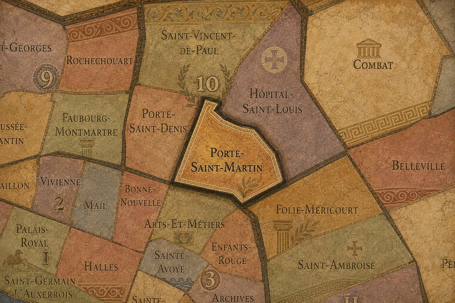
Within the official geography of Paris, Porte Saint-Martin is one of the four administrative quarters of the 10th arrondissement, alongside Porte Saint-Denis, Saint-Vincent-de-Paul, and Hôpital-Saint-Louis. It occupies the arrondissement’s southern and central sector, giving civic form to the area around the old gate, the boulevard line, the Faubourg Saint-Martin, and the western approaches to République and Canal Saint-Martin.
As an administrative quarter, Porte Saint-Martin helps clarify a landscape often described through overlapping names: Strasbourg-Saint-Denis, République, Faubourg Saint-Martin, Château d’Eau, the Grands Boulevards, or the canal-adjacent 10th. The official quarter name anchors these identities in the old gate and its historic route, allowing the district to be understood as more than a corridor between better-known places.
This civic frame is especially useful because Porte Saint-Martin is a quarter of overlap. It belongs to the 10th arrondissement, but its southern edge faces the older central city. It looks west toward Porte Saint-Denis, east toward République, north toward the railway districts, and southeast toward the canal and the former Temple landscapes. The administrative name gives this dense urban seam a legible place in the larger Parisian system.
Civic Framework
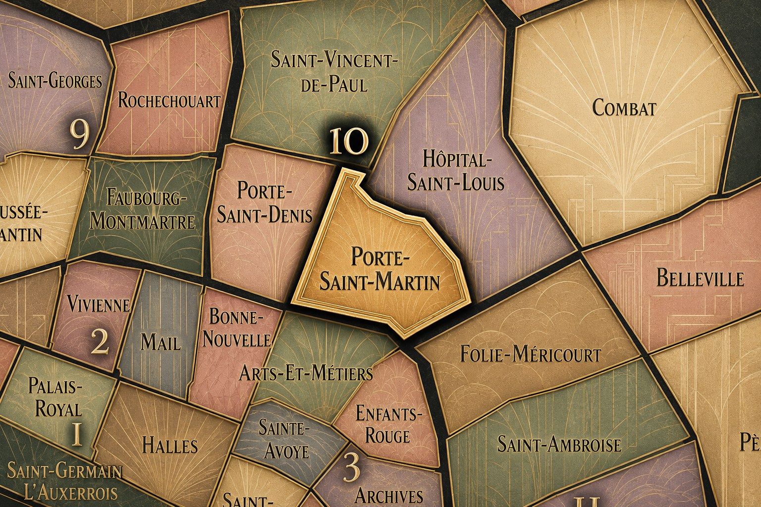
Porte Saint-Martin differs from the other quarters of the 10th arrondissement through its combination of gate memory, boulevard theater, and eastward civic transition. Porte Saint-Denis is its closest sibling: both are named for triumphal gates along the old boulevard line, both remember roads leading beyond the city, and both stand at the former threshold between Paris and faubourg. But Porte Saint-Denis feels more tied to the lower faubourg, Passage Brady, Strasbourg-Saint-Denis, and the northbound route toward Saint-Denis; Porte Saint-Martin turns more directly toward the Saint-Martin corridor, République, and the canal world.
Saint-Vincent-de-Paul is the 10th arrondissement of rail arrival, dominated by Gare du Nord and Gare de l’Est. Hôpital-Saint-Louis is the quarter of care, enclosure, and the medical institution around which the surrounding neighborhood turns. Porte Saint-Martin is more public, more theatrical, and more civic in its street life: a quarter of boulevard façades, old theaters, hotels, restaurants, transit, and the busy human movement of the former gate.
It should also be distinguished from République. The Place de la République and its surrounding civic landscape belong to a larger cultural and political geography that crosses arrondissement lines. Porte Saint-Martin approaches that world from the west and northwest, but its own identity remains rooted in the old gate and the faubourg route. It is not the square itself; it is the threshold leading toward it.
Neighborhood Distinction
Parisian Identity
Porte Saint-Martin expresses Paris as a city where old boundaries become public life. The arch still recalls the fortified and royal city, but the streets around it belong to a much broader urban story: theaters, cafés, restaurants, workers, travelers, residents, commuters, demonstrations, shops, hotels, and the constant eastward movement from the old center toward République and beyond.
The quarter’s identity is especially tied to the Grands Boulevards. These boulevards were born from the transformation of former fortification lines into places of promenade, entertainment, and commerce. Porte Saint-Martin stands directly within that history. The city’s defensive edge became a stage. The old wall became a route for strolling, performance, and crowd life. The gate remained, but its meaning changed.
This gives the quarter a deeply Parisian tension: monument and everyday use, royal stone and popular street, old inscription and modern traffic, theater and transit. Porte Saint-Martin is not a frozen historic site. It is a place where history has to share the sidewalk with everything else.
Neighborhood Connections
Every administrative quarter belongs to a wider Parisian fabric. These connections place Porte Saint-Martin within the city’s civic, participatory, and cultural geography:
-
10e - Entrepôt
-

Château d'Eau - Lancry • Grange-aux-Belles - Terrage • Saint-Louis - Faubourg du Temple
The History
The origins of Porte Saint-Martin lie in the road and gate system of medieval and early modern Paris. Before the modern administrative quarter existed, this area marked one of the northern exits from the city. Rue Saint-Martin led outward from the old center, and beyond the gate, the Faubourg Saint-Martin developed as an extension of urban life outside the walls.
Like many Parisian faubourgs, the area beyond the gate grew because boundaries generate activity. Travelers needed lodging and food. Goods moved in and out. Trades and workshops took root near routes of movement. The gate did not simply separate city from outside; it produced a zone of exchange on both sides of the line.
The quarter’s origin is therefore not one of enclosure alone, but of passage. From the beginning, Porte Saint-Martin was shaped by the act of crossing: entering Paris, leaving Paris, bringing goods, carrying news, moving between the old core and the lands beyond.
Origins
16th–17th Century
In the 16th and 17th centuries, the Porte Saint-Martin area stood along one of the important northern approaches to Paris. The older defensive logic of the city still mattered, and the gate marked a practical relationship between inner Paris and the growing faubourg outside it. Rue Saint-Martin and Rue du Faubourg-Saint-Martin formed a continuous route whose name still preserves that movement through the old threshold.
The decisive symbolic transformation came in the 17th century, when Louis XIV’s Paris turned old gates into triumphal monuments. The present Porte Saint-Martin was built to commemorate royal military victories, replacing the language of defense with the language of glory. The arch gave the site a monumental identity while preserving the memory of entry.
This transformation reveals one of the quarter’s central patterns. Porte Saint-Martin did not stop being a place of passage when it became a monument. Instead, the old crossing acquired a new public image. The gate became a stone proclamation set directly into the flow of the city.
In the 18th century, Porte Saint-Martin became increasingly part of the lively boulevard landscape that developed along the old fortification lines. As defensive walls lost their practical importance, the boulevards became places of promenade, theater, café life, commercial activity, and urban display. The gate remained, but the city around it had changed from boundary to public corridor.
The quarter’s relationship to theater and entertainment deepened during this period and into the next. Boulevard Saint-Martin and the surrounding streets formed part of a broader performance geography that included melodrama, popular theater, cafés, and the crowded amusements of the boulevard city. This was not the formal theater of elite interiors alone. It was the theater of the public street, where audiences, signs, posters, and crowds helped animate the district.
The French Revolution transformed the meanings of royal monuments, public gatherings, theaters, and boulevards. Porte Saint-Martin, like Porte Saint-Denis, carried royal imagery into a city that was radically rewriting the language of power. Its survival gave the quarter a visible reminder that Paris often keeps the symbols of earlier regimes while surrounding them with new forms of public life.
18th Century
19th Century
The 19th century made Porte Saint-Martin one of the important districts of popular boulevard culture. The area around Boulevard Saint-Martin and nearby theaters became associated with melodrama, spectacle, popular audiences, and the entertainment world of eastern-central Paris. The Théâtre de la Porte Saint-Martin, whose name preserves the quarter’s gate identity, became one of the major theatrical landmarks of the boulevard landscape.
The century also transformed the surrounding street fabric through modernization, circulation, and the growth of the northeastern city. Boulevard de Strasbourg, Rue du Château-d’Eau, and the expanding railway districts to the north increased the quarter’s role as a corridor of movement. The area became not only a theater district, but a practical route between the old city, the stations, République, and the faubourgs.
Porte Saint-Martin therefore held two forms of modernity at once. One was theatrical and public: stage, crowd, boulevard, poster, café. The other was infrastructural: widened streets, transit, hotels, commerce, and movement toward the railway age. Together, they made the quarter one of the active seams of the modern capital.
In the early and mid 20th century, Porte Saint-Martin remained a dense and active quarter of theaters, hotels, restaurants, commerce, offices, and transit. Its streets carried the energy of people moving between the Grands Boulevards, the railway stations, République, and the canal-side districts. The old gate and theater names preserved historical continuity, while the everyday life around them changed with the rhythms of a modern city.
The quarter’s popular and commercial character gave it resilience, but also exposed it to the pressures of the century: war, occupation, liberation, postwar rebuilding, changing entertainment forms, and shifts in retail and street life. Theaters and cinemas adapted to new publics. Hotels and restaurants served travelers and workers. The faubourg streets continued to absorb social change.
During this period, Porte Saint-Martin remained less polished than the western boulevards and less institutional than the grand state districts. Its identity was practical, lively, and sometimes rough-edged. It belonged to the Paris of use: people entering, leaving, working, performing, eating, lodging, and crossing.
Early–Mid 20th Century
Late 20th Century
In the late 20th century, Porte Saint-Martin adapted to the changing identities of the 10th arrondissement. The boulevard theaters and historic arches became heritage markers, while the surrounding streets absorbed new patterns of immigration, commerce, nightlife, office work, transit, and urban reinvestment. The quarter remained central, but its social and commercial texture continued to evolve.
The nearby rise of République as a major civic and cultural node also affected the quarter’s eastern orientation. Bars, restaurants, cultural venues, and new residential interest began to reshape parts of the district, while older working and commercial functions remained. Porte Saint-Martin became a place where older boulevard Paris and newer east-central Paris overlapped.
This period also brought renewed appreciation for the city’s former gate landscapes. The arches of Porte Saint-Denis and Porte Saint-Martin came to be read not only as monuments of royal triumph, but as evidence of how Paris repeatedly transformed its boundaries. In Porte Saint-Martin, the old gate remained visible inside a neighborhood no longer organized by walls.
In the 21st century, Porte Saint-Martin remains one of the 10th arrondissement’s most layered and energetic quarters. The triumphal arch, boulevard theaters, restaurants, hotels, shops, offices, residential streets, and transit corridors all contribute to a district that feels central, restless, and porous. It connects the Grands Boulevards to République, the old Right Bank to the canal, and the former city gate to contemporary street life.
Today, the quarter balances heritage and reinvention. The arch and theaters preserve the old boulevard identity, while the streets around them participate in the changing culture of the 10th: food, nightlife, design, small businesses, residential renewal, and the broader eastward shift of Parisian energy. The neighborhood is not simply being preserved; it is being reused, reinterpreted, and reoccupied by each generation.
For CityNeighborhoods: Paris, Porte Saint-Martin is essential because it reveals how administrative quarters can decode the city’s old thresholds. A visitor may see the arch, pass beneath it, and continue onward. But the quarter asks for a deeper reading: gate, boulevard, theater, faubourg, République edge, canal approach, and the long transformation of boundary into neighborhood.
21st Century
Spirit and Legacy
Porte Saint-Martin is the quarter of the eastern gate made theatrical. Its spirit is active, public, and layered with movement. It belongs to royal stone and boulevard stages, faubourg streets and restaurant signs, theater doors and metro entrances, old routes and contemporary crossings. It is a place where Paris keeps its former edge alive by turning it into circulation.
Its legacy is the conversion of boundary into performance. A defensive gate became a triumphal arch. A wall line became a boulevard. A road outward became a commercial and theatrical corridor. A former edge became a central neighborhood. Through each transformation, Porte Saint-Martin retained the memory of passage while gaining new forms of urban life.
To walk Porte Saint-Martin is to encounter Paris at the moment of crossing. The city is no longer inside or outside; it is both at once. The arch marks a vanished boundary, but the street keeps moving through it. In this quarter, neighborhood identity is not defined by stillness. It is made by passage, performance, and the continuing life of the old gate within the modern city.
The Photography
The arrondissements do not share a single visual identity. Instead, they organize Paris into twenty broad visual fields, each gathering its own combination of landmarks, streetscapes, institutions, residential districts, commercial corridors, parks, rail stations, markets, cemeteries, and riverfront edges.
Some arrondissements are defined by monumental scale: royal palaces, ceremonial avenues, government buildings, museums, formal gardens, and internationally recognized landmarks. Others are shaped by hills, canals, rail gateways, apartment-lined boulevards, neighborhood markets, former village streets, industrial remnants, parks, or the quieter rhythms of residential Paris. The arrondissement system gives these varied landscapes a civic frame, allowing the city to be read not as one visual language, but as a sequence of overlapping Parisian atmospheres.

Visual Identity
Through The Lens
Photographing the arrondissements means moving between the official map and the street-level experience. The camera does not treat each arrondissement as visually uniform. Instead, it looks for the recurring forms, textures, transitions, and contrasts that make each district legible: the geometry of boulevards, the shade of plane trees, the repetition of balconies, the rise of stairways, the curve of canals, the presence of rail stations, the opening of parks, the weight of monuments, and the intimacy of side streets.
On CityNeighborhoods, the arrondissement provides the frame, but the photograph comes from the encounter between map, movement, light, and observation. As the Paris photography is processed, this section will connect each arrondissement more directly to the project’s Photographic Lexicon: the visual strategies, recurring motifs, and compositional patterns that shape how the city is seen through the lens.

If you visit Paris, these ideas can help inspire your own photography.



Paris: J’Espere, Je Rêve, Je Vive
Paris Photo Gallery
Paris Field Notes
-
Field Note: August 18, 2025 | 07:58 AM
Conditions: 73°F | Humidity: 72%.
Within the park's interior, the glacial kettle ponds acted as humidity traps, creating a soft, hazy light that filtered through the old-growth oaks. The transition from the park's dense shade to the sun-drenched edges of Oakland Gardens highlighted the day's exceptional "picture-perfect" clarity.
There is a fleeting window in Queens where the humidity of August hasn't yet heavy-set, and the morning sun hits the canopy of Alley Pond Park at a perfect oblique angle. Arriving just before 8:00 AM, I watched the light break through the oaks and tulip trees, casting long, dramatic shadows across the wet grass. It’s in these quiet, golden moments that the park feels less like a city escape and more like the ancient glacial valley it actually is.
Other neighborhoods visited:











































































































Explore Paris
-

The twenty arrondissements form the civic spiral of Paris, organizing the city into its broad local districts of government, identity, and daily life.
-

Each arrondissement is divided into four official administrative quarters, giving Paris a more precise civic and geographic framework.
-

The conseils de quartier bring participation to street level, giving residents a voice in neighborhood needs, public space, and local civic life.
-

Les Deux Rives trace Paris through the Seine’s two banks, revealing how the Rive Droite and Rive Gauche shaped the city’s civic power, commerce, learning, art, and cultural identity.
-

Cultural neighborhoods reveal the Paris people recognize through history, cafés, architecture, memory, atmosphere, and local belonging.