
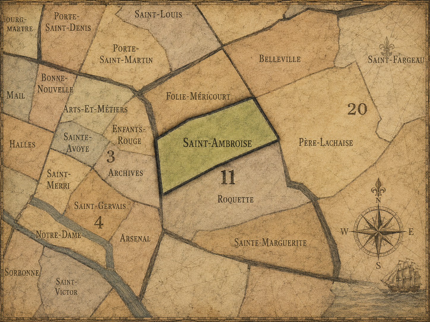
11e - SAINT-AMBROISE
Quartiers Administratifs
Part of an ongoing project to walk and photograph every neighborhood in Paris, this page explores the Administrative Quarter: 11e - Saint-Ambroise through maps, district identity, history, and photography.




The Map
Download the Paris Arrondissements Map
Geographic Setting
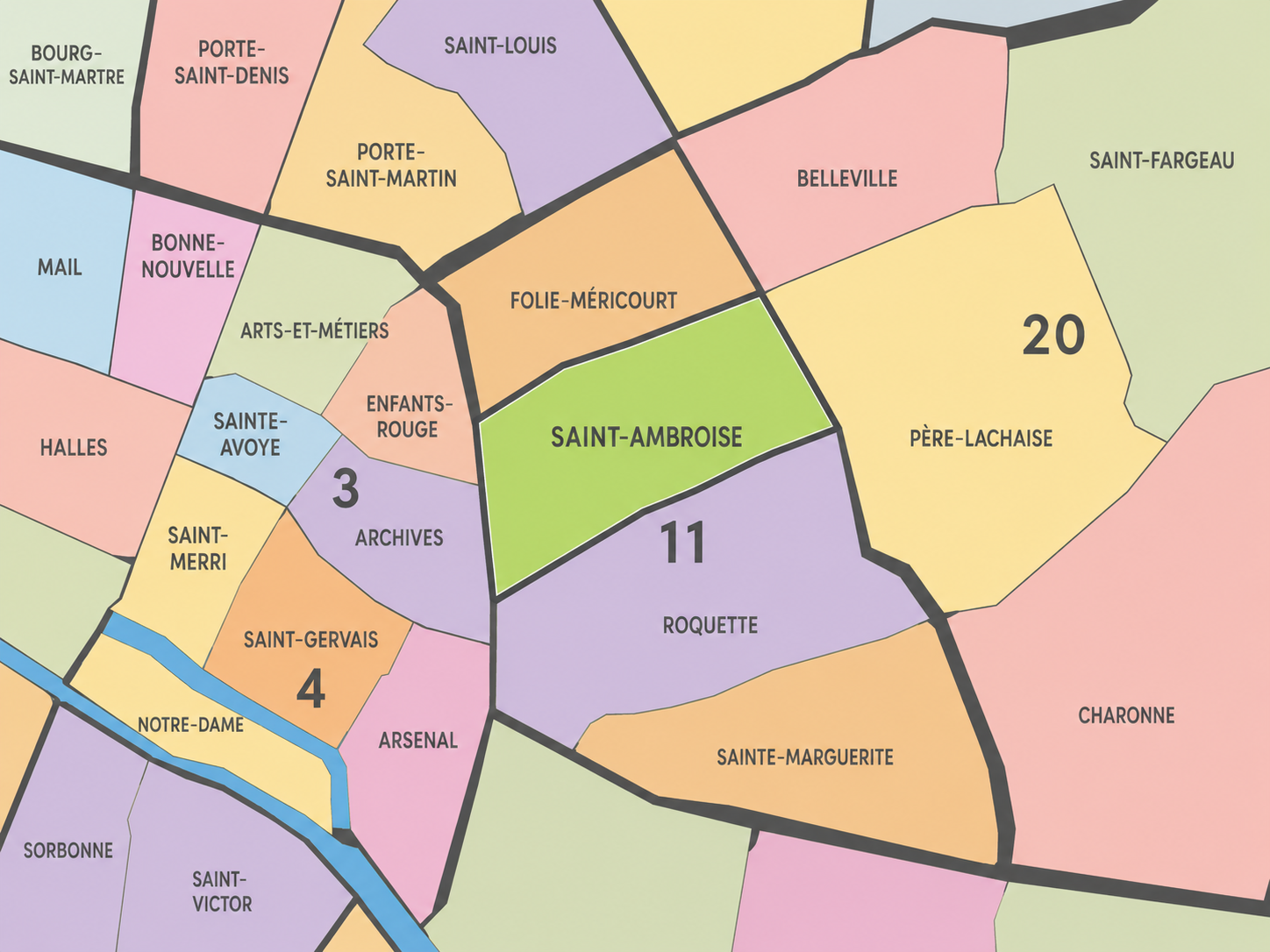
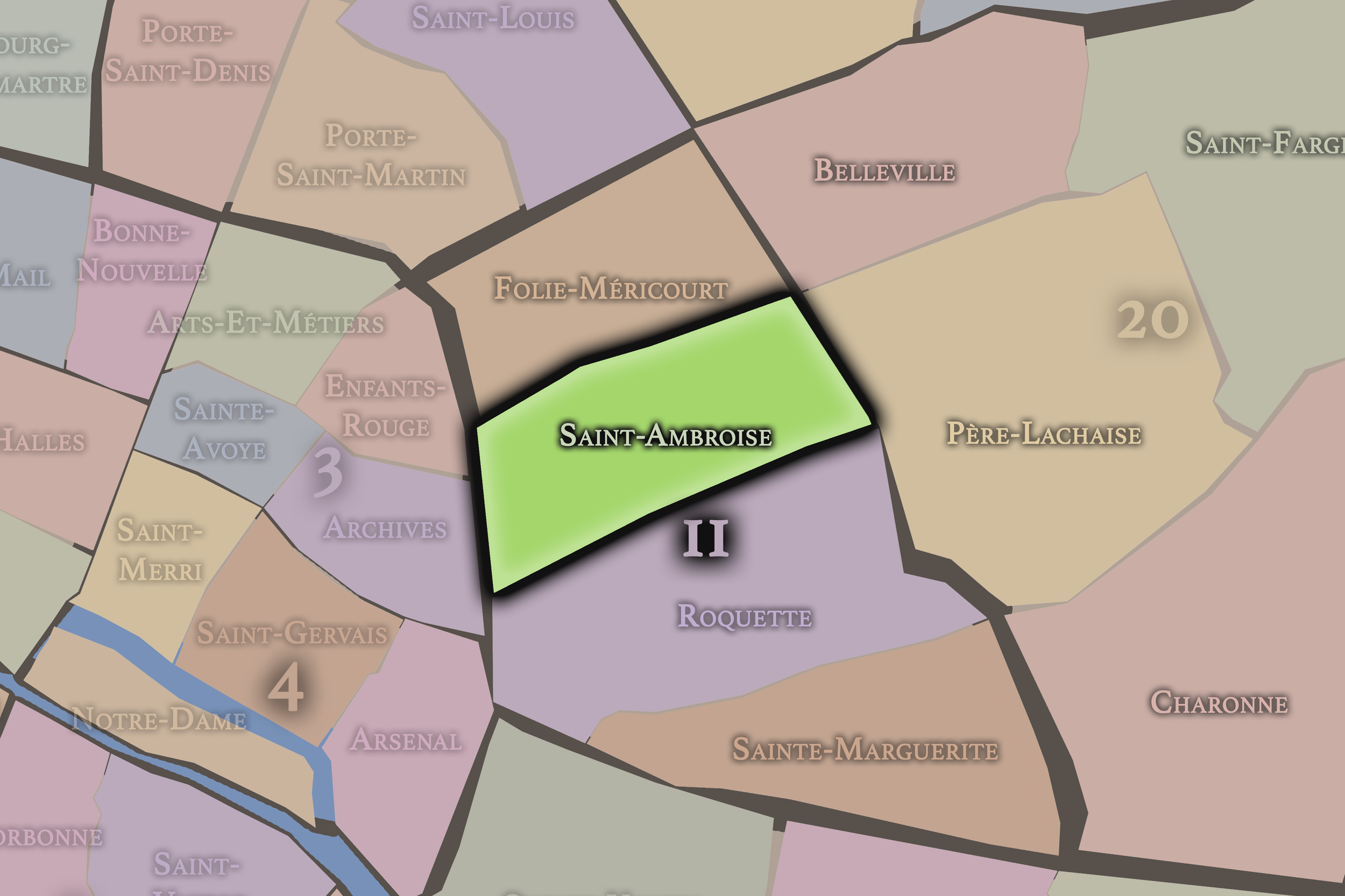
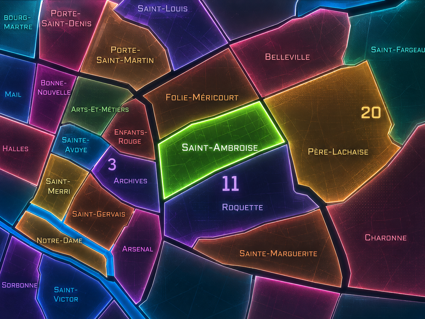
Saint-Ambroise occupies the central portion of the 11th arrondissement, where the dense eastern fabric of Paris gathers around Boulevard Voltaire, Avenue Parmentier, Rue Saint-Maur, Rue Oberkampf, Rue de la Folie-Méricourt, Rue Popincourt, and the residential streets that connect République, Bastille, Ménilmontant, and Père-Lachaise. Set between Folie-Méricourt to the north, Roquette to the southwest, Sainte-Marguerite to the southeast, and the 20th arrondissement’s Père-Lachaise / Ménilmontant edge to the east, Saint-Ambroise is one of the 11th arrondissement’s most central and connective quarters.
The quarter is anchored by the Église Saint-Ambroise, which stands along Boulevard Voltaire and gives the district both its name and its most visible civic-religious landmark. Around it extends a neighborhood of apartment blocks, small shops, cafés, schools, courtyards, ateliers, and side streets where the 11th arrondissement’s working, residential, political, and everyday identities remain closely intertwined. This is not a quarter of grand state spectacle or singular tourist monument. It is a district of lived density: streets crossed daily, errands repeated, cafés occupied, schools entered, and older working-class memory folded into contemporary urban life.
Unlike Folie-Méricourt, whose identity is strongly tied to République, Oberkampf, nightlife, and the northern social energy of the arrondissement, or Roquette, whose history is marked by Bastille, prisons, and popular memory, Saint-Ambroise feels more centered and residential. It is the 11th arrondissement as neighborhood fabric: active, grounded, politically aware, and held together by the rhythm of ordinary streets.
Administrative Quarter Identity
Etymology and Origins
The name Saint-Ambroise comes from the Église Saint-Ambroise, dedicated to Saint Ambrose, the 4th-century bishop of Milan and one of the great Doctors of the Western Church. The church gave the quarter its official administrative name, placing a Christian and ecclesiastical reference at the center of a district otherwise known for working streets, apartment life, and the social history of eastern Paris.
The present church belongs to the 19th-century reshaping of Paris, but the dedication carries a much older religious lineage. Saint Ambrose was associated with theology, pastoral authority, music, moral discipline, and the relationship between church and civic life. In the context of the 11th arrondissement, the name introduces a note of spiritual and institutional order into a quarter shaped by popular urban growth.
That contrast is important. Saint-Ambroise is not one of the older village names of Paris, nor a former gate, nor a market, nor a faubourg road. It is a parish-based administrative name imposed within a district that developed through the city’s eastward expansion. The name gives the quarter a formal anchor, but the life around it has always been broader: residential, artisanal, political, commercial, and social.
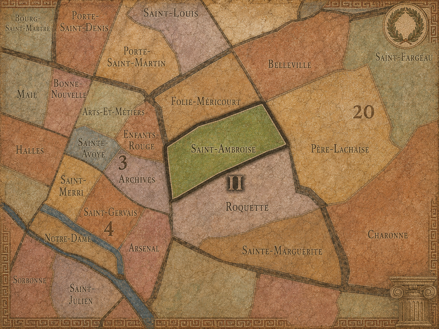
Within the official geography of Paris, Saint-Ambroise is one of the four administrative quarters of the 11th arrondissement, alongside Folie-Méricourt, Roquette, and Sainte-Marguerite. It occupies the arrondissement’s central sector, making it one of the key interior quarters of eastern Paris. Its position helps connect the northern Oberkampf / République world, the southern Bastille / Roquette landscape, the Faubourg Saint-Antoine edge, and the eastern approaches toward Père-Lachaise and Ménilmontant.
As an administrative quarter, Saint-Ambroise gives civic shape to an area often described through nearby streets and metro stations rather than through the official quarter name itself. A visitor or resident may orient by Saint-Ambroise, Voltaire, Parmentier, Rue Saint-Maur, Richard-Lenoir, Popincourt, or Oberkampf without necessarily thinking of the full administrative geography. The official name gathers those fragments into a single civic unit.
This frame is especially useful because Saint-Ambroise is less mythologized than some neighboring quarters. It does not have Bastille’s symbolic force, Oberkampf’s nightlife shorthand, or the Faubourg Saint-Antoine’s craft identity. Its importance lies in its centrality within the 11th itself. It is a quarter that helps hold the arrondissement together.
Civic Framework
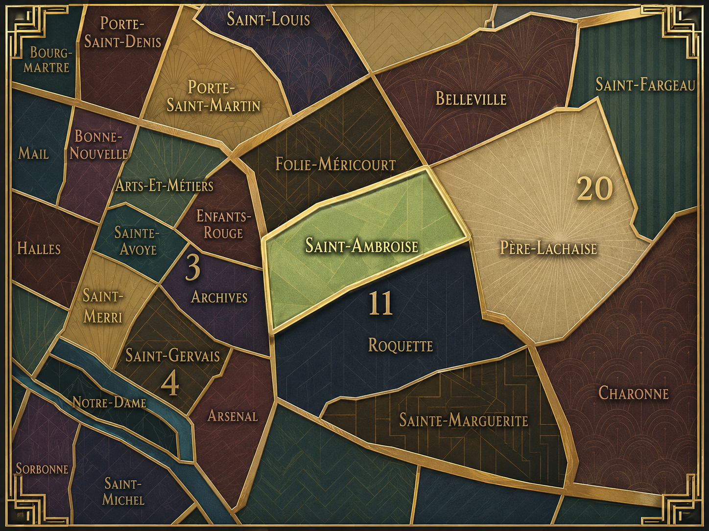
Saint-Ambroise differs from the other quarters of the 11th arrondissement through its central, residential, and civic-parish character. Folie-Méricourt is more associated with République, Oberkampf, bars, restaurants, and the energetic northern edge of the arrondissement. Roquette carries the historical drama of Bastille, prisons, Rue de la Roquette, Rue de Lappe, and the popular memory of the lower 11th. Sainte-Marguerite is more closely tied to the Faubourg Saint-Antoine, craft traditions, furniture-making, and the eastern extension of the working faubourg.
Saint-Ambroise is quieter in myth, but not in life. Its distinction lies in the everyday structure of the arrondissement: apartment streets, schools, cafés, shops, churches, local squares, and the strong east-west presence of Boulevard Voltaire. It is the quarter where the 11th’s larger identities pass through one another without being reduced to any single one.
It should also be distinguished from Popincourt, a name often used in the surrounding area and historically associated with local streets, markets, and administrative life. Popincourt is an important cultural and historical layer within the 11th, but Saint-Ambroise is the official administrative quarter. The distinction matters because it shows how Parisian neighborhoods can carry several naming systems at once: official, historic, commercial, and lived.
Neighborhood Distinction
Parisian Identity
Saint-Ambroise expresses Paris as a city of ordinary intensity. It is not ordinary in the sense of dull; it is ordinary in the sense of deeply lived. Its streets are not arranged around spectacle, but around the habits that make a neighborhood real: food shopping, school runs, café meetings, political posters, apartment entrances, church bells, metro stops, weekend errands, and the daily density of people living close together.
The quarter also carries the political and social memory of eastern Paris. The 11th arrondissement has long been associated with working-class life, republican energy, labor politics, protest, and the popular culture of the faubourgs. Saint-Ambroise sits within that inheritance. Its identity is not as dramatically insurrectionary as Bastille or as nightlife-driven as Oberkampf, but it belongs to the same eastern civic temperament: engaged, social, and alert to public life.
This makes Saint-Ambroise a valuable corrective to more picturesque ideas of Paris. It is not a quarter where the city poses for the visitor. It is a quarter where Paris works through the day: living, arguing, shopping, resting, organizing, and adapting. Its beauty is found in density and use.
Neighborhood Connections
Every administrative quarter belongs to a wider Parisian fabric. These connections place Saint-Ambroise within the city’s civic, participatory, and cultural geography:
-
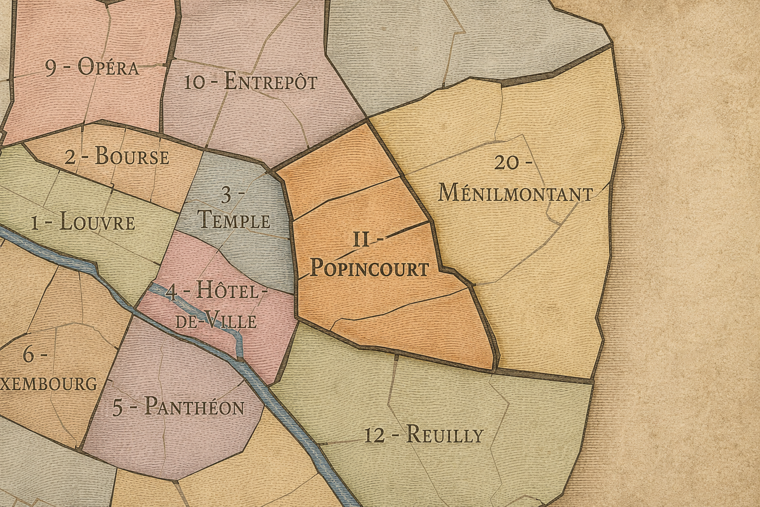
11e - Popincourt
-

Belleville - Saint-Maur • Léon Blum - Folie-Régnault • République - Saint-Ambroise
The History
The origins of Saint-Ambroise lie in the eastward expansion of Paris beyond the older central city and into the faubourg landscapes that developed around Popincourt, Saint-Antoine, Belleville, Ménilmontant, and the roads leading outward from Bastille and République. Before the modern quarter took shape, this area was part of a semi-urban edge: fields, gardens, religious lands, workshops, roads, and scattered settlement gradually absorbed into the growing capital.
The quarter’s later identity was shaped by this faubourg condition. Eastern Paris developed differently from the aristocratic west. It attracted artisans, workers, small industries, modest housing, and trades that relied on space, proximity to roads, and looser conditions than the dense historic center could provide. Saint-Ambroise inherited that practical and social urban DNA.
The parish and church name came later as the district became more fully urban and required civic, religious, and administrative structure. In that sense, Saint-Ambroise began as a landscape of growth before becoming a named quarter of the modern city.
Origins
16th–17th Century
In the 16th and 17th centuries, the future Saint-Ambroise quarter remained beyond the densest core of Paris, within the eastern outer lands connected to Popincourt, Charonne, Ménilmontant, and the Faubourg Saint-Antoine world. Roads, gardens, small properties, religious holdings, and early workshop activity shaped the landscape. It was close to Paris, but not yet fully Paris in the central urban sense.
The eastern faubourgs grew through function. They were places of labor, production, services, and movement, situated outside or near the limits of the old city. Unlike the courtly west or the academic Left Bank, this landscape was shaped more by work and practical settlement than by prestige institutions. That difference would become essential to the 11th arrondissement’s later identity.
By the end of the 17th century, the pressure of Paris’s expansion was increasingly felt. Bastille, the Faubourg Saint-Antoine, the roads toward Belleville and Ménilmontant, and the growing density of eastern settlement prepared the ground for Saint-Ambroise’s eventual urbanization. The quarter’s later centrality within the 11th began as an edge condition.
In the 18th century, the area that would become Saint-Ambroise grew more closely tied to the developing life of eastern Paris. Housing, workshops, gardens, religious sites, and small commerce thickened the urban fabric. The district remained less formal than western Paris, but increasingly important as part of the popular and productive city.
The broader 11th arrondissement area was shaped by the powerful social geography of the eastern faubourgs. The Faubourg Saint-Antoine, Popincourt, and surrounding streets were associated with artisans, furniture trades, workers, and politically active populations. Saint-Ambroise, situated within this larger environment, absorbed the atmosphere of a Paris built from labor and neighborhood solidarity.
The French Revolution gave this eastern landscape extraordinary importance. The people and streets of the faubourgs played central roles in revolutionary and popular politics. Saint-Ambroise’s future quarter identity cannot be separated from this inheritance: a district shaped by the belief that urban life and political life are closely connected.
18th Century
19th Century
The 19th century transformed Saint-Ambroise into a fully urban quarter. The creation of the modern 11th arrondissement, the development of Boulevard Voltaire, the growth of apartment housing, the expansion of workshops and small industries, and the construction of the Église Saint-Ambroise all gave the district the structure recognizable today. The church provided a formal landmark within a quarter otherwise defined by dense street life.
Boulevard Voltaire became one of the great organizing axes of the arrondissement, linking République and Nation through eastern Paris. Saint-Ambroise’s location along this corridor placed it within a powerful civic and political geography. The boulevard was not merely a street; it was a route through the popular east, a line of movement, protest, commerce, and everyday life.
The quarter also participated in the working-class and artisanal life of the 11th. Workshops, small manufacturers, furniture-related trades, metalwork, printing, cafés, and modest housing created a dense urban landscape. Saint-Ambroise became one of the places where Paris’s modern working city took shape block by block.
In the early and mid 20th century, Saint-Ambroise remained a residential and working quarter of eastern Paris. Its streets held apartment buildings, workshops, cafés, schools, small businesses, parish life, and the routines of families and workers living within a dense urban environment. The quarter was not isolated from the larger city, but it retained a strongly local character.
The political memory of the 11th arrondissement continued to matter. Eastern Paris remained associated with labor movements, republican and left-wing politics, neighborhood organization, and public demonstrations. Saint-Ambroise, with Boulevard Voltaire running through its civic landscape, belonged to that culture of political visibility. The street was a route as well as a stage.
During the First World War, interwar period, occupation, liberation, and postwar recovery, the quarter shared in the hardships and resilience of working Paris. Its importance lay less in famous monuments than in the continuity of daily urban life under pressure: food, work, school, church, neighborhood ties, and public memory.
Early–Mid 20th Century
Late 20th Century
In the late 20th century, Saint-Ambroise began to change as the industrial and workshop functions of the 11th declined or moved outward, while residential reinvestment, new businesses, restaurants, cultural venues, and younger populations reshaped the arrondissement. The quarter did not transform as dramatically into a nightlife shorthand as Folie-Méricourt or Oberkampf, but it participated in the broader reinvention of eastern Paris.
Former workshops were converted, small businesses changed, and older working-class patterns faced pressure from rising property values and new forms of urban consumption. At the same time, Saint-Ambroise retained a grounded neighborhood quality. Its central location within the 11th made it attractive, but its identity remained more local and residential than spectacular.
This period also reinforced the importance of memory. As the material traces of workshop Paris became less dominant, the history of labor, craft, and popular politics required more conscious preservation. Saint-Ambroise’s streets still carried that inheritance, even as their uses evolved.
In the 21st century, Saint-Ambroise remains one of the most balanced and lived-in quarters of the 11th arrondissement. It is central within the arrondissement, active without being overwhelmingly touristic, and shaped by a mixture of residents, families, students, workers, cafés, restaurants, shops, schools, offices, and small cultural spaces. Boulevard Voltaire, Avenue Parmentier, Rue Saint-Maur, and the surrounding side streets give the district both movement and neighborhood scale.
Today, the quarter reflects many of the broader changes of eastern Paris: gentrification, new food culture, renovated housing, creative businesses, and rising desirability. But it also retains older elements of the 11th: social density, political memory, local commerce, apartment life, and the sense that public life belongs naturally on the street. Saint-Ambroise remains Paris as neighborhood rather than postcard.
For CityNeighborhoods: Paris, Saint-Ambroise is essential because it shows how an administrative quarter can be important without being dominated by one global landmark. Its identity lies in civic texture: church, boulevard, school, workshop memory, residential street, café, and the political-social inheritance of eastern Paris. It is the 11th arrondissement at its center of gravity.
21st Century
Spirit and Legacy
Saint-Ambroise is the quarter of the lived middle. Its spirit is steady, social, and deeply urban. It belongs to Boulevard Voltaire and parish steps, apartment courtyards and workshop traces, neighborhood cafés and school gates, political posters and ordinary errands, the daily life of eastern Paris continuing across generations.
Its legacy is the transformation of faubourg ground into civic neighborhood. Outer roads became residential streets. Workshops became apartments, studios, restaurants, and shops. A working district became a central and desirable part of the modern 11th. Yet beneath those changes, the quarter’s deeper identity remains tied to density, public life, and the habits of people living close together.
To walk Saint-Ambroise is to encounter Paris without needing the city to announce itself. The quarter’s meaning is not hidden, but it is quiet enough to reward attention. It is found in crossings, façades, storefronts, bells, errands, and the way eastern Paris carries its history through use. In Saint-Ambroise, neighborhood identity is not spectacle. It is continuity — the life of the city held in the center of the arrondissement.
The Photography
The arrondissements do not share a single visual identity. Instead, they organize Paris into twenty broad visual fields, each gathering its own combination of landmarks, streetscapes, institutions, residential districts, commercial corridors, parks, rail stations, markets, cemeteries, and riverfront edges.
Some arrondissements are defined by monumental scale: royal palaces, ceremonial avenues, government buildings, museums, formal gardens, and internationally recognized landmarks. Others are shaped by hills, canals, rail gateways, apartment-lined boulevards, neighborhood markets, former village streets, industrial remnants, parks, or the quieter rhythms of residential Paris. The arrondissement system gives these varied landscapes a civic frame, allowing the city to be read not as one visual language, but as a sequence of overlapping Parisian atmospheres.

Visual Identity
Through The Lens
Photographing the arrondissements means moving between the official map and the street-level experience. The camera does not treat each arrondissement as visually uniform. Instead, it looks for the recurring forms, textures, transitions, and contrasts that make each district legible: the geometry of boulevards, the shade of plane trees, the repetition of balconies, the rise of stairways, the curve of canals, the presence of rail stations, the opening of parks, the weight of monuments, and the intimacy of side streets.
On CityNeighborhoods, the arrondissement provides the frame, but the photograph comes from the encounter between map, movement, light, and observation. As the Paris photography is processed, this section will connect each arrondissement more directly to the project’s Photographic Lexicon: the visual strategies, recurring motifs, and compositional patterns that shape how the city is seen through the lens.

If you visit Paris, these ideas can help inspire your own photography.



Paris: J’Espere, Je Rêve, Je Vive
Paris Photo Gallery
Paris Field Notes
-
Field Note: August 18, 2025 | 07:58 AM
Conditions: 73°F | Humidity: 72%.
Within the park's interior, the glacial kettle ponds acted as humidity traps, creating a soft, hazy light that filtered through the old-growth oaks. The transition from the park's dense shade to the sun-drenched edges of Oakland Gardens highlighted the day's exceptional "picture-perfect" clarity.
There is a fleeting window in Queens where the humidity of August hasn't yet heavy-set, and the morning sun hits the canopy of Alley Pond Park at a perfect oblique angle. Arriving just before 8:00 AM, I watched the light break through the oaks and tulip trees, casting long, dramatic shadows across the wet grass. It’s in these quiet, golden moments that the park feels less like a city escape and more like the ancient glacial valley it actually is.
Other neighborhoods visited:











































































































Explore Paris
-

The twenty arrondissements form the civic spiral of Paris, organizing the city into its broad local districts of government, identity, and daily life.
-

Each arrondissement is divided into four official administrative quarters, giving Paris a more precise civic and geographic framework.
-

The conseils de quartier bring participation to street level, giving residents a voice in neighborhood needs, public space, and local civic life.
-

Les Deux Rives trace Paris through the Seine’s two banks, revealing how the Rive Droite and Rive Gauche shaped the city’s civic power, commerce, learning, art, and cultural identity.
-

Cultural neighborhoods reveal the Paris people recognize through history, cafés, architecture, memory, atmosphere, and local belonging.