
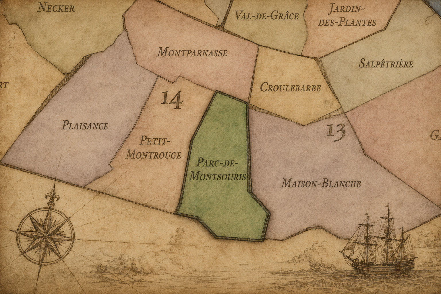
14e - PARC-DE-MONTSOURIS
Quartiers Administratifs
Part of an ongoing project to walk and photograph every neighborhood in Paris, this page explores the Administrative Quarter: 14e - Parc-de-Montsouris through maps, district identity, history, and photography.




The Map
Download the Paris Arrondissements Map
Geographic Setting
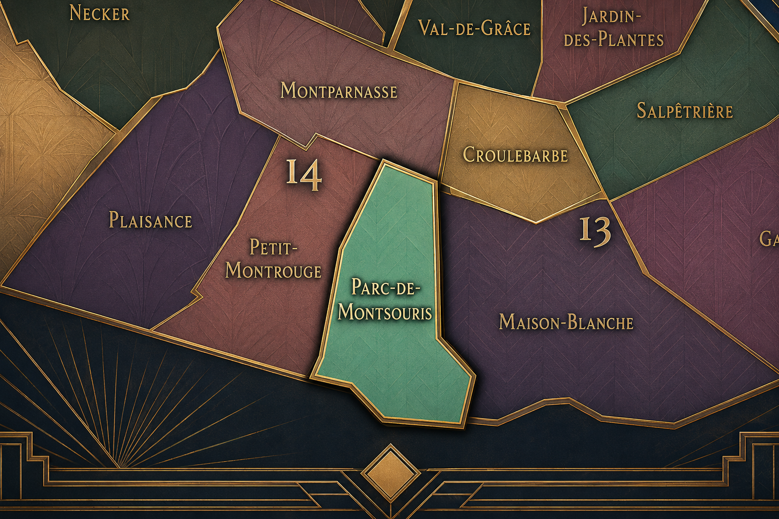
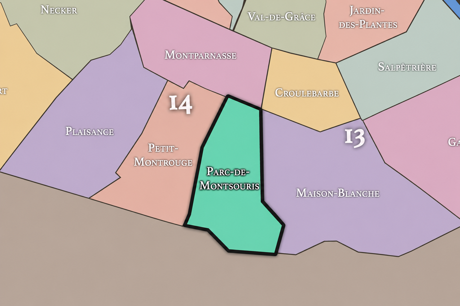
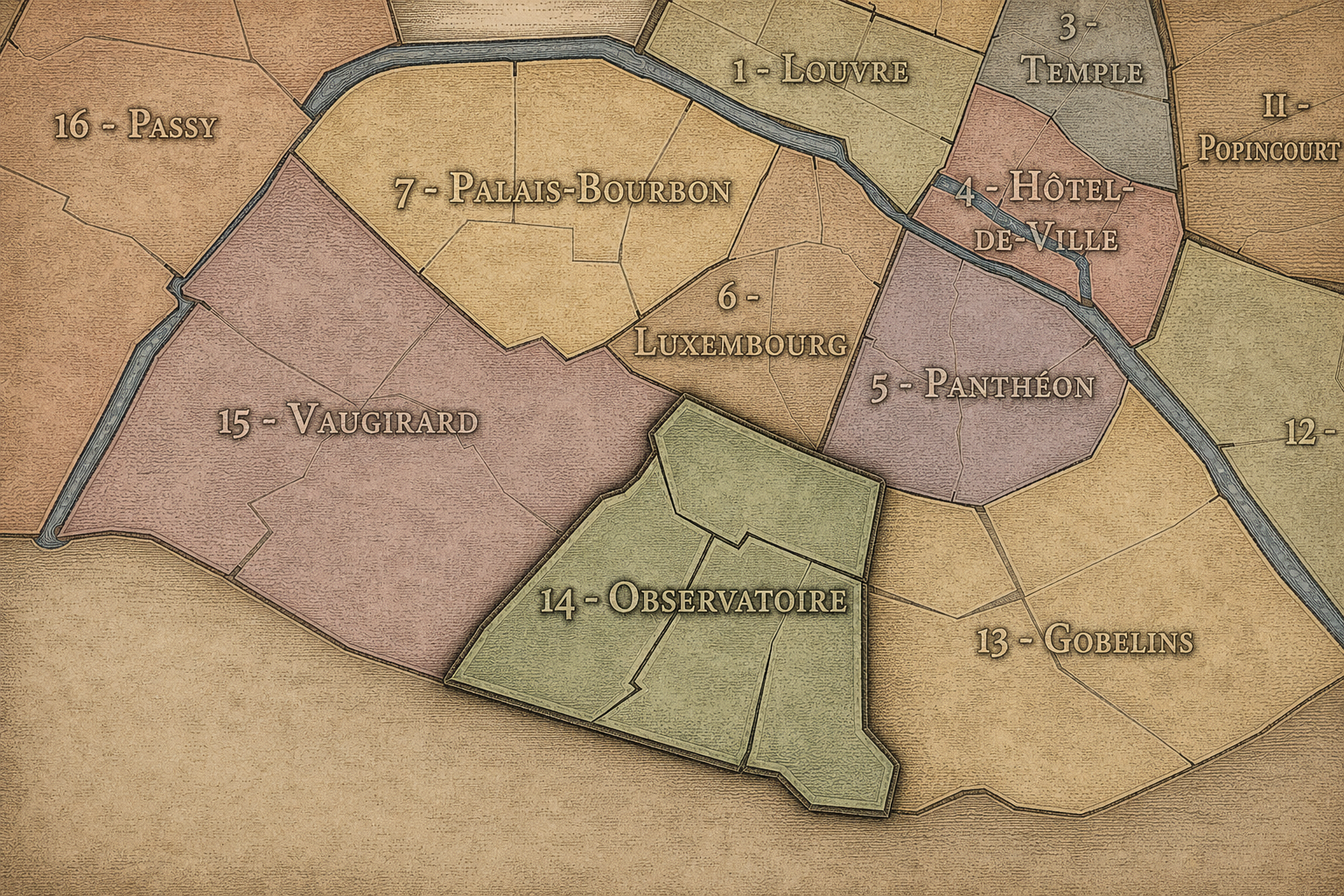
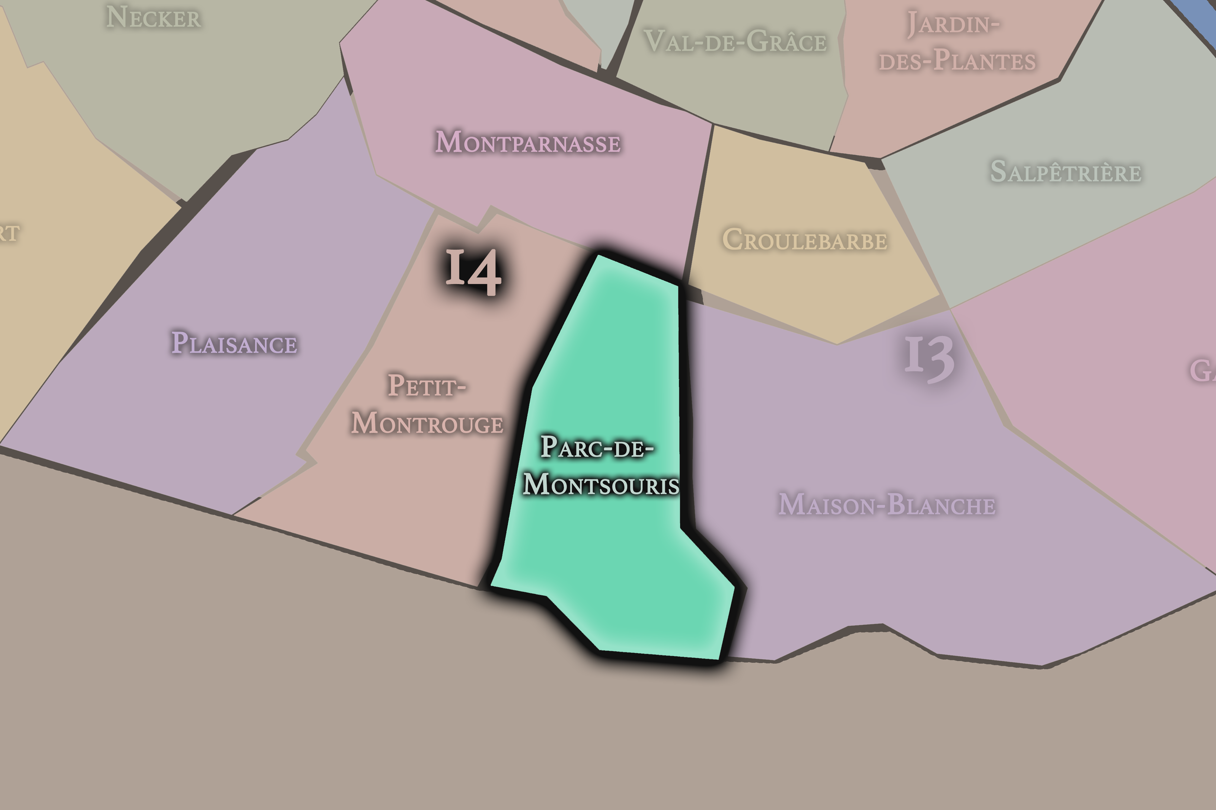
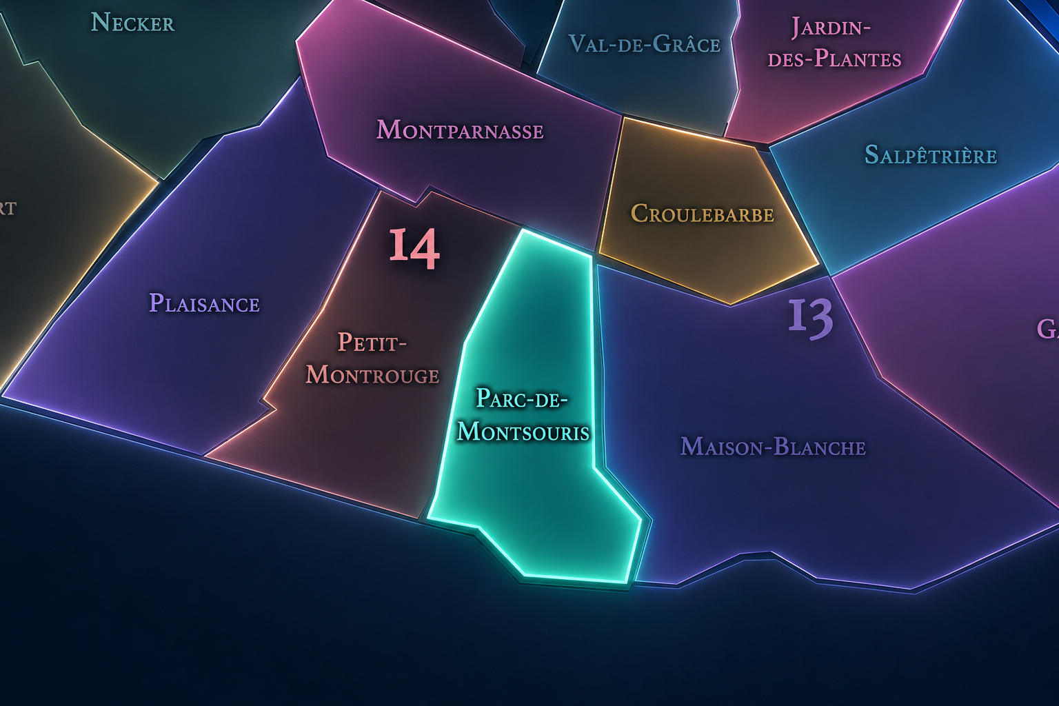
Parc-de-Montsouris occupies the southeastern portion of the 14th arrondissement, where Paris approaches its southern edge through parkland, university residences, reservoirs, hospitals, villas, rail corridors, and the quiet residential streets between Alésia, Glacière, Porte d’Orléans, Porte de Gentilly, and the boundary with Gentilly and Montrouge. It lies south and southeast of Petit-Montrouge, east of Plaisance, and below the Montparnasse and Observatory landscapes that shape the northern 14th. It is one of the arrondissement’s most green and spatially open quarters, defined less by a single commercial center than by institutions and breathing room.
The quarter’s defining landscape is Parc Montsouris itself, one of the major public parks created under Napoleon III and the Second Empire. Its winding paths, lake, lawns, slopes, tree cover, and railway-edge setting give the quarter an unusually pastoral identity within the southern city. Around the park are Rue Gazan, Avenue Reille, Boulevard Jourdan, Rue de la Cité-Universitaire, Rue Nansouty, Rue Émile-Deutsch-de-la-Meurthe, and the residential streets and villas that create some of the 14th arrondissement’s most quietly distinctive urban fabric.
The quarter also includes or closely relates to major institutions such as the Cité internationale universitaire de Paris, the Réservoir de Montsouris, the former southern railway landscapes, and the Sainte-Anne hospital edge. Unlike Montparnasse, whose identity is cultural, café-centered, and station-driven, or Plaisance, whose history is more working-residential and tied to southern expansion, Parc-de-Montsouris is the 14th arrondissement as green threshold: Paris turning toward open space, student internationalism, water infrastructure, and the city’s southern boundary.
Administrative Quarter Identity
Etymology and Origins
The name Parc-de-Montsouris comes from Parc Montsouris, the large public park that gives the quarter its central identity. “Montsouris” is usually understood as a local place-name of uncertain or debated origin, often linked to older forms such as “Moque-Souris” or to the rougher, semi-rural landscape that existed before the park. Whatever its exact derivation, the name preserves a pre-park memory of the southern outskirts before this part of Paris was formalized into a public landscape.
The administrative quarter’s name is therefore unusually landscape-centered. It is not named for a church, former village, saint, gate, station, or market. It is named for a park — and through that park, for the Second Empire’s effort to bring large public green spaces to different parts of the city. Parc Montsouris was part of the same broad urban vision that also gave modern Paris places such as the Bois de Boulogne, Bois de Vincennes, Parc Monceau, and Buttes-Chaumont: spaces where the dense city could be balanced by carefully designed nature.
This gives the quarter a strong atmospheric identity. The name does not simply identify a district around a park; it frames the entire neighborhood through air, trees, paths, water, and repose. Parc-de-Montsouris is one of the places where Paris names itself through relief from itself.
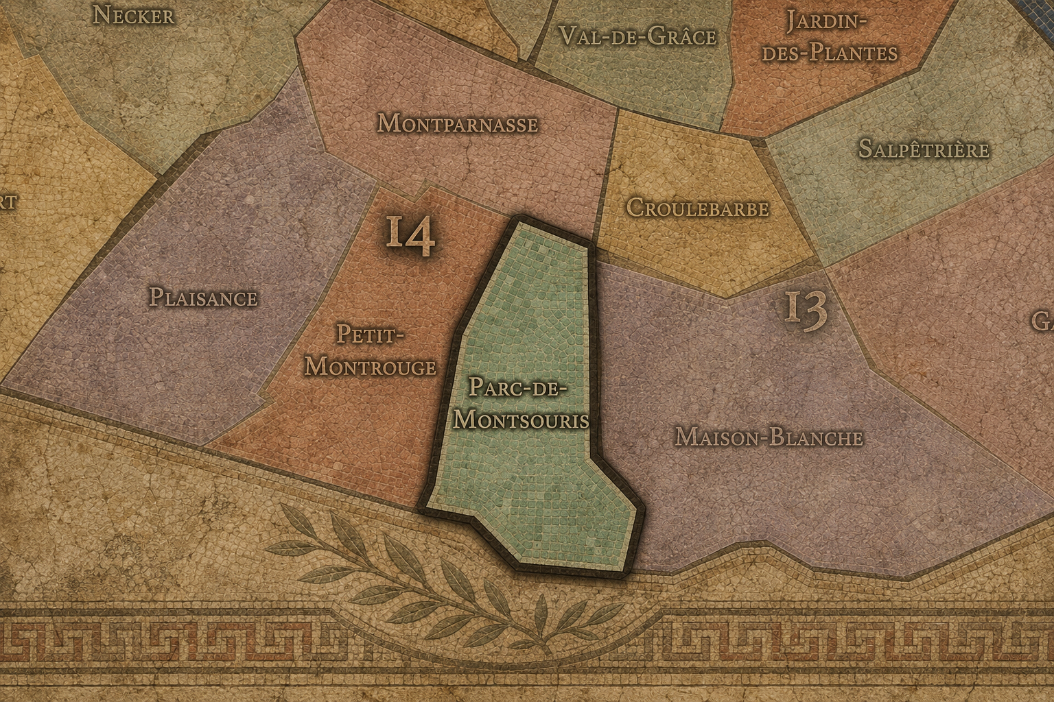
Within the official geography of Paris, Parc-de-Montsouris is one of the four administrative quarters of the 14th arrondissement, alongside Montparnasse, Plaisance, and Petit-Montrouge. It is traditionally counted as the 54th administrative quarter of Paris and occupies the eastern / southeastern sector of the arrondissement. District references identify it as one of the four official quarters that make up the 14th arrondissement.
As an administrative quarter, Parc-de-Montsouris gives civic shape to an area that might otherwise be described through several stronger local names: Montsouris, Cité Universitaire, Alésia, Glacière, Porte d’Orléans, Porte de Gentilly, or the southern edge of the 14th. The official name gathers these identities into one mapped unit and places the park at the center of the quarter’s meaning.
This civic frame is especially useful because the area is more diffuse than some other Parisian quarters. It does not revolve around a single market street or monumental square. Instead, it is structured by open space, institutional grounds, residential pockets, and edge conditions. The administrative name helps reveal that these elements belong together: park, university city, reservoir, hospital edge, villas, rail traces, and southern boundary.
Civic Framework
Parc-de-Montsouris differs from the other quarters of the 14th arrondissement through its green, institutional, and southern-edge identity. Montparnasse is the quarter of cafés, studios, cemeteries, theater, rail, tower, and artistic mythology. Plaisance is more residential and working-class in inheritance, tied to the southern growth of Paris, local streets, and the old village / faubourg fabric beyond the famous Montparnasse axis. Petit-Montrouge is more parish-centered and commercial-residential, shaped by Alésia, local shopping streets, and the absorption of the former Montrouge landscape.
Parc-de-Montsouris is quieter, more open, and more campus-like. Its distinction lies in the concentration of green and semi-institutional landscapes: the park, the Cité internationale universitaire, the reservoirs, hospital grounds, rail edges, villas, and the residential streets around them. It is not empty or suburban, but it has a different breath from the denser northern and western parts of the arrondissement.
It should also be distinguished from Cité Universitaire as a cultural and institutional name. The Cité internationale universitaire de Paris is one of the quarter’s major anchors, but it is not the whole quarter. Parc-de-Montsouris is the official administrative frame; Cité Universitaire is the international academic and residential landscape within and beside it. Together, they give the quarter a rare combination: neighborhood, park, and world-campus.
Neighborhood Distinction
Parisian Identity
Parc-de-Montsouris expresses Paris as a city that makes room for breath, study, and managed nature. Its identity is not built on spectacle, but on relief. The park opens a large green interior within the southern city, while the Cité internationale universitaire brings a cosmopolitan academic mission to the edge of Paris. The quarter is therefore both restful and outward-looking: a place of trees and paths, but also of students, researchers, languages, national houses, and international exchange.
Parc Montsouris itself belongs to the 19th-century transformation of Paris under Napoleon III and Haussmann’s administration. Work on the park was part of the city’s larger effort to create major public green spaces across Paris, with Adolphe Alphand’s landscape service playing a central role in this new urban park system; accounts commonly date its dedication to 1869, with work continuing into the 1870s.
The Cité internationale universitaire adds a 20th-century layer of idealism. It was born after the First World War in a pacifist interwar context and was entrusted in 1925 to a foundation dedicated to its mission of housing and bringing together students from different countries. In Parc-de-Montsouris, Paris becomes not only a national capital, but a place where the world is invited to live, study, and encounter itself.
Neighborhood Connections
Every administrative quarter belongs to a wider Parisian fabric. These connections place Parc-de-Montsouris within the city’s civic, participatory, and cultural geography:
-
14e - Observatoire
-

Montsouris - Dareau • Mouton-Duvernet
The History
The origins of Parc-de-Montsouris lie in the southern outskirts of Paris, beyond the older Left Bank and outside the dense central city. Before the modern quarter took shape, this area was associated with open ground, quarries, roads, small settlements, reservoirs, rail corridors, and the transitional landscapes near Montrouge and Gentilly. It was not part of the old monumental center. It was edge-land — useful, uneven, and available for later transformation.
This peripheral condition made possible the quarter’s later identity. Large parks, reservoirs, hospitals, railways, and university campuses require space. The southern edge of Paris offered that space in a way the dense central neighborhoods did not. Parc-de-Montsouris grew not from medieval enclosure or market life, but from the city’s modern need to organize health, water, transport, education, and public green space.
The quarter’s origin story is therefore one of conversion. Former outer land became civic landscape. Quarries and rough ground became park. Southern boundary became campus edge. Peripheral territory became one of the 14th arrondissement’s most distinct environments.
Origins
16th–17th Century
In the 16th and 17th centuries, the future Parc-de-Montsouris quarter lay outside the dense built fabric of Paris. The area was closer to the outer landscapes of Montrouge and Gentilly than to the older Left Bank neighborhoods around the Latin Quarter, Saint-Germain, or Montparnasse. Roads, fields, quarries, religious properties, gardens, and scattered settlement shaped the southern approach to the city.
This distance from the center gave the land a different character. It was not yet a fashionable residential quarter or a symbolic urban landscape. It belonged to the practical outskirts, where activities requiring space could exist beyond the crowded core. The later park and institutions would draw on that geography of availability.
By the end of the 17th century, Paris was expanding, but the southern edge still retained much of its outer character. The future quarter remained a landscape waiting to be absorbed — close enough to the city to be shaped by its needs, but open enough to be transformed at scale.
In the 18th century, the area continued to sit within the southern fringe of Paris. The road networks toward Orléans, Gentilly, and Montrouge grew in importance, while outer lands gradually filled with more settlement, service uses, quarries, gardens, and institutions. The future Parc-de-Montsouris quarter remained peripheral, but less remote than before.
This was also a period when Paris’s relationship to its surrounding territory became increasingly administrative and infrastructural. The capital needed water, roads, burial grounds, hospitals, military and tax boundaries, and better control over the edges where city and countryside met. The future quarter would eventually be shaped by exactly these systems: reservoirs, rail, parkland, and institutional grounds.
The French Revolution and later administrative changes altered the relationship between Paris and its outskirts, but the decisive incorporation and transformation of this area came in the 19th century. In the 18th century, Parc-de-Montsouris was still more potential than place: southern ground awaiting the modern city’s plans.
18th Century
19th Century
The 19th century created the modern identity of Parc-de-Montsouris. The 1860 expansion of Paris brought surrounding southern lands into the capital, and the Second Empire’s urban vision soon turned part of this former edge into a major public park. Parc Montsouris was conceived as one of the large parks intended to improve urban life by bringing air, greenery, promenade, and designed landscape to a growing city.
The park’s design followed the picturesque principles associated with Alphand, with curving paths, lawns, an artificial lake, planted slopes, and carefully arranged views. Its southern location made it especially important for the newly incorporated parts of Paris, giving the 14th arrondissement a major green anchor comparable in civic purpose, if not in exact character, to the great parks created elsewhere in the city.
The 19th century also brought infrastructure. Rail lines, reservoirs, new streets, and urban boundaries reshaped the district around the park. The quarter became a place where the modern city layered leisure, engineering, and public health onto land that had once been peripheral. Parc-de-Montsouris was born from this combination: a public park surrounded by the systems that made modern Paris work.
In the early and mid 20th century, Parc-de-Montsouris gained a new layer of identity through the creation and development of the Cité internationale universitaire de Paris. Founded in the aftermath of the First World War, the Cité grew from an idealistic belief that housing students from different nations together could support peace, cultural exchange, and international understanding. Its foundation structure dates from 1925, and its development added a major academic and diplomatic landscape to the southern edge of the city.
This transformed the quarter’s meaning. Parc-de-Montsouris was no longer only a park quarter or southern residential edge. It became part of an international student geography, with houses and pavilions representing different countries, architectural traditions, and educational ambitions. The area around Boulevard Jourdan became one of the most cosmopolitan landscapes of the 14th arrondissement.
During the same period, the park continued to serve local residents as a place of walking, rest, childhood, and neighborhood rhythm. Through war, occupation, liberation, and postwar recovery, green spaces and institutional campuses carried special importance: places of pause, gathering, survival, and rebuilding. Parc-de-Montsouris held both local calm and international aspiration.
Early–Mid 20th Century
Late 20th Century
In the late 20th century, Parc-de-Montsouris retained its character as one of the 14th arrondissement’s most desirable green and residential quarters while the institutions around it continued to evolve. The Cité internationale universitaire expanded its role as a campus-like world of residences, cultural programming, and international exchange. The park remained a major open space for southern Paris, valued for its calm and scale.
The quarter also became increasingly appreciated for its distinctive residential pockets. Streets and villas around the park, including areas near Square de Montsouris and Villa Seurat, gained attention for their architecture, quiet atmosphere, and connections to artists, writers, and modernist houses. The neighborhood’s appeal came not from grand spectacle, but from a rare combination of greenery, intimacy, and architectural discovery.
At the same time, the quarter remained tied to the realities of the southern edge: traffic corridors, rail lines, institutional boundaries, hospital proximity, and the physical limits of the city. This gave Parc-de-Montsouris an identity of contrast. It was peaceful, but not isolated; green, but structured by infrastructure; residential, but shaped by major institutions.
In the 21st century, Parc-de-Montsouris remains one of the 14th arrondissement’s most quietly cherished quarters. The park continues to provide green relief within the dense city, while the Cité internationale universitaire remains a major site of international student life and cultural exchange. Recent accounts of the Cité describe it as a campus of dozens of houses that welcomes thousands of students, researchers, and artists each year from a wide range of nationalities, reinforcing its identity as a “world campus” on the edge of Paris.
Today, the quarter’s identity is increasingly important in a city concerned with climate, public space, student housing, and livable density. Parc-de-Montsouris offers shade, water, lawns, tree cover, walking paths, and a neighborhood relationship to nature that feels both historic and contemporary. What began as a 19th-century public-health and beautification project now reads as urban resilience.
For CityNeighborhoods: Paris, Parc-de-Montsouris is essential because it shows how an administrative quarter can be defined by green space without being merely recreational. It is park, campus, reservoir, hospital edge, residential quarter, architectural pocket, and southern boundary all at once. It is one of the places where Paris breathes — and where the city’s edge becomes unexpectedly generous.
21st Century
Spirit and Legacy
Parc-de-Montsouris is the quarter where southern Paris opens to air, study, and quiet invention. Its spirit is green, reflective, international, and gently removed from the city’s louder centers. It belongs to curving park paths and student houses, reservoir walls and railway traces, villas and hospital edges, lawns and languages, neighborhood walks and world-facing ideals.
Its legacy is the transformation of edge into refuge. Former outskirts became a public park. Southern boundary land became an international university city. Infrastructure and institutions gathered around a landscape of trees and water. What could have remained peripheral became one of the 14th arrondissement’s most meaningful civic environments.
To walk Parc-de-Montsouris is to encounter Paris in a softer register. The quarter reminds us that neighborhoods are not only made from density, commerce, or spectacle. They are also made from shade, paths, benches, students, reservoirs, quiet streets, and the deliberate creation of breathing room. In Parc-de-Montsouris, neighborhood identity becomes respite — a place where the city gathers itself beneath the trees.
The Photography
The arrondissements do not share a single visual identity. Instead, they organize Paris into twenty broad visual fields, each gathering its own combination of landmarks, streetscapes, institutions, residential districts, commercial corridors, parks, rail stations, markets, cemeteries, and riverfront edges.
Some arrondissements are defined by monumental scale: royal palaces, ceremonial avenues, government buildings, museums, formal gardens, and internationally recognized landmarks. Others are shaped by hills, canals, rail gateways, apartment-lined boulevards, neighborhood markets, former village streets, industrial remnants, parks, or the quieter rhythms of residential Paris. The arrondissement system gives these varied landscapes a civic frame, allowing the city to be read not as one visual language, but as a sequence of overlapping Parisian atmospheres.

Visual Identity
Through The Lens
Photographing the arrondissements means moving between the official map and the street-level experience. The camera does not treat each arrondissement as visually uniform. Instead, it looks for the recurring forms, textures, transitions, and contrasts that make each district legible: the geometry of boulevards, the shade of plane trees, the repetition of balconies, the rise of stairways, the curve of canals, the presence of rail stations, the opening of parks, the weight of monuments, and the intimacy of side streets.
On CityNeighborhoods, the arrondissement provides the frame, but the photograph comes from the encounter between map, movement, light, and observation. As the Paris photography is processed, this section will connect each arrondissement more directly to the project’s Photographic Lexicon: the visual strategies, recurring motifs, and compositional patterns that shape how the city is seen through the lens.

If you visit Paris, these ideas can help inspire your own photography.



Paris: J’Espere, Je Rêve, Je Vive
Paris Photo Gallery
Paris Field Notes
-
Field Note: August 18, 2025 | 07:58 AM
Conditions: 73°F | Humidity: 72%.
Within the park's interior, the glacial kettle ponds acted as humidity traps, creating a soft, hazy light that filtered through the old-growth oaks. The transition from the park's dense shade to the sun-drenched edges of Oakland Gardens highlighted the day's exceptional "picture-perfect" clarity.
There is a fleeting window in Queens where the humidity of August hasn't yet heavy-set, and the morning sun hits the canopy of Alley Pond Park at a perfect oblique angle. Arriving just before 8:00 AM, I watched the light break through the oaks and tulip trees, casting long, dramatic shadows across the wet grass. It’s in these quiet, golden moments that the park feels less like a city escape and more like the ancient glacial valley it actually is.
Other neighborhoods visited:











































































































Explore Paris
-

The twenty arrondissements form the civic spiral of Paris, organizing the city into its broad local districts of government, identity, and daily life.
-

Each arrondissement is divided into four official administrative quarters, giving Paris a more precise civic and geographic framework.
-

The conseils de quartier bring participation to street level, giving residents a voice in neighborhood needs, public space, and local civic life.
-

Les Deux Rives trace Paris through the Seine’s two banks, revealing how the Rive Droite and Rive Gauche shaped the city’s civic power, commerce, learning, art, and cultural identity.
-

Cultural neighborhoods reveal the Paris people recognize through history, cafés, architecture, memory, atmosphere, and local belonging.