
15e - GRENELLE
Quartiers Administratifs
Part of an ongoing project to walk and photograph every neighborhood in Paris, this page 15e - Grenelle through maps, district identity, history, and photography.




The Map
Download the Paris Arrondissements Map
Geographic Setting
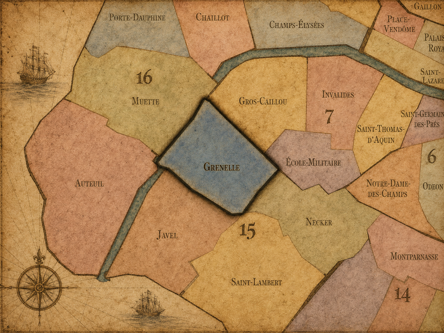
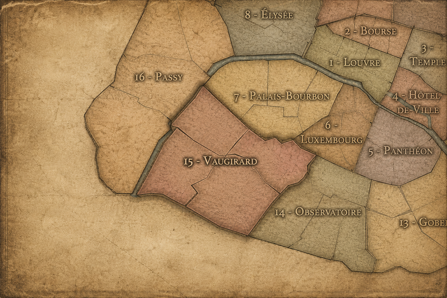
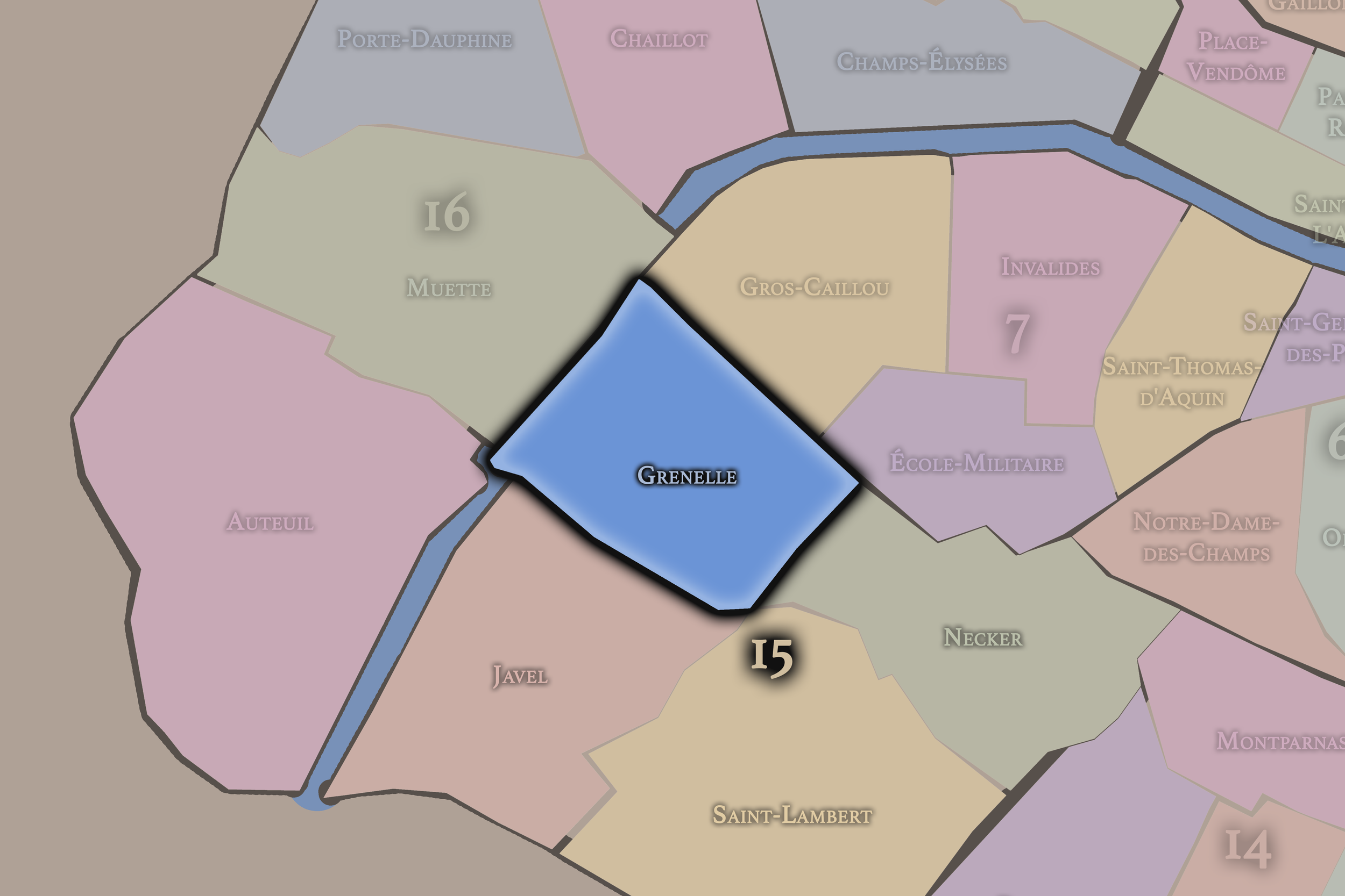
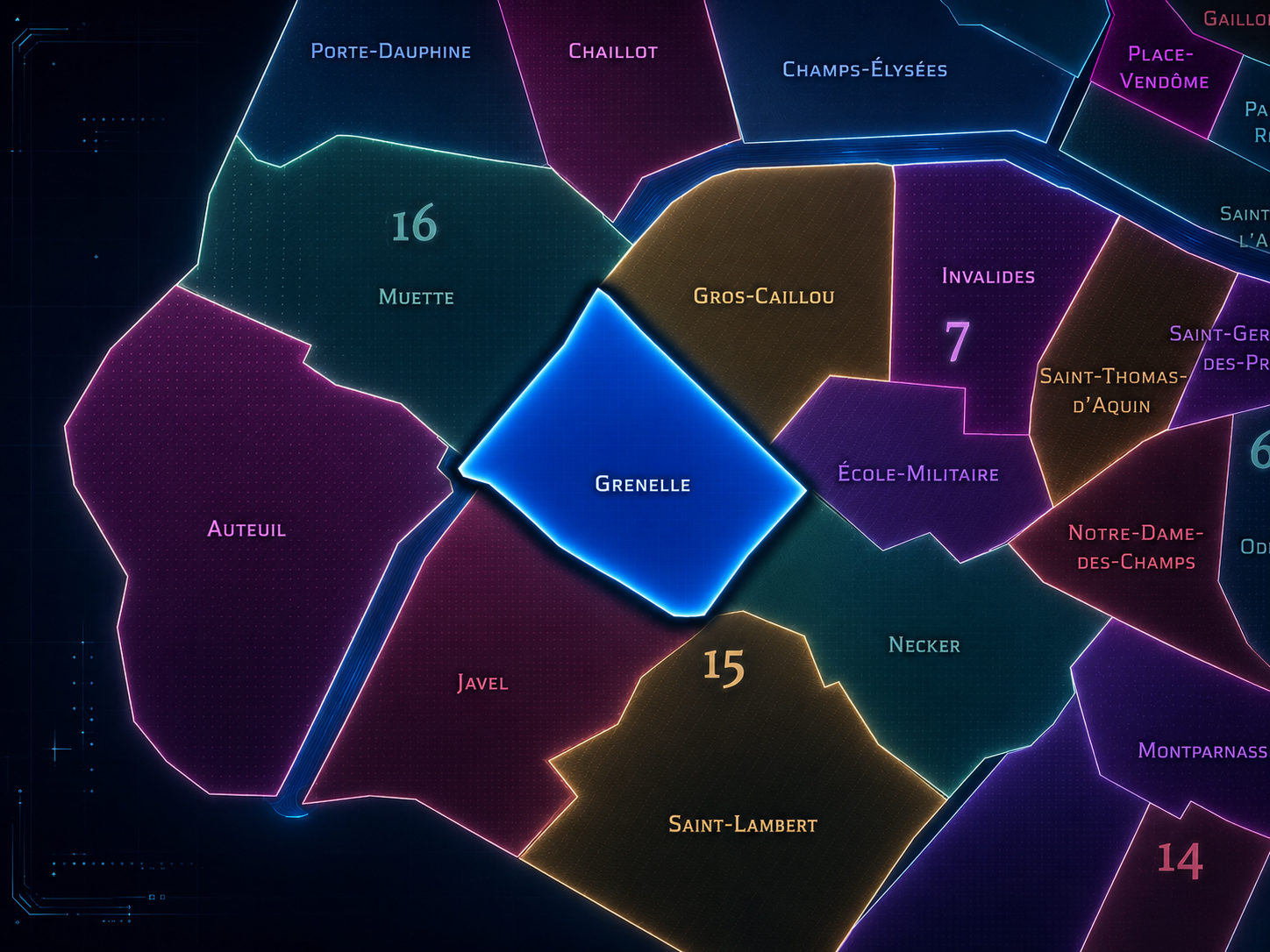
Grenelle occupies the northern and northwestern portion of the 15th arrondissement, where the Left Bank opens toward the Seine, the Eiffel Tower’s southern approaches, the Beaugrenelle / Front de Seine high-rise landscape, the Commerce corridor, and the dense residential fabric between Dupleix, La Motte-Picquet, Charles Michels, and Bir-Hakeim. It lies west of Necker, north of Vaugirard, and east of Javel, forming one of the 15th arrondissement’s most distinctive mixtures of former village, modern residential district, commercial center, riverfront redevelopment, and high-rise experimentation.
The quarter’s geography is shaped by Boulevard de Grenelle, Rue du Commerce, Avenue Émile-Zola, Rue de Lourmel, Rue Saint-Charles, Quai de Grenelle, Pont de Bir-Hakeim, Île aux Cygnes, Place du Commerce, the Beaugrenelle shopping district, and the towers of the Front de Seine. It is a quarter of striking contrasts. Around Rue du Commerce, Grenelle feels like an older neighborhood center of shops, cafés, apartments, and daily errands. Along the Seine, it becomes modern, vertical, and infrastructural, with towers, slabs, river views, shopping complexes, and the monumental proximity of the Eiffel Tower across the 7th arrondissement.
Unlike Vaugirard, whose identity is broader, more residential, and deeply tied to the old village and southern heart of the 15th, or Javel, whose character is shaped by industry, Citroën, riverfront transformation, and the southwestern edge, Grenelle is more concentrated around urban reinvention. It is the 15th arrondissement as former commune, planned neighborhood, commercial high street, and modern riverfront — a place where the ordinary life of western Left Bank Paris meets some of the city’s boldest late-20th-century planning.
Administrative Quarter Identity
Etymology and Origins
The name Grenelle is usually connected to the old “plaine de Grenelle,” a broad plain west of the older Left Bank and south of the Invalides / École Militaire landscapes. Before its urban development, this area was long difficult to cultivate and only sparsely inhabited. The City of Paris’s 15th arrondissement history notes that the 15th was formed in 1860 largely from the former communes of Vaugirard and Grenelle, and that the plaine de Grenelle was long a challenging landscape before its 19th-century subdivision.
The name therefore preserves an older geographic identity: a plain before a neighborhood, an open stretch before a commune, a peripheral landscape before incorporation into Paris. Grenelle was not born as a medieval parish or royal square. It became urban through development, speculation, subdivision, and annexation. Its name carries the memory of ground transformed by planning.
That transformation is central to the quarter’s identity. In the 1820s, developers Jean-Léonard Violet and Alphonse Letellier began subdividing land in the Grenelle plain, with the City of Paris noting that streets such as Rue des Entrepreneurs preserve the memory of the development companies involved in the operation; in 1830, Grenelle became a separate commune before being annexed to Paris in 1860. The name Grenelle thus belongs to one of the clearest stories of Parisian urbanization: land planned, named, settled, municipalized, and finally absorbed into the capital.
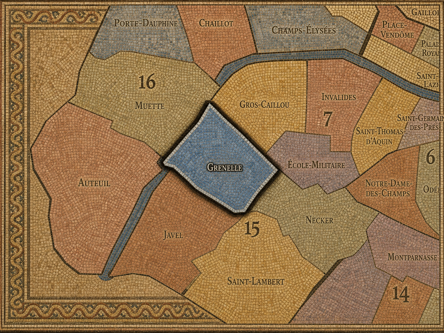
Within the official geography of Paris, Grenelle is one of the four administrative quarters of the 15th arrondissement, alongside Saint-Lambert, Necker, and Javel. It is traditionally counted as the 59th administrative quarter of Paris, and district references identify it as one of the four quarters that form the 15th arrondissement.
As an administrative quarter, Grenelle gives civic shape to an area that is often described through more specific names: Beaugrenelle, Front de Seine, Dupleix, Commerce, Bir-Hakeim, La Motte-Picquet, or the northern 15th. Those names are useful and often more immediately recognizable, but Grenelle is the official frame that holds them together. It connects the local shopping streets, riverfront towers, former commune history, and western Left Bank residential life into one mapped unit.
This frame is especially useful because Grenelle contains several identities that can otherwise feel separate. Rue du Commerce and Place du Commerce preserve the neighborhood-center feeling of older Grenelle. Beaugrenelle and Front de Seine express the late-modern redevelopment of the riverfront. Boulevard de Grenelle and La Motte-Picquet connect the quarter to the military and exposition landscapes of the 7th. The administrative quarter allows these layers to be read as part of one larger urban story.
Civic Framework
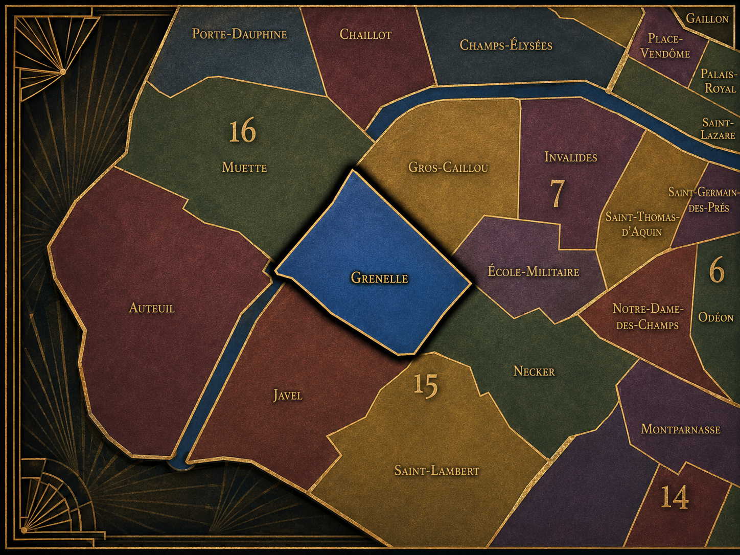
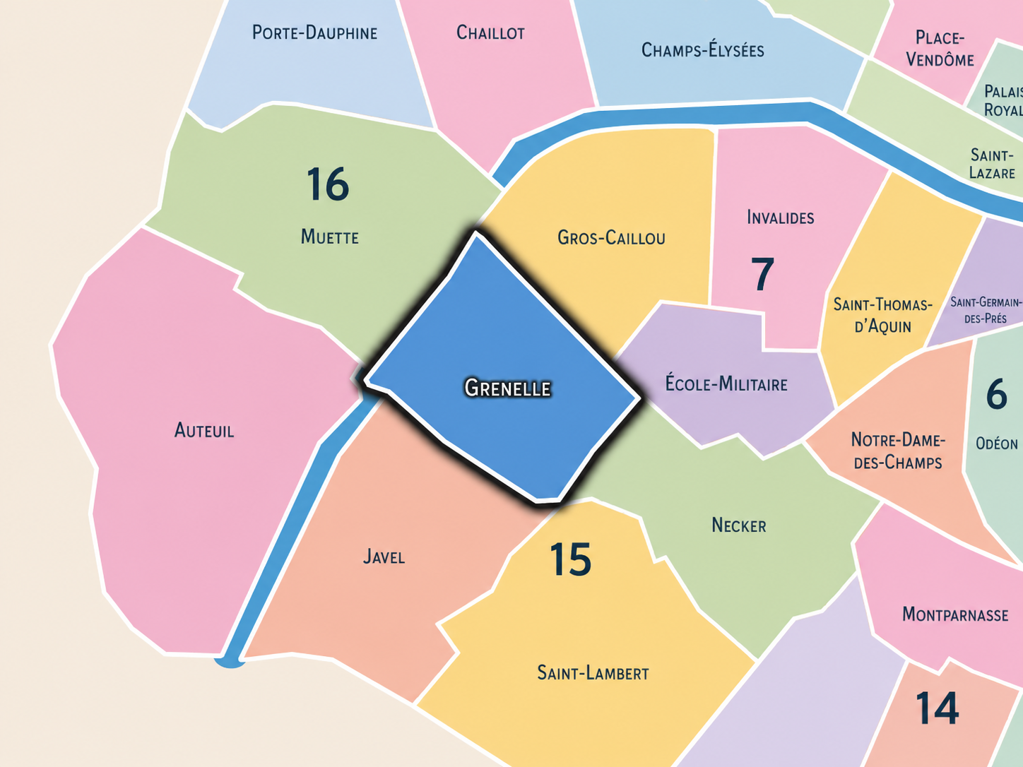
Grenelle differs from the other quarters of the 15th arrondissement through its combination of former commune identity, commercial neighborhood center, and high-rise riverfront modernism. Saint-Lambert is more southern and residential, tied to the former village of Vaugirard, Parc Georges-Brassens, and the quieter interior of the arrondissement. Necker is more northeastern, shaped by Montparnasse, the hospital, Pasteur, and the railway-station edge. Javel is more industrial-riverfront in origin, strongly associated with Citroën, factories, docks, and the later Parc André-Citroën landscape.
Grenelle is more mixed between village-center memory and modern redevelopment. Its distinction lies in the fact that it can feel traditional and contemporary within a few blocks. Rue du Commerce provides one of the 15th’s strongest local shopping spines, while the Front de Seine presents an entirely different image: towers, slabs, open decks, and river-facing urbanism. The Beaugrenelle / Front de Seine sector emerged from a renovation operation begun in the early 1960s along the Seine, according to Paris planning documents.
It should also be distinguished from Beaugrenelle. Beaugrenelle is a powerful local and commercial name within Grenelle, especially for the riverfront and shopping-center landscape, but it is not the whole administrative quarter. Grenelle is broader and older. Beaugrenelle is one modern layer within it — an especially visible layer, but not the origin of the district’s identity.
Neighborhood Distinction
Parisian Identity
Grenelle expresses Paris as a city of planned absorption. It is one of the places where the capital did not simply inherit an old village unchanged, but actively transformed peripheral land into a modern urban quarter. The Grenelle plain was subdivided, organized, promoted, made into a commune, and then incorporated into Paris. This gives the quarter a very different identity from older central districts whose street patterns grew over centuries.
Its Parisian identity is also strongly residential. The 15th arrondissement is often described as one of Paris’s most lived-in, family-oriented, and locally grounded districts, and Grenelle contributes to that atmosphere through shops, markets, schools, apartment buildings, cafés, transit, and a daily rhythm that is often more local than touristic. Yet the quarter also faces the river and the Eiffel Tower’s visual field, giving it a relationship to global Paris without becoming entirely absorbed by tourism.
The Front de Seine adds another layer. Here, Paris becomes vertical, modernist, and experimental. The towers and slab landscape challenge the older stone-and-boulevard image of the capital, but they also reveal an important truth: Paris is not only preservation. It has repeatedly tried to modernize itself, sometimes controversially, sometimes boldly, and sometimes with results that become part of the city’s complexity. Grenelle is one of the quarters where that modern Paris is impossible to ignore.
Neighborhood Connections
Every administrative quarter belongs to a wider Parisian fabric. These connections place Grenelle within the city’s civic, participatory, and cultural geography:
-
15e - Vaugirard
-

Dupleix / La Motte Picquet • Émeriau / Zola • Violet / Commerce
The History
The origins of Grenelle lie in the plain west of the older Left Bank, beyond the dense medieval and early modern city. For centuries, the area was sparsely inhabited and difficult to cultivate, more open ground than neighborhood. It stood near major military and institutional landscapes such as the École Militaire and Champ-de-Mars, but it did not yet possess the residential and commercial character that would later define it.
The plain’s openness was crucial. It gave 19th-century developers room to imagine a new settlement rather than merely extend an existing street fabric. In 1824, Jean-Léonard Violet and Alphonse Letellier purchased and began subdividing land in the area, helping create the planned development of Beau-Grenelle and the future commune of Grenelle. The City of Paris connects this subdivision directly to the development of the area and to Grenelle’s emergence as a distinct commune in 1830.
Grenelle’s origin story is therefore less about ancient continuity than modern creation. It began as a peripheral plain, then became a speculative and planned urban settlement. The quarter’s later identity — practical, residential, commercially organized, and open to modern redevelopment — reflects that founding condition.
Origins
16th–17th Century
In the 16th and 17th centuries, the future Grenelle quarter remained outside the dense built fabric of Paris. The plain lay beyond the older urban core, closer to fields, military landscapes, roads, and the western Left Bank’s outer ground than to the parish-centered city. It was not yet a village of strong urban identity, nor a quarter with a defined commercial center.
This peripheral condition gave the area a different rhythm from the older Left Bank neighborhoods to the east. Saint-Germain, the Latin Quarter, and the riverfront institutions were already deeply urban, while Grenelle remained open and marginal. Its importance lay more in land and space than in monuments or dense settlement.
By the end of the 17th century, the western Left Bank was becoming increasingly important through royal and military development, especially around Invalides and the future Champ-de-Mars / École Militaire landscapes. Grenelle remained outside the densest activity, but the gradual westward and southward organization of Paris would eventually make its open plain valuable.
In the 18th century, Grenelle’s relationship to the city changed as the military and ceremonial landscapes nearby grew in importance. The École Militaire and Champ-de-Mars gave the western Left Bank a vast formal and public presence, while the Grenelle plain remained largely open and only partially developed. This proximity mattered: the future quarter lay beside one of the great open spaces of Paris, yet remained distinct from it.
The area’s sparse settlement and difficult agricultural conditions continued to define it. Grenelle was still not the dense residential district it would become. It belonged to the outer ground around Paris — useful, visible, but not yet fully urban. Its later transformation would depend on the availability of land and the growing pressure for development outside the older city.
The French Revolution and later administrative reforms changed the civic landscape of Paris and its surroundings, but Grenelle’s decisive transformation did not occur until the 19th century. In the 18th century, the quarter remained more potential than place: a plain waiting for the city to arrive.
18th Century
19th Century
The 19th century created modern Grenelle. In 1824, Jean-Léonard Violet and Alphonse Letellier launched the subdivision of the plain, and in 1830 Grenelle became an independent commune separated from Vaugirard. The City of Paris’s 15th arrondissement history identifies this 1830 moment as the birth of Grenelle as a distinct commune.
The new commune developed with streets, houses, commerce, workshops, and a growing population. Its planned character set it apart from older organic villages. Names such as Rue des Entrepreneurs still preserve the memory of development companies and the speculative urbanization of the area. Grenelle became a place made by 19th-century expansion: practical, modern, and deliberately organized.
In 1860, Paris annexed Grenelle along with Vaugirard and other surrounding territories to create the modern 15th arrondissement. This changed Grenelle from an independent commune into a Parisian quarter. Yet the older municipal identity did not disappear. The name remained, and with it the memory of a brief but meaningful autonomy between subdivision and annexation.
In the early and mid 20th century, Grenelle consolidated its identity as a residential and commercial quarter of the 15th arrondissement. Rue du Commerce and nearby streets became strong local corridors, while apartment buildings, schools, shops, cafés, and transit gave the area a durable neighborhood rhythm. Grenelle was no longer a new commune or outer plain; it had become a settled part of western Left Bank Paris.
The quarter also stood close to the great modern images of the city. The Eiffel Tower, Champ-de-Mars, Bir-Hakeim, and Seine crossings gave the northern edge of Grenelle a powerful visual relationship to monumental Paris. Yet the quarter itself remained more residential and local than spectacular. It was the Paris of daily life within sight of global icons.
During the wars, occupation, liberation, and postwar reconstruction, Grenelle shared the experiences of residential Paris: scarcity, continuity, rebuilding, and the persistence of neighborhood routines. Its history in this period is less about a single dramatic monument than about the stabilization of a district built from 19th-century planning and 20th-century daily use.
Early–Mid 20th Century
Late 20th Century
In the late 20th century, Grenelle became one of the most visibly modernized quarters of the 15th arrondissement through the development of Beaugrenelle and the Front de Seine. The riverfront sector was reshaped by a major renovation operation launched in the early 1960s, producing a landscape of towers, slabs, elevated circulation, offices, housing, shopping, and open spaces along the Seine.
This transformation gave Grenelle a radically different visual language from much of traditional Paris. The Front de Seine towers created a skyline of high-rise modernism just south of the Eiffel Tower, making the quarter one of the city’s most striking examples of postwar urban planning. For some, this was bold modernization; for others, a difficult rupture with the older scale of Paris. That tension remains part of the quarter’s identity.
At the same time, older Grenelle continued around Rue du Commerce, Rue Saint-Charles, and the surrounding residential streets. This coexistence is crucial. Late-20th-century Grenelle was not simply modernized into one form. It became a quarter of contrast: local street life beside high-rise urbanism, former commune memory beside redevelopment, daily neighborhood commerce beside metropolitan-scale planning.
In the 21st century, Grenelle remains one of the 15th arrondissement’s most layered quarters. Rue du Commerce continues to function as a major neighborhood shopping street, while Beaugrenelle and the Front de Seine provide a more contemporary commercial and residential identity along the river. The Beaugrenelle shopping center was redeveloped and reopened in the 2010s, reinforcing the quarter’s role as a modern retail and river-adjacent destination.
Today, Grenelle balances several versions of Paris. It is residential and commercial, local and river-facing, historically rooted in a former commune yet marked by high-rise modernism. It offers views toward the Eiffel Tower and Île aux Cygnes, but also the lived routine of one of Paris’s largest and most residential arrondissements. It is neither purely picturesque nor purely modern. It is both.
For CityNeighborhoods: Paris, Grenelle is essential because it shows how an administrative quarter can hold the full arc of modern urbanization: open plain, planned subdivision, independent commune, annexed Parisian district, commercial neighborhood, high-rise redevelopment, and contemporary mixed-use riverfront. Grenelle is one of the places where Paris’s expansion and modernization can be read almost chapter by chapter.
21st Century
Spirit and Legacy
Grenelle is the quarter where the western Left Bank turns planned ground into lived city. Its spirit is practical, residential, modern, and quietly ambitious. It belongs to the old plain and the brief commune, to Rue du Commerce and the Seine towers, to developers’ streets and neighborhood shops, to Bir-Hakeim views and the modern vertical edge of the Front de Seine.
Its legacy is transformation through planning. A difficult plain became a subdivision. A subdivision became a commune. A commune became Paris. A residential quarter became a site of high-rise experimentation. Through each change, Grenelle retained its essential character as a place made by the city’s need to expand, house, organize, and reinvent itself.
To walk Grenelle is to encounter Paris as both neighborhood and project. The quarter does not fit a single inherited image of the capital. It is older and newer at once, local and metropolitan, modest and vertical, familiar and experimental. In Grenelle, neighborhood identity becomes urban conversion — the long process by which open land becomes home, and home becomes part of the changing city.
The Photography
The arrondissements do not share a single visual identity. Instead, they organize Paris into twenty broad visual fields, each gathering its own combination of landmarks, streetscapes, institutions, residential districts, commercial corridors, parks, rail stations, markets, cemeteries, and riverfront edges.
Some arrondissements are defined by monumental scale: royal palaces, ceremonial avenues, government buildings, museums, formal gardens, and internationally recognized landmarks. Others are shaped by hills, canals, rail gateways, apartment-lined boulevards, neighborhood markets, former village streets, industrial remnants, parks, or the quieter rhythms of residential Paris. The arrondissement system gives these varied landscapes a civic frame, allowing the city to be read not as one visual language, but as a sequence of overlapping Parisian atmospheres.

Visual Identity
Through The Lens
Photographing the arrondissements means moving between the official map and the street-level experience. The camera does not treat each arrondissement as visually uniform. Instead, it looks for the recurring forms, textures, transitions, and contrasts that make each district legible: the geometry of boulevards, the shade of plane trees, the repetition of balconies, the rise of stairways, the curve of canals, the presence of rail stations, the opening of parks, the weight of monuments, and the intimacy of side streets.
On CityNeighborhoods, the arrondissement provides the frame, but the photograph comes from the encounter between map, movement, light, and observation. As the Paris photography is processed, this section will connect each arrondissement more directly to the project’s Photographic Lexicon: the visual strategies, recurring motifs, and compositional patterns that shape how the city is seen through the lens.

If you visit Paris, these ideas can help inspire your own photography.



Paris: J’Espere, Je Rêve, Je Vive
Paris Photo Gallery
Paris Field Notes
-
Field Note: August 18, 2025 | 07:58 AM
Conditions: 73°F | Humidity: 72%.
Within the park's interior, the glacial kettle ponds acted as humidity traps, creating a soft, hazy light that filtered through the old-growth oaks. The transition from the park's dense shade to the sun-drenched edges of Oakland Gardens highlighted the day's exceptional "picture-perfect" clarity.
There is a fleeting window in Queens where the humidity of August hasn't yet heavy-set, and the morning sun hits the canopy of Alley Pond Park at a perfect oblique angle. Arriving just before 8:00 AM, I watched the light break through the oaks and tulip trees, casting long, dramatic shadows across the wet grass. It’s in these quiet, golden moments that the park feels less like a city escape and more like the ancient glacial valley it actually is.
Other neighborhoods visited:











































































































Explore Paris
-

The twenty arrondissements form the civic spiral of Paris, organizing the city into its broad local districts of government, identity, and daily life.
-

Each arrondissement is divided into four official administrative quarters, giving Paris a more precise civic and geographic framework.
-

The conseils de quartier bring participation to street level, giving residents a voice in neighborhood needs, public space, and local civic life.
-

Les Deux Rives trace Paris through the Seine’s two banks, revealing how the Rive Droite and Rive Gauche shaped the city’s civic power, commerce, learning, art, and cultural identity.
-

Cultural neighborhoods reveal the Paris people recognize through history, cafés, architecture, memory, atmosphere, and local belonging.