
15e - JAVEL
Quartiers Administratifs
Part of an ongoing project to walk and photograph every neighborhood in Paris, this page 15e - Javel through maps, district identity, history, and photography.




The Map
Download the Paris Arrondissements Map
Geographic Setting
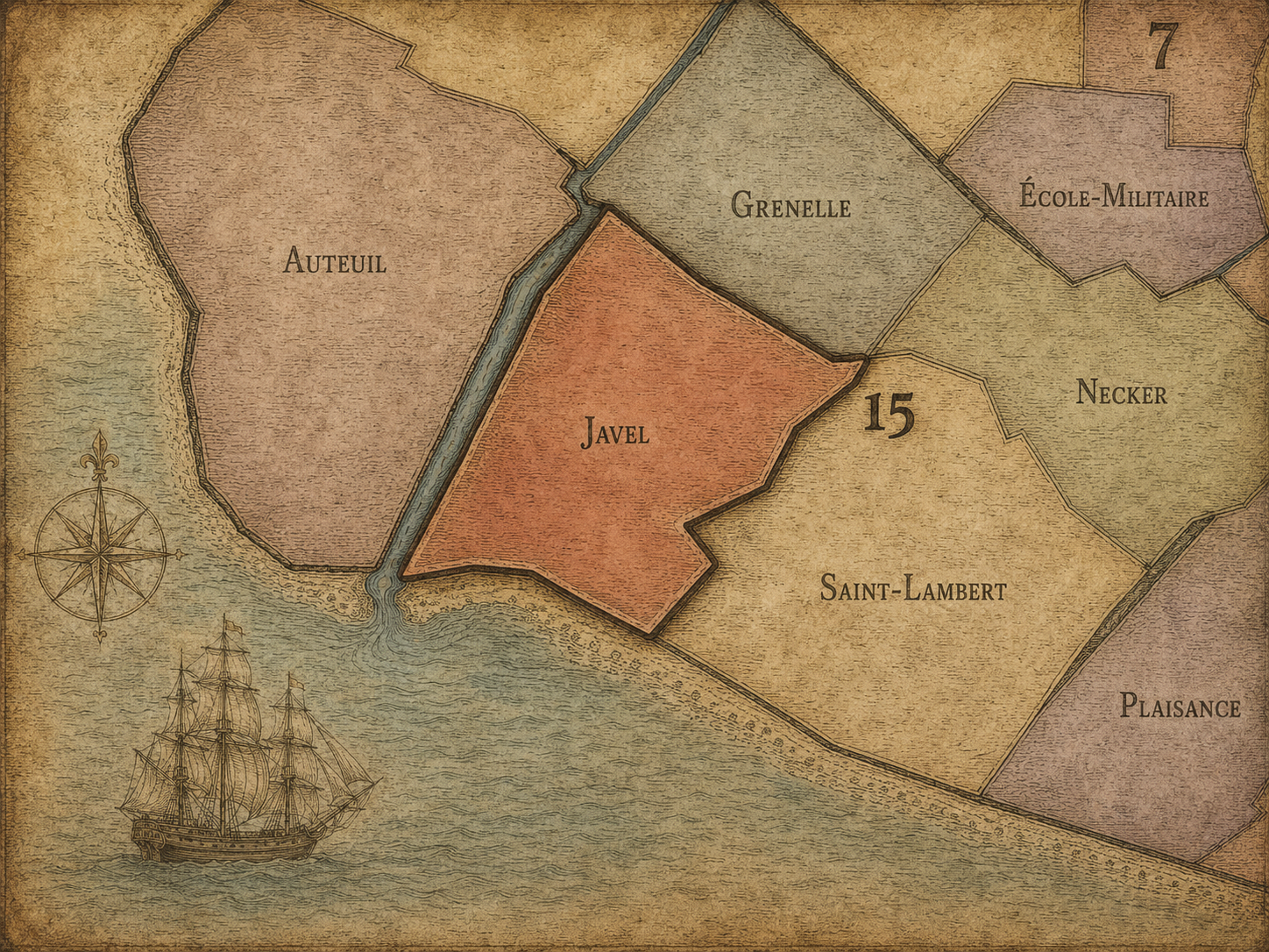
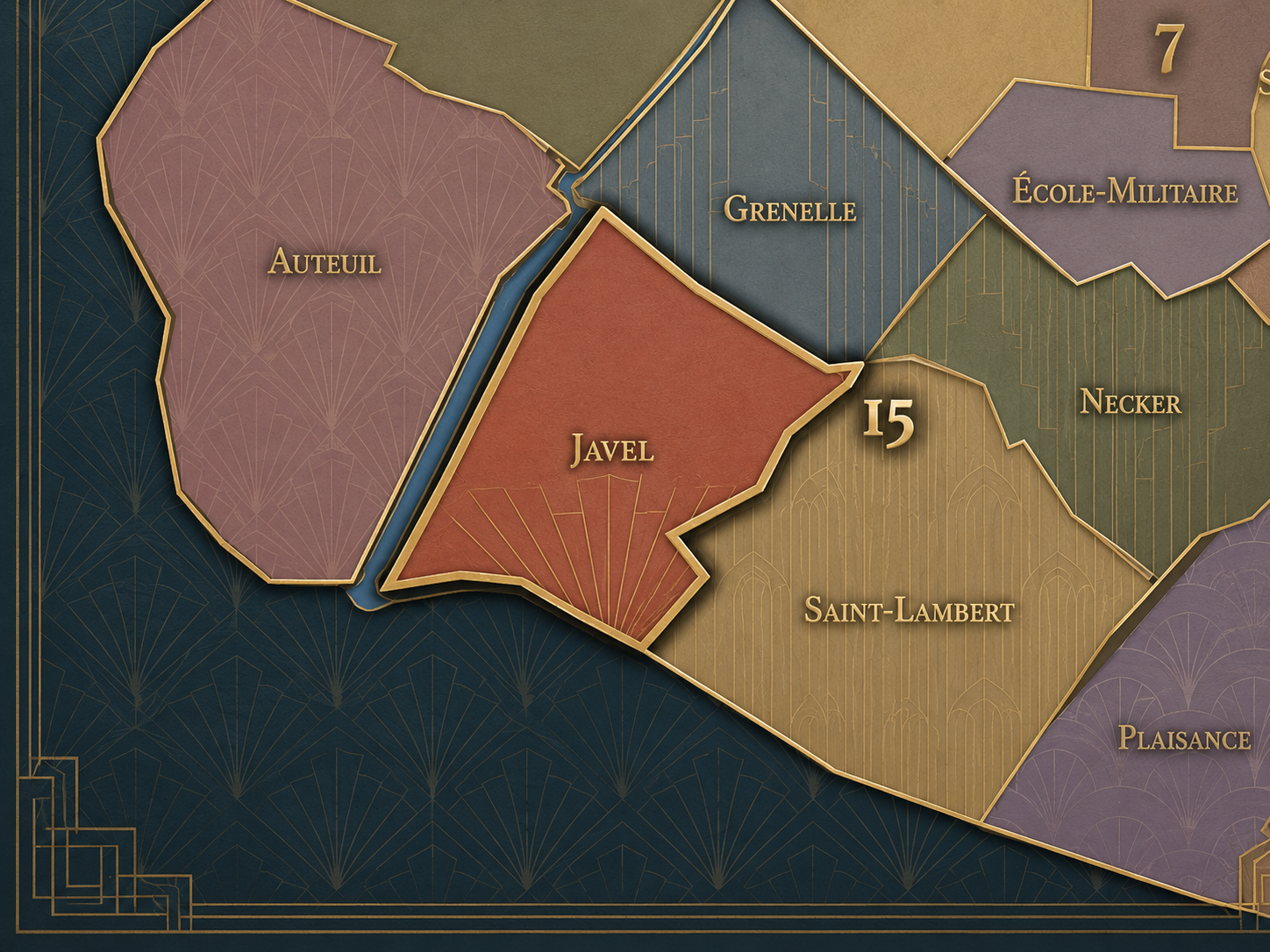
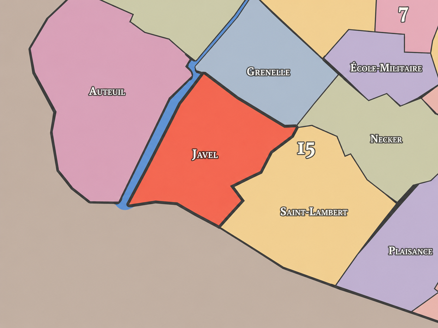
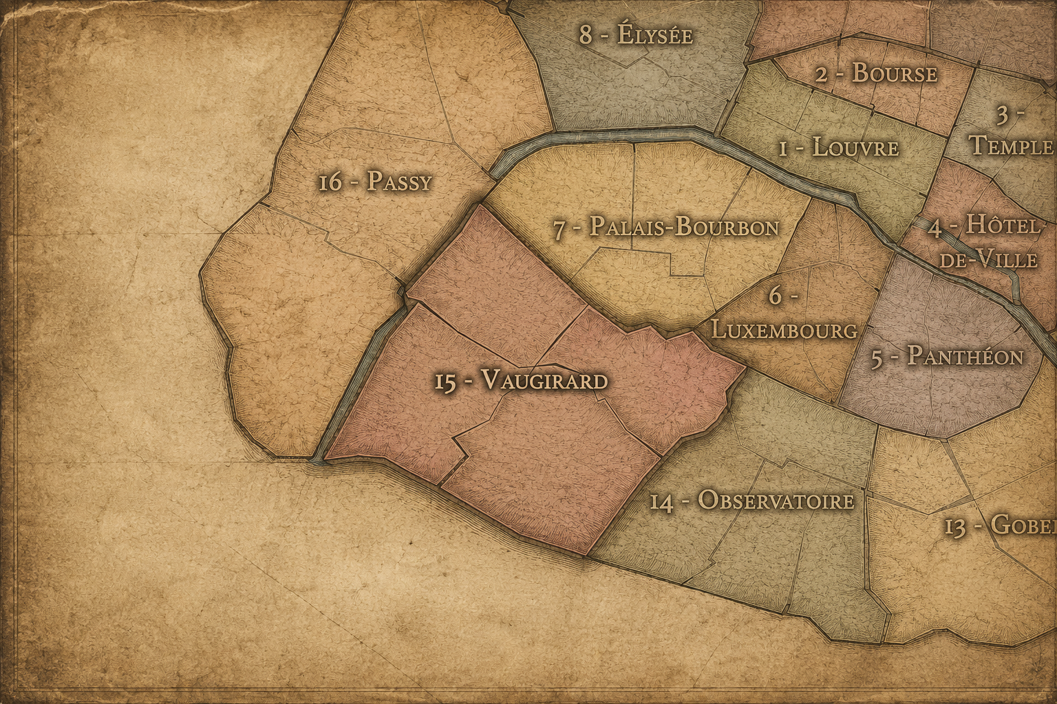
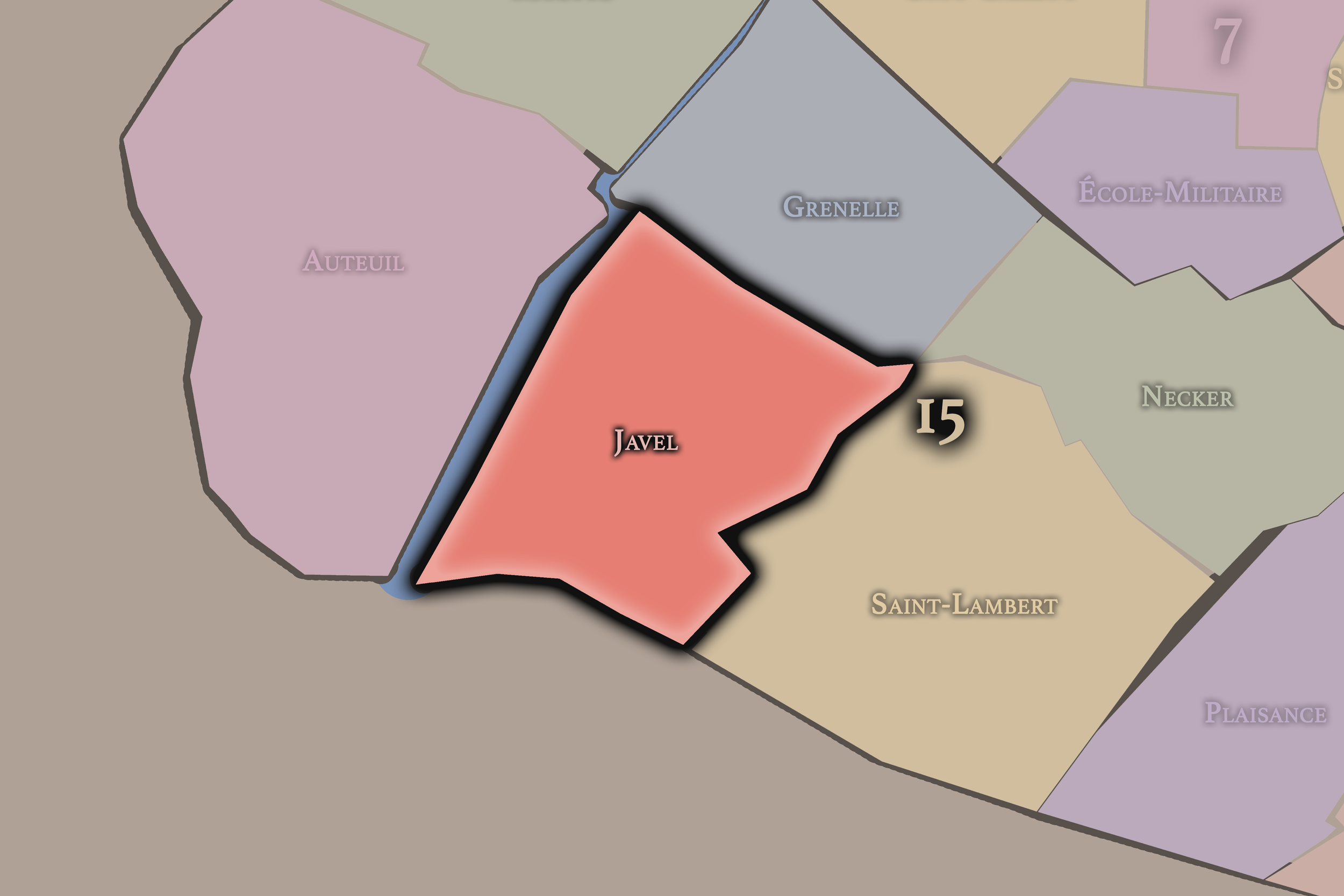
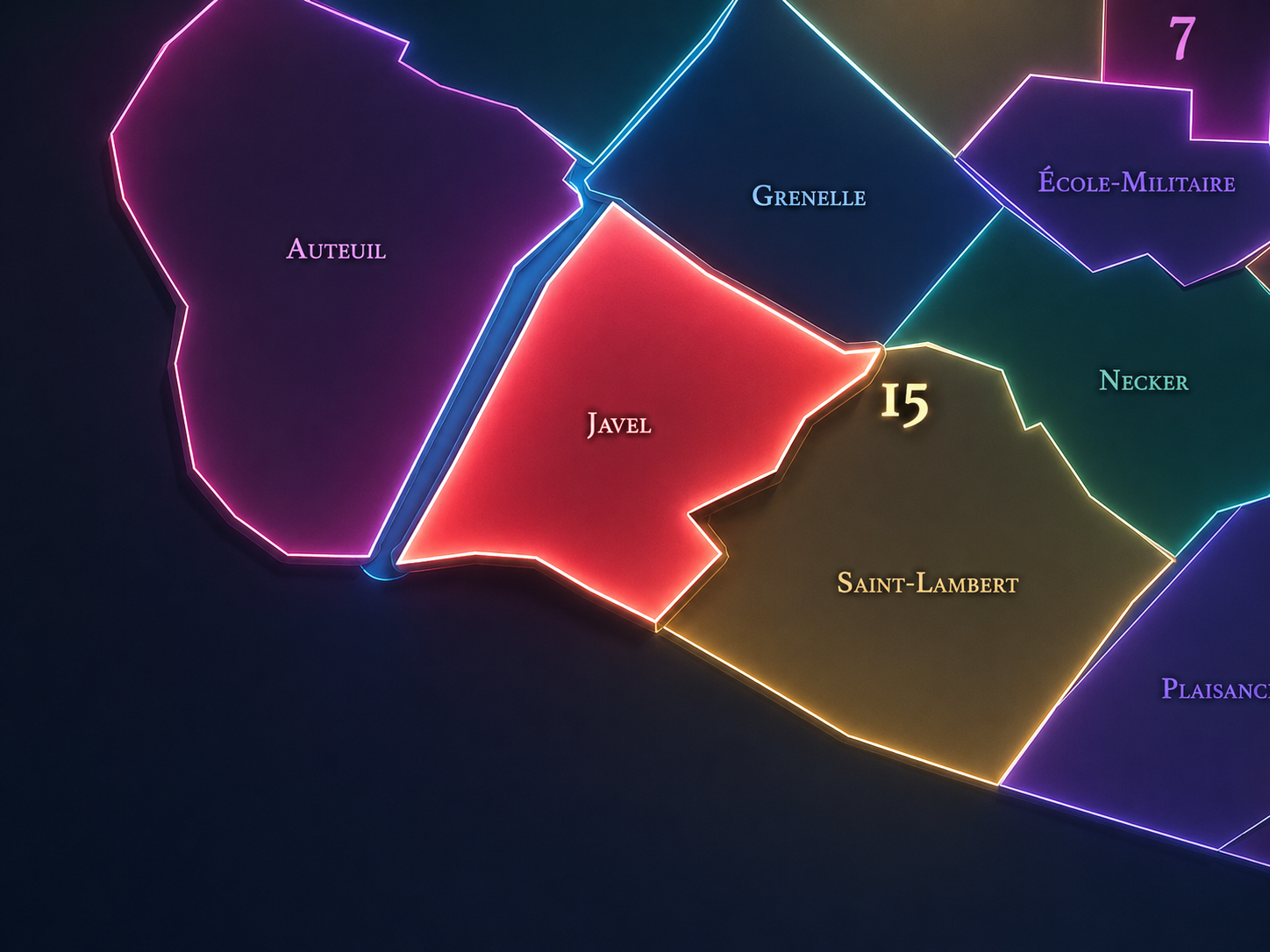
Javel occupies the southwestern portion of the 15th arrondissement, where Paris follows the Seine toward Issy-les-Moulineaux, the former industrial riverfront, the Parc André-Citroën, the Aquaboulevard / Porte de Versailles edge, and the residential-commercial streets between Lourmel, Balard, Mirabeau, and the outer boulevards. It lies south and southwest of Grenelle, west of Saint-Lambert, and along one of the longest river-facing edges of the 15th arrondissement. This is the quarter where the Left Bank becomes visibly industrial, modern, and edge-oriented before yielding to the neighboring communes beyond the périphérique.
The quarter’s geography is shaped by Quai André-Citroën, Rue Balard, Avenue Félix-Faure, Rue Saint-Charles, Rue Leblanc, Boulevard Victor, Rue de la Convention, Rue de Javel, Pont Mirabeau, Pont du Garigliano, the Seine quays, the former Citroën factory lands, and the open space of Parc André-Citroën. District references identify Javel as the 60th administrative quarter of Paris and place it within the 15th arrondissement, bounded by Grenelle to the north, Saint-Lambert to the east, Issy-les-Moulineaux to the south, and the Seine to the west.
Unlike Grenelle, whose identity balances former commune, Rue du Commerce, Beaugrenelle, and the high-rise Front de Seine, or Saint-Lambert, whose character is more residential and interior, Javel is more river-industrial and transformative. It is the 15th arrondissement as factory ground, chemical memory, automobile history, technological reinvention, and contemporary parkland — a place where the working edge of Paris became one of its most important modern redevelopment landscapes.
Administrative Quarter Identity
Etymology and Origins
The name Javel comes from an older hamlet or locality on the plain of Grenelle, along the Seine southwest of central Paris. Before it was absorbed into the modern capital, Javel was part of the outer landscape beyond the dense Left Bank, connected to river movement, fields, workshops, and later industrial uses. Historical accounts of the 15th identify Javel as one of the older components of the arrondissement, alongside Grenelle and Vaugirard, before the 1860 annexation brought these territories into Paris.
The name is famous far beyond the quarter because of eau de Javel, the bleaching and disinfecting solution first associated with chemical production in the area. The site’s industrial history made the local place-name into a household term in French. A neighborhood name became the name of a substance, and that substance carried the word “Javel” into everyday language across the French-speaking world.
This gives the quarter an unusual linguistic legacy. Many Parisian names preserve saints, gates, markets, or former villages. Javel preserves a place that became a product name — and not a luxury product, but a practical chemical used for whitening, cleaning, disinfecting, and domestic labor. The name links Paris not only to monuments and beauty, but to chemistry, industry, hygiene, and the material work of modern life.
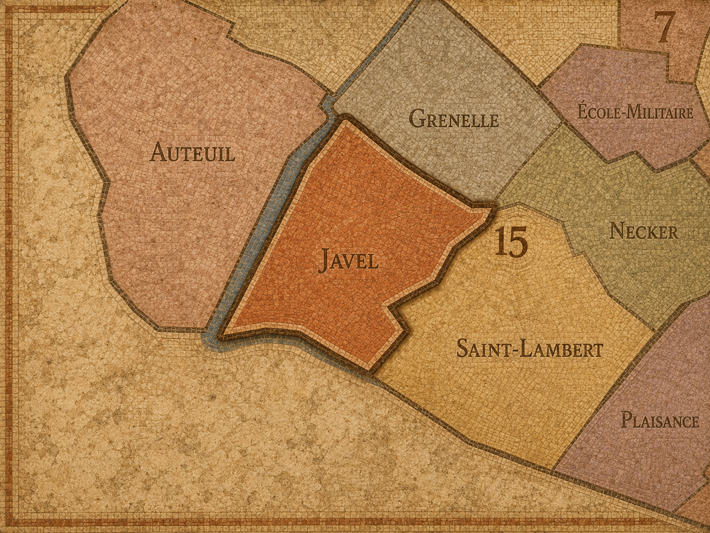
Within the official geography of Paris, Javel is one of the four administrative quarters of the 15th arrondissement, alongside Saint-Lambert, Necker, and Grenelle. It occupies the arrondissement’s southwestern sector and provides the civic frame for the riverfront landscape stretching from the Mirabeau / Balard area toward the edge of Issy-les-Moulineaux. It is traditionally counted as the 60th administrative quarter of Paris.
As an administrative quarter, Javel gives formal shape to an area often described through more specific or more recent names: Balard, André-Citroën, Pont Mirabeau, Lourmel, Boucicaut, Aquaboulevard, or the southwestern 15th. These names remain useful, but Javel is the older official frame that gathers the factory lands, river edge, residential streets, park, and modern institutional landscape into one mapped unit.
This frame is especially useful because Javel has been repeatedly remade. It was a riverside locality, then a chemical and industrial zone, then a major automobile landscape, then a post-industrial redevelopment district. Without the administrative quarter name, these layers can seem disconnected. Javel holds them together.
Civic Framework
Javel differs from the other quarters of the 15th arrondissement through its industrial inheritance, riverfront geography, and extraordinary association with Citroën. Necker is more closely tied to Montparnasse, Pasteur, hospitals, rail, and the northeastern edge of the arrondissement. Saint-Lambert is more residential and southern-interior, associated with Vaugirard, Convention, and Parc Georges-Brassens. Grenelle is more northern and mixed between former commune, Rue du Commerce, Beaugrenelle, and Front de Seine modernism.
Javel is more industrial in memory and more river-facing in form. Its distinction lies in the conversion of working land into contemporary public space and residential / institutional development. The historical society of the 15th describes Javel as a district with a strong industrial past, once marked by large factories, smaller workshops, bourgeois buildings, and commerce, with much of that industrial character lasting until the deindustrialization of the 1960s and 1970s.
It should also be distinguished from Citroën as a site identity. Citroën is one of Javel’s defining modern layers, but it is not the whole quarter. Javel existed before Citroën and continues after the factory’s closure. The automobile story is central, but it rests on an older riverside-industrial landscape and has now been transformed into parkland, housing, offices, and public space.
Neighborhood Distinction
Parisian Identity
Javel expresses Paris as a city of industry converted into landscape. It challenges the idea that Paris is only a city of stone façades, cafés, churches, and monuments. Here, Paris is chemical works, river docks, factories, assembly lines, workshops, laboratories, warehouses, power, noise, labor, invention, and later redevelopment. Javel is one of the quarters where the modern material city becomes visible.
The quarter’s Parisian identity is especially tied to the Citroën works along Quai de Javel. The historical society of the 15th notes that André Citroën built a munitions factory on Quai de Javel in 1915 and that, after conversion, the first Citroën automobile came off the line in 1919. The same industrial site later became associated with some of France’s most famous vehicles, including the Traction Avant and the DS, before the Javel factory closed in 1975.
This history gives Javel a powerful modern identity: Paris as production and innovation. The city did not only consume culture; it manufactured modernity. It made chemicals, cars, weapons, and technologies. It organized labor and capital along the river. Javel reminds us that the elegance of Paris has always depended on working landscapes that were often pushed to the edges — until those edges became desirable parts of the city.
Neighborhood Connections
Every administrative quarter belongs to a wider Parisian fabric. These connections place Javel within the city’s civic, participatory, and cultural geography:
-
15e - Vaugirard
-

Citroën / Boucicaut • Émeriau / Zola • Violet / Commerce • Vaugirard / Parc des Expositions
The History
The origins of Javel lie in the southwestern outskirts of Paris, on the plain of Grenelle near the Seine. Before it became a Parisian administrative quarter, the area was a hamlet or riverside locality connected to fields, river movement, workshops, storage, and later industrial activity. Its position along the Seine made it useful for activities that needed water, space, transport, and some distance from the denser central city.
That riverside position shaped its destiny. Javel was not originally a monumental or elite district. It was practical ground. It could receive industrial uses because it offered access to water and land at the city’s edge. The same qualities that made it peripheral also made it valuable.
Its origin story is therefore one of utility before prestige. Javel became important not because Paris staged ceremony there, but because the city needed places to produce, process, store, and move materials. The quarter’s later transformations all build from that first logic: useful edge becoming industrial district, industrial district becoming redevelopment landscape.
Origins
16th–17th Century
In the 16th and 17th centuries, the future Javel quarter remained beyond the dense core of Paris, within the western and southwestern Left Bank outskirts. The area was shaped by the Seine, fields, roads, scattered settlements, and the broad plain associated with Grenelle and Vaugirard. It was close enough to Paris to serve the city, but far enough away to retain a more open and peripheral character.
This distance from the center made the area suitable for practical and semi-rural uses rather than ceremonial urban life. It did not yet have the strong factory identity of later centuries, but the groundwork was present: river access, available land, and a position beyond the most regulated and crowded parts of the city.
By the end of the 17th century, the western Left Bank was becoming more important through nearby military and institutional landscapes, but Javel remained largely an outer riverside locality. Its later industrial identity would grow from that edge condition.
The 18th century was decisive for Javel’s association with chemistry and industry. The area became known for chemical production, especially the development of the bleaching solution that would become famous as eau de Javel. Accounts of the neighborhood’s industrial history connect the village of Javel and its Seine-side setting to early chemical production useful to dyers and laundresses.
This chemical identity changed the meaning of the name. Javel was no longer only a place on the map; it became associated with a substance that entered workshops, laundries, households, and public hygiene. The neighborhood’s industrial activity gave the word a practical national life beyond the quarter itself.
The 18th century also linked Javel to the broader transformation of Parisian outskirts into zones of production. Activities that depended on water, chemicals, and space found room at the edge. Javel’s industrial destiny was already clear before the automobile age arrived.
18th Century
19th Century
The 19th century brought Javel fully into the industrial and urban growth of western Paris. In 1860, the territories that formed the modern 15th arrondissement, including Javel, were annexed to Paris. The former riverside locality became part of the capital’s administrative map, but its industrial role remained central.
Factories, warehouses, workshops, and river-related uses continued to shape the quarter. The industrial profile of Javel was not limited to one giant plant; it included a wider mixture of large industrial sites and smaller workshops. The historical society of the 15th emphasizes that Javel’s industrial character resembled Grenelle’s, with large factories, many small workshops, residential buildings, and commerce existing side by side.
This century established Javel as one of the 15th arrondissement’s great working landscapes. It was Paris as industry, not Paris as salon. The quarter’s riverfront made it useful, and its incorporation into Paris made it central to the capital’s modern expansion.
In the early and mid 20th century, Javel became inseparable from Citroën. André Citroën established a major munitions factory on Quai de Javel during the First World War, and after the war the site was converted to automobile production. In 1919, the first Citroën automobile left the converted production line, marking the beginning of a new chapter in the quarter’s industrial history.
The Citroën factory gave Javel national and international significance. The quarter became associated with mass production, modern engineering, automobile design, labor organization, and the industrial modernization of France. This was not a small workshop story; it was one of the great industrial episodes within Paris itself.
During the mid-20th century, Javel remained a working district shaped by factory labor, riverfront infrastructure, residential streets, and the social life surrounding large-scale industry. Citroën’s presence made the quarter a symbol of modern mobility. Cars built in Javel traveled far beyond Paris, carrying the name and industrial memory of the neighborhood into the world.
Early–Mid 20th Century
Late 20th Century
In the late 20th century, Javel experienced one of the most important deindustrializations and redevelopments in Paris. The Citroën factory closed in 1975 after producing millions of vehicles, including the last DS made at Javel in April of that year. The historical society of the 15th describes the site as having produced 3.2 million vehicles before closure.
The closure transformed the quarter. Industrial land along the Seine became available for new uses, and the former factory landscape was gradually remade into a major park, housing, offices, and public facilities. Parc André-Citroën, created on the former industrial site, became the most visible sign of this conversion. It turned factory ground into open space, memory, leisure, and contemporary landscape design.
This period also shifted the emotional identity of Javel. The quarter moved from production to remembrance and redevelopment. The sounds of factories gave way to park paths, residential buildings, and institutional uses. Yet the Citroën name remained embedded in the landscape, ensuring that the industrial past could not simply be erased.
In the 21st century, Javel remains one of the 15th arrondissement’s most important landscapes of post-industrial Paris. Parc André-Citroën anchors the former factory site with lawns, gardens, water features, greenhouses, and open views toward the Seine. Around it, the quarter includes offices, residences, schools, cultural and sports facilities, riverfront walks, and the transit connections of Balard, Javel, Lourmel, and Mirabeau.
Today, the quarter is no longer primarily industrial, but its industrial memory remains central to its identity. The former Citroën site has become one of the clearest examples of how Paris converts working infrastructure into public urban space. The historical society of the 15th describes the park as a 13-hectare landscape named for André Citroën and integrated into a new, airy neighborhood conceived at a human scale.
For CityNeighborhoods: Paris, Javel is essential because it reveals a modern Paris that is too often left outside the postcard. It is a quarter of chemical invention, automotive history, factory labor, riverfront redevelopment, and green conversion. Javel shows how the city’s industrial edge can become one of its most meaningful urban transformations.
21st Century
Spirit and Legacy
Javel is the quarter where Paris remembers how it made modern life. Its spirit is industrial, riverine, inventive, and transformed. It belongs to chemical works and bleach, factory gates and assembly lines, Citroën cars and Seine-side logistics, park lawns and greenhouse glass, working memory and contemporary renewal.
Its legacy is the transformation of production into public landscape. A riverside hamlet became an industrial district. A chemical name became a household word. A munitions factory became an automobile empire. A factory site became a park. Through each conversion, Javel remained a place where Paris used its edge to build the future.
To walk Javel is to encounter Paris after industry — not as erasure, but as afterlife. The quarter reminds us that neighborhoods are shaped by labor as much as by beauty, by factories as much as by cafés, by closure as much as by creation. In Javel, neighborhood identity becomes reinvention: the city taking the ground of work and giving it back as memory, air, and public life.
The Photography
The arrondissements do not share a single visual identity. Instead, they organize Paris into twenty broad visual fields, each gathering its own combination of landmarks, streetscapes, institutions, residential districts, commercial corridors, parks, rail stations, markets, cemeteries, and riverfront edges.
Some arrondissements are defined by monumental scale: royal palaces, ceremonial avenues, government buildings, museums, formal gardens, and internationally recognized landmarks. Others are shaped by hills, canals, rail gateways, apartment-lined boulevards, neighborhood markets, former village streets, industrial remnants, parks, or the quieter rhythms of residential Paris. The arrondissement system gives these varied landscapes a civic frame, allowing the city to be read not as one visual language, but as a sequence of overlapping Parisian atmospheres.

Visual Identity
Through The Lens
Photographing the arrondissements means moving between the official map and the street-level experience. The camera does not treat each arrondissement as visually uniform. Instead, it looks for the recurring forms, textures, transitions, and contrasts that make each district legible: the geometry of boulevards, the shade of plane trees, the repetition of balconies, the rise of stairways, the curve of canals, the presence of rail stations, the opening of parks, the weight of monuments, and the intimacy of side streets.
On CityNeighborhoods, the arrondissement provides the frame, but the photograph comes from the encounter between map, movement, light, and observation. As the Paris photography is processed, this section will connect each arrondissement more directly to the project’s Photographic Lexicon: the visual strategies, recurring motifs, and compositional patterns that shape how the city is seen through the lens.

If you visit Paris, these ideas can help inspire your own photography.



Paris: J’Espere, Je Rêve, Je Vive
Paris Photo Gallery
Paris Field Notes
-
Field Note: August 18, 2025 | 07:58 AM
Conditions: 73°F | Humidity: 72%.
Within the park's interior, the glacial kettle ponds acted as humidity traps, creating a soft, hazy light that filtered through the old-growth oaks. The transition from the park's dense shade to the sun-drenched edges of Oakland Gardens highlighted the day's exceptional "picture-perfect" clarity.
There is a fleeting window in Queens where the humidity of August hasn't yet heavy-set, and the morning sun hits the canopy of Alley Pond Park at a perfect oblique angle. Arriving just before 8:00 AM, I watched the light break through the oaks and tulip trees, casting long, dramatic shadows across the wet grass. It’s in these quiet, golden moments that the park feels less like a city escape and more like the ancient glacial valley it actually is.
Other neighborhoods visited:











































































































Explore Paris
-

The twenty arrondissements form the civic spiral of Paris, organizing the city into its broad local districts of government, identity, and daily life.
-

Each arrondissement is divided into four official administrative quarters, giving Paris a more precise civic and geographic framework.
-

The conseils de quartier bring participation to street level, giving residents a voice in neighborhood needs, public space, and local civic life.
-

Les Deux Rives trace Paris through the Seine’s two banks, revealing how the Rive Droite and Rive Gauche shaped the city’s civic power, commerce, learning, art, and cultural identity.
-

Cultural neighborhoods reveal the Paris people recognize through history, cafés, architecture, memory, atmosphere, and local belonging.