
15e - NECKER
Quartiers Administratifs
Part of an ongoing project to walk and photograph every neighborhood in Paris, this page 15e - Necker through maps, district identity, history, and photography.




The Map
Download the Paris Arrondissements Map
Geographic Setting
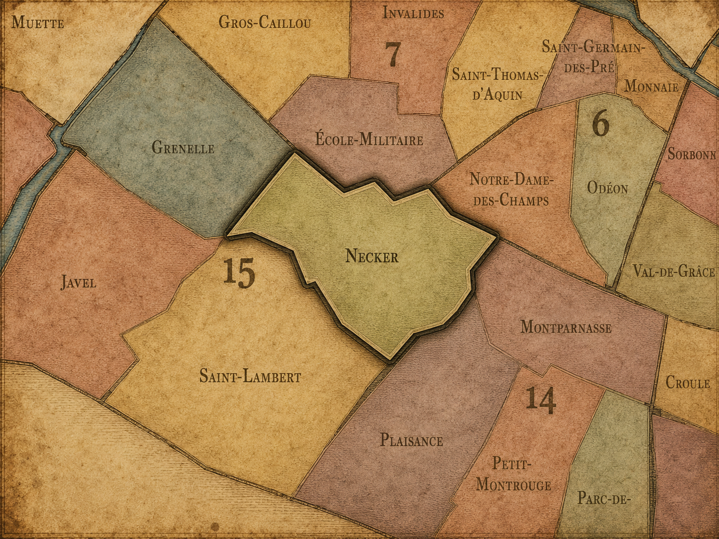
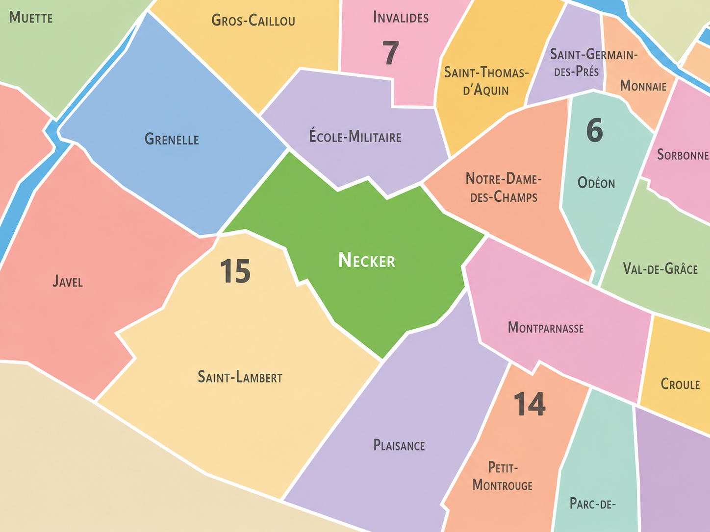
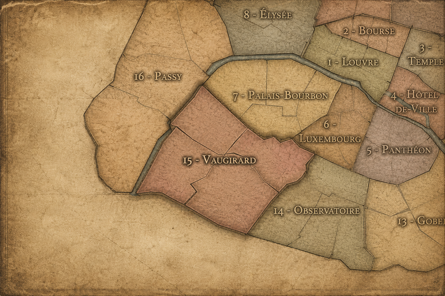
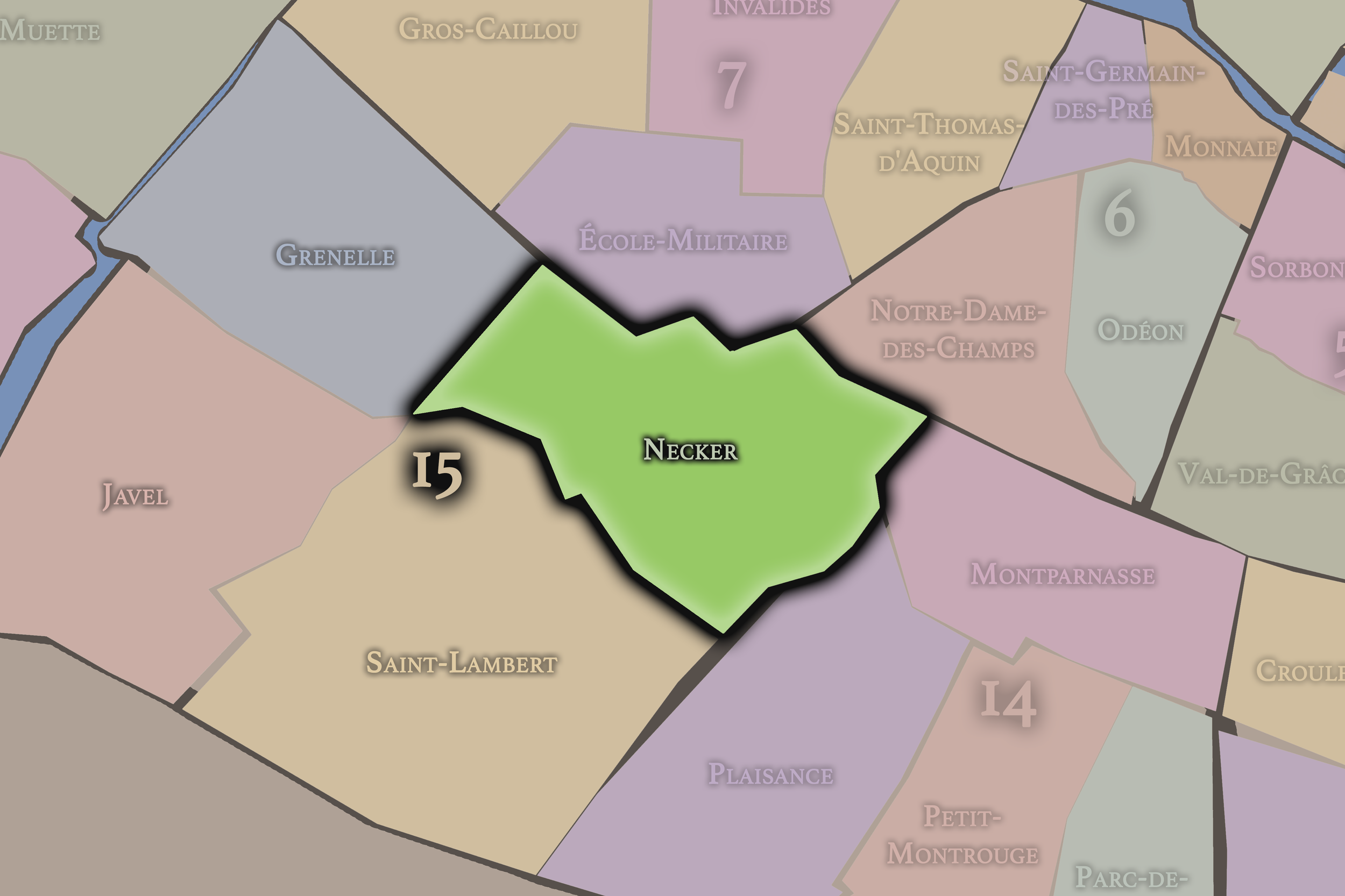
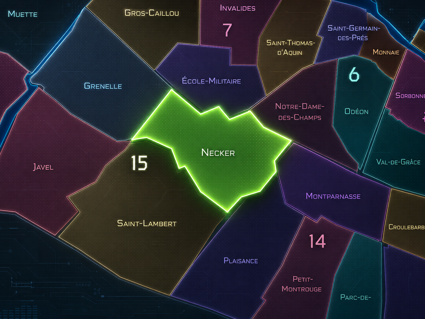
Necker occupies the northeastern portion of the 15th arrondissement, where the residential fabric of western Left Bank Paris meets Montparnasse, Pasteur, Sèvres-Lecourbe, Vaugirard, Grenelle, and the great rail-and-hospital landscapes that define this part of the city. It lies south and southwest of the 6th and 7th arrondissements, west of the 14th arrondissement’s Montparnasse quarter, east of Grenelle, and north of Saint-Lambert. This is the 15th arrondissement’s most immediate connection to central Left Bank Paris: close to Montparnasse, close to Invalides and Saint-Germain, but firmly rooted in the practical residential identity of the 15th.
The quarter’s geography is shaped by Boulevard de Vaugirard, Rue de Vaugirard, Avenue de Breteuil, Boulevard Pasteur, Rue de Sèvres, Rue Lecourbe, Rue Cambronne, Rue Falguière, Rue du Cherche-Midi, and the edges of the Gare Montparnasse complex. Its strongest landmarks include the Necker-Enfants Malades hospital, the Institut Pasteur, the Montparnasse rail landscape, the Lycée Buffon, and the dense apartment streets that link the 15th to the 6th, 7th, and 14th. Necker is not as visually experimental as Grenelle’s Front de Seine, nor as industrial-riverfront in memory as Javel, nor as village-residential as Saint-Lambert. It is more institutional, medical, educational, and connective.
The quarter is therefore one of thresholds rather than spectacle. It gathers hospital care, scientific research, rail movement, residential stability, and the quieter prestige of the western Left Bank. From certain streets, it feels nearly central; from others, it feels unmistakably like the 15th: inhabited, practical, family-oriented, and woven into the daily routines of one of Paris’s largest residential arrondissements.
Administrative Quarter Identity
Etymology and Origins
The name Necker comes from the Hôpital Necker, originally founded in the 18th century as the Hospice de Charité by Suzanne Curchod, wife of Jacques Necker, the Swiss-born banker and statesman who served as finance minister under Louis XVI. The hospital later took the Necker name, and that institutional identity eventually gave the administrative quarter its official title. Like Hôpital-Saint-Louis, Salpêtrière, and Quinze-Vingts, Necker is one of the Parisian quarters named through care.
That origin gives the name a distinctly civic and humane character. Necker does not come from a former village, a saint, a gate, a market, a royal square, or a landscape feature. It comes from an institution created to care for the sick and poor. The quarter’s name therefore preserves a history of public welfare, hospital reform, medical service, and the relationship between philanthropy and the modern city.
Over time, the Necker name became especially associated with children’s medicine through the Necker-Enfants Malades hospital, formed from the connection between the Necker hospital and the earlier Hôpital des Enfants Malades. That pediatric identity gives the quarter a particular emotional weight. Necker is not only an institutional name; it is a name many Parisians associate with vulnerability, family, treatment, and hope.
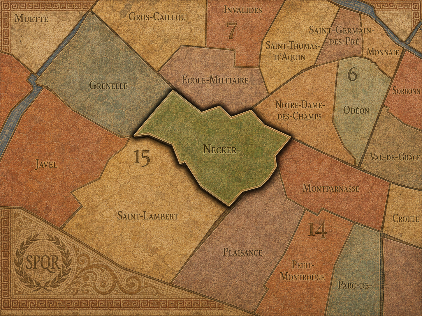
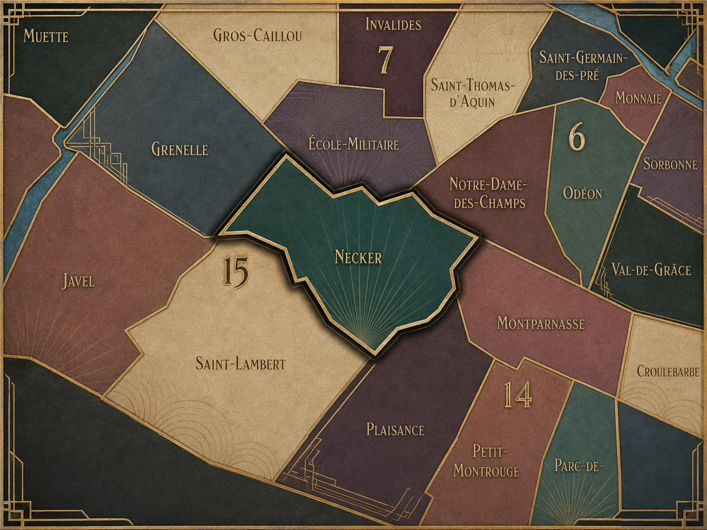
Within the official geography of Paris, Necker is one of the four administrative quarters of the 15th arrondissement, alongside Saint-Lambert, Grenelle, and Javel. It occupies the arrondissement’s northeastern sector, placing it at the meeting point between the residential 15th, the Montparnasse landscape of the 14th, the institutional and governmental Left Bank to the north, and the older Vaugirard / Grenelle fabric to the west and south.
As an administrative quarter, Necker gives civic shape to an area often described through several stronger local names: Pasteur, Sèvres-Lecourbe, Falguière, Volontaires, Montparnasse, Cambronne, or the area around Necker hospital. The official name gathers these fragments into one mapped unit, anchoring them to the medical institution that gives the quarter its identity.
This civic frame is especially useful because Necker is a quarter of overlap. Montparnasse’s rail and cultural geography spills into it. Pasteur gives it a scientific identity. Rue de Vaugirard and Sèvres-Lecourbe connect it to old roads and western Left Bank residence. The hospital gives it a deeper civic purpose. Necker is the quarter where the 15th meets the institutional and infrastructural edge of central Paris.
Civic Framework
Necker differs from the other quarters of the 15th arrondissement through its concentration of medical, scientific, educational, and rail-adjacent landscapes. Grenelle is more strongly defined by the former commune, Rue du Commerce, Beaugrenelle, Front de Seine, and modern riverfront development. Javel is more industrial and post-industrial, shaped by chemical history, Citroën, the Seine, and Parc André-Citroën. Saint-Lambert is more southern, residential, and tied to Vaugirard, Convention, and Parc Georges-Brassens.
Necker is more institutional and connective. Its identity comes from hospital grounds, research institutions, schools, rail edges, and apartment streets that mediate between the 15th and the more famous central neighborhoods nearby. It is not a quarter of a single grand public square or a strongly branded cultural village. Its distinction lies in its civic infrastructure: places where Parisians are treated, taught, housed, trained, and moved.
It should also be distinguished from Montparnasse. The two are closely related geographically, especially around Gare Montparnasse and Boulevard de Vaugirard, but their identities differ. Montparnasse carries artistic mythology, café culture, theaters, the cemetery, and the tower. Necker carries hospital care, science, schools, and the residential-institutional life of the northeastern 15th. Montparnasse is mythic arrival; Necker is everyday support.
Neighborhood Distinction
Parisian Identity
Necker expresses Paris as a city of institutions embedded in daily life. It is not a grand ceremonial district, but it contains places that matter profoundly to the functioning of the city: hospitals, laboratories, schools, transit corridors, residential blocks, and streets where the ordinary and the vulnerable constantly meet. Its identity is practical, but not cold. It is civic in the deepest sense.
The Necker-Enfants Malades hospital gives the quarter a strong emotional center. Hospitals are not usually thought of as neighborhood landmarks in the same way as churches, markets, or monuments, yet in Paris they often define entire districts. They create patterns of arrival, anxiety, care, waiting, work, family presence, and relief. Necker’s Parisian identity is tied to that human choreography: parents and children, doctors and nurses, patients and visitors, ambulances and appointments, all woven into the streets of the 15th.
The Institut Pasteur adds a second layer: Paris as scientific city. With Pasteur, the quarter becomes part of the history of microbiology, vaccination, public health, laboratory research, and the modern battle against disease. Necker therefore holds both bedside care and scientific investigation. It is a quarter where the body is treated, studied, protected, and understood.
Neighborhood Connections
Every administrative quarter belongs to a wider Parisian fabric. These connections place Necker within the city’s civic, participatory, and cultural geography:
-
15e - Vaugirard
-

Alleray / Procession • Cambronne / Garibaldi • Pasteur / Montparnasse • Saint-Lamber
The History
The origins of Necker lie in the western and southwestern expansion of Paris beyond the older Left Bank core. Before the quarter became part of the modern 15th arrondissement, the area belonged to the outer landscapes of Vaugirard and Grenelle: roads, gardens, religious properties, small settlements, institutions, and land gradually drawn into the orbit of the growing city. Rue de Vaugirard, one of the longest streets in Paris, preserves the memory of the old road connection between central Paris and the former village of Vaugirard.
The quarter’s institutional identity emerged before full annexation into Paris. The hospital foundation that became Necker was established in the late 18th century, when this part of the Left Bank still offered more space than the dense center. Its location reflected a recurring Parisian pattern: institutions of care often grew where land was available, slightly removed from the oldest urban core but close enough to serve the capital.
Necker’s origin story is therefore one of service on the edge. The area was not originally central in the way Saint-Germain or the Latin Quarter were central. It became important because the expanding city placed essential institutions there — care, science, education, rail, and residence — until the former edge became a necessary part of Paris itself.
Origins
16th–17th Century
In the 16th and 17th centuries, the future Necker quarter lay outside the densest fabric of Paris, within the western Left Bank outskirts associated with Vaugirard, Grenelle, Sèvres, and the roads leading southwest from the city. The land was shaped by fields, gardens, religious houses, scattered residences, and routes connecting Paris to nearby villages and royal or suburban destinations.
This peripheral condition gave the area a different character from the older Left Bank neighborhoods to the northeast. It did not yet have the hospital, rail, or scientific identity that would later define it. Instead, it belonged to a landscape of gradual expansion, where Paris’s needs slowly reached outward into the surrounding communes and open lands.
By the end of the 17th century, western and southwestern Paris were becoming increasingly important through military, religious, residential, and road development. The future Necker quarter remained less formal than Invalides or Saint-Germain, but the conditions were forming for later institutional growth: available land, road access, and proximity to the capital.
In the 18th century, the area that would become Necker moved closer to the life of the expanding city. Vaugirard and Grenelle were increasingly tied to Paris through roads, settlement, institutions, and suburban development. The district remained outside the old center, but no longer felt remote from the capital’s social and administrative needs.
The founding of the hospital that later took the Necker name marked a decisive shift. Suzanne Necker’s charitable foundation reflected 18th-century concerns with poor relief, hospital reform, and more humane forms of institutional care. At a time when Paris was rethinking public welfare, hospitals, sanitation, and the organization of the sick, Necker became part of the city’s evolving medical landscape.
The Revolution then changed the political and institutional context in which hospitals operated. Charitable foundations, royal patronage, religious care, and civic responsibility were all reinterpreted. Necker’s later development would take place within this modernizing framework, as Paris moved toward more organized public health and medical specialization.
18th Century
19th Century
The 19th century transformed Necker into a fully Parisian quarter. The 1860 annexation of Vaugirard and Grenelle brought this landscape into the capital as part of the new 15th arrondissement. What had been outer institutional and residential land became official Paris. Streets, apartment buildings, schools, hospitals, rail corridors, and civic infrastructure gave the quarter its modern form.
The hospital landscape became increasingly significant. Necker’s connection with the Hôpital des Enfants Malades strengthened the quarter’s association with pediatric care, while the broader medical system of Paris became more specialized and scientific. The hospital was no longer simply a charitable refuge; it became part of a modern medical network.
The 19th century also brought the growing importance of rail and Montparnasse. The station and its surrounding infrastructure affected the northeastern edge of the 15th, shaping movement, commerce, housing, and the quarter’s relationship to the rest of the city. Necker became a place where medicine, residence, and mobility converged.
In the early and mid 20th century, Necker remained a quarter of hospitals, schools, rail proximity, and residential life. The Necker-Enfants Malades hospital continued to anchor the district with medical care, while the Institut Pasteur strengthened the surrounding area’s scientific identity. These institutions placed the quarter within the modern history of medicine, public health, and laboratory research.
The Montparnasse station landscape also continued to shape the quarter’s eastern edge. Travelers, workers, railway employees, residents, students, patients, and hospital staff all moved through the same district. Necker’s streets carried a practical urban rhythm: appointments, commutes, school days, local shopping, and the daily circulation of people using the city’s institutional systems.
During the upheavals of war, occupation, liberation, and postwar recovery, hospitals and research institutions took on heightened importance. The quarter’s identity as a landscape of care and science became even more meaningful in periods of crisis. Necker was not only a residential district; it was part of the city’s capacity to survive, heal, and rebuild.
Early–Mid 20th Century
Late 20th Century
In the late 20th century, Necker was shaped by the modernization of hospital care, the restructuring of the Montparnasse rail landscape, and the broader residential stability of the 15th arrondissement. The hospital remained one of the quarter’s defining anchors, while medical specialization, pediatric treatment, research, and public health gave the name Necker a significance far beyond the neighborhood itself.
The reconstruction and modernization of Gare Montparnasse and the development of the surrounding station district also affected the quarter. The northeastern 15th became increasingly tied to office buildings, transit flows, high-density movement, and the modern urban forms around Montparnasse. Necker thus shared in the tension between traditional residential Paris and late-20th-century infrastructural redevelopment.
At the same time, the quarter retained a quieter neighborhood life. Streets away from the hospital and station held apartment buildings, schools, shops, cafés, and the local routines of the 15th arrondissement. Necker’s late-20th-century identity was not purely institutional; it remained residential, stable, and deeply integrated into everyday Paris.
In the 21st century, Necker remains one of the 15th arrondissement’s most important civic quarters. The Necker-Enfants Malades hospital continues to serve as a major medical center, while the Institut Pasteur remains one of the world’s most recognizable names in biomedical research. The surrounding streets connect Montparnasse, Pasteur, Sèvres-Lecourbe, Vaugirard, Cambronne, and the residential heart of the 15th.
Today, the quarter balances care, science, transport, and daily life. Patients and families arrive at the hospital; researchers and medical workers move through institutional campuses; residents shop, commute, attend school, and live in the apartment streets around them. This coexistence gives Necker a serious but grounded identity. It is not a district of spectacle, but of function made human.
For CityNeighborhoods: Paris, Necker is essential because it shows how an administrative quarter can be defined by institutions that support life rather than display power. It is Paris as hospital, laboratory, school, station edge, and residential neighborhood. Its history is not always visually dramatic, but it is deeply consequential. Necker is one of the places where the city cares for itself.
21st Century
Spirit and Legacy
Necker is the quarter where the 15th arrondissement gathers care, science, and everyday residence into one civic landscape. Its spirit is practical, humane, and quietly serious. It belongs to hospital corridors and laboratory memory, schoolyards and apartment streets, rail edges and local shops, family anxieties and medical hope, the ordinary rhythms of a district built around service.
Its legacy is the transformation of outer land into essential city. Roads and suburban ground became hospital quarter, research landscape, residential neighborhood, and Montparnasse threshold. Institutions of care and science gave the area a meaning that extends far beyond its borders, while daily life kept it grounded in the routines of the 15th.
To walk Necker is to encounter Paris through responsibility. The quarter does not rely on spectacle to matter. It matters because people come here when care is needed, because knowledge is made here, because families wait here, because the city’s systems of health, research, education, and movement are woven into ordinary streets. In Necker, neighborhood identity becomes support — the quiet infrastructure of life within Paris.
The Photography
The arrondissements do not share a single visual identity. Instead, they organize Paris into twenty broad visual fields, each gathering its own combination of landmarks, streetscapes, institutions, residential districts, commercial corridors, parks, rail stations, markets, cemeteries, and riverfront edges.
Some arrondissements are defined by monumental scale: royal palaces, ceremonial avenues, government buildings, museums, formal gardens, and internationally recognized landmarks. Others are shaped by hills, canals, rail gateways, apartment-lined boulevards, neighborhood markets, former village streets, industrial remnants, parks, or the quieter rhythms of residential Paris. The arrondissement system gives these varied landscapes a civic frame, allowing the city to be read not as one visual language, but as a sequence of overlapping Parisian atmospheres.

Visual Identity
Through The Lens
Photographing the arrondissements means moving between the official map and the street-level experience. The camera does not treat each arrondissement as visually uniform. Instead, it looks for the recurring forms, textures, transitions, and contrasts that make each district legible: the geometry of boulevards, the shade of plane trees, the repetition of balconies, the rise of stairways, the curve of canals, the presence of rail stations, the opening of parks, the weight of monuments, and the intimacy of side streets.
On CityNeighborhoods, the arrondissement provides the frame, but the photograph comes from the encounter between map, movement, light, and observation. As the Paris photography is processed, this section will connect each arrondissement more directly to the project’s Photographic Lexicon: the visual strategies, recurring motifs, and compositional patterns that shape how the city is seen through the lens.

If you visit Paris, these ideas can help inspire your own photography.



Paris: J’Espere, Je Rêve, Je Vive
Paris Photo Gallery
Paris Field Notes
-
Field Note: August 18, 2025 | 07:58 AM
Conditions: 73°F | Humidity: 72%.
Within the park's interior, the glacial kettle ponds acted as humidity traps, creating a soft, hazy light that filtered through the old-growth oaks. The transition from the park's dense shade to the sun-drenched edges of Oakland Gardens highlighted the day's exceptional "picture-perfect" clarity.
There is a fleeting window in Queens where the humidity of August hasn't yet heavy-set, and the morning sun hits the canopy of Alley Pond Park at a perfect oblique angle. Arriving just before 8:00 AM, I watched the light break through the oaks and tulip trees, casting long, dramatic shadows across the wet grass. It’s in these quiet, golden moments that the park feels less like a city escape and more like the ancient glacial valley it actually is.
Other neighborhoods visited:











































































































Explore Paris
-

The twenty arrondissements form the civic spiral of Paris, organizing the city into its broad local districts of government, identity, and daily life.
-

Each arrondissement is divided into four official administrative quarters, giving Paris a more precise civic and geographic framework.
-

The conseils de quartier bring participation to street level, giving residents a voice in neighborhood needs, public space, and local civic life.
-

Les Deux Rives trace Paris through the Seine’s two banks, revealing how the Rive Droite and Rive Gauche shaped the city’s civic power, commerce, learning, art, and cultural identity.
-

Cultural neighborhoods reveal the Paris people recognize through history, cafés, architecture, memory, atmosphere, and local belonging.