
17e - ÉPINETTES
Quartiers Administratifs
Part of an ongoing project to walk and photograph every neighborhood in Paris, this page 17e - Épinettes through maps, district identity, history, and photography.




The Map
Download the Paris Arrondissements Map
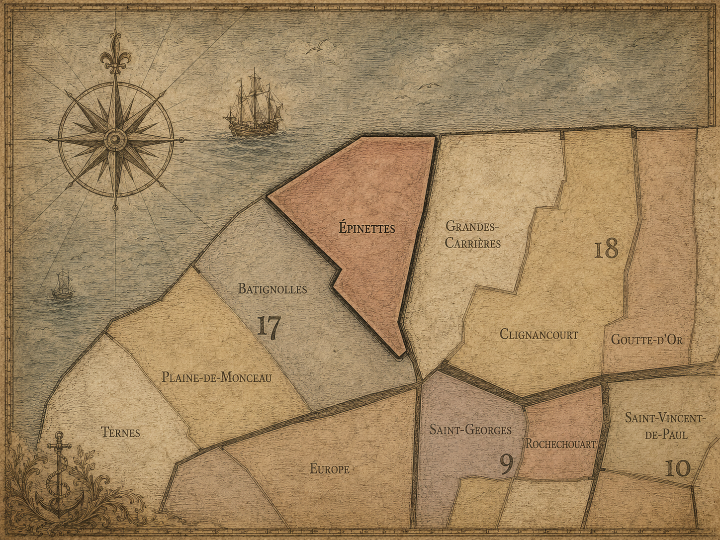
Geographic Setting
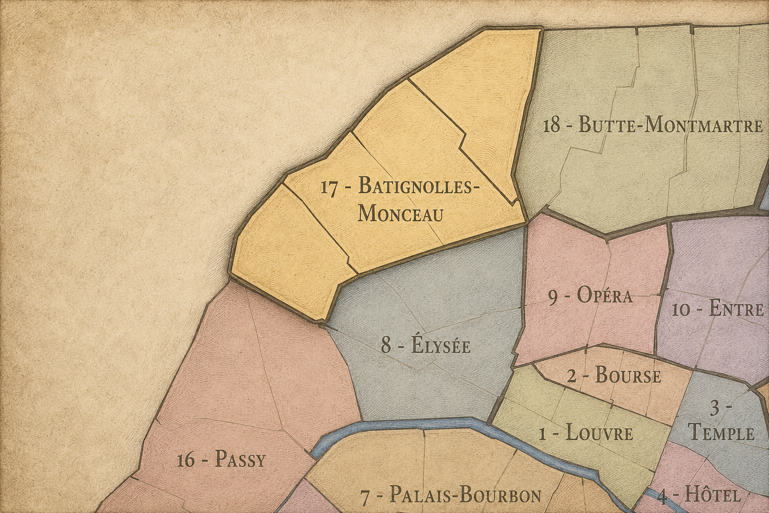
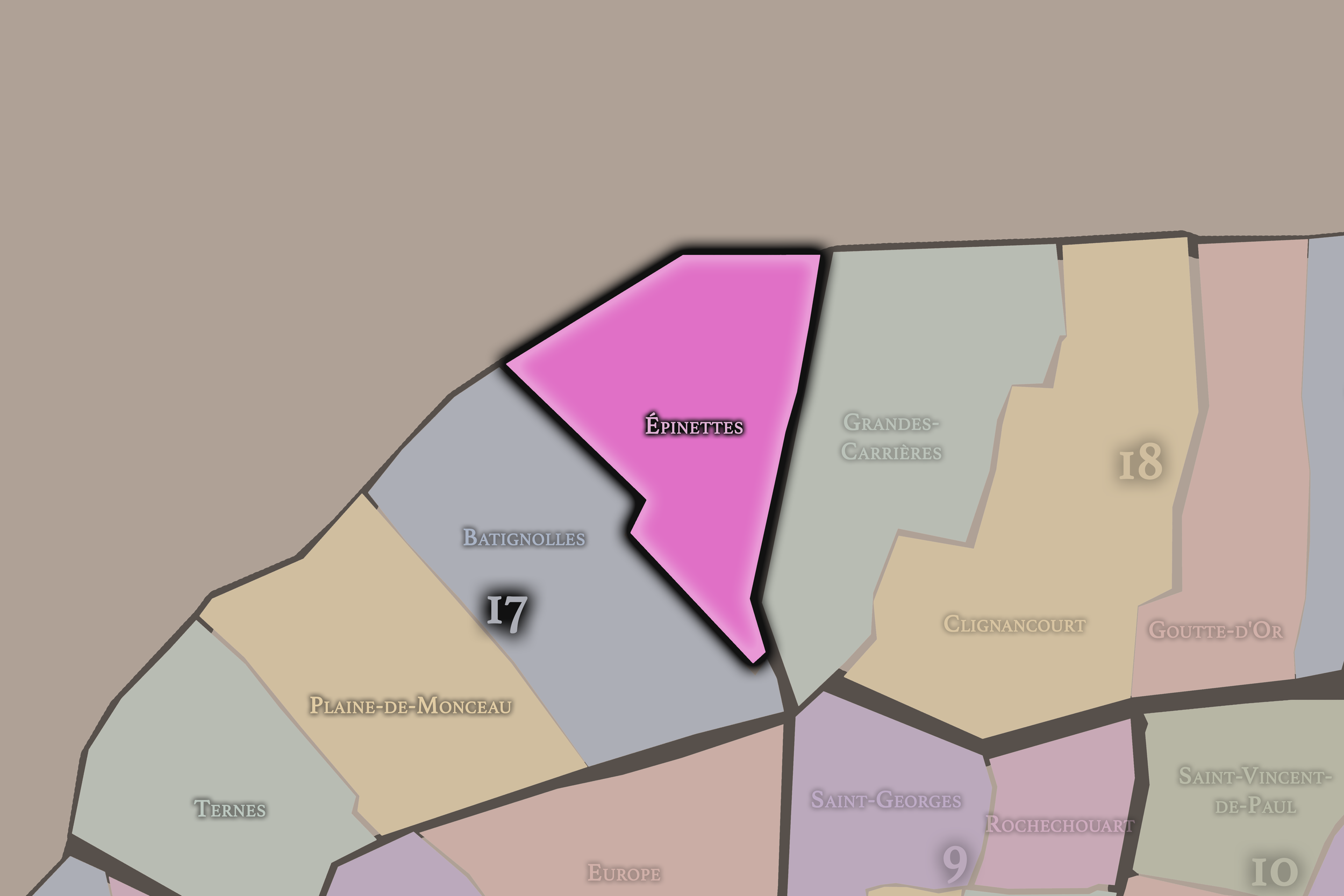
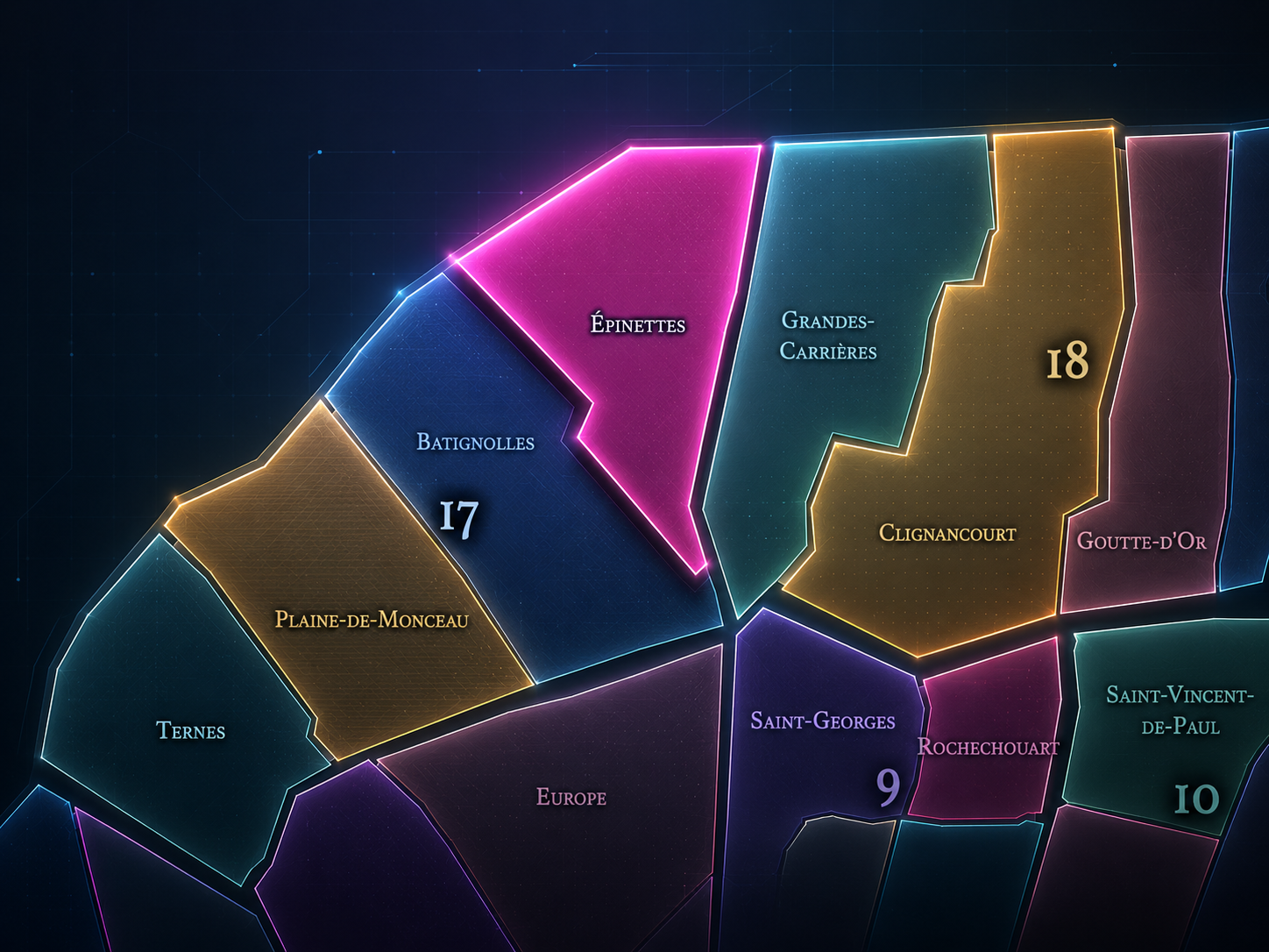
Épinettes occupies the northern portion of the 17th arrondissement, where Paris meets the edges of Clichy, Saint-Ouen, the former industrial belt, and the rail landscapes that shaped the city’s northwestern expansion. It lies north of Batignolles, northeast of Plaine-de-Monceaux, and east / northeast of Ternes, forming the 17th arrondissement’s most openly working-class and edge-conscious quarter. Its geography is defined by the transition from older village and faubourg settlement into a dense urban district shaped by housing, industry, rail, markets, and the city boundary.
The quarter’s principal streets and landmarks include Avenue de Clichy, Rue de La Jonquière, Rue des Épinettes, Rue Guy-Môquet, Rue Pouchet, Rue de la Jonquière, Rue Brochant, Rue Legendre, Boulevard Bessières, Porte de Clichy, and the northern edges around the périphérique. It is also closely connected to the newer Clichy-Batignolles developments to the south and the Tribunal de Paris / Porte de Clichy landscape to the west. The quarter’s atmosphere is dense, residential, active, and less polished than the grander western sections of the 17th.
Unlike Batignolles, whose identity has become associated with village charm, café life, and contemporary redevelopment, or Plaine-de-Monceaux, whose character is more bourgeois, Haussmannian, and park-adjacent, Épinettes carries more of the northern working city. It is the 17th arrondissement as edge and endurance: apartment blocks, public housing, local commerce, former industrial memory, immigrant and working-class traces, and the social life of a district built close to the boundary of Paris.
Administrative Quarter Identity
Etymology and Origins
The name Épinettes likely comes from épines or small thorn bushes, referring to the vegetation that once marked the former fields and outskirts north of Paris. Like many names on the city’s former edge, it preserves a landscape that predates dense urbanization: open ground, paths, fields, gardens, scrubland, and small settlements beyond the old city. Before Épinettes was a Parisian administrative quarter, it belonged to the outer geography of the northern plain.
The name is modest and local. It does not refer to a saint, a palace, a gate, or a monumental institution. It recalls vegetation and land. That makes it especially fitting for a quarter whose later history would be shaped not by aristocratic display, but by the slow transformation of peripheral ground into housing and working streets. The name keeps the older terrain visible beneath the modern fabric.
Over time, Épinettes became attached to one of the 17th arrondissement’s most socially grounded districts. The thorny origin of the name almost becomes symbolic: this was not the easy, manicured Paris of prestige avenues. It was a tougher, denser, more practical Paris — a quarter that grew from the margins and carried the marks of labor, migration, industry, and urban pressure.
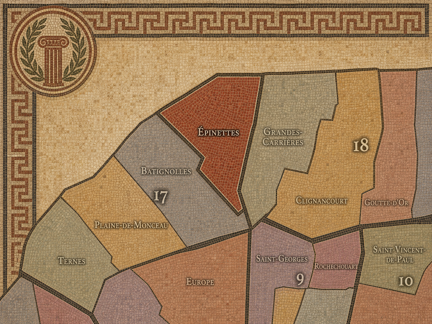
Within the official geography of Paris, Épinettes is one of the four administrative quarters of the 17th arrondissement, alongside Batignolles, Plaine-de-Monceaux, and Ternes. It occupies the arrondissement’s northern sector, giving civic form to the Parisian landscape between Batignolles, Clichy, Saint-Ouen, Porte de Clichy, and the outer boulevards.
As an administrative quarter, Épinettes clarifies an area often described through more specific or lived names: Guy-Môquet, Brochant, Porte de Clichy, La Jonquière, Avenue de Clichy, or the northern 17th. Those names remain useful, but Épinettes is the official frame that gathers them into one neighborhood system. It links local streets, boundary conditions, former industrial land, residential density, and the newer transformations around Clichy-Batignolles into a single civic unit.
This frame is especially useful because Épinettes is often overshadowed by Batignolles. The two are closely connected, and the contemporary cultural pull of Batignolles can blur the distinction. But Épinettes has its own identity: more northern, more working in memory, more boundary-facing, and more shaped by the social histories of the city’s edge.
Civic Framework
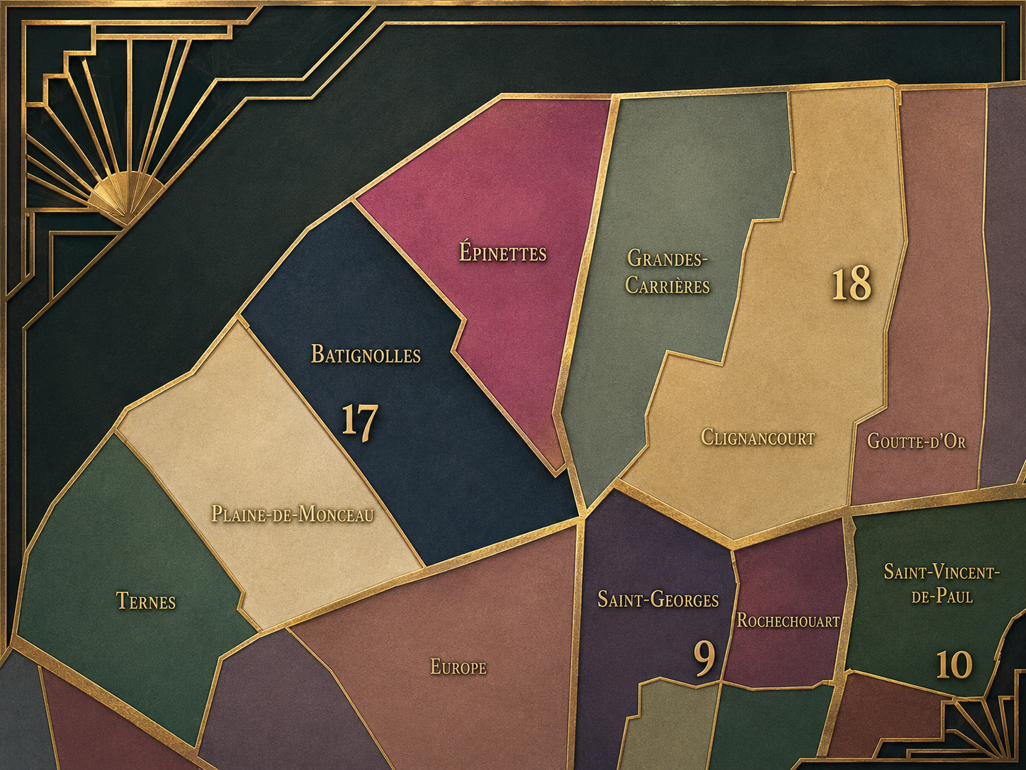
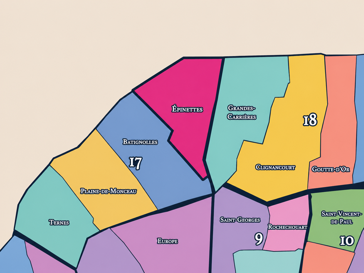
Épinettes differs from the other quarters of the 17th arrondissement through its northern edge condition, its working-class inheritance, and its relationship to Clichy, Saint-Ouen, and the former industrial belt. Ternes is more western and prestigious, tied to the Arc de Triomphe, Avenue des Ternes, Porte Maillot, and the routes toward Neuilly. Plaine-de-Monceaux is more bourgeois and Haussmannian, shaped by Parc Monceau, grand apartment buildings, and the refined expansion of western Paris. Batignolles is more village-like and increasingly associated with cafés, families, parks, and urban reinvention.
Épinettes is more direct, denser, and less curated. Its distinction lies in the everyday fabric of northern Paris: local shops, apartment blocks, schools, community life, social housing, boundary streets, and the long memory of workers and modest households living near the city’s edge. It is not the postcard 17th. It is the 17th as a lived urban seam.
It should also be distinguished from Clichy and Saint-Ouen, which border the quarter beyond Paris. Épinettes shares some of their edge-city energy, but it remains inside the capital. That inside / outside condition gives the quarter much of its meaning. It belongs to Paris, but it faces outward toward the suburbs and toward the metropolitan north.
Neighborhood Distinction
Parisian Identity
Épinettes expresses Paris as a city of margins made central to everyday life. It is one of the places where the capital’s social history becomes visible without grand monumentality. Its identity is built from housing, labor, street commerce, transport, schools, cafés, neighborhood associations, and the persistence of local life in a district that has often stood outside the city’s most celebrated images.
This makes Épinettes deeply Parisian in a way that is easy to overlook. Paris is not only the city of boulevards, museums, palaces, and café mythology. It is also the city of northern-edge quarters where working people lived close to rail lines, factories, warehouses, repair shops, markets, and boundaries. Épinettes belongs to that Paris of use and survival.
The quarter also reflects the ongoing transformation of the city’s northwestern edge. The redevelopment of nearby Clichy-Batignolles, the rise of the Tribunal de Paris, new transit connections, and the broader revaluation of northern Paris have changed how the area is perceived. Yet Épinettes remains distinct because it carries a stronger memory of the older working district beneath the new metropolitan layer.
Neighborhood Connections
Every administrative quarter belongs to a wider Parisian fabric. These connections place Épinettes within the city’s civic, participatory, and cultural geography:
-
17e - Batignolles-Monceau
-

Batignolles • Épinettes-Bessières • La Fourche-G. Môquet
The History
The origins of Épinettes lie in the northern outskirts of Paris, beyond the dense central city and within the open lands that connected the capital to Clichy, Saint-Ouen, and the villages and roads of the northern plain. Before the modern quarter existed, the area contained fields, paths, gardens, small settlements, quarries or extraction-related landscapes in the wider region, and practical land uses tied to the edge of the city.
Its development was shaped by proximity to Paris without full incorporation. As the capital grew, its outskirts absorbed population and activity that could not easily fit into the crowded center. Housing, workshops, storage, and services grew along the roads and boundaries. Épinettes emerged from this outer belt, where land was more available and social life was tied to both Paris and the neighboring communes.
The quarter’s origin story is therefore one of peripheral growth. It was not planned first as a prestigious district. It developed through need: housing, work, movement, and the gradual thickening of urban life beyond the old city. That practical beginning shaped the neighborhood’s enduring identity.
Origins
16th–17th Century
In the 16th and 17th centuries, the future Épinettes quarter lay outside the dense urban core of Paris. The area belonged to the northern plain, with fields, rural paths, scattered houses, and land connected to the villages and estates beyond the city. It had no formal urban identity in the later sense and was not yet part of the Parisian built fabric.
This outer position matters because Épinettes was shaped first by distance. It was near enough to Paris to be influenced by the capital, but far enough away to retain a rural and marginal character. The name itself, with its likely connection to thorny vegetation, preserves the memory of this pre-urban landscape.
By the end of the 17th century, Paris was expanding outward, but the northern edge remained largely outside the formal city. Épinettes’ later development would come through the long conversion of this outer ground into suburban settlement, then into a Parisian quarter after annexation.
In the 18th century, the area that would become Épinettes became more closely tied to the expanding city. Roads northward grew busier, settlement increased, and the land between Paris, Clichy, and Saint-Ouen began to absorb more of the capital’s population pressure. It remained beyond the old center, but it was increasingly part of Paris’s functional surroundings.
This was not the Paris of aristocratic western development or carefully staged urban grandeur. The northern outskirts grew more practically: housing, trades, market activity, modest dwellings, and small industries gradually appeared as the city pressed outward. The future quarter’s social identity was already forming around utility rather than prestige.
The French Revolution and the administrative changes that followed altered the relationship between Paris and surrounding communes, but Épinettes remained outside the capital until the 19th century. By the end of the 18th century, however, the boundary between city and outskirts had become increasingly porous. Épinettes was no longer remote countryside. It was a developing edge.
18th Century
19th Century
The 19th century transformed Épinettes into an urban neighborhood. The commune of Batignolles-Monceau developed rapidly north of Paris, and Épinettes became part of that expanding suburban-industrial landscape before being annexed to Paris in 1860 as part of the new 17th arrondissement. This incorporation brought the quarter into the capital, but did not erase its edge identity.
Industrial and railway development strongly affected the district. The rail approaches to Saint-Lazare, workshops, storage sites, factories, modest housing, and the growth of northern Paris created a dense working environment. Épinettes became one of the places where the city housed and organized the people who supported the modern economy but did not live in its grandest districts.
The quarter’s 19th-century identity was therefore working, residential, and boundary-conscious. Streets were laid out, apartment buildings rose, local commerce developed, and the former outskirts became part of the urban body of Paris. But Épinettes retained a rougher, more practical character than the bourgeois sectors to the south and west.
In the early and mid 20th century, Épinettes remained a working and residential quarter of the northern 17th. Its streets held apartment blocks, modest shops, cafés, schools, workshops, small factories, railway-adjacent employment, and the everyday life of families living near the city’s edge. It was a neighborhood of routines rather than spectacle.
The quarter’s social character was strongly shaped by labor and local solidarity. Like many northern and eastern districts of Paris, Épinettes carried a more popular identity than the affluent western image often associated with the 17th arrondissement. It belonged to the Paris of workers, small renters, shopkeepers, and communities formed through proximity and necessity.
During the wars, occupation, liberation, and postwar reconstruction, Épinettes shared the pressures of residential and working Paris: shortages, displacement, hardship, rebuilding, and demographic change. Its history in this period lies less in famous monuments than in the resilience of ordinary streets under extraordinary circumstances.
Early–Mid 20th Century
Late 20th Century
In the late 20th century, Épinettes changed as industrial functions declined, railway lands were reconsidered, and the northern 17th began to be drawn into broader processes of renewal and gentrification. Some older workshops disappeared or were converted, while residential demand increased and the area’s proximity to Batignolles and central Paris made it more attractive to new residents.
Yet the quarter did not immediately lose its social complexity. Épinettes retained a mixed identity: older residents, modest housing, public facilities, immigrant communities, local commerce, and traces of working-class Paris coexisted with newer cafés, renovated buildings, and rising property values. This unevenness is part of the quarter’s character.
The late 20th century also prepared the transformation of nearby rail and industrial lands into the Clichy-Batignolles project. Although the redevelopment is often culturally associated with Batignolles, its effects reach into the northern 17th and reshape the way Épinettes relates to the city. The old edge was becoming a new center of planning attention.
In the 21st century, Épinettes stands at a powerful moment of transition. The quarter remains dense, residential, and socially varied, but it is increasingly affected by the transformation of the surrounding area: the Tribunal de Paris at Porte de Clichy, the Clichy-Batignolles redevelopment, new public spaces, improved transit, and the changing perception of the northern 17th.
Today, Épinettes holds several identities at once. It is still a neighborhood of local commerce, schools, apartment streets, boundary crossings, and everyday routines. It is also part of a wider revaluation of northern Paris, where former industrial and rail-edge districts are being redesigned, marketed, and absorbed into newer images of metropolitan life. The quarter’s challenge is how to remain socially rooted while becoming more desirable.
For CityNeighborhoods: Paris, Épinettes is essential because it shows how administrative quarters can reveal the less polished histories of Parisian expansion. It is not only the neighbor of Batignolles, nor merely the northern edge of the 17th. It is a quarter where former fields, working streets, city boundaries, industrial memory, and contemporary redevelopment all remain visible in the same urban fabric.
21st Century
Spirit and Legacy
Épinettes is the quarter where the northern edge of the 17th remembers its working ground. Its spirit is dense, practical, resilient, and socially layered. It belongs to thorny old fields and apartment blocks, rail edges and local shops, boundary streets and school routes, modest façades and changing cafés, the former outside and the city still pressing outward.
Its legacy is the transformation of margin into neighborhood. Open land became settlement. Settlement became working suburb. Working suburb became Paris. Industrial edges became redevelopment frontiers. Through each stage, Épinettes carried the reality of the city’s growth more plainly than its grander neighbors.
To walk Épinettes is to encounter Paris without the filter of polish. The quarter reminds us that neighborhood identity is often made from endurance: people living near boundaries, adapting to change, holding local life together while the city expands around them. In Épinettes, Paris is not performed as spectacle. It is lived as persistence.
The Photography
The arrondissements do not share a single visual identity. Instead, they organize Paris into twenty broad visual fields, each gathering its own combination of landmarks, streetscapes, institutions, residential districts, commercial corridors, parks, rail stations, markets, cemeteries, and riverfront edges.
Some arrondissements are defined by monumental scale: royal palaces, ceremonial avenues, government buildings, museums, formal gardens, and internationally recognized landmarks. Others are shaped by hills, canals, rail gateways, apartment-lined boulevards, neighborhood markets, former village streets, industrial remnants, parks, or the quieter rhythms of residential Paris. The arrondissement system gives these varied landscapes a civic frame, allowing the city to be read not as one visual language, but as a sequence of overlapping Parisian atmospheres.

Visual Identity
Through The Lens
Photographing the arrondissements means moving between the official map and the street-level experience. The camera does not treat each arrondissement as visually uniform. Instead, it looks for the recurring forms, textures, transitions, and contrasts that make each district legible: the geometry of boulevards, the shade of plane trees, the repetition of balconies, the rise of stairways, the curve of canals, the presence of rail stations, the opening of parks, the weight of monuments, and the intimacy of side streets.
On CityNeighborhoods, the arrondissement provides the frame, but the photograph comes from the encounter between map, movement, light, and observation. As the Paris photography is processed, this section will connect each arrondissement more directly to the project’s Photographic Lexicon: the visual strategies, recurring motifs, and compositional patterns that shape how the city is seen through the lens.

If you visit Paris, these ideas can help inspire your own photography.



Paris: J’Espere, Je Rêve, Je Vive
Paris Photo Gallery
Paris Field Notes
-
Field Note: August 18, 2025 | 07:58 AM
Conditions: 73°F | Humidity: 72%.
Within the park's interior, the glacial kettle ponds acted as humidity traps, creating a soft, hazy light that filtered through the old-growth oaks. The transition from the park's dense shade to the sun-drenched edges of Oakland Gardens highlighted the day's exceptional "picture-perfect" clarity.
There is a fleeting window in Queens where the humidity of August hasn't yet heavy-set, and the morning sun hits the canopy of Alley Pond Park at a perfect oblique angle. Arriving just before 8:00 AM, I watched the light break through the oaks and tulip trees, casting long, dramatic shadows across the wet grass. It’s in these quiet, golden moments that the park feels less like a city escape and more like the ancient glacial valley it actually is.
Other neighborhoods visited:











































































































Explore Paris
-

The twenty arrondissements form the civic spiral of Paris, organizing the city into its broad local districts of government, identity, and daily life.
-

Each arrondissement is divided into four official administrative quarters, giving Paris a more precise civic and geographic framework.
-

The conseils de quartier bring participation to street level, giving residents a voice in neighborhood needs, public space, and local civic life.
-

Les Deux Rives trace Paris through the Seine’s two banks, revealing how the Rive Droite and Rive Gauche shaped the city’s civic power, commerce, learning, art, and cultural identity.
-

Cultural neighborhoods reveal the Paris people recognize through history, cafés, architecture, memory, atmosphere, and local belonging.