
18e - LA CHAPELLE
Quartiers Administratifs
Part of an ongoing project to walk and photograph every neighborhood in Paris, this page 18e - La Chapelle through maps, district identity, history, and photography.




The Map
Download the Paris Arrondissements Map
Geographic Setting
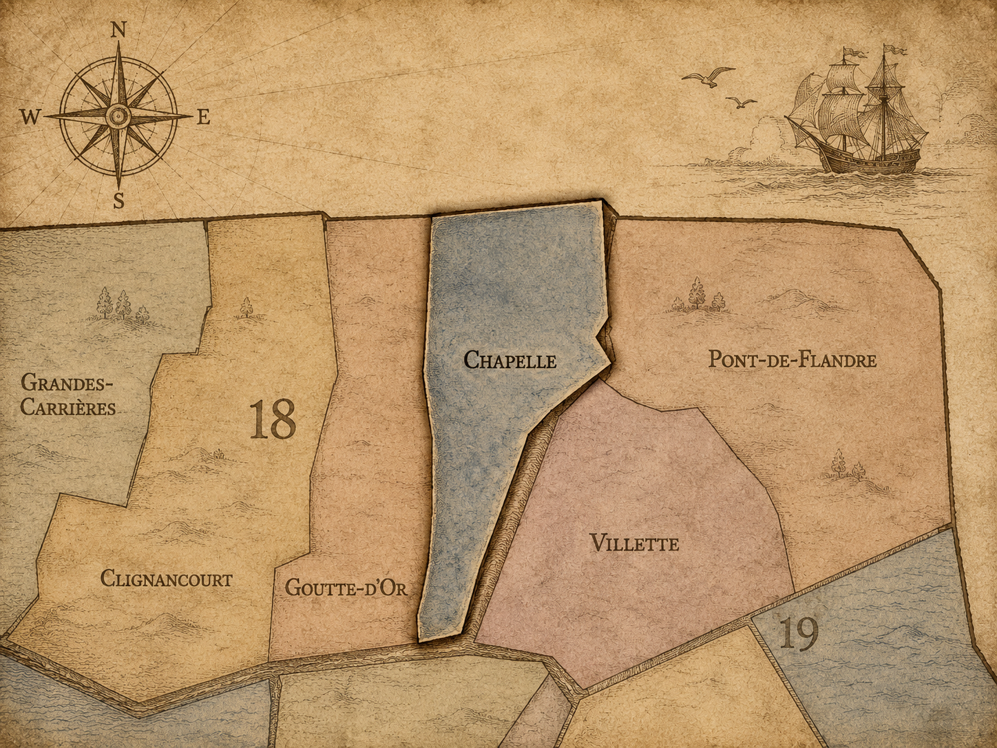
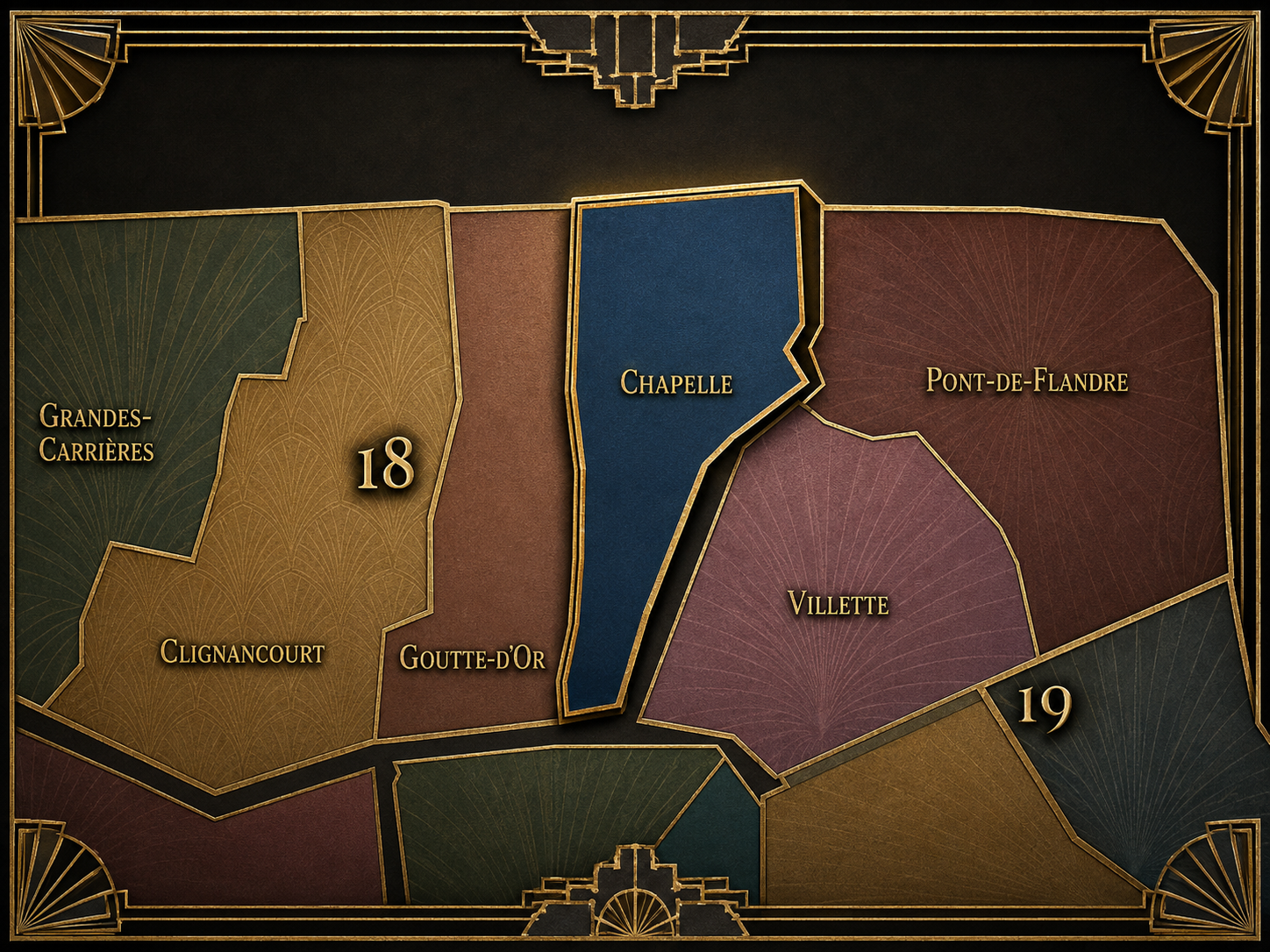
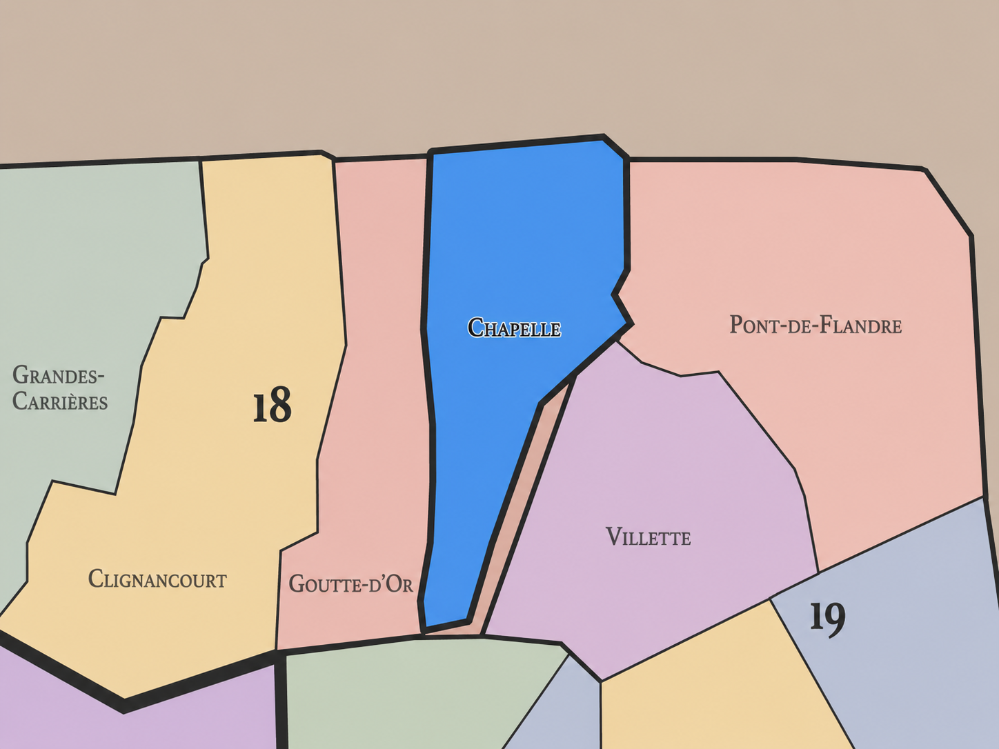
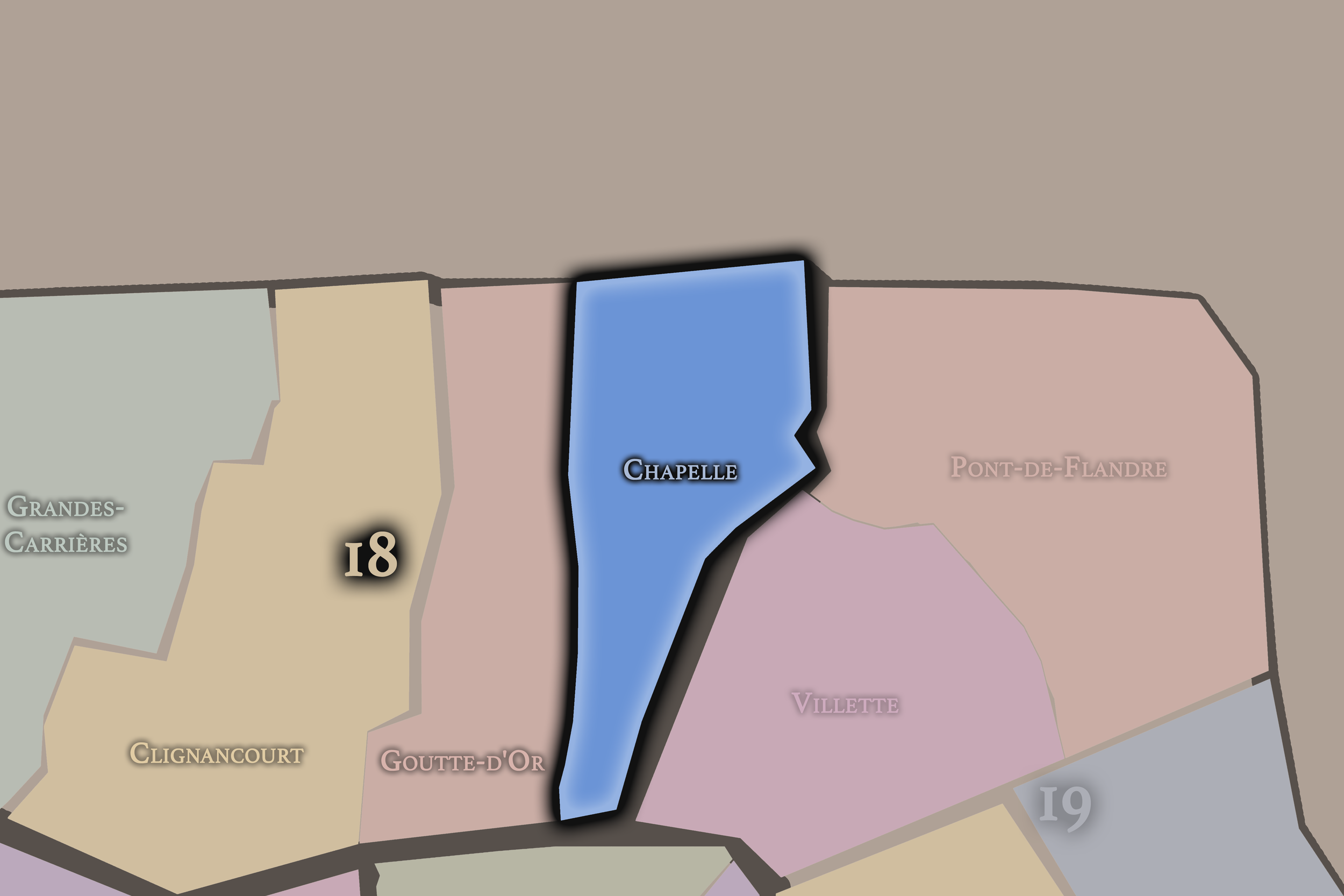
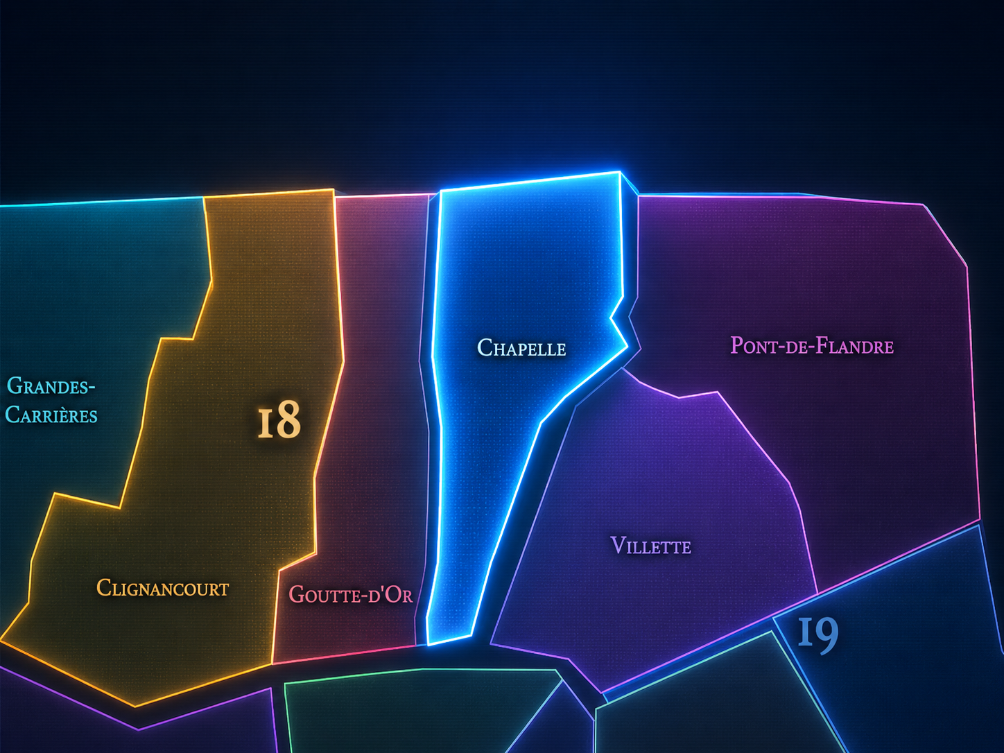
La Chapelle occupies the eastern portion of the 18th arrondissement, where Paris gathers around the rail corridors north of Gare du Nord, the old road to Saint-Denis, the Porte de la Chapelle, Marx Dormoy, the Canal Saint-Denis edge, and the boundary with Saint-Denis and Aubervilliers. It lies east of Goutte-d’Or, north and northeast of the 10th arrondissement’s Saint-Vincent-de-Paul and Hôpital-Saint-Louis quarters, and west of the 19th arrondissement’s Villette landscape. Few administrative quarters in Paris are so defined by infrastructure, movement, and metropolitan edge.
The quarter’s geography is shaped by Rue de la Chapelle, Boulevard de la Chapelle, Boulevard Ney, Rue Marx-Dormoy, Rue Ordener, Rue Pajol, Rue Riquet, Rue de l’Évangile, Porte de la Chapelle, the rail approaches to Gare du Nord and Gare de l’Est, and the redevelopment zones of Chapelle International and nearby Rosa Parks / Pajol-adjacent landscapes. The old north-south road remains essential: La Chapelle grew along the route from Paris toward Saint-Denis, one of the most historically significant roads in France, connecting the capital to the royal necropolis at the Basilica of Saint-Denis.
Unlike Montmartre, whose identity is elevated, picturesque, touristic, and globally mythologized, La Chapelle is lower, more infrastructural, and more openly metropolitan. Unlike Clignancourt, whose northern edge turns toward Saint-Ouen and the flea-market threshold, or Goutte-d’Or, whose street identity is concentrated around Barbès and Château Rouge, La Chapelle is the 18th arrondissement as passage: railway, road, warehouse, migration, housing, industry, redevelopment, and the difficult but essential seam between Paris and the northern suburbs.
Administrative Quarter Identity
Etymology and Origins
The name La Chapelle comes from the old village of La Chapelle, historically known as La Chapelle-Saint-Denis, whose identity was tied to the road between Paris and Saint-Denis and to the church of Saint-Denys de la Chapelle. Before becoming an administrative quarter of Paris, La Chapelle was an independent commune in the former département of the Seine from 1790 until its incorporation into Paris in 1860. The City of Paris describes La Chapelle as an ancient commune that existed before being integrated into the capital, while district references identify the present quarter as the former village center of La Chapelle.
The name itself is modest but powerful. “La Chapelle” simply means “the chapel,” yet in this case the chapel stood on one of the oldest and most symbolically charged roads north of Paris. The church of Saint-Denys de la Chapelle, traditionally associated with the route to Saint-Denis, gives the name a sacred and processional layer: this was not just a roadside settlement, but a place on the path between Paris and the burial church of French kings.
Over time, the old chapel name became attached to a much larger urban identity. La Chapelle moved from village and road settlement to commune, from commune to Parisian quarter, from Parisian quarter to railway and industrial landscape, and now to one of the city’s most active redevelopment and metropolitan-edge districts. The name preserves a small sacred origin beneath a vast modern infrastructure.
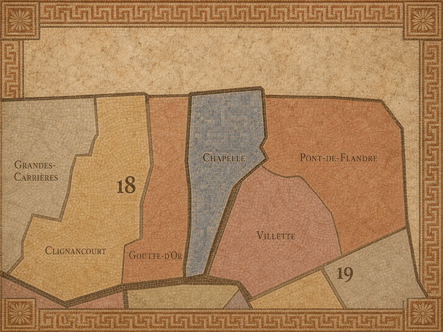
Within the official geography of Paris, La Chapelle is one of the four administrative quarters of the 18th arrondissement, alongside Montmartre, Clignancourt, and Goutte-d’Or. It occupies the arrondissement’s eastern sector and gives civic shape to the area between the Goutte-d’Or / Barbès edge, the rail lines north of Gare du Nord, the Porte de la Chapelle, and the boundary with Saint-Denis and Aubervilliers.
As an administrative quarter, La Chapelle clarifies a district often described through stronger functional or local names: Marx Dormoy, Porte de la Chapelle, Pajol, Évangile, Chapelle International, Gare du Nord north, or the Paris-Saint-Denis edge. These names all matter, but each captures only one layer. La Chapelle is the official frame that gathers the old village, the rail corridors, the industrial lands, the immigrant and working-class histories, the northern boundary, and the new redevelopment zones into one mapped unit.
This civic frame is especially important because La Chapelle can otherwise be reduced to infrastructure or reputation. It is often seen only as a difficult edge, a railway zone, a traffic corridor, or a redevelopment frontier. The administrative quarter restores the deeper continuity: La Chapelle is not merely a problem space or transit space. It is one of Paris’s oldest northern thresholds, with a history that predates the modern city boundary and continues to shape the metropolitan present.
Civic Framework
La Chapelle differs from the other quarters of the 18th arrondissement through its railway geography, its old Saint-Denis road identity, and its relationship to the northern suburbs. Montmartre is the quarter of the hill, Sacré-Cœur, artists, tourism, village imagery, stairways, and global myth. Clignancourt is more northern and residential-boundary-facing, tied to Porte de Clignancourt, Jules Joffrin, Rue du Poteau, and Saint-Ouen. Goutte-d’Or is more compact and street-intensive, shaped by Barbès, Château Rouge, African and Maghrebi commerce, dense housing, and the social life of the lower eastern slope.
La Chapelle is broader, more infrastructural, and more linear. Its identity follows roads and rails. The old route to Saint-Denis gives it historical depth; the rail approaches to Gare du Nord give it modern scale; the Porte de la Chapelle and outer boulevards give it boundary tension; Chapelle International and other projects give it a contemporary redevelopment layer. It is a quarter where movement is not incidental. Movement is the structure.
It should also be distinguished from La Chapelle as a broader cultural shorthand that can spill into the 10th, 19th, and Saint-Denis-adjacent imagination of northern Paris. The administrative quarter is the Parisian unit within the 18th. But the lived geography of La Chapelle is larger: road, rail, immigration, industry, logistics, and suburb-facing metropolitan life all exceed the clean lines of the map.
Neighborhood Distinction
Parisian Identity
La Chapelle expresses Paris as a city of arrival, passage, and unfinished transformation. It is one of the places where the capital’s relationship to its northern edge becomes visible without ornament. Trains enter, trucks pass, commuters cross, residents live beside infrastructure, migrants build networks, developers remake former rail land, and public policy tries to repair the scars left by decades of heavy urban systems.
This makes La Chapelle deeply Parisian, even though it rarely fits the city’s polished image of itself. Paris is not only the city of boulevards, cafés, monuments, and museums. It is also the city of rail yards, storage zones, social housing, working-class streets, contested public space, immigrant commerce, and redevelopment sites where the future is unevenly built. La Chapelle belongs to that second Paris — not separate from the first, but essential to it.
The quarter also reveals the long relationship between Paris and Saint-Denis. The road north has carried kings, pilgrims, workers, goods, soldiers, commuters, and migrants. Across centuries, La Chapelle has been shaped by what moves through it. Its Parisian identity is therefore not one of stillness, but of passage made lived — a neighborhood formed along the line between the capital and everything beyond it.
Neighborhood Connections
Every administrative quarter belongs to a wider Parisian fabric. These connections place La Chapelle within the city’s civic, participatory, and cultural geography:
-
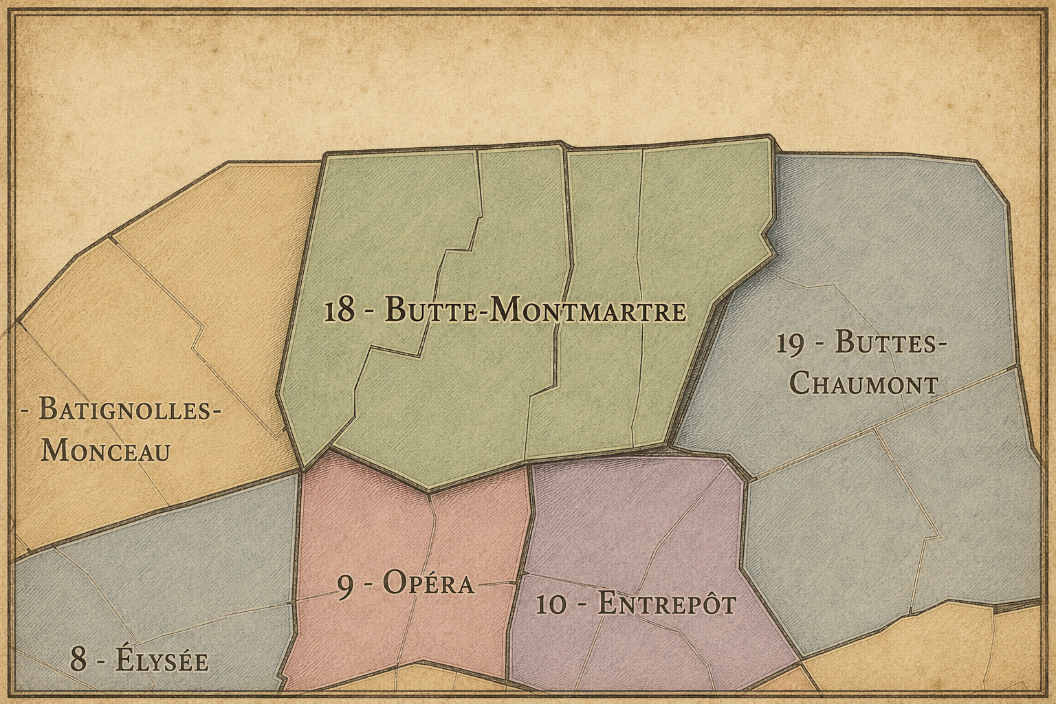
18e - Butte-Montmartre
-

Charles Hermite - Evangile • La Chapelle - Marx Dormoy
The History
The origins of La Chapelle lie in the ancient road between Paris and Saint-Denis. Long before the modern arrondissement system, this route was one of the most important lines of movement north of the city. Saint-Denis was the burial place of French kings and a major religious center, so the road carried political, royal, spiritual, and commercial significance. The settlement of La Chapelle grew along this route, close to Paris but distinct from it.
The church of Saint-Denys de la Chapelle gave the village one of its central anchors. District references describe the church as built on one of Paris’s oldest roads, l’Estrée, and date the building to 1204. This early road-and-church identity shaped La Chapelle before it became industrial, railway-bound, or urban in the modern sense.
Its origin story is therefore one of sacred passage and suburban settlement. La Chapelle was not born as a Parisian neighborhood. It was a village at the gate of Paris, on the way to Saint-Denis. That road identity never disappeared. It was transformed — first by markets and faubourg growth, then by annexation, then by railways and industry, and now by metropolitan redevelopment.
Origins
16th–17th Century
In the 16th and 17th centuries, La Chapelle remained outside the dense built fabric of Paris, but it was deeply connected to the capital through the Saint-Denis road. The village served as a northern approach, a place of passage, worship, lodging, trade, and local life between Paris and the surrounding countryside. Fields, religious properties, fairs, roads, and scattered settlement shaped the landscape.
The road’s importance gave La Chapelle more meaning than a typical rural edge. It stood on a historic axis of movement between the capital and the royal necropolis. Processions, commerce, and travelers passed through the area, linking local village life to the ceremonial and economic geography of the kingdom.
During this period, La Chapelle remained separate from Paris, but not peripheral in the sense of irrelevance. It was outside the city walls, yet tied to one of the oldest and most significant routes in the Paris region. The future quarter’s identity as a threshold was already established.
In the 18th century, La Chapelle became more closely tied to the expansion of Paris while retaining its village and commune-like identity. The northern approach to the capital grew busier, and the lands between Paris, Montmartre, Saint-Denis, and La Villette became increasingly connected to the city’s food supply, trade, fairs, markets, and population growth.
The area’s market and fair traditions were important. The wider La Chapelle landscape had long been associated with commerce linked to the Saint-Denis road and the northern plain. These activities helped make the village an active threshold rather than a quiet rural settlement. It was a place where goods, animals, people, and information moved between Paris and the surrounding region.
The French Revolution reorganized local government, and La Chapelle became a commune in 1790. That municipal identity lasted until 1860, when the commune disappeared into Paris’s expansion. This period is crucial because it shows La Chapelle not simply as a neighborhood-to-be, but as a civic entity with its own local life before annexation.
18th Century
19th Century
The 19th century transformed La Chapelle more dramatically than any earlier period. The former commune was absorbed into Paris in 1860 as part of the creation of the modern outer arrondissements; the present quarter corresponds to the southeastern part of the old commune attached to Paris. Annexation made La Chapelle officially Parisian, but the quarter retained its old road, village, and northern-edge identity.
Railway expansion then reshaped the district at a massive scale. The approaches to Gare du Nord and Gare de l’Est cut through and reorganized the eastern 18th and northern 10th, making La Chapelle part of one of Paris’s most important rail landscapes. Tracks, workshops, warehouses, bridges, embankments, and industrial uses gave the quarter a heavier and more infrastructural character than many older village districts absorbed into Paris.
This century also strengthened La Chapelle’s working-class and industrial identity. The old village on the Saint-Denis road became a district of workers, factories, railway labor, housing, markets, and northern Parisian density. The chapel-road settlement was converted into the machinery of the modern capital.
In the early and mid 20th century, La Chapelle remained a working, railway, and industrial quarter of northern Paris. Its streets and rail edges held warehouses, depots, workshops, modest housing, cafés, markets, schools, churches, and the daily life of residents living beside the systems that moved the city. It was not a decorative quarter; it was one of the places where Paris functioned.
The rail corridors gave the district both purpose and burden. They connected Paris to France and Europe, but they also divided streets, created noise, limited neighborhood continuity, and concentrated industrial uses. La Chapelle became a place where residents lived with infrastructure at close range. Its urban form reflected this tension between human neighborhood and metropolitan machinery.
During war, occupation, liberation, and postwar reconstruction, La Chapelle’s infrastructure made it strategically important and socially vulnerable. Rail lines, warehouses, and northern access routes were never neutral in times of crisis. The quarter’s history in this period is tied to movement, scarcity, work, control, damage, repair, and the endurance of local life around heavy systems.
Early–Mid 20th Century
Late 20th Century
In the late 20th century, La Chapelle became increasingly shaped by deindustrialization, immigration, social housing, public-space challenges, and the changing relationship between Paris and its northern suburbs. As traditional industrial and railway functions declined or shifted, parts of the district were left with underused land, infrastructure barriers, and difficult urban conditions. At the same time, new communities gave the neighborhood cultural vitality and social depth.
The quarter became one of the areas where postcolonial and immigrant Paris met the older working-class city. North African, South Asian, sub-Saharan African, and other communities contributed to local commerce, food, religious life, and neighborhood networks, especially around Marx Dormoy, La Chapelle, and adjacent districts. La Chapelle’s identity became more multicultural and more openly metropolitan.
This period also fixed some of the quarter’s difficult reputation, especially around Porte de la Chapelle and certain rail-edge spaces. But reputation alone is too shallow a reading. La Chapelle’s late-20th-century story is also one of resilience: residents, community groups, local businesses, schools, and cultural spaces sustaining neighborhood life amid infrastructure, poverty, policy failure, and uneven investment.
In the 21st century, La Chapelle stands at the center of major questions about the future of northern Paris. Former railway and logistics lands have been redeveloped or reimagined through projects such as Chapelle International, while the Porte de la Chapelle area has received renewed attention through sports facilities, public-space works, and broader efforts to reconnect the city’s northern edge. The City of Paris has described Porte de la Chapelle as undergoing significant transformation following the opening of the Adidas Arena.
Today, the quarter remains complex. It is residential, infrastructural, multicultural, contested, and increasingly redeveloped. New buildings, logistics projects, public spaces, student housing, sports venues, and urban design interventions coexist with older housing, immigrant commerce, railway edges, social challenges, and the still-difficult conditions of the northern boundary. La Chapelle is not a finished success story. It is an active urban negotiation.
For CityNeighborhoods: Paris, La Chapelle is essential because it shows how administrative quarters can reveal the city’s hardest and most important layers. This is Paris as old road, former commune, railway machine, working district, immigrant neighborhood, redevelopment frontier, and metropolitan seam. It is not merely an edge to pass through. It is one of the places where the future of Paris is being tested.
21st Century
Spirit and Legacy
La Chapelle is the quarter where northern Paris carries the weight of passage. Its spirit is old, infrastructural, working, contested, and deeply alive. It belongs to the road to Saint-Denis and the church of Saint-Denys, to railway bridges and warehouse walls, to Marx Dormoy shops and Porte de la Chapelle crossings, to immigrant networks and redevelopment cranes, to residents living where the city’s systems press hardest.
Its legacy is the transformation of sacred road into metropolitan threshold. A village on the way to Saint-Denis became a commune. A commune became Paris. A Parisian quarter became a rail and industrial landscape. That landscape is now being remade again, unevenly, into housing, sports, logistics, public space, and new forms of urban connection.
To walk La Chapelle is to encounter Paris without illusion. The quarter does not offer easy charm, and that is exactly why it matters. It shows the city as road, rail, boundary, labor, migration, policy, failure, repair, and hope. In La Chapelle, neighborhood identity becomes passage made visible — Paris moving through history, infrastructure, and the lives of people who continue to make a home at the edge.
The Photography
The arrondissements do not share a single visual identity. Instead, they organize Paris into twenty broad visual fields, each gathering its own combination of landmarks, streetscapes, institutions, residential districts, commercial corridors, parks, rail stations, markets, cemeteries, and riverfront edges.
Some arrondissements are defined by monumental scale: royal palaces, ceremonial avenues, government buildings, museums, formal gardens, and internationally recognized landmarks. Others are shaped by hills, canals, rail gateways, apartment-lined boulevards, neighborhood markets, former village streets, industrial remnants, parks, or the quieter rhythms of residential Paris. The arrondissement system gives these varied landscapes a civic frame, allowing the city to be read not as one visual language, but as a sequence of overlapping Parisian atmospheres.

Visual Identity
Through The Lens
Photographing the arrondissements means moving between the official map and the street-level experience. The camera does not treat each arrondissement as visually uniform. Instead, it looks for the recurring forms, textures, transitions, and contrasts that make each district legible: the geometry of boulevards, the shade of plane trees, the repetition of balconies, the rise of stairways, the curve of canals, the presence of rail stations, the opening of parks, the weight of monuments, and the intimacy of side streets.
On CityNeighborhoods, the arrondissement provides the frame, but the photograph comes from the encounter between map, movement, light, and observation. As the Paris photography is processed, this section will connect each arrondissement more directly to the project’s Photographic Lexicon: the visual strategies, recurring motifs, and compositional patterns that shape how the city is seen through the lens.

If you visit Paris, these ideas can help inspire your own photography.



Paris: J’Espere, Je Rêve, Je Vive
Paris Photo Gallery
Paris Field Notes
-
Field Note: August 18, 2025 | 07:58 AM
Conditions: 73°F | Humidity: 72%.
Within the park's interior, the glacial kettle ponds acted as humidity traps, creating a soft, hazy light that filtered through the old-growth oaks. The transition from the park's dense shade to the sun-drenched edges of Oakland Gardens highlighted the day's exceptional "picture-perfect" clarity.
There is a fleeting window in Queens where the humidity of August hasn't yet heavy-set, and the morning sun hits the canopy of Alley Pond Park at a perfect oblique angle. Arriving just before 8:00 AM, I watched the light break through the oaks and tulip trees, casting long, dramatic shadows across the wet grass. It’s in these quiet, golden moments that the park feels less like a city escape and more like the ancient glacial valley it actually is.
Other neighborhoods visited:











































































































Explore Paris
-

The twenty arrondissements form the civic spiral of Paris, organizing the city into its broad local districts of government, identity, and daily life.
-

Each arrondissement is divided into four official administrative quarters, giving Paris a more precise civic and geographic framework.
-

The conseils de quartier bring participation to street level, giving residents a voice in neighborhood needs, public space, and local civic life.
-

Les Deux Rives trace Paris through the Seine’s two banks, revealing how the Rive Droite and Rive Gauche shaped the city’s civic power, commerce, learning, art, and cultural identity.
-

Cultural neighborhoods reveal the Paris people recognize through history, cafés, architecture, memory, atmosphere, and local belonging.