
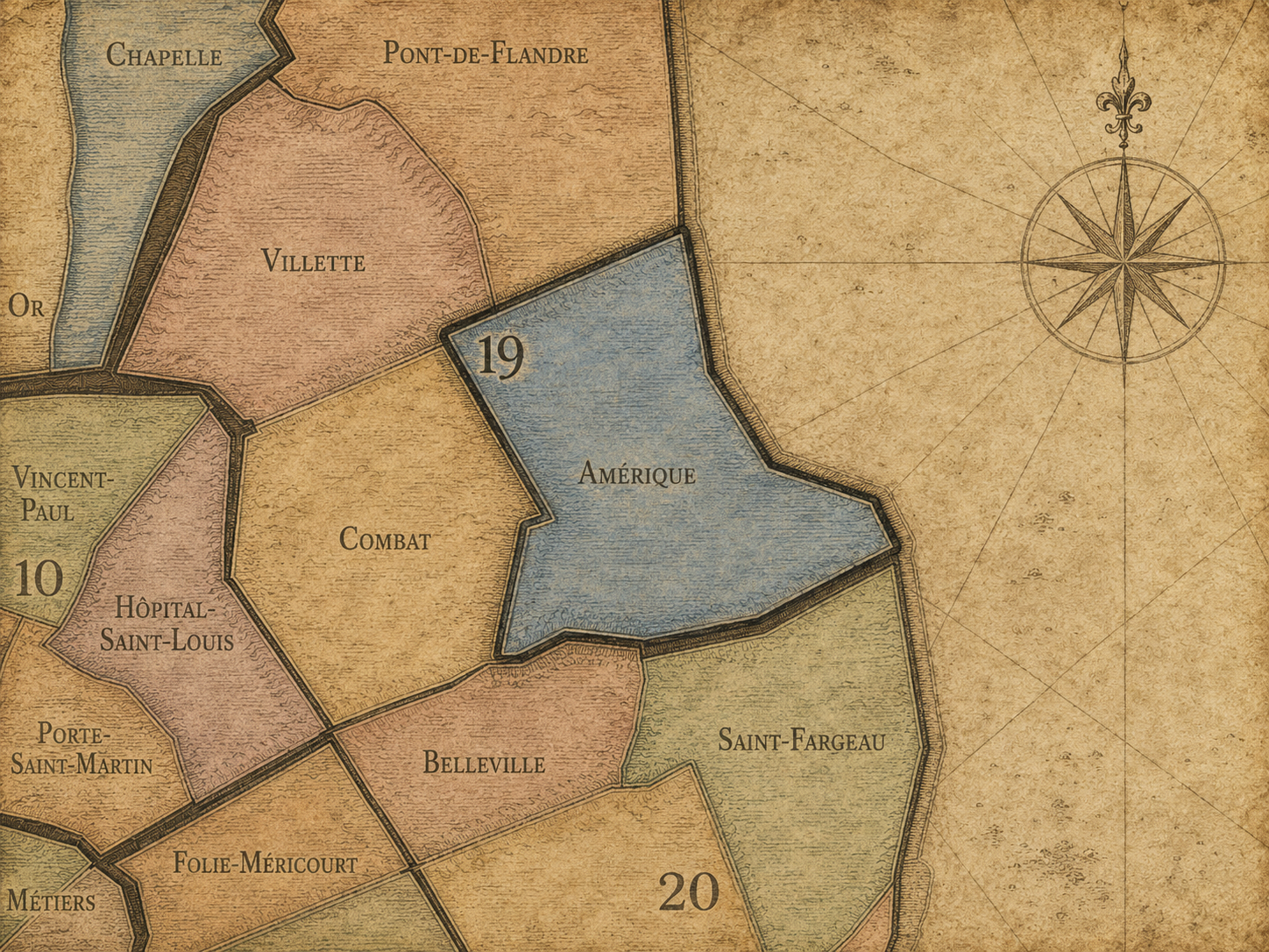
19e - AMÉRIQUE
Quartiers Administratifs
Part of an ongoing project to walk and photograph every neighborhood in Paris, this page 19e - Amérique through maps, district identity, history, and photography.




The Map
Download the Paris Arrondissements Map
Geographic Setting
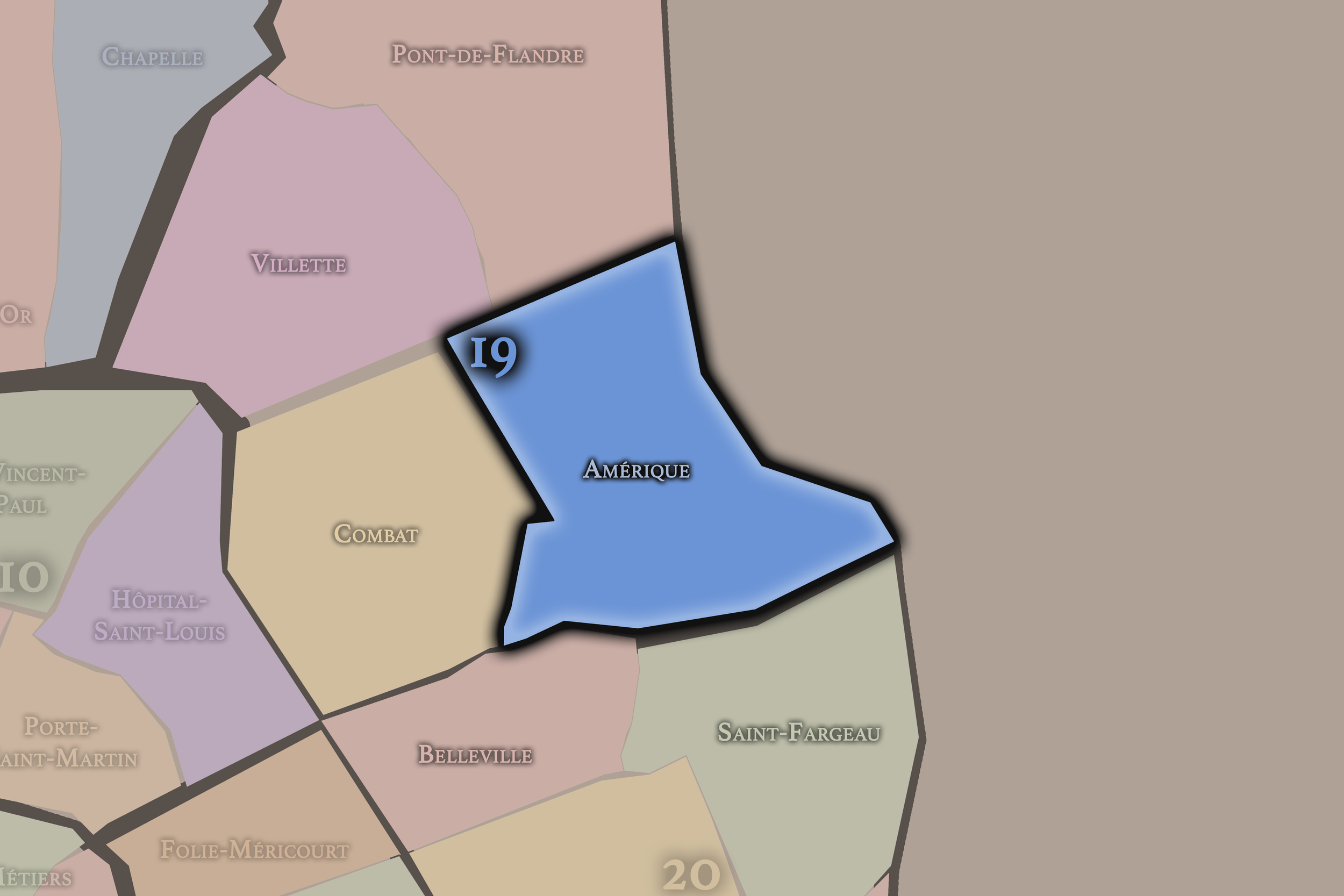
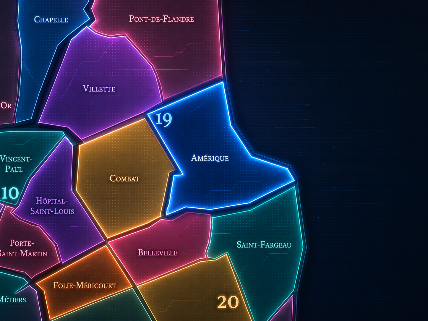
Amérique occupies the southeastern portion of the 19th arrondissement, where the eastern heights of Paris rise between Buttes-Chaumont, Belleville, the Porte des Lilas, the Danube / Mouzaïa district, and the city’s boundary with Le Pré-Saint-Gervais. It lies east of Combat, south of La Villette, and west / southwest of the communes beyond the Paris edge, forming one of the 19th arrondissement’s most topographically distinct quarters: steep streets, former quarry ground, small houses, hidden villas, apartment blocks, schools, local commerce, and the unusual gardened intimacy of the Mouzaïa.
The quarter’s geography is shaped by Rue Manin, Rue de Crimée, Rue de la Villette, Avenue Jean-Jaurès, Rue Botzaris, Rue de Mouzaïa, Rue de Bellevue, Rue de la Liberté, Rue du Général-Brunet, Rue David-d’Angers, Boulevard Sérurier, Danube, Place des Fêtes, and the eastern approaches toward Porte des Lilas and Pré-Saint-Gervais. It sits beside one of Paris’s most dramatic park landscapes, Parc des Buttes-Chaumont, though the park itself belongs to the neighboring Combat quarter. The relationship still matters deeply: Amérique and Buttes-Chaumont share the geological memory of gypsum, excavation, slope, and the transformation of former quarry landscapes into some of the most surprising urban scenery in Paris.
Unlike La Villette, whose identity is shaped by canals, former slaughterhouses, cultural institutions, and large-scale redevelopment, or Combat, whose name and geography gather around Buttes-Chaumont and the older entertainment and quarry landscapes nearby, Amérique is more residential, hidden, and topographic. It is the 19th arrondissement as hillside neighborhood: modest, steep, green in pockets, socially mixed, and built over ground that once helped furnish the city itself.
Administrative Quarter Identity
Etymology and Origins
The name Amérique comes from the old Carrières d’Amérique, the “Quarries of America,” where gypsum and millstone were extracted before the area was urbanized. The name has produced a persistent local legend: that plaster from these quarries was exported to the United States and used in the construction of the White House. District histories repeat the legend while noting that the City of Paris has rejected it. What remains historically solid is the quarry origin: the quarter’s name comes from the former quarry landscape, not from any direct American settlement or political connection.
That origin gives Amérique one of the most evocative names among Paris’s administrative quarters. It sounds global, almost mythic, but its roots are local and geological. “America” here does not begin as a diplomatic or immigrant story; it begins in the ground — in gypsum, stone, extraction, and the material needs of a growing city. The name turns a working landscape into an imaginative one.
The irony is part of the quarter’s charm. A neighborhood whose name suggests the far horizon is, in lived experience, one of Paris’s more enclosed and tucked-away landscapes. The villas of the Mouzaïa, the slopes around Danube, and the residential streets near Place des Fêtes feel less like a gateway to the Atlantic world than a hidden village built into the eastern heights of the city. Amérique is a name of distance attached to a quarter of local intimacy.
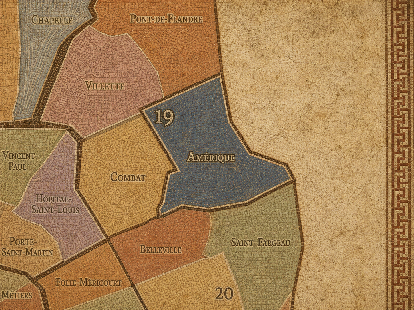
Within the official geography of Paris, Amérique is one of the four administrative quarters of the 19th arrondissement, alongside Combat, La Villette, and Pont-de-Flandre. It occupies the arrondissement’s southeastern sector, giving civic shape to the area around Danube, Mouzaïa, Place des Fêtes, the Porte des Lilas edge, and the former quarry lands east of Buttes-Chaumont.
As an administrative quarter, Amérique helps clarify a landscape often described through smaller or stronger lived names: Mouzaïa, Danube, Place des Fêtes, Buttes-Chaumont edge, Jourdain edge, Porte des Lilas, or Pré-Saint-Gervais. Those names each capture part of the district. Amérique is the official frame that gathers them into one civic unit, linking hillside topography, quarry memory, residential streets, and eastern-edge Paris into one mapped neighborhood system.
This civic frame is especially useful because the quarter can be hard to read at first glance. Some parts feel like ordinary dense Paris; others feel unexpectedly village-like; others are shaped by postwar housing and 20th-century urban renewal; others look toward the périphérique and the suburbs beyond. The administrative name allows these layers to be understood as parts of one larger story: a former extraction landscape remade into residential Paris.
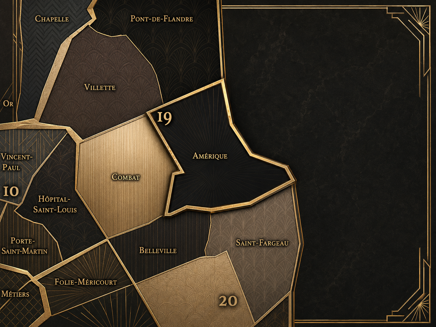
Civic Framework
Amérique differs from the other quarters of the 19th arrondissement through its topography, its quarry origin, and the distinctive small-house fabric of the Mouzaïa / Danube area. Combat is defined by Buttes-Chaumont, Belleville-facing slopes, and the park’s dramatic transformation of former quarry ground into public spectacle. La Villette is more canal-oriented and institutional, shaped by the Bassin de la Villette, the Canal de l’Ourcq, former slaughterhouses, Parc de la Villette, the Cité des Sciences, and the Philharmonie. Pont-de-Flandre is more northern, industrial, and redevelopment-driven, tied to the Porte de la Villette, rail / canal infrastructure, and the metropolitan edge toward Aubervilliers and Pantin.
Amérique is more residential and tucked into the hill. The Mouzaïa is especially distinctive: a network of narrow lanes, small houses, planted fronts, and unexpected quiet that feels almost impossible inside Paris. Some descriptions present Mouzaïa-Danube as a hidden, village-like labyrinth near Buttes-Chaumont, known for its small flowered houses and provincial calm within the city.
It should also be distinguished from Buttes-Chaumont. The park strongly shapes the quarter’s atmosphere and nearby geography, but Parc des Buttes-Chaumont belongs administratively to Combat, not Amérique. Amérique is the eastern companion to that park landscape — less monumental, more domestic, and more closely tied to the residential afterlife of the old quarries.
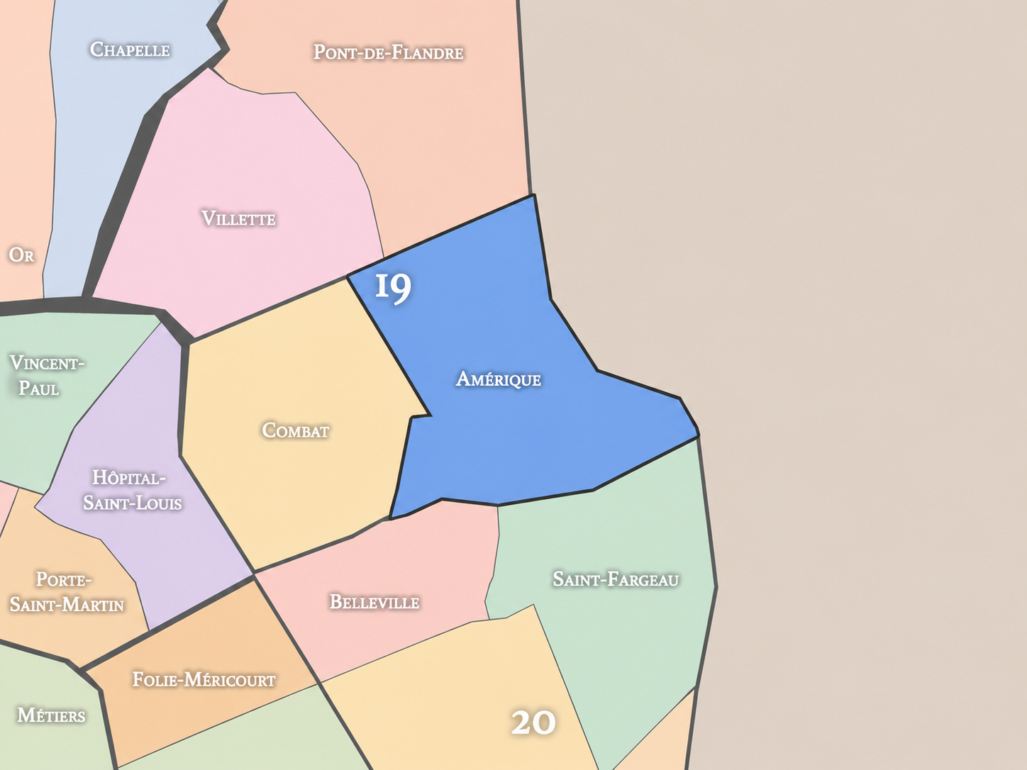
Neighborhood Distinction
Parisian Identity
Amérique expresses Paris as a city built from excavated ground and hidden reinvention. It is one of the quarters where the capital’s surface charm depends on a deeper history of extraction. Gypsum from the eastern hills helped produce plaster, and plaster helped shape the interiors, façades, and material life of Paris. The quarter’s name preserves the working geology beneath the city’s elegance.
At the same time, Amérique offers one of the strongest counter-images to the dense, uniform idea of Paris. The Mouzaïa lanes, the slopes around Danube, and the pocketed residential fabric create moments where the city seems to loosen into a village of small houses, gardens, stairs, and quiet passages. This is not the Paris of grand boulevards or royal squares. It is Paris as hidden topography, almost secretive in its charm.
The quarter’s Parisian identity also includes social and architectural contrast. Around Place des Fêtes, Danube, and the eastern edge, Amérique reveals the 20th-century city of public housing, towers, schools, local services, and urban renewal. The district is not only picturesque. It holds the full complexity of eastern Paris: village lanes, working geology, popular housing, metropolitan boundary, and everyday neighborhood life.
Neighborhood Connections
Every administrative quarter belongs to a wider Parisian fabric. These connections place Amérique within the city’s civic, participatory, and cultural geography:
-
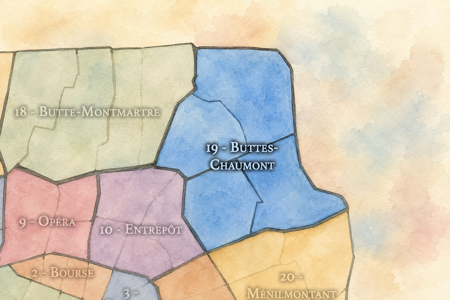
19e - Buttes-Chaumont
-

Danube • Manin - Jaurès • Place des Fêtes • Plateau • Porte des Lilas
The History
The origins of Amérique lie in the eastern heights beyond old Paris, in a landscape shaped by hills, gypsum deposits, quarries, paths, fields, and the outer settlements of Belleville, La Villette, and Pré-Saint-Gervais. Before the modern quarter existed, this area was useful less for urban residence than for what could be taken from the ground. Its geology made it part of the city’s material supply system.
The old Carrières d’Amérique formed the central origin of the name and identity. Paris Musées describes the Carrières d’Amérique as gypsum quarries located roughly between what became Rue Manin to the north, Rue de Crimée to the west, Rue de Mouzaïa to the south, and the Maréchaux / Boulevard Sérurier edge to the east. That geography maps closely onto the later Amérique quarter’s most distinctive terrain.
This origin story is therefore not pastoral alone, even though the area later gained charming village-like pockets. Amérique began as worked land: cut, quarried, unstable, valuable, and difficult. The residential quarter emerged from the transformation of that extraction landscape into streets, villas, housing, and public life.
Origins
16th–17th Century
In the 16th and 17th centuries, the future Amérique quarter lay outside the dense city of Paris, within the eastern and northeastern outskirts connected to Belleville, La Villette, Pré-Saint-Gervais, and the roads beyond the capital. The area was shaped by open land, slopes, small settlements, religious or agricultural properties, and the practical use of geological resources.
Quarrying and extraction belonged to the wider history of the northeastern hills. These landscapes were not simply scenic heights; they were working ground. Stone, gypsum, and related materials were part of the city’s growth, connecting the outer hill country to the building needs of Paris.
During this period, Amérique did not yet exist as an administrative quarter or even as a fully urban neighborhood. But the fundamental conditions were already present: height, geology, distance from the old center, and a relationship to the city based on material usefulness rather than prestige.
In the 18th century, the eastern heights became more closely tied to the expanding city. Quarrying continued to shape the landscape, while the surrounding villages and outer lands absorbed more settlement, roads, gardens, and small-scale urban activity. The area remained beyond the formal Parisian core, but it was increasingly drawn into the capital’s economy.
The quarries gave the district both value and danger. Extraction created cavities, slopes, unstable ground, and rough terrain. These conditions made later urbanization complicated, but they also gave the quarter its distinctive form. Amérique’s future village-like lanes and unusual topography would grow from land that was never a blank, flat canvas.
By the revolutionary era, the old relationship between Paris and its outskirts was changing. The future Amérique quarter remained outside the city, but its fate was tied to the growth of the capital. It was a landscape of use, waiting to become a landscape of habitation.
18th Century
19th Century
The 19th century transformed Amérique. The eastern quarries were still active for much of the century, with gypsum extraction continuing until the 1870s in the Carrières d’Amérique. At the same time, the surrounding communes and outer districts were annexed to Paris in 1860, creating the modern 19th arrondissement and bringing this formerly peripheral landscape into the capital.
The closure and exhaustion of quarry lands opened the way for new forms of development. Some areas were difficult to build on because of unstable ground, which helped shape the unusual low-rise, small-house fabric associated with the Mouzaïa. The quarter’s urbanization did not follow the same logic as the broad Haussmannian avenues of western Paris. It grew out of constraint: slopes, former pits, fragile ground, and the need to adapt construction to the land.
The nearby creation of Parc des Buttes-Chaumont in 1867 also transformed the meaning of the surrounding area. The park turned a dramatic quarry landscape into one of the city’s most spectacular public spaces, and although the park belongs to Combat, its presence gave Amérique a powerful neighbor. Together, the park and the quarter show how the 19th century converted extraction landscapes into urban scenery and residence.
In the early and mid 20th century, Amérique developed as a residential quarter of eastern Paris with a highly varied built fabric. The Mouzaïa lanes and small houses gave part of the quarter an almost hidden village identity, while other sections grew denser through apartment buildings, schools, local shops, and the ordinary infrastructure of working and middle-class Paris.
The quarter’s topography continued to shape daily life. Streets climbed, curved, and shifted around the memory of old quarry ground. The area never acquired the grand uniformity of more formal districts. Its charm and complexity came from irregularity: villas, steps, small gardens, sudden views, retaining walls, and the sense that the neighborhood had been fitted carefully onto difficult terrain.
During war, occupation, liberation, and postwar reconstruction, Amérique shared the experiences of residential eastern Paris: shortage, endurance, repair, housing need, and social change. Its history in this period is less about one famous monument than about the persistence of neighborhood life on ground already marked by earlier extraction and adaptation.
Early–Mid 20th Century
Late 20th Century
In the late 20th century, Amérique became increasingly valued for the contrast between its hidden village-like pockets and the denser, more modern urban forms around them. The Mouzaïa, in particular, gained recognition as one of Paris’s most surprising residential landscapes: small houses, planted lanes, and a quietness that seemed to resist the scale of the surrounding city. This made the quarter a destination for walkers and photographers seeking the less familiar Paris.
At the same time, the broader quarter was shaped by the 20th-century realities of the 19th arrondissement: public housing, urban renewal, immigration, social diversity, and the changing reputation of eastern Paris. Around Place des Fêtes and nearby streets, postwar planning introduced a different scale and social history from the intimate villas of Mouzaïa. Amérique became a quarter of strong internal contrast.
This period also brought renewed interest in the old quarry story. As Parisians and historians paid closer attention to hidden infrastructures, former industrial landscapes, and the geology beneath the city, Amérique’s name became newly meaningful. The quarter’s unusual form could be read not as eccentricity alone, but as the urban afterlife of quarry ground.
In the 21st century, Amérique remains one of the 19th arrondissement’s most distinctive quarters. It combines the hidden village atmosphere of Mouzaïa-Danube, the dense residential and commercial life around Place des Fêtes and Jourdain-adjacent streets, the eastern boundary near Porte des Lilas, and the powerful nearby presence of Buttes-Chaumont. It is green in fragments, steep in places, socially mixed, and more layered than its quiet lanes might first suggest.
Today, the quarter has increasing appeal because it offers an alternative image of Paris: not monumental, not polished into global iconography, but intimate, topographic, and unexpected. Yet its identity should not be reduced to charm. Amérique is also a quarter of housing, schools, public services, local commerce, and the everyday life of eastern Paris. Its beauty is inseparable from its lived complexity.
For CityNeighborhoods: Paris, Amérique is essential because it shows how an administrative quarter can reveal the relationship between geology and neighborhood form. Its name, streets, slopes, houses, and hidden lanes all point back to the same story: Paris built itself from the earth, then learned how to live on the altered ground left behind.
21st Century
Spirit and Legacy
Amérique is the quarter where eastern Paris turns quarry ground into hidden neighborhood. Its spirit is steep, discreet, domestic, and quietly surprising. It belongs to gypsum and millstone, to the old Carrières d’Amérique, to Mouzaïa lanes and Danube slopes, to small houses and apartment blocks, to the edge of Buttes-Chaumont and the eastern horizon of the city.
Its legacy is the transformation of extraction into habitation. The city cut into the hill, took what it needed, and left behind difficult ground. That ground became streets, villas, homes, schools, and one of the most unexpected residential landscapes in Paris. The name Amérique still suggests distance, but the quarter’s deepest meaning is local: the intimate afterlife of worked earth.
To walk Amérique is to encounter Paris as terrain. The quarter asks the visitor to look below the surface — to see how geology, labor, instability, planning, housing, and memory shape the neighborhood. In Amérique, identity is not only written in façades or monuments. It is written in the ground itself, in the steep and quiet places where Paris learned to build after digging.
The Photography
The arrondissements do not share a single visual identity. Instead, they organize Paris into twenty broad visual fields, each gathering its own combination of landmarks, streetscapes, institutions, residential districts, commercial corridors, parks, rail stations, markets, cemeteries, and riverfront edges.
Some arrondissements are defined by monumental scale: royal palaces, ceremonial avenues, government buildings, museums, formal gardens, and internationally recognized landmarks. Others are shaped by hills, canals, rail gateways, apartment-lined boulevards, neighborhood markets, former village streets, industrial remnants, parks, or the quieter rhythms of residential Paris. The arrondissement system gives these varied landscapes a civic frame, allowing the city to be read not as one visual language, but as a sequence of overlapping Parisian atmospheres.

Visual Identity
Through The Lens
Photographing the arrondissements means moving between the official map and the street-level experience. The camera does not treat each arrondissement as visually uniform. Instead, it looks for the recurring forms, textures, transitions, and contrasts that make each district legible: the geometry of boulevards, the shade of plane trees, the repetition of balconies, the rise of stairways, the curve of canals, the presence of rail stations, the opening of parks, the weight of monuments, and the intimacy of side streets.
On CityNeighborhoods, the arrondissement provides the frame, but the photograph comes from the encounter between map, movement, light, and observation. As the Paris photography is processed, this section will connect each arrondissement more directly to the project’s Photographic Lexicon: the visual strategies, recurring motifs, and compositional patterns that shape how the city is seen through the lens.

If you visit Paris, these ideas can help inspire your own photography.



Paris: J’Espere, Je Rêve, Je Vive
Paris Photo Gallery
Paris Field Notes
-
Field Note: August 18, 2025 | 07:58 AM
Conditions: 73°F | Humidity: 72%.
Within the park's interior, the glacial kettle ponds acted as humidity traps, creating a soft, hazy light that filtered through the old-growth oaks. The transition from the park's dense shade to the sun-drenched edges of Oakland Gardens highlighted the day's exceptional "picture-perfect" clarity.
There is a fleeting window in Queens where the humidity of August hasn't yet heavy-set, and the morning sun hits the canopy of Alley Pond Park at a perfect oblique angle. Arriving just before 8:00 AM, I watched the light break through the oaks and tulip trees, casting long, dramatic shadows across the wet grass. It’s in these quiet, golden moments that the park feels less like a city escape and more like the ancient glacial valley it actually is.
Other neighborhoods visited:











































































































Explore Paris
-

The twenty arrondissements form the civic spiral of Paris, organizing the city into its broad local districts of government, identity, and daily life.
-

Each arrondissement is divided into four official administrative quarters, giving Paris a more precise civic and geographic framework.
-

The conseils de quartier bring participation to street level, giving residents a voice in neighborhood needs, public space, and local civic life.
-

Les Deux Rives trace Paris through the Seine’s two banks, revealing how the Rive Droite and Rive Gauche shaped the city’s civic power, commerce, learning, art, and cultural identity.
-

Cultural neighborhoods reveal the Paris people recognize through history, cafés, architecture, memory, atmosphere, and local belonging.