
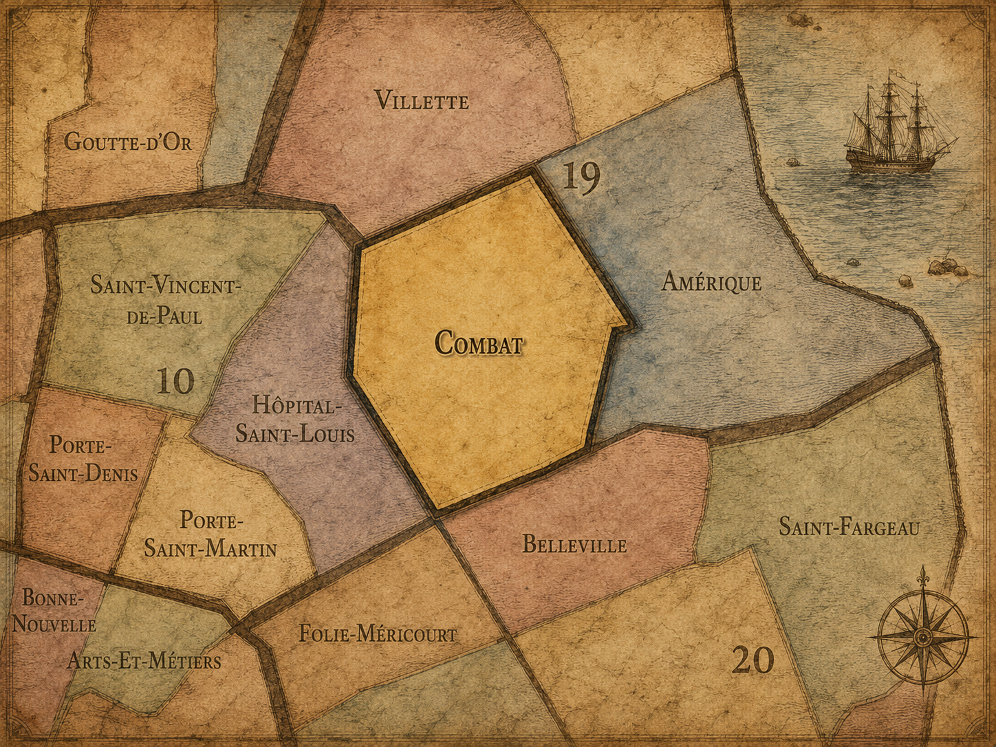
19e - COMBAT
Quartiers Administratifs
Part of an ongoing project to walk and photograph every neighborhood in Paris, this page 19e - Combat through maps, district identity, history, and photography.




The Map
Download the Paris Arrondissements Map
Geographic Setting
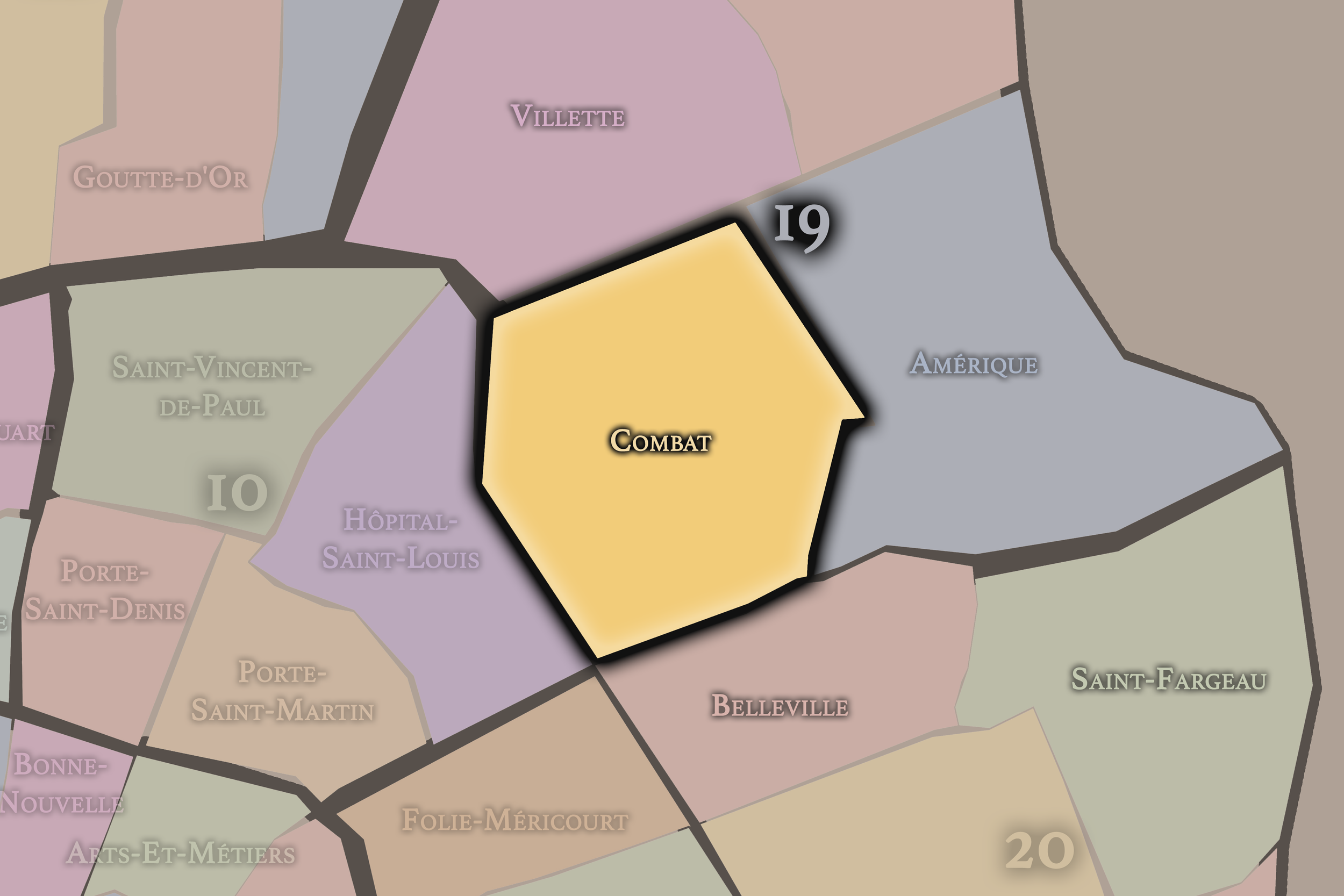
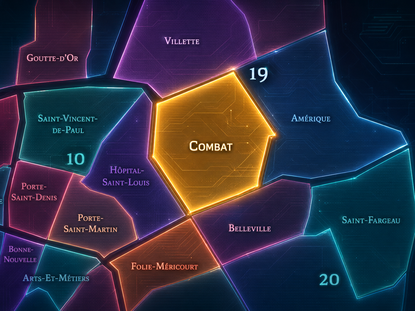
Combat occupies the southwestern portion of the 19th arrondissement, where the eastern heights of Paris rise around Parc des Buttes-Chaumont, descend toward Belleville, and meet the canal-side and residential landscapes of La Villette, Amérique, and the 10th / 11th arrondissement edges. It lies west of Amérique, south of La Villette and Pont-de-Flandre, north of Belleville’s 20th arrondissement edge, and east of the lower northern city around Colonel Fabien and the Canal Saint-Martin. It is one of the 19th arrondissement’s most dramatic quarters because its geography is shaped by slope, quarry, parkland, working-class memory, and the transformation of difficult ground into one of Paris’s great public landscapes.
The quarter’s defining feature is Parc des Buttes-Chaumont, whose cliffs, lake, island temple, bridges, lawns, paths, and steep views turn the former quarry landscape into a theatrical composition of nature and city. Around it are Rue Botzaris, Rue Manin, Avenue Simon-Bolivar, Rue de Crimée, Rue de Meaux, Rue de Belleville, Rue de la Villette, Place du Colonel-Fabien, and the streets that connect the park to Belleville, Jourdain, La Villette, and the eastern slopes of Paris. This is a quarter where the street grid often feels shaped by topography rather than imposed over it. The land rises, drops, opens, and folds.
Unlike La Villette, whose identity is canal-oriented, industrial, and institutionally remade through cultural redevelopment, or Amérique, whose character is more residential and hidden around Mouzaïa, Danube, and the eastern quarry lands, Combat is more park-centered and historically charged. It is the 19th arrondissement as spectacle of transformation: a place where former quarry, refuse ground, and popular entertainment landscape became one of the most beloved green spaces in eastern Paris.
Administrative Quarter Identity
Etymology and Origins
The name Combat comes from the old Place du Combat, a site associated with animal fighting in the former outskirts of Paris. Before the quarter became known through Buttes-Chaumont and the modern residential fabric around it, this part of the northeastern edge carried a rougher reputation tied to popular spectacles, marginal land uses, and the kinds of entertainment and activity that often gathered beyond the older city limits.
That origin gives the name a striking harshness. “Combat” does not sound like a saint, a village, a market, or a cultivated landscape. It evokes struggle, spectacle, force, and contest. The name preserves a memory of the outer city before urban refinement — a landscape where animals, crowds, quarries, taverns, labor, and edge-of-city amusements existed outside the stricter order of central Paris.
The modern quarter is therefore built over a powerful reversal. A name rooted in fighting now belongs to a district centered on one of Paris’s most lyrical parks. The old violence of the name is softened by trees, water, slopes, and views, but it does not disappear. Combat remains a reminder that beauty in Paris is often made through conversion: rough land into public space, quarry into park, edge into neighborhood, conflict into memory.
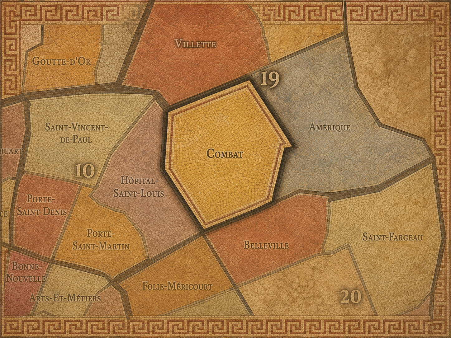
Within the official geography of Paris, Combat is one of the four administrative quarters of the 19th arrondissement, alongside La Villette, Pont-de-Flandre, and Amérique. It occupies the arrondissement’s southwestern sector, giving civic shape to the area around Parc des Buttes-Chaumont, Colonel Fabien, the western Belleville slope, Jourdain’s lower approaches, and the residential streets between the park and the canals.
As an administrative quarter, Combat helps clarify a landscape often described through stronger lived names: Buttes-Chaumont, Colonel Fabien, Belleville edge, Botzaris, Bolivar, Secrétan, or Jourdain. Each of those names captures part of the district. Combat is the official frame that gathers the former quarry ground, the old place-name, the park, the residential slopes, and the western 19th’s social geography into one mapped civic unit.
This civic frame is especially useful because the quarter’s official name is less commonly used in everyday speech than Buttes-Chaumont. Most visitors and many Parisians orient by the park rather than by the administrative quarter. But Combat restores the older, rougher, pre-park identity beneath the green landscape. It reminds us that the park did not arrive on neutral ground; it transformed a complex and difficult urban edge.
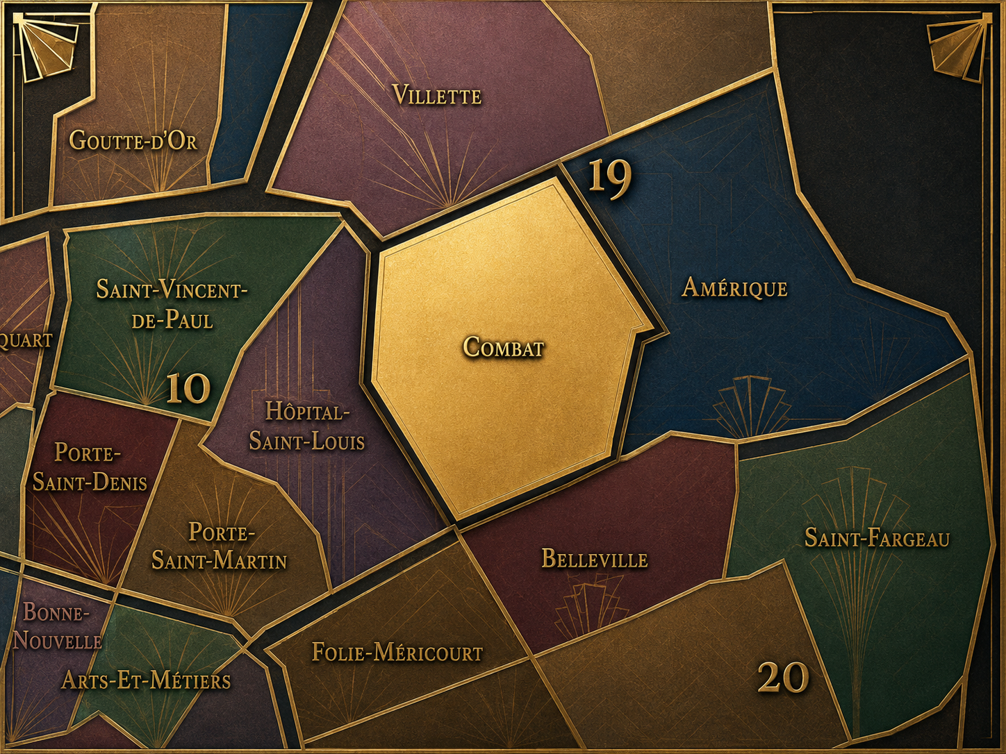
Civic Framework
Combat differs from the other quarters of the 19th arrondissement through its relationship to Parc des Buttes-Chaumont, its former quarry and spectacle landscape, and its position between Belleville, La Villette, and the lower northern city. La Villette is more defined by canals, the Bassin de la Villette, former slaughterhouses, cultural institutions, and the long industrial redevelopment of northeastern Paris. Pont-de-Flandre is more outer-facing and infrastructural, tied to Porte de la Villette, the canal edges, Parc de la Villette, and the boundary with Pantin and Aubervilliers. Amérique is more eastern, residential, and topographic, shaped by the Carrières d’Amérique, Mouzaïa, Danube, and Place des Fêtes.
Combat is more dramatic in landscape. Its identity gathers around the transformation of quarried and marginal ground into urban theater. Buttes-Chaumont is not a flat, formal garden; it is a constructed landscape of cliffs, heights, bridges, surprise views, and controlled wildness. That gives the whole quarter a different atmosphere from the rest of the 19th. It feels less like a canal district, less like a hidden residential hill, and more like a place where Paris deliberately staged nature out of broken ground.
It should also be distinguished from Belleville. Belleville’s cultural identity extends into the southern and eastern edges of the area, and the Belleville slope influences the quarter’s social and topographic character. But Combat is the official administrative quarter of the 19th, while Belleville is a larger historical and cultural landscape crossing arrondissement lines, especially into the 20th. Combat is one civic layer within the broader eastern-hill world.
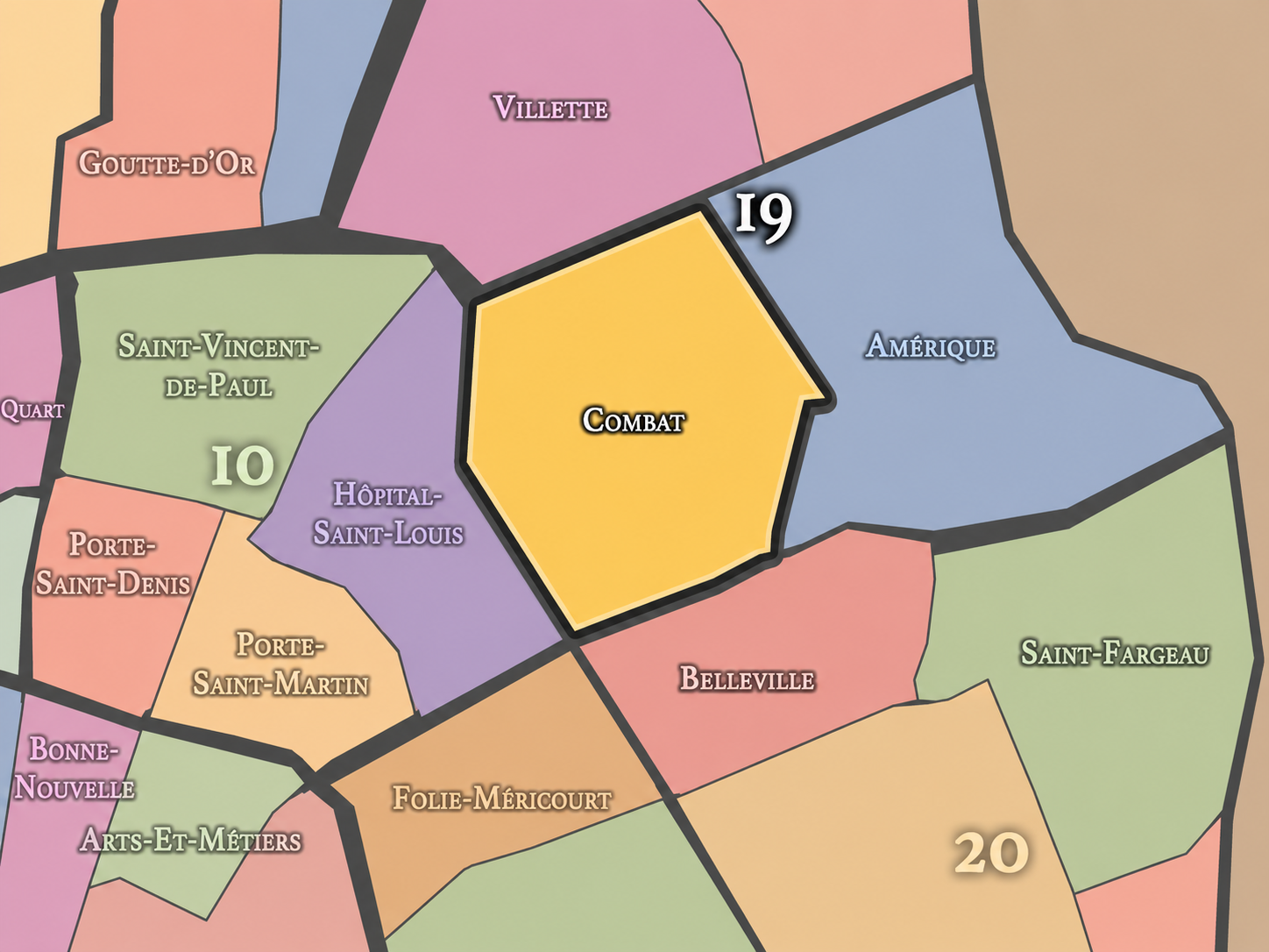
Neighborhood Distinction
Parisian Identity
Combat expresses Paris as a city that can make beauty from difficult land. The quarter’s central landscape, Buttes-Chaumont, is one of the clearest examples of this transformation. The park was created from former quarries and rough peripheral ground, then reshaped into a public landscape of spectacle, leisure, health, and civic pride. Paris did not simply preserve nature here. It manufactured a new kind of urban nature.
This gives Combat a distinctly eastern Parisian identity. The quarter does not carry the aristocratic polish of the west or the medieval density of the center. It belongs to the city of quarries, slopes, workers, outer roads, popular amusements, and later public reform. Its beauty is hard-won. The park’s cliffs and lake are picturesque, but they also speak to extraction, instability, engineering, and the enormous effort required to turn the city’s damaged edges into shared public space.
Combat also holds the social identity of the 19th arrondissement: mixed, residential, popular in inheritance, increasingly desirable, but still shaped by the memory of working and immigrant Paris. Around the park, the quarter can feel serene and almost romantic; beyond the park, the streets return to the everyday life of eastern Paris — schools, cafés, public housing, apartment blocks, food shops, steep walks, and the constant movement between Belleville, La Villette, and the canal-side north.
Neighborhood Connections
Every administrative quarter belongs to a wider Parisian fabric. These connections place Combat within the city’s civic, participatory, and cultural geography:
-
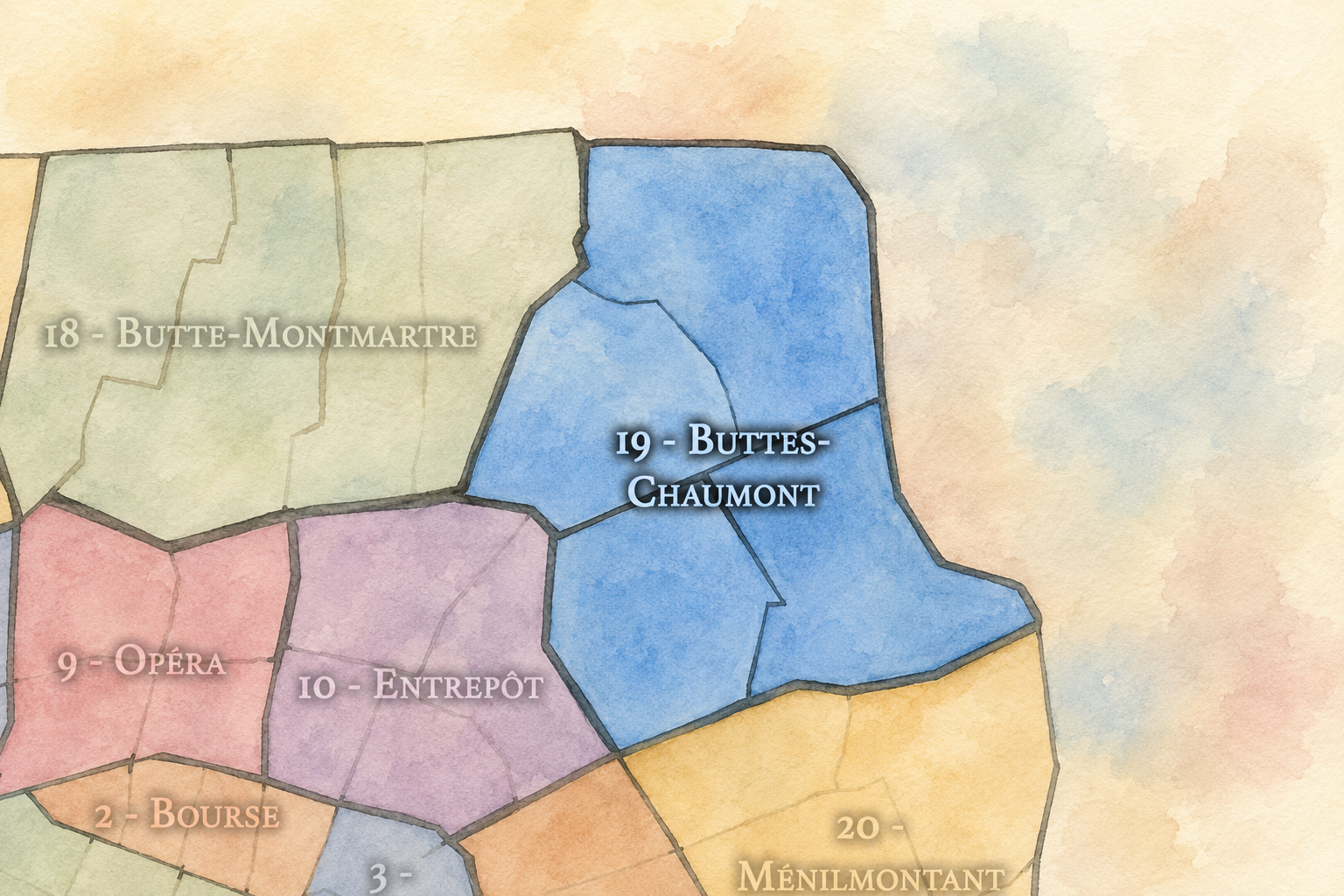
19e - Buttes-Chaumont
-

Bas-Belleville • Manin - Jaurès • Plateau • Secrétan
The History
The origins of Combat lie in the northeastern outskirts of Paris, where the hills around Belleville, La Villette, and the future 19th arrondissement were shaped by quarries, open land, roads, popular entertainment, refuse grounds, and practical uses that the older city often placed at its margins. Before the district became part of Paris, it belonged to the outer landscapes beyond the formal core: useful, rough, and only gradually urbanized.
The quarter’s earliest identity was tied to the conditions of the edge. Activities that required space, created noise, produced smells, or drew crowds often gathered outside the older city. Animal fighting, quarrying, taverns, extraction, and peripheral amusements all belonged to this world. Combat’s name preserves that harder pre-urban layer.
The later creation of Parc des Buttes-Chaumont did not erase these origins; it transformed them. The quarter’s story begins not with a natural park, but with land that had been cut, used, and burdened. The park is the second life of the ground.
Origins
16th–17th Century
In the 16th and 17th centuries, the future Combat quarter remained outside the dense built fabric of Paris. The area belonged to the northeastern hills and outer lands connected to Belleville, La Villette, and the roads beyond the capital. It was shaped by rural settlement, slopes, quarrying, agriculture, religious lands, and the practical activities of the city’s outskirts.
This peripheral position mattered because the area’s later identity depended on distance from central regulation and prestige. The land was useful because it was not central. It could be quarried, used for rougher activities, and gradually settled by communities whose lives were tied to the city without being fully inside it.
By the end of the 17th century, Paris was expanding outward, but the future Combat quarter still retained much of its edge character. The city’s needs were already reshaping the land, yet the area remained distinct from the formal, built-up Paris of the center and west.
In the 18th century, Combat became more closely tied to the growing city while still retaining the qualities of an outer district. The surrounding landscapes of Belleville and La Villette were increasingly active with roads, settlement, taverns, quarrying, gardens, and popular recreation. Paris was pressing outward, and the northeastern edge became a place where the social and material life of the capital spilled beyond older limits.
The old Place du Combat and its association with animal fighting belong to this world of peripheral spectacle. Such activities existed near the city but outside its more formal ceremonial spaces. They reveal a Parisian edge where entertainment could be raw, public, and physically intense — a reminder that popular leisure was not always refined, polite, or picturesque.
By the revolutionary era, the northeastern outskirts were already woven into the life of Paris, even before formal annexation. Combat entered the modern age as a district of rough ground, popular memory, and growing urban pressure. Its transformation into a civic landscape would come later, through annexation and park-making.
18th Century
19th Century
The 19th century transformed Combat more radically than any earlier period. In 1860, the surrounding communes and outer territories were annexed into Paris, creating the modern 19th arrondissement. The former edge became part of the capital, and the city began reshaping its difficult northeastern landscapes into modern urban districts.
The creation of Parc des Buttes-Chaumont under Napoleon III and the Second Empire was the defining event of the century for Combat. Opened in 1867, the park converted former quarry and rough ground into one of the most dramatic public landscapes in Paris. Cliffs, paths, a lake, bridges, grottoes, lawns, and the Temple de la Sibylle were arranged to create a theatrical experience of nature within the city. What had been a place of extraction and marginality became a landscape of leisure, health, and civic beauty.
This was not merely beautification. It was social and political urbanism. The park brought a major green space to eastern Paris, balancing — at least symbolically — the great parks and promenades of the west. Combat became part of the Second Empire’s attempt to modernize the city not only through boulevards, but through public air, light, trees, and recreation.
In the early and mid 20th century, Combat became a residential and park-centered quarter of eastern Paris. Parc des Buttes-Chaumont served as a major neighborhood landscape, giving residents access to green space, views, promenades, and relief from the density of the surrounding streets. The park’s dramatic form made it both a local amenity and one of the city’s most distinctive public spaces.
The surrounding streets retained the social character of the eastern arrondissements: apartment buildings, modest commerce, cafés, schools, workshops, and a mixed population connected to Belleville, La Villette, and the wider working-class north and east of Paris. Combat was not transformed into an elite park quarter in the western sense. Its green space belonged to a popular city.
During war, occupation, liberation, and postwar recovery, the park and neighborhood carried the ordinary burdens of urban life under stress: scarcity, fear, endurance, public gathering, and gradual recovery. Buttes-Chaumont’s open space likely mattered deeply to residents as a place of respite, even as the surrounding quarter absorbed the social and economic pressures of the century.
Early–Mid 20th Century
Late 20th Century
In the late 20th century, Combat began to participate in the broader revaluation of eastern Paris. Buttes-Chaumont became increasingly appreciated not only as a local park, but as one of the most beautiful and unusual parks in the city. The surrounding streets, once strongly associated with working and modest residential life, grew more desirable as Parisians sought neighborhoods with parks, views, local commerce, and a less formal atmosphere than the central-western districts.
At the same time, the quarter remained socially mixed. Public housing, older apartment blocks, immigrant communities, long-time residents, students, artists, and newer middle-class households all contributed to the area’s changing identity. Combat did not become simply gentrified charm. It retained the unevenness of the 19th arrondissement: desirable and difficult, green and dense, local and metropolitan.
This period also brought renewed interest in the history of the park and its quarry origins. The more people appreciated Buttes-Chaumont’s beauty, the more meaningful its transformation became. Combat’s official name and the park’s geology together offered a counter-history to the idea of Paris as effortless elegance. Here, beauty had been engineered from rupture.
In the 21st century, Combat is one of the most admired yet still locally grounded quarters of the 19th arrondissement. Buttes-Chaumont gives it a major identity, drawing residents, walkers, families, photographers, runners, picnickers, and visitors from across the city. Around the park, neighborhoods such as Botzaris, Bolivar, Secrétan, Jourdain edge, and Colonel Fabien each add their own rhythm of streets, cafés, shops, housing, and transit.
Today, the quarter is shaped by both desirability and memory. The park increases the area’s appeal, and gentrification has changed the social and commercial landscape in many streets. Yet Combat remains tied to the broader eastern city: socially varied, historically working, and marked by the infrastructure and topography of the 19th. Its beauty does not erase its past; it makes that past more important to understand.
For CityNeighborhoods: Paris, Combat is essential because it shows how administrative quarters can explain the making of public nature. Buttes-Chaumont is not just a pretty park. It is the transformation of quarry, rough ground, and edge condition into civic landscape. Combat is the quarter that holds that transformation in its name, its slopes, its streets, and its urban memory.
21st Century
Spirit and Legacy
Combat is the quarter where eastern Paris turns struggle into landscape. Its spirit is steep, theatrical, popular, and resilient. It belongs to old animal-fighting grounds and quarry scars, to cliffs and bridges, to the lake of Buttes-Chaumont, to apartment streets and park paths, to the eastern city’s ability to make beauty without forgetting difficulty.
Its legacy is the transformation of rough ground into public grace. A peripheral landscape of quarrying, spectacle, and marginal uses became an official Parisian quarter. A damaged hill became a park of astonishing drama. A former edge became a neighborhood where residents live beside one of the city’s most generous green spaces.
To walk Combat is to encounter Paris as conversion. The quarter reminds us that urban beauty is often not inherited intact, but made through repair, imagination, and civic will. In Combat, neighborhood identity becomes transformation — the city taking a place marked by struggle and turning it into height, shade, water, path, and shared relief.
The Photography
The arrondissements do not share a single visual identity. Instead, they organize Paris into twenty broad visual fields, each gathering its own combination of landmarks, streetscapes, institutions, residential districts, commercial corridors, parks, rail stations, markets, cemeteries, and riverfront edges.
Some arrondissements are defined by monumental scale: royal palaces, ceremonial avenues, government buildings, museums, formal gardens, and internationally recognized landmarks. Others are shaped by hills, canals, rail gateways, apartment-lined boulevards, neighborhood markets, former village streets, industrial remnants, parks, or the quieter rhythms of residential Paris. The arrondissement system gives these varied landscapes a civic frame, allowing the city to be read not as one visual language, but as a sequence of overlapping Parisian atmospheres.

Visual Identity
Through The Lens
Photographing the arrondissements means moving between the official map and the street-level experience. The camera does not treat each arrondissement as visually uniform. Instead, it looks for the recurring forms, textures, transitions, and contrasts that make each district legible: the geometry of boulevards, the shade of plane trees, the repetition of balconies, the rise of stairways, the curve of canals, the presence of rail stations, the opening of parks, the weight of monuments, and the intimacy of side streets.
On CityNeighborhoods, the arrondissement provides the frame, but the photograph comes from the encounter between map, movement, light, and observation. As the Paris photography is processed, this section will connect each arrondissement more directly to the project’s Photographic Lexicon: the visual strategies, recurring motifs, and compositional patterns that shape how the city is seen through the lens.

If you visit Paris, these ideas can help inspire your own photography.



Paris: J’Espere, Je Rêve, Je Vive
Paris Photo Gallery
Paris Field Notes
-
Field Note: August 18, 2025 | 07:58 AM
Conditions: 73°F | Humidity: 72%.
Within the park's interior, the glacial kettle ponds acted as humidity traps, creating a soft, hazy light that filtered through the old-growth oaks. The transition from the park's dense shade to the sun-drenched edges of Oakland Gardens highlighted the day's exceptional "picture-perfect" clarity.
There is a fleeting window in Queens where the humidity of August hasn't yet heavy-set, and the morning sun hits the canopy of Alley Pond Park at a perfect oblique angle. Arriving just before 8:00 AM, I watched the light break through the oaks and tulip trees, casting long, dramatic shadows across the wet grass. It’s in these quiet, golden moments that the park feels less like a city escape and more like the ancient glacial valley it actually is.
Other neighborhoods visited:











































































































Explore Paris
-

The twenty arrondissements form the civic spiral of Paris, organizing the city into its broad local districts of government, identity, and daily life.
-

Each arrondissement is divided into four official administrative quarters, giving Paris a more precise civic and geographic framework.
-

The conseils de quartier bring participation to street level, giving residents a voice in neighborhood needs, public space, and local civic life.
-

Les Deux Rives trace Paris through the Seine’s two banks, revealing how the Rive Droite and Rive Gauche shaped the city’s civic power, commerce, learning, art, and cultural identity.
-

Cultural neighborhoods reveal the Paris people recognize through history, cafés, architecture, memory, atmosphere, and local belonging.