
19e - VILLETTE
Quartiers Administratifs
Part of an ongoing project to walk and photograph every neighborhood in Paris, this page 19e - Villette through maps, district identity, history, and photography.




The Map
Download the Paris Arrondissements Map
Geographic Setting
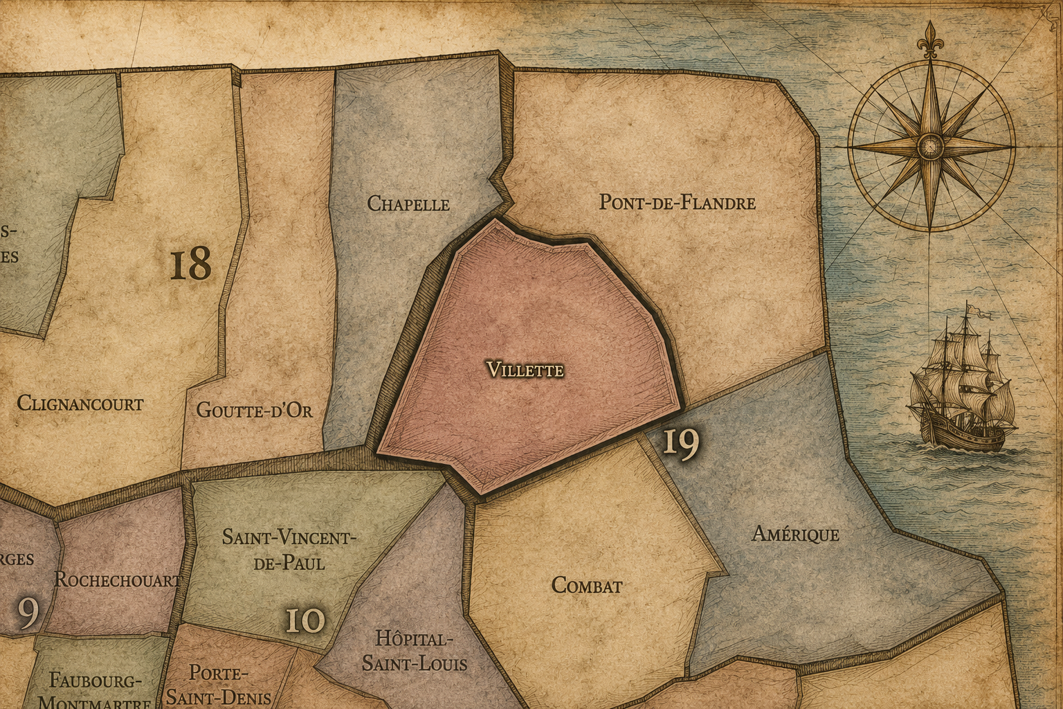
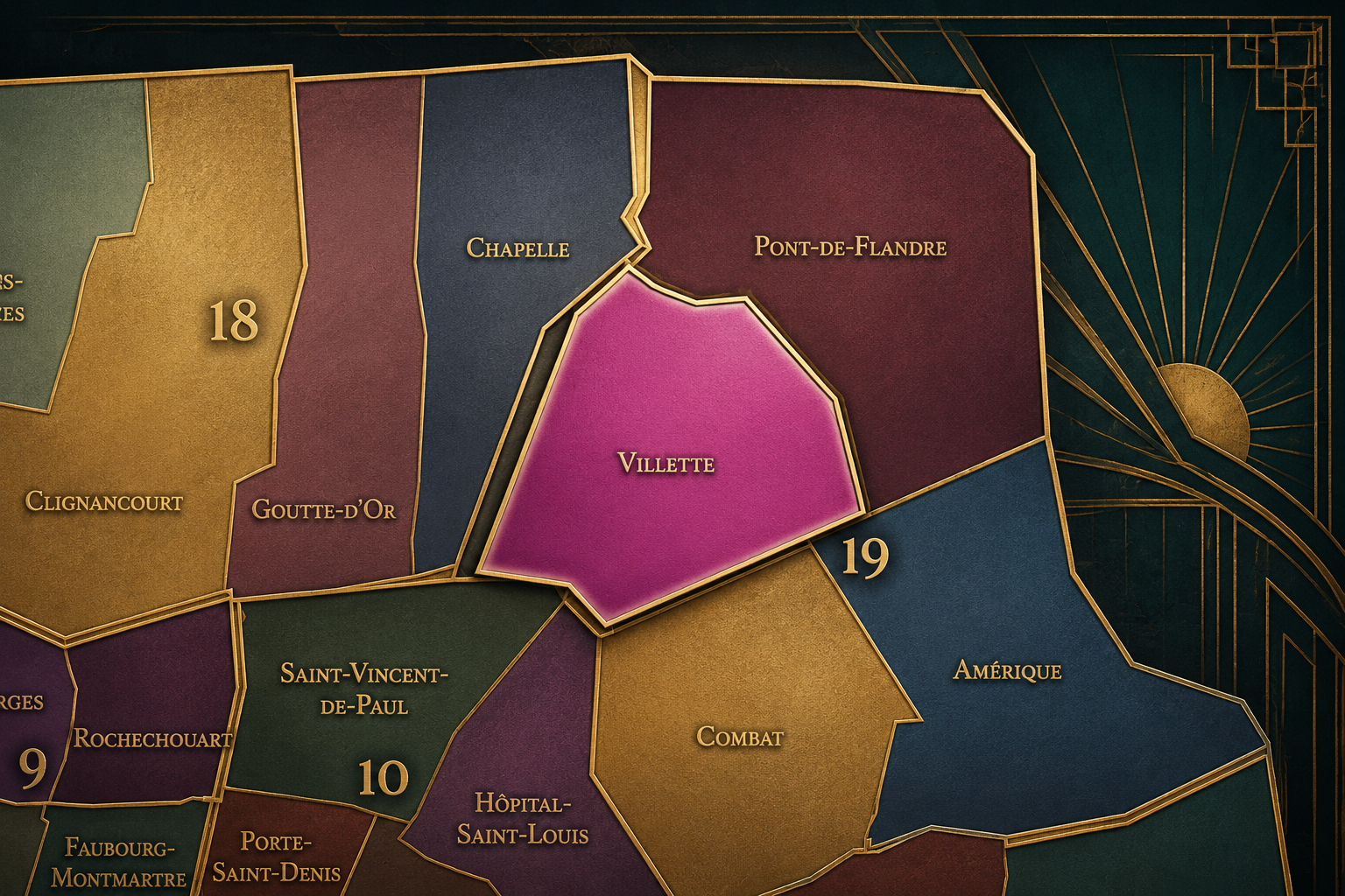
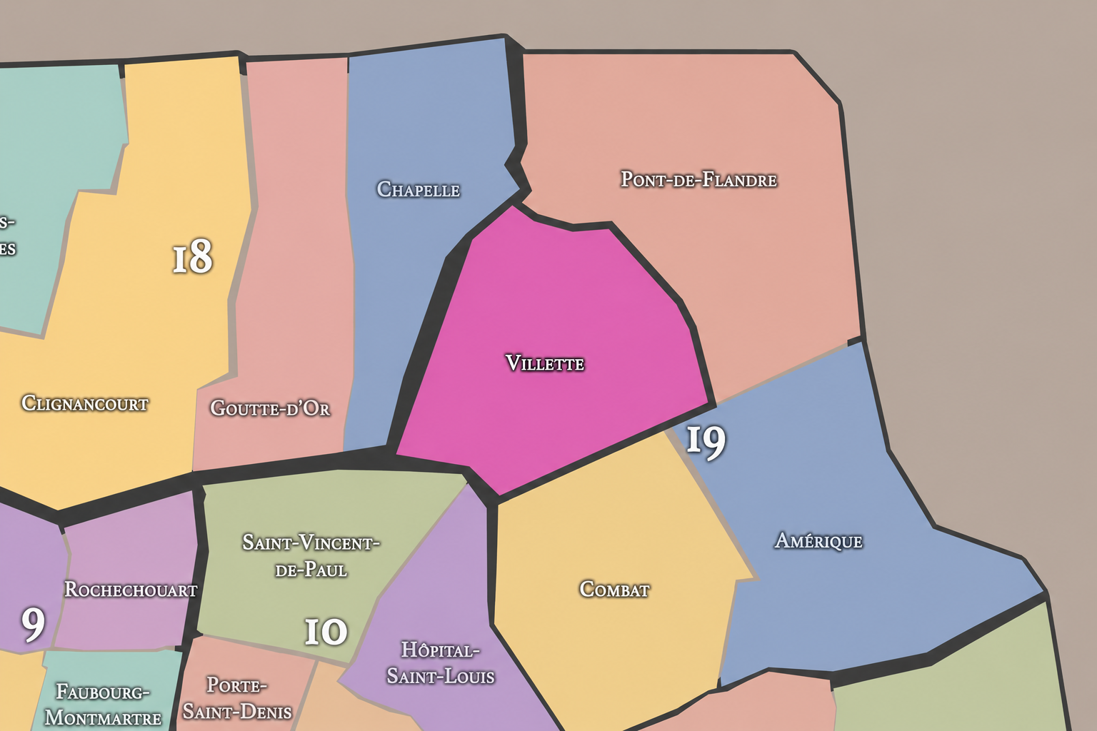
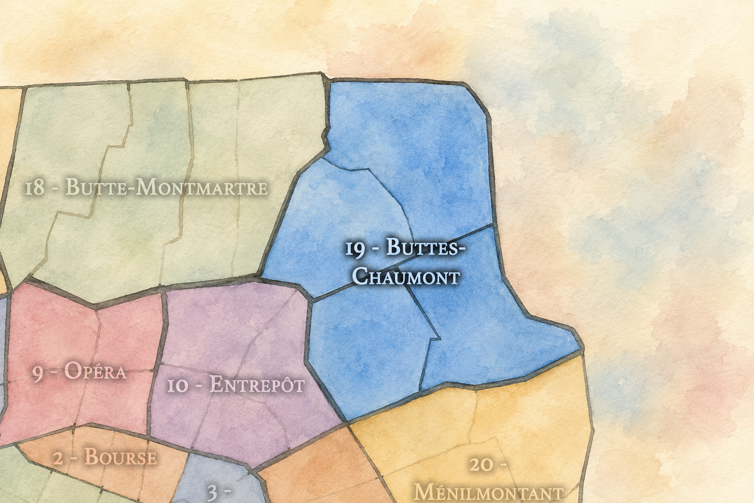
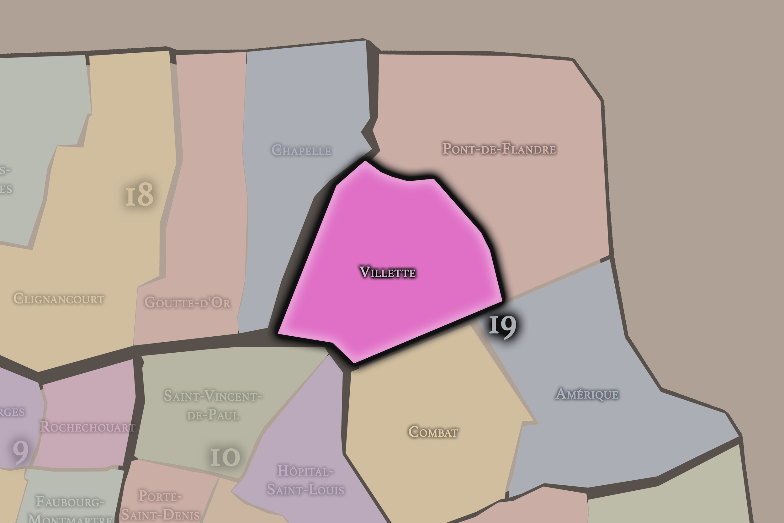
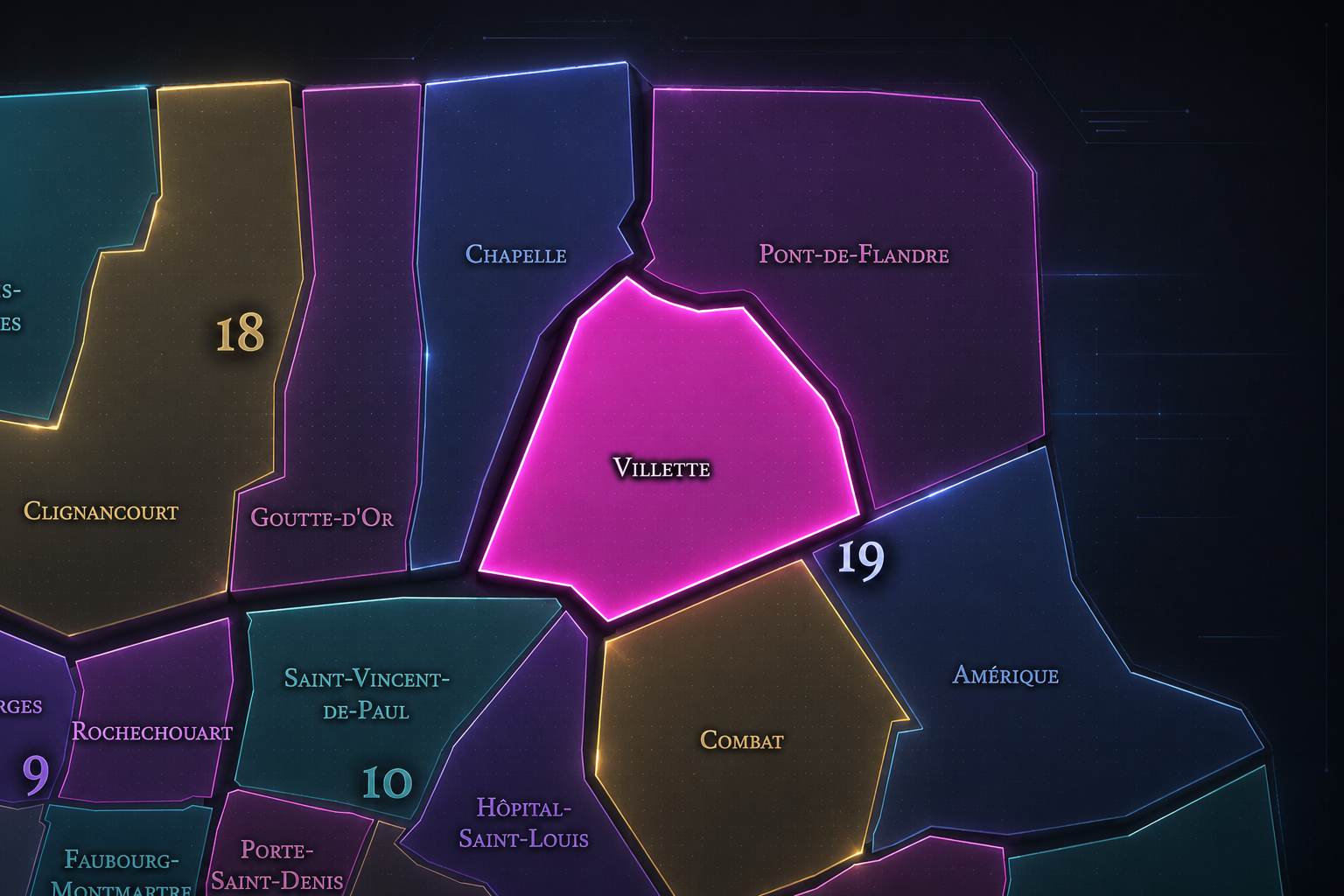
La Villette occupies the northwestern and central portion of the 19th arrondissement, where the Canal de l’Ourcq, the Bassin de la Villette, Avenue Jean-Jaurès, the Ourcq-side residential streets, and the approaches toward Pantin, Stalingrad, Jaurès, and Parc de la Villette form one of northeastern Paris’s most fluid urban landscapes. It lies south of Pont-de-Flandre, west of Amérique, north of Combat, and along the important canal corridor that connects inner Paris to the larger metropolitan northeast.
The quarter’s geography is shaped by Avenue Jean-Jaurès, Rue de Crimée, Rue de Flandre, Quai de la Loire, Quai de la Seine, Rue de Meaux, Rue Armand-Carrel, Rue Petit, Rue de l’Ourcq, Rue Curial, Rue de Thionville, and the waterside spaces around the Bassin de la Villette and Canal de l’Ourcq. The City of Paris describes Parc de la Villette as sitting at the edge of city and suburb, crossed by the Canal de l’Ourcq and mixing nature, architecture, exhibitions, performances, leisure spaces, and cultural institutions. Although the park is often culturally associated with the broader La Villette name, the administrative quarter of La Villette is the civic layer that connects the canal-side neighborhood, the old village memory, and the northern cultural landscape into one larger geography.
Unlike Amérique, whose identity is shaped by hills, quarries, and residential topography, or Combat, whose character is centered on Buttes-Chaumont and the conversion of quarry ground into dramatic parkland, La Villette is more linear, watery, and infrastructural. It is the 19th arrondissement as canal city: a place where water, industry, housing, markets, cafés, public space, and cultural redevelopment have repeatedly remade the northeastern edge of Paris.
Administrative Quarter Identity
Etymology and Origins
The name La Villette comes from the old village of La Villette, a settlement outside Paris before the city’s 19th-century annexations. The name is often understood as a diminutive form of ville — a “little town” or small settlement — which suits its history as a former commune and village at the edge of the capital. Long before La Villette became associated with canals, slaughterhouses, science museums, and cultural redevelopment, it was a place beyond the older city, tied to roads, water, land, and the practical life of the northeastern outskirts.
That village origin is essential. La Villette was not born as a park brand or cultural district. It was a settlement with its own pre-Parisian identity, later absorbed into the capital and folded into the 19th arrondissement. Its name preserves the old relationship between Paris and the small towns around it: close enough to serve the city, distinct enough to retain a local identity.
Over time, La Villette became one of the most important working landscapes of Paris. The name came to evoke canals, cattle markets, slaughterhouses, warehouses, workers, and eventually the great cultural park that replaced the industrial complex. In this way, La Villette carries an unusually full urban arc: village, commune, canal district, meat-market city, industrial edge, cultural park, and contemporary waterfront neighborhood.
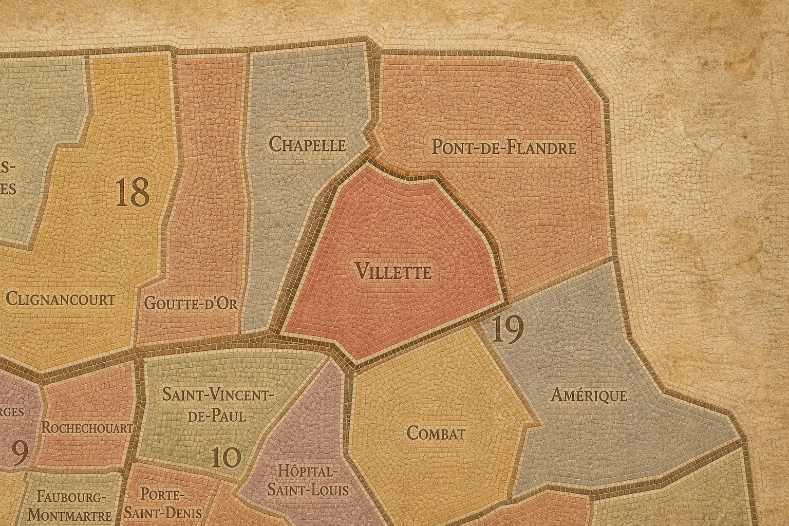
Within the official geography of Paris, La Villette is one of the four administrative quarters of the 19th arrondissement, alongside Combat, Amérique, and Pont-de-Flandre. It is traditionally counted as the 73rd administrative quarter of Paris and has formed part of the 19th arrondissement since the 1860 creation of the modern outer arrondissements.
As an administrative quarter, La Villette clarifies a district often described through more specific lived or landmark names: Jaurès, Stalingrad, Ourcq, Crimée, Bassin de la Villette, Parc de la Villette, Canal de l’Ourcq, or the northern canal corridor. Those names each capture one layer of the neighborhood. La Villette is the official frame that gathers the old village, the canal system, the industrial memory, the residential streets, and the cultural redevelopment landscape into one civic unit.
This frame is especially useful because La Villette is often stretched in everyday use. Sometimes the name means the park. Sometimes it means the basin and canal-side neighborhoods. Sometimes it means the former slaughterhouse district. Sometimes it refers to the broader northeastern cultural zone reaching toward Pantin. The administrative quarter gives that elastic identity a mapped anchor while still allowing the cultural meaning of La Villette to remain larger than any single landmark.
Civic Framework
La Villette differs from the other quarters of the 19th arrondissement through its canal geography, its old village identity, and its long transformation from provisioning landscape to cultural waterfront. Combat is more defined by Buttes-Chaumont, quarry memory, slopes, and dramatic park-making. Amérique is more topographic and residential, shaped by the Carrières d’Amérique, Mouzaïa, Danube, and Place des Fêtes. Pont-de-Flandre is more outer-facing and infrastructural, tied to Porte de la Villette, the Parc de la Villette complex, the Cité des Sciences, the canal edges, and the boundary toward Pantin and Aubervilliers.
La Villette sits between interior neighborhood and metropolitan edge. Around the Bassin de la Villette and Canal de l’Ourcq, it has become one of Paris’s strongest examples of canal-side public life: walking, cycling, cafés, bridges, cinemas, markets, waterfront seating, summer activities, and new forms of leisure layered over older working infrastructure. Farther north and east, the name connects to the larger cultural and institutional world of Parc de la Villette, with science, music, performance, and architecture emerging from the former industrial landscape.
It should also be distinguished from Pont-de-Flandre, even though the two are closely related. Pont-de-Flandre is the more outer and institutional quarter around Porte de la Villette and the major cultural park complex. La Villette is the older village-and-canal quarter that links the Bassin, the canal corridor, Avenue Jean-Jaurès, and the residential life of the central 19th. Together they form one of Paris’s great northeastern transformations, but they are not the same layer.
Neighborhood Distinction
Parisian Identity
La Villette expresses Paris as a city of water, work, and reinvention. It is one of the places where the capital’s everyday needs became visible in the landscape: water supply, goods movement, animal markets, slaughterhouses, warehouses, canals, road traffic, and working-class housing. The Canal de l’Ourcq and related waterways were not originally designed as scenery. They were systems — carrying water, materials, and goods into the growing city.
Yet La Villette also shows how those systems can become public culture. The canal banks and basin, once tied to transport and industry, now support walking, recreation, cafés, cinemas, cultural venues, and waterfront life. Parc de la Villette, built from the former slaughterhouse and wholesale meat-market lands, turned one of the city’s most functional landscapes into a major district of science, music, performance, and public space. The park was designed by Bernard Tschumi and built from 1984 to 1987 on the site of the old abattoirs and national wholesale meat market.
This gives La Villette a distinctly modern Parisian identity. It is not picturesque in the old village sense alone, and not monumental in the royal sense. It is Paris as adaptive infrastructure: the city taking canals, markets, abattoirs, warehouses, and edge land, then converting them into one of the most open and experimental landscapes in the capital.
Neighborhood Connections
Every administrative quarter belongs to a wider Parisian fabric. These connections place Villette within the city’s civic, participatory, and cultural geography:
-
19e - Buttes-Chaumont
-

Bassin de la Villette • Flandre - Aubervilliers
The History
The origins of La Villette lie in the northeastern outskirts of Paris, where a small settlement developed beyond the old city along routes and water systems connecting the capital to the surrounding plains, villages, and productive landscapes. Before the modern 19th arrondissement existed, La Villette was a village and later a commune outside Paris, tied to agriculture, roads, watercourses, commerce, and the expanding needs of the capital.
Its position made it useful before it became famous. The northeastern edge of Paris offered land and access: space for markets, transport, storage, animal movement, and later industrial activity. The area stood close enough to Paris to serve it, but far enough from the center to hold functions that the dense city could not easily accommodate.
La Villette’s origin story is therefore one of service from the edge. It began as a small place outside Paris, then became one of the city’s working lungs — a district through which water, food, animals, goods, labor, and later culture moved into the capital.
Origins
16th–17th Century
In the 16th and 17th centuries, the future La Villette quarter remained outside the dense urban fabric of Paris. It belonged to the northeastern countryside and village belt, connected to roads, fields, religious lands, small settlements, and the routes leading toward Flanders, Pantin, and the northern plain. It was not yet an urban district in the modern sense, but it was already connected to the capital through movement and supply.
This outer condition shaped its later identity. La Villette was useful because it lay beyond the crowded and regulated center. Activities that required land, access, or distance from central neighborhoods could settle in the outer belt. The district’s later canal, market, and slaughterhouse functions all built on this older geography of service and threshold.
By the end of the 17th century, Paris’s growth was drawing the northeastern villages more closely into its orbit. La Villette remained outside the city, but its future was increasingly tied to the capital’s need for water, food, roads, and working land.
In the 18th century, La Villette became more closely connected to the expanding city while retaining its village and outer-commune identity. The northeastern approaches to Paris grew busier, and the lands around La Villette became increasingly important to the supply systems of the capital. Roads, markets, agriculture, inns, small trades, and settlement linked the village more tightly to Parisian daily life.
This was a period when the city’s functional edges mattered enormously. Paris depended on surrounding settlements for food, animals, materials, labor, and movement. La Villette’s location made it part of that provisioning geography. It was not yet the great canal-and-abattoir landscape of the 19th century, but the underlying role was already present: a place where the city’s needs could gather before entering the center.
The French Revolution and the reorganization of local government helped define La Villette as a commune before its later incorporation into Paris. By the end of the 18th century, it was no longer a remote village. It was an active edge settlement bound to the growth and pressure of the capital.
18th Century
19th Century
The 19th century transformed La Villette into one of the great working landscapes of Paris. The Canal de l’Ourcq, whose navigable role was established in the early 19th century, reorganized the district around water, transport, and supply. The Philharmonie de Paris notes that the area was linked to Paris in 1808 through an aqueduct later turned into the navigable Canal de l’Ourcq in 1825, making La Villette one of the capital’s economic hubs.
The 1860 annexation brought La Villette into Paris as part of the new 19th arrondissement. This transformed the former commune into a Parisian quarter, but its working identity intensified rather than disappeared. The creation of major slaughterhouses and livestock markets in the area made La Villette central to the city’s meat supply. The district became a place of animals, workers, blood, markets, canals, rail, warehouses, and the intense logistics of feeding a growing capital.
This century established La Villette as Paris’s northeastern industrial-provisioning landscape. It was not a decorative edge; it was one of the places where the city’s body was supplied. The later cultural district would be built on this powerful, physical history.
In the early and mid 20th century, La Villette remained strongly associated with slaughterhouses, markets, canals, warehouses, and working-class life. The abattoirs and related facilities were among the city’s major employment landscapes, and the quarter’s identity was shaped by labor at a scale rarely visible in the more refined images of Paris. The Philharmonie’s history of the site notes that La Villette’s slaughterhouses were among the capital’s biggest employers.
The canals gave the district its atmosphere and function. Barges, bridges, quays, storage buildings, industrial sites, and waterside labor made La Villette a practical aquatic landscape. Its water was not primarily romantic; it was industrial, logistical, and necessary. The district was shaped by the movement of goods and animals as much as by the movement of people.
During war, occupation, liberation, and postwar recovery, La Villette’s infrastructure and food systems remained deeply important. Working districts like this carried the burdens of supply, scarcity, labor, and repair. The quarter’s history in this period belongs to the city’s metabolism: the systems that kept Paris fed and functioning under pressure.
Early–Mid 20th Century
Late 20th Century
In the late 20th century, La Villette underwent one of the most dramatic transformations in modern Paris. The old slaughterhouse and market functions declined and closed, leaving behind vast industrial grounds that were reimagined as a new cultural and public landscape. The Parc de la Villette project converted former abattoir and wholesale market lands into a major park of architecture, performance, science, music, gardens, and open space.
The opening of the Cité des Sciences et de l’Industrie in 1986 gave the area a major new identity as a public science and exhibition center. The Philharmonie’s history of the site marks the Cité’s opening on March 13, 1986, under President François Mitterrand. The later development of music, performance, and cultural institutions reinforced La Villette as one of Paris’s most ambitious post-industrial cultural districts.
At the same time, the canal-side neighborhoods around the Bassin de la Villette also began to change. Former working waterfronts gradually became spaces of leisure, housing, cafés, cinema, and public recreation. La Villette shifted from a district of supply and slaughter to one of culture and waterfront life, though the older working memory remained essential beneath the transformation.
In the 21st century, La Villette is one of the most important cultural and canal-side quarters of northeastern Paris. It combines residential life around Avenue Jean-Jaurès and the Ourcq corridor, waterfront activity along the Bassin de la Villette, and the broader cultural magnetism of Parc de la Villette and its institutions. The official La Villette site describes the park’s 55 hectares as containing prairies, gardens, bosquets, a pedagogical farm, and spaces where biodiversity and shared nature are emphasized.
Today, the quarter is shaped by multiple forms of public life. Canal banks host walkers, cyclists, families, students, cafés, cinemas, pétanque players, and summer events. Cultural institutions draw visitors from across Paris and beyond. Residential streets hold schools, shops, apartment blocks, and the everyday routines of the 19th arrondissement. The quarter has become more desirable, but it remains socially and architecturally mixed.
For CityNeighborhoods: Paris, La Villette is essential because it shows how an administrative quarter can hold the full modern arc of a city’s working edge: village, commune, canal district, abattoir landscape, industrial corridor, cultural park, and contemporary waterfront. It is not only a place to visit. It is a record of how Paris has repeatedly transformed the systems that once fed and supplied it into places for gathering, learning, leisure, and urban life.
21st Century
Spirit and Legacy
La Villette is the quarter where northeastern Paris turns work into water, and water into culture. Its spirit is fluid, practical, public, and inventive. It belongs to the old village and the canal banks, to barges and slaughterhouses, to warehouses and market halls, to science museums, music venues, cinemas, cafés, bridges, families, runners, and the long movement of the city along water.
Its legacy is the transformation of provisioning into public life. La Villette fed Paris, moved goods for Paris, watered Paris, employed Paris, and then reinvented itself as one of the capital’s great cultural landscapes. The old industrial memory has not vanished; it gives the quarter depth beneath its contemporary openness.
To walk La Villette is to encounter Paris as a city that reuses its own machinery. The quarter reminds us that neighborhoods are not only made by monuments or villages, but also by canals, markets, labor, closure, renewal, and the patient conversion of working systems into shared space. In La Villette, neighborhood identity becomes flow — the city moving from utility to culture without losing the memory of what once passed through its waters.
The Photography
The arrondissements do not share a single visual identity. Instead, they organize Paris into twenty broad visual fields, each gathering its own combination of landmarks, streetscapes, institutions, residential districts, commercial corridors, parks, rail stations, markets, cemeteries, and riverfront edges.
Some arrondissements are defined by monumental scale: royal palaces, ceremonial avenues, government buildings, museums, formal gardens, and internationally recognized landmarks. Others are shaped by hills, canals, rail gateways, apartment-lined boulevards, neighborhood markets, former village streets, industrial remnants, parks, or the quieter rhythms of residential Paris. The arrondissement system gives these varied landscapes a civic frame, allowing the city to be read not as one visual language, but as a sequence of overlapping Parisian atmospheres.

Visual Identity
Through The Lens
Photographing the arrondissements means moving between the official map and the street-level experience. The camera does not treat each arrondissement as visually uniform. Instead, it looks for the recurring forms, textures, transitions, and contrasts that make each district legible: the geometry of boulevards, the shade of plane trees, the repetition of balconies, the rise of stairways, the curve of canals, the presence of rail stations, the opening of parks, the weight of monuments, and the intimacy of side streets.
On CityNeighborhoods, the arrondissement provides the frame, but the photograph comes from the encounter between map, movement, light, and observation. As the Paris photography is processed, this section will connect each arrondissement more directly to the project’s Photographic Lexicon: the visual strategies, recurring motifs, and compositional patterns that shape how the city is seen through the lens.

If you visit Paris, these ideas can help inspire your own photography.



Paris: J’Espere, Je Rêve, Je Vive
Paris Photo Gallery
Paris Field Notes
-
Field Note: August 18, 2025 | 07:58 AM
Conditions: 73°F | Humidity: 72%.
Within the park's interior, the glacial kettle ponds acted as humidity traps, creating a soft, hazy light that filtered through the old-growth oaks. The transition from the park's dense shade to the sun-drenched edges of Oakland Gardens highlighted the day's exceptional "picture-perfect" clarity.
There is a fleeting window in Queens where the humidity of August hasn't yet heavy-set, and the morning sun hits the canopy of Alley Pond Park at a perfect oblique angle. Arriving just before 8:00 AM, I watched the light break through the oaks and tulip trees, casting long, dramatic shadows across the wet grass. It’s in these quiet, golden moments that the park feels less like a city escape and more like the ancient glacial valley it actually is.
Other neighborhoods visited:











































































































Explore Paris
-

The twenty arrondissements form the civic spiral of Paris, organizing the city into its broad local districts of government, identity, and daily life.
-

Each arrondissement is divided into four official administrative quarters, giving Paris a more precise civic and geographic framework.
-

The conseils de quartier bring participation to street level, giving residents a voice in neighborhood needs, public space, and local civic life.
-

Les Deux Rives trace Paris through the Seine’s two banks, revealing how the Rive Droite and Rive Gauche shaped the city’s civic power, commerce, learning, art, and cultural identity.
-

Cultural neighborhoods reveal the Paris people recognize through history, cafés, architecture, memory, atmosphere, and local belonging.