
1er - HALLES
Quartiers Administratifs
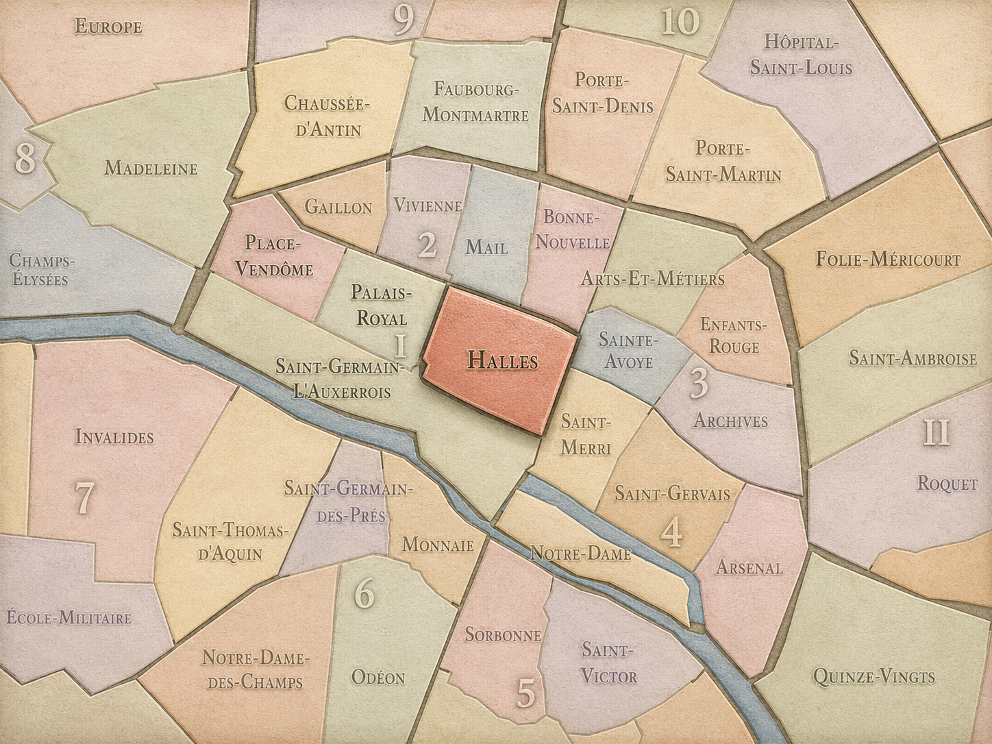
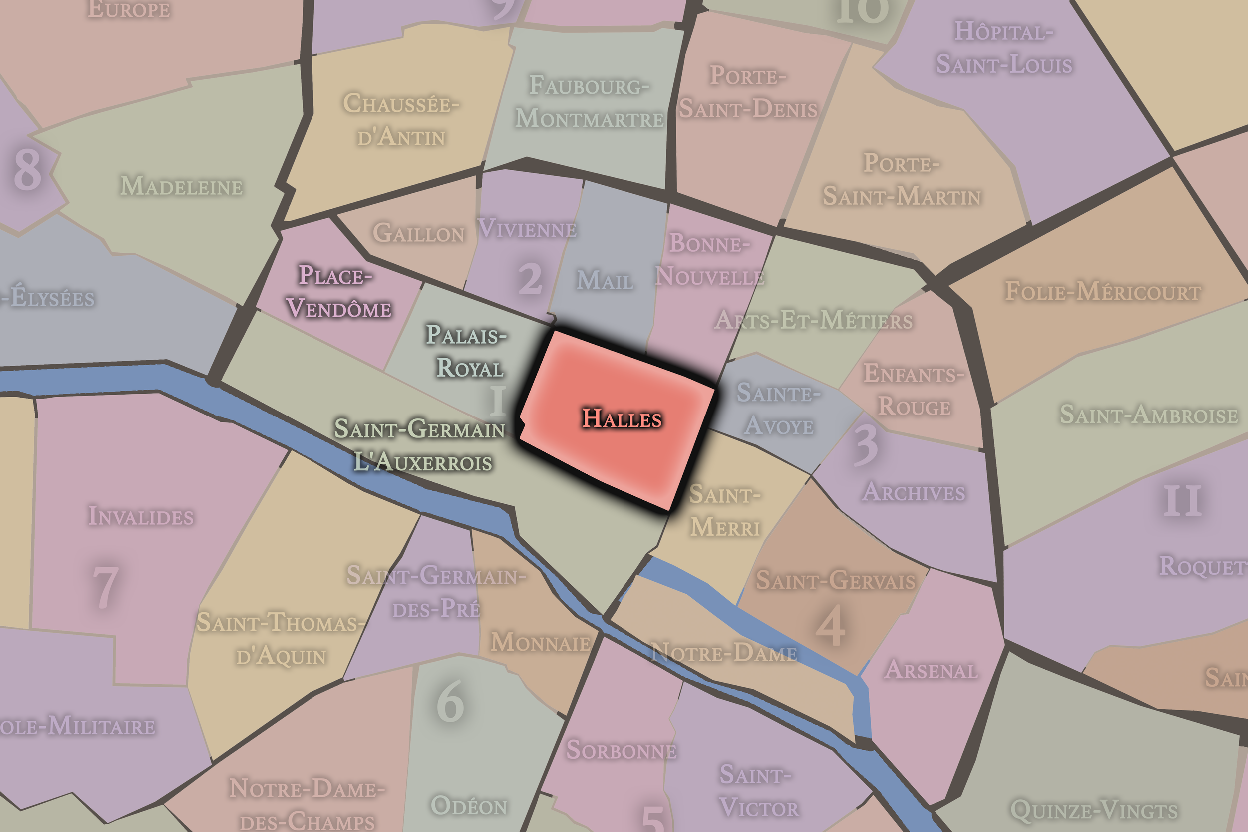
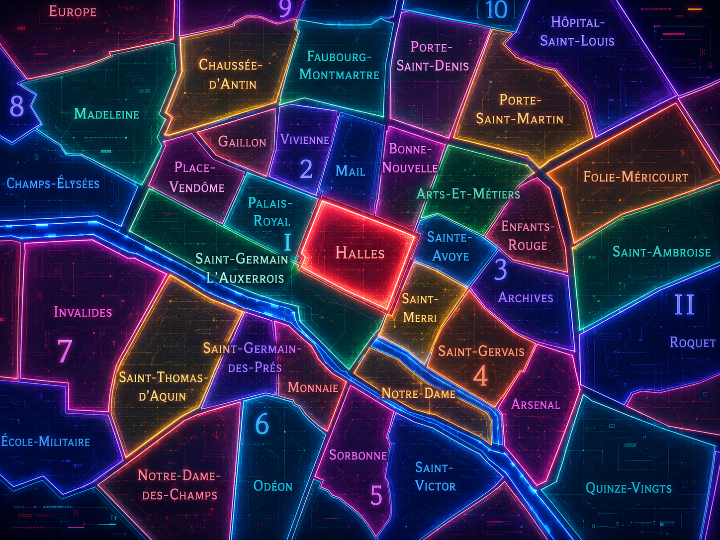
Part of an ongoing project to walk and photograph every neighborhood in Paris, this page explores the Administrative Quarter: 1er - Halles through maps, district identity, history, and photography.




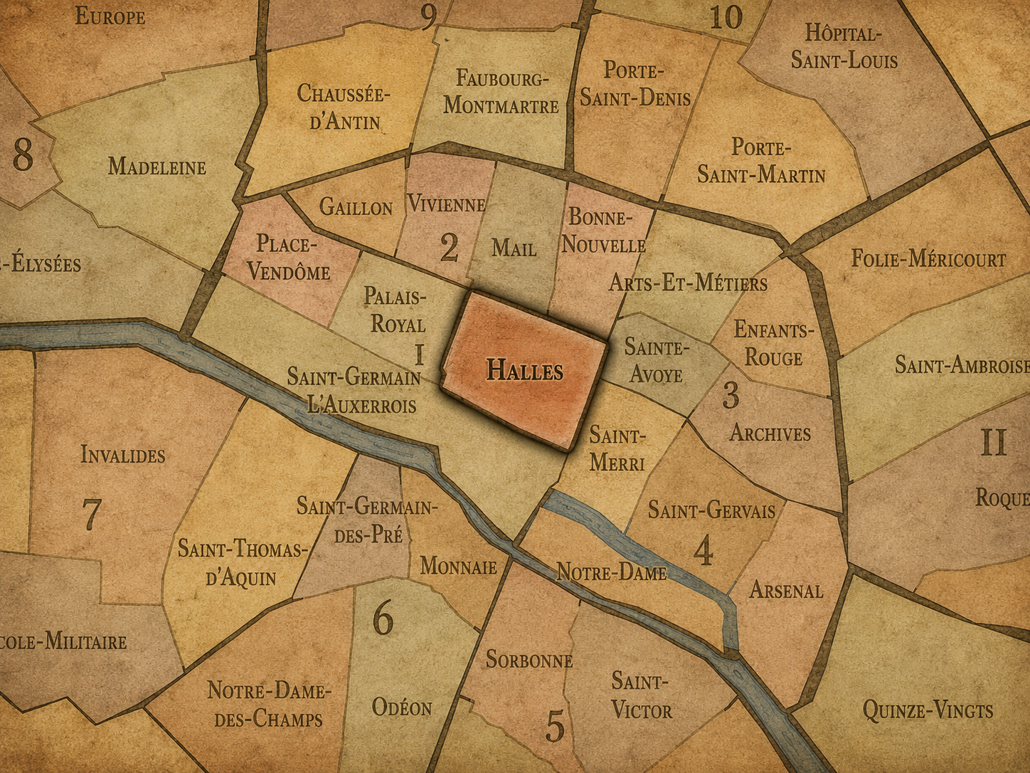
The Map
Download the Paris Arrondissements Map
Geographic Setting
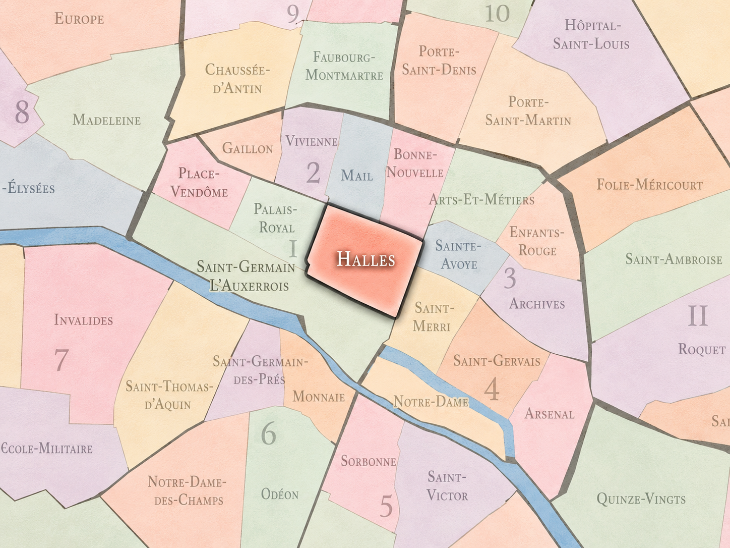
Halles occupies the eastern side of the 1st arrondissement, between the royal and institutional landscapes of the Louvre and Palais-Royal to the west, the Hôtel-de-Ville quarter to the south, the Sentier and Bonne-Nouvelle districts to the north, and the historic Right Bank corridors leading toward the Marais to the east. At its center lies the former site of Les Halles, the great central food market of Paris, whose memory still defines the quarter even after the market itself was transferred away from the city center in 1969.
This is one of the most layered geographies in central Paris. Halles is not riverfront Paris, though the Seine is close. It is not royal Paris in the formal sense of the Louvre or Place-Vendôme. It is the city’s old commercial heart: a district of market streets, church towers, underground passages, shopping corridors, transit flows, pedestrian squares, and dense urban crossings. If Saint-Germain-l’Auxerrois speaks through palace, church, and river, Halles speaks through movement — goods, people, trains, streets, commerce, redevelopment, and memory.
Administrative Quarter Identity
Etymology and Origins
The name Halles comes from the market halls that once stood here. In French, halles refers to covered market structures or market halls, and in Paris the name became inseparable from the vast central marketplace that supplied the city for centuries. Over time, Les Halles came to mean not only the buildings of the market, but the surrounding quarter of trades, streets, restaurants, labor, and urban appetite.
The name is practical rather than aristocratic. Unlike Place-Vendôme, Palais-Royal, or Saint-Germain-l’Auxerrois, Halles does not arise from a palace, church, noble residence, or royal title. It comes from the everyday machinery of feeding the city. That gives the quarter its essential character. Halles is named for function, abundance, exchange, and labor — for the place where Paris gathered to buy, sell, unload, carry, cook, bargain, eat, and survive.
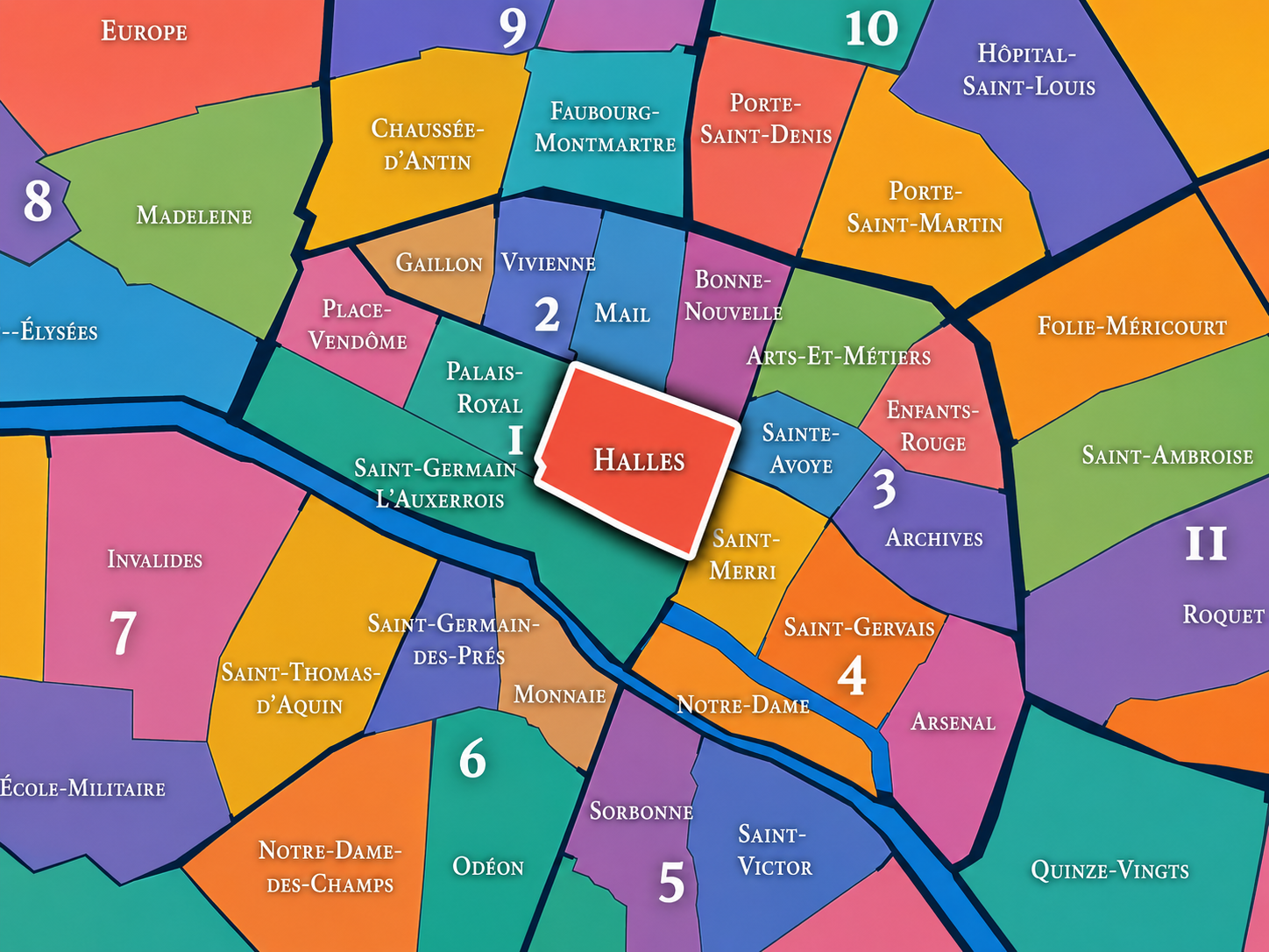
Within the official geography of Paris, Halles is one of the four administrative quarters of the 1st arrondissement, alongside Saint-Germain-l’Auxerrois, Palais-Royal, and Place-Vendôme. It occupies a distinct role within that group. Saint-Germain-l’Auxerrois holds the city’s oldest symbolic core along the Louvre, river, and Île de la Cité. Palais-Royal contains enclosed gardens, arcades, theaters, and state institutions. Place-Vendôme expresses formal grandeur, luxury, and ceremonial urbanism. Halles is the quarter of commerce, transit, and urban metabolism.
As an administrative quarter, Halles gives official form to a place whose identity has long exceeded its boundaries. The old market drew goods from beyond Paris and people from across the city. The modern quarter continues that function in another form, through the Forum des Halles, the Châtelet–Les Halles transit complex, shopping passages, pedestrian corridors, and the renewed public spaces around the Canopée. It remains a place where centrality is experienced less as monument than as circulation.
Civic Framework
Halles should be distinguished from the rest of the 1st arrondissement by its commercial and infrastructural character. It does not possess the royal gravity of Saint-Germain-l’Auxerrois, the enclosed elegance of Palais-Royal, or the luxury formalism of Place-Vendôme. Its identity is less polished and more public, less ceremonial and more functional, less architectural in a singular sense and more urban in a collective sense.
It should also be distinguished from the broader cultural idea of central Paris. Halles is often experienced as a passage through the city rather than a destination of stillness. People arrive, transfer, shop, meet, descend underground, emerge into the gardens, cross toward Beaubourg, move west toward the Louvre, or continue north toward the old commercial streets of the Right Bank. That constant movement is not incidental to the quarter. It is the quarter.
As an administrative quarter, Halles is therefore both historic and modern. It preserves the name of one of Paris’s oldest commercial institutions while containing one of the city’s most important contemporary transit and shopping complexes. Few quarters show so clearly how an old urban function can vanish physically while remaining powerfully alive in name, memory, and spatial behavior.
Neighborhood Distinction
Parisian Identity
Halles expresses Paris as a city of appetite and exchange. For centuries, this was the place where the capital fed itself. The quarter’s identity was not built on quiet elegance, but on abundance: produce, meat, fish, flowers, laborers, carts, porters, merchants, restaurants, cafés, and the nighttime economy of the market. Émile Zola famously gave Les Halles one of its enduring literary identities as the “belly of Paris,” a phrase that still clings to the district because it captures the market’s bodily, material relationship to the city.
That identity did not disappear when the wholesale market moved to Rungis. It changed shape. Today Halles is no longer the central food market, but it remains one of Paris’s most intense centers of movement. The quarter has become a place of underground trains, retail space, public gathering, renovation, and urban controversy. It is not always beloved in the same way as older picturesque districts, but it is profoundly Parisian: restless, central, crowded, contested, rebuilt, criticized, used, and impossible to ignore.
Neighborhood Connections
Every administrative quarter belongs to a wider Parisian fabric. These connections place Halles within the city’s civic, participatory, and cultural geography:
-
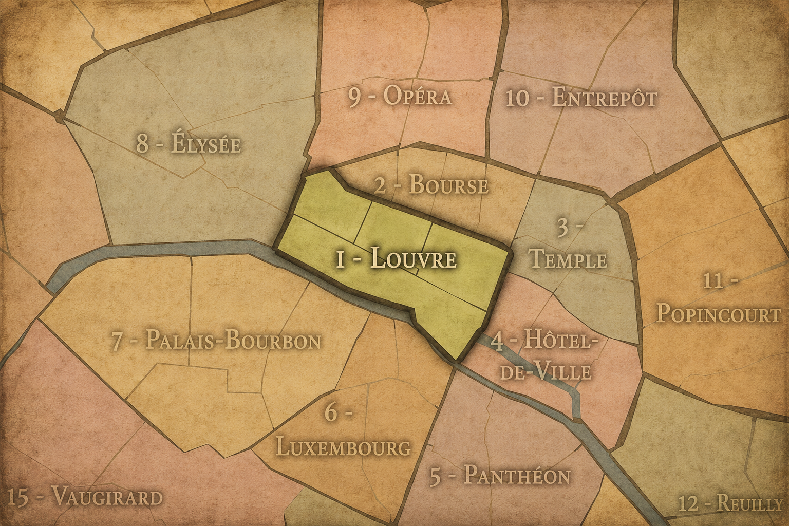
1er Arrondissement — Louvre
-

Louvre-Opéra • Halles-Beaubourg-Montorgueil
The History
The origins of Halles lie in the medieval growth of Paris on the Right Bank. As the city expanded beyond the Île de la Cité, trade and market activity increasingly shaped the streets north of the Seine. The central market developed in the 12th century, and by the late 12th century it had become one of the essential economic anchors of the city. Britannica notes that the Halles functioned as Paris’s central market from 1183 until 1969, a span that gives the quarter one of the longest continuous commercial identities in the capital.
From the beginning, the market was more than a local convenience. It was a city-scale institution. Food, animals, produce, and goods moved through Halles in quantities that tied the quarter to the countryside, the river, regional trade routes, and the growing demands of the capital. The neighborhood that formed around it was therefore shaped by labor as much as by architecture: merchants, carriers, cooks, innkeepers, craftsmen, and workers whose lives were organized around the needs of the market.
Origins
16th–17th Century
In the 16th and 17th centuries, Halles remained the great commercial heart of Paris. The city was growing in population, power, and complexity, and its central market had to feed an increasingly dense capital. The streets around Les Halles became crowded with specialized trades, food-related commerce, taverns, storage spaces, and routes of delivery. Nearby churches, including Saint-Eustache, helped anchor the quarter within the religious and civic fabric of the Right Bank.
The market’s proximity to royal and administrative Paris made it especially significant. Halles was not physically far from the Louvre, Palais-Royal, or the Hôtel de Ville, but it represented a different Paris from the ceremonial and courtly landscapes nearby. It was the working center beneath the capital’s grandeur. The same city that built palaces and churches also depended on the messy, noisy, necessary economy of the market.
By the 17th century, Halles had become one of the places where the practical life of Paris could be seen most directly. Its identity was not abstract. It was measured in baskets, carts, stalls, smells, voices, and the rhythms of delivery before dawn.
In the 18th century, Halles continued to operate as the city’s great provisioning center, but the quarter also became increasingly associated with the density and disorder of old Paris. Markets were essential, but they were also difficult to control. Crowding, sanitation, traffic, storage, and regulation were constant concerns. The neighborhood’s vitality was inseparable from its congestion.
This was also a century in which the social geography of Paris became more visible. Halles stood at the meeting point of different classes and functions: merchants and officials, workers and shoppers, restaurants and suppliers, parish life and street commerce. The market made the city physically interdependent. Aristocratic and royal Paris might seem distant in image, but it too relied on the flows of food and labor that passed through the quarter.
By the time of the French Revolution, Halles belonged to the urban landscape of popular Paris. It was a place of crowds, rumor, food politics, and public feeling. In a city where bread, markets, and supply could become matters of political urgency, the quarter’s role was never merely commercial. It was civic, social, and deeply tied to the material life of the capital.
18th Century
19th Century
The 19th century transformed Halles into one of the great modern market districts of Europe. Under Napoleon III and Baron Haussmann, Paris undertook massive programs of modernization, and Les Halles was rebuilt with the iron-and-glass pavilions designed by Victor Baltard. The École nationale des chartes notes the construction of the Baltard pavilions beginning in 1857 as one of the major stages in the long history of the Halles.
These pavilions gave physical form to the modern identity of Les Halles. They were practical, airy, industrial, and monumental in their own way: architecture for food, labor, circulation, and hygiene. The market became a symbol of modern Paris not through imperial avenues or luxury squares, but through infrastructure. Baltard’s halls showed that even the city’s provisioning could be made architectural.
The 19th century also fixed the quarter in literature and public imagination. Zola’s Le Ventre de Paris transformed Les Halles into a powerful image of the city as body: full, hungry, abundant, unequal, alive. The quarter became more than a marketplace. It became a metaphor for Paris itself — its appetite, its labor, its excess, and its uneasy relationship between plenty and deprivation.
In the early and mid 20th century, Halles remained a working market district, but the pressures on the old central market grew more severe. Trucks, congestion, storage demands, sanitation requirements, and the changing logistics of a modern metropolis increasingly strained the historic site. The market still fed Paris, but the mechanisms of feeding a capital were becoming too large, too heavy, and too complex for the old central quarter.
The neighborhood retained a powerful atmosphere. Night work, early-morning commerce, cafés, restaurants, wholesalers, and market workers gave Halles a rhythm distinct from the rest of central Paris. It was one of the few places in the city where the working infrastructure of daily survival remained visible at monumental scale. While other central districts became more governmental, cultural, or luxurious, Halles retained a rawer urban identity.
Yet its future was already uncertain. The same centrality that had made Les Halles indispensable now made it difficult. A wholesale food market in the heart of Paris no longer fit easily into the transportation, hygiene, and planning logic of the 20th-century city. The question was no longer whether Halles mattered. It was whether that function could remain there.
Early–Mid 20th Century
Late 20th Century
The late 20th century brought the quarter’s most dramatic rupture. In 1969, the wholesale market of Les Halles was transferred to Rungis, ending centuries of central-market life in the 1st arrondissement. Britannica identifies 1969 as the endpoint of Les Halles as Paris’s central market, while the City of Paris frames the modern site as the result of later restructuring and redevelopment after the old market function had been removed.
The demolition of the Baltard pavilions and the redevelopment of the site created one of the great urban controversies of modern Paris. The old “belly of Paris” was replaced by a vast underground complex: shopping, transit, circulation, and public space layered beneath and around the former market ground. The Forum des Halles opened as a new kind of central infrastructure, but it never fully escaped comparison with what had been lost.
This period gave Halles a new identity: not only market memory, but redevelopment trauma. The quarter became a case study in how cities modernize, what they sacrifice, and how difficult it can be to replace a deeply rooted urban function with an architectural and commercial substitute. Halles remained central, but its centrality became contested.
In the 21st century, Halles continues to be one of Paris’s most important and heavily used central spaces. The Forum des Halles and the surrounding public areas have undergone major renovation, including the creation of the Canopée, a large contemporary structure intended to modernize the site, improve circulation, and give the quarter a new architectural identity. The City of Paris described the renovation as responding to heavy use, aging structures, and evolving safety standards more than thirty years after the Forum’s opening.
Today, Halles is a place of layered centrality. It is a transit hub, a shopping district, a public gathering place, a redevelopment zone, a memory site, and a point of connection between the Louvre, Beaubourg, the Marais, the Sentier, and the old Right Bank commercial streets. Its identity is not simple, and that is part of its importance.
For CityNeighborhoods: Paris, Halles is essential because it reveals how a neighborhood can remain defined by a vanished function. The market is gone, but the name remains. The physical halls are gone, but the idea of central circulation remains. The old food economy has moved elsewhere, but the quarter still behaves like a place through which Paris passes.
21st Century
Spirit and Legacy
Halles is the quarter where Paris remembers its appetite. Its spirit is not quiet or ornamental. It is crowded, practical, restless, and unresolved. It has been praised, demolished, mourned, rebuilt, criticized, used, and reimagined. It is a place where the city’s needs have always been visible: food, movement, commerce, transit, gathering, renovation, and reinvention.
Its legacy lies in continuity through rupture. Medieval market became modern market. Modern market became iron-and-glass pavilions. Pavilions became absence. Absence became Forum. Forum became Canopée. Through every transformation, the quarter retained its central role as a place of exchange. The goods changed. The architecture changed. The criticism changed. But the function of movement remained.
To walk Halles is to encounter a Paris that is not only beautiful, but hungry and unfinished. It reminds us that neighborhoods are not preserved only by buildings. They are also preserved by names, habits, routes, arguments, and collective memory. Halles may no longer be the belly of Paris in the literal sense, but it remains one of the places where the city’s metabolism can still be felt.
The Photography
The arrondissements do not share a single visual identity. Instead, they organize Paris into twenty broad visual fields, each gathering its own combination of landmarks, streetscapes, institutions, residential districts, commercial corridors, parks, rail stations, markets, cemeteries, and riverfront edges.
Some arrondissements are defined by monumental scale: royal palaces, ceremonial avenues, government buildings, museums, formal gardens, and internationally recognized landmarks. Others are shaped by hills, canals, rail gateways, apartment-lined boulevards, neighborhood markets, former village streets, industrial remnants, parks, or the quieter rhythms of residential Paris. The arrondissement system gives these varied landscapes a civic frame, allowing the city to be read not as one visual language, but as a sequence of overlapping Parisian atmospheres.

Visual Identity
Through The Lens
Photographing the arrondissements means moving between the official map and the street-level experience. The camera does not treat each arrondissement as visually uniform. Instead, it looks for the recurring forms, textures, transitions, and contrasts that make each district legible: the geometry of boulevards, the shade of plane trees, the repetition of balconies, the rise of stairways, the curve of canals, the presence of rail stations, the opening of parks, the weight of monuments, and the intimacy of side streets.
On CityNeighborhoods, the arrondissement provides the frame, but the photograph comes from the encounter between map, movement, light, and observation. As the Paris photography is processed, this section will connect each arrondissement more directly to the project’s Photographic Lexicon: the visual strategies, recurring motifs, and compositional patterns that shape how the city is seen through the lens.

If you visit Paris, these ideas can help inspire your own photography.



Paris: J’Espere, Je Rêve, Je Vive
Paris Photo Gallery
Paris Field Notes
-
Field Note: August 18, 2025 | 07:58 AM
Conditions: 73°F | Humidity: 72%.
Within the park's interior, the glacial kettle ponds acted as humidity traps, creating a soft, hazy light that filtered through the old-growth oaks. The transition from the park's dense shade to the sun-drenched edges of Oakland Gardens highlighted the day's exceptional "picture-perfect" clarity.
There is a fleeting window in Queens where the humidity of August hasn't yet heavy-set, and the morning sun hits the canopy of Alley Pond Park at a perfect oblique angle. Arriving just before 8:00 AM, I watched the light break through the oaks and tulip trees, casting long, dramatic shadows across the wet grass. It’s in these quiet, golden moments that the park feels less like a city escape and more like the ancient glacial valley it actually is.
Other neighborhoods visited:











































































































Explore Paris
-

The twenty arrondissements form the civic spiral of Paris, organizing the city into its broad local districts of government, identity, and daily life.
-

Each arrondissement is divided into four official administrative quarters, giving Paris a more precise civic and geographic framework.
-

The conseils de quartier bring participation to street level, giving residents a voice in neighborhood needs, public space, and local civic life.
-

Les Deux Rives trace Paris through the Seine’s two banks, revealing how the Rive Droite and Rive Gauche shaped the city’s civic power, commerce, learning, art, and cultural identity.
-

Cultural neighborhoods reveal the Paris people recognize through history, cafés, architecture, memory, atmosphere, and local belonging.