
20e - CHARONNE
Quartiers Administratifs
Part of an ongoing project to walk and photograph every neighborhood in Paris, this page 20e - Charonne through maps, district identity, history, and photography.




The Map
Download the Paris Arrondissements Map
Geographic Setting
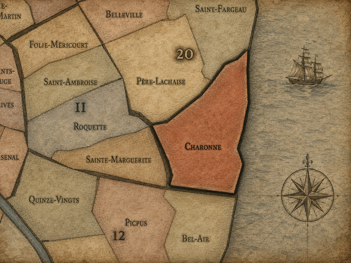
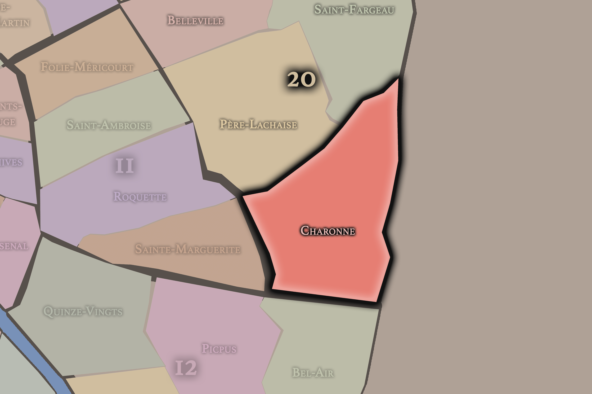
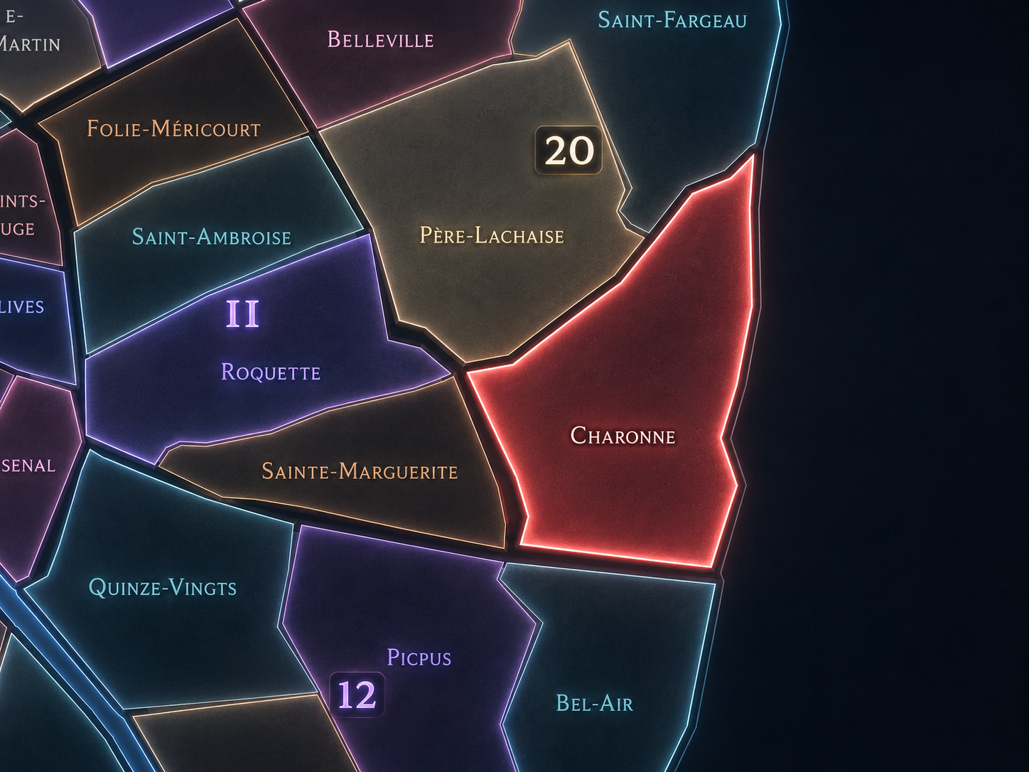
Charonne occupies the southeastern portion of the 20th arrondissement, where the old village landscape of eastern Paris stretches between Père-Lachaise, Bagnolet, Montreuil, the Porte de Montreuil, the Porte de Bagnolet, and the dense residential streets that descend from the heights of the 20th toward the city’s outer edge. It lies south and southeast of Père-Lachaise, east of Belleville, south of Saint-Fargeau, and along one of the capital’s most important seams with the eastern suburbs. This is the 20th arrondissement as former village and working edge: parish church, cemetery walls, modest streets, public housing, old roads, immigrant commerce, market life, and the long memory of a settlement absorbed into Paris but never fully erased.
The quarter’s geography is shaped by Rue de Bagnolet, Rue des Pyrénées, Rue d’Avron, Boulevard de Charonne, Boulevard Davout, Rue de la Réunion, Rue Vitruve, Rue des Orteaux, Rue Saint-Blaise, Rue de Lagny, Porte de Montreuil, Porte de Bagnolet, and the approaches toward Montreuil and Bagnolet beyond the périphérique. At its historic heart stands the old village core around Rue Saint-Blaise and the Église Saint-Germain de Charonne, one of the clearest surviving reminders that Charonne was once a place outside Paris with its own parish, cemetery, streets, and local identity.
Unlike Belleville, whose identity is hilltop, multicultural, artistic, and politically resonant, or Père-Lachaise, whose identity is shaped by the great cemetery and its memorial landscape, Charonne is more village-rooted and southeastern. It is less mythologized than Belleville, less internationally visited than Père-Lachaise, and less edge-high than Saint-Fargeau. Its strength lies in continuity: the old eastern village still visible within a dense modern arrondissement.
Administrative Quarter Identity
Etymology and Origins
The name Charonne comes from the old village of Charonne, a settlement that existed beyond the walls of Paris before its incorporation into the capital. Its exact linguistic origin is older and less transparent than a saint’s name or modern institutional title, but as a place-name it preserves the identity of one of the eastern villages that surrounded Paris for centuries. Before it was an administrative quarter, Charonne was a distinct locality with its own church, roads, fields, vineyards, and social life.
That former-village origin is essential. Charonne is not a name invented by urban planners or by contemporary real estate geography. It belongs to the pre-annexation landscape of eastern Paris, when the city was surrounded by villages that supplied, housed, served, and stood apart from the capital. The name carries that older independence into the modern map.
Over time, Charonne became associated with several overlapping identities: the village core around Saint-Blaise, the working-class streets of eastern Paris, the industrial and residential growth around Avron and Montreuil, the cemetery and parish memory, and the outer boulevards leading toward the suburbs. The name therefore holds both intimacy and scale. It is a village name attached to a broad eastern quarter of the modern city.
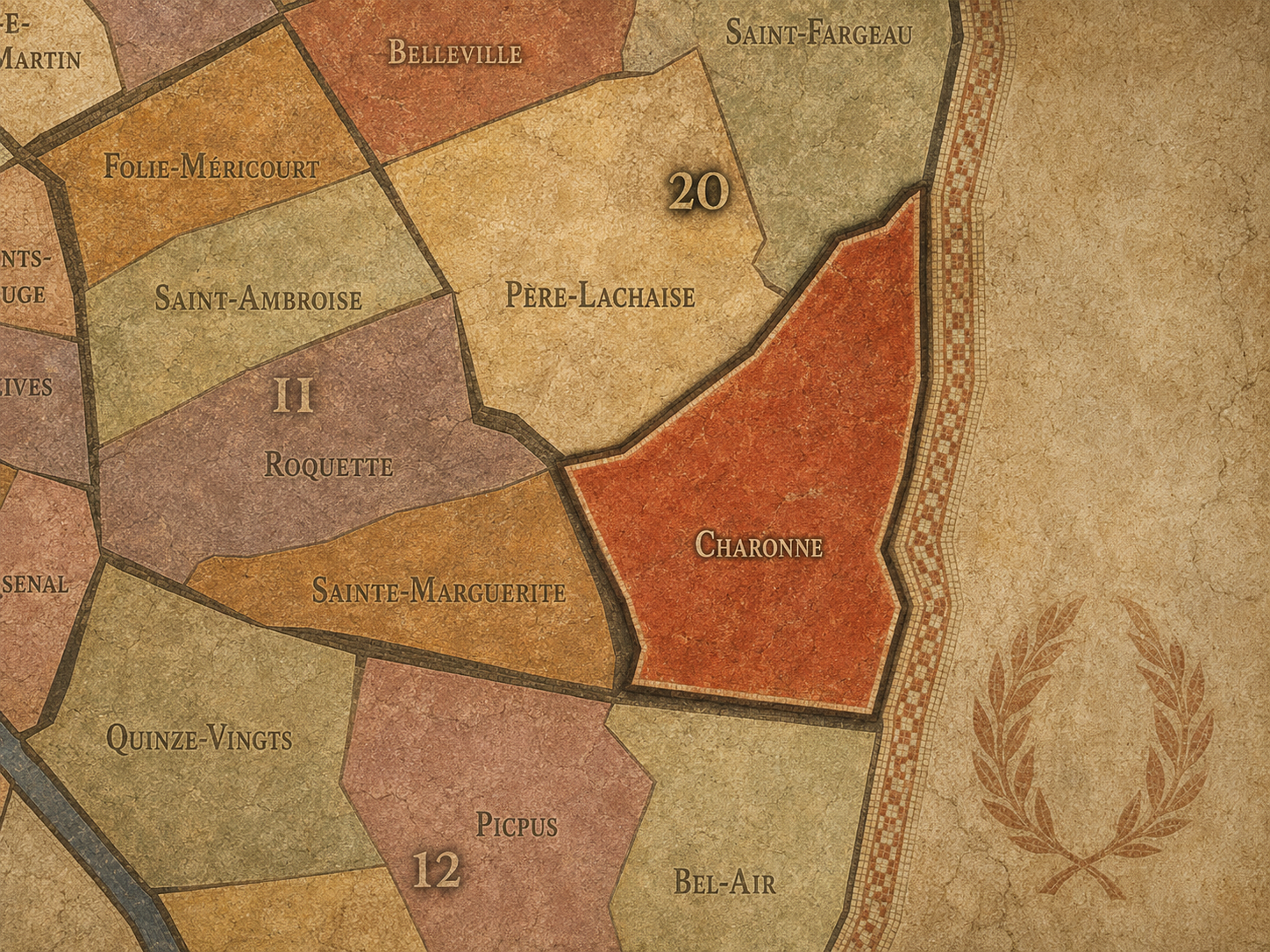
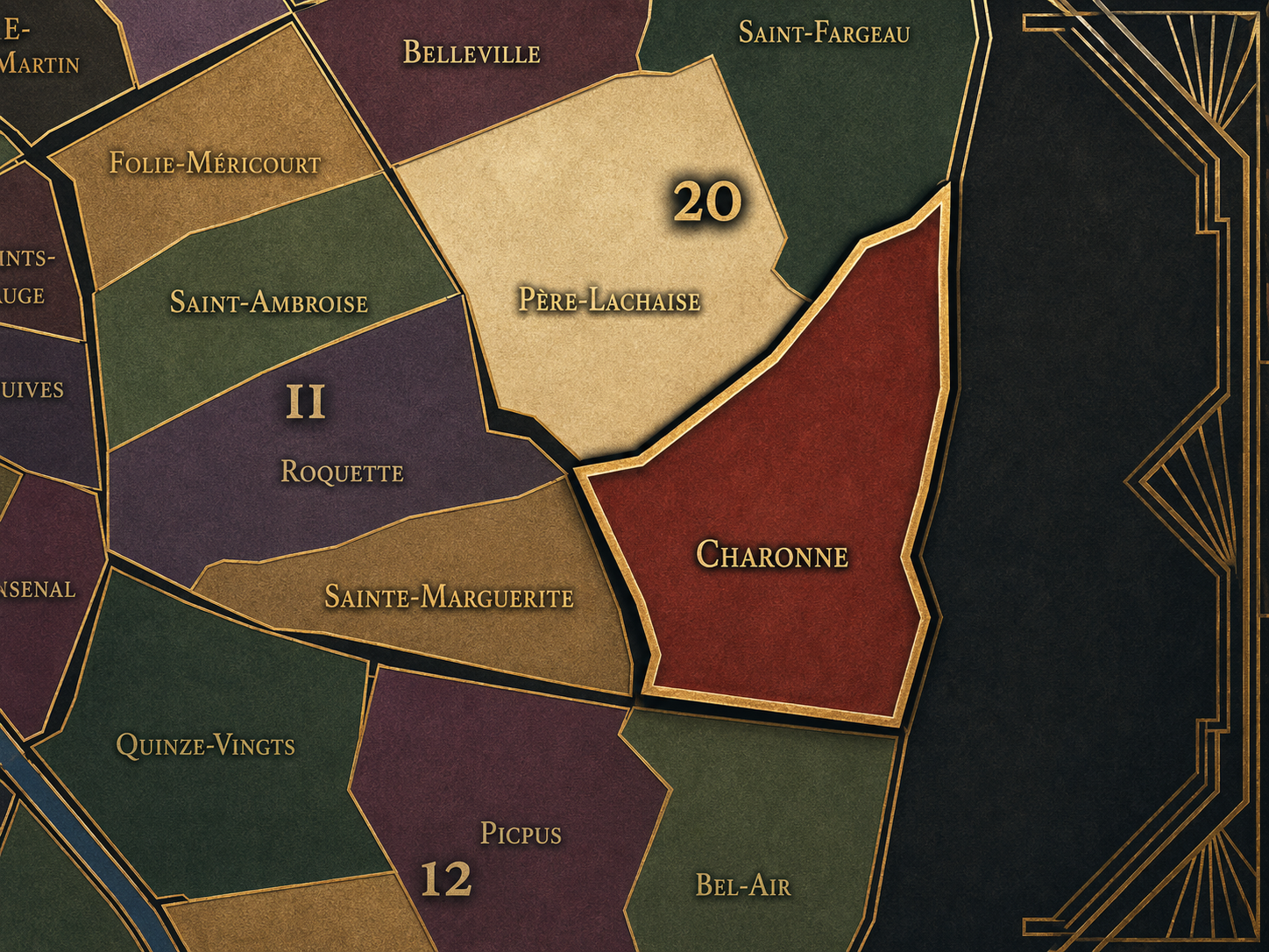
Within the official geography of Paris, Charonne is one of the four administrative quarters of the 20th arrondissement, alongside Belleville, Père-Lachaise, and Saint-Fargeau. It occupies the arrondissement’s southeastern sector and gives civic shape to the area between Père-Lachaise, Avron, Saint-Blaise, Porte de Montreuil, Porte de Bagnolet, and the city’s eastern boundary.
As an administrative quarter, Charonne clarifies a district often described through smaller or more familiar names: Saint-Blaise, Avron, Buzenval, Maraîchers, Porte de Montreuil, Porte de Bagnolet, Réunion, or the eastern 20th. Those names each capture one layer of the area. Charonne is the official frame that gathers the old village, the residential streets, the working-class inheritance, the outer boulevards, the market corridors, and the suburb-facing edge into one mapped civic unit.
This civic frame is especially useful because cultural Charonne can be both smaller and larger than the administrative quarter. Some people think of Charonne primarily as the old village core near Saint-Blaise. Others associate it with the boulevard and metro station farther west. The administrative quarter restores the full southeastern geography of the name, allowing Charonne to be understood as one of the major building blocks of the 20th arrondissement.
Civic Framework
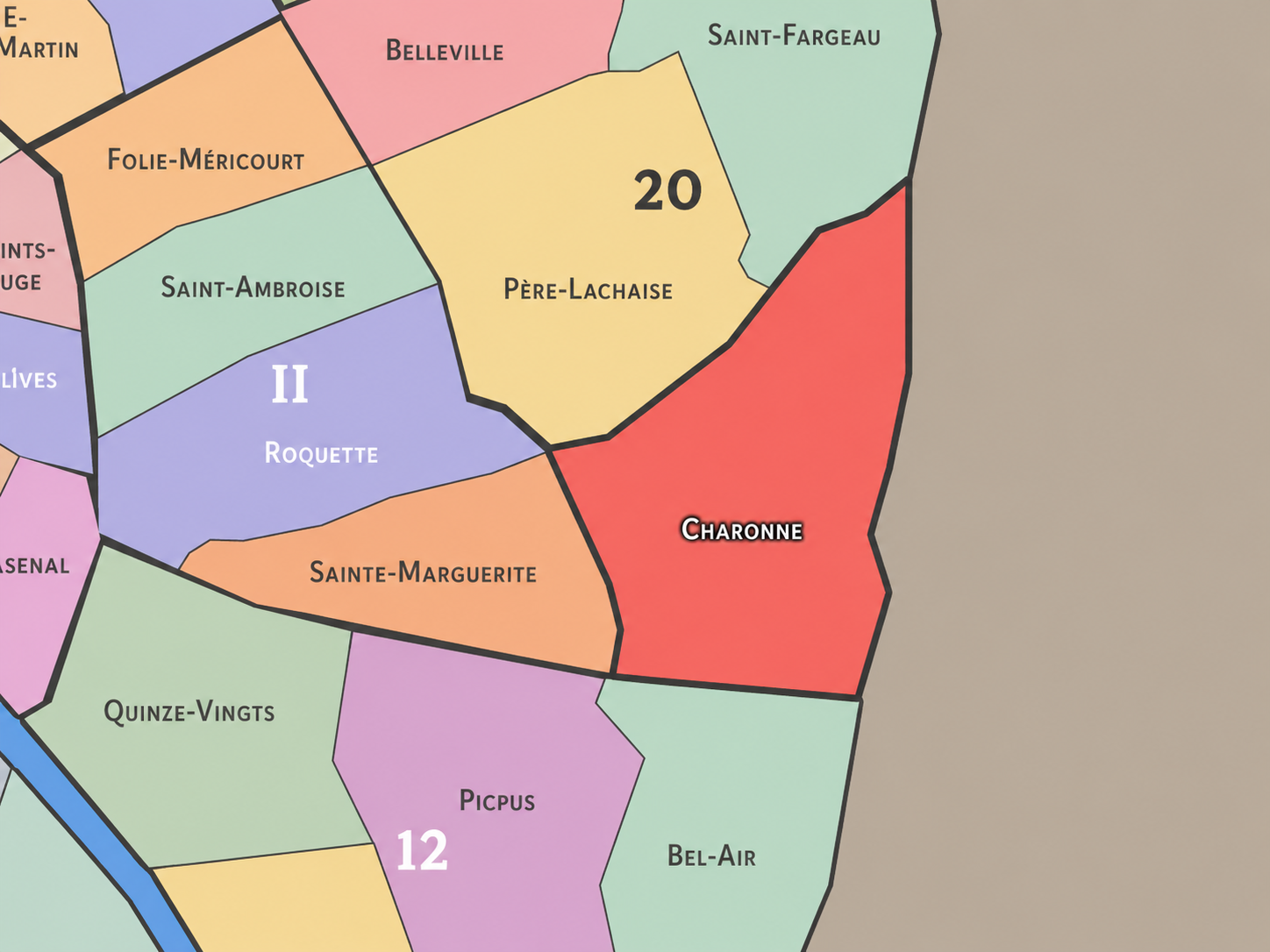
Charonne differs from the other quarters of the 20th arrondissement through its strong former-village identity, its southeastern edge position, and its connection to the roads toward Bagnolet and Montreuil. Belleville is more hilltop, multicultural, artistic, and politically symbolic, with a cultural geography that spills into the 19th arrondissement. Père-Lachaise is more memorial and cemetery-centered, shaped by the great burial ground, Gambetta, Philippe-Auguste, and the historical memory of the Commune. Saint-Fargeau is more northeastern and height-oriented, tied to Télégraphe, outer boulevards, and the later residential expansion toward Porte des Lilas and Bagnolet.
Charonne is more deeply rooted in the old village fabric of southeastern Paris. Its distinction lies in the survival of Rue Saint-Blaise, the old parish church, the small-scale streets around the village core, and the way those remnants sit within a much broader working and residential urban landscape. It is one of the places where the pre-Parisian east remains most legible.
It should also be distinguished from the Boulevard de Charonne / Charonne metro identity farther west along the 11th / 20th boundary. That name marks an important boulevard and transit geography, but the administrative quarter of Charonne extends much farther east and southeast. The old village core, not only the boulevard, is central to understanding the quarter.
Neighborhood Distinction
Parisian Identity
Charonne expresses Paris as a city of absorbed villages and working continuities. It is one of the quarters where the capital’s expansion can still be read in the street pattern: a former village core surrounded by dense residential streets, public housing, local commerce, outer boulevards, and the infrastructure of the modern metropolitan edge. It is Paris, but it remembers having been a village outside Paris.
This gives Charonne a deeply eastern Parisian identity. The quarter belongs to the city of workers, artisans, small shops, immigrants, families, markets, cafés, schools, cemeteries, and outer roads rather than to the monumental or aristocratic image of the capital. It is not polished into a single postcard form. It is practical, layered, and lived.
Charonne also helps explain the moral geography of the 20th arrondissement. The old village gives the quarter historical rootedness; the working streets give it social depth; the outer gates connect it to the suburbs; and the proximity of Père-Lachaise links it to one of the great memorial landscapes of Paris. Charonne is therefore not only a local quarter. It is a place where the old eastern village, popular Paris, and Greater Paris meet.
Neighborhood Connections
Every administrative quarter belongs to a wider Parisian fabric. These connections place Charonne within the city’s civic, participatory, and cultural geography:
-
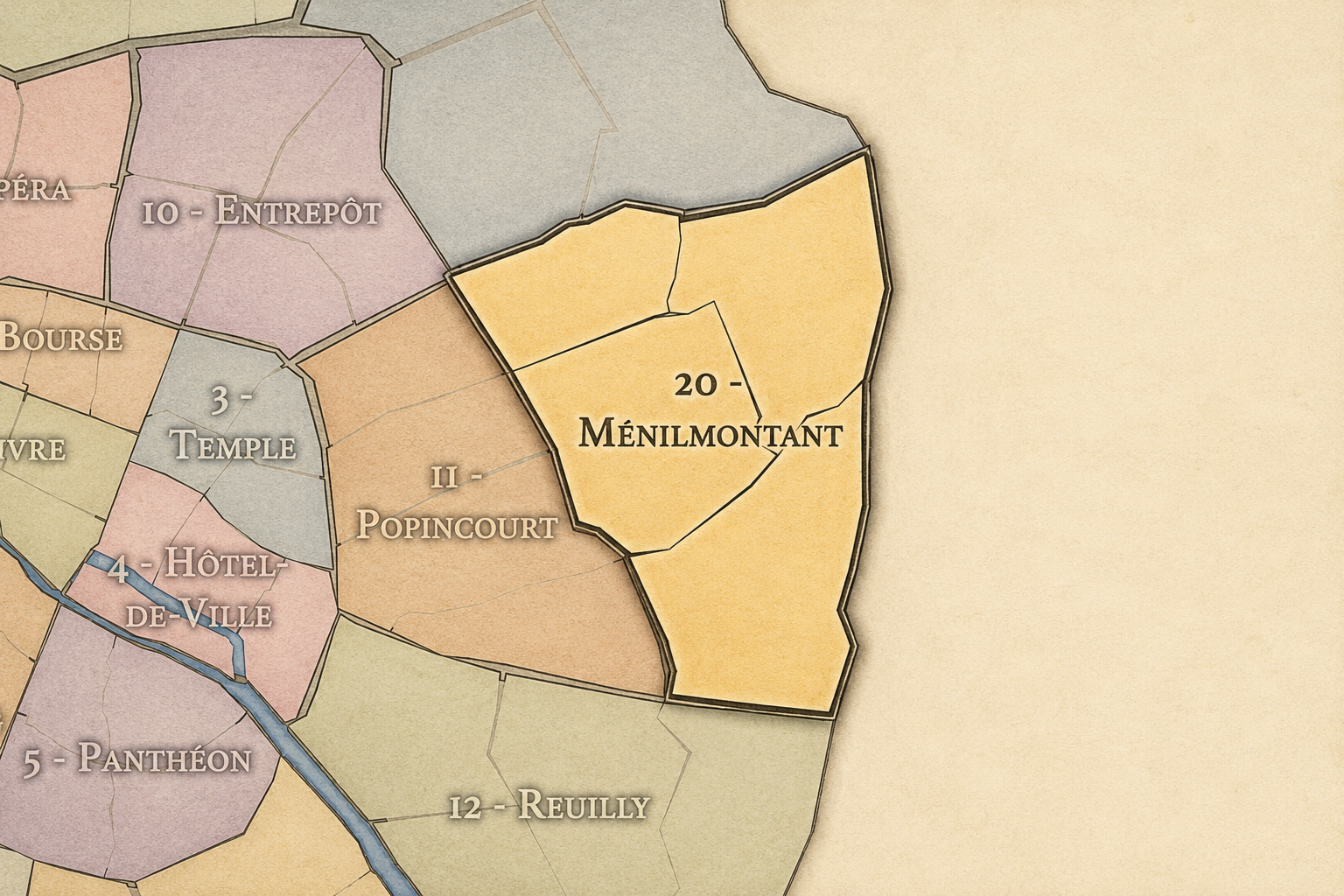
20e-Ménilmontant
-

Gambetta • Plaine-Lagny • Réunion Père - Lachaise • Saint-Blaise
The History
The origins of Charonne lie in the eastern countryside beyond old Paris, where a village developed along roads leading toward Bagnolet, Montreuil, Vincennes, and the surrounding agricultural lands. Before the modern 20th arrondissement existed, Charonne had its own parish, cultivated land, vineyards, gardens, houses, and local institutions. It was close to Paris, but distinct from it.
Its village core around Saint-Germain de Charonne became the heart of that identity. The church and surrounding cemetery gave the settlement a spiritual and civic center, while the roads and fields around it tied the village to the practical life of the eastern outskirts. Charonne was not a grand symbolic place at first. It was a local settlement shaped by land, parish, and proximity to the capital.
The quarter’s origin story is therefore one of long independence before absorption. Charonne developed as its own place, then gradually became entangled with Paris through work, roads, housing, markets, and urban growth. Annexation would make it Parisian in law, but the older village identity remained embedded in the ground.
Origins
16th–17th Century
In the 16th and 17th centuries, Charonne remained outside the dense urban fabric of Paris. It was a village in the eastern landscape, surrounded by fields, vineyards, gardens, religious properties, roads, and smaller settlements connected to Bagnolet, Montreuil, and the routes leading beyond the city. Its distance from Paris gave it space and local coherence, while its proximity kept it tied to the capital’s economic life.
The parish church and village streets gave Charonne a clear identity long before it became part of Paris. The eastern hills and outer lands were not empty spaces waiting for the city. They were inhabited, cultivated, and organized around local communities. Charonne belonged to that older ring of villages around the capital.
By the end of the 17th century, Paris’s growth was increasingly drawing the surrounding villages into its orbit. Charonne remained separate, but its future was tied to the expanding city. The old village would eventually become an urban quarter, but the parish and road structure would continue to mark the landscape.
In the 18th century, Charonne became more closely connected to Paris while preserving its village identity. The eastern outskirts were important to the capital’s food supply, labor networks, and popular leisure. Vineyards, gardens, farms, small workshops, and roads continued to shape the area, while settlement gradually thickened under the pressure of Parisian growth.
Charonne also belonged to the broader culture of the eastern hills and villages, where taverns, guinguettes, working people, and local communities formed a world distinct from the formal center of Paris. Like Belleville and Ménilmontant, Charonne stood close to the city but maintained a more open, popular, and local atmosphere.
The French Revolution altered the administrative and political relationship between Paris and its surrounding villages, but Charonne remained outside the capital until the 19th century. By the end of the 18th century, however, the old village was already part of the city’s expanding social and economic field. It was outside the walls, but increasingly inside the life of Paris.
18th Century
19th Century
The 19th century transformed Charonne from village into Parisian quarter. The village and commune were incorporated into Paris in 1860, when the capital expanded and created the modern outer arrondissements. Charonne became part of the new 20th arrondissement, but its older village center remained visible around Rue Saint-Blaise and the church of Saint-Germain de Charonne.
Urbanization accelerated after annexation. Streets were laid out or extended, apartment buildings rose, workshops and small industries developed, and the population grew. The quarter became part of working-class eastern Paris, shaped by modest housing, labor, migration from other parts of France, and the practical needs of a growing capital. The old village did not disappear all at once; it was surrounded, absorbed, and transformed.
The events of 1871 and the Paris Commune also marked the wider eastern landscape deeply. While Père-Lachaise became the most famous memorial site of the Commune’s final repression, Charonne belonged to the same broader geography of popular eastern Paris: streets of resistance, working-class politics, and social memory. The quarter entered the modern era with both village roots and political weight.
In the early and mid 20th century, Charonne remained a strongly residential and working-class quarter of eastern Paris. Its streets held apartment buildings, small shops, workshops, cafés, schools, markets, churches, and families living within the dense fabric of the 20th arrondissement. The old village core around Saint-Blaise survived as a distinctive pocket within a larger urban district.
The quarter’s position near the eastern boundary also shaped its life. Roads and transit connections toward Montreuil and Bagnolet made Charonne part of the everyday exchange between Paris and the suburbs. Workers, goods, shoppers, and families moved across this edge, blurring the line between capital and neighboring communes. Charonne was never isolated inside Paris; it faced outward.
During the wars, occupation, liberation, and postwar reconstruction, Charonne shared the hardships of working Paris: shortages, fear, political tension, local solidarity, rebuilding, and demographic change. Its history in this period is written through ordinary streets, neighborhood institutions, and the endurance of residents rather than through a single monument.
Early–Mid 20th Century
Late 20th Century
In the late 20th century, Charonne underwent significant transformation as eastern Paris changed socially, economically, and physically. Older working-class patterns persisted, but public housing, urban renewal, immigration, deindustrialization, and changing retail reshaped the quarter. Some older buildings disappeared; others were rehabilitated; new housing and public facilities altered the streetscape.
The Saint-Blaise area became especially important as a surviving village-like core within the modern city. Its narrow streets, church, and older fabric stood in contrast to larger housing blocks and more contemporary urban forms nearby. This contrast made Charonne one of the 20th arrondissement’s clearest examples of historical layering: village remnant beside modern residential density.
The late 20th century also brought new cultural and demographic energy. Like much of eastern Paris, Charonne became more diverse, with immigrant communities, artists, working families, students, and newer middle-class residents all contributing to a changing neighborhood. The quarter began to attract more attention for its authenticity, affordability, and local texture, even as that attention brought new pressures.
In the 21st century, Charonne remains one of the 20th arrondissement’s most historically grounded and socially layered quarters. It contains old village streets, dense apartment blocks, public housing, local shops, markets, schools, cafés, immigrant commerce, and the strong suburb-facing energy of Porte de Montreuil and Porte de Bagnolet. It is neither frozen in the past nor fully remade into a polished new district. Its character comes from the coexistence of layers.
Today, the old village of Charonne is one of the quarter’s most valuable identities. Around Rue Saint-Blaise and Saint-Germain de Charonne, the visitor can still sense the pre-annexation landscape inside Paris. But the larger quarter is equally important: Avron, Réunion, Maraîchers, Porte de Montreuil, and the outer boulevards show Charonne as a living eastern district, not a preserved village museum.
For CityNeighborhoods: Paris, Charonne is essential because it shows how an administrative quarter can hold the whole story of Parisian expansion: village, parish, commune, annexation, working-class city, political memory, immigration, public housing, and metropolitan edge. It is one of the places where the 20th arrondissement’s identity becomes most legible — rooted, popular, and open toward the east.
21st Century
Spirit and Legacy
Charonne is the quarter where eastern Paris keeps its village heart. Its spirit is grounded, popular, and quietly enduring. It belongs to Saint-Blaise and Saint-Germain de Charonne, to old roads and apartment blocks, to market streets and cemetery walls, to the crossings toward Bagnolet and Montreuil, to families, workers, newcomers, and the everyday continuity of the southeastern 20th.
Its legacy is the transformation of village into urban memory without the complete loss of local identity. Charonne was outside Paris, then inside Paris. It was parish and commune, then arrondissement quarter. It was rural edge, working district, residential neighborhood, and metropolitan seam. Through each transformation, the old name remained strong enough to hold the story together.
To walk Charonne is to encounter Paris as absorption and survival. The quarter reminds us that the city did not grow over empty land; it grew into places that already had names, churches, roads, fields, and memories. In Charonne, neighborhood identity becomes persistence — the former village still speaking through the dense, living fabric of eastern Paris.
The Photography
The arrondissements do not share a single visual identity. Instead, they organize Paris into twenty broad visual fields, each gathering its own combination of landmarks, streetscapes, institutions, residential districts, commercial corridors, parks, rail stations, markets, cemeteries, and riverfront edges.
Some arrondissements are defined by monumental scale: royal palaces, ceremonial avenues, government buildings, museums, formal gardens, and internationally recognized landmarks. Others are shaped by hills, canals, rail gateways, apartment-lined boulevards, neighborhood markets, former village streets, industrial remnants, parks, or the quieter rhythms of residential Paris. The arrondissement system gives these varied landscapes a civic frame, allowing the city to be read not as one visual language, but as a sequence of overlapping Parisian atmospheres.

Visual Identity
Through The Lens
Photographing the arrondissements means moving between the official map and the street-level experience. The camera does not treat each arrondissement as visually uniform. Instead, it looks for the recurring forms, textures, transitions, and contrasts that make each district legible: the geometry of boulevards, the shade of plane trees, the repetition of balconies, the rise of stairways, the curve of canals, the presence of rail stations, the opening of parks, the weight of monuments, and the intimacy of side streets.
On CityNeighborhoods, the arrondissement provides the frame, but the photograph comes from the encounter between map, movement, light, and observation. As the Paris photography is processed, this section will connect each arrondissement more directly to the project’s Photographic Lexicon: the visual strategies, recurring motifs, and compositional patterns that shape how the city is seen through the lens.

If you visit Paris, these ideas can help inspire your own photography.



Paris: J’Espere, Je Rêve, Je Vive
Paris Photo Gallery
Paris Field Notes
-
Field Note: August 18, 2025 | 07:58 AM
Conditions: 73°F | Humidity: 72%.
Within the park's interior, the glacial kettle ponds acted as humidity traps, creating a soft, hazy light that filtered through the old-growth oaks. The transition from the park's dense shade to the sun-drenched edges of Oakland Gardens highlighted the day's exceptional "picture-perfect" clarity.
There is a fleeting window in Queens where the humidity of August hasn't yet heavy-set, and the morning sun hits the canopy of Alley Pond Park at a perfect oblique angle. Arriving just before 8:00 AM, I watched the light break through the oaks and tulip trees, casting long, dramatic shadows across the wet grass. It’s in these quiet, golden moments that the park feels less like a city escape and more like the ancient glacial valley it actually is.
Other neighborhoods visited:











































































































Explore Paris
-

The twenty arrondissements form the civic spiral of Paris, organizing the city into its broad local districts of government, identity, and daily life.
-

Each arrondissement is divided into four official administrative quarters, giving Paris a more precise civic and geographic framework.
-

The conseils de quartier bring participation to street level, giving residents a voice in neighborhood needs, public space, and local civic life.
-

Les Deux Rives trace Paris through the Seine’s two banks, revealing how the Rive Droite and Rive Gauche shaped the city’s civic power, commerce, learning, art, and cultural identity.
-

Cultural neighborhoods reveal the Paris people recognize through history, cafés, architecture, memory, atmosphere, and local belonging.