
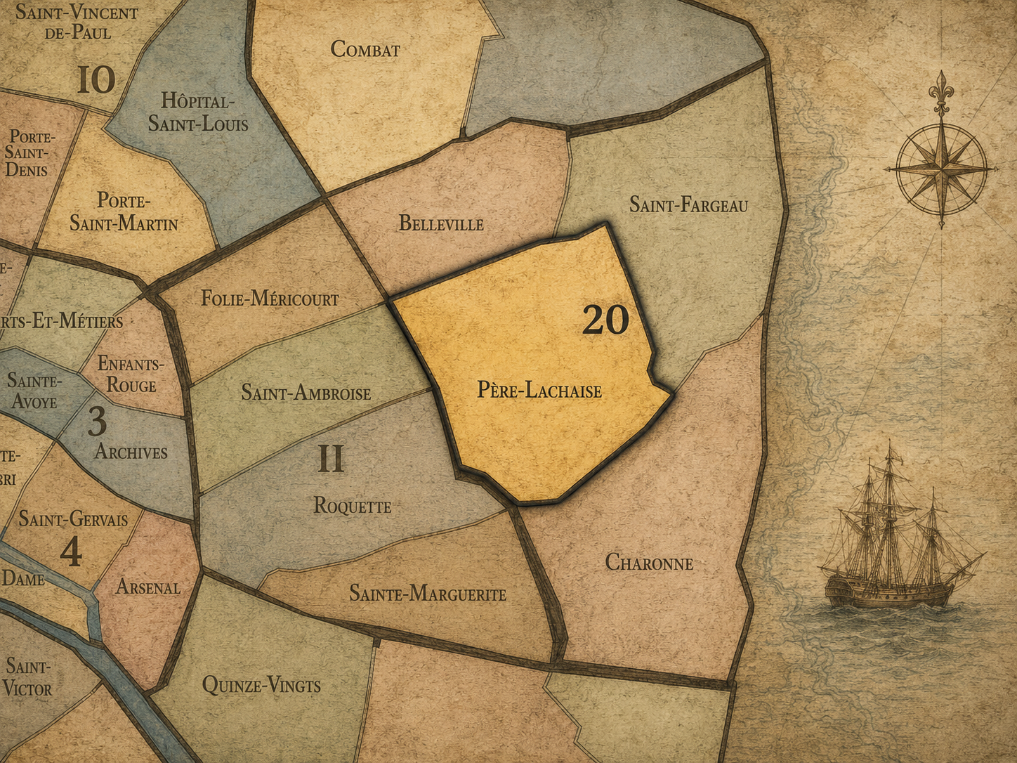
20e - PÈRE-LASCHAISE
Quartiers Administratifs
Part of an ongoing project to walk and photograph every neighborhood in Paris, this page 20e - Père-Lachaise through maps, district identity, history, and photography.




The Map
Download the Paris Arrondissements Map
Geographic Setting
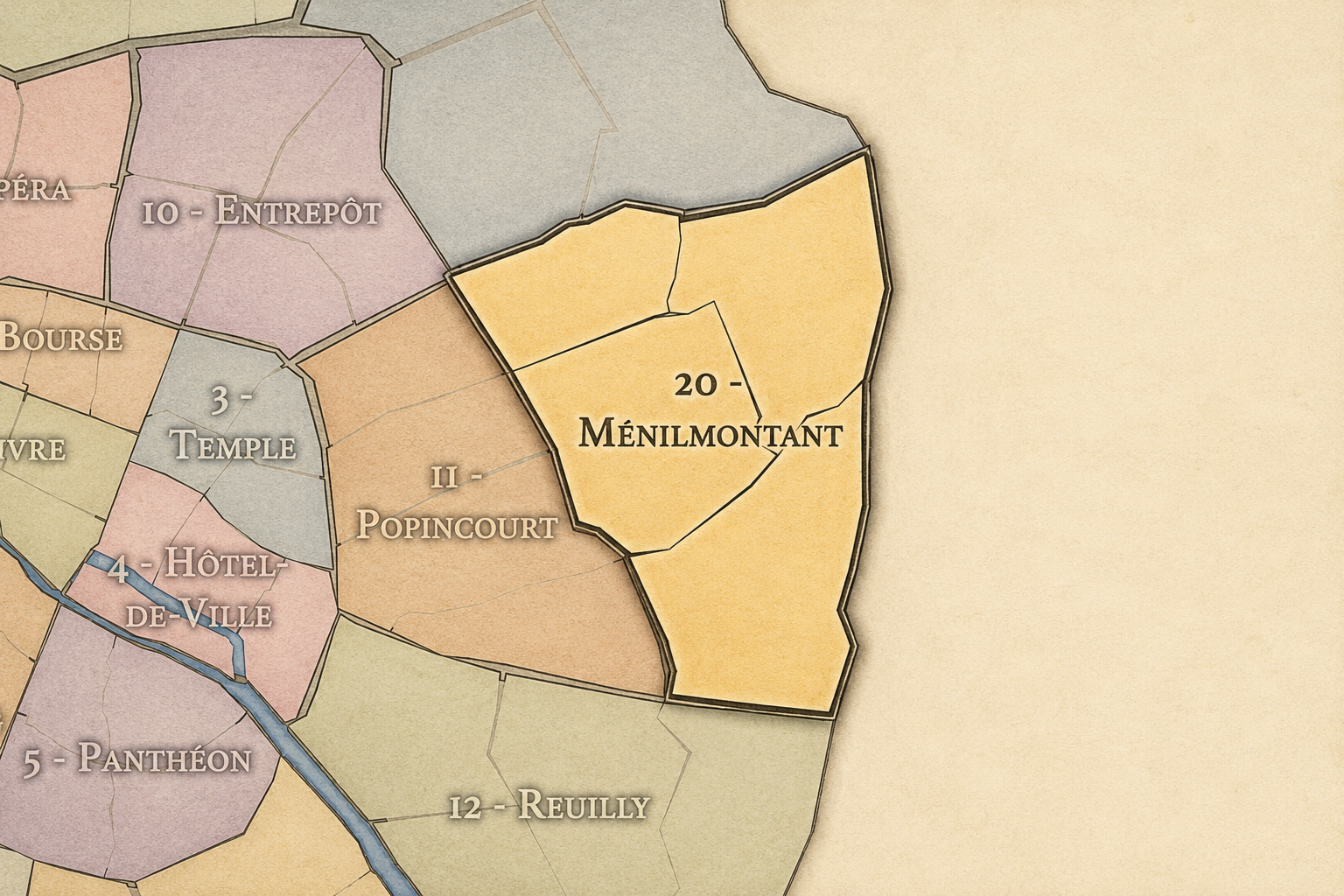
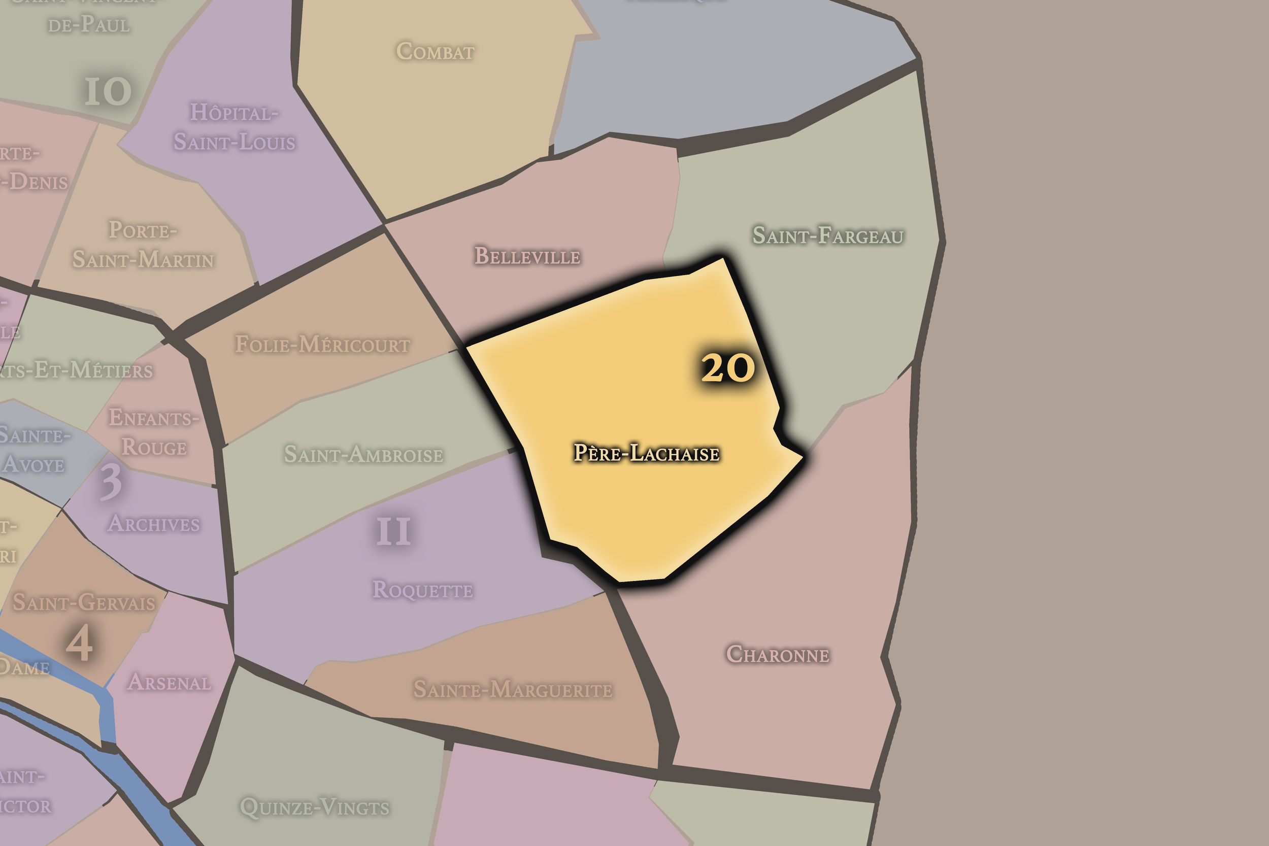
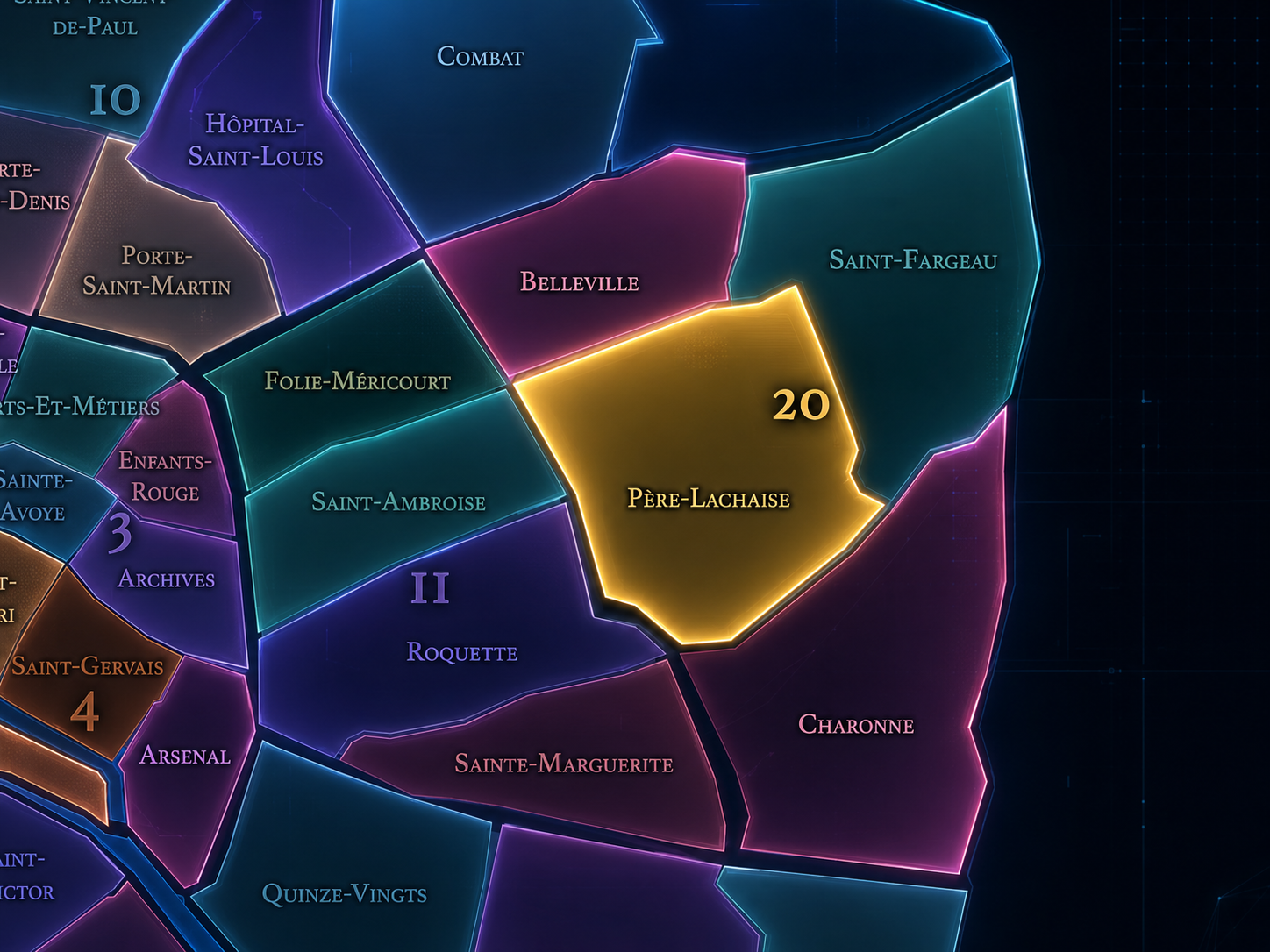
Père-Lachaise occupies the southwestern portion of the 20th arrondissement, where the eastern slopes of Paris gather around the great cemetery, the boundary with the 11th arrondissement, the edges of Belleville and Charonne, and the dense residential streets between Ménilmontant, Gambetta, Philippe-Auguste, Alexandre-Dumas, and Boulevard de Charonne. It lies south of Belleville, west and northwest of Charonne, southwest of Saint-Fargeau, and along one of the most symbolically charged landscapes of eastern Paris.
The quarter’s geography is shaped by Boulevard de Ménilmontant, Boulevard de Charonne, Avenue Gambetta, Rue de la Roquette, Rue des Rondeaux, Rue des Pyrénées, Rue de Bagnolet, Rue de Ménilmontant, Rue de la Réunion, Rue du Repos, and the sloping interior of the Cimetière du Père-Lachaise itself. The cemetery dominates the quarter’s identity, but the administrative quarter is not only the cemetery. It includes the surrounding streets, residential blocks, shops, schools, cafés, transit stations, and working-eastern-Paris fabric that turns the cemetery from an isolated monument into part of a living neighborhood.
Unlike Belleville, whose identity is hilltop, multicultural, artistic, and politically expressive, or Charonne, whose character is rooted in old village streets and the southeastern edge of Paris, Père-Lachaise is more memorial and contemplative. It is the 20th arrondissement as city of the dead and city of the living together: tombs, walls, apartments, flower shops, school routes, cafés, funeral processions, visitors, residents, and the everyday life of a district organized around memory.
Administrative Quarter Identity
Etymology and Origins
The name Père-Lachaise comes from Père François de La Chaise d’Aix, the Jesuit confessor to Louis XIV, who lived on the hill where the cemetery would later be established. The City of Paris notes that François de La Chaise stayed there and helped embellish and enlarge the estate, leaving his name attached to the property.
This makes Père-Lachaise unusual among Paris’s administrative quarters. Its name does not begin with a village, a gate, a market, or a parish church, but with a person whose association with the site predated the cemetery. The quarter’s identity then shifted from estate to burial ground, from religious and aristocratic memory to municipal cemetery, and from cemetery to one of the most famous landscapes of remembrance in the world.
The hyphenated administrative name also matters. Père-Lachaise names both the cemetery and the surrounding quarter, but the two are not identical. The cemetery is the quarter’s central monument and emotional anchor; the administrative quarter is the larger civic landscape that includes it. The name therefore holds two scales at once: a world-famous burial ground and a lived Parisian neighborhood around it.
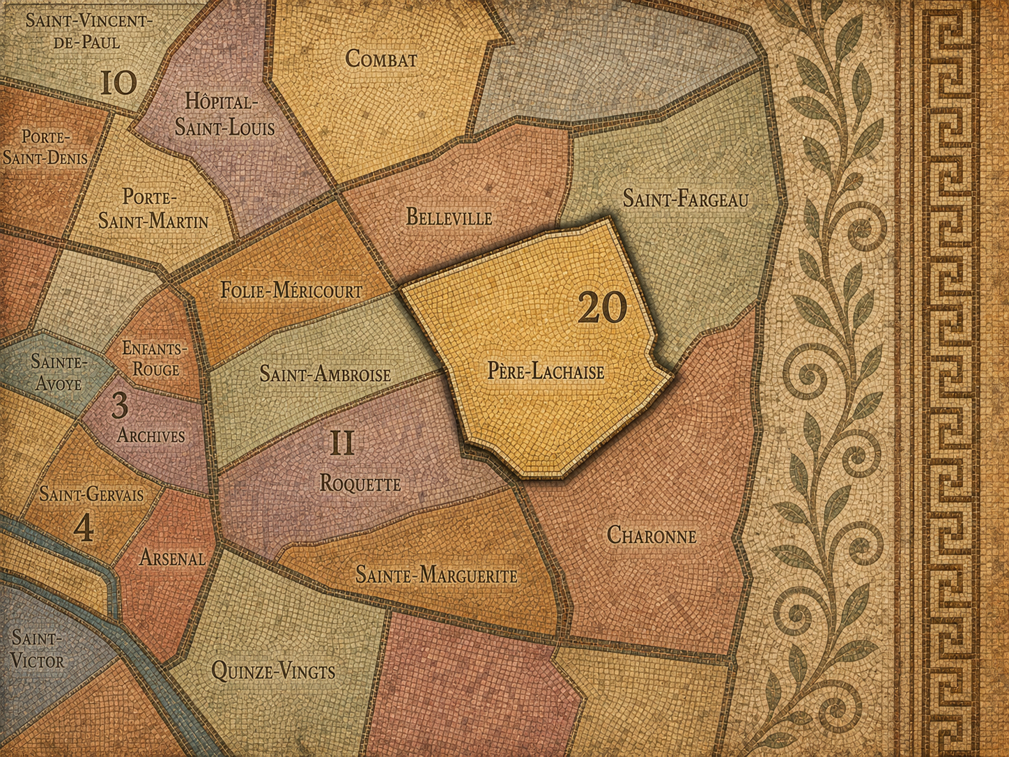
Within the official geography of Paris, Père-Lachaise is one of the four administrative quarters of the 20th arrondissement, alongside Belleville, Saint-Fargeau, and Charonne. It occupies the arrondissement’s southwestern sector, giving civic shape to the area around the cemetery, Gambetta, Philippe-Auguste, Père-Lachaise, Ménilmontant, Alexandre-Dumas, and the western approaches toward the 11th arrondissement.
As an administrative quarter, Père-Lachaise clarifies a district often described through nearby metro stations, cemetery entrances, or adjacent cultural names: Gambetta, Ménilmontant, Philippe-Auguste, Père-Lachaise cemetery, Charonne edge, or lower Belleville. These names each capture part of the area. Père-Lachaise is the official frame that gathers the cemetery, the surrounding residential streets, the memorial landscapes, the Commune history, and the western edge of the 20th into one mapped civic unit.
This civic frame is especially useful because the cemetery’s fame can overwhelm the neighborhood around it. Visitors may come to Père-Lachaise as a destination and leave without understanding the surrounding quarter as part of eastern Paris’s daily life. The administrative quarter restores that context. It shows that the cemetery is not floating apart from the city; it is embedded in the residential, political, and social geography of the 20th arrondissement.
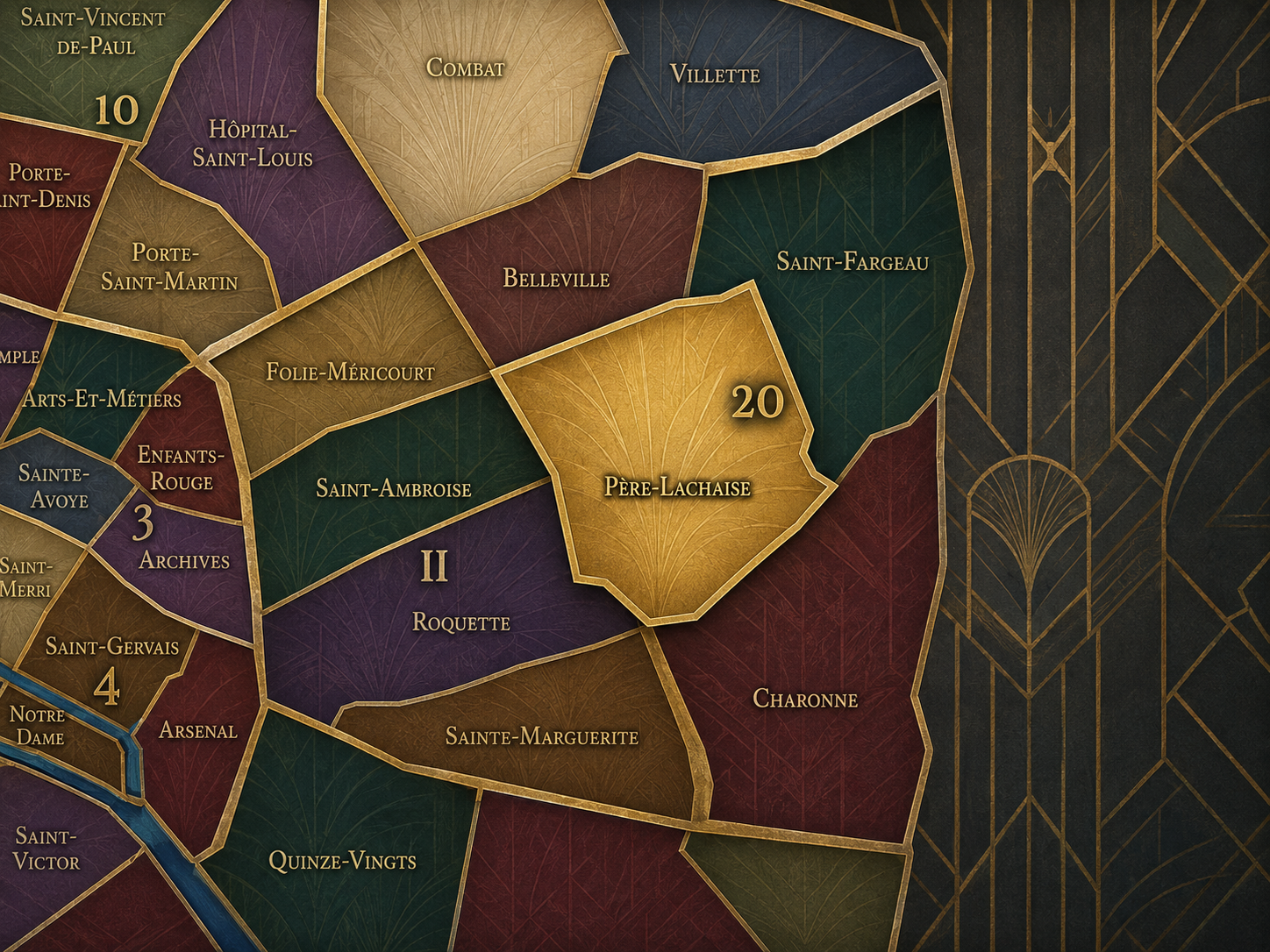
Civic Framework
Père-Lachaise differs from the other quarters of the 20th arrondissement through its cemetery-centered identity, its memorial depth, and its position between the popular slopes of Belleville / Ménilmontant and the old village geography of Charonne. Belleville is more overtly multicultural, hilltop, artistic, and politically alive in the street. Charonne is more village-rooted and southeastern, preserving the old parish and Saint-Blaise core. Saint-Fargeau is more northeastern and edge-oriented, tied to Télégraphe, outer boulevards, later residential development, and the heights toward Porte des Lilas.
Père-Lachaise is quieter in tone but heavier in symbolic meaning. Its distinction lies in the presence of the cemetery as a city within the city: lanes, divisions, monuments, chapels, family tombs, trees, cats, visitors, graves, memorials, and names from every layer of French and international culture. The City of Paris describes Père-Lachaise as having more than two centuries of history and as one of the great eastern cemeteries created beyond the dense center in the early 19th century.
It should also be distinguished from Ménilmontant. The cultural geography of Ménilmontant overlaps strongly with the quarter’s northern and western edges, especially around Boulevard de Ménilmontant and the slopes toward Belleville. But Père-Lachaise is the administrative quarter whose identity is anchored by burial, memory, and the cemetery wall. Ménilmontant is a broader cultural and slope identity; Père-Lachaise is the civic-memorial frame.
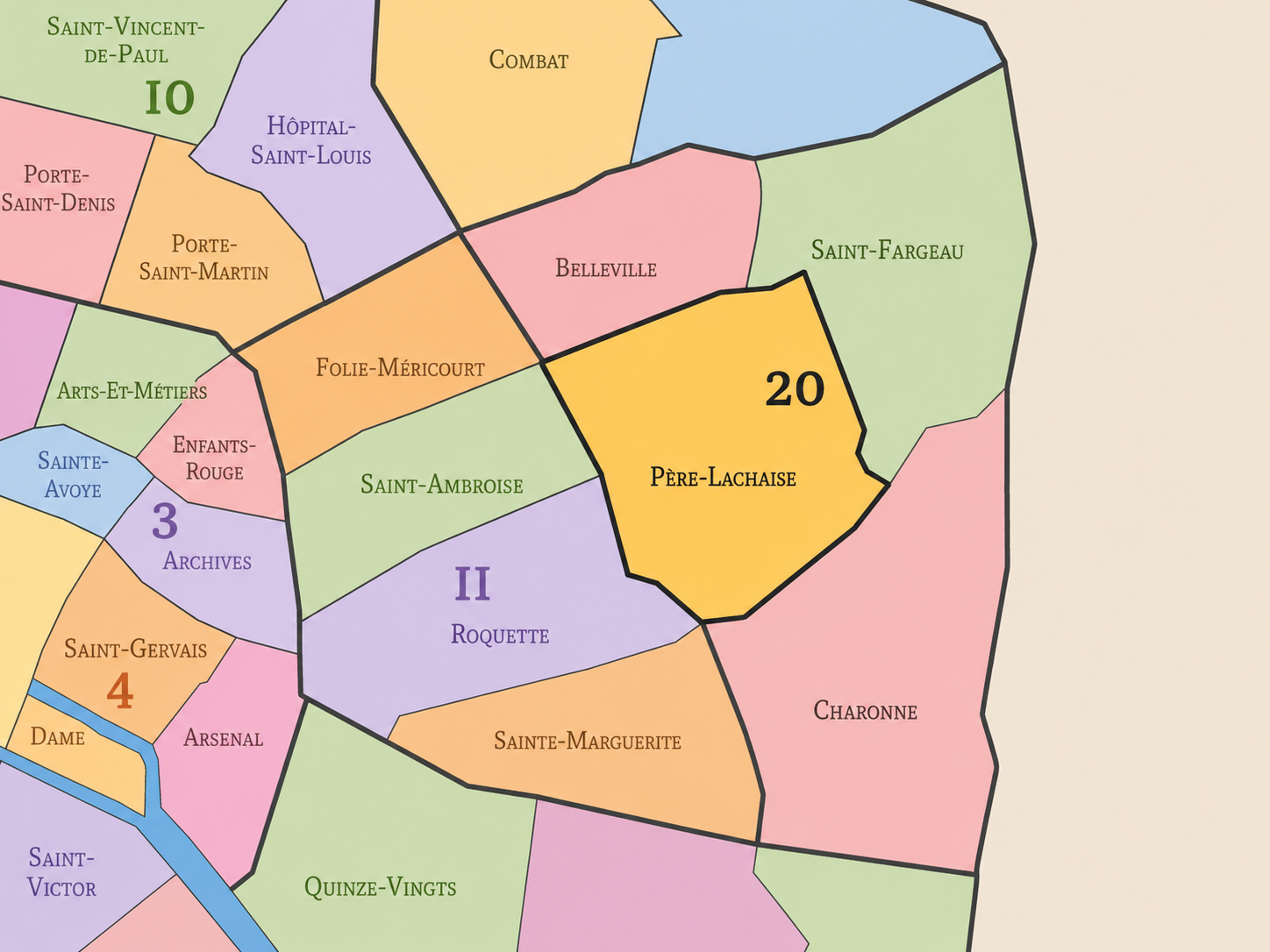
Neighborhood Distinction
Parisian Identity
Père-Lachaise expresses Paris as a city that remembers in public. Its cemetery is not merely a place of burial; it is a landscape where private grief, national culture, political memory, artistic pilgrimage, and urban walking all meet. Britannica notes that the cemetery was established in 1804 amid concerns over overcrowded burial grounds in the city, and that its name derives from Father François de La Chaise, Louis XIV’s confessor.
The quarter’s Parisian identity depends on this balance between intimacy and fame. A grave may belong to a family, an artist, a revolutionary, a writer, a musician, or an unknown person visited only by descendants. Yet together, these graves form a civic archive. Père-Lachaise is a museum without becoming only a museum, a park without being only a park, a cemetery that also functions as a map of cultural memory.
The cemetery also gives eastern Paris a counterweight to the monumental center. It is not a royal palace, not a grand boulevard, and not a triumphal arch. It is a democratic and uneven landscape of the dead: famous and obscure, ornate and modest, bourgeois and revolutionary, French and international. Père-Lachaise makes Paris’s memory walkable.
Neighborhood Connections
Every administrative quarter belongs to a wider Parisian fabric. These connections place Père-Lachaise within the city’s civic, participatory, and cultural geography:
-
20e-Ménilmontant
-

Amandiers - Ménilmontant • Gambetta • Réunion Père - Lachaise • Télégraphe - Pelleport - Saint-Fargeau - Fougères
The History
The origins of Père-Lachaise lie in the eastern heights beyond old Paris, where estates, religious properties, gardens, vineyards, and village landscapes stood outside the dense central city. Before the cemetery existed, the hill was associated with a Jesuit property and with the residence of Père François de La Chaise. This was not yet an urban quarter in the modern sense, but an outer landscape overlooking the growing capital.
The cemetery’s creation emerged from a larger transformation in burial practices. By the late 18th century, overcrowded churchyards and inner-city cemeteries had become major public-health concerns. The City of Paris explains that, in anticipation of the imperial decree on burials of June 12, 1804, Prefect Nicolas Frochot acquired the large rural property on January 10, 1804 to establish what became the eastern cemetery, or Père-Lachaise.
The quarter’s origin story is therefore one of movement outward. Paris pushed burial beyond the dense center, placing the dead on the eastern edge. What was once peripheral became central to the city’s memory. Père-Lachaise began as a hygienic and administrative solution, but became one of the capital’s most powerful symbolic landscapes.
Origins
16th–17th Century
In the 16th and 17th centuries, the future Père-Lachaise quarter lay outside the dense built fabric of Paris, within the eastern hill country connected to Charonne, Ménilmontant, Belleville, and the roads beyond the capital. The area was shaped by fields, vineyards, religious holdings, estates, gardens, and the practical landscape of the city’s outskirts.
The 17th century gave the site its most important pre-cemetery association through Père François de La Chaise, the Jesuit confessor to Louis XIV. His residence on the hill helped attach his name to the estate. This association would later become the cemetery’s name and, eventually, the administrative quarter’s name.
During this period, the area was still outside Paris in both atmosphere and administration. It did not yet carry the dense urban or memorial identity it would later acquire. But its elevation, estate landscape, and religious association prepared the ground for a later transformation into a place set apart from ordinary street life.
In the 18th century, the eastern outskirts of Paris became increasingly tied to the growing city while still retaining their village, garden, and estate character. The area around the future Père-Lachaise remained outside the dense core, but Paris’s expansion, public-health concerns, and changing ideas about burial began to alter the meaning of such peripheral landscapes.
The overcrowding of central cemeteries was one of the great urban problems of the period. Traditional burial grounds within the city had become dangerous, unsanitary, and insufficient for the growing population. This helped prepare the shift toward large cemeteries outside the old urban center, where burial could be organized more spaciously and hygienically.
By the end of the century, the future of the site was becoming clear. The former estate associated with Père de La Chaise stood on ground that could serve the modern city’s new burial needs. The eastern edge was about to become part of a new civic geography of death.
18th Century
19th Century
The 19th century created Père-Lachaise as one of Paris’s defining landscapes. The cemetery opened in 1804 as the eastern cemetery of Paris, one of the new burial grounds established outside the old dense center. The City of Paris identifies it as the first of the three major cemeteries planned at the gates of Paris, followed by Montparnasse in 1824 and Montmartre in 1825.
At first, Père-Lachaise was not immediately embraced by Parisians, partly because it felt distant from the city’s traditional burial places. Its reputation grew through landscaping, reburials, monuments, and the gradual transformation of the cemetery into a place of prestige. Over time, burial at Père-Lachaise became desirable, and the cemetery developed into a vast landscape of funerary art, social memory, and cultural pilgrimage.
The Paris Commune of 1871 gave the cemetery one of its most powerful political meanings. The Mur des Fédérés, where Communards were executed during the Bloody Week, made Père-Lachaise a site of working-class, revolutionary, and republican memory. The cemetery became not only a place of personal mourning, but a landscape of collective political remembrance.
In the early and mid 20th century, Père-Lachaise remained one of the great memorial landscapes of Paris while the surrounding quarter continued to function as a dense residential part of the 20th arrondissement. The cemetery drew mourners, visitors, writers, artists, political pilgrims, and curious walkers, while the streets around it supported ordinary eastern Paris life: apartments, shops, schools, cafés, workshops, florists, funeral businesses, and local commerce.
The two world wars added new layers of memory. Memorials to deportees, résistants, political victims, and wartime suffering joined the cemetery’s older layers of family tombs, artistic graves, and Commune memory. Père-Lachaise became a place where the 20th century’s catastrophes were added to the 19th century’s revolutionary grief and the private mourning of generations.
During this period, the quarter’s identity deepened as a place where the dead and the living shared urban space. The cemetery wall did not separate memory from the city; it placed memory in daily proximity to residents who passed its edges on their way to work, school, shops, or home.
Early–Mid 20th Century
Late 20th Century
In the late 20th century, Père-Lachaise became increasingly international as a site of cultural tourism and pilgrimage. Visitors came for the graves of writers, musicians, performers, political figures, and artists, turning the cemetery into one of Paris’s most visited nontraditional monuments. Its fame grew not only from French history, but from global cultural memory.
The City of Paris notes that in 1962 the oldest and most picturesque part of Père-Lachaise received protection as a classified site, recognizing the cemetery’s landscape and heritage value. This protection reflects the cemetery’s dual identity as burial ground and historic urban landscape. It is not only a collection of graves, but a designed environment of paths, trees, monuments, topography, and atmosphere.
The surrounding quarter also changed with the broader transformations of eastern Paris. Gentrification, demographic shifts, rising property values, and new cultural interest in the 20th arrondissement altered the streets around the cemetery. Yet Père-Lachaise retained a solemn gravitational force. The neighborhood could change, but the cemetery held the long memory of the place.
In the 21st century, Père-Lachaise remains one of the most powerful landscapes of memory in Paris. The cemetery continues to attract visitors from around the world while serving its original function as a place of burial, mourning, and remembrance. The City of Paris describes it as a “conservatoire de l’art funéraire,” preserving a wide variety of tomb types, architectural styles, materials, and funerary techniques across more than two centuries of continuous use.
Today, the quarter’s identity is shaped by the relationship between global fame and local life. Tourists move through cemetery paths searching for famous graves. Residents live around its walls, shop nearby, wait for buses, meet friends, and pass the gates as part of daily routine. Florists, funeral services, cafés, bookshops, and neighborhood businesses all participate in the cemetery’s urban ecosystem.
For CityNeighborhoods: Paris, Père-Lachaise is essential because it shows how an administrative quarter can be defined by memory without becoming only a monument. It is cemetery and neighborhood, pilgrimage site and residential district, political memorial and everyday place. It reveals the 20th arrondissement not only as popular eastern Paris, but as one of the great archives of the city’s dead.
21st Century
Spirit and Legacy
Père-Lachaise is the quarter where Paris learns to walk with its dead. Its spirit is solemn, green, literary, political, and intimate. It belongs to cemetery walls and sloping paths, to family tombs and famous graves, to Communards and musicians, to florists and apartment windows, to the quiet daily coexistence of mourning and neighborhood life.
Its legacy is the transformation of an eastern estate into a civic landscape of memory. A hill outside Paris became a cemetery. A cemetery became a pantheon of artists, workers, revolutionaries, families, strangers, and international figures. A burial ground became one of the city’s most meaningful public archives.
To walk Père-Lachaise is to encounter Paris as remembrance made spatial. The quarter reminds us that cities are not only built for the living. They are also built from grief, gratitude, fame, anonymity, politics, art, and the long desire to leave a name somewhere in stone. In Père-Lachaise, neighborhood identity becomes memory under trees — the city holding its dead close enough that daily life must pass beside them.
The Photography
The arrondissements do not share a single visual identity. Instead, they organize Paris into twenty broad visual fields, each gathering its own combination of landmarks, streetscapes, institutions, residential districts, commercial corridors, parks, rail stations, markets, cemeteries, and riverfront edges.
Some arrondissements are defined by monumental scale: royal palaces, ceremonial avenues, government buildings, museums, formal gardens, and internationally recognized landmarks. Others are shaped by hills, canals, rail gateways, apartment-lined boulevards, neighborhood markets, former village streets, industrial remnants, parks, or the quieter rhythms of residential Paris. The arrondissement system gives these varied landscapes a civic frame, allowing the city to be read not as one visual language, but as a sequence of overlapping Parisian atmospheres.

Visual Identity
Through The Lens
Photographing the arrondissements means moving between the official map and the street-level experience. The camera does not treat each arrondissement as visually uniform. Instead, it looks for the recurring forms, textures, transitions, and contrasts that make each district legible: the geometry of boulevards, the shade of plane trees, the repetition of balconies, the rise of stairways, the curve of canals, the presence of rail stations, the opening of parks, the weight of monuments, and the intimacy of side streets.
On CityNeighborhoods, the arrondissement provides the frame, but the photograph comes from the encounter between map, movement, light, and observation. As the Paris photography is processed, this section will connect each arrondissement more directly to the project’s Photographic Lexicon: the visual strategies, recurring motifs, and compositional patterns that shape how the city is seen through the lens.

If you visit Paris, these ideas can help inspire your own photography.



Paris: J’Espere, Je Rêve, Je Vive
Paris Photo Gallery
Paris Field Notes
-
Field Note: August 18, 2025 | 07:58 AM
Conditions: 73°F | Humidity: 72%.
Within the park's interior, the glacial kettle ponds acted as humidity traps, creating a soft, hazy light that filtered through the old-growth oaks. The transition from the park's dense shade to the sun-drenched edges of Oakland Gardens highlighted the day's exceptional "picture-perfect" clarity.
There is a fleeting window in Queens where the humidity of August hasn't yet heavy-set, and the morning sun hits the canopy of Alley Pond Park at a perfect oblique angle. Arriving just before 8:00 AM, I watched the light break through the oaks and tulip trees, casting long, dramatic shadows across the wet grass. It’s in these quiet, golden moments that the park feels less like a city escape and more like the ancient glacial valley it actually is.
Other neighborhoods visited:











































































































Explore Paris
-

The twenty arrondissements form the civic spiral of Paris, organizing the city into its broad local districts of government, identity, and daily life.
-

Each arrondissement is divided into four official administrative quarters, giving Paris a more precise civic and geographic framework.
-

The conseils de quartier bring participation to street level, giving residents a voice in neighborhood needs, public space, and local civic life.
-

Les Deux Rives trace Paris through the Seine’s two banks, revealing how the Rive Droite and Rive Gauche shaped the city’s civic power, commerce, learning, art, and cultural identity.
-

Cultural neighborhoods reveal the Paris people recognize through history, cafés, architecture, memory, atmosphere, and local belonging.