
20e - SAINT-FARGEAU
Quartiers Administratifs
Part of an ongoing project to walk and photograph every neighborhood in Paris, this page 20e - Saint-Fargeau through maps, district identity, history, and photography.




The Map
Download the Paris Arrondissements Map
Geographic Setting
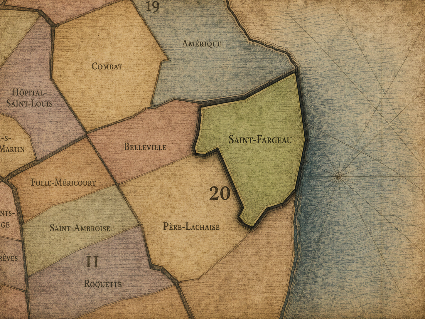
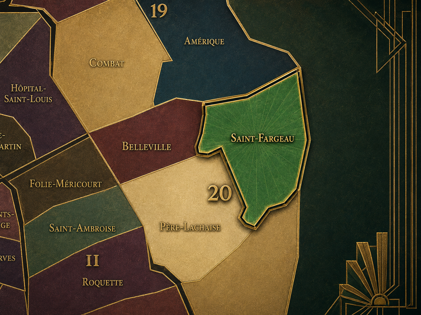
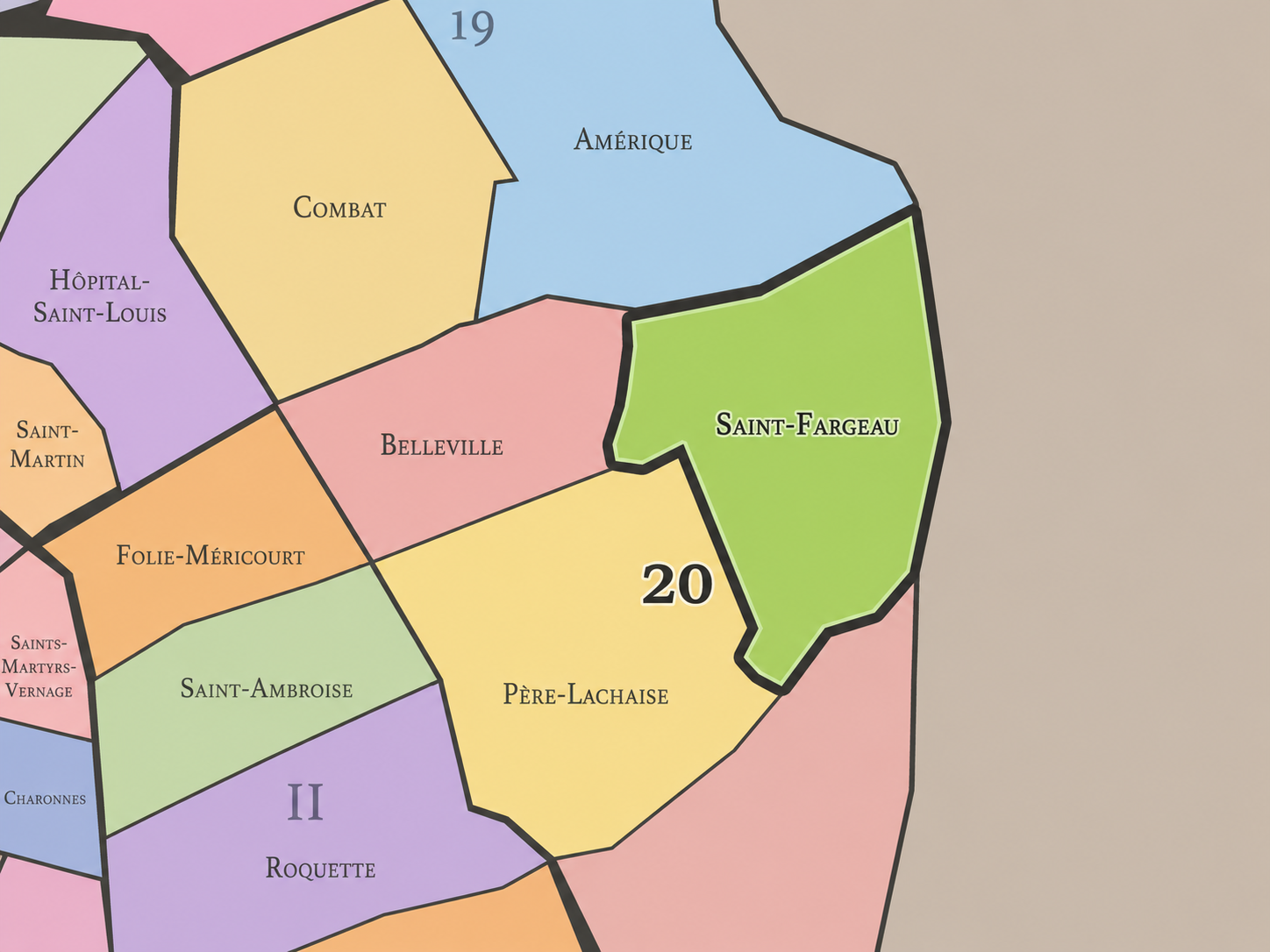
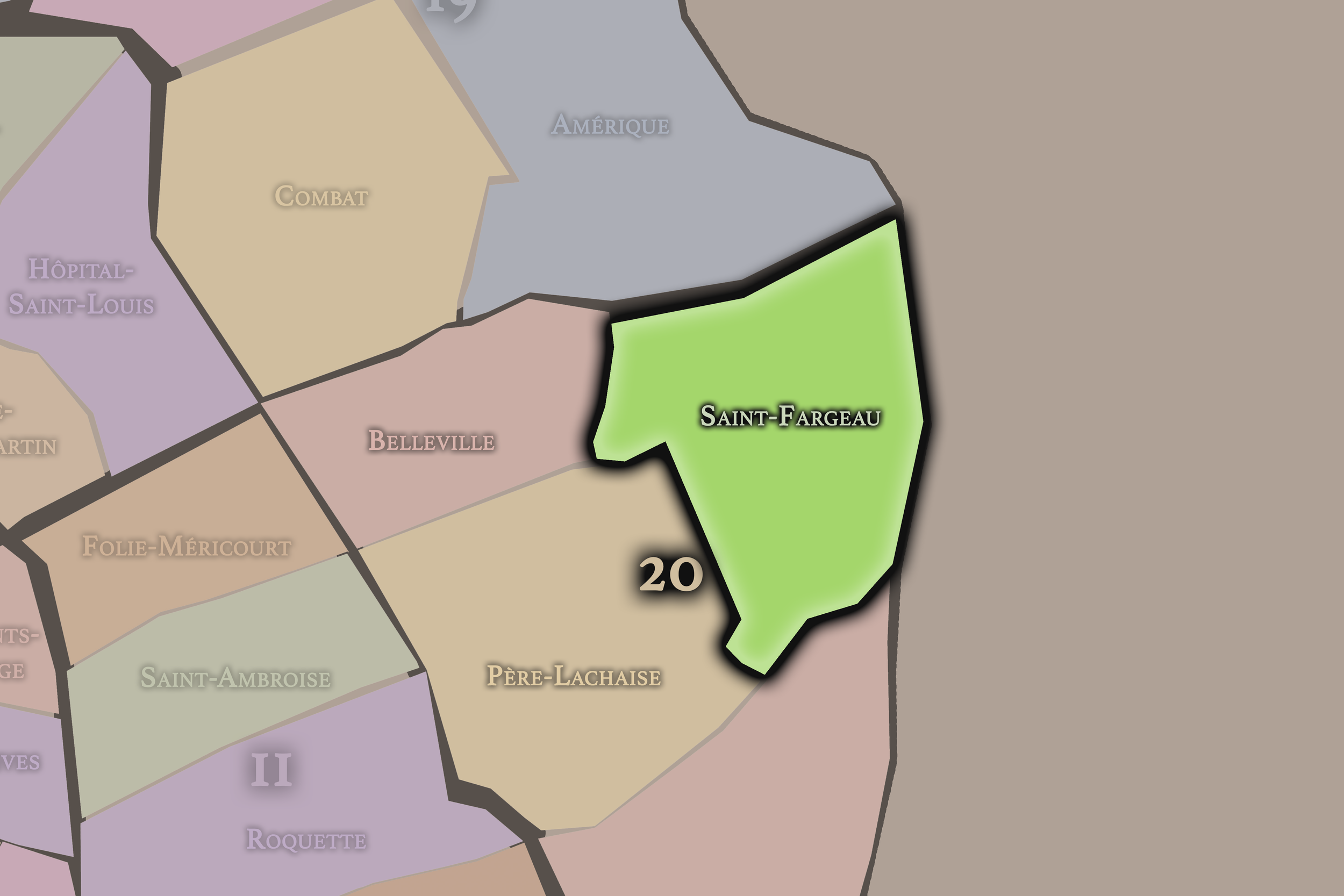
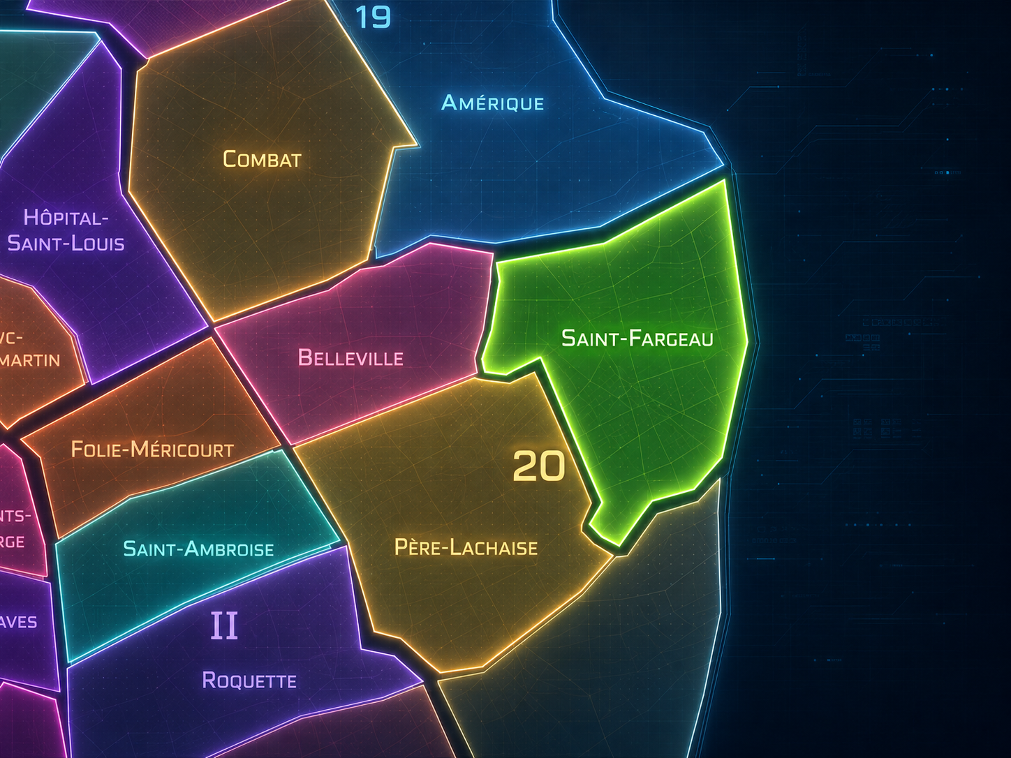
Saint-Fargeau occupies the northeastern portion of the 20th arrondissement, where the eastern heights of Paris rise between Belleville, Père-Lachaise, Charonne, Porte des Lilas, Porte de Bagnolet, and the boundary with Les Lilas and Bagnolet. It lies east of Belleville, northeast of Père-Lachaise, north of Charonne, and along one of the capital’s most residential and topographically varied eastern edges. It is the 20th arrondissement at its quieter, higher, more tucked-away register: a quarter of slopes, reservoirs, apartment blocks, hidden villas, schools, public housing, local shops, and the outer boulevards that mark Paris’s transition toward the suburbs.
The quarter’s geography is shaped by Rue Pelleport, Rue du Surmelin, Rue Haxo, Rue Saint-Fargeau, Rue du Borrégo, Rue des Tourelles, Rue de Belleville, Avenue Gambetta, Boulevard Mortier, Porte des Lilas, Porte de Bagnolet, and the elevated residential landscapes around Télégraphe and Pelleport. Sources describe Saint-Fargeau as the 78th administrative quarter of Paris, forming a triangular area between the mairie of the 20th at Place Gambetta, Porte des Lilas, and Porte de Bagnolet.
Unlike Belleville, whose identity is hilltop, multicultural, artistic, and politically expressive, or Charonne, whose character is rooted in old village streets and the southeastern edge, Saint-Fargeau is more residential, elevated, and understated. It is the 20th arrondissement as upper eastern Paris: less mythologized, less touristic, and less immediately legible, but deeply revealing of how the city absorbed old estates, village land, industrial pockets, reservoirs, and modern housing into one lived quarter.
Administrative Quarter Identity
Etymology and Origins
The name Saint-Fargeau comes from the Saint-Fargeau family name associated with the former Château de Ménilmontant and its estate. The mairie of the 20th notes that the former Château de Ménilmontant was once the residence of the comtes de Saint-Fargeau, and that the only remaining vestige of the château is its portal at 6 bis Rue Saint-Fargeau. It also identifies several present streets — including Haxo, Saint-Fargeau, du Borrégo, du Télégraphe, parts of Rue de Belleville, Rue de Romainville, and Rue des Tourelles — as former allées of the château’s park.
This gives the quarter a name rooted in estate memory rather than in village core, church, market, or gate. Saint-Fargeau is not simply a saintly or devotional name in this Parisian context. It is a family and property name carried into the map through the remnants of an aristocratic landscape that once occupied part of the eastern heights. Beneath the modern residential quarter is the memory of a château, a park, and the ordered paths of a private domain.
The name is therefore quieter than Belleville or Charonne, but not less historical. It points to a vanished landscape: an estate absorbed into streets, housing, reservoirs, and public life. Saint-Fargeau’s identity begins with disappearance as much as survival — a château largely gone, a portal remaining, allées turned into streets, and a former private geography translated into the civic fabric of Paris.
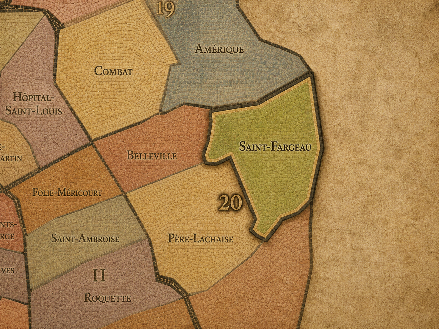
Within the official geography of Paris, Saint-Fargeau is one of the four administrative quarters of the 20th arrondissement, alongside Belleville, Père-Lachaise, and Charonne. It occupies the arrondissement’s northeastern sector, giving civic shape to the area between Gambetta, Télégraphe, Pelleport, Porte des Lilas, Porte de Bagnolet, and the suburb-facing eastern edge of the capital.
As an administrative quarter, Saint-Fargeau clarifies a district often described through more localized or transit-oriented names: Pelleport, Télégraphe, Saint-Fargeau, Porte des Lilas, Porte de Bagnolet, Gambetta edge, or the upper 20th. These names each capture one part of the district. Saint-Fargeau is the official frame that gathers them into one civic unit, linking estate memory, former Charonne territory, residential streets, hidden passages, reservoirs, public housing, and the outer boulevards.
This civic frame is especially useful because Saint-Fargeau is less widely known than the other quarters of the 20th. Belleville has a powerful cultural identity; Père-Lachaise has international fame; Charonne has a visible old village core. Saint-Fargeau is subtler. Its official quarter name helps make visible a part of eastern Paris whose identity is dispersed across slopes, streets, hidden villas, and residential continuity.
Civic Framework
Saint-Fargeau differs from the other quarters of the 20th arrondissement through its elevated residential character, its estate and infrastructure layers, and its position along the northeastern edge of Paris. Belleville is more multicultural, artistic, street-intensive, and politically resonant, with a cultural geography that spills into the 19th arrondissement. Père-Lachaise is more memorial and cemetery-centered, organized around the great burial landscape and the streets around Gambetta and Philippe-Auguste. Charonne is more village-rooted and southeastern, preserving the old parish and Saint-Blaise core while facing toward Montreuil and Bagnolet.
Saint-Fargeau is less centered on a single monument or cultural myth. Its distinction lies in its topographic and residential texture: sloping streets, quiet pockets, public housing, older villas, green passages, local schools, and the sense of being high in the eastern city without the more famous identity of Belleville. The mairie of the 20th has highlighted the “voies secrètes” of Saint-Fargeau — lesser-known green and peaceful streets that reveal a hidden residential landscape within the quarter.
It should also be distinguished from Ménilmontant and Télégraphe. Ménilmontant is a broader cultural and historical landscape crossing parts of the 20th, associated with slopes, water, working-class memory, and popular eastern Paris. Télégraphe is a powerful local high-point and transit identity. Saint-Fargeau is the official administrative quarter that includes and frames some of these layers, but its identity is broader than either single name.
Neighborhood Distinction
Parisian Identity
Saint-Fargeau expresses Paris as a city of hidden heights. It does not announce itself through a grand monument, global tourist destination, or instantly recognizable cultural brand. Instead, it shows how eastern Paris becomes meaningful through slope, street, housing, quiet passages, old property lines, public infrastructure, and the layered transformation of former outer land into urban home.
The quarter’s Parisian identity is deeply residential. It belongs to the Paris of school commutes, apartment courtyards, local bakeries, neighborhood cafés, métro entrances, stair-steep errands, municipal services, and the ordinary routines that give the city continuity beyond spectacle. It is one of the places where the 20th arrondissement feels most like lived elevation: above the center, facing the suburbs, but still fully Parisian.
Saint-Fargeau also reveals the city’s less visible infrastructures of growth. The surrounding heights of Belleville and Ménilmontant were historically important for water collection and reservoirs, while the quarter’s later industrial and technological history includes the arrival of Bull, whose 1931 headquarters made the company one of the major employers in the arrondissement. The mairie’s history of the 20th notes that Saint-Fargeau was less industrialized than the rest of the arrondissement, but still hosted Bull’s headquarters in 1931.
Neighborhood Connections
Every administrative quarter belongs to a wider Parisian fabric. These connections place Saint-Fargeau within the city’s civic, participatory, and cultural geography:
-
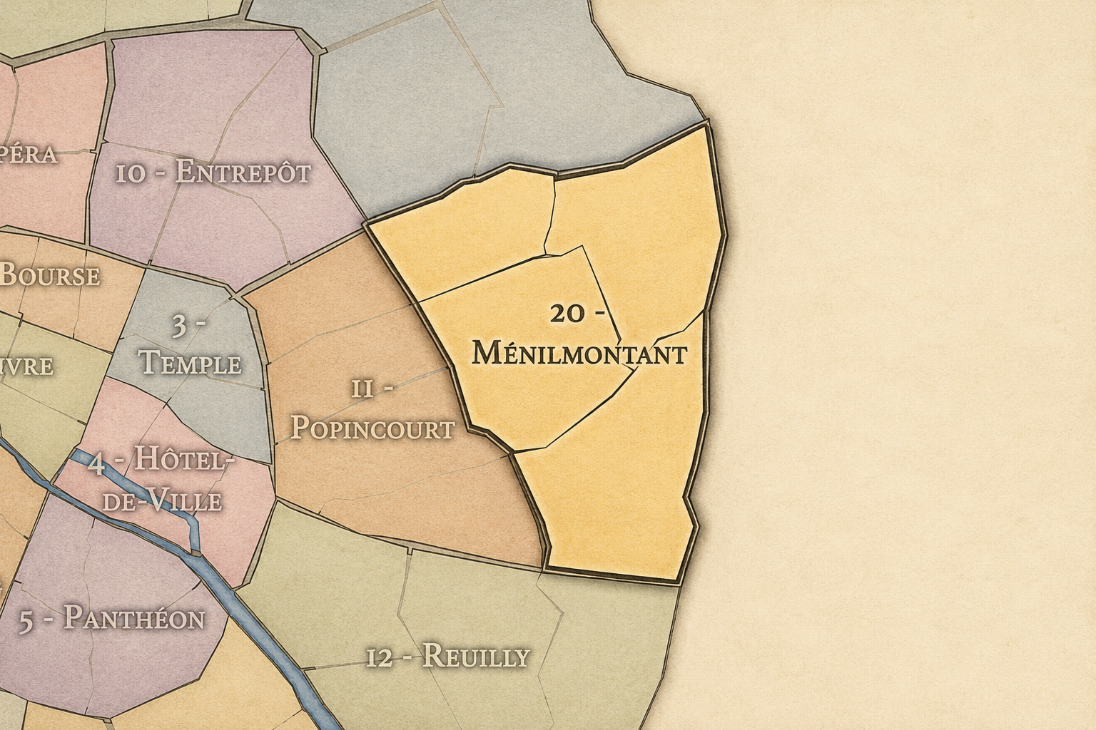
20e-Ménilmontant
-

Belleville • Gambetta • Télégraphe - Pelleport - Saint-Fargeau - Fougères
The History
The origins of Saint-Fargeau lie in the eastern heights beyond old Paris, in territory connected to the former villages and communes of Charonne, Belleville, and Ménilmontant. Before the modern 20th arrondissement existed, this landscape was shaped by slopes, fields, vineyards, estates, quarries, water systems, roads toward Romainville and Bagnolet, and the outer settlements that formed a ring around the capital.
The area’s history is especially tied to the former territory of Charonne. A recent mairie article identifies streets in Saint-Fargeau, including Rue du Capitaine-Marchal, Rue Étienne-Marey, and Rue de la Dhuis, as lying on the old territory of the commune of Charonne, which was annexed to Paris in 1860. This places Saint-Fargeau within the same broader pre-annexation eastern village geography as Charonne, even though the modern quarter’s name comes from the Saint-Fargeau estate layer.
Its origin story is therefore not singular. Saint-Fargeau is part Charonne, part Ménilmontant estate memory, part Belleville / eastern heights infrastructure, and part modern residential Paris. It is a quarter made from overlays rather than one simple founding center.
Origins
16th–17th Century
In the 16th and 17th centuries, the future Saint-Fargeau quarter lay outside the dense urban fabric of Paris. It belonged to the eastern high ground beyond the city, connected to Charonne, Belleville, Ménilmontant, Romainville, Bagnolet, and the surrounding countryside. The landscape was shaped by fields, vineyards, roads, religious lands, estates, water sources, and the rural or semi-rural life of the city’s outer belt.
This distance from the center gave the area a different identity from the older Parisian quarters. It was not built around medieval density or royal urban display. It served the city from the outside: through land, water, agriculture, roads, and later extraction and infrastructure. Its height mattered, both physically and practically.
By the end of the 17th century, Paris’s growth was increasingly drawing these eastern landscapes into its orbit. The future Saint-Fargeau remained outside the capital, but its roads, estates, and water systems were already part of the larger life of the city.
In the 18th century, the eastern heights around Saint-Fargeau became more closely tied to Paris while still preserving their outer-village and estate character. The Château de Ménilmontant and its park formed one important layer of this landscape, organizing parts of the area through private allées, property boundaries, and elite residence.
At the same time, the broader territory remained connected to Charonne and the working eastern outskirts. Fields, vineyards, gardens, quarries, water sources, and local roads continued to shape the land. Saint-Fargeau’s later identity would grow from the tension between these different uses: aristocratic estate, village territory, useful infrastructure, and modest outer settlement.
The French Revolution transformed property relations, aristocratic holdings, and the civic organization of the villages surrounding Paris. The Saint-Fargeau name itself carries a revolutionary resonance through Louis-Michel Le Peletier de Saint-Fargeau, the aristocrat and Convention deputy who voted for the death of Louis XVI and was assassinated in 1793. In the local quarter, however, the most important legacy is spatial: the estate landscape gradually giving way to streets and public urban form.
18th Century
19th Century
The 19th century transformed Saint-Fargeau from outer land into Parisian quarter. In 1860, Paris annexed surrounding communes including Charonne and Belleville, creating the modern 20th arrondissement. Saint-Fargeau’s territory was drawn into the capital through this larger incorporation of the eastern villages and outskirts.
Urbanization followed unevenly. Former estate lands, old roads, quarry edges, water systems, and village territories were gradually converted into streets, housing, public facilities, and civic infrastructure. The mairie’s discussion of hidden Saint-Fargeau streets notes that some paths preserve memories of quarry land and old localities, including the former open-air gypsum quarry of Père Roussel at the time Charonne was annexed to Paris in 1860.
This century established Saint-Fargeau as part of eastern Paris, but not in the same way as the denser, more immediately urban quarters closer to Belleville or Père-Lachaise. It remained more peripheral, higher, and less industrialized than some neighboring areas. Its modern identity developed through gradual absorption rather than one dramatic urban center.
In the early and mid 20th century, Saint-Fargeau became more clearly residential while retaining pockets of industry, infrastructure, and institutional life. Apartment buildings, schools, public facilities, local shops, religious buildings, and transit stations gave the quarter a stronger urban structure, while its elevation and eastern-edge position continued to distinguish it from the lower, denser streets of central Paris.
The arrival of the Compagnie des Machines Bull headquarters in 1931 added an important technological and industrial layer. The mairie of the 20th describes Saint-Fargeau as less industrialized than other parts of the arrondissement, but notes that Bull became the first employer of the 20th arrondissement. This makes Saint-Fargeau part of a less expected history: eastern Paris not only as working-class housing and old villages, but also as a site of modern technical enterprise.
During the wars, occupation, liberation, and postwar reconstruction, Saint-Fargeau shared the experiences of residential eastern Paris: scarcity, endurance, rebuilding, demographic change, and the expansion of municipal services. Its story in this period is one of ordinary streets and essential continuity rather than spectacle.
Early–Mid 20th Century
Late 20th Century
Saint-Fargeau is the quarter where eastern Paris keeps its quieter heights. Its spirit is residential, sloped, hidden, and quietly persistent. It belongs to château allées turned into streets, to Charonne’s old territory, to Télégraphe’s rise and Pelleport’s local life, to public housing and green passages, to outer boulevards and the eastern horizon beyond Paris.
Its legacy is the transformation of estate, village, and edge into neighborhood. A château disappeared, but left its name and portal. A former park became streets. Charonne’s old ground became part of the 20th. Industrial and technological pockets gave way to a mostly residential quarter. Through each change, Saint-Fargeau remained a place of layers rather than spectacle.
To walk Saint-Fargeau is to encounter Paris in a quieter key. The quarter does not announce itself like Belleville, memorialize itself like Père-Lachaise, or preserve a village heart as visibly as Charonne. It asks to be read through slopes, street names, hidden passages, and the calm routines of residential life at the city’s edge. In Saint-Fargeau, neighborhood identity becomes elevation and trace — the eastern heights of Paris remembering what has vanished while continuing, steadily, as home.
In the 21st century, Père-Lachaise remains one of the most powerful landscapes of memory in Paris. The cemetery continues to attract visitors from around the world while serving its original function as a place of burial, mourning, and remembrance. The City of Paris describes it as a “conservatoire de l’art funéraire,” preserving a wide variety of tomb types, architectural styles, materials, and funerary techniques across more than two centuries of continuous use.
Today, the quarter’s identity is shaped by the relationship between global fame and local life. Tourists move through cemetery paths searching for famous graves. Residents live around its walls, shop nearby, wait for buses, meet friends, and pass the gates as part of daily routine. Florists, funeral services, cafés, bookshops, and neighborhood businesses all participate in the cemetery’s urban ecosystem.
For CityNeighborhoods: Paris, Père-Lachaise is essential because it shows how an administrative quarter can be defined by memory without becoming only a monument. It is cemetery and neighborhood, pilgrimage site and residential district, political memorial and everyday place. It reveals the 20th arrondissement not only as popular eastern Paris, but as one of the great archives of the city’s dead.
21st Century
Spirit and Legacy
Père-Lachaise is the quarter where Paris learns to walk with its dead. Its spirit is solemn, green, literary, political, and intimate. It belongs to cemetery walls and sloping paths, to family tombs and famous graves, to Communards and musicians, to florists and apartment windows, to the quiet daily coexistence of mourning and neighborhood life.
Its legacy is the transformation of an eastern estate into a civic landscape of memory. A hill outside Paris became a cemetery. A cemetery became a pantheon of artists, workers, revolutionaries, families, strangers, and international figures. A burial ground became one of the city’s most meaningful public archives.
To walk Père-Lachaise is to encounter Paris as remembrance made spatial. The quarter reminds us that cities are not only built for the living. They are also built from grief, gratitude, fame, anonymity, politics, art, and the long desire to leave a name somewhere in stone. In Père-Lachaise, neighborhood identity becomes memory under trees — the city holding its dead close enough that daily life must pass beside them.
The Photography
The arrondissements do not share a single visual identity. Instead, they organize Paris into twenty broad visual fields, each gathering its own combination of landmarks, streetscapes, institutions, residential districts, commercial corridors, parks, rail stations, markets, cemeteries, and riverfront edges.
Some arrondissements are defined by monumental scale: royal palaces, ceremonial avenues, government buildings, museums, formal gardens, and internationally recognized landmarks. Others are shaped by hills, canals, rail gateways, apartment-lined boulevards, neighborhood markets, former village streets, industrial remnants, parks, or the quieter rhythms of residential Paris. The arrondissement system gives these varied landscapes a civic frame, allowing the city to be read not as one visual language, but as a sequence of overlapping Parisian atmospheres.

Visual Identity
Through The Lens
Photographing the arrondissements means moving between the official map and the street-level experience. The camera does not treat each arrondissement as visually uniform. Instead, it looks for the recurring forms, textures, transitions, and contrasts that make each district legible: the geometry of boulevards, the shade of plane trees, the repetition of balconies, the rise of stairways, the curve of canals, the presence of rail stations, the opening of parks, the weight of monuments, and the intimacy of side streets.
On CityNeighborhoods, the arrondissement provides the frame, but the photograph comes from the encounter between map, movement, light, and observation. As the Paris photography is processed, this section will connect each arrondissement more directly to the project’s Photographic Lexicon: the visual strategies, recurring motifs, and compositional patterns that shape how the city is seen through the lens.

If you visit Paris, these ideas can help inspire your own photography.



Paris: J’Espere, Je Rêve, Je Vive
Paris Photo Gallery
Paris Field Notes
-
Field Note: August 18, 2025 | 07:58 AM
Conditions: 73°F | Humidity: 72%.
Within the park's interior, the glacial kettle ponds acted as humidity traps, creating a soft, hazy light that filtered through the old-growth oaks. The transition from the park's dense shade to the sun-drenched edges of Oakland Gardens highlighted the day's exceptional "picture-perfect" clarity.
There is a fleeting window in Queens where the humidity of August hasn't yet heavy-set, and the morning sun hits the canopy of Alley Pond Park at a perfect oblique angle. Arriving just before 8:00 AM, I watched the light break through the oaks and tulip trees, casting long, dramatic shadows across the wet grass. It’s in these quiet, golden moments that the park feels less like a city escape and more like the ancient glacial valley it actually is.
Other neighborhoods visited:











































































































Explore Paris
-

The twenty arrondissements form the civic spiral of Paris, organizing the city into its broad local districts of government, identity, and daily life.
-

Each arrondissement is divided into four official administrative quarters, giving Paris a more precise civic and geographic framework.
-

The conseils de quartier bring participation to street level, giving residents a voice in neighborhood needs, public space, and local civic life.
-

Les Deux Rives trace Paris through the Seine’s two banks, revealing how the Rive Droite and Rive Gauche shaped the city’s civic power, commerce, learning, art, and cultural identity.
-

Cultural neighborhoods reveal the Paris people recognize through history, cafés, architecture, memory, atmosphere, and local belonging.