
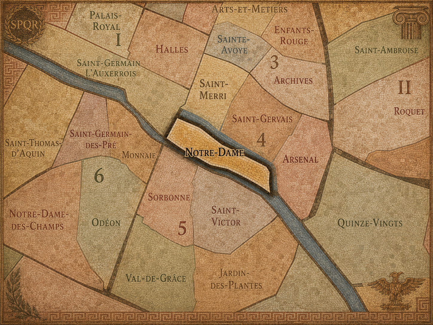
4e - NOTRE-DAME
Quartiers Administratifs
Part of an ongoing project to walk and photograph every neighborhood in Paris, this page explores the Administrative Quarter: 4e - Notre-Dame through maps, district identity, history, and photography.




The Map
Download the Paris Arrondissements Map
Geographic Setting
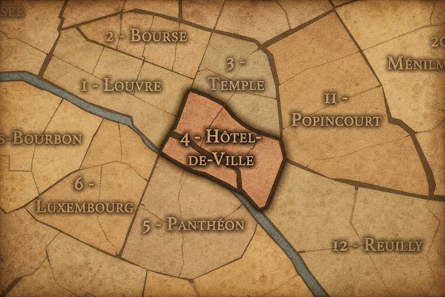
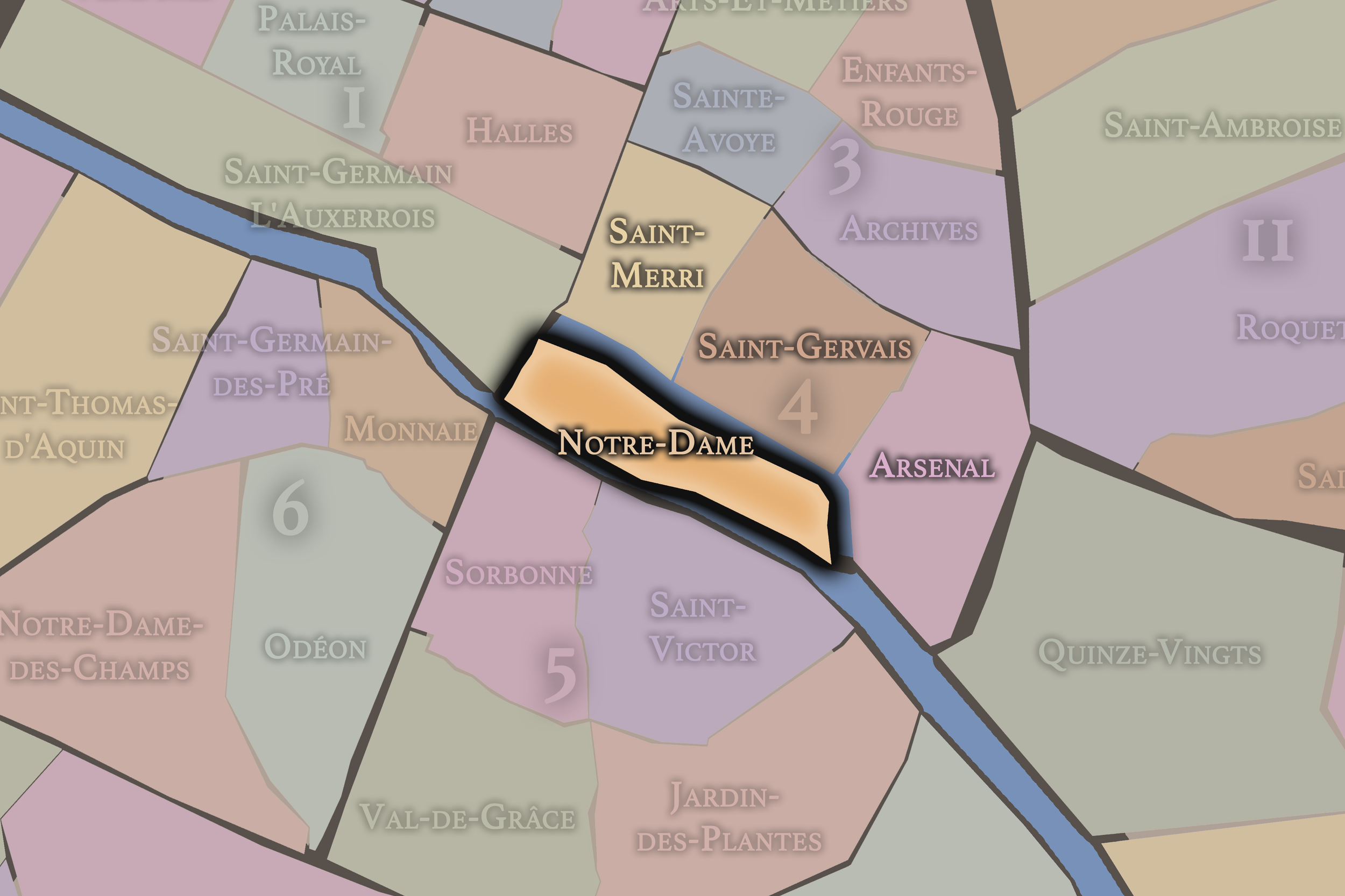
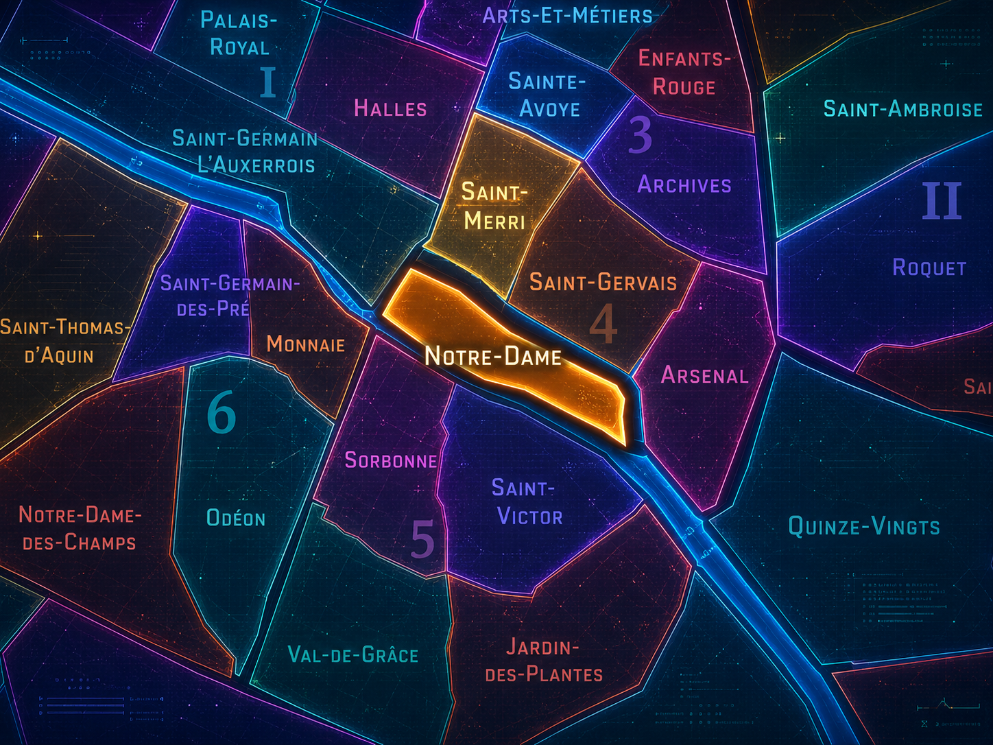
Notre-Dame occupies the island heart of Paris, gathering the Île de la Cité and Île Saint-Louis into one of the city’s most concentrated landscapes of origin, monument, river, law, faith, and memory. Set within the 4th arrondissement, the quarter stands between the Right Bank and Left Bank, between the older civic worlds of Hôtel de Ville and the Latin Quarter, and between the Seine’s two arms as they divide and rejoin around the islands. Few administrative quarters in Paris are so geographically distinct, or so symbolically charged.
Its defining landmarks include Notre-Dame Cathedral, the parvis before the cathedral, the Hôtel-Dieu, the Palais de Justice, the Sainte-Chapelle, the Conciergerie, the Pont Neuf, the Pont Saint-Louis, the island quays, and the ordered residential streets of Île Saint-Louis. The quarter is both open and enclosed: open to the river, bridges, and long views across the Seine; enclosed by island edges, stone embankments, narrow streets, and the sense of being set apart from the surrounding city.
Unlike Saint-Gervais and Saint-Merri, whose identities are rooted in the old Right Bank, or Arsenal, which looks toward Bastille and the eastern edge of Paris Centre, Notre-Dame is island Paris. It is the place where the city seems to gather itself before spreading outward. Its geography makes the quarter feel foundational: not simply central, but originary.
Administrative Quarter Identity
Etymology and Origins
The name Notre-Dame comes from Notre-Dame de Paris, the cathedral dedicated to Our Lady, the Virgin Mary. The cathedral gives the quarter its name and its most visible symbol, but the name reaches beyond the building itself. “Notre-Dame” has come to stand for a sacred, civic, literary, architectural, and emotional image of Paris. It is a church name, but also a city name in miniature.
As an administrative quarter, Notre-Dame is named for the cathedral, yet its identity includes much more than the cathedral precinct. It encompasses the broader island landscape of the Île de la Cité and Île Saint-Louis: royal and judicial memory, hospital history, bridge construction, riverfront life, medieval streets, 17th-century residences, and some of the most photographed views in Paris.
The name therefore carries a productive tension. Notre-Dame is specific enough to identify a cathedral, but expansive enough to evoke the spiritual and historical center of the city. It gives the quarter an identity that is both devotional and civic — a name rooted in religion, but enlarged by centuries of urban memory.
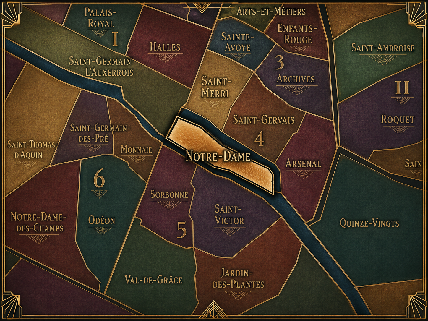
Within the official geography of Paris, Notre-Dame is one of the four administrative quarters of the 4th arrondissement, alongside Saint-Merri, Saint-Gervais, and Arsenal. It occupies the island portion of the arrondissement and belongs to Paris Centre, the municipal structure that now gathers the 1st, 2nd, 3rd, and 4th arrondissements into a shared local governance framework.
As an administrative quarter, Notre-Dame gives formal civic shape to the island core of the city. This is important because the Île de la Cité and Île Saint-Louis are often understood through their own names, or through individual monuments, rather than through the official quarter structure. The administrative name gathers those island geographies into one mapped civic unit.
The quarter also sits at the meeting point of several Parisian systems. It is part of the 4th arrondissement, but it touches the 1st across the western bridges, the 5th across the Left Bank, and the Right Bank civic world around Hôtel de Ville. It is official neighborhood, historic core, cathedral landscape, judicial district, hospital quarter, and river island all at once.
Civic Framework
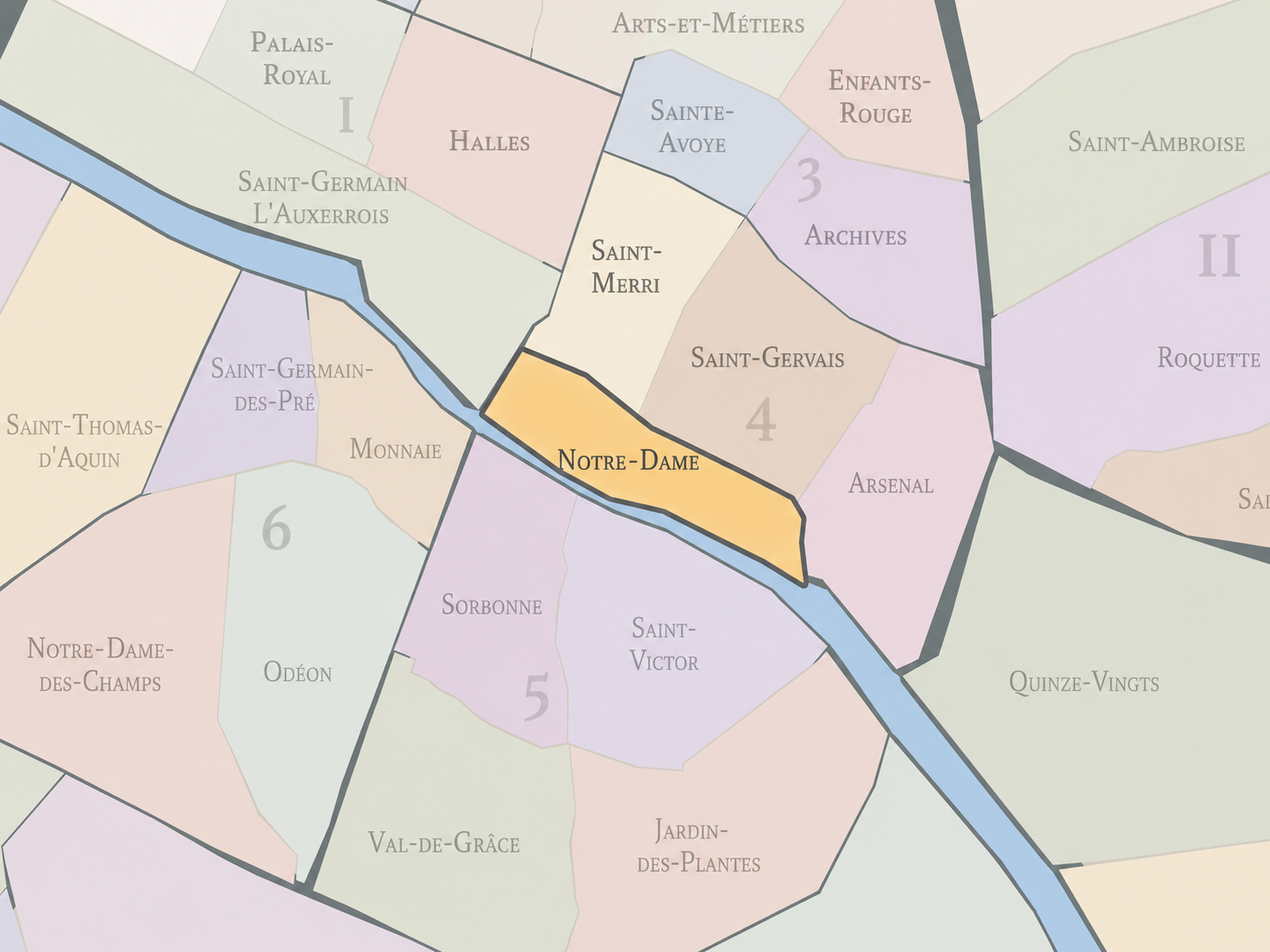
Notre-Dame differs from the other quarters of the 4th arrondissement through its island geography and its foundational symbolic weight. Saint-Merri is shaped by Beaubourg, church streets, and the modern cultural energy around the Centre Pompidou. Saint-Gervais carries the old Right Bank fabric of the Marais, Hôtel de Ville, Jewish history, and parish memory. Arsenal is defined by the Bastille threshold, the former royal arsenal, the basin, and the eastern edge of Paris Centre.
Notre-Dame stands apart because it is not merely a quarter within the city. It is the city’s historic center made visible through islands, cathedral, palace, court, hospital, and river. Its identity is not neighborhood-like in the ordinary sense. It is too ceremonial, too visited, too mythologized, and too central to be understood only through everyday local life.
Yet that does not make it less of a neighborhood. It makes it a different kind of neighborhood: one shaped by institutions, pilgrimage, tourism, law, residence, memory, and the constant crossing of bridges. Notre-Dame is both inhabited and monumental, both local and global, both civic quarter and symbolic origin point.
Neighborhood Distinction
Parisian Identity
Notre-Dame expresses Paris as a city of origin and endurance. The quarter holds some of the city’s oldest urban memory, yet it continues to live in the present through worship, tourism, law, residence, restoration, photography, public gathering, and daily movement across the Seine. It is a place where Paris’s identity is repeatedly renewed through return: people come back to the cathedral, back to the river, back to the bridges, back to the islands.
The quarter also reveals how Paris turns geography into myth. The Île de la Cité is not only a piece of land in the Seine; it is a symbolic birthplace. Notre-Dame is not only a cathedral; it is a national and global emblem. The Pont Neuf is not only a bridge; it is a statement about public space and urban connection. Île Saint-Louis is not only a residential island; it is an image of contained urban elegance.
This is one of the quarter’s great powers. It transforms infrastructure and architecture into memory. Bridges become thresholds. Quays become promenades. Towers become silhouettes. Stone becomes identity. In Notre-Dame, Paris does not merely display its history. It lets history organize the experience of place.
Neighborhood Connections
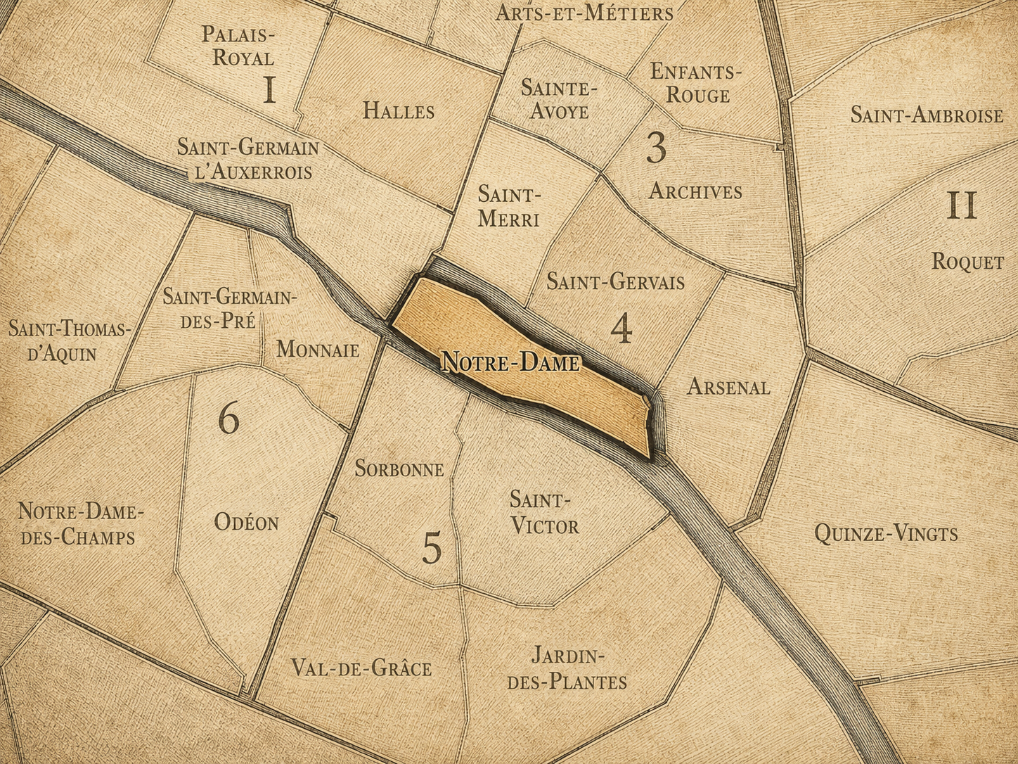
Every administrative quarter belongs to a wider Parisian fabric. These connections place Notre-Dame within the city’s civic, participatory, and cultural geography:
-
4e - Hôtel-de-Ville
-

Seine
The History
The origins of Notre-Dame reach back to the earliest urban life of Paris. The Île de la Cité was the ancient and medieval heart of the city, a defensible island in the Seine from which Paris developed outward toward the Right Bank and Left Bank. Long before the modern administrative quarter existed, this island was a center of settlement, power, worship, and exchange.
In Roman and early medieval Paris, the island held strategic and civic importance. Over time, it became the seat of royal, religious, and judicial authority. Churches, palaces, bridges, streets, markets, and institutions gathered there, making the island not simply the geographic center of Paris, but the organizing core from which the city’s larger identity expanded.
The quarter’s origins are therefore inseparable from the origins of Paris itself. Other neighborhoods preserve former villages, markets, aristocratic estates, or industrial landscapes. Notre-Dame preserves the central island from which the city learned to become a capital.
Origins
16th–17th Century
In the 16th and 17th centuries, Notre-Dame remained one of the great institutional centers of Paris. The cathedral continued to dominate the eastern Île de la Cité, while the western part of the island retained its association with royal and judicial power through the Palais de la Cité, the Sainte-Chapelle, the Conciergerie, and the developing structures of law and administration.
This period also strengthened the quarter’s role as a space of connection. Bridges across the Seine were essential to the city’s life, and the Pont Neuf, completed in the early 17th century, became one of Paris’s defining urban inventions. Unlike older bridges lined with houses, the Pont Neuf opened the river view and turned the bridge itself into a public stage. It connected the island to both banks while also changing how Parisians experienced the Seine.
The 17th century also saw the development of Île Saint-Louis as an elegant residential island. Where the Île de la Cité carried the older weight of cathedral, court, and civic origin, Île Saint-Louis became a carefully planned landscape of townhouses, quays, and restrained urban refinement. Together, the two islands gave the quarter a dual identity: ancient and composed, institutional and residential, sacred and urban.
In the 18th century, Notre-Dame continued to hold major religious, legal, and civic functions, but the meaning of the quarter was shifting within a changing capital. The cathedral remained central to Catholic life and ceremonial Paris, while the island’s judicial and administrative institutions maintained their importance. The surrounding streets, bridges, hospitals, and quays sustained the everyday movement of the city.
At the same time, Enlightenment Paris and the pressures of modern urban life changed how old institutions were understood. Medieval fabric, crowded streets, religious authority, and royal justice all came under new forms of scrutiny. The Île de la Cité was revered as ancient, but also increasingly seen as dense, irregular, and in need of improvement.
The French Revolution transformed the symbolic order of the quarter. Religious institutions were challenged, sacred spaces were repurposed or reinterpreted, and royal and judicial symbols were drawn into the revolutionary remaking of Paris. Notre-Dame itself became part of this upheaval, as the old relationship between church, monarchy, and city was broken and reconfigured.
18th Century
19th Century
The 19th century dramatically reshaped Notre-Dame’s public image. The cathedral, damaged by revolution and time, became a major focus of restoration, preservation, and national imagination. Victor Hugo’s Notre-Dame de Paris, published in 1831, helped turn attention back to the medieval monument and the threatened historic fabric of the city. The cathedral became not only a religious building, but a literary and architectural symbol of France’s medieval inheritance.
The restoration led by Eugène Viollet-le-Duc and Jean-Baptiste Lassus transformed the cathedral’s 19th-century appearance, including the famous spire that would later become one of its defining silhouettes. This was preservation as interpretation: the medieval cathedral was restored through 19th-century ideas of Gothic unity, national heritage, and architectural imagination.
The broader quarter also changed under modernization. Haussmann-era interventions cleared and reorganized parts of the Île de la Cité, widening approaches, creating new perspectives, and altering the dense medieval fabric around the cathedral and judicial institutions. Notre-Dame became more visible, more isolated, and more monumental. The city gained dramatic views, but lost much of the older neighborhood fabric that had once pressed closely around the cathedral.
In the early and mid 20th century, Notre-Dame stood as one of the great symbolic quarters of Paris: a place of worship, tourism, national ceremony, legal authority, and visual memory. The cathedral and the surrounding islands were central to how Paris presented itself to the world, while Île Saint-Louis retained a more residential and quietly elegant atmosphere.
The quarter lived through the upheavals of war, occupation, liberation, and postwar recovery as both a real urban district and a symbolic landscape. The cathedral, bridges, quays, and island streets served as images of continuity during a century often marked by rupture. Notre-Dame’s silhouette across the Seine became one of the visual assurances that Paris endured.
Yet the quarter was not only symbol. The Palais de Justice, Hôtel-Dieu, police and administrative functions, churches, residences, shops, and tourist routes all continued to make the islands part of the working city. The challenge of Notre-Dame has always been this balance: a place of global image that must still function as a local and civic landscape.
Early–Mid 20th Century
Late 20th Century
In the late 20th century, Notre-Dame became increasingly shaped by mass tourism, heritage culture, photography, and the growing global visibility of Paris as a historic city. The cathedral drew millions of visitors, while the quays and bridges surrounding the islands became some of the most photographed and walked spaces in the capital.
This period also brought a deeper appreciation for the quarter’s layered urban form. The islands were no longer understood only through the cathedral. Île Saint-Louis, the Sainte-Chapelle, the Conciergerie, the Pont Neuf, the riverbanks, and the older traces of the Palais de la Cité all contributed to the quarter’s image as a dense archive of Parisian history.
At the same time, the pressures of preservation, security, tourism, and institutional use intensified. Notre-Dame had to accommodate worshippers, residents, officials, commuters, visitors, and the global imagination. It became one of the clearest examples of a Parisian neighborhood whose meaning far exceeded its physical scale.
In the 21st century, Notre-Dame entered a new chapter after the fire of April 2019, which severely damaged the cathedral and destroyed Viollet-le-Duc’s 19th-century spire. The fire became a global moment of shock and mourning, revealing how deeply the cathedral lived not only in Parisian memory, but in the imagination of people far beyond France. The restoration that followed has made the quarter once again a place where questions of heritage, craftsmanship, national identity, and public emotion converge.
The cathedral’s reopening and restoration process have renewed attention to the quarter as a living heritage landscape. Notre-Dame today is not simply a monument recovered from disaster; it is a reminder that even the most iconic places remain vulnerable, maintained, repaired, and reinterpreted. The work of restoring stone, timber, glass, metal, and liturgical space has returned the cathedral to the world not as a static relic, but as an active site of care.
Beyond the cathedral, the quarter continues to hold the full complexity of island Paris. The Île de la Cité remains a civic and judicial center. Île Saint-Louis remains one of the city’s most refined residential landscapes. The bridges and quays continue to gather walkers, photographers, worshippers, lawyers, police, tourists, residents, and the endless movement of the city around the Seine.
For CityNeighborhoods: Paris, Notre-Dame is essential because it shows how an administrative quarter can hold myth and daily life at once. It is origin point, cathedral quarter, legal district, residential island, global symbol, and neighborhood of passage. It is one of the places where Paris is most obviously itself — and therefore one of the places where it must be read most carefully.
21st Century
Spirit and Legacy
Notre-Dame is the quarter where Paris remembers its beginning. Its spirit is riverine, sacred, civic, and enduring. It is carried in cathedral stone, island quays, bridge arches, palace walls, chapel glass, hospital memory, judicial corridors, and the quiet streets of Île Saint-Louis. Here, the city feels both ancient and continuously renewed.
Its legacy lies in concentration. Few quarters hold so many forms of Parisian identity in such a small geography: ancient settlement, medieval cathedral, royal palace, Sainte-Chapelle, law courts, hospital, bridge, residential island, literary myth, restoration, and global memory. Notre-Dame is not just a place of monuments. It is a place where monuments speak to one another across the river and across time.
To walk Notre-Dame is to move through the city’s central grammar. Island, bridge, cathedral, court, quay, and river form a composition that has shaped Paris for centuries. In this quarter, neighborhood identity becomes origin story — not because the city ended here, but because from here, Paris began to unfold.
The Photography
The arrondissements do not share a single visual identity. Instead, they organize Paris into twenty broad visual fields, each gathering its own combination of landmarks, streetscapes, institutions, residential districts, commercial corridors, parks, rail stations, markets, cemeteries, and riverfront edges.
Some arrondissements are defined by monumental scale: royal palaces, ceremonial avenues, government buildings, museums, formal gardens, and internationally recognized landmarks. Others are shaped by hills, canals, rail gateways, apartment-lined boulevards, neighborhood markets, former village streets, industrial remnants, parks, or the quieter rhythms of residential Paris. The arrondissement system gives these varied landscapes a civic frame, allowing the city to be read not as one visual language, but as a sequence of overlapping Parisian atmospheres.

Visual Identity
Through The Lens
Photographing the arrondissements means moving between the official map and the street-level experience. The camera does not treat each arrondissement as visually uniform. Instead, it looks for the recurring forms, textures, transitions, and contrasts that make each district legible: the geometry of boulevards, the shade of plane trees, the repetition of balconies, the rise of stairways, the curve of canals, the presence of rail stations, the opening of parks, the weight of monuments, and the intimacy of side streets.
On CityNeighborhoods, the arrondissement provides the frame, but the photograph comes from the encounter between map, movement, light, and observation. As the Paris photography is processed, this section will connect each arrondissement more directly to the project’s Photographic Lexicon: the visual strategies, recurring motifs, and compositional patterns that shape how the city is seen through the lens.

If you visit Paris, these ideas can help inspire your own photography.



Paris: J’Espere, Je Rêve, Je Vive
Paris Photo Gallery
Paris Field Notes
-
Field Note: August 18, 2025 | 07:58 AM
Conditions: 73°F | Humidity: 72%.
Within the park's interior, the glacial kettle ponds acted as humidity traps, creating a soft, hazy light that filtered through the old-growth oaks. The transition from the park's dense shade to the sun-drenched edges of Oakland Gardens highlighted the day's exceptional "picture-perfect" clarity.
There is a fleeting window in Queens where the humidity of August hasn't yet heavy-set, and the morning sun hits the canopy of Alley Pond Park at a perfect oblique angle. Arriving just before 8:00 AM, I watched the light break through the oaks and tulip trees, casting long, dramatic shadows across the wet grass. It’s in these quiet, golden moments that the park feels less like a city escape and more like the ancient glacial valley it actually is.
Other neighborhoods visited:











































































































Explore Paris
-

The twenty arrondissements form the civic spiral of Paris, organizing the city into its broad local districts of government, identity, and daily life.
-

Each arrondissement is divided into four official administrative quarters, giving Paris a more precise civic and geographic framework.
-

The conseils de quartier bring participation to street level, giving residents a voice in neighborhood needs, public space, and local civic life.
-

Les Deux Rives trace Paris through the Seine’s two banks, revealing how the Rive Droite and Rive Gauche shaped the city’s civic power, commerce, learning, art, and cultural identity.
-

Cultural neighborhoods reveal the Paris people recognize through history, cafés, architecture, memory, atmosphere, and local belonging.