
4e - SAINT-MERRI
Quartiers Administratifs
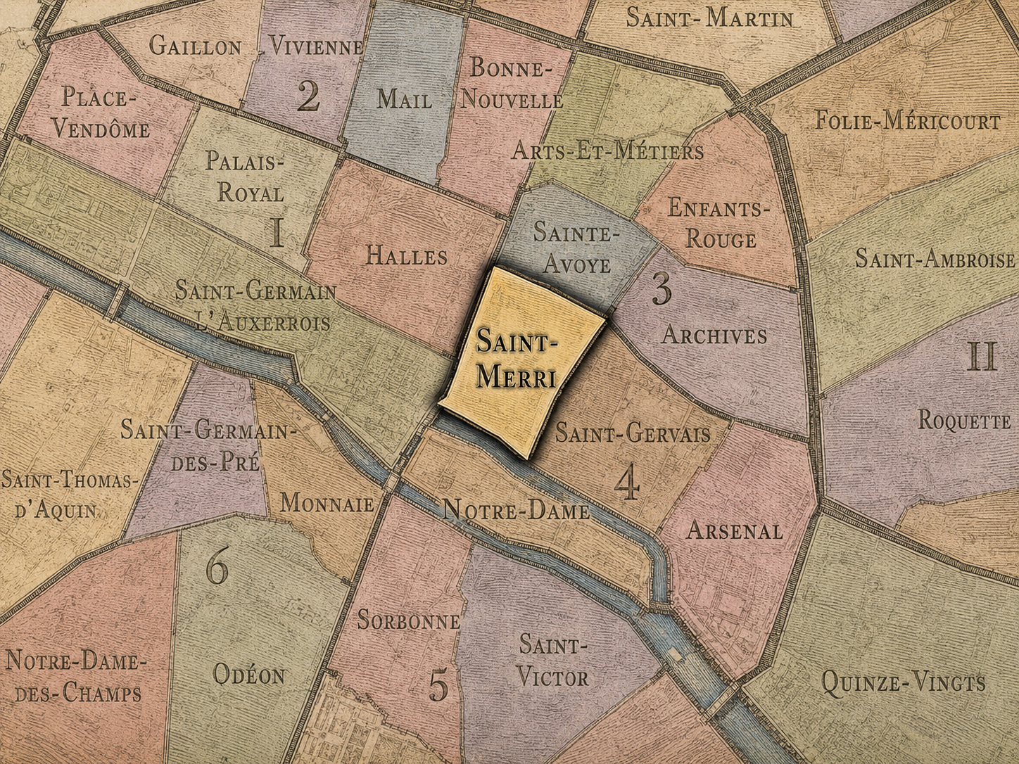
Part of an ongoing project to walk and photograph every neighborhood in Paris, this page explores the Administrative Quarter: 4e - Saint-Merri through maps, district identity, history, and photography.




The Map
Download the Paris Arrondissements Map
Geographic Setting
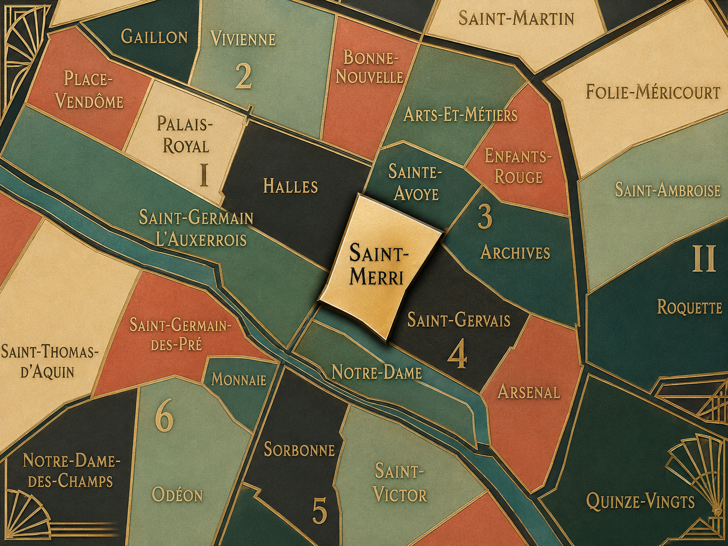
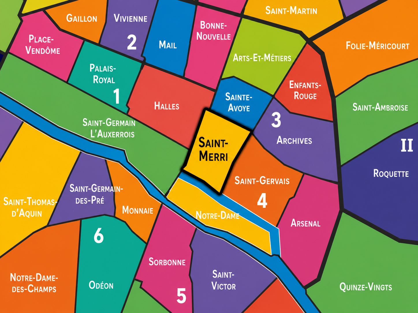
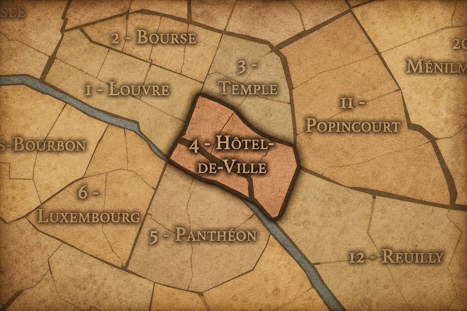
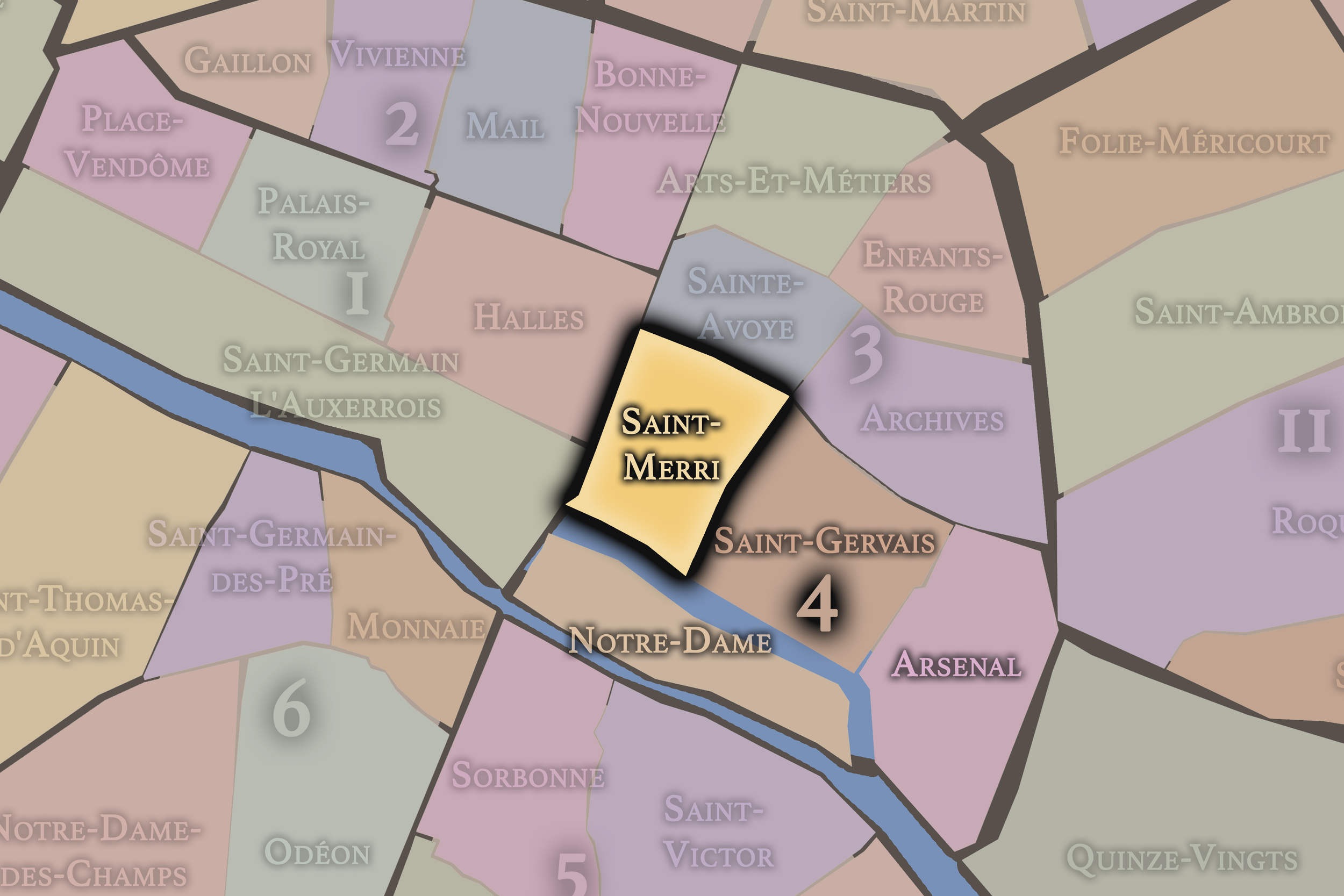
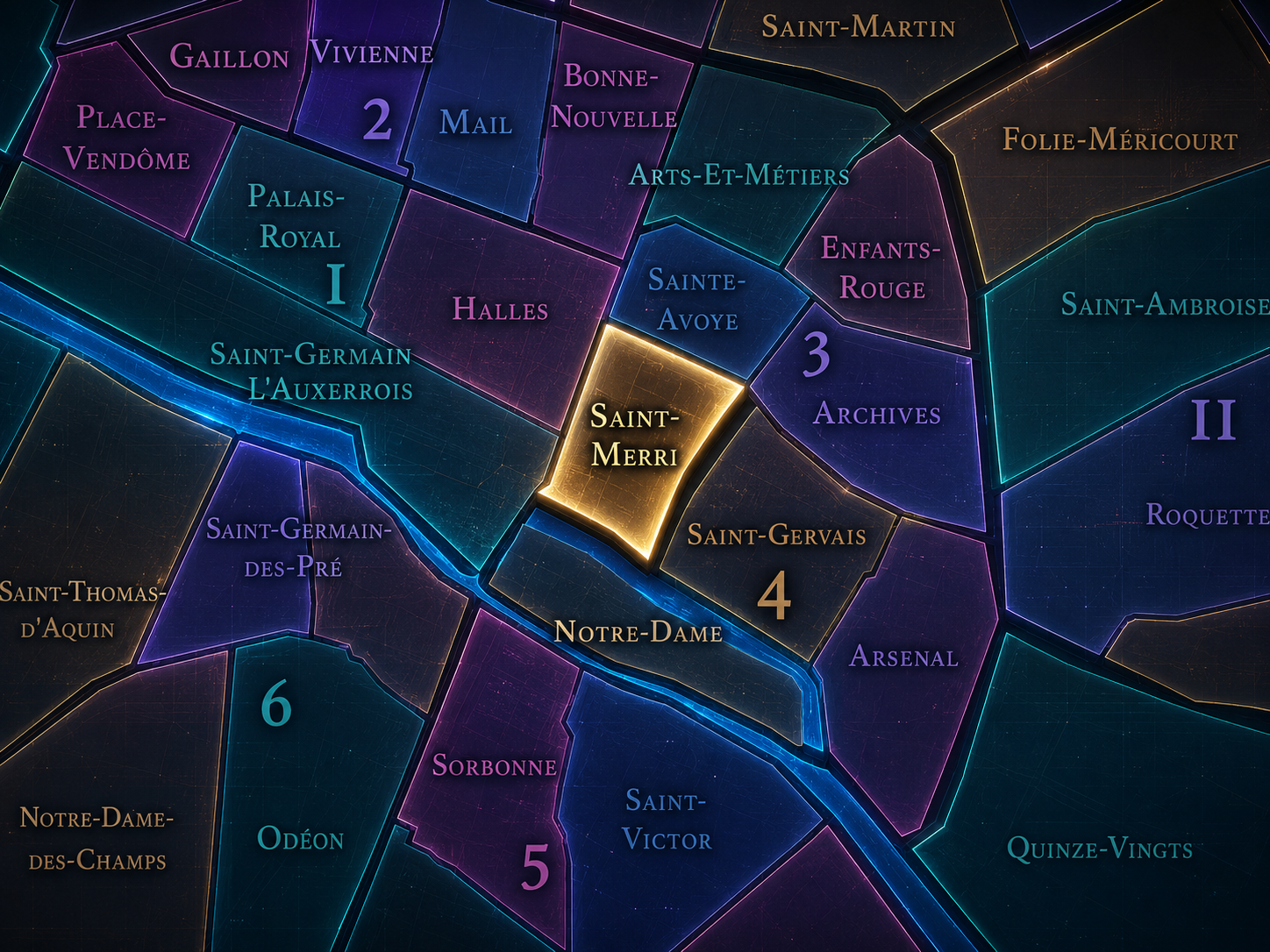
Saint-Merri occupies the northwestern portion of the 4th arrondissement, where the old Right Bank meets Beaubourg, Châtelet, Les Halles, the Marais, and the cultural shock of the Centre Pompidou. It sits between Saint-Gervais to the east, the 1st arrondissement’s Halles quarter to the west, the Seine and Hôtel de Ville landscape to the south, and Sainte-Avoye / Arts-et-Métiers in the 3rd arrondissement to the north. Within Paris Centre, it is one of the city’s most compact but forceful quarters: a place where medieval streets, church history, modern art, public squares, pedestrian corridors, and redevelopment memory press tightly against one another.
Its defining landmarks include the Church of Saint-Merri, the Centre Pompidou, the Plateau Beaubourg, Rue Saint-Martin, Rue du Renard, Rue de la Verrerie, Rue Quincampoix, and the streets leading toward Châtelet and Les Halles. The quarter’s geography is neither purely Marais nor purely Halles, neither strictly medieval nor strictly modern. It is a zone of collision and exchange: the old commercial city meeting the late-20th-century cultural machine, the parish street meeting the open plaza, the narrow Right Bank fabric meeting exposed pipes, escalators, galleries, and public spectacle.
Unlike Notre-Dame, whose island geography gives it a powerful symbolic enclosure, or Arsenal, whose edges open toward Bastille and the basin, Saint-Merri is intensely urban and interstitial. It is a quarter of proximity — to transit, culture, commerce, church, crowds, and the historic center’s constant reinvention.
Administrative Quarter Identity
Etymology and Origins
The name Saint-Merri comes from the Church of Saint-Merri, also commonly rendered Saint-Merry, dedicated to Saint Mederic, an 8th-century abbot whose name evolved in Parisian usage. The church stands near Rue Saint-Martin, close to the Centre Pompidou, and gives the administrative quarter its religious and historical anchor. The form “Merri” belongs to the place-name tradition of Paris, while “Merry” often appears in references to the church; both point back to the same saintly dedication.
This spelling variation is part of the quarter’s character. The official quarter name preserves Saint-Merri, while the church is often called Église Saint-Merri in French and Church of Saint-Merry in English. The shift between Merri and Merry reflects linguistic transmission, local usage, and the way saints’ names change as they pass through centuries of speech, writing, and urban memory.
The name itself gives the quarter a sacred origin beneath its contemporary cultural identity. Today, many visitors associate this area first with the Centre Pompidou or Beaubourg. But the administrative name reminds us that before the exposed steel and glass of modern art, before the plaza and the museum crowds, the neighborhood was organized by parish, street, and church. Saint-Merri is the older name beneath Beaubourg’s modern image.
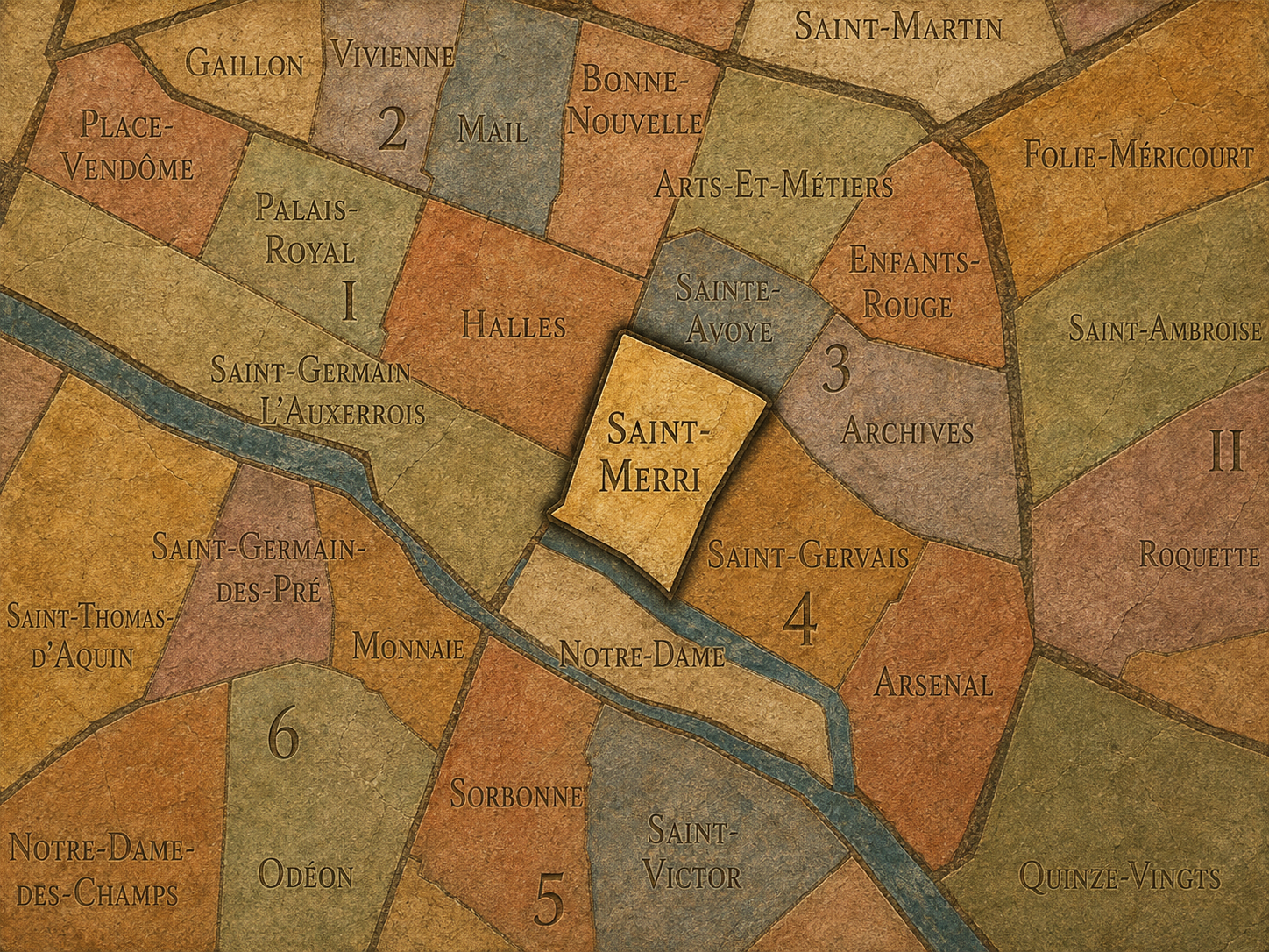
Within the official geography of Paris, Saint-Merri is one of the four administrative quarters of the 4th arrondissement, alongside Saint-Gervais, Arsenal, and Notre-Dame. It forms the arrondissement’s northwestern quarter and belongs to Paris Centre, the municipal structure that groups the 1st, 2nd, 3rd, and 4th arrondissements under shared local governance.
As an administrative quarter, Saint-Merri gives civic shape to a landscape that is often described through other names: Beaubourg, Centre Pompidou, Châtelet, Les Halles, the Marais edge, or Hôtel de Ville. The official name helps hold those overlapping identities together without letting any one of them dominate completely. This is especially important because Saint-Merri sits at one of the most active seams in central Paris.
The quarter is traditionally counted as the 13th administrative quarter of Paris and is closely associated with the Church of Saint-Merri and the Beaubourg area. Real-estate and district guides often describe it as the quarter around Saint-Merri and the Centre Pompidou, emphasizing how dramatically the area changed with the creation of the cultural center in the 1970s.
Civic Framework
Saint-Merri differs from the other quarters of the 4th arrondissement through its fusion of old parish fabric and modern cultural infrastructure. Saint-Gervais is rooted more deeply in Hôtel de Ville, southern Marais streets, Jewish history, and parish memory. Notre-Dame gathers the cathedral, islands, courts, hospital, bridges, and river origin of Paris. Arsenal turns toward Bastille, the former royal arsenal, the Bassin de l’Arsenal, and the transition to eastern Paris.
Saint-Merri, by contrast, is defined by urban collision. It holds the old Church of Saint-Merri and the modern Centre Pompidou within the same compact quarter. It looks west toward Les Halles and Châtelet, north toward Beaubourg and Arts-et-Métiers, east toward the Marais, and south toward Hôtel de Ville. Its identity is made from the friction between these neighboring systems.
It should also be distinguished from Beaubourg. Beaubourg is the cultural shorthand many people use for the area around the Centre Pompidou, but Saint-Merri is the older administrative quarter that contains that modern identity within a broader historical fabric. Beaubourg may be the shock of modernity; Saint-Merri is the quarter that absorbs that shock into the older city.
Neighborhood Distinction
Parisian Identity
Saint-Merri expresses Paris as a city willing to place rupture beside inheritance. The quarter contains one of the most visible architectural interventions of late-20th-century Paris: the Centre Pompidou, designed by Renzo Piano and Richard Rogers and opened in 1977. The Centre Pompidou’s own institutional history describes the building as a “living organism” placed in one of the capital’s oldest districts, the Beaubourg plateau.
That juxtaposition defines the quarter. A Gothic church and an inside-out cultural machine stand within a few steps of each other. Medieval street lines and modern public plazas meet. The old commercial Right Bank and the contemporary museum city overlap. Saint-Merri is not a place where Paris hides its contradictions; it stages them.
This makes the quarter especially Parisian in a modern sense. Paris is often described through harmony, but Saint-Merri shows the city’s capacity for argument. It is beautiful, awkward, crowded, brilliant, controversial, and alive. Its identity comes from the fact that the old city did not remain untouched. It was challenged, cut, cleared, rebuilt, and reimagined — and then folded back into daily urban life.
Neighborhood Connections
Every administrative quarter belongs to a wider Parisian fabric. These connections place Saint-Merri within the city’s civic, participatory, and cultural geography:
-
4e - Hôtel-de-Ville
-

Halles-Beaubourg-Montorgueil • Marais-Archives • Seine
The History
The origins of Saint-Merri lie in the growth of the medieval Right Bank along important routes such as Rue Saint-Martin, which connected the city center to northern roads and commercial activity. Before the modern quarter existed, this area belonged to the dense urban world near Châtelet, Les Halles, Hôtel de Ville, and the early Right Bank parishes. Streets, shops, workshops, markets, churches, and residences formed a close-grained landscape of central Parisian life.
The Church of Saint-Merri became one of the key local anchors of this fabric. Religious institutions in medieval Paris did more than provide worship. They structured parish identity, festivals, charity, burial, bells, and everyday belonging. The church gave the area a sacred center, while the surrounding streets tied it to the commercial energy of the Right Bank.
From the beginning, then, Saint-Merri was shaped by the relationship between movement and parish. Rue Saint-Martin brought circulation; the church brought local identity. That pairing — route and anchor, passage and memory — remains central to the quarter’s character.
Origins
16th–17th Century
In the 16th and 17th centuries, Saint-Merri developed within a dense and active Right Bank landscape. The Church of Saint-Merri took much of its present late Gothic form during the 16th century, giving the parish a strong architectural presence near Rue Saint-Martin. Its proximity to the commercial and civic center of Paris made it part of a lively district of trades, religious life, and urban movement.
The surrounding streets were shaped by workshops, shops, residences, and the circulation between Châtelet, Les Halles, Hôtel de Ville, and the routes northward. Unlike the more aristocratic sections of the Marais farther east, Saint-Merri retained a stronger connection to the old commercial body of central Paris. Its identity was less enclosed and more street-driven.
During the 17th century, as nearby districts developed through royal, civic, and aristocratic institutions, Saint-Merri remained an older parish and commercial quarter at the edge of many worlds. It was close to power, but not defined by court life. Close to markets, but not identical to Halles. Close to the Marais, but more mixed and practical in texture.
In the 18th century, Saint-Merri remained part of the busy central Right Bank, where parish life, commerce, workshops, and urban sociability continued to shape the streets. The district was dense, practical, and deeply embedded in the everyday life of Paris. Its streets connected the market world of Les Halles, the municipal world of Hôtel de Ville, the routes toward the north, and the emerging cultural and commercial life of central Paris.
This was also a century in which older urban fabric came under increasing pressure. Crowding, sanitation, traffic, and the irregularity of medieval streets were recurring concerns in central Paris. Saint-Merri, like neighboring districts, was valuable because of its centrality but difficult because of its density.
The French Revolution transformed the symbolic order of the neighborhood. Churches, parishes, municipal spaces, and central streets were drawn into new civic meanings. Religious institutions were challenged or repurposed, and the old relationship between church and neighborhood was altered. Yet the name Saint-Merri endured, preserving the parish memory even as the political and social framework of the city changed.
18th Century
19th Century
The 19th century brought major change to Saint-Merri and its surroundings. Central Paris was modernized through new streets, widened axes, public works, and changing commercial structures. The quarter remained close to Les Halles, Châtelet, and Hôtel de Ville, all of which were reshaped by the century’s interventions. Old streets persisted, but the city around them was increasingly reorganized by circulation, visibility, and infrastructure.
The Church of Saint-Merri remained an important landmark, while the surrounding district continued to hold workshops, commerce, residences, and institutions. Its older fabric gave the quarter a sense of depth, even as modern Paris pressed in around it. Saint-Merri became one of those central districts where medieval inheritance and 19th-century modernization existed side by side.
By the end of the century, the area’s future was already tied to questions that would intensify later: How much old fabric should remain? Which districts should be cleared, preserved, or rebuilt? What kind of modern life should central Paris make room for? Saint-Merri would become one of the places where those questions were answered dramatically in the 20th century.
In the early and mid 20th century, parts of Saint-Merri were considered insalubrious and targeted for clearance and redevelopment. District guides note that part of the quarter was demolished in the 1930s as part of renovation efforts, a process that later opened the way for the development of the Quartier de l’Horloge and, eventually, the Centre Pompidou area.
This period is essential to understanding the quarter’s modern form. Saint-Merri was not simply preserved intact from the medieval city. It was cut, judged, cleared, and reimagined. The loss of older fabric is part of its identity, even if later cultural development made the area famous in a new way.
During the upheavals of war, occupation, liberation, and postwar reconstruction, the quarter remained embedded in the central city’s working life. But the long-term direction was toward redevelopment. The old central Right Bank, once defined by dense streets and mixed uses, was increasingly seen through the lens of modernization, hygiene, traffic, and public planning.
Early–Mid 20th Century
Late 20th Century
The late 20th century transformed Saint-Merri more dramatically than almost any other quarter of Paris Centre. The Centre Pompidou opened on January 31, 1977, bringing a major national museum, public library, cultural center, and architectural landmark into the old Beaubourg plateau. The building, designed by Renzo Piano and Richard Rogers, became famous for its exposed structure and services, often described as an “inside-out” work of high-tech architecture.
Its arrival reshaped the quarter’s identity. What had been a dense and sometimes criticized central district became one of the world’s most recognizable cultural landscapes. The plaza before the Centre Pompidou created a new public stage for performers, visitors, students, artists, residents, and passersby. Galleries, cafés, bookshops, and cultural businesses gathered around it. Beaubourg became a name of its own.
But this transformation came through rupture. The modern cultural quarter was built on cleared ground and inserted into an older city fabric. Saint-Merri’s late-20th-century identity therefore contains both excitement and loss: architectural audacity, cultural openness, urban spectacle, and the memory of what had to be removed to make space for it.
In the 21st century, Saint-Merri remains one of the most important cultural quarters of central Paris. The Centre Pompidou continues to shape its image, while the surrounding streets connect Beaubourg to Les Halles, Châtelet, Hôtel de Ville, and the Marais. The quarter is constantly used: by museum visitors, students, tourists, performers, residents, workers, shoppers, and people moving through Paris Centre.
The Centre Pompidou’s continuing evolution, including major renovation planning and temporary closure periods, also reveals how deeply the building affects the surrounding neighborhood. Recent reporting has emphasized that the area around the Centre faces economic and cultural consequences from the museum’s multi-year closure, underscoring how strongly Saint-Merri’s contemporary identity is tied to Beaubourg’s cultural ecosystem.
Yet Saint-Merri is not only the Centre Pompidou. The church, older streets, shops, cafés, galleries, pedestrian passages, and proximity to the Marais and Halles all contribute to its ongoing life. For CityNeighborhoods: Paris, Saint-Merri is essential because it shows how an administrative quarter can become a meeting ground between old Paris and experimental Paris — between the inherited city and the city that insists on remaking itself.
21st Century
Spirit and Legacy
Saint-Merri is the quarter where Paris argues with itself in public. Its spirit is lively, uneven, historic, modern, crowded, and creative. It carries the memory of a parish church, the density of the old Right Bank, the trauma and ambition of redevelopment, and the audacity of the Centre Pompidou rising in the middle of one of the city’s oldest districts.
Its legacy is not simple preservation. It is confrontation and reinvention. Medieval street and modern plaza, church and museum, commercial corridor and cultural machine, lost fabric and new public space — all of these belong to Saint-Merri. The quarter reminds us that cities do not only inherit their identities. They contest them, demolish them, rebuild them, and learn to live with the consequences.
To walk Saint-Merri is to feel Paris in a state of encounter. The old city is still present, but it is not untouched. The modern city is bold, but it is not unburdened. In this quarter, neighborhood identity becomes a dialogue between memory and experiment — one of the clearest expressions of Paris as a city layered not only by time, but by argument.
The Photography
The arrondissements do not share a single visual identity. Instead, they organize Paris into twenty broad visual fields, each gathering its own combination of landmarks, streetscapes, institutions, residential districts, commercial corridors, parks, rail stations, markets, cemeteries, and riverfront edges.
Some arrondissements are defined by monumental scale: royal palaces, ceremonial avenues, government buildings, museums, formal gardens, and internationally recognized landmarks. Others are shaped by hills, canals, rail gateways, apartment-lined boulevards, neighborhood markets, former village streets, industrial remnants, parks, or the quieter rhythms of residential Paris. The arrondissement system gives these varied landscapes a civic frame, allowing the city to be read not as one visual language, but as a sequence of overlapping Parisian atmospheres.

Visual Identity
Through The Lens
Photographing the arrondissements means moving between the official map and the street-level experience. The camera does not treat each arrondissement as visually uniform. Instead, it looks for the recurring forms, textures, transitions, and contrasts that make each district legible: the geometry of boulevards, the shade of plane trees, the repetition of balconies, the rise of stairways, the curve of canals, the presence of rail stations, the opening of parks, the weight of monuments, and the intimacy of side streets.
On CityNeighborhoods, the arrondissement provides the frame, but the photograph comes from the encounter between map, movement, light, and observation. As the Paris photography is processed, this section will connect each arrondissement more directly to the project’s Photographic Lexicon: the visual strategies, recurring motifs, and compositional patterns that shape how the city is seen through the lens.

If you visit Paris, these ideas can help inspire your own photography.



Paris: J’Espere, Je Rêve, Je Vive
Paris Photo Gallery
Paris Field Notes
-
Field Note: August 18, 2025 | 07:58 AM
Conditions: 73°F | Humidity: 72%.
Within the park's interior, the glacial kettle ponds acted as humidity traps, creating a soft, hazy light that filtered through the old-growth oaks. The transition from the park's dense shade to the sun-drenched edges of Oakland Gardens highlighted the day's exceptional "picture-perfect" clarity.
There is a fleeting window in Queens where the humidity of August hasn't yet heavy-set, and the morning sun hits the canopy of Alley Pond Park at a perfect oblique angle. Arriving just before 8:00 AM, I watched the light break through the oaks and tulip trees, casting long, dramatic shadows across the wet grass. It’s in these quiet, golden moments that the park feels less like a city escape and more like the ancient glacial valley it actually is.
Other neighborhoods visited:











































































































Explore Paris
-

The twenty arrondissements form the civic spiral of Paris, organizing the city into its broad local districts of government, identity, and daily life.
-

Each arrondissement is divided into four official administrative quarters, giving Paris a more precise civic and geographic framework.
-

The conseils de quartier bring participation to street level, giving residents a voice in neighborhood needs, public space, and local civic life.
-

Les Deux Rives trace Paris through the Seine’s two banks, revealing how the Rive Droite and Rive Gauche shaped the city’s civic power, commerce, learning, art, and cultural identity.
-

Cultural neighborhoods reveal the Paris people recognize through history, cafés, architecture, memory, atmosphere, and local belonging.