
7e - GROS-CAILLOU
Quartiers Administratifs
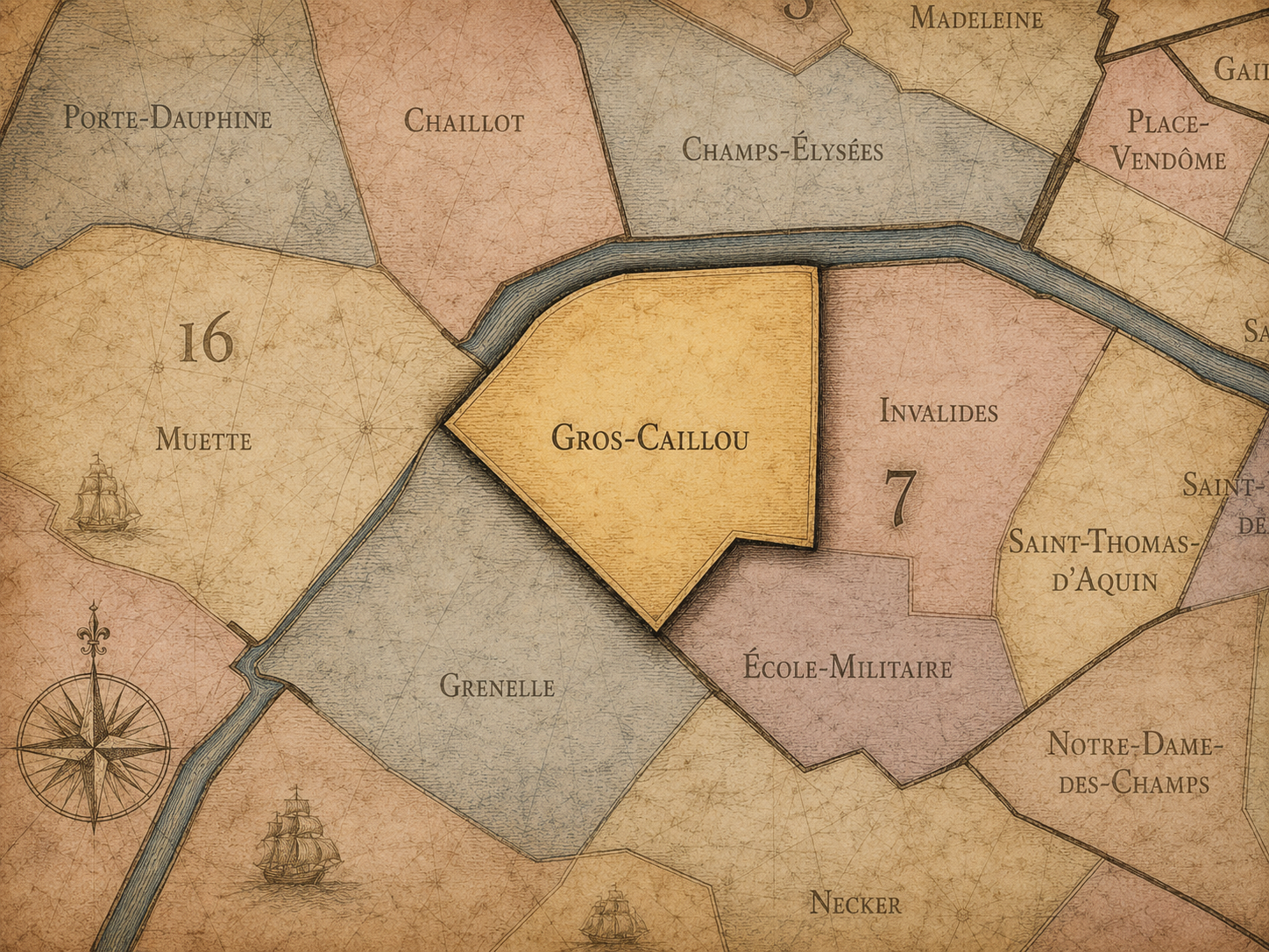
Part of an ongoing project to walk and photograph every neighborhood in Paris, this page explores the Administrative Quarter: 7e - Gros-Caillou through maps, district identity, history, and photography.




The Map
Download the Paris Arrondissements Map
Geographic Setting
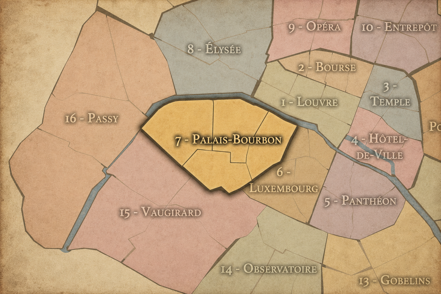
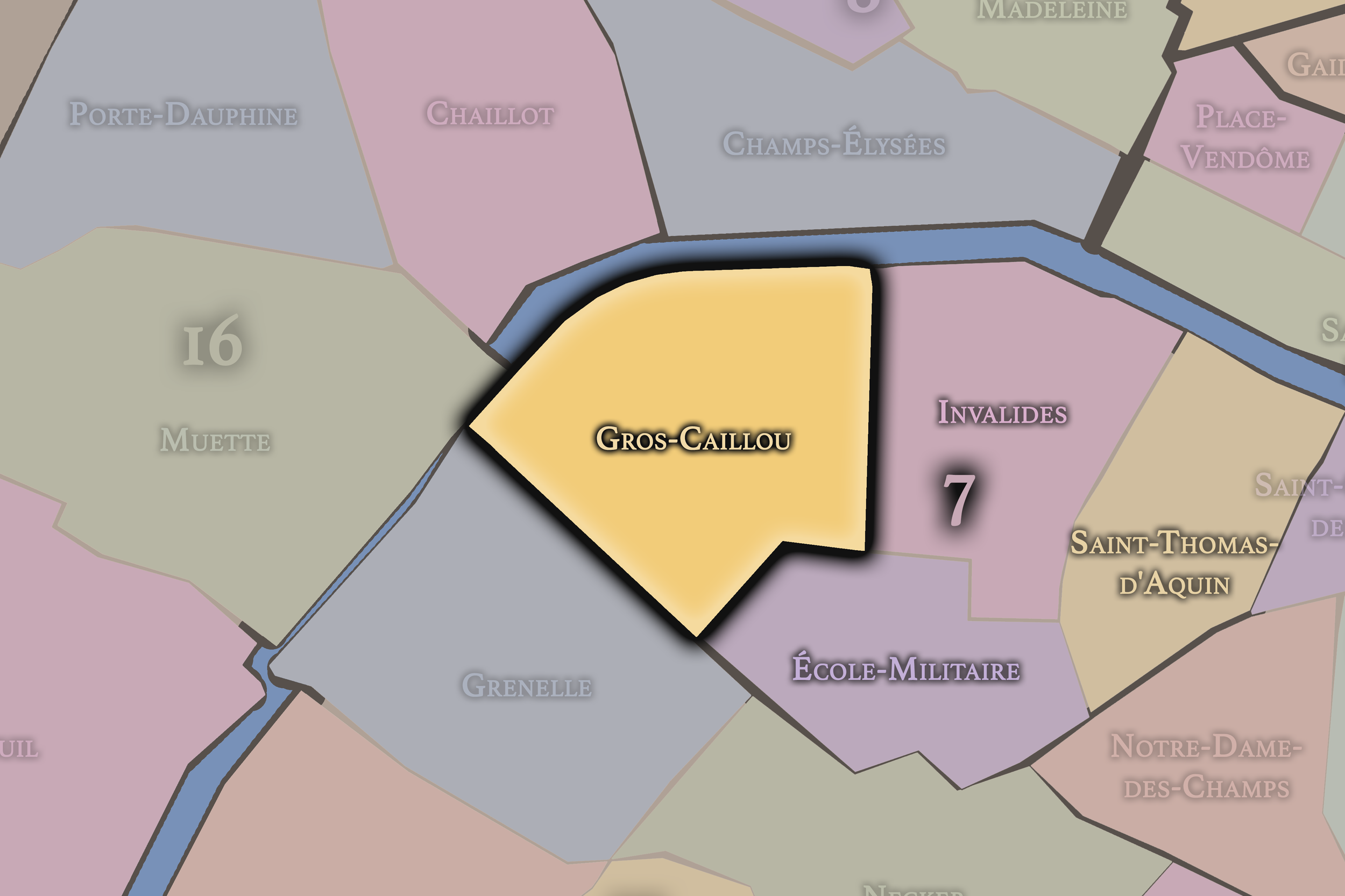
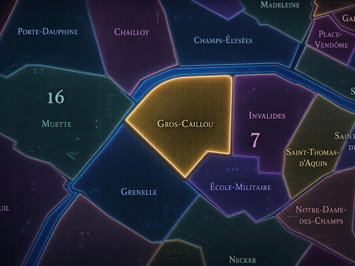
Gros-Caillou occupies the western portion of the 7th arrondissement, where the Left Bank opens toward the Seine, the Champ-de-Mars, the Eiffel Tower, the École Militaire edge, and the elegant residential streets between Invalides and the river. It lies west of Invalides, north of École-Militaire, and along the Seine-facing border of the arrondissement, forming one of the most visually recognizable landscapes in Paris. The district is often described as lying between the Eiffel Tower, the Champ-de-Mars, the Seine, and the Invalides-adjacent streets of the western 7th.
Its geography is both monumental and residential. The Eiffel Tower and Champ-de-Mars give the quarter one of the most famous images in the world, while streets such as Rue Saint-Dominique, Rue Cler, Avenue Rapp, Rue de l’Université, Avenue de La Bourdonnais, Avenue Bosquet, and the quays along the Seine give it a more lived Left Bank texture. Gros-Caillou is not only the postcard of the tower. It is also a quarter of apartment buildings, markets, cafés, schools, embassies, museums, military traces, and neighborhood routines arranged around some of the most iconic views in Paris.
Unlike Monnaie or Saint-Germain-des-Prés, whose Left Bank identities are shaped by books, cafés, academies, and riverfront culture, Gros-Caillou belongs to a more spatially open and western Paris. Its identity is built from scale: the breadth of the Champ-de-Mars, the verticality of the Eiffel Tower, the long Seine views, and the ordered residential streets that soften the monumentality around them.
Administrative Quarter Identity
Etymology and Origins
The name Gros-Caillou means “large stone” or “big pebble.” Its origin is somewhat legendary, but the name is usually connected to a prominent boundary stone, landmark stone, or large rock that once marked the area when it was still more peripheral and less urbanized. The phrase itself has a plain, almost rustic quality, very different from the formal institutional names elsewhere in the 7th arrondissement.
That contrast is part of the quarter’s charm. Today, Gros-Caillou is associated with some of the most globally recognized Parisian scenery: the Eiffel Tower, the Champ-de-Mars, the Seine, and the elegant streets of the western Left Bank. Yet its name preserves something far humbler — a physical marker, a stone in the landscape, a memory of place before the full choreography of monuments, exhibitions, and residential prestige.
The name also connects the quarter to a Paris that existed before its grand image. Before the tower, before the universal exhibitions, before the polished residential streets of the modern 7th, this was a landscape of fields, military grounds, religious and aristocratic holdings, and transitional land at the edge of the expanding city. Gros-Caillou keeps that earlier ground-level memory inside one of Paris’s most elevated visual districts.
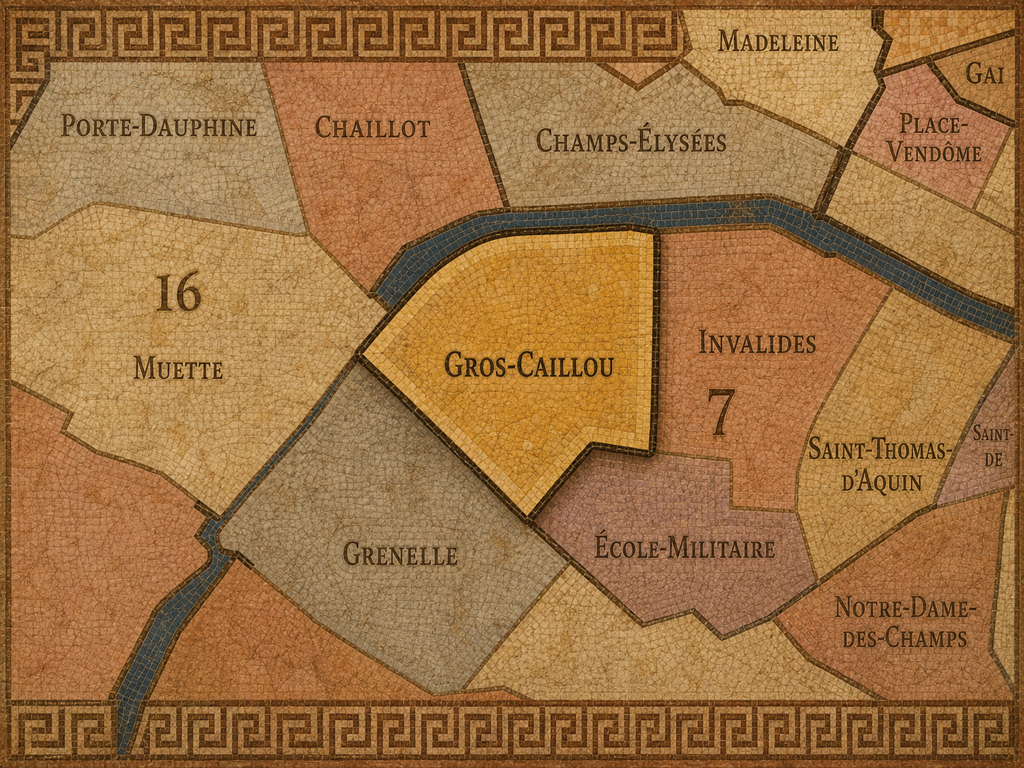
Within the official geography of Paris, Gros-Caillou is one of the four administrative quarters of the 7th arrondissement, alongside Saint-Thomas-d’Aquin, Invalides, and École-Militaire. It is traditionally counted as the 28th administrative quarter of Paris, completing the 7th arrondissement’s sequence of official quartiers. Its administrative identity helps distinguish the western residential and Eiffel Tower area from the more governmental, military, and institutional landscapes elsewhere in the arrondissement.
As an administrative quarter, Gros-Caillou gives civic form to a place often described through other names: the Eiffel Tower, Champ-de-Mars, Rue Cler, the Seine quays, or the western 7th. Those names are useful, but each captures only one part of the district. The official quarter name gathers the monument, park, streets, markets, museums, riverfront, and residential fabric into one mapped unit.
This civic frame is especially important because the Eiffel Tower can easily overwhelm the local geography around it. Gros-Caillou reminds us that the tower stands within a neighborhood, not outside one. The administrative quarter restores the broader urban setting around the landmark.
Civic Framework
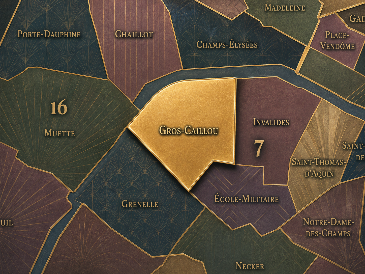
Gros-Caillou differs from the other quarters of the 7th arrondissement through its combination of monumentality, residential refinement, and open space. Saint-Thomas-d’Aquin is more closely tied to aristocratic residences, ministries, museums, and the cultivated eastern 7th. Invalides is shaped by the Hôtel des Invalides, military memory, state ceremony, and the great esplanade. École-Militaire is defined by military education, the southern edge of the Champ-de-Mars, and the transition toward the quieter interior streets of the arrondissement.
Gros-Caillou is the quarter where those military and civic landscapes meet the image of modern Paris most dramatically. It contains the Eiffel Tower and much of the Champ-de-Mars, but it also includes a dense residential and commercial fabric that often escapes the visitor’s first glance. Its distinction lies in the coexistence of global symbol and neighborhood life.
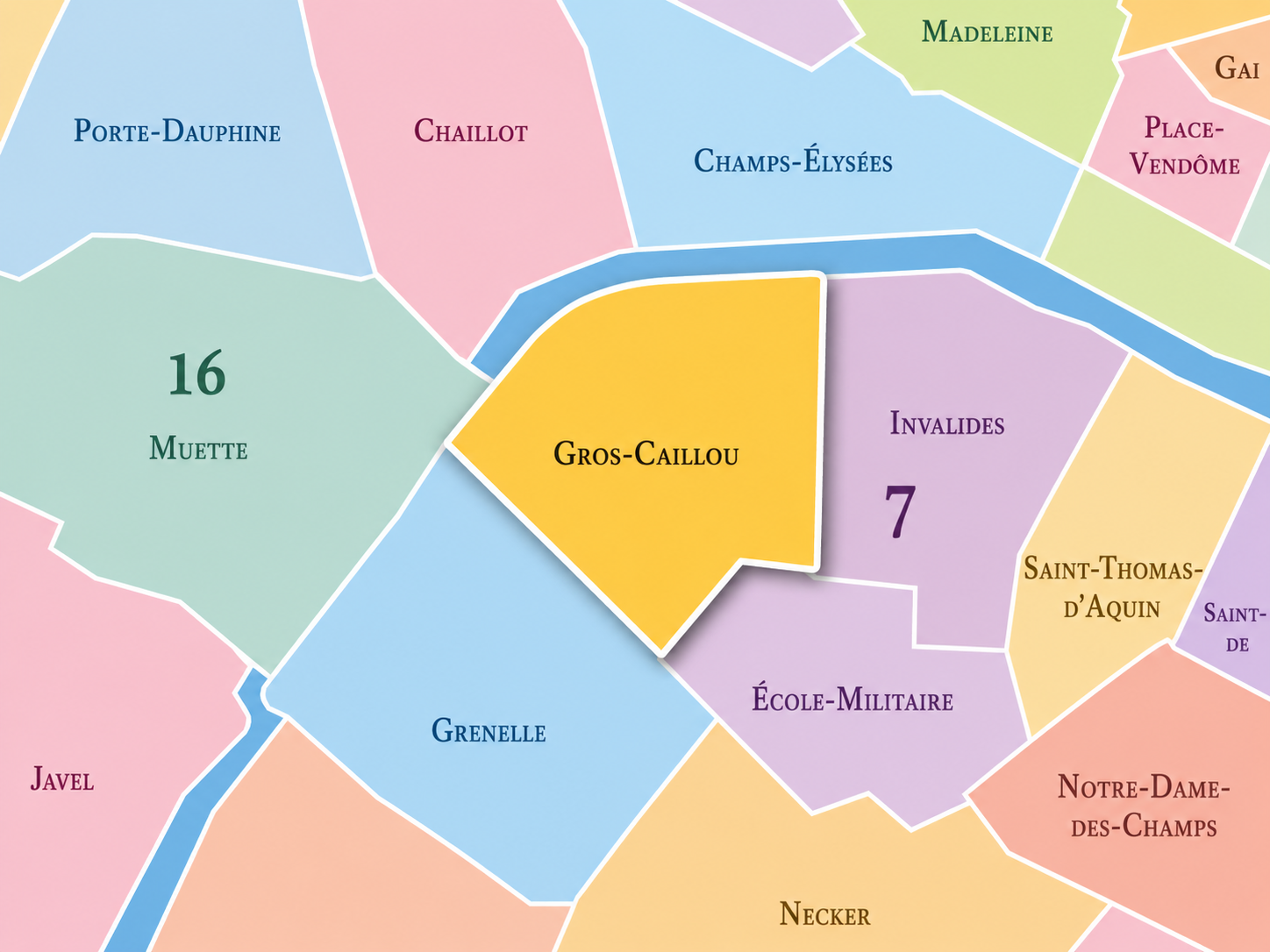
It should also be distinguished from the Eiffel Tower as an attraction. The tower is a landmark; Gros-Caillou is a quarter. The tower draws the eye upward and outward; the quarter draws attention back to streets, markets, cafés, façades, schools, courtyards, and the daily rhythms of the western Left Bank. The two are inseparable, but they are not identical.
Neighborhood Distinction
Parisian Identity
Gros-Caillou expresses Paris as a city where the monumental and the domestic live side by side. The Eiffel Tower may dominate the skyline, but the neighborhood around it is not simply a viewing platform. It is a lived district of apartment balconies, local shops, market streets, schoolchildren, embassy walls, museum visitors, river walks, and residents who move through one of the world’s most photographed landscapes as part of daily life.
The quarter also expresses the Paris of modern spectacle. The Eiffel Tower was built for the 1889 Exposition Universelle on the Champ-de-Mars and became one of the defining symbols of industrial modernity and modern Paris, despite its initial controversy and temporary intent. In Gros-Caillou, Paris does not only inherit history; it stages itself for the world.
Yet the quarter’s identity is not merely spectacular. The quieter streets around Rue Cler, Rue Saint-Dominique, and Avenue Rapp give Gros-Caillou a neighborhood intimacy that balances the immense scale of the tower and Champ-de-Mars. The result is a Parisian identity built on contrast: monument and market, exhibition and residence, open lawn and narrow street, global image and local habit.
Neighborhood Connections
Every administrative quarter belongs to a wider Parisian fabric. These connections place Gros-Caillou within the city’s civic, participatory, and cultural geography:
-
7e - Palais-Bourbon
-

Gros Caillou
The History
The origins of Gros-Caillou lie in the western expansion of the Left Bank beyond the older core of Paris. Before it became a prestigious and highly recognizable quarter, this area belonged to a more open landscape of fields, religious lands, military grounds, roads, and gradually urbanizing edges. The name itself suggests a time when local markers and rural or semi-rural features mattered more than formal urban addresses.
The quarter’s later identity was shaped by its proximity to the Champ-de-Mars, originally associated with military exercises and the École Militaire. This gave the surrounding area a broad, open character uncommon in central Paris. Long before the Eiffel Tower turned the skyline into an international image, the ground beneath it was already tied to the public and military use of space.
Gros-Caillou’s origin story is therefore one of transformation from edge to emblem. A peripheral Left Bank landscape became a military and exhibition ground. That exhibition ground became the setting for Paris’s most famous modern monument. Around it, residential streets and neighborhood institutions formed a district whose name still recalls an earlier, rougher ground.
Origins
16th–17th Century
In the 16th and 17th centuries, the future Gros-Caillou quarter remained outside the densest urban fabric of Paris. The western Left Bank was still marked by open land, religious holdings, aristocratic properties, roads, gardens, and rural or semi-rural uses. It was not yet the monumental and residential landscape associated with the modern 7th arrondissement.
The area’s distance from the medieval city center allowed larger properties, fields, and institutional lands to persist longer than in the older quarters near the Seine and the Latin Quarter. This gave the western Left Bank a different rhythm from the tight medieval streets to the east. Gros-Caillou’s later openness was rooted in this earlier spatial condition.
During this period, the quarter’s future identity was still latent. It had not yet become the district of the Eiffel Tower or the Champ-de-Mars in the modern sense. But the ingredients were present: open land, proximity to the river, expanding urban pressure, and a location that would eventually allow Paris to stage some of its largest civic and international spectacles.
The 18th century brought a decisive transformation to the surrounding landscape through the development of the École Militaire and the Champ-de-Mars. The creation of a vast open field for military exercises gave the western Left Bank a monumental scale that would later define Gros-Caillou and neighboring École-Militaire. The district’s identity became increasingly tied to state power, military training, and controlled open space.
This open field also made the area available for later public events, ceremonies, and spectacles. The Champ-de-Mars was not merely empty ground. It was a shaped civic landscape, one that could hold crowds, military display, political ceremony, and eventually international exhibitions. Gros-Caillou developed beside this powerful spatial resource.
By the time of the French Revolution, the Champ-de-Mars had become one of the symbolic public spaces of Paris. Events held there helped transform the western Left Bank from a military landscape into a stage for national life. Gros-Caillou stood near the edge of that transformation, absorbing the shift from peripheral ground to public theater.
18th Century
19th Century
The 19th century made Gros-Caillou world-famous. The Champ-de-Mars became a major site of international exhibitions, and in 1889 the Eiffel Tower was erected there as the entrance arch and centerpiece of the Exposition Universelle. Britannica notes that the tower was constructed for the 1889 exposition and stood at 300 meters when completed, making it the tallest structure in the world at the time.
The tower transformed the quarter’s image. What had been a western Left Bank district of military ground, residential streets, and exhibition space now became attached to the most recognizable silhouette in Paris. The Eiffel Tower initially provoked criticism from artists and writers, but it quickly became one of the central emblems of the modern city. The quarter around it acquired a new visual destiny.
At the same time, Gros-Caillou developed as an elegant residential district. Streets such as Rue Saint-Dominique, Avenue Rapp, and the surrounding avenues filled with apartment buildings, shops, cafés, and institutions serving a growing bourgeois and diplomatic quarter. The result was a double identity: grand public spectacle at the Champ-de-Mars, refined neighborhood life in the streets around it.
In the early and mid 20th century, Gros-Caillou consolidated its place in the global image of Paris. The Eiffel Tower, initially controversial and intended as temporary, remained standing and became increasingly central to the city’s visual identity. The surrounding quarter absorbed visitors, ceremonies, exhibitions, and the daily presence of a monument that was no longer a novelty but a symbol.
The quarter also retained a strong residential and local identity. The streets around Rue Cler, Rue Saint-Dominique, and Avenue Bosquet supported markets, shops, cafés, schools, and apartment life. The nearby Seine and Champ-de-Mars provided open space in a part of Paris otherwise defined by formal façades and refined residential blocks.
During the wars and upheavals of the 20th century, the Eiffel Tower and the 7th arrondissement carried immense symbolic weight. Gros-Caillou’s image could be monumental and vulnerable at once: a landscape of national pride, occupation-era visibility, liberation imagery, and postwar renewal. The quarter’s daily life continued beneath an icon that belonged, increasingly, to the world.
Early–Mid 20th Century
Late 20th Century
In the late 20th century, Gros-Caillou became one of Paris’s most intensely visited yet still residential quarters. Tourism around the Eiffel Tower expanded, while the surrounding streets retained the high-status calm of the western Left Bank. The neighborhood became a place where global flows of visitors encountered local rhythms of food shopping, school routes, residential life, and diplomatic presence.
The development of cultural institutions along the Seine strengthened the quarter’s role as part of a broader museum and riverfront landscape. The Musée du quai Branly – Jacques Chirac, planned in the late 20th century and opened in the early 21st, would later add a major cultural presence near the tower and river, extending the quarter’s identity beyond the Eiffel image alone.
This period also sharpened the tension between neighborhood and spectacle. Gros-Caillou had to hold one of the world’s most visited monuments while remaining a functioning Parisian district. That tension remains central to its contemporary character.
In the 21st century, Gros-Caillou remains one of the most globally visible quarters of Paris. The Eiffel Tower continues to define its skyline and visitor economy, while the Champ-de-Mars, Seine quays, Rue Cler, Rue Saint-Dominique, Avenue Rapp, and the surrounding residential streets give the quarter a layered local identity. The Musée du quai Branly – Jacques Chirac, opened in 2006 near the Eiffel Tower, adds a major museum of arts and civilizations from Africa, Asia, Oceania, and the Americas to the quarter’s cultural geography.
Today, Gros-Caillou must balance many versions of itself. It is a residential quarter, a tourist magnet, a diplomatic and institutional landscape, a museum district, a market-street neighborhood, and one of the world’s most photographed urban settings. Its greatest challenge is also its greatest power: the global image of Paris passes through an actual neighborhood.
For CityNeighborhoods: Paris, Gros-Caillou is essential because it demonstrates how an administrative quarter can contain a landmark without being reduced to it. The Eiffel Tower is the visual magnet, but the neighborhood is the structure that holds it: streets, markets, buildings, residents, schools, cafés, embassies, gardens, and riverfront paths all giving daily form to the icon.
21st Century
Spirit and Legacy
Gros-Caillou is the quarter where Paris turns spectacle into neighborhood. Its spirit is expansive and intimate at once. It belongs to the great iron silhouette of the Eiffel Tower, the lawns of the Champ-de-Mars, the market rhythm of Rue Cler, the elegance of Rue Saint-Dominique, the river light along the Seine, and the ordinary routines carried out beneath a world-famous landmark.
Its legacy is transformation through visibility. A semi-rural edge became military ground. Military ground became exhibition field. Exhibition field became the stage for the Eiffel Tower. Around that stage, Paris built and preserved a district of residential refinement, public space, and global recognition. The quarter’s humble name — the big stone — now sits beneath one of the most powerful images in the world.
To walk Gros-Caillou is to experience Paris at two scales at once. The city is immense, vertical, iconic, almost unreal; and then suddenly it is local again, in a bakery window, a market stall, a courtyard entrance, a school crossing, a café table, or the shadow of a balcony. In Gros-Caillou, neighborhood identity survives the monument not by resisting it, but by surrounding it with life.
The Photography
The arrondissements do not share a single visual identity. Instead, they organize Paris into twenty broad visual fields, each gathering its own combination of landmarks, streetscapes, institutions, residential districts, commercial corridors, parks, rail stations, markets, cemeteries, and riverfront edges.
Some arrondissements are defined by monumental scale: royal palaces, ceremonial avenues, government buildings, museums, formal gardens, and internationally recognized landmarks. Others are shaped by hills, canals, rail gateways, apartment-lined boulevards, neighborhood markets, former village streets, industrial remnants, parks, or the quieter rhythms of residential Paris. The arrondissement system gives these varied landscapes a civic frame, allowing the city to be read not as one visual language, but as a sequence of overlapping Parisian atmospheres.

Visual Identity
Through The Lens
Photographing the arrondissements means moving between the official map and the street-level experience. The camera does not treat each arrondissement as visually uniform. Instead, it looks for the recurring forms, textures, transitions, and contrasts that make each district legible: the geometry of boulevards, the shade of plane trees, the repetition of balconies, the rise of stairways, the curve of canals, the presence of rail stations, the opening of parks, the weight of monuments, and the intimacy of side streets.
On CityNeighborhoods, the arrondissement provides the frame, but the photograph comes from the encounter between map, movement, light, and observation. As the Paris photography is processed, this section will connect each arrondissement more directly to the project’s Photographic Lexicon: the visual strategies, recurring motifs, and compositional patterns that shape how the city is seen through the lens.

If you visit Paris, these ideas can help inspire your own photography.



Paris: J’Espere, Je Rêve, Je Vive
Paris Photo Gallery
Paris Field Notes
-
Field Note: August 18, 2025 | 07:58 AM
Conditions: 73°F | Humidity: 72%.
Within the park's interior, the glacial kettle ponds acted as humidity traps, creating a soft, hazy light that filtered through the old-growth oaks. The transition from the park's dense shade to the sun-drenched edges of Oakland Gardens highlighted the day's exceptional "picture-perfect" clarity.
There is a fleeting window in Queens where the humidity of August hasn't yet heavy-set, and the morning sun hits the canopy of Alley Pond Park at a perfect oblique angle. Arriving just before 8:00 AM, I watched the light break through the oaks and tulip trees, casting long, dramatic shadows across the wet grass. It’s in these quiet, golden moments that the park feels less like a city escape and more like the ancient glacial valley it actually is.
Other neighborhoods visited:











































































































Explore Paris
-

The twenty arrondissements form the civic spiral of Paris, organizing the city into its broad local districts of government, identity, and daily life.
-

Each arrondissement is divided into four official administrative quarters, giving Paris a more precise civic and geographic framework.
-

The conseils de quartier bring participation to street level, giving residents a voice in neighborhood needs, public space, and local civic life.
-

Les Deux Rives trace Paris through the Seine’s two banks, revealing how the Rive Droite and Rive Gauche shaped the city’s civic power, commerce, learning, art, and cultural identity.
-

Cultural neighborhoods reveal the Paris people recognize through history, cafés, architecture, memory, atmosphere, and local belonging.