
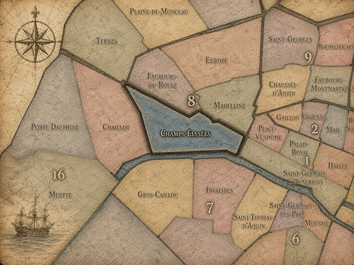
8e - CHAMPS-ÉLYÉES
Quartiers Administratifs
Part of an ongoing project to walk and photograph every neighborhood in Paris, this page explores the Administrative Quarter: 8e - Champs-Élysées through maps, district identity, history, and photography.




The Map
Download the Paris Arrondissements Map
Geographic Setting
Champs-Élysées occupies the northwestern portion of the 8th arrondissement, where Paris opens into one of its grandest ceremonial landscapes. The quarter stretches across the western side of the arrondissement, gathering the Avenue des Champs-Élysées, the Arc de Triomphe, the Rond-Point des Champs-Élysées, the Grand Palais and Petit Palais edge, the Seine-facing quays, and the monumental approach between Place de la Concorde and Place Charles-de-Gaulle. It is one of the most internationally recognizable quarters of Paris, shaped by spectacle, procession, prestige, tourism, commerce, and national memory.
Its geography is defined by axis. Few parts of Paris are so powerfully organized by a single line of sight. The Champs-Élysées extends from the formal garden and political space of the Tuileries / Concorde landscape toward the Arc de Triomphe, creating the central stretch of the larger Axe historique that continues west toward La Défense. Around this axis, the quarter contains a mixture of monumental institutions, luxury commerce, theaters, cinemas, embassies, offices, gardens, restaurants, and high-profile public spaces.
Unlike Europe, which gathers around railways and 19th-century residential development, or Madeleine, which is shaped by church, luxury food, and formal urban elegance, Champs-Élysées is the 8th arrondissement’s great public stage. It is less intimate than many Parisian quarters and more symbolic than residential. Its identity rests in being seen, crossed, paraded, celebrated, criticized, and continually reimagined as one of the great avenues of the world.
Administrative Quarter Identity
Etymology and Origins
The name Champs-Élysées comes from the Elysian Fields of Greek mythology, the paradisiacal realm reserved for heroic and blessed souls after death. In French, Champs-Élysées carries that mythic association into the urban landscape: fields of bliss, fields of honor, fields beyond ordinary life. The name gives the quarter a deliberately elevated tone, as if the avenue were never meant to be merely a road, but an idealized landscape.
This mythological naming is especially revealing. The Champs-Élysées did not begin as dense medieval city, nor as a village absorbed into Paris, nor as a market or parish quarter. It emerged from royal planning, garden extension, and ceremonial landscape design. Its name reflects aspiration: the desire to turn open land west of the city into a place of beauty, movement, display, and prestige.
Over time, the name expanded from avenue to quarter, and from quarter to global image. “Champs-Élysées” now evokes not only mythology or urban design, but luxury storefronts, military parades, national celebrations, tourists, traffic, cinema, shopping, protest, and the spectacle of modern Paris. Its name began in paradise; its history has been far more human, contested, and urban.
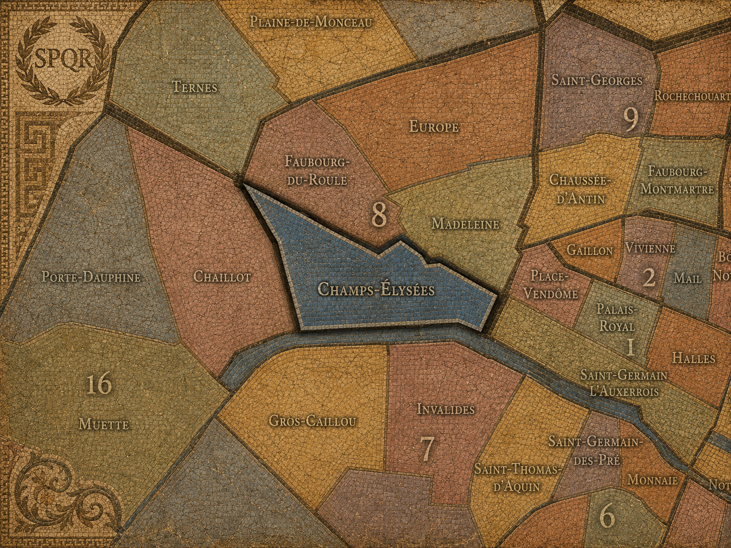
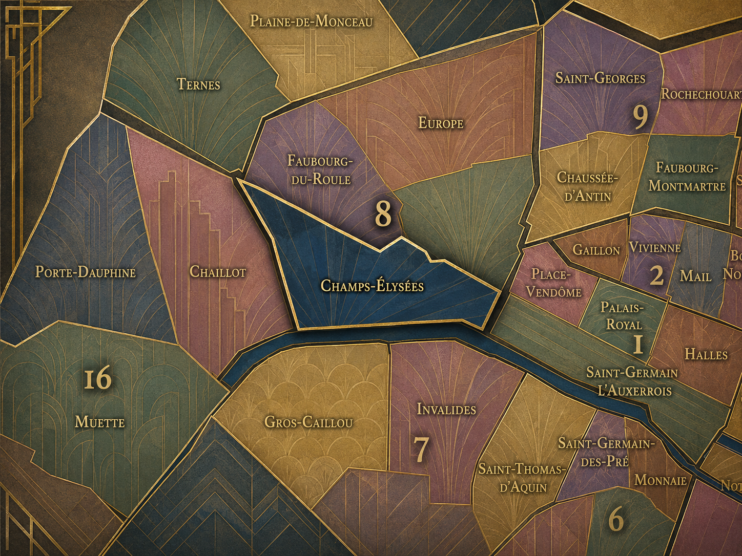
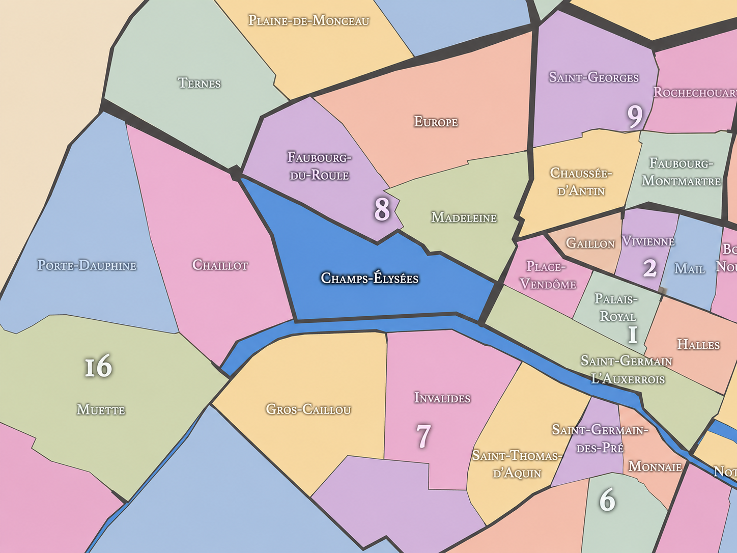
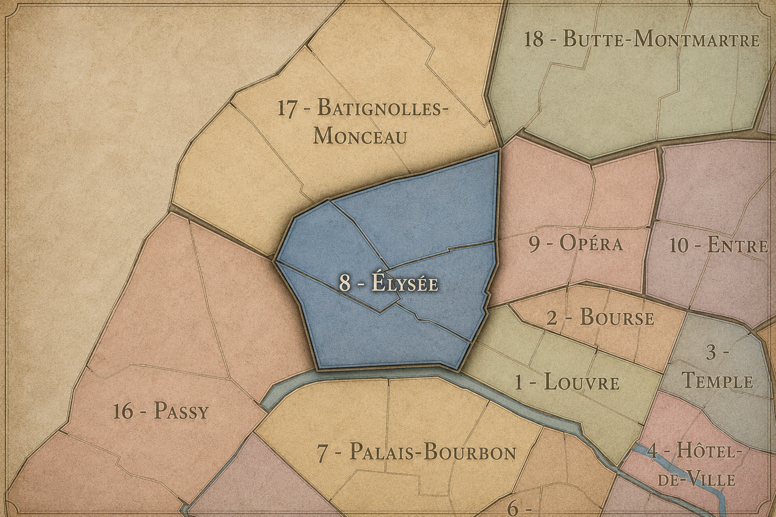
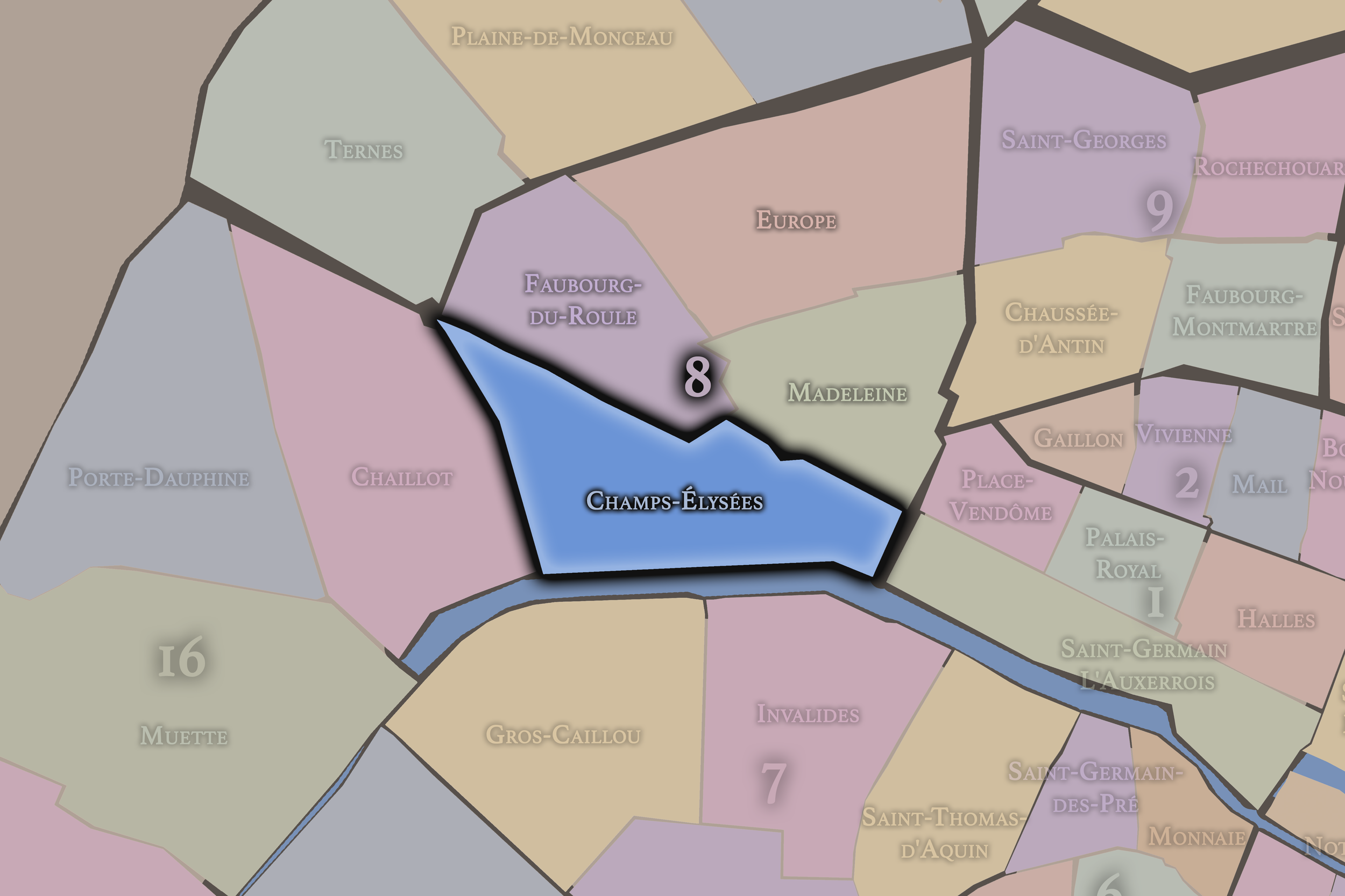
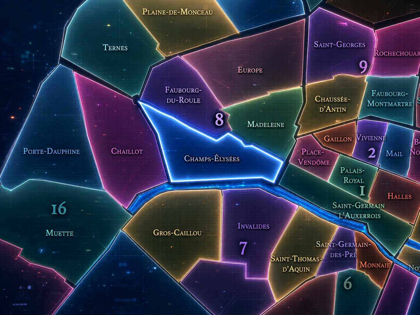
Within the official geography of Paris, Champs-Élysées is one of the four administrative quarters of the 8th arrondissement, alongside Faubourg-du-Roule, Madeleine, and Europe. It forms the arrondissement’s western and southwestern ceremonial face, connecting the 8th to the 16th and 17th at the Arc de Triomphe, to the 7th across the Seine, and to the 1st through Concorde and the Tuileries axis.
As an administrative quarter, Champs-Élysées gives civic shape to a landscape that is often understood through a single famous avenue. The official quarter, however, is more than the Avenue des Champs-Élysées alone. It includes the surrounding gardens, monumental buildings, riverfront edges, commercial corridors, cultural venues, and the urban approaches that make the avenue part of a larger district.
This civic frame matters because the Champs-Élysées can easily become a symbol detached from its neighborhood context. The administrative quarter restores that context. It reminds us that the famous avenue belongs to a mapped part of the city, with boundaries, institutions, neighboring quarters, and evolving local conditions. It is both global emblem and Parisian administrative unit.
Civic Framework
Champs-Élysées differs from the other quarters of the 8th arrondissement through its ceremonial scale and symbolic public role. Madeleine is more compactly elegant, tied to the church, luxury food, formal streets, and the western approach to the Opéra / Concorde landscape. Europe is residential and infrastructural, shaped by railway geography, 19th-century streets, and the Saint-Lazare edge. Faubourg-du-Roule is more associated with the urban fabric north and east of the Arc de Triomphe, carrying a mixture of residential, commercial, and prestige corridors around the upper Champs-Élysées.
Champs-Élysées is more axial, more theatrical, and more publicly visible. Its identity is not primarily neighborhood intimacy, but national performance. It is where Bastille Day military parades unfold, where victories are celebrated, where crowds gather on New Year’s Eve, where tourists arrive seeking the Paris they already know from images, and where commerce has repeatedly adapted to the avenue’s symbolic power.
It should also be distinguished from the broader Axe historique. The axis links Louvre, Tuileries, Concorde, Champs-Élysées, Arc de Triomphe, and La Défense, but the Champs-Élysées quarter is one specific civic and urban segment of that larger composition. It is the part where royal garden, modern boulevard, national ceremony, and commercial spectacle most visibly converge.
Neighborhood Distinction
Parisian Identity
Champs-Élysées expresses Paris as a city of display. It is one of the places where the capital performs itself to the world: through processions, monuments, storefronts, flags, lights, traffic, tourists, architecture, parades, demonstrations, and the great westward sweep of perspective. Its identity is not quiet, hidden, or local in the usual sense. It is declarative. It says: this is Paris as spectacle.
Yet the quarter’s Parisian identity is not simply glamorous. It is also complicated. The Champs-Élysées has been celebrated as the most beautiful avenue in the world, but it has also been criticized as commercialized, traffic-heavy, over-touristed, and detached from everyday Parisian life. That tension is part of its meaning. The avenue belongs to Paris, but also to the global imagination of Paris, and those two identities do not always coincide.
For that reason, Champs-Élysées is a crucial neighborhood layer. It shows that Parisian identity can be made not only from local intimacy, but from public image. This is the Paris of monuments and crowds, but also the Paris of debates over what a famous place becomes when fame itself reshapes its use.
Neighborhood Connections
Every administrative quarter belongs to a wider Parisian fabric. These connections place Champs-Élysées within the city’s civic, participatory, and cultural geography:
-
8e - Élysées
-

Triangle d'Or
The History
The origins of Champs-Élysées lie west of the older city, in a landscape that was once more open, marshy, rural, and gardened than urban. Before the avenue became the world-famous boulevard of modern Paris, the area beyond the Tuileries and Concorde belonged to the western approach from the city, gradually shaped by royal planning and the extension of formal garden design.
The decisive origin came in the 17th century, when the western extension of the Tuileries landscape began to organize this open ground into a formal avenue and promenade. The future Champs-Élysées grew from the logic of perspective, procession, and royal urbanism. It was not a medieval street that accumulated meaning over time by chance. It was conceived as a planned landscape of approach and display.
From its beginnings, then, the quarter’s identity was tied to vision. The line mattered. The view mattered. The movement westward mattered. Champs-Élysées began as a designed experience, a place where Paris expanded itself through geometry and ceremonial space.
Origins
16th–17th Century
In the 16th century, the future Champs-Élysées quarter still lay beyond the dense central fabric of Paris. The western side of the city included gardens, open land, roads, and semi-rural areas connected to the royal and aristocratic landscapes that would later define this part of the capital. The Tuileries Palace and gardens to the east helped prepare the urban logic that would eventually extend westward.
The 17th century transformed the area through royal planning. Under Louis XIV, the extension of the Tuileries axis westward gave the future avenue its foundational form. André Le Nôtre, associated with the great formal gardens of the age, helped shape the perspective that would become the Champs-Élysées. The landscape became organized not as ordinary street fabric, but as a grand promenade and visual axis.
This was the birth of the quarter’s ceremonial identity. The future Champs-Élysées began as an ordered expansion of royal Paris into open ground. Its meaning was tied to movement, display, control, and beauty — a landscape designed to frame power and leisure at monumental scale.
In the 18th century, the Champs-Élysées developed as a fashionable promenade and western extension of elite Paris. The avenue and surrounding gardens became places for walking, carriage traffic, sociability, and public visibility. The landscape retained its open, gardened character, but it increasingly served as a stage for urban life.
The creation and development of Place Louis XV, later Place de la Concorde, strengthened the eastern anchor of the quarter. This formal square connected the Champs-Élysées to the Tuileries and the royal ceremonial landscape. The avenue’s identity as part of a larger composition became clearer: garden, square, avenue, and western horizon aligned within a grand spatial sequence.
The French Revolution transformed the meaning of the area. Place de la Concorde became a site of execution and political rupture, while the western avenue remained tied to public gathering and movement. The landscape that had been shaped by royal planning entered the modern era marked by revolutionary memory. The quarter’s axis would never again be merely royal; it became national, contested, and public.
18th Century
19th Century
The 19th century made Champs-Élysées one of the great monumental landscapes of modern Paris. The Arc de Triomphe, commissioned under Napoleon and completed in the 1830s, gave the western end of the avenue its defining monument. It transformed the avenue into an axis of military memory, imperial ambition, and national commemoration. The Champs-Élysées was no longer only a promenade; it became a ceremonial route toward a triumphal arch.
The century also urbanized and commercialized the quarter. The avenue and surrounding streets gained cafés, theaters, private mansions, gardens, exhibition spaces, and new forms of metropolitan leisure. Under Haussmann and Napoleon III, western Paris was further reorganized through broad avenues, formal perspectives, and prestige development. The Champs-Élysées became a central piece of the modern capital’s self-image.
Universal exhibitions, public ceremonies, and the development of nearby cultural institutions also strengthened the quarter’s role as a stage for national and international display. By the end of the century, Champs-Élysées had become one of the signature landscapes through which Paris presented modernity, elegance, and authority to both itself and the world.
In the early and mid 20th century, Champs-Élysées became one of the great symbolic avenues of modern France. The Arc de Triomphe and the Tomb of the Unknown Soldier gave the western end of the quarter a profound commemorative role after the First World War. National ceremonies, military parades, armistice commemorations, and public gatherings made the avenue central to the ritual life of the republic.
At the same time, the avenue became increasingly associated with cinema, cafés, luxury commerce, automobiles, tourism, and modern metropolitan life. The Champs-Élysées was both solemn and glamorous, memorial and commercial, national and international. Its sidewalks and storefronts carried the energy of modern leisure, while its axis carried the weight of national history.
During the Second World War, occupation, liberation, and postwar recovery, the avenue again became a stage for history. Images of military presence, occupation-era control, and liberation celebrations reinforced the quarter’s identity as a place where national emotion becomes public spectacle. Few streets in Paris have been asked to carry so much symbolic weight.
Early–Mid 20th Century
Late 20th Century
In the late 20th century, Champs-Élysées became increasingly globalized and commercial. International brands, cinemas, restaurants, offices, and tourist-oriented businesses reshaped the avenue, while traffic and crowds intensified. The avenue remained famous, but its character changed. It became less of a traditional Parisian promenade and more of a global commercial corridor layered onto a national ceremonial axis.
This transformation produced both energy and criticism. The Champs-Élysées remained a place of celebration, shopping, nightlife, cinema, and national gatherings, but many Parisians began to feel that the avenue had lost some of its elegance and everyday connection to local life. Its fame became a burden as much as an asset.
Still, the quarter retained immense symbolic power. The Arc de Triomphe, the presidential ceremonies, the Bastille Day parade, major sporting celebrations, and public gatherings kept the avenue at the center of French civic imagination. The late 20th century did not diminish Champs-Élysées; it made its contradictions more visible.
In the 21st century, Champs-Élysées remains one of the most famous urban landscapes in the world, but also one of the most debated in Paris. It is a tourist destination, shopping corridor, ceremonial avenue, traffic artery, protest landscape, celebration site, and symbol of national identity. Its meaning continues to evolve as the city debates pedestrianization, greening, traffic reduction, commercial balance, and how to restore a stronger civic and Parisian character to the avenue.
The quarter today is shaped by this question: how can a global icon remain a living part of the city? The Champs-Élysées must serve visitors, residents, workers, national ceremonies, environmental needs, commercial interests, and the symbolic expectations of Paris itself. It is not a static monument. It is an urban stage under constant revision.
For CityNeighborhoods: Paris, Champs-Élysées is essential because it shows how a neighborhood can become a world image — and how difficult it is for a world image to remain a neighborhood. Its identity is immense, but not simple. It must be read as royal axis, revolutionary landscape, imperial route, republican stage, commercial boulevard, tourist corridor, and contested public space all at once.
21st Century
Spirit and Legacy
Champs-Élysées is the quarter where Paris performs grandeur in public. Its spirit is axial, ceremonial, luminous, commercial, crowded, and restless. It belongs to mythic fields and royal geometry, triumphal arches and national parades, storefronts and cinema marquees, traffic and flags, celebration and protest. It is one of the places where Paris most visibly becomes an image — and where that image is constantly tested.
Its legacy is the transformation of open western ground into national theater. Fields became promenade. Promenade became avenue. Avenue became imperial and republican axis. Axis became global symbol. Through each transformation, the quarter retained its central grammar: a long view, a public route, and the sense that the city is moving toward something larger than itself.
To walk Champs-Élysées is to encounter Paris at its most exposed. Nothing here is small in meaning. The avenue invites admiration, criticism, memory, desire, and debate. In this quarter, neighborhood identity becomes spectacle — not empty spectacle, but the spectacle of a city trying to understand what its most famous public image should mean in the present.
The Photography
The arrondissements do not share a single visual identity. Instead, they organize Paris into twenty broad visual fields, each gathering its own combination of landmarks, streetscapes, institutions, residential districts, commercial corridors, parks, rail stations, markets, cemeteries, and riverfront edges.
Some arrondissements are defined by monumental scale: royal palaces, ceremonial avenues, government buildings, museums, formal gardens, and internationally recognized landmarks. Others are shaped by hills, canals, rail gateways, apartment-lined boulevards, neighborhood markets, former village streets, industrial remnants, parks, or the quieter rhythms of residential Paris. The arrondissement system gives these varied landscapes a civic frame, allowing the city to be read not as one visual language, but as a sequence of overlapping Parisian atmospheres.

Visual Identity
Through The Lens
Photographing the arrondissements means moving between the official map and the street-level experience. The camera does not treat each arrondissement as visually uniform. Instead, it looks for the recurring forms, textures, transitions, and contrasts that make each district legible: the geometry of boulevards, the shade of plane trees, the repetition of balconies, the rise of stairways, the curve of canals, the presence of rail stations, the opening of parks, the weight of monuments, and the intimacy of side streets.
On CityNeighborhoods, the arrondissement provides the frame, but the photograph comes from the encounter between map, movement, light, and observation. As the Paris photography is processed, this section will connect each arrondissement more directly to the project’s Photographic Lexicon: the visual strategies, recurring motifs, and compositional patterns that shape how the city is seen through the lens.

If you visit Paris, these ideas can help inspire your own photography.



Paris: J’Espere, Je Rêve, Je Vive
Paris Photo Gallery
Paris Field Notes
-
Field Note: August 18, 2025 | 07:58 AM
Conditions: 73°F | Humidity: 72%.
Within the park's interior, the glacial kettle ponds acted as humidity traps, creating a soft, hazy light that filtered through the old-growth oaks. The transition from the park's dense shade to the sun-drenched edges of Oakland Gardens highlighted the day's exceptional "picture-perfect" clarity.
There is a fleeting window in Queens where the humidity of August hasn't yet heavy-set, and the morning sun hits the canopy of Alley Pond Park at a perfect oblique angle. Arriving just before 8:00 AM, I watched the light break through the oaks and tulip trees, casting long, dramatic shadows across the wet grass. It’s in these quiet, golden moments that the park feels less like a city escape and more like the ancient glacial valley it actually is.
Other neighborhoods visited:











































































































Explore Paris
-

The twenty arrondissements form the civic spiral of Paris, organizing the city into its broad local districts of government, identity, and daily life.
-

Each arrondissement is divided into four official administrative quarters, giving Paris a more precise civic and geographic framework.
-

The conseils de quartier bring participation to street level, giving residents a voice in neighborhood needs, public space, and local civic life.
-

Les Deux Rives trace Paris through the Seine’s two banks, revealing how the Rive Droite and Rive Gauche shaped the city’s civic power, commerce, learning, art, and cultural identity.
-

Cultural neighborhoods reveal the Paris people recognize through history, cafés, architecture, memory, atmosphere, and local belonging.