
9e - ROCHECHOUART
Quartiers Administratifs
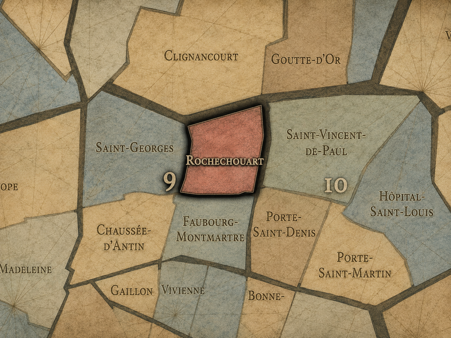
Part of an ongoing project to walk and photograph every neighborhood in Paris, this page explores the Administrative Quarter: 9e - Rochechouart through maps, district identity, history, and photography.




The Map
Download the Paris Arrondissements Map
Geographic Setting
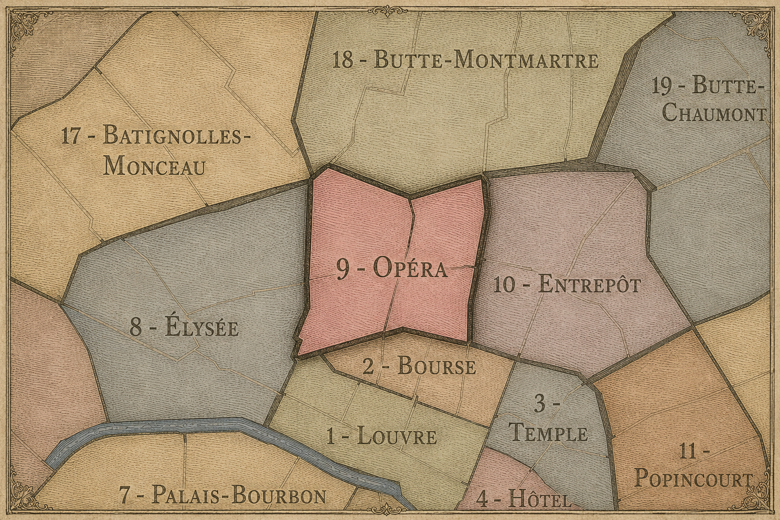
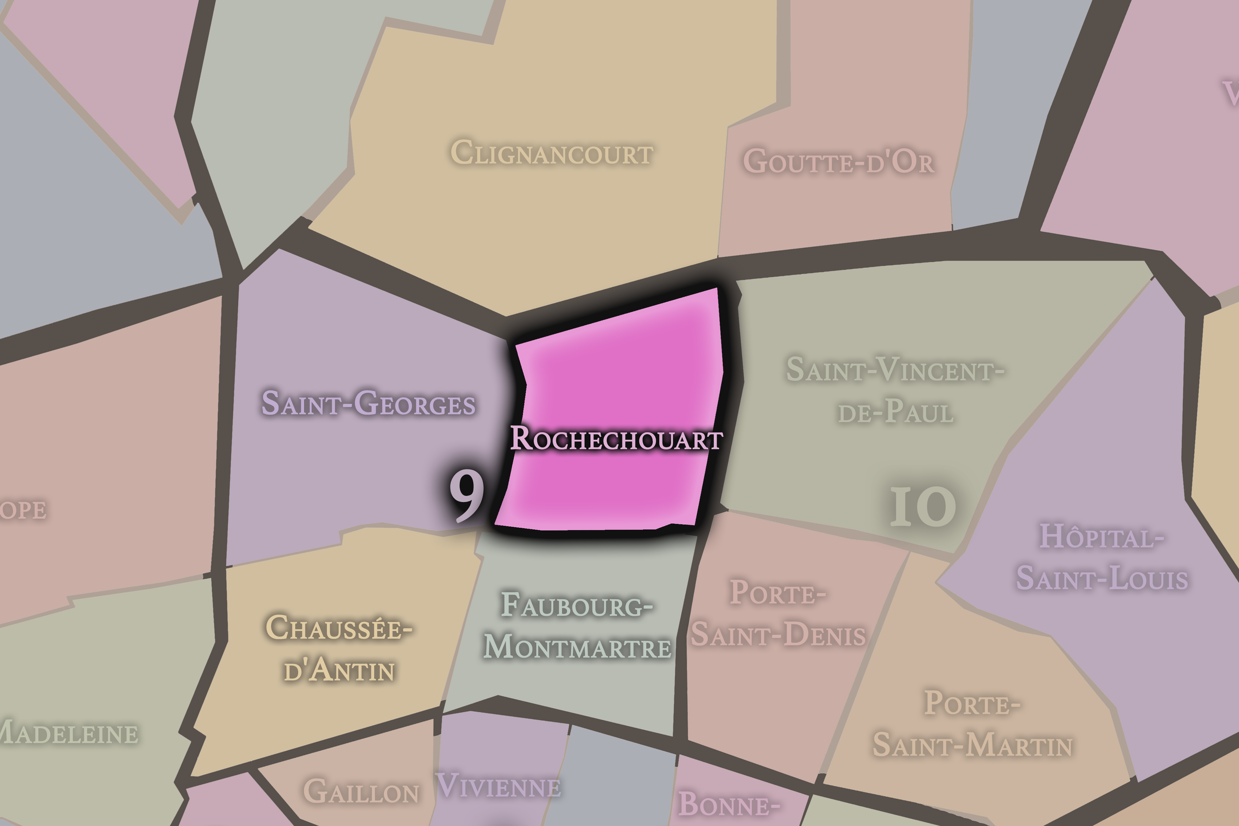
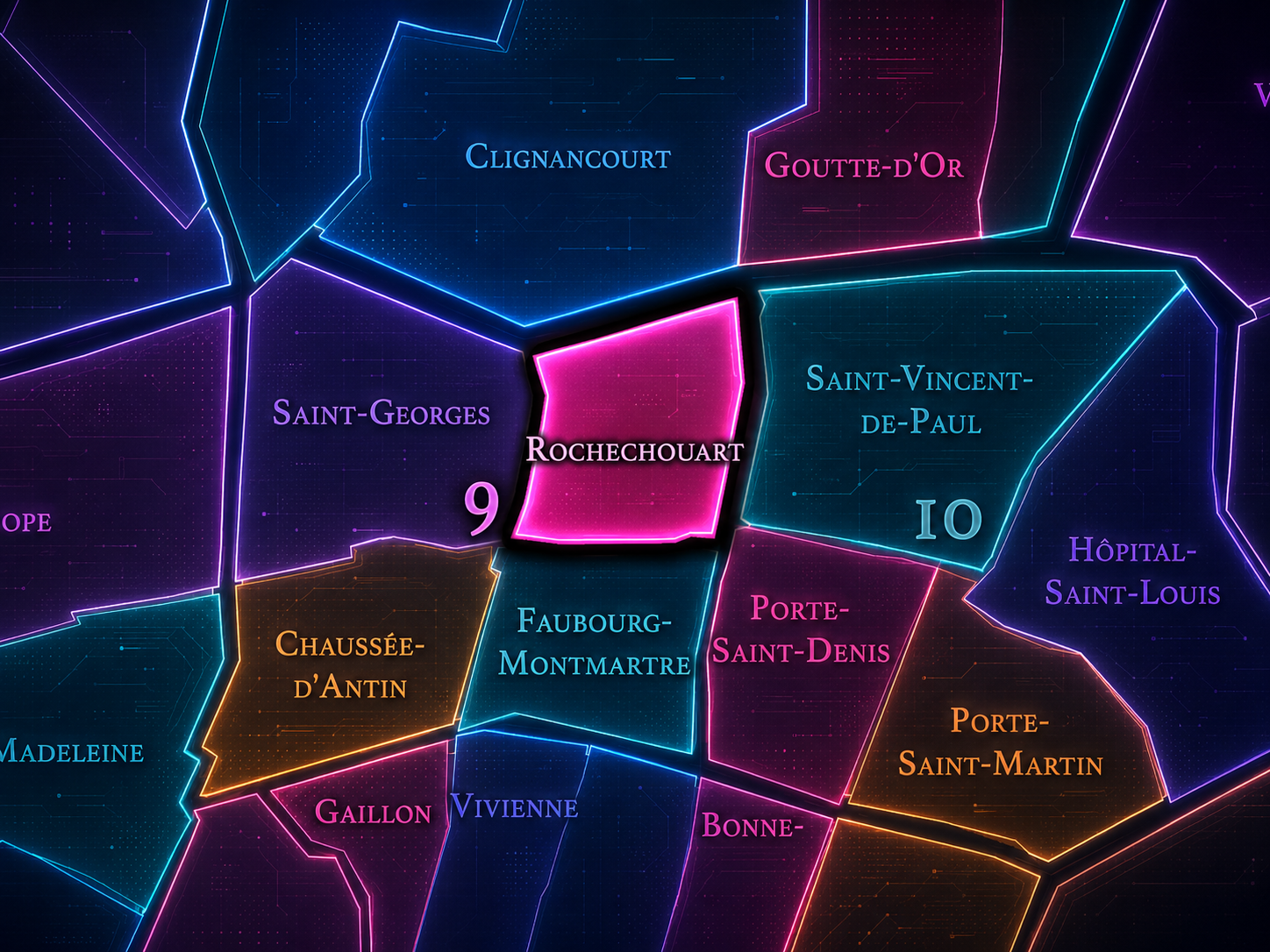
Rochechouart occupies the northern portion of the 9th arrondissement, where the lower slopes of Montmartre meet the boulevards, theaters, music halls, residential streets, and transitional corridors between Pigalle, Anvers, Barbès, Saint-Georges, and the Grands Boulevards. It is the 36th administrative quarter of Paris, forming the northern edge of the 9th arrondissement and touching the powerful cultural gravity of Montmartre without fully belonging to the hill itself.
The quarter’s geography is shaped by Boulevard de Rochechouart, Boulevard de Clichy, Rue de Rochechouart, Rue de Maubeuge, Rue des Martyrs, Rue de Dunkerque, Rue de Trévise, Rue de Bellefond, Rue de Châteaudun, and the approaches to Pigalle, Anvers, Notre-Dame-de-Lorette, and Gare du Nord beyond the arrondissement’s eastern edge. It is a quarter of ascent and approach: not the summit of Montmartre, not the polished Opéra-Haussmann district, and not the intimate romantic core of Saint-Georges, but the active slope and threshold between them.
Unlike Chaussée-d’Antin, whose identity is shaped by department stores, opera, and metropolitan retail spectacle, or Faubourg-Montmartre, whose character belongs more fully to the boulevard entertainment corridors below, Rochechouart is more topographic and transitional. It is the 9th arrondissement facing north — toward the hill, toward Pigalle, toward Barbès, toward movement, music, nightlife, immigration, commerce, and the complicated energy of Paris at the foot of Montmartre.
Administrative Quarter Identity
Etymology and Origins
The name Rochechouart comes from Marguerite de Rochechouart de Montpipeau, abbess of Montmartre in the late 17th and early 18th centuries. The name entered the geography of Paris through the boulevard and surrounding district, preserving the memory of the powerful religious and territorial presence once associated with the Abbey of Montmartre.
This origin is important because Rochechouart sounds, at first, like a purely street-based or aristocratic name. But in Parisian geography it also points toward the older ecclesiastical landscape of Montmartre. The abbey held lands, authority, and memory on and around the hill, and the name Rochechouart carries one fragment of that institutional past into the modern administrative map.
The name therefore sits at the meeting point of several histories: religious authority, noble lineage, boulevard urbanism, and northern Parisian movement. It is not as immediately descriptive as Faubourg-Montmartre, nor as iconic as Pigalle or Montmartre. But precisely because it is quieter, Rochechouart reveals how Paris often preserves old power through names that later generations pass by without fully reading.
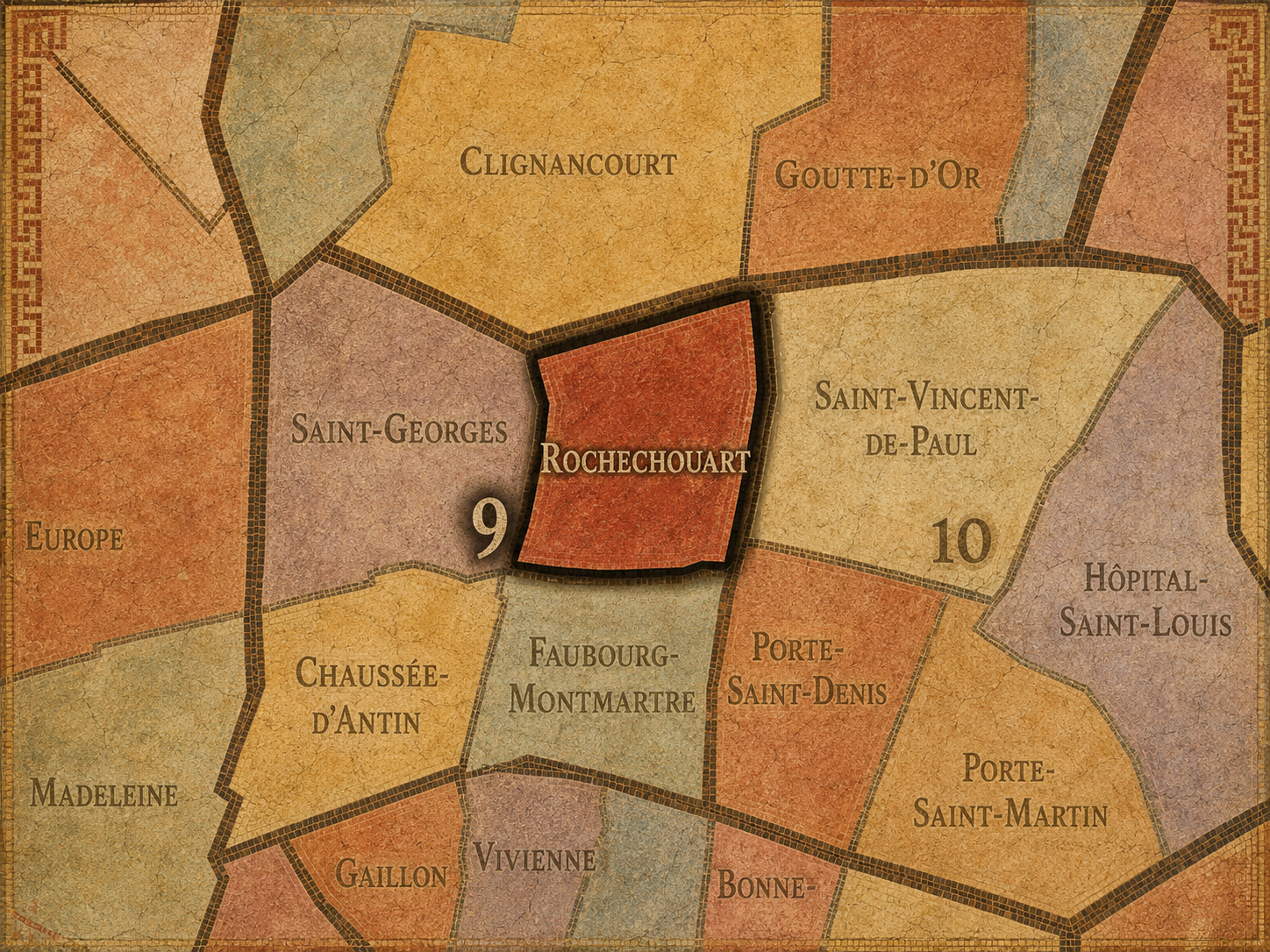
Within the official geography of Paris, Rochechouart is one of the four administrative quarters of the 9th arrondissement, alongside Chaussée-d’Antin, Faubourg-Montmartre, and Saint-Georges. It occupies the arrondissement’s northern sector and forms the administrative boundary between the 9th and the 18th, linking the lower 9th to Montmartre, Pigalle, Anvers, and the broader northern city.
As an administrative quarter, Rochechouart gives civic form to a landscape that is often described through stronger cultural or transit names: Pigalle, Anvers, lower Montmartre, Barbès-Rochechouart, Notre-Dame-de-Lorette, or the northern 9th. The official name helps gather these overlapping impressions into one mapped unit, clarifying the 9th arrondissement side of a district that easily spills across boundaries.
That civic role matters because Rochechouart is a border quarter. Its identity cannot be fully understood by looking inward only to the 9th arrondissement. It belongs to a seam: between the Haussmannian and theatrical Right Bank below, the Montmartre hill above, the transit and commercial energy around Barbès to the east, and the nightlife and performance geography around Pigalle to the west. The administrative quarter gives that seam a name.
Civic Framework
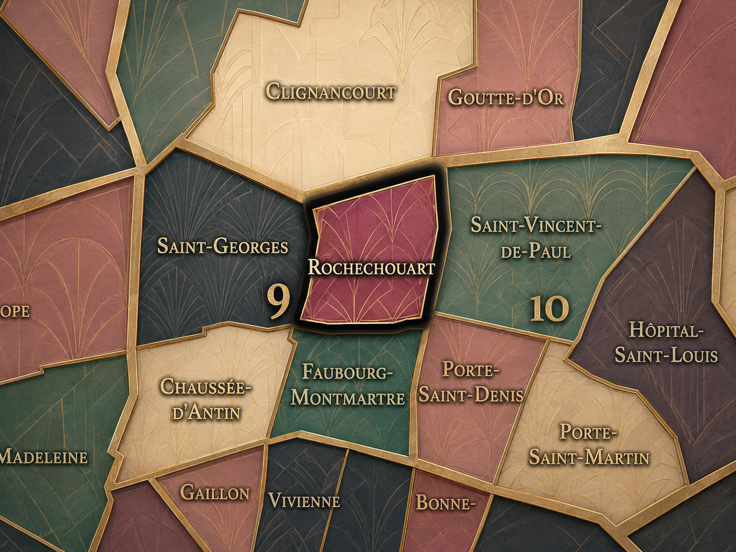
Rochechouart differs from the other quarters of the 9th arrondissement through its northern edge condition and its relationship to Montmartre, Pigalle, and the boulevard slope. Chaussée-d’Antin is the 9th as Opéra-adjacent spectacle: department stores, transit, theaters, offices, and the bright architecture of commercial modernity. Faubourg-Montmartre is the 9th of the Grands Boulevards and popular entertainment corridors. Saint-Georges is more residential, romantic, and associated with the Nouvelle Athènes, artists, writers, and refined 19th-century domestic architecture.
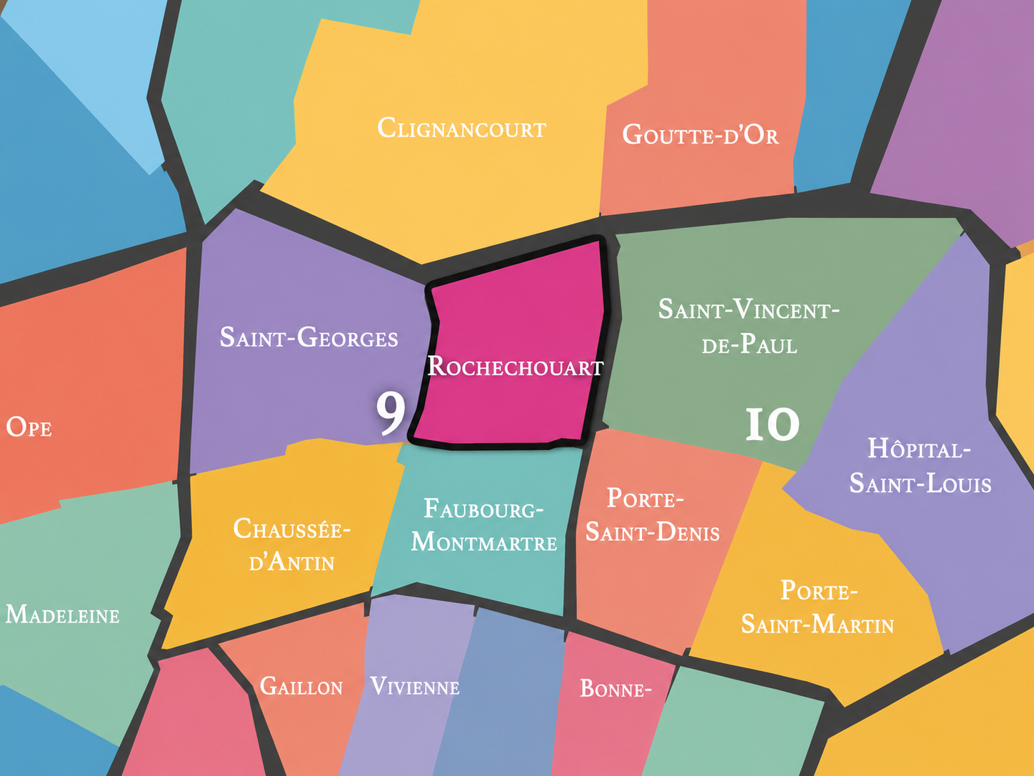
Rochechouart is more mixed, more transitional, and more openly connected to the popular and nocturnal geographies of northern Paris. It carries the foot-of-the-hill energy that leads toward Montmartre without becoming the Montmartre village itself. It touches Pigalle without being reducible to Pigalle. It faces Barbès without belonging entirely to Barbès. Its distinction lies in this in-between quality.
It should also be distinguished from Montmartre proper. Montmartre is the hill, the former village, the basilica, the artists’ mythology, the stairways, and the elevated geography of the 18th arrondissement. Rochechouart is the lower threshold — the boulevard and street fabric below, where the hill’s cultural energy meets the denser movement of the 9th and the northern Right Bank.
Neighborhood Distinction
Parisian Identity
Rochechouart expresses Paris as a city of thresholds. It is not the polished postcard of the summit, nor the formal grandeur of the Opéra district, nor the enclosed elegance of the Nouvelle Athènes. It is Paris in transition: up the hill, down toward the boulevards, west toward Pigalle, east toward Barbès and Gare du Nord, south toward Saint-Georges and Faubourg-Montmartre. Its identity is made by direction as much as destination.
The quarter belongs to a Paris of music halls, theaters, schools, small hotels, restaurants, late-night streets, apartment façades, churches, traffic, metro entrances, and crowds moving between atmospheres. It carries some of the theatrical and musical energy of the 9th arrondissement, but with a rougher, more northern edge. The name Rochechouart may be official and historical, but the district’s lived identity is kinetic.
This makes Rochechouart especially valuable within the CityNeighborhoods Paris framework. It is the kind of administrative quarter that might be overlooked if one only follows famous names. But once seen as its own civic unit, it becomes clear that Rochechouart is one of the hinge pieces of Paris: a place where official geography, cultural shorthand, transit movement, and topographic identity all overlap.
Neighborhood Connections
Every administrative quarter belongs to a wider Parisian fabric. These connections place Rochechouart within the city’s civic, participatory, and cultural geography:
-
9e - Opéra
-

Anvers-Montholon • Faubourg Montmartre • Pigalle-Martyrs
The History
The origins of Rochechouart lie in the lands below Montmartre, beyond the older core of Paris and near the northern routes that connected the city to the hill, the abbey, and the surrounding countryside. Before this area became part of the 9th arrondissement’s dense urban fabric, it belonged to the broader outer landscape of faubourgs, religious lands, roads, gardens, quarries, and gradual settlement around Montmartre.
The association with Marguerite de Rochechouart and the abbey of Montmartre points toward the older ecclesiastical and territorial structures that shaped the northern edge of Paris. The hill was not merely picturesque. It was a place of religious authority, landholding, and local jurisdiction before it became one of the city’s great artistic and touristic myths.
Rochechouart’s origin story is therefore tied to the descent from Montmartre into Paris. It was not born as a monumental center. It emerged from the meeting of abbey land, road, slope, and city growth. Over time, that edge was absorbed into the capital, but the name retained the memory of the older hill-bound order.
Origins
16th–17th Century
In the 16th and 17th centuries, the future Rochechouart quarter remained outside the densest fabric of central Paris, close to the lands and routes associated with Montmartre. The area below the hill was still shaped by roads, religious properties, semi-rural land, and the gradual extension of the city northward. It did not yet have the urban intensity or entertainment identity it would later acquire.
The Abbey of Montmartre remained an important presence in the wider landscape, and the later Rochechouart name reflects that older world of ecclesiastical power and landholding. The hill and its surroundings were not simply marginal. They held religious memory, institutional authority, and a distinct local geography that stood apart from the city below.
By the end of the 17th century, Paris was pressing outward. The northern approaches became increasingly active, and the old boundary between city and countryside began to soften. Rochechouart’s future identity as a quarter of transition was already forming in this pressure between slope, road, and expanding urban fabric.
In the 18th century, the area that would become Rochechouart grew more closely connected to the expanding city and to the lively northern edge of Paris. The boulevards, created along former defensive lines, increasingly became spaces of promenade, movement, entertainment, and urban sociability. The lower approaches to Montmartre began to take on a more distinctly urban character.
The name Rochechouart entered the city’s geography through the memory of Marguerite de Rochechouart de Montpipeau, whose connection to Montmartre’s abbey preserved an older religious-aristocratic layer within a changing urban landscape. That connection gives the quarter a more complex origin than the nightlife and boulevard associations that later dominated the area’s image.
By the revolutionary era, the older religious and institutional geography of Montmartre and its surroundings was deeply disrupted. Abbey lands, church authority, and old regime structures were transformed or dismantled. Rochechouart entered the modern age carrying a name rooted in the old order, even as the district around it moved toward a more secular, commercial, and popular urban identity.
18th Century
19th Century
The 19th century transformed Rochechouart into a fully urban quarter. The incorporation of surrounding northern districts into Paris, the growth of boulevards, the expansion of residential and commercial streets, and the rise of Montmartre and Pigalle as cultural and entertainment landscapes all reshaped the area. Rochechouart became part of the city’s northern theater of movement: boulevard, hill, railway-adjacent streets, music halls, cafés, and popular leisure.
Boulevard de Rochechouart and the surrounding streets helped organize the threshold between the 9th and 18th arrondissements. The quarter stood below the hill but close enough to absorb its energy. Montmartre’s artistic and popular reputation grew during this period, while Pigalle and the lower slopes developed stronger associations with cafés-concerts, cabarets, theaters, and nightlife.
The 19th century also gave the quarter a Haussmannian and post-Haussmannian urban frame: apartment buildings, wider streets, new transport connections, and the increasing density of a capital expanding northward. Rochechouart became one of those Parisian places where the former edge turned into a highly active urban seam.
In the early and mid 20th century, Rochechouart was strongly shaped by the cultural life of lower Montmartre and Pigalle. Theaters, music halls, cafés, cinemas, dance halls, hotels, and nightlife gave the surrounding district a reputation for entertainment and urban intensity. The quarter stood close to some of the most famous popular-cultural landscapes of Paris, while also retaining a residential and everyday street life of its own.
The proximity to Anvers, Barbès, and Gare du Nord also made the district a place of movement and arrival. Rochechouart was not only a nightlife threshold; it was part of a broader northern Parisian geography of migration, transit, commerce, and social mixing. This gave the quarter a more complex character than the romantic Montmartre myth alone can contain.
During the upheavals of war, occupation, liberation, and postwar recovery, the entertainment districts of northern Paris carried ambiguous meanings: escape, survival, collaboration, resistance, control, and renewal all passed through places of public gathering. Rochechouart’s identity in this period was not static. It reflected the tensions of a city whose pleasures and vulnerabilities often occupied the same streets.
Early–Mid 20th Century
Late 20th Century
In the late 20th century, Rochechouart adapted to changing patterns of nightlife, immigration, tourism, commerce, and urban reinvestment. Pigalle and the lower Montmartre area shifted repeatedly in reputation: from music hall and cabaret district to red-light and nightlife landscape, then gradually toward a more mixed environment of bars, restaurants, hotels, theaters, music venues, and renovated residential streets.
The eastern edge near Barbès-Rochechouart carried another kind of energy, shaped by transit, markets, immigrant commerce, wedding shops, discount retail, and the everyday diversity of northern Paris. This gave the quarter and its surroundings a social texture quite different from the polished central 9th around Opéra or the refined residential streets of Saint-Georges.
At the same time, heritage and nostalgia began to reshape how the district was perceived. The old cabaret and music-hall landscapes became part of Parisian memory, while contemporary businesses and residents continued to remake the area. Rochechouart remained neither fully gentrified nor fully rough, neither purely touristic nor purely local. Its identity stayed transitional.
In the 21st century, Rochechouart remains one of the 9th arrondissement’s most layered edge quarters. It links Saint-Georges, Pigalle, Anvers, Barbès, and the lower Montmartre approaches within a compact but highly varied urban field. The quarter contains residential streets, hotels, restaurants, theaters, schools, music venues, shops, and the constant movement of people crossing between the 9th and 18th arrondissements.
Today, Rochechouart’s identity lies in its refusal to become one thing. It is not simply Montmartre, not simply Pigalle, not simply Barbès, not simply the 9th arrondissement’s northern border. It is a threshold district where each of those identities touches the others. Its streets hold polished renovations and rough edges, tourist movement and local routines, nightlife memory and ordinary residential life.
For CityNeighborhoods: Paris, Rochechouart is essential because it shows how administrative quarters can reveal the seams that cultural names blur. “Montmartre,” “Pigalle,” and “Barbès” may dominate the imagination, but Rochechouart names the official 9th arrondissement landscape where those identities meet. It is one of the places where the map helps decode the city rather than simplify it.
21st Century
Spirit and Legacy
Rochechouart is the quarter of the lower threshold. Its spirit is sloped, restless, musical, and mixed. It belongs to the boulevard beneath the hill, to the routes toward Montmartre, to Pigalle’s glow and Barbès’s movement, to old abbey memory and modern nightlife, to apartment façades and metro entrances, to the edge where central Paris begins to change tone.
Its legacy is the transformation of border into energy. Religious lands and outer roads became boulevards. Boulevards became entertainment corridors. The foot of Montmartre became a district of music, movement, commerce, and social mixture. The name of an abbess survived inside a quarter better known for the city’s secular pleasures and restless street life.
To walk Rochechouart is to feel Paris shifting underfoot. The city rises toward Montmartre, opens toward Pigalle, thickens toward Barbès, and descends toward the 9th’s more formal quarters. In Rochechouart, neighborhood identity is not a fixed image. It is a crossing — between hill and boulevard, memory and nightlife, official map and lived Paris.
The Photography
The arrondissements do not share a single visual identity. Instead, they organize Paris into twenty broad visual fields, each gathering its own combination of landmarks, streetscapes, institutions, residential districts, commercial corridors, parks, rail stations, markets, cemeteries, and riverfront edges.
Some arrondissements are defined by monumental scale: royal palaces, ceremonial avenues, government buildings, museums, formal gardens, and internationally recognized landmarks. Others are shaped by hills, canals, rail gateways, apartment-lined boulevards, neighborhood markets, former village streets, industrial remnants, parks, or the quieter rhythms of residential Paris. The arrondissement system gives these varied landscapes a civic frame, allowing the city to be read not as one visual language, but as a sequence of overlapping Parisian atmospheres.

Visual Identity
Through The Lens
Photographing the arrondissements means moving between the official map and the street-level experience. The camera does not treat each arrondissement as visually uniform. Instead, it looks for the recurring forms, textures, transitions, and contrasts that make each district legible: the geometry of boulevards, the shade of plane trees, the repetition of balconies, the rise of stairways, the curve of canals, the presence of rail stations, the opening of parks, the weight of monuments, and the intimacy of side streets.
On CityNeighborhoods, the arrondissement provides the frame, but the photograph comes from the encounter between map, movement, light, and observation. As the Paris photography is processed, this section will connect each arrondissement more directly to the project’s Photographic Lexicon: the visual strategies, recurring motifs, and compositional patterns that shape how the city is seen through the lens.

If you visit Paris, these ideas can help inspire your own photography.



Paris: J’Espere, Je Rêve, Je Vive
Paris Photo Gallery
Paris Field Notes
-
Field Note: August 18, 2025 | 07:58 AM
Conditions: 73°F | Humidity: 72%.
Within the park's interior, the glacial kettle ponds acted as humidity traps, creating a soft, hazy light that filtered through the old-growth oaks. The transition from the park's dense shade to the sun-drenched edges of Oakland Gardens highlighted the day's exceptional "picture-perfect" clarity.
There is a fleeting window in Queens where the humidity of August hasn't yet heavy-set, and the morning sun hits the canopy of Alley Pond Park at a perfect oblique angle. Arriving just before 8:00 AM, I watched the light break through the oaks and tulip trees, casting long, dramatic shadows across the wet grass. It’s in these quiet, golden moments that the park feels less like a city escape and more like the ancient glacial valley it actually is.
Other neighborhoods visited:











































































































Explore Paris
-

The twenty arrondissements form the civic spiral of Paris, organizing the city into its broad local districts of government, identity, and daily life.
-

Each arrondissement is divided into four official administrative quarters, giving Paris a more precise civic and geographic framework.
-

The conseils de quartier bring participation to street level, giving residents a voice in neighborhood needs, public space, and local civic life.
-

Les Deux Rives trace Paris through the Seine’s two banks, revealing how the Rive Droite and Rive Gauche shaped the city’s civic power, commerce, learning, art, and cultural identity.
-

Cultural neighborhoods reveal the Paris people recognize through history, cafés, architecture, memory, atmosphere, and local belonging.