

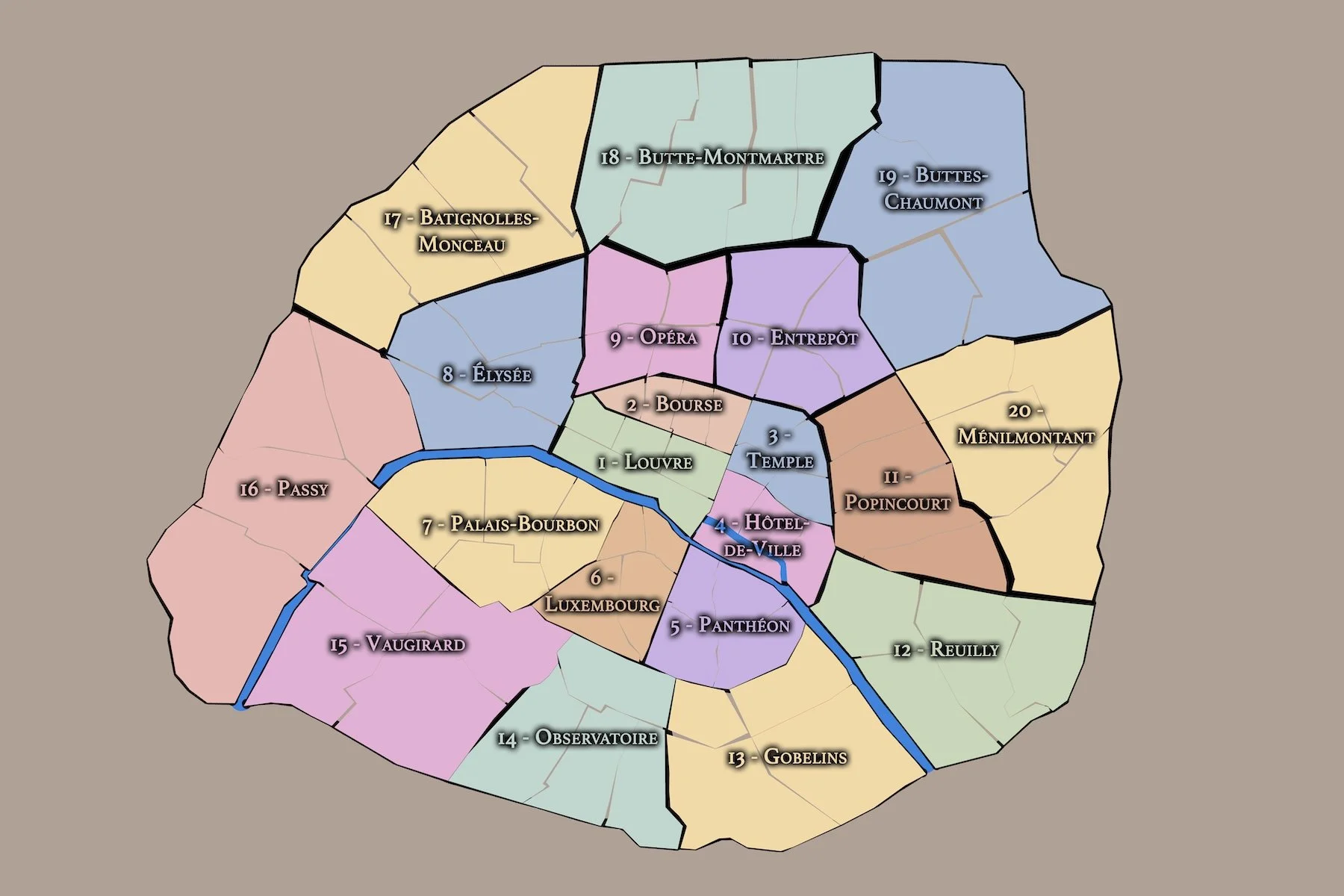
ARRONDISSEMENTS
Paris is often understood through its arrondissements: twenty civic districts arranged in a spiral from the historic core, carrying the city from royal and revolutionary center to residential quarters, village annexations, grand boulevards, parks, stations, hills, and riverfront edges. Part of an ongoing project to walk and photograph every neighborhood in Paris, this page explores the arrondissements as the broadest official neighborhood layer in the CityNeighborhoods Paris project — shaping civic life, geographic orientation, and the larger structure of the city.


The Map
Geographic Setting
The twenty arrondissements of Paris are arranged within the city’s modern municipal boundary, enclosed today by the Boulevard Périphérique and shaped by the Seine as it bends through the capital. Together, they form the official civic geography of Paris proper.
Their numbering follows one of the most distinctive patterns in urban geography: a clockwise spiral beginning near the historic and administrative heart of the city. The 1er Arrondissement sits at the center, around the Louvre and the Right Bank core. From there, the numbers circle outward in a pattern often compared to an escargot, or snail shell, moving through the central city before reaching the larger outer districts of western, northern, eastern, and southern Paris.
This spiral gives the arrondissement system both order and personality. The lowest numbers tend to cluster near the historic center, where royal, religious, commercial, and governmental power shaped the early modern city. The higher numbers reach outward toward former villages, industrial edges, residential districts, parks, cemeteries, rail stations, markets, and modern boulevards.
The Seine also gives the arrondissements a second geography. Some belong largely to the Right Bank, including the historic commercial and governmental core. Others belong to the Left Bank, long associated with scholarship, religious institutions, publishing, intellectual life, and monumental state architecture. Several districts are shaped by bridges, islands, riverfronts, or the shift between central Paris and its outer residential ring.
To move through the arrondissements is therefore to move through Paris at multiple scales: center and edge, Right Bank and Left Bank, monument and neighborhood, royal city and modern municipality.
Arrondissement Identity
Etymology and Origins

The word arrondissement comes from the French verb arrondir, meaning “to round,” “to make round,” or “to give shape.” In administrative use, an arrondissement refers to a defined district or subdivision: a portion of a larger territory given civic, municipal, or governmental meaning.
For English-speaking visitors, the word can be tempting to translate simply as “district,” “borough,” or “neighborhood,” but none of those terms is quite exact. In Paris, an arrondissement is not a neighborhood in the intimate cultural sense, nor a borough in the New York sense. It is an official municipal district: one of twenty civic divisions through which the modern city is organized, addressed, governed, and understood.
Civic Framework

Each arrondissement has its own mairie, or town hall, and functions as part of the city’s municipal structure. Arrondissement numbers appear in addresses, postal codes, official documents, real estate descriptions, travel guides, and everyday directions. To say “the 7th,” “the 11th,” or “the 18th” is to locate a place within the formal civic geography of Paris.
The arrondissement system gives Paris a broad administrative frame. It does not describe every local identity within the city, but it provides the structure beneath them: twenty numbered districts that gather monuments, residential streets, parks, markets, institutions, schools, commercial corridors, and historic places into recognizable municipal areas.
Parisian Identity

The arrondissements give Paris one of its most familiar civic images: the spiral city. Beginning with the 1er Arrondissement near the historic center, the numbers move outward in a clockwise pattern often compared to an escargot, or snail shell. This spiral is more than a numbering system. It gives Paris a memorable spatial logic, moving from the old royal and administrative core toward the larger districts shaped by nineteenth-century expansion, former villages, rail corridors, parks, and residential growth.
In everyday language, arrondissement numbers carry associations beyond the map. The 1er suggests centrality, monuments, museums, and royal Paris. The 5e evokes scholarship, the Latin Quarter, and ancient streets. The 7e carries the image of state power, embassies, broad avenues, and the Eiffel Tower. The 10e suggests canals, stations, movement, and urban crossings. The 18e brings together hilltop views, Montmartre, working-class memory, tourism, and northern Paris. The 20e points toward Belleville, Ménilmontant, Père-Lachaise, slopes, street art, and the eastern edge of the city.
Neighborhood Distinction
The arrondissement system is one of several ways to understand Paris, but it is not the only one. Arrondissements are official municipal districts. Administrative Quarters divide (literally quarter) those 20 districts into eighty formal subdivisions. Conseils de Quartier reveal a more recent (and detailed) layer of civic participation and local democratic organization. Cultural Neighborhoods represent the lived, historical, artistic, commercial, and atmospheric identities that often matter most to residents and visitors.
This distinction is essential. Some arrondissements contain world-famous cultural neighborhoods, but the two are not interchangeable. The 18e contains Montmartre, La Goutte d’Or, and parts of La Chapelle, but none of those places is identical to the 18e as a whole. The 5e overlaps with the Latin Quarter, but the Latin Quarter extends beyond a single administrative frame. The 4e contains parts of Le Marais and the historic islands, but its arrondissement boundary does not define the full cultural geography of those places. The arrondissement gathers local worlds into one official district; it does not erase their separate identities.
The Arrondissements
-
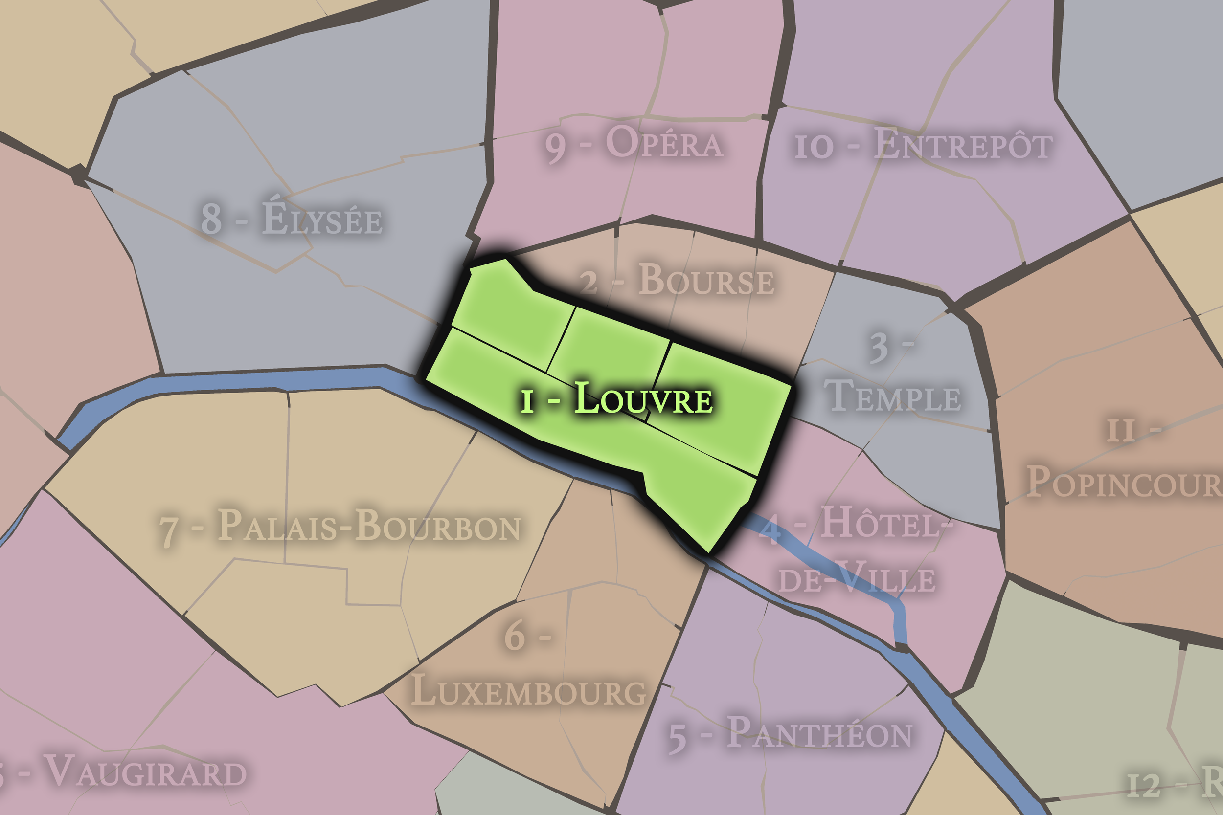
1er — Louvre
At the historic heart of Paris, the 1er includes the Louvre, the Tuileries, the Palais-Royal, and some of the city’s most monumental royal and civic landscapes.
-
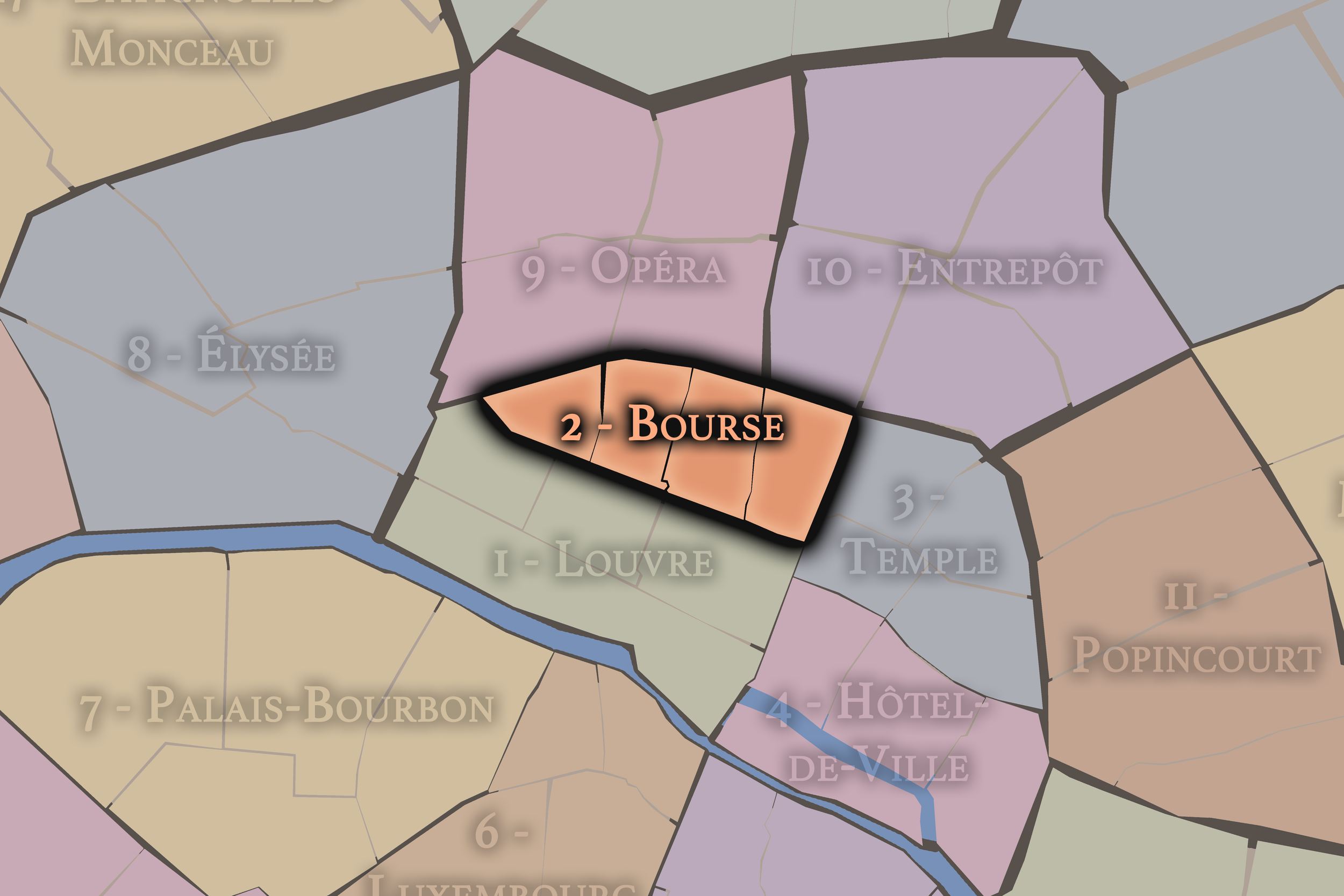
2e — Bourse
The smallest arrondissement, the 2e is associated with the former Paris stock exchange, covered passages, dense commercial streets, textile history, and the compact urban fabric of the Right Bank.
-
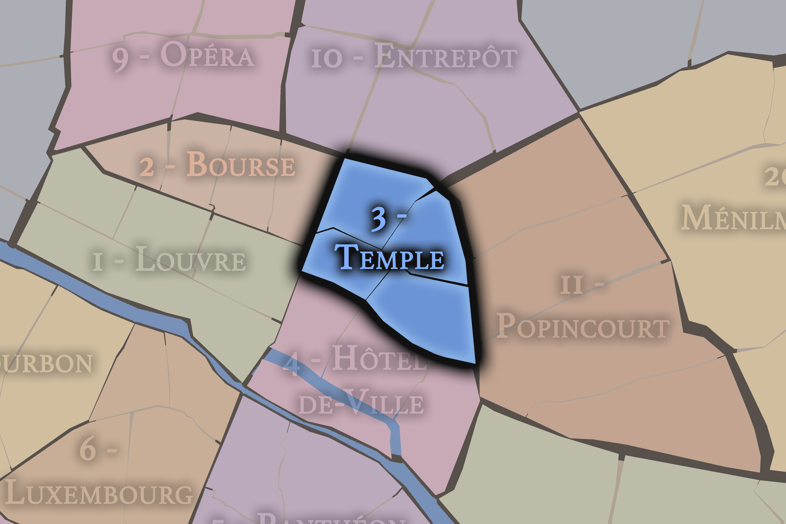
3e — Temple
Part of the northern Marais, the 3e includes historic mansions, museums, quiet streets, and layers of aristocratic, religious, commercial, and creative identity
-
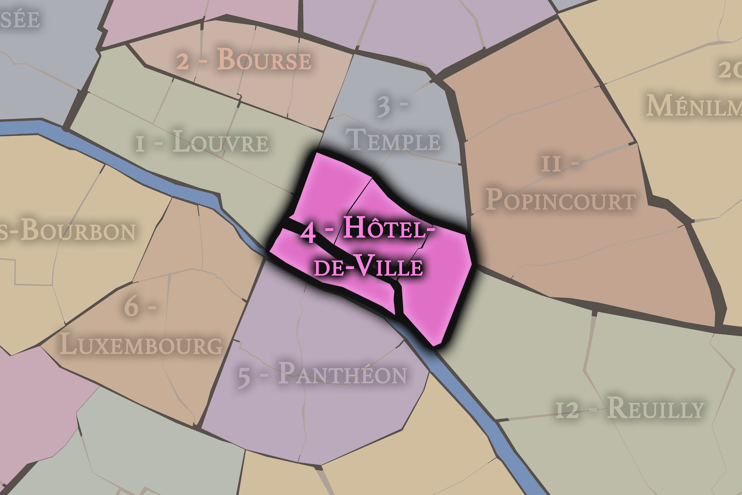
4e — Hôtel-de-Ville
The 4e contains the Hôtel de Ville, the Île de la Cité, the Île Saint-Louis, and portions of Le Marais, making it one of the most historically concentrated districts in Paris.
-
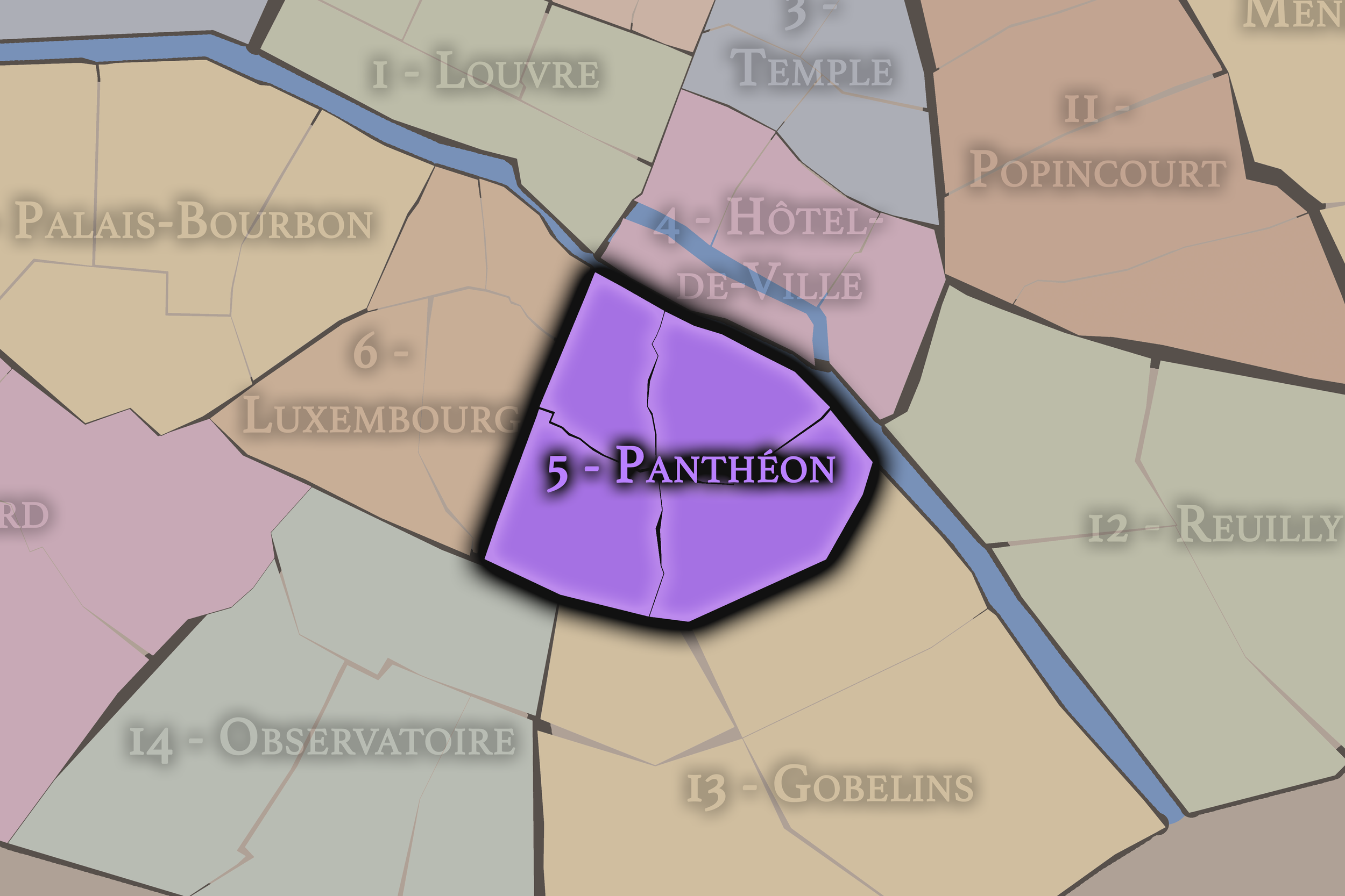
5e — Panthéon
The 5e is closely tied to the Latin Quarter, with ancient streets, universities, churches, bookshops, the Panthéon, and a long association with scholarship and intellectual life
-
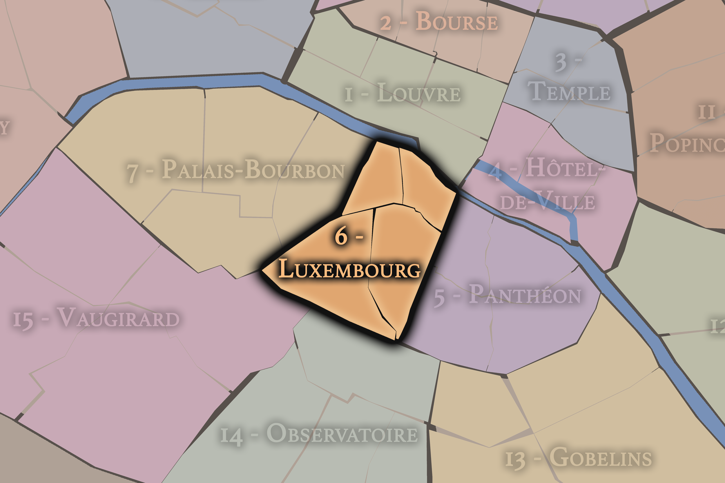
6e — Luxembourg
Centered around the Luxembourg Garden and associated with Saint-Germain-des-Prés, the 6e carries an identity shaped by publishing, cafés, galleries, religious history, and literary mythology.
-
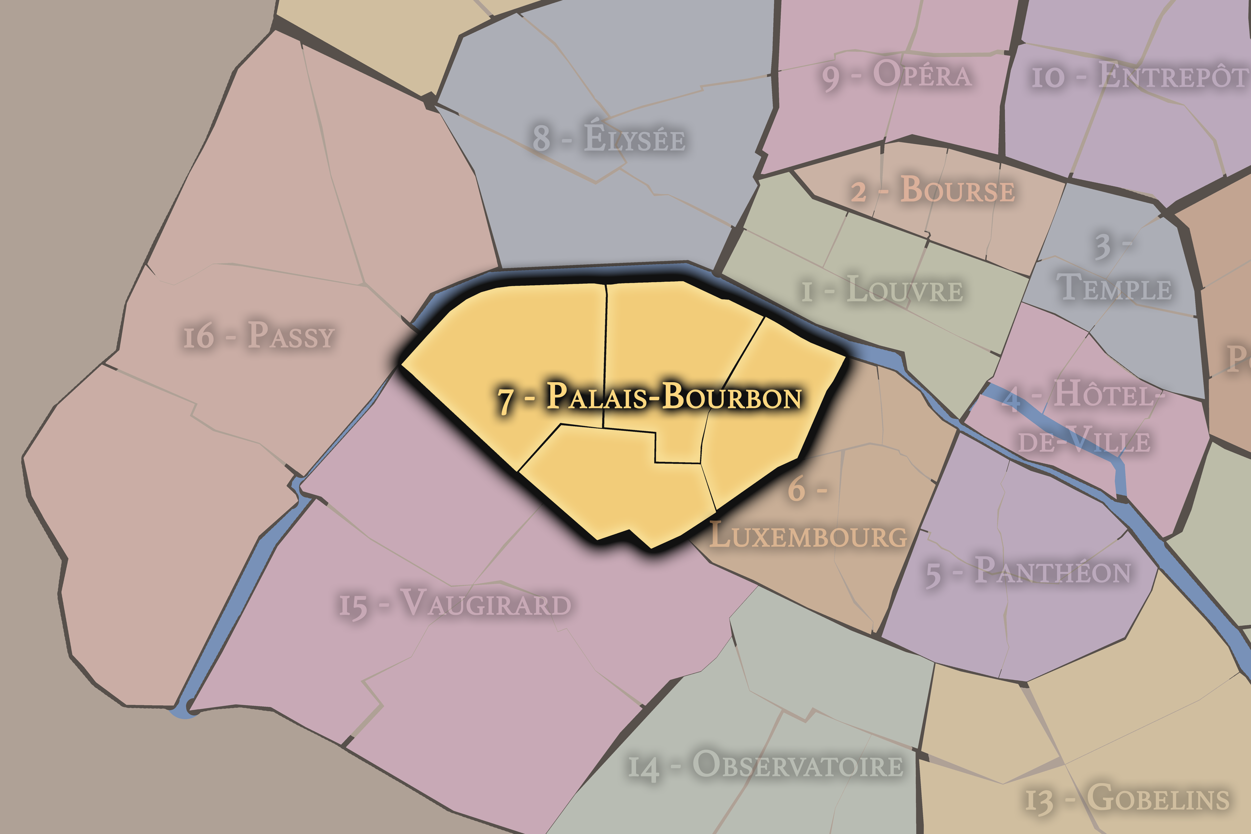
7e — Palais-Bourbon
The 7e is one of Paris’s great districts of state power and monumental form, home to the Eiffel Tower, Les Invalides, the National Assembly, museums, embassies, and broad institutional avenues.
-
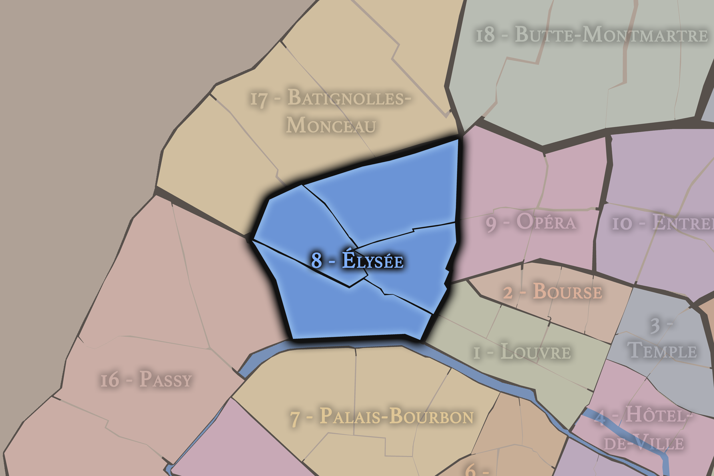
8e — Élysée
The 8e includes the Champs-Élysées, the Élysée Palace, major luxury corridors, theaters, hotels, and some of the most internationally recognized ceremonial spaces in Paris.
-
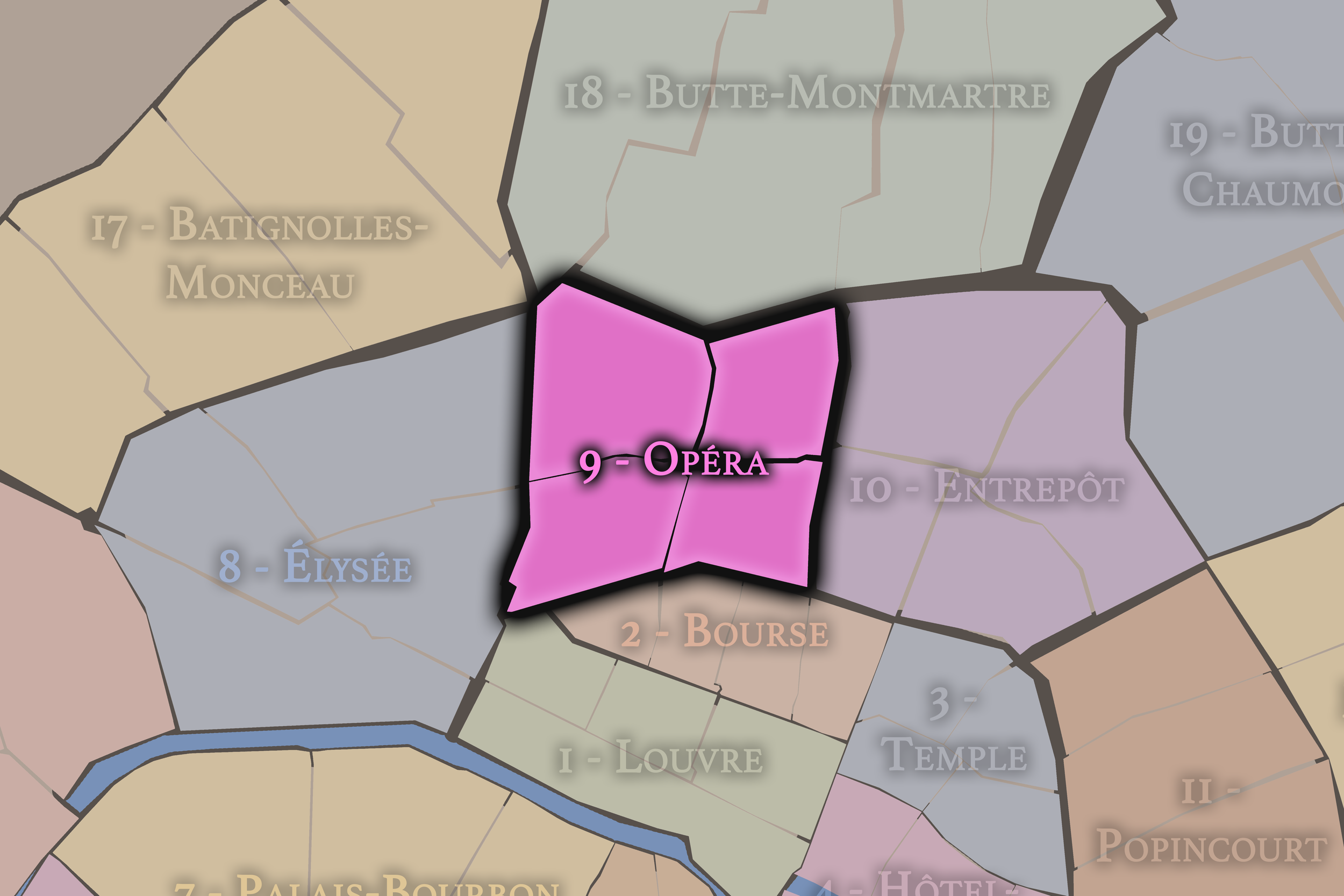
9e — Opéra
The 9e is shaped by the Palais Garnier, department stores, theater streets, banking history, and the lively transition between central boulevards and the slopes below Montmartre.
-
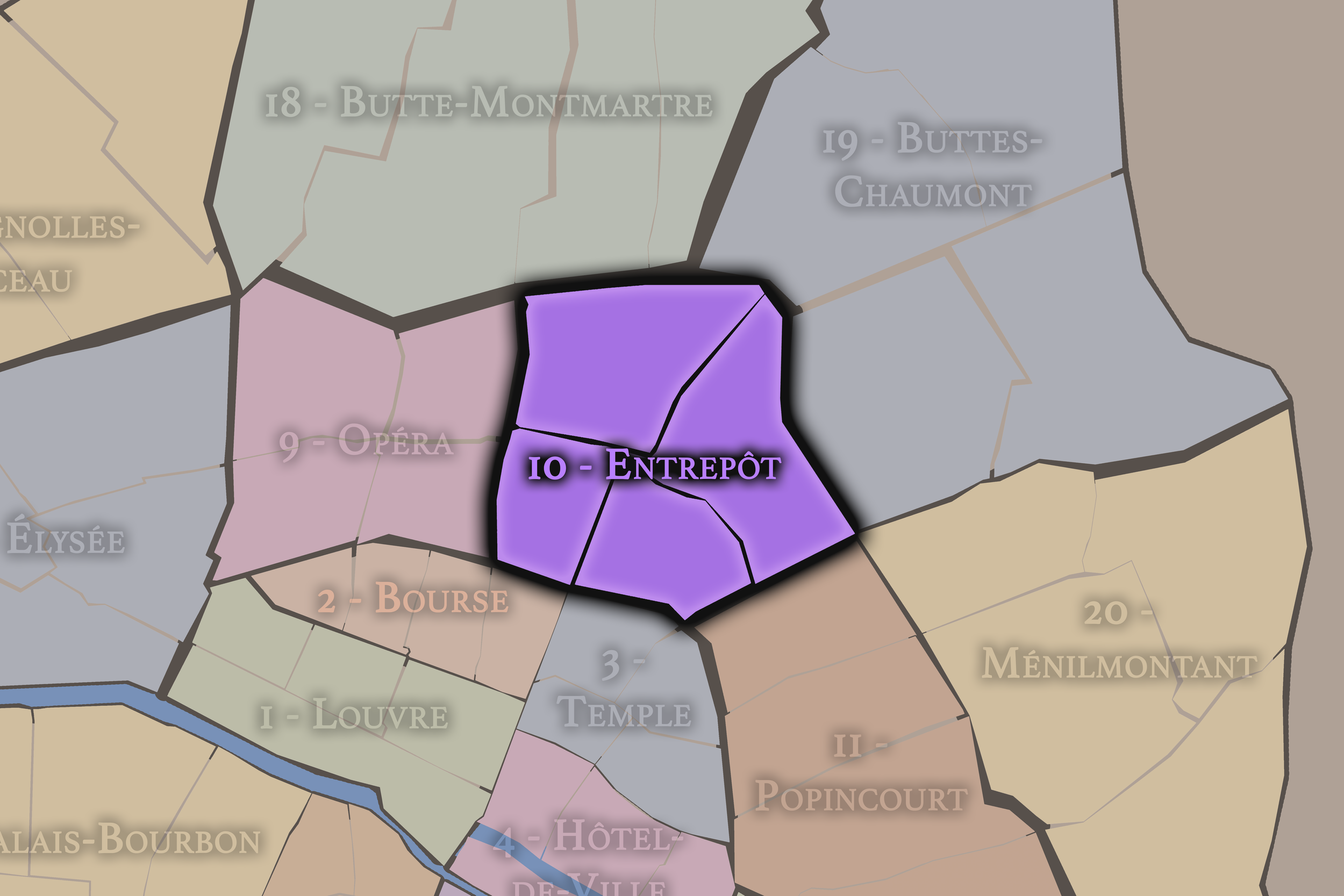
10e — Entrepôt
The 10e is a district of movement and crossings, defined by the Canal Saint-Martin, Gare du Nord, Gare de l’Est, markets, dense streets, and the energy of arrival and departure.
-
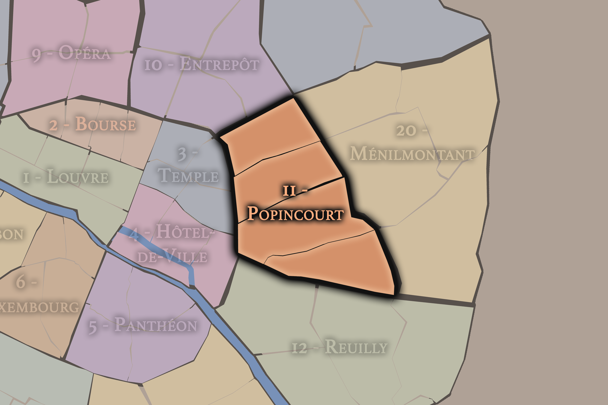
11e — Popincourt
The 11e is one of Paris’s great districts of popular life, associated with workshops, revolutionary memory, nightlife, residential density, and the streets between Bastille, République, and Nation
-
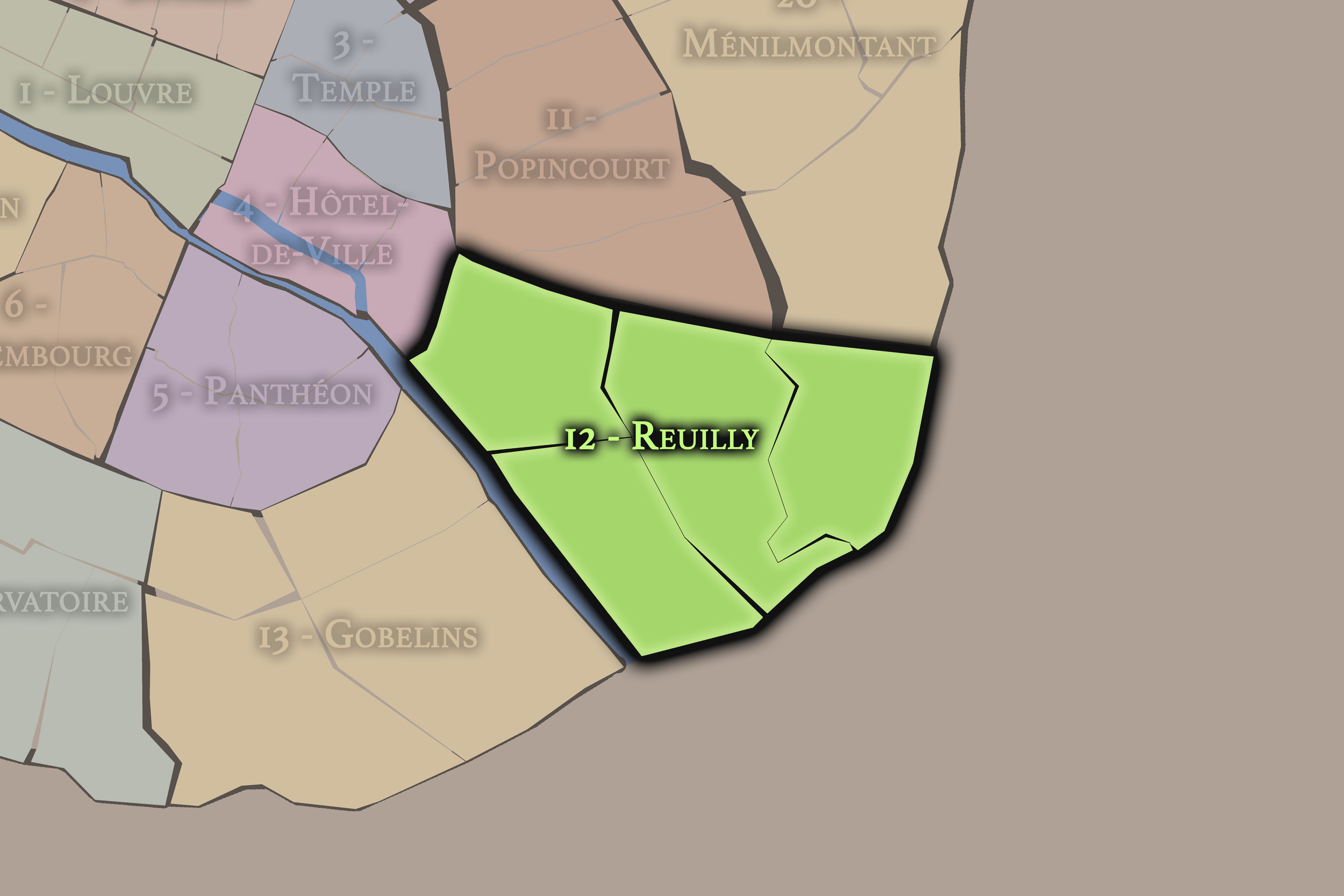
12e — Reuilly
The 12e stretches from the historic edges near Bastille toward the Bois de Vincennes, combining markets, rail history, residential quarters, parks, and eastern gateways into the city.
-
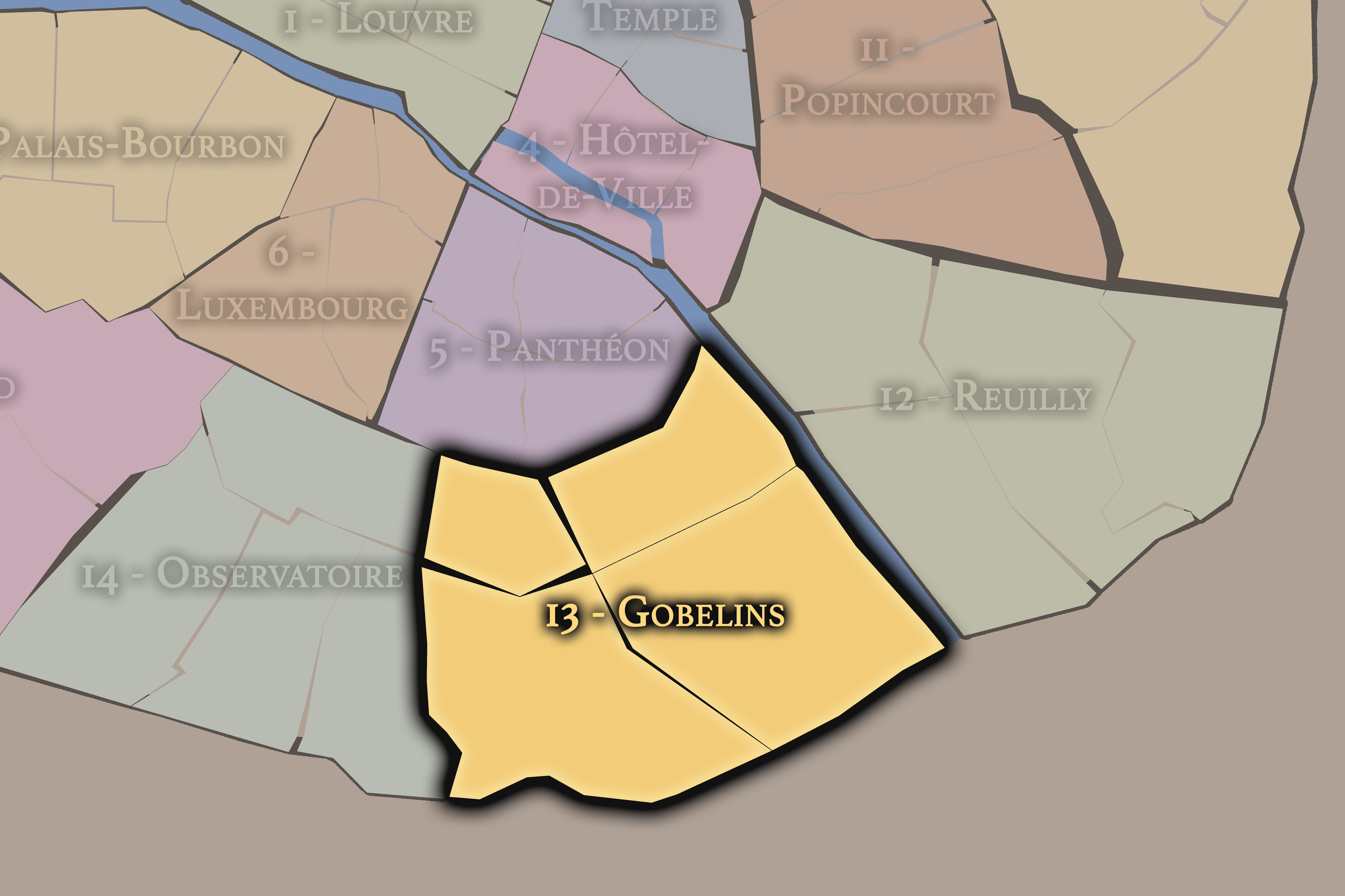
13e — Gobelins
The 13e includes the Gobelins area, Butte-aux-Cailles, modern towers, Asian commercial districts, rail corridors, and large-scale urban development along the southeastern edge of Paris.
-
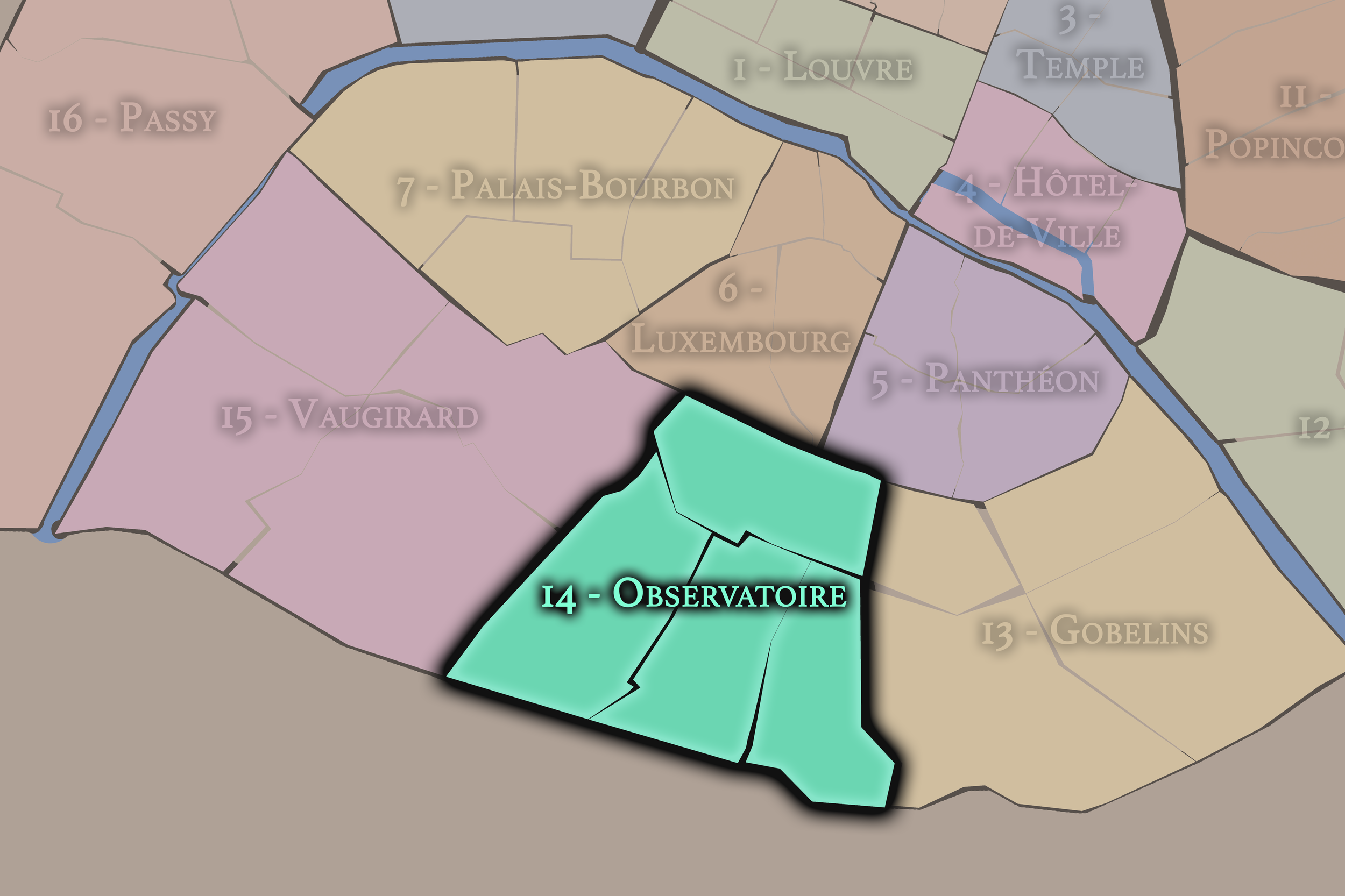
14e — Observatoire
The 14e is associated with the Paris Observatory, Montparnasse, residential streets, cemeteries, artists’ histories, and the southern approaches to the city.
-
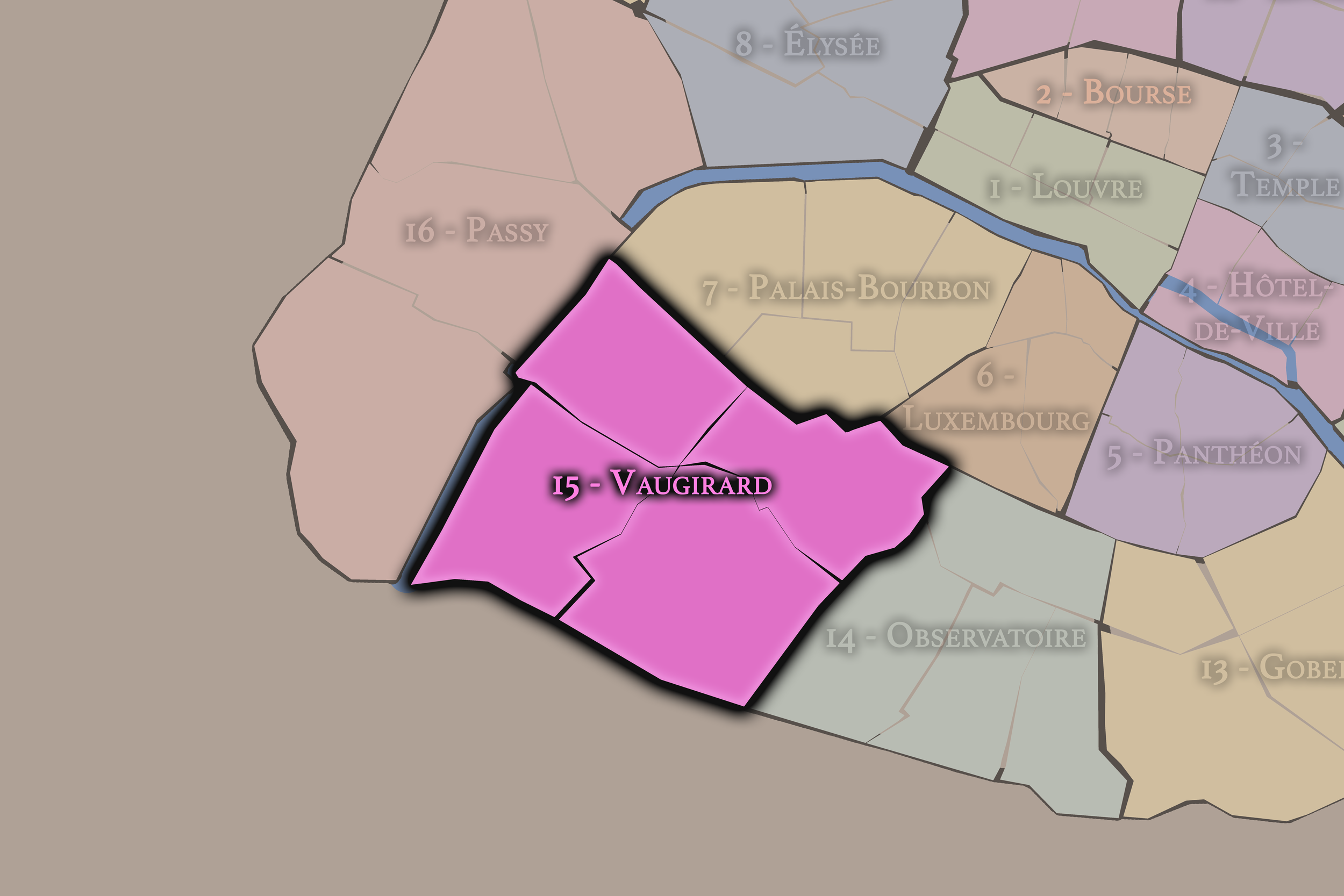
15e — Vaugirard
The largest arrondissement by population, the 15e is a broad Left Bank district of residential neighborhoods, commercial avenues, parks, exhibition grounds, and everyday Parisian life.
-
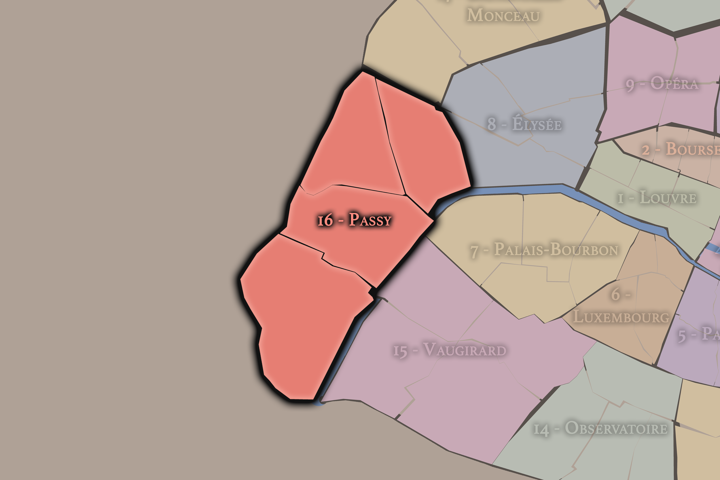
16e — Passy
The 16e is shaped by the former village of Passy, grand residential avenues, museums, embassies, the Bois de Boulogne, and views across the Seine toward the Eiffel Tower.
-
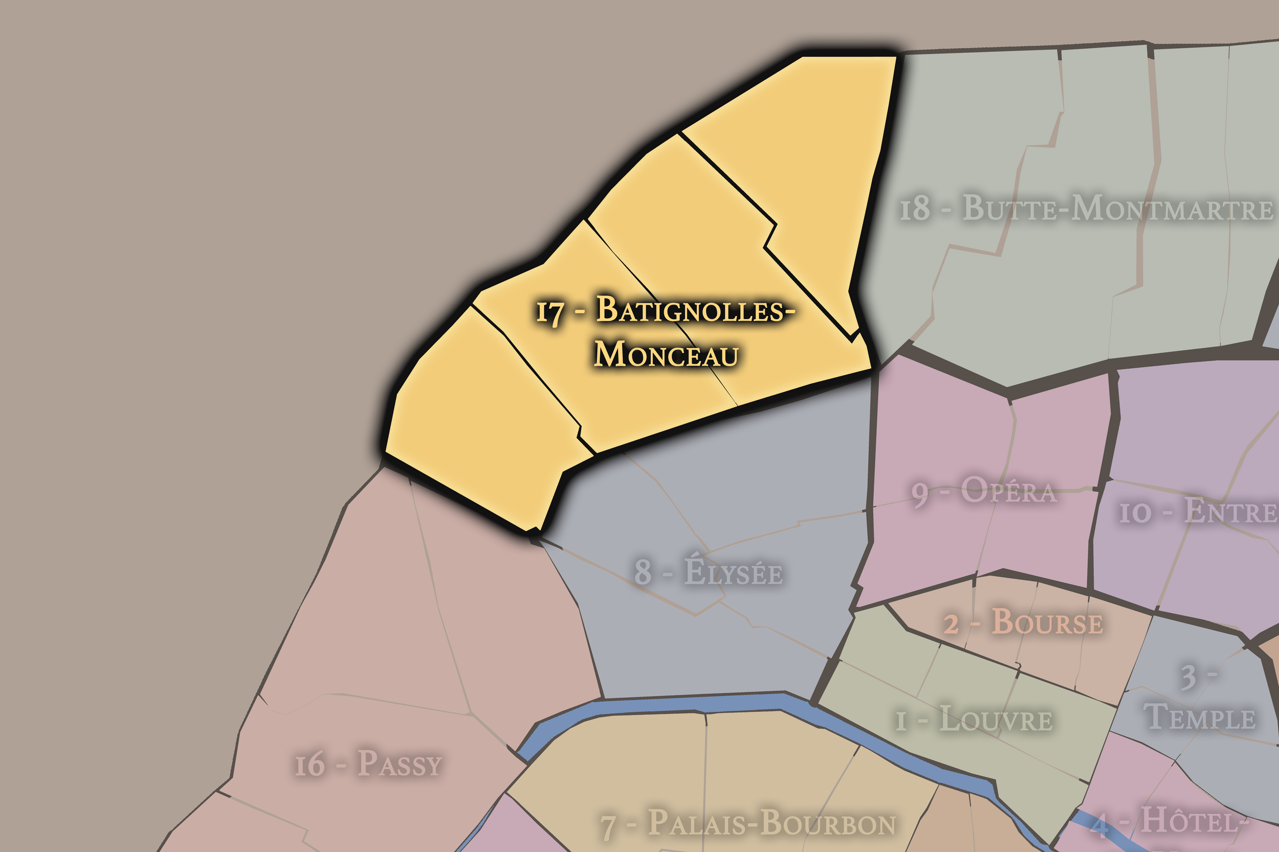
17e — Batignolles-Monceau
The 17e brings together Batignolles, Monceau, Ternes, and other districts, shifting from elegant western avenues to village-like streets, rail edges, markets, and residential quarters
-
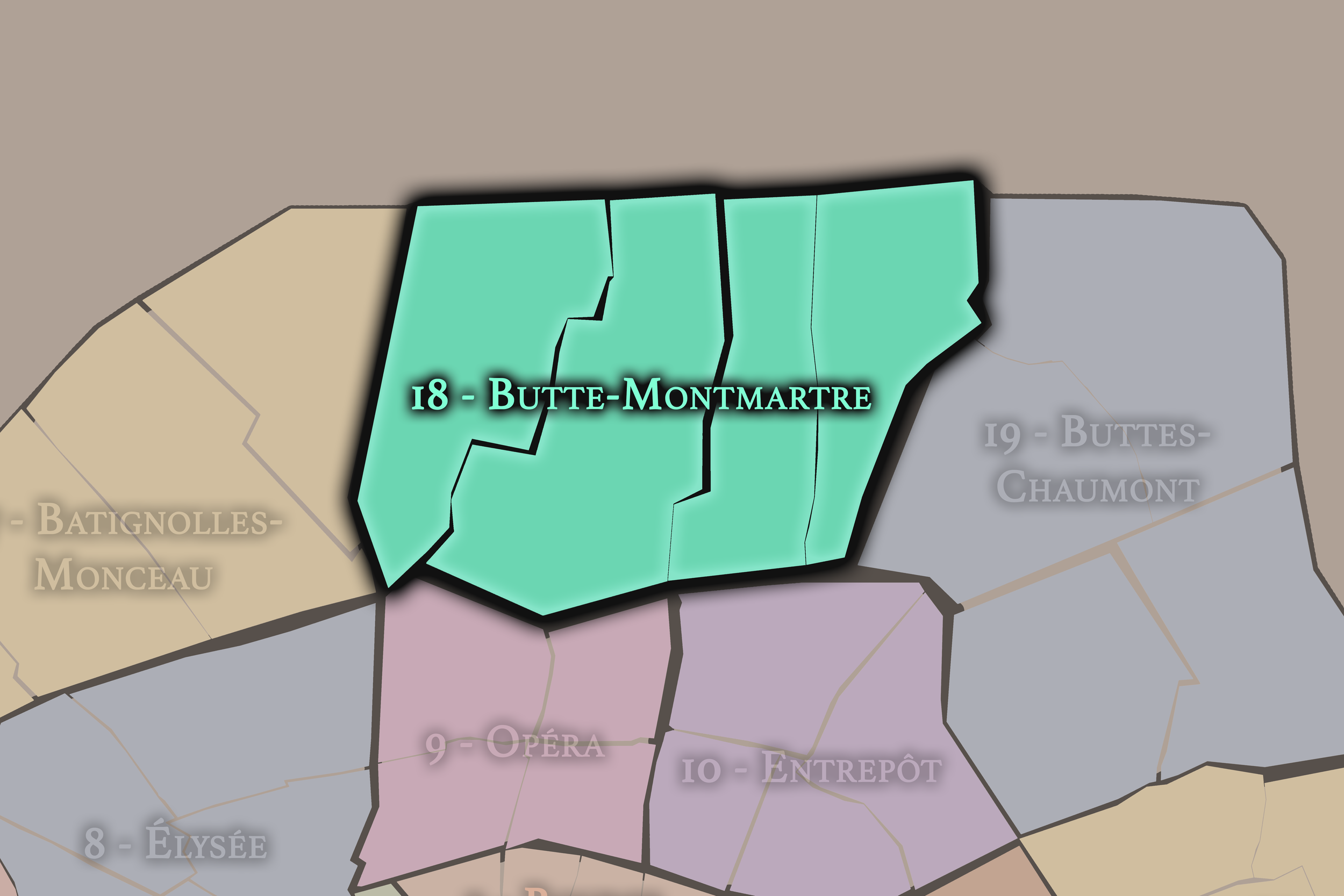
18e — Butte-Montmartre
The 18e includes Montmartre, La Goutte d’Or, parts of La Chapelle, and northern hilltop and working-class landscapes, making it one of the city’s most visually and culturally varied arrondissements.
-
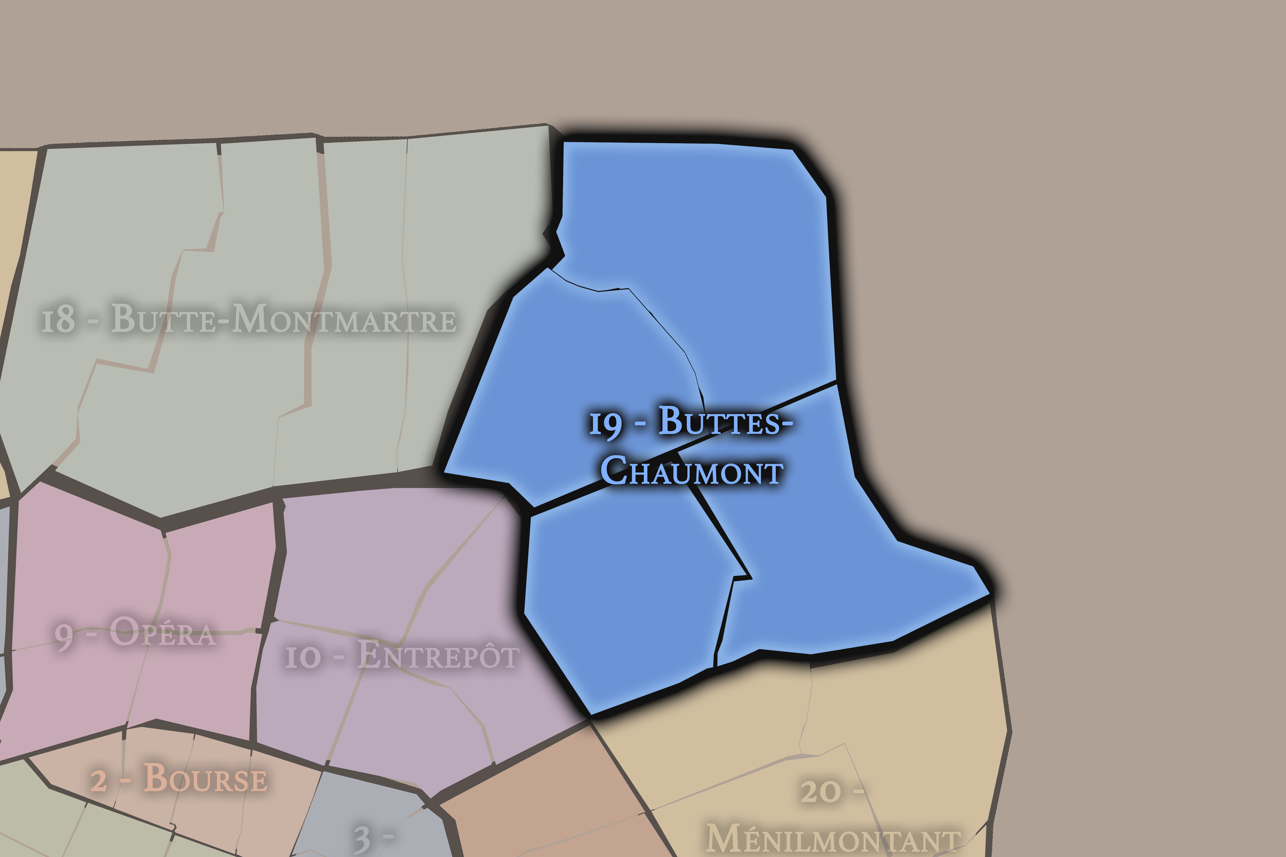
19e — Buttes-Chaumont
The 19e is defined by parks, canals, slopes, reservoirs, working-class history, music venues, and the northeastern edge of Paris, including the Parc des Buttes-Chaumont and the Bassin de la Villette.
-
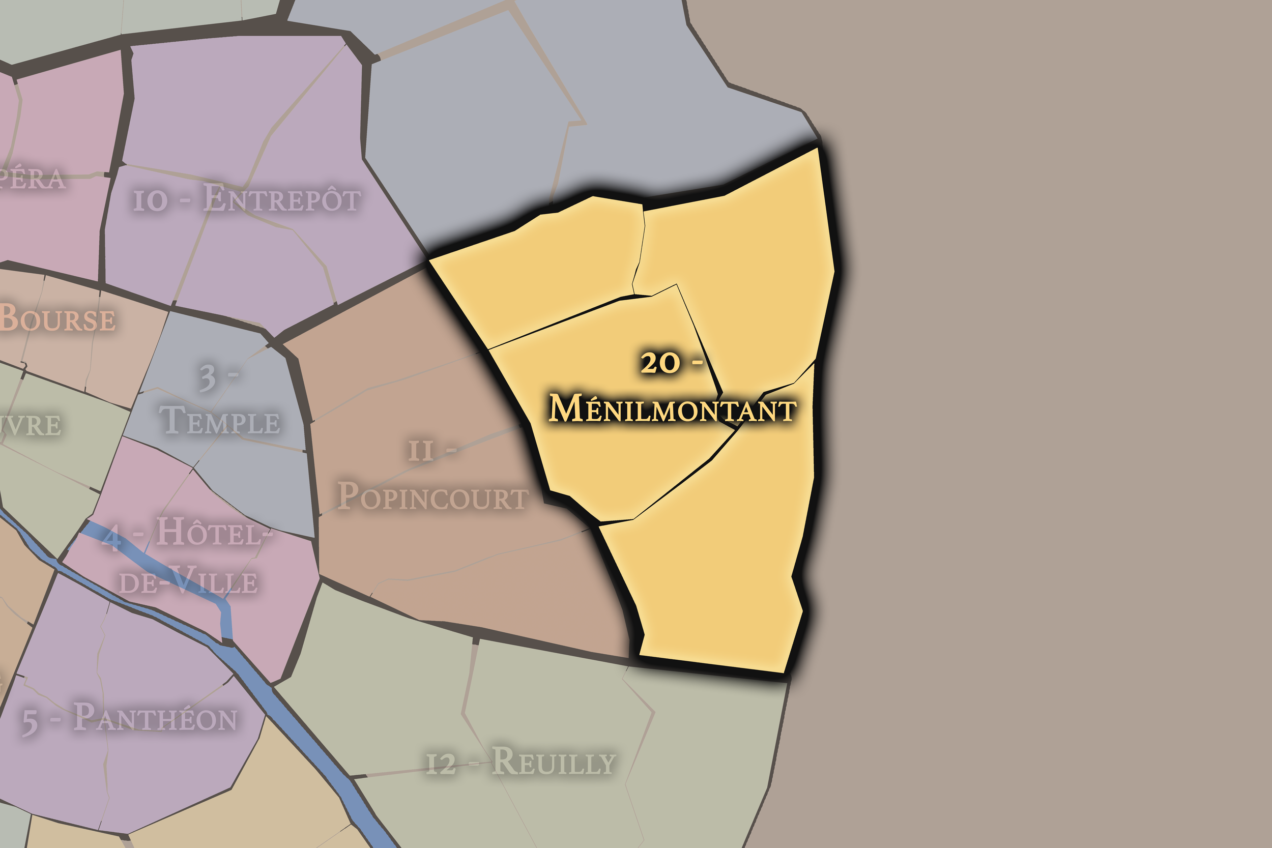
20e — Ménilmontant
The 20e includes Belleville, Ménilmontant, Père-Lachaise, and eastern residential districts, with a strong identity shaped by hills, immigration, popular culture, cemeteries, street art, and neighborhood memory.
The History
Late 18th Century: Revolutionary Reorganization

Paris first received an arrondissement structure during the French Revolution. On 11 October 1795, the city was divided into twelve arrondissements, replacing earlier revolutionary sections with a new administrative geography. This reorganization reflected the revolutionary effort to remake civic life through clearer, more systematic forms of government.
The first arrondissement system did not yet resemble the Parisian spiral known today. The twelve districts were arranged largely from west to east, with nine on the Right Bank and three on the Left Bank. Paris was still a smaller city, confined within earlier limits, and many places now considered unmistakably Parisian still remained outside the official capital.
Early–Mid 19th Century: The Twelve-Arrondissement City

For the first half of the nineteenth century, Paris remained a twelve-arrondissement city. Its official geography covered the historic capital, while surrounding communes, villages, and suburban districts developed beyond the city’s administrative boundary. Montmartre, Belleville, Passy, Vaugirard, Grenelle, Batignolles, La Villette, and other areas were not yet fully absorbed into Paris.
This created a growing mismatch between the city as it was officially defined and the city as it was expanding in practice. Paris was becoming larger, denser, and more economically complex, but its administrative map still reflected an earlier urban form. By the middle of the nineteenth century, the pressure to reorganize the capital had become part of a much larger transformation of Paris.
1860: Annexation and the Twenty Arrondissements

The decisive transformation came on 1 January 1860, when Paris annexed surrounding communes and expanded dramatically. Eleven communes were annexed in whole or in part, including Auteuil, Passy, Batignolles, Montmartre, La Chapelle, La Villette, Belleville, Charonne, Bercy, Vaugirard, and Grenelle. The capital grew from twelve arrondissements to twenty, and the modern municipal map of Paris was born.
This was also the moment when the familiar spiral arrangement took shape. The new arrondissements were numbered from the center outward in a clockwise pattern, creating the famous escargot form that still defines Parisian civic geography. The arrondissement system became more than an administrative convenience; it became a new way of reading the city from its historic core toward its expanded modern edges.
Late 19th Century: Haussmann and the Modern Capital
The creation of the twenty arrondissements belonged to the same era as the transformation of Paris under Napoleon III and Baron Georges-Eugène Haussmann, Prefect of the Seine from 1853 to 1870. New boulevards, parks, sewers, rail connections, civic buildings, and monumental perspectives reshaped the capital. The expanded arrondissement map gave administrative form to a city being remade for movement, infrastructure, visibility, and modern governance.
This did not mean Paris became uniform. The new civic order gathered very different landscapes into a single municipal system: old central districts, former villages, industrial edges, market streets, aristocratic quarters, working-class neighborhoods, parks, cemeteries, and rail corridors. The arrondissement map helped organize this complexity without erasing it.
20th Century: Local Identity Within the Municipal Frame

Through the twentieth century, the arrondissements remained the broad official framework of Paris, but older and more intimate place identities continued to matter. Former villages and local districts retained their names, memories, and associations. Montmartre remained Montmartre. Belleville remained Belleville. Passy, Vaugirard, Grenelle, Batignolles, Ménilmontant, and other older places continued to shape how residents and visitors understood the city.
The arrondissement system therefore became both practical and symbolic. It organized addresses, town halls, local administration, and everyday orientation, while also holding together places whose identities were older, smaller, or more culturally specific than the arrondissement itself. Paris could be read by number, but it could not be reduced to number.
21st Century: The Layered City

Today, the arrondissements remain central to how Paris is governed, addressed, described, and imagined. Each arrondissement still has a local town hall structure, although a major change took effect on 29 June 2020, when the first four arrondissements were administratively grouped into Paris Centre without eliminating their historic arrondissement identities.
In the twenty-first century, the arrondissement is best understood as one layer within a richer urban geography. It sits alongside the eighty Administrative Quarters, the Conseils de Quartier, Cultural Neighborhoods, historic place-names, tourist districts, residential identities, and the lived language of Paris itself. The arrondissement remains the broad civic frame, but Paris continues to be a city of overlapping maps.
The Photography
Visual Identity

The visual identity of each Paris district begins with its position in the city’s layered geography. Before the photographs arrive, the maps establish a first way of seeing: where the district sits, what civic layer it belongs to, which boundaries define it, and how it connects to the surrounding fabric of Paris. In CityNeighborhoods Paris, cartography is not merely orientation; it is part of the visual language of the project.
As the photographic archive grows, this section will continue to develop through images gathered on foot. Streets, façades, monuments, markets, parks, river edges, passages, signs, textures, and everyday details will gradually reveal how each district presents itself visually. The goal is not only to show what a place looks like, but to trace how its identity becomes visible through form, atmosphere, memory, and use.
Through The Lens

CityNeighborhoods Paris is built from walking, looking, and returning. Each district is approached through photography as a way of paying attention: to the obvious landmarks and the quieter details, to historic structures and ordinary streets, to the moments where civic geography becomes lived experience. The camera becomes a tool for noticing how Paris changes from one district to the next, and how each place holds its own relationship to the larger city.
As photographs are processed and added, this section will become a more specific visual record of the district. Future updates may include dated field notes, galleries, and reflections from individual walks. For now, the page remains part of the larger CityNeighborhoods effort to document every Paris neighborhood through maps, history, identity, and photography — one district, one walk, and one visual encounter at a time.
If you visit Paris, these ideas can help inspire your own photography.


Paris: J’Espere, Je Rêve, Je Vive
Paris Photo Gallery
Paris Flâneur Notes
Flâneur Notes document the walks, photographs, light, and street-level observations behind this neighborhood entry. Learn more about the Spirit of the Flâneur.


Explore Paris
-

The twenty arrondissements form the civic spiral of Paris, organizing the city into its broad local districts of government, identity, and daily life.
-

Each arrondissement is divided into four official administrative quarters, giving Paris a more precise civic and geographic framework.
-

The conseils de quartier bring participation to street level, giving residents a voice in neighborhood needs, public space, and local civic life.
-

Les Deux Rives trace Paris through the Seine’s two banks, revealing how the Rive Droite and Rive Gauche shaped the city’s civic power, commerce, learning, art, and cultural identity.
-

Cultural neighborhoods reveal the Paris people recognize through history, cafés, architecture, memory, atmosphere, and local belonging.