
MILIEUX CULTURELS
Cultural Neighborhoods
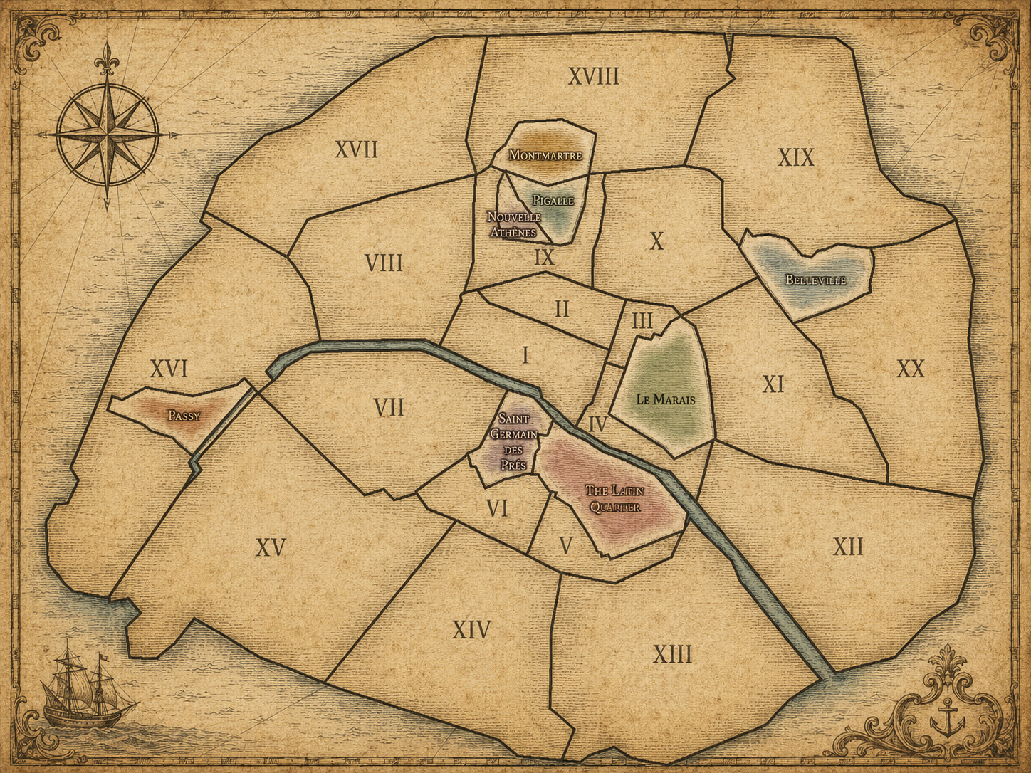
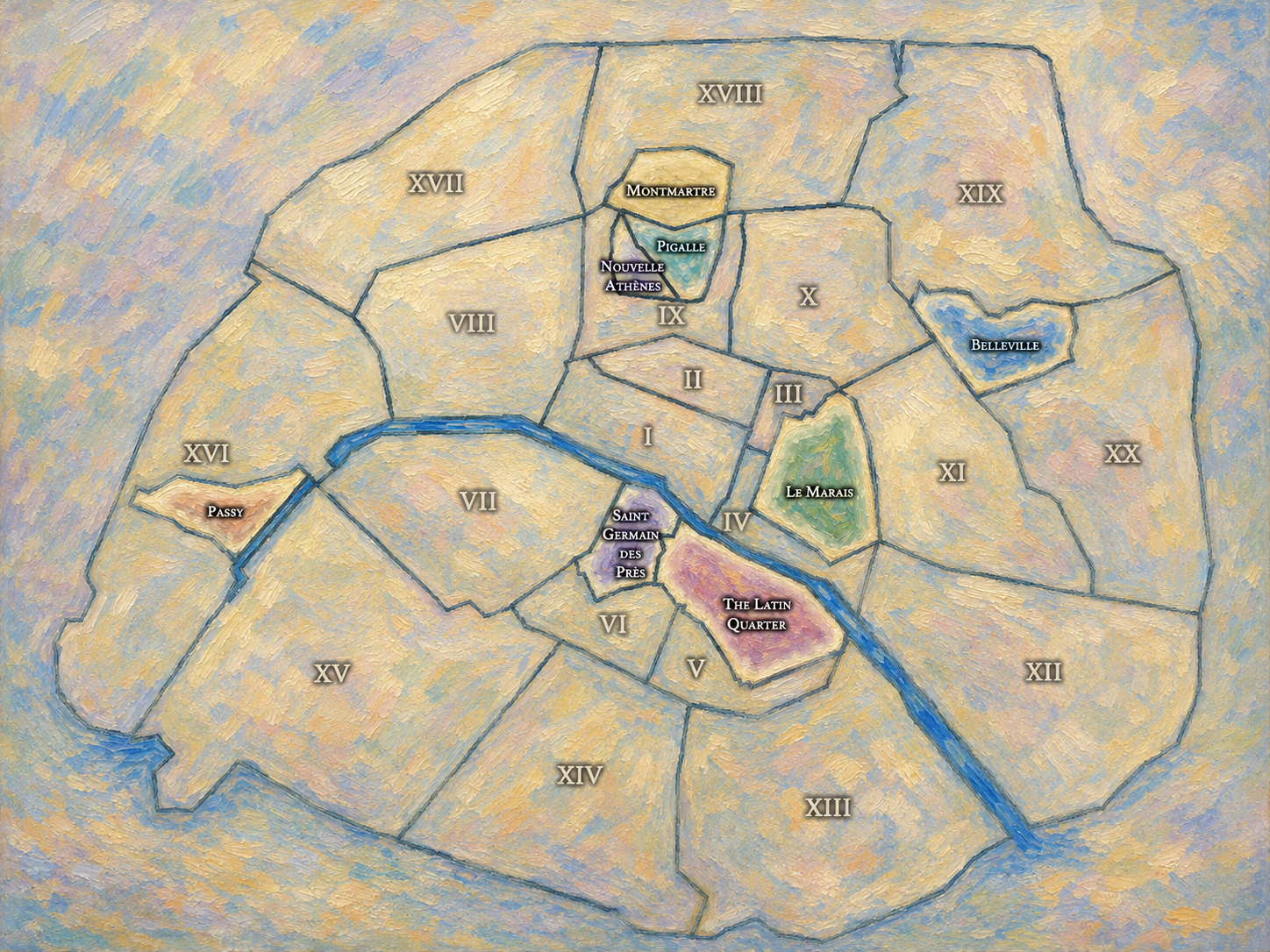
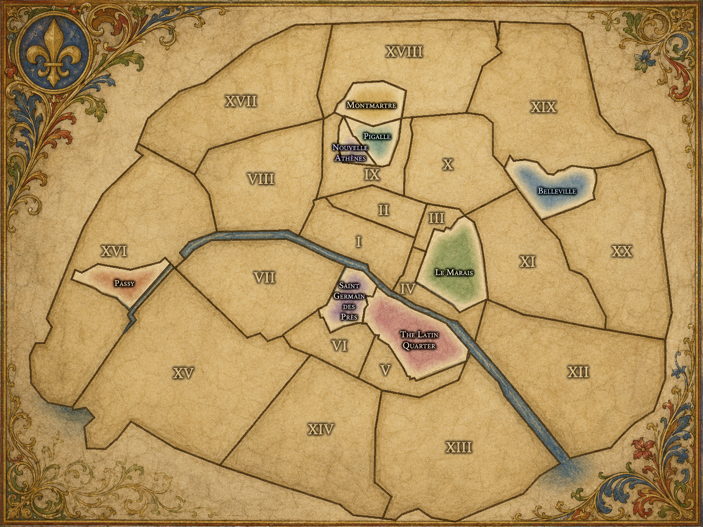
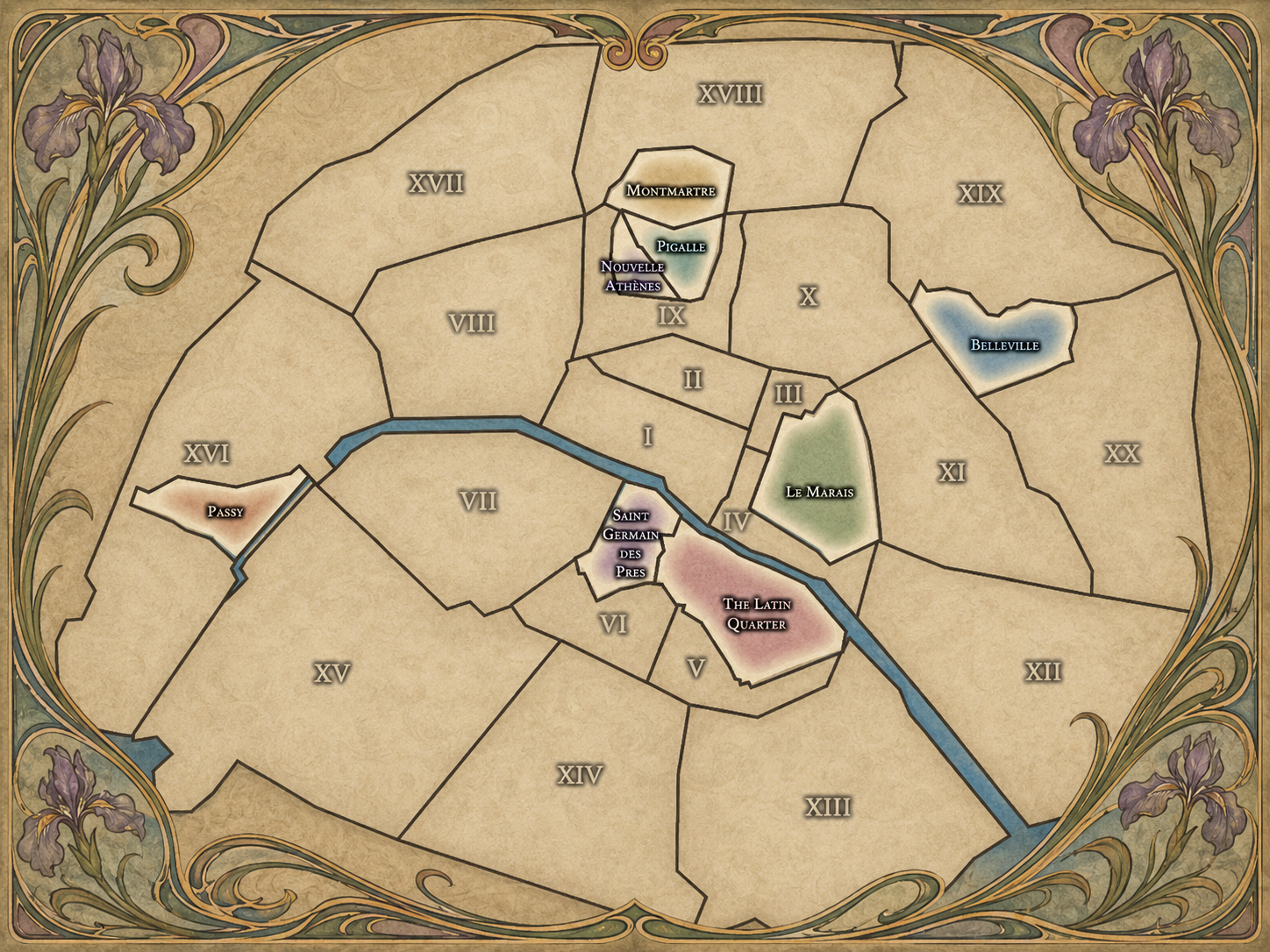
Beyond Paris’s official civic boundaries, cultural neighborhoods give the city many of its most recognizable identities. These are the historic districts, artistic milieus, commercial corridors, village remnants, literary quarters, immigrant crossroads, and lived places that shape how Paris is remembered, described, photographed, and experienced. Some align closely with official boundaries; others cross arrondissements, administrative quarters, and neighborhood council areas. Together, they reveal Paris not only as a city of civic divisions, but as a layered cultural atlas of memory, movement, identity, and urban life.


The Map
Geographic Setting
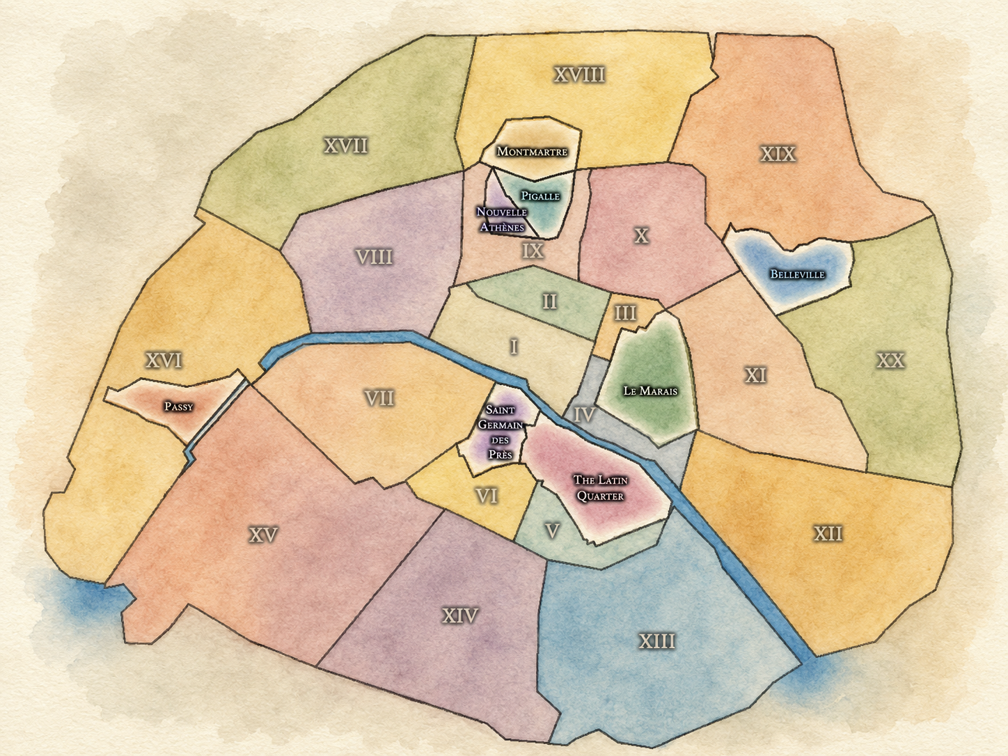
Paris’s cultural neighborhoods do not form a single official civic layer. Unlike arrondissements, administrative quarters, or neighborhood councils, they are not arranged according to one fixed municipal framework. Instead, they emerge from history, geography, memory, culture, commerce, architecture, and daily use.
Some cultural neighborhoods are closely tied to a specific arrondissement or administrative quarter. Others extend across several official boundaries, following older village lines, market streets, artistic milieus, immigrant communities, nightlife districts, religious centers, university landscapes, or historic corridors of urban growth. Their geography is often recognizable, but not always exact.
This is part of their importance. Cultural neighborhoods reveal how Paris is lived and remembered beyond its formal divisions. They help explain why a place can be official in one sense, informal in another, and culturally powerful even when its borders remain open to interpretation.
Milieux Culturels Identity
Etymology and Origins
Paris’s cultural neighborhoods begin with names, but they do not end there.
Some names preserve older villages, hillsides, abbeys, markets, streets, or landmarks. Others gather meaning through literature, music, nightlife, migration, commerce, political memory, artistic life, or the slow accumulation of daily use. A name like Montmartre, Belleville, Pigalle, Passy, Le Marais, or Saint-Germain-des-Prés does more than identify a place. It carries an atmosphere, a history, a reputation, and a set of associations that may extend beyond any single official boundary.
CityNeighborhoods Paris uses the term Cultural Neighborhoods to describe these named landscapes of memory and identity. They are not official districts in the same sense as arrondissements or administrative quarters, but they are no less important to the way Paris is understood. They reveal how the city’s meanings are formed not only by government and geography, but by recognition, repetition, experience, and imagination.
Cultural Framework
Cultural neighborhoods are the places through which many people first come to know Paris. Names like Montmartre, Le Marais, Belleville, Pigalle, Passy, the Latin Quarter, and Saint-Germain-des-Prés carry more than location. They carry associations: artistic life, intellectual history, nightlife, village memory, architecture, migration, commerce, religion, class, literature, and style.
Yet those names can also become simplified. A cultural neighborhood may be reduced to a mood, a postcard, a shopping district, or a guidebook shorthand. CityNeighborhoods Paris treats those names differently. It asks what makes them meaningful, where their identities come from, how they relate to official Paris, and why their boundaries are often more cultural than administrative.
In this sense, cultural neighborhoods are not alternatives to the civic map. They are a layer placed in conversation with it. They show how Paris exceeds its administrative structure without abandoning it: how official divisions, historical memory, and lived experience overlap.
Neighborhood Distinction
Cultural neighborhoods differ from the other layers of CityNeighborhoods Paris because they are interpretive rather than strictly official. Arrondissements divide Paris into twenty municipal districts. Administrative quarters divide each arrondissement into four smaller official units. Neighborhood councils reflect local participatory civic life. The Deux Rives express one of the city’s most enduring geographic and cultural distinctions.
Cultural neighborhoods, by contrast, arise from recognition. They are shaped by people, history, reputation, use, and memory. Their identities may be reinforced by monuments, streets, institutions, markets, cafés, churches, theaters, schools, transit hubs, nightlife, or architecture, but they are not always defined by a single legal boundary.
That ambiguity is not a weakness. It is part of what makes cultural neighborhoods essential. They reveal the difference between a city as administered and a city as experienced.
Parisian Identity
Paris has always been more than its official map. The city’s identity has been formed through quarters, villages, faubourgs, parishes, markets, intellectual circles, artistic districts, religious communities, immigrant landscapes, and working-class neighborhoods. Many of the places now recognized as cultural neighborhoods began as settlements, suburbs, hillsides, monastic lands, commercial corridors, or social worlds outside the administrative center.
As Paris expanded, absorbed surrounding villages, reorganized its civic boundaries, and transformed through royal planning, revolutionary government, Haussmannian reconstruction, industrial growth, immigration, tourism, and preservation, these cultural identities did not disappear. They changed form. Some became famous. Some became contested. Some became commercialized. Some remained local. Some became symbols of Paris itself.
CityNeighborhoods Paris presents cultural neighborhoods as one of the clearest ways to understand this layered identity. They are where history becomes atmosphere, where civic geography becomes lived place, and where Paris’s official structure meets the imagination of the city.
Les Milieux Culturels
-
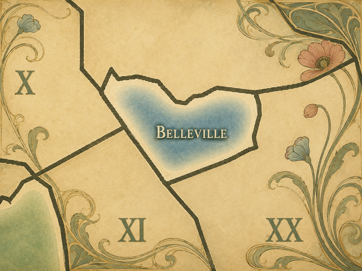
Belleville is one of eastern Paris’s most layered cultural landscapes, shaped by working-class history, immigration, street art, music, and hillside views across the city. Long associated with village life beyond old Paris, it remains a place where local identity, cultural mixture, and political memory meet.
-
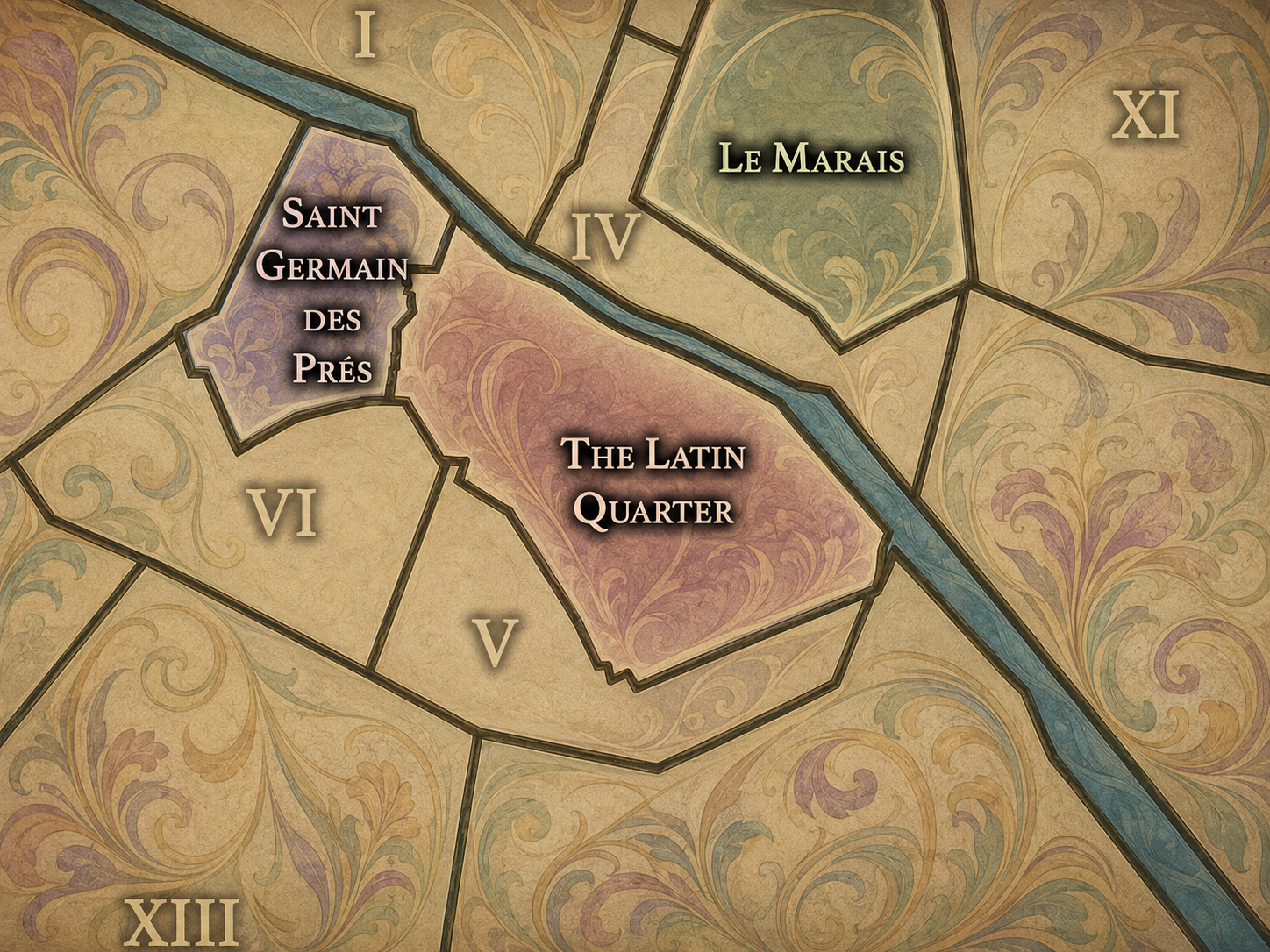
The Latin Quarter is one of Paris’s great intellectual and educational landscapes, rooted in the medieval university world around the Sorbonne and the Left Bank’s long scholarly tradition. Its streets, bookshops, churches, schools, and cafés preserve a cultural identity shaped by learning, debate, student life, and literary memory.
-
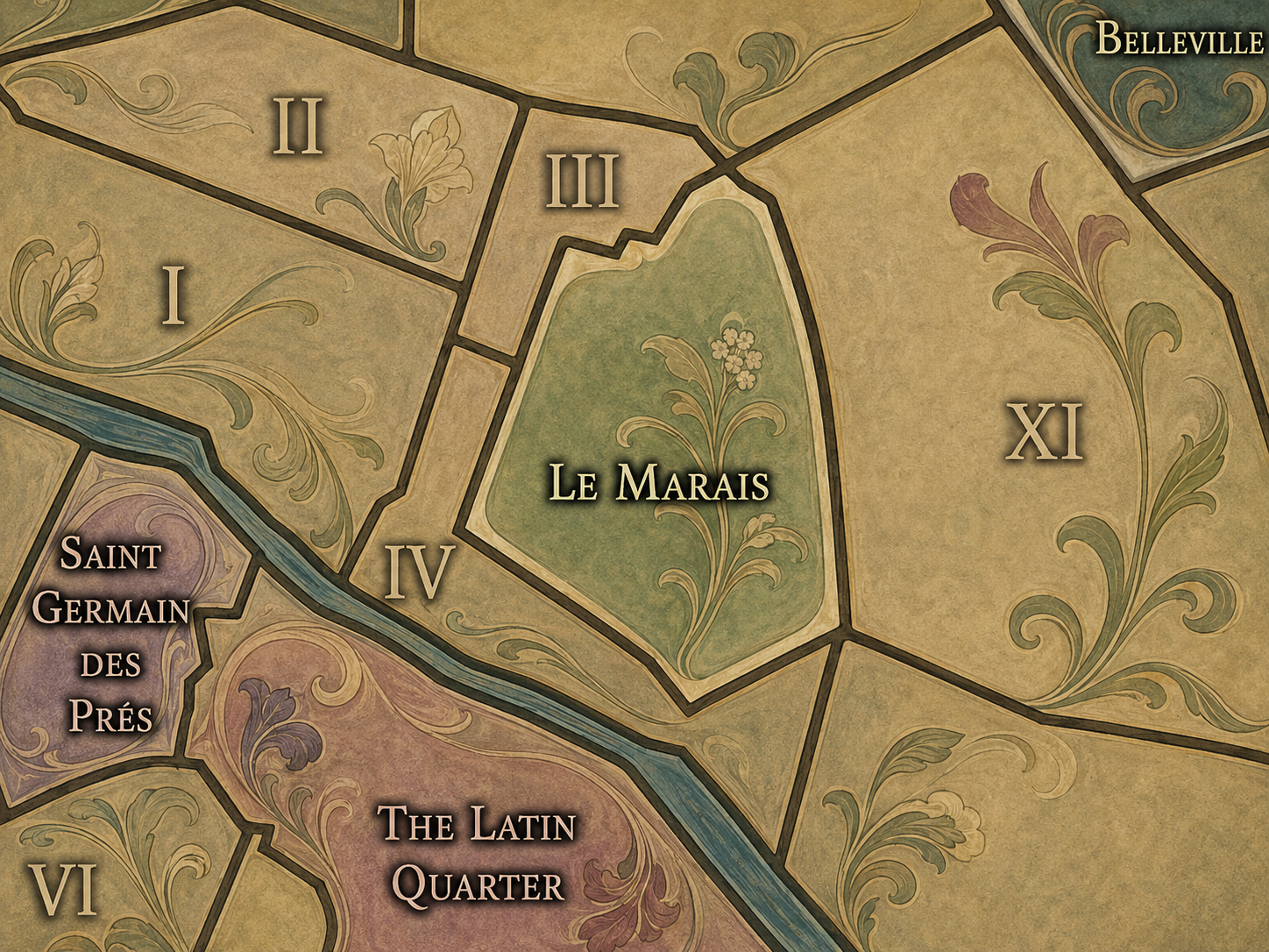
Le Marais is one of Paris’s most historically layered cultural neighborhoods, shaped by aristocratic residences, Jewish Paris, queer Paris, museum culture, preservation, fashion, and street life. Its identity crosses civic boundaries and reveals how architecture, memory, community, and cultural reinvention can occupy the same urban fabric.
-
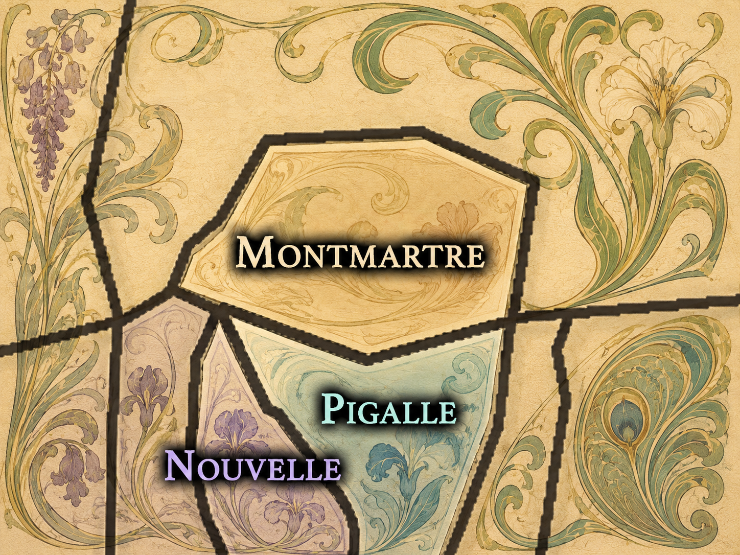
Montmartre rises above Paris as a former village, artistic landmark, religious height, and mythic district of bohemian memory. From the Butte and Sacré-Cœur to its studios, stairways, cafés, and views, Montmartre carries one of the city’s most enduring identities as both lived neighborhood and cultural symbol.
-

Nouvelle Athènes is a refined cultural quarter of the 9e arrondissement, associated with Romantic-era Paris, artistic circles, writers, composers, and elegant 19th-century urban form. Its mansions, studios, theaters, and quiet streets preserve the memory of a Paris where artistic life and domestic architecture became deeply intertwined.
-

Passy carries the memory of a former village absorbed into western Paris, shaped by residential elegance, hillside geography, refined shopping streets, museums, gardens, and views toward the Seine. More restrained than many of the city’s famous cultural quarters, it reveals a quieter form of Parisian identity rooted in distance, discretion, and continuity.
-
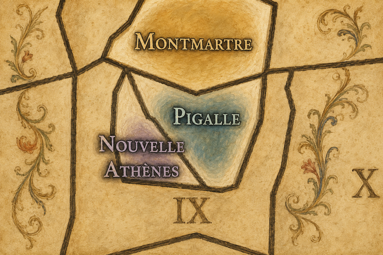
Pigalle is one of Paris’s most charged cultural crossroads, shaped by nightlife, music halls, cabarets, artistic myth, commercial energy, and the slopes leading toward Montmartre. Its identity has long moved between performance, transgression, tourism, everyday life, and the restless urban imagination of northern Paris.
-
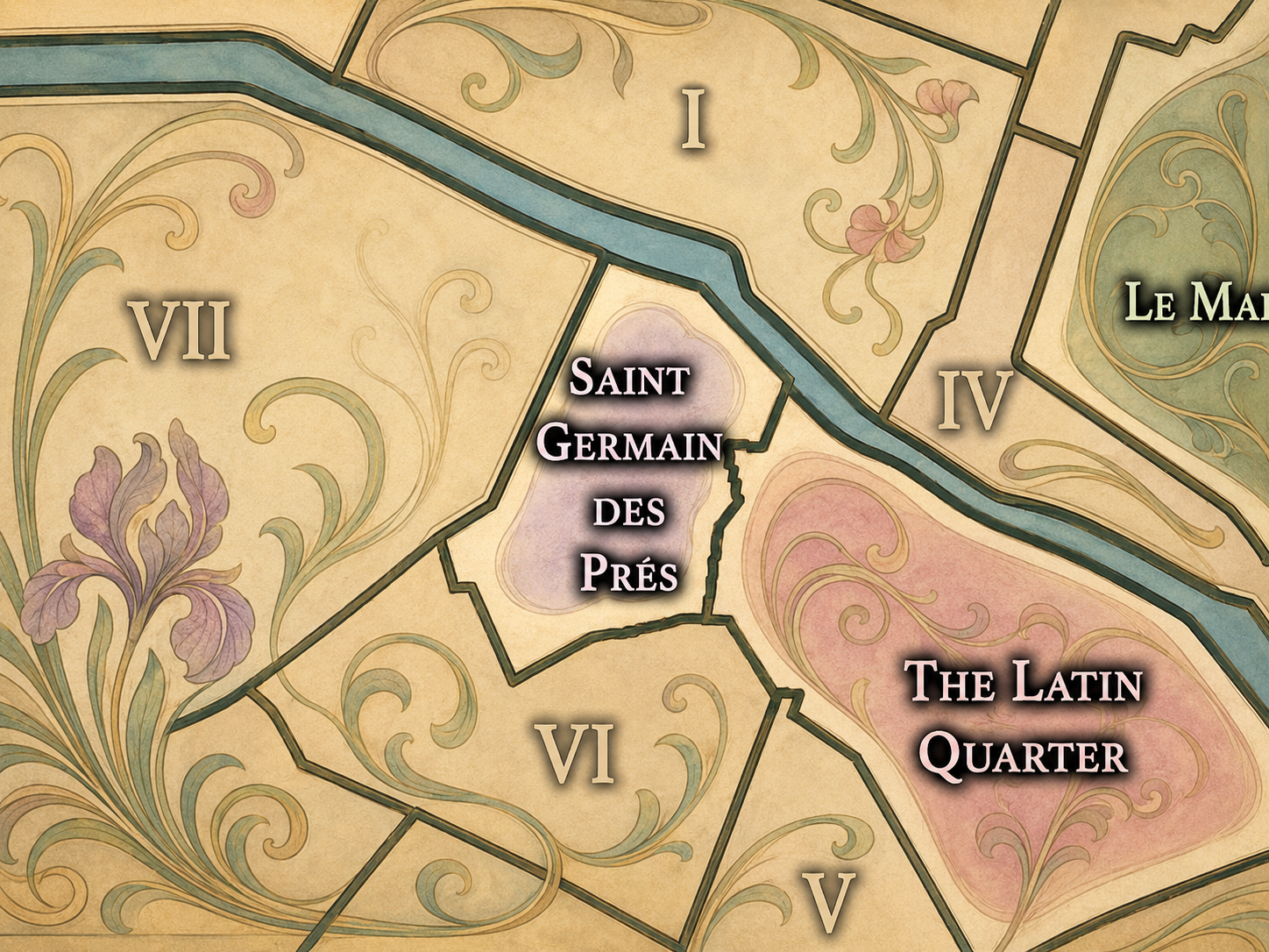
Saint-Germain-des-Prés is one of the Left Bank’s defining cultural neighborhoods, associated with cafés, publishing, philosophy, literature, art, churches, galleries, and postwar intellectual life. Its identity reaches beyond any single boundary, gathering centuries of religious, artistic, literary, and urban memory into one of Paris’s most recognizable cultural landscapes.
The History
Origins / Early Formation
The roots of Paris’s cultural neighborhoods reach back to the city’s earliest patterns of settlement, movement, worship, commerce, and learning. Long before modern arrondissements or official administrative quarters, Paris developed through islands, riverbanks, roads, religious institutions, markets, bridges, and settlements beyond the walls of the central city.
The Seine shaped the earliest geography of Paris, dividing and connecting the Right Bank, Left Bank, and Île de la Cité. Around these zones, different kinds of urban life began to emerge: civic and religious authority near the island, commercial activity along the Right Bank, and scholarly and monastic life on the Left Bank. These differences would eventually contribute to the cultural identities of later districts.
Even in the city’s early formation, Paris was not a single uniform place. It was a gathering of functions, routes, institutions, and communities. The later cultural neighborhoods of Paris would grow from these older patterns: markets and trades, churches and abbeys, schools and colleges, hills and villages, roads and faubourgs, power and proximity.
Medieval / Early Formation
The Latin Quarter emerged from this medieval scholarly world, gaining its identity from the Latin-speaking students, teachers, and religious institutions clustered around the university. On the Right Bank, commercial streets, markets, and dense urban quarters helped form the foundations of later cultural districts. Religious institutions, bridges, city walls, and parish boundaries gave shape to neighborhoods long before modern civic divisions.
Beyond the city walls, villages, hillsides, and faubourgs developed their own identities. Places that would later become part of Paris, such as Belleville, Montmartre, and Passy, had distinct local histories before incorporation into the modern city. These outer settlements, religious sites, vineyards, workshops, and rural edges formed some of the cultural memories that Paris would later absorb.
Medieval Paris therefore provides one of the earliest foundations for understanding cultural neighborhoods. It shows that the city’s identity was always layered: official and informal, central and peripheral, sacred and commercial, intellectual and everyday. The cultural neighborhoods of modern Paris are heirs to this older geography of difference.
Early Modern Paris
In the early modern period, Paris became more socially and architecturally differentiated. Aristocratic residences, religious houses, commercial streets, theaters, gardens, and new urban developments helped sharpen the identities of particular districts. Neighborhoods began to accumulate reputations based not only on function, but on class, taste, fashion, and cultural association.
The city’s growth also absorbed nearby villages and faubourgs into a larger Parisian orbit. These places often retained a distinct local memory even as they became part of the expanding city. This tension between incorporation and identity remains central to many Cultural Neighborhoods.
18th Century
The 18th century brought new forms of sociability, consumption, performance, and intellectual life to Paris. Cafés, salons, theaters, promenades, print culture, and commercial entertainment helped define the city as a center of public conversation and cultural display. The geography of Paris became increasingly connected to habits of reading, debating, shopping, strolling, seeing, and being seen.
Many Cultural Neighborhoods gained sharper identities through these practices. Some became associated with aristocratic refinement, others with intellectual exchange, theater, popular entertainment, or political ferment. The city’s neighborhoods were not simply places of residence; they were stages for social and cultural life.
19th Century
The 19th century transformed Paris physically and symbolically. Industrialization, revolution, annexation, railway development, Haussmann’s reconstruction, new boulevards, and the incorporation of surrounding communes altered the map of the city. Older neighborhoods were demolished, reshaped, or reimagined, while newly absorbed areas such as Montmartre, Belleville, Passy, and others entered Paris with strong local identities of their own.
This period was especially important for the formation of modern Cultural Neighborhoods. Bohemian Montmartre, literary and artistic Left Bank districts, bourgeois western Paris, popular northeastern Paris, entertainment corridors, and modern commercial landscapes all became part of the expanding cultural geography of the capital.
Early–Mid 20th Century
In the early and mid 20th century, the Cultural Neighborhoods of Paris became increasingly tied to modern art, literature, politics, exile, nightlife, cinema, jazz, photography, and intellectual life. The city’s cafés, studios, theaters, hotels, bookshops, cabarets, and streets became internationally recognized as places where modern culture was made and performed.
At the same time, many neighborhoods experienced social upheaval, war, occupation, displacement, rebuilding, and changing patterns of migration and class. Their identities were not frozen in romantic myth; they were shaped by conflict, survival, reinvention, and everyday continuity.
Late 20th Century
The late 20th century brought preservation, gentrification, tourism, immigration, cultural reinvention, and new forms of neighborhood politics. Some Cultural Neighborhoods became global symbols of Parisian life, while others were transformed by redevelopment, rising property values, or changing commercial patterns. Historic districts were restored and reinterpreted; formerly working-class areas became centers of artistic or alternative culture; nightlife zones shifted; and immigrant communities reshaped the cultural map of the city.
This period also made the question of neighborhood identity more complicated. As Paris became more global, many Cultural Neighborhoods had to balance memory and reinvention, local life and visitor expectation, preservation and change.
21st Century
In the 21st century, the Cultural Neighborhoods of Paris continue to evolve. Some remain strongly connected to long-standing identities, while others are changing through new residents, new businesses, tourism pressures, cultural institutions, urban planning, and shifting patterns of everyday life. Their boundaries may be debated, their meanings revised, and their reputations reshaped.
For CityNeighborhoods, this makes the Milieux Culturels an ongoing project rather than a closed catalog. To map them is not to claim that their identities are fixed forever. It is to study how cultural geography lives: how places inherit meaning, how they change, and how they continue to shape the experience of Paris.
Spirit & Legacy
The legacy of the Milieux Culturels is the recognition that Paris is not only a city of monuments, districts, or official divisions. It is a city of cultural worlds. Each neighborhood gathers its own history of people, practices, symbols, and atmospheres, contributing to the larger identity of Paris while retaining a character of its own.
These Cultural Neighborhoods help explain why Paris can feel endlessly layered. One can move only a short distance and enter a different historical memory, social rhythm, architectural language, or cultural inheritance. Together, they form a living map of Parisian identity: precise enough to walk, rich enough to debate, and open enough to keep expanding as the city itself continues to change.
The Photography
Visual Identity

The visual identity of each Paris district begins with its position in the city’s layered geography. Before the photographs arrive, the maps establish a first way of seeing: where the district sits, what civic layer it belongs to, which boundaries define it, and how it connects to the surrounding fabric of Paris. In CityNeighborhoods Paris, cartography is not merely orientation; it is part of the visual language of the project.
As the photographic archive grows, this section will continue to develop through images gathered on foot. Streets, façades, monuments, markets, parks, river edges, passages, signs, textures, and everyday details will gradually reveal how each district presents itself visually. The goal is not only to show what a place looks like, but to trace how its identity becomes visible through form, atmosphere, memory, and use.
Through The Lens

CityNeighborhoods Paris is built from walking, looking, and returning. Each district is approached through photography as a way of paying attention: to the obvious landmarks and the quieter details, to historic structures and ordinary streets, to the moments where civic geography becomes lived experience. The camera becomes a tool for noticing how Paris changes from one district to the next, and how each place holds its own relationship to the larger city.
As photographs are processed and added, this section will become a more specific visual record of the district. Future updates may include dated field notes, galleries, and reflections from individual walks. For now, the page remains part of the larger CityNeighborhoods effort to document every Paris neighborhood through maps, history, identity, and photography — one district, one walk, and one visual encounter at a time.
If you visit Paris, these ideas can help inspire your own photography.


Paris: J’Espere, Je Rêve, Je Vive
Paris Photo Gallery
Paris Flâneur Notes
Flâneur Notes document the walks, photographs, light, and street-level observations behind this neighborhood entry. Learn more about the Spirit of the Flâneur.


Explore Paris
-

The twenty arrondissements form the civic spiral of Paris, organizing the city into its broad local districts of government, identity, and daily life.
-

Each arrondissement is divided into four official administrative quarters, giving Paris a more precise civic and geographic framework.
-

The conseils de quartier bring participation to street level, giving residents a voice in neighborhood needs, public space, and local civic life.
-

Les Deux Rives trace Paris through the Seine’s two banks, revealing how the Rive Droite and Rive Gauche shaped the city’s civic power, commerce, learning, art, and cultural identity.
-

Cultural neighborhoods reveal the Paris people recognize through history, cafés, architecture, memory, atmosphere, and local belonging.