
CONSEILS DE QUARTIER
Paris’s conseils de quartier form one of the city’s most granular civic neighborhood layers, dividing arrondissements into resident-facing council territories where everyday streets, squares, schools, markets, associations, public spaces, and local concerns come into closer view. Part of an ongoing project to walk and photograph every neighborhood in Paris, this page explores the conseils de quartier as a participatory geography of the city — a layer that reveals how official Paris is not only mapped and governed, but discussed, experienced, and shaped at the neighborhood scale.
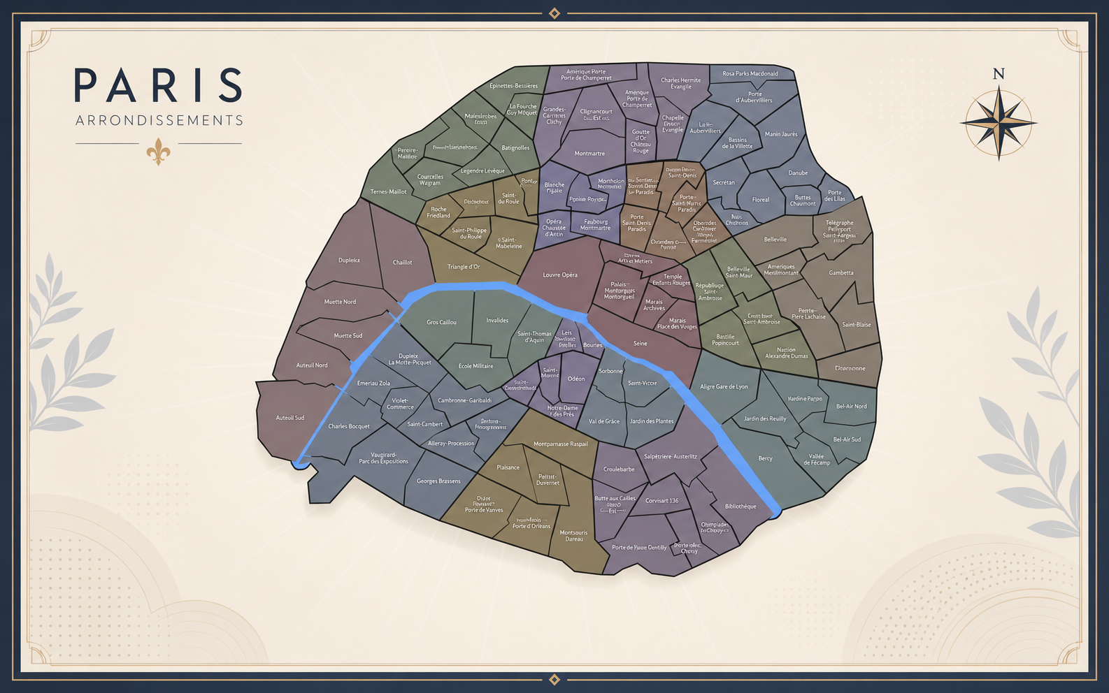


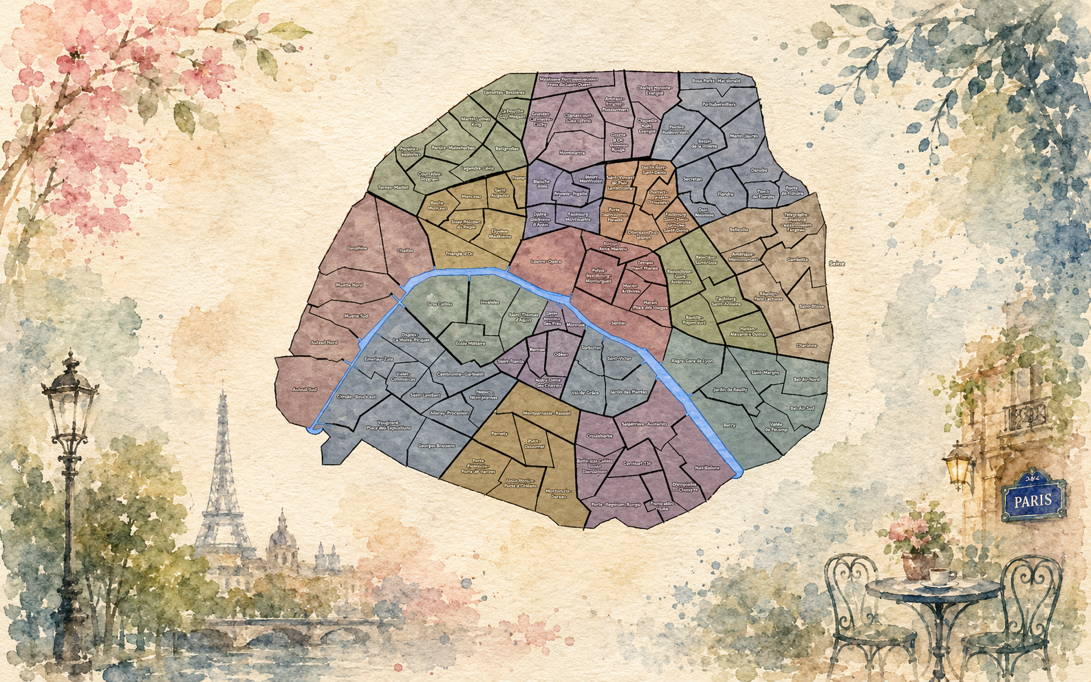
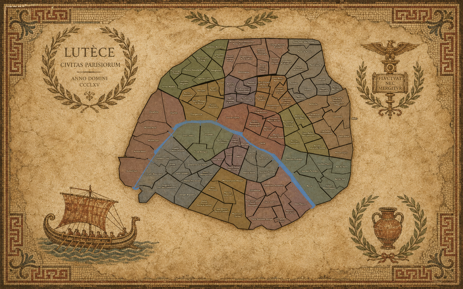
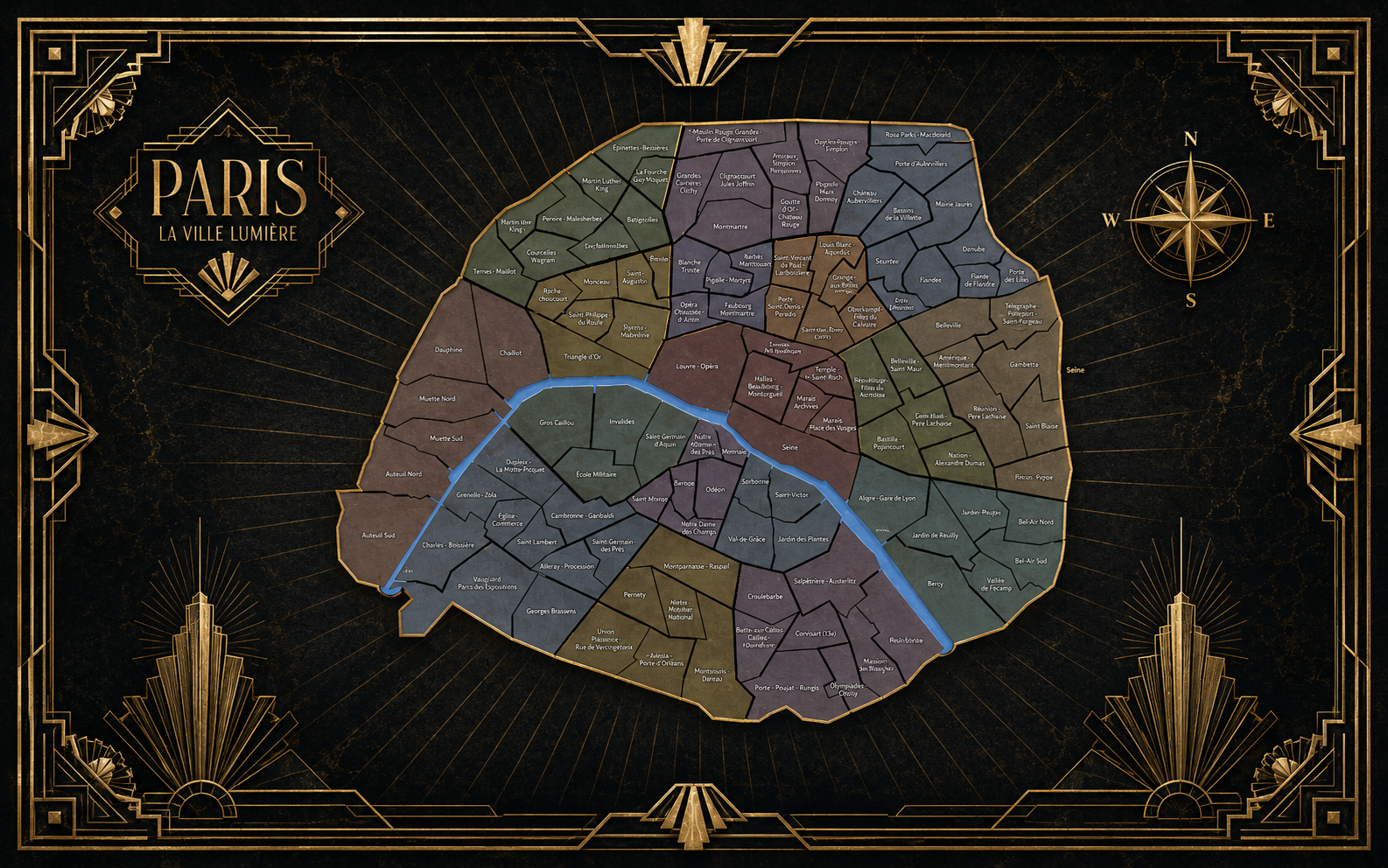
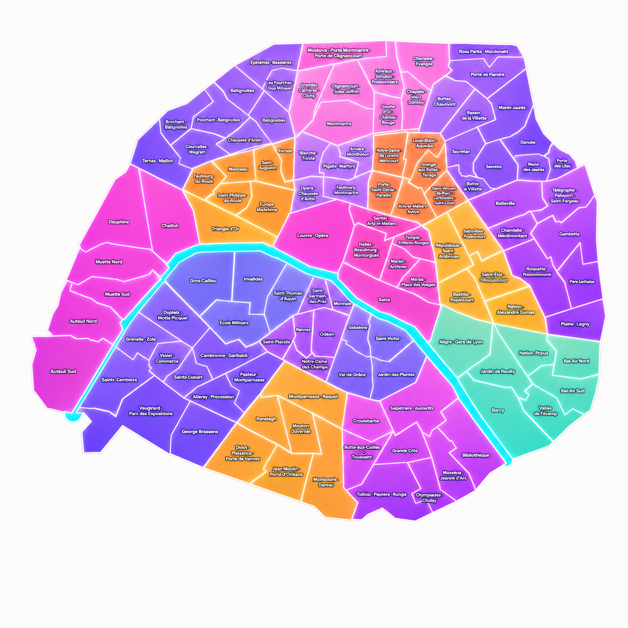
The Map
Geographic Setting
The Conseils de Quartier form one of the most local civic geographies of Paris. Unlike the arrondissements, which divide the city into broad municipal districts, or the Administrative Quarters, which organize Paris into eighty official neighborhood units, the Conseils de Quartier operate at the scale of local participation. Their boundaries identify the territories through which residents, associations, neighborhood users, and arrondissement officials can address the everyday life of the city: its streets, squares, schools, markets, public spaces, services, and shared concerns.
This layer of Paris is organized through the contemporary arrondissement structure, with Paris Centre — the merged civic sector of the former 1st, 2nd, 3rd, and 4th arrondissements — standing apart from the remaining arrondissements. For the purposes of this guide, the Conseils de Quartier are grouped into seventeen civic buckets: Paris Centre, followed by the 5th through 20th arrondissements. This organization reflects the practical structure through which the councils are administered and encountered, rather than the older spiral logic of the twenty arrondissements themselves.
Geographically, the Conseils de Quartier reveal Paris as a city of proximity. Some correspond closely to recognizable neighborhoods or historic place names; others follow more functional civic boundaries, grouping streets, institutions, commercial corridors, parks, transit nodes, or residential districts into local areas of consultation. Their value lies not only in what they map, but in what they make visible: the scale at which Paris becomes a shared, negotiated, and lived civic environment.
Conseils de Quartier Identity
Etymology and Origins
The phrase Conseil de Quartier may be translated as “neighborhood council” or “quarter council,” but its French meaning carries a specific civic weight. A quartier can refer to a neighborhood, district, or quarter of the city, while conseil suggests a council, forum, or advisory body. Together, the phrase describes not simply a place, but an institution rooted in local participation.
This distinction matters. A Conseil de Quartier is not the same thing as an Administrative Quarter, nor is it always identical to a cultural or historic neighborhood. It is a defined civic territory: a local framework through which residents and neighborhood actors may express concerns, propose ideas, discuss public space, and participate in the life of the arrondissement.
The modern Conseils de Quartier emerged from France’s early-21st-century movement toward démocratie de proximité — democracy of proximity. The 2002 law on local democracy established the legal framework for neighborhood councils in large French cities, and in Paris the municipal council fixed the council perimeters based on proposals from the arrondissement councils. APUR notes that 121 Parisian neighborhood councils were approved by the Paris municipal council on July 8, 2002. (apur.org)
Civic Framework
The Conseils de Quartier are part of Paris’s participatory civic architecture. They do not govern neighborhoods as independent municipalities, nor do they replace the arrondissements, the Mairie de Paris, or the Conseil de Paris. Instead, they provide a local forum where neighborhood life can be discussed, interpreted, and acted upon at a smaller scale.
Their purpose is rooted in proximity. Paris Centre describes its neighborhood councils as places of information, expression, and consideration for the expectations and concerns of residents, local actors, and users of the neighborhood. The City of Paris also places the Conseils de Quartier among its participatory bodies, alongside other institutions designed to bring residents into public life.
In practice, this makes the Conseil de Quartier a civic meeting point. It is where the abstract city becomes local: a street crossing, a planted square, a market street, a school entrance, a noisy intersection, a proposed improvement, a neighborhood event, a public-space concern. Each council gives form to the idea that urban life is not shaped only by grand plans or historic boundaries, but also by the repeated attention of those who live, work, walk, shop, gather, and care within a particular part of the city.
Neighborhood Distinction
The Conseils de Quartier occupy a distinct place within the layered geography of Paris. The arrondissements provide the city’s municipal frame. The Administrative Quarters divide Paris into official neighborhood units. Cultural Neighborhoods preserve the more elastic geographies of memory, identity, architecture, commerce, and reputation. The Conseils de Quartier, by contrast, represent the participatory neighborhood: the city understood through local voice and civic proximity.
Not every Conseil de Quartier corresponds neatly to a historic district. Some follow names and boundaries that feel immediately recognizable. Others are more procedural, shaped by the practical needs of representation within an arrondissement. This makes them different from the older quarters, villages, faubourgs, and cultural districts that give Paris much of its historical texture.
Yet that difference is exactly what makes them useful. The Conseils de Quartier show where local identity becomes local process. They reveal Paris not only as a city of monuments, streets, and inherited names, but as a city of residents, associations, proposals, meetings, budgets, public questions, and shared responsibility. They are not always the most romantic layer of Paris, but they are among the most civic.
Parisian Identity
Paris is often understood through its monuments, boulevards, arrondissements, and historic neighborhoods. The Conseils de Quartier reveal another Paris: the city as a daily civic practice. This is the Paris of local meetings and neighborhood associations, of residents debating public space, of streets improved through attention, of small projects that make a place more usable, welcoming, or humane.
In this sense, the Conseils de Quartier belong to the everyday Paris that sits beneath the monumental city. They speak to a capital where identity is not only inherited from history, but continually shaped through participation. A neighborhood is not only what it was called, how it was built, or where its boundaries fall. It is also what its residents notice, protect, contest, repair, celebrate, and imagine together.
For CityNeighborhoods, this layer is especially important. It connects the act of mapping with the act of walking. It asks the viewer to look beyond the postcard image and consider the local systems that sustain urban life: the bench, the garden, the schoolyard, the intersection, the market, the community room, the side street, the small public gesture. The Conseils de Quartier remind us that Paris is not only admired from afar. It is also maintained from within.
Les Conseils de Quartier
By Arrondissement
-
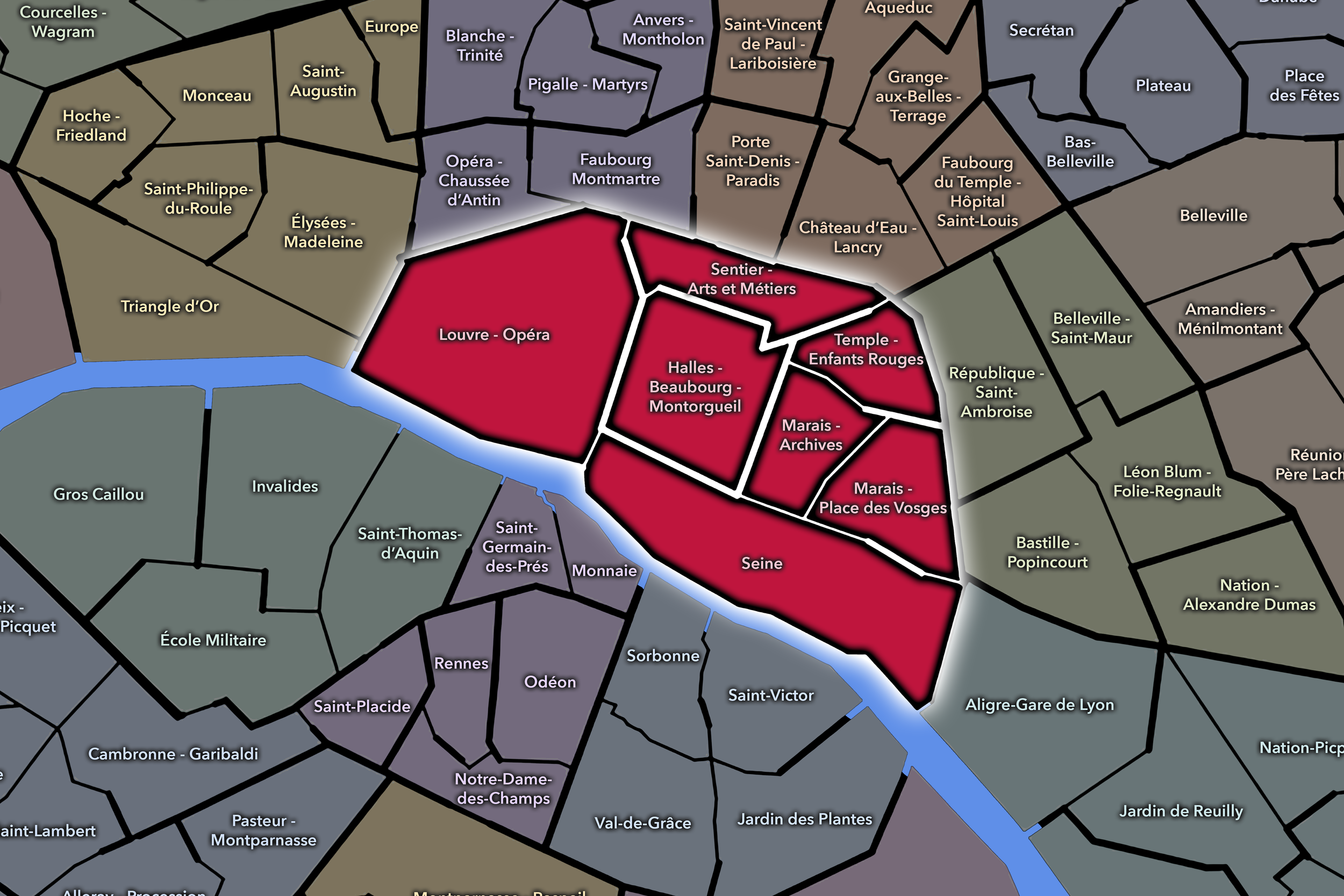
At the historic heart of the capital, Paris Centre gathers the former 1st, 2nd, 3rd, and 4th arrondissements into a single contemporary civic framework. Its Conseils de Quartier give local voice to a district of royal landmarks, river islands, religious sites, commercial passages, civic institutions, dense residential quarters, and some of the oldest streets in Paris — a place where monumental, administrative, visitor-facing, and everyday Paris continually overlap.
-
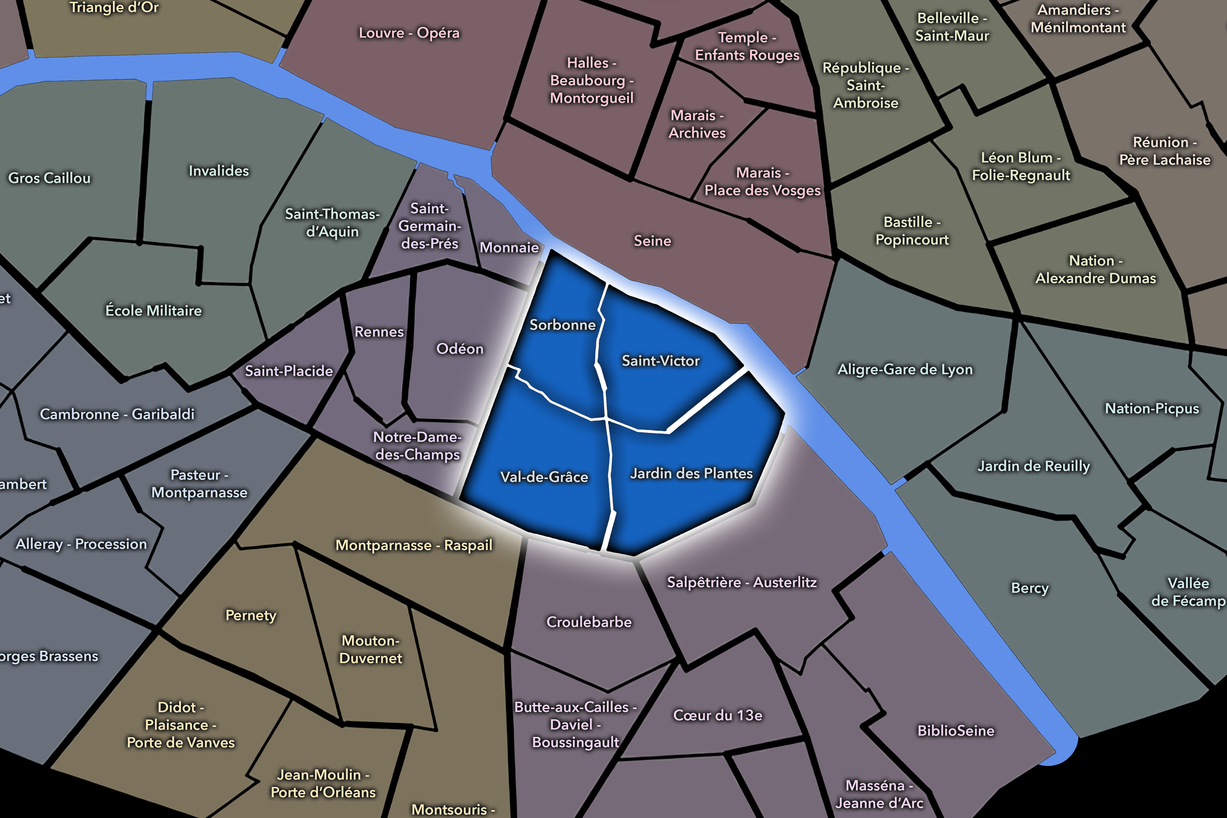
Ancient, academic, and quietly residential, the 5e carries some of Paris’s deepest layers of memory. Its Conseils de Quartier move through the Latin Quarter, Montagne Sainte-Geneviève, Roman remnants, university corridors, garden edges, market streets, schools, and hillside neighborhoods, revealing how one of the city’s oldest intellectual landscapes still functions at the scale of local civic life.
-
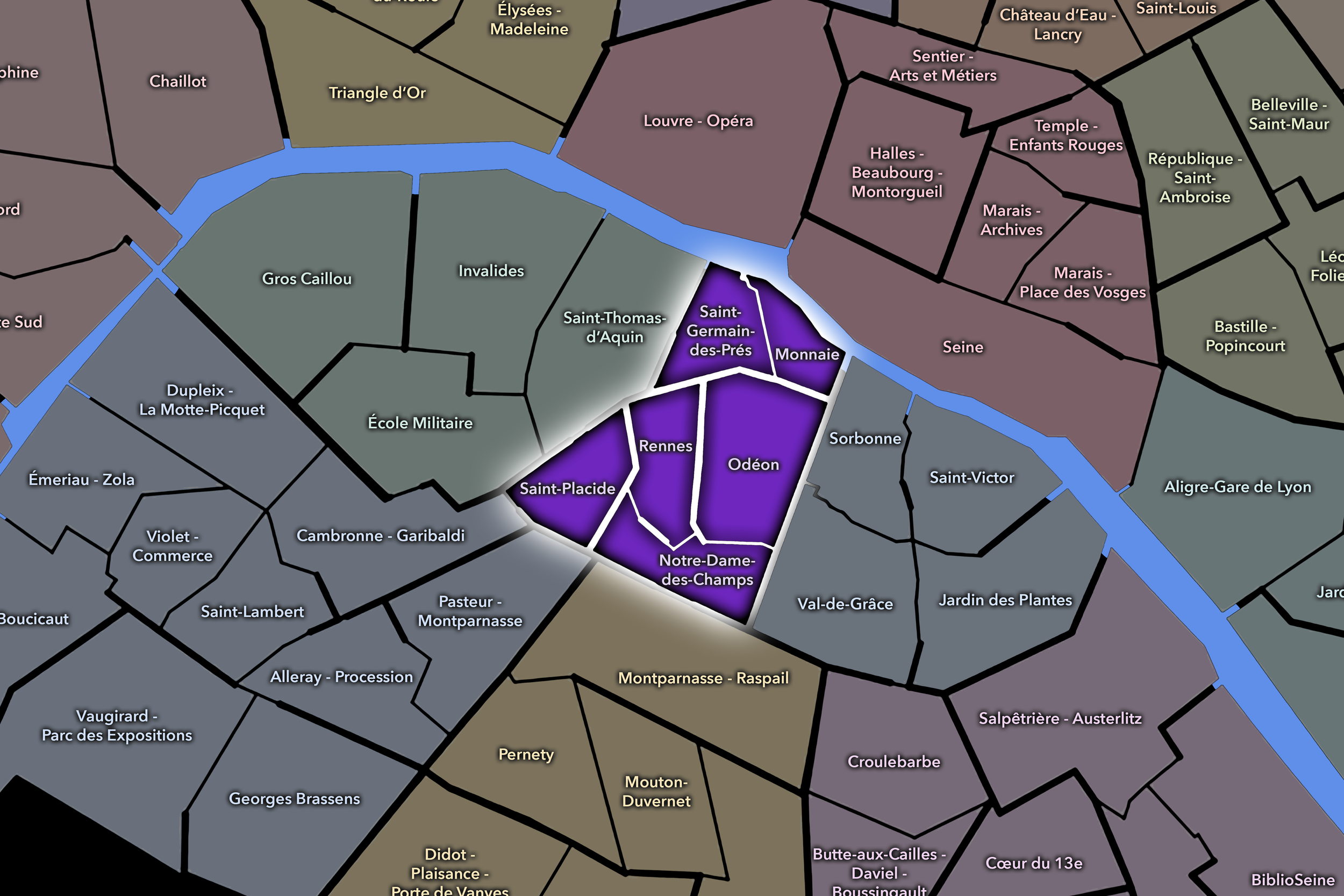
Behind the polished Left Bank image of the 6e lies a more intimate civic geography of side streets, schools, markets, institutions, and residential routines. Literary cafés, religious landmarks, academic traditions, elegant streets, and the Luxembourg Garden may define the arrondissement’s public image, but its Conseils de Quartier reveal the local stewardship that keeps this historic district lived-in rather than merely admired.
-
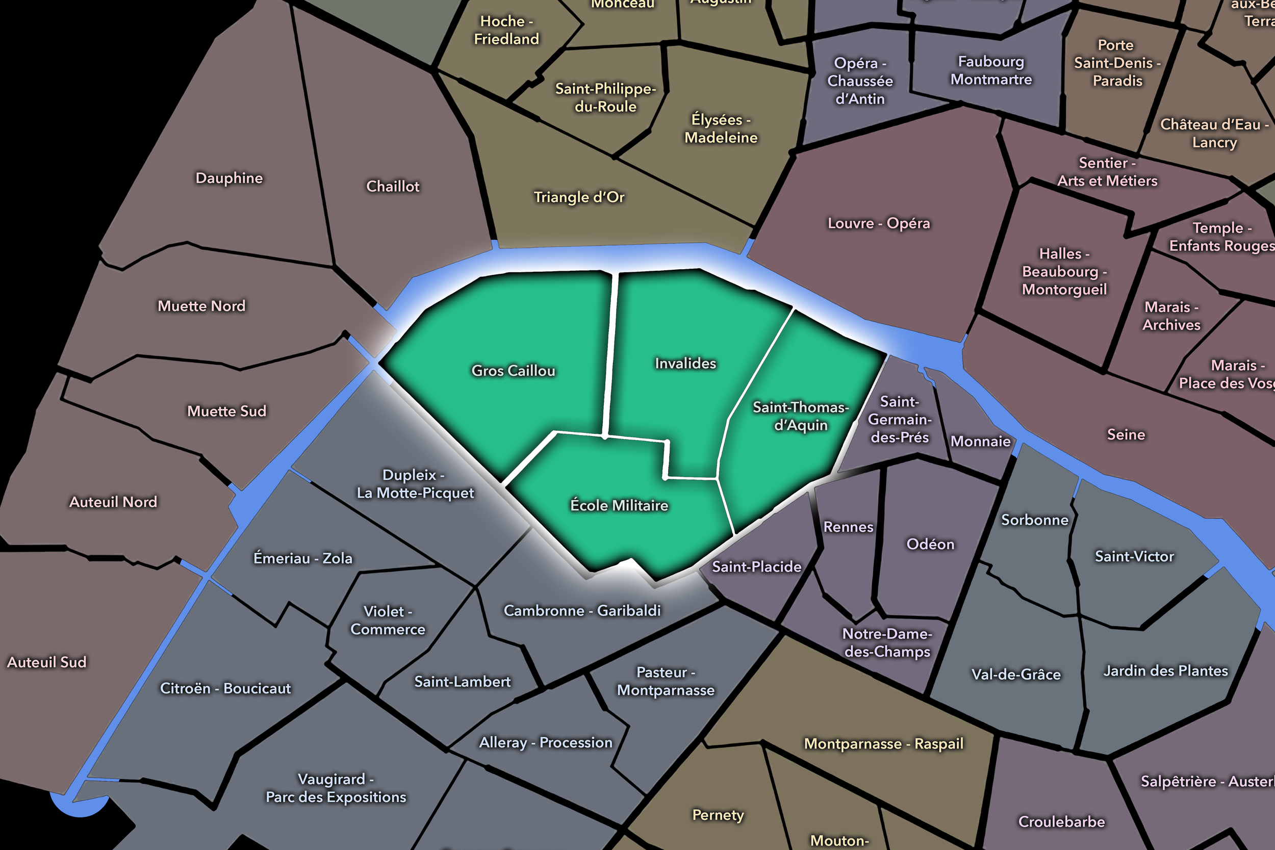
National ceremony and neighborhood life meet unusually closely in the 7e. Ministries, embassies, museums, aristocratic streets, the Eiffel Tower, Champ de Mars, Invalides, Saint-Thomas-d’Aquin, and the riverfront give the arrondissement enormous symbolic weight, while its Conseils de Quartier bring attention back to homes, schools, gardens, markets, local services, and the everyday concerns behind the monumental image.
-
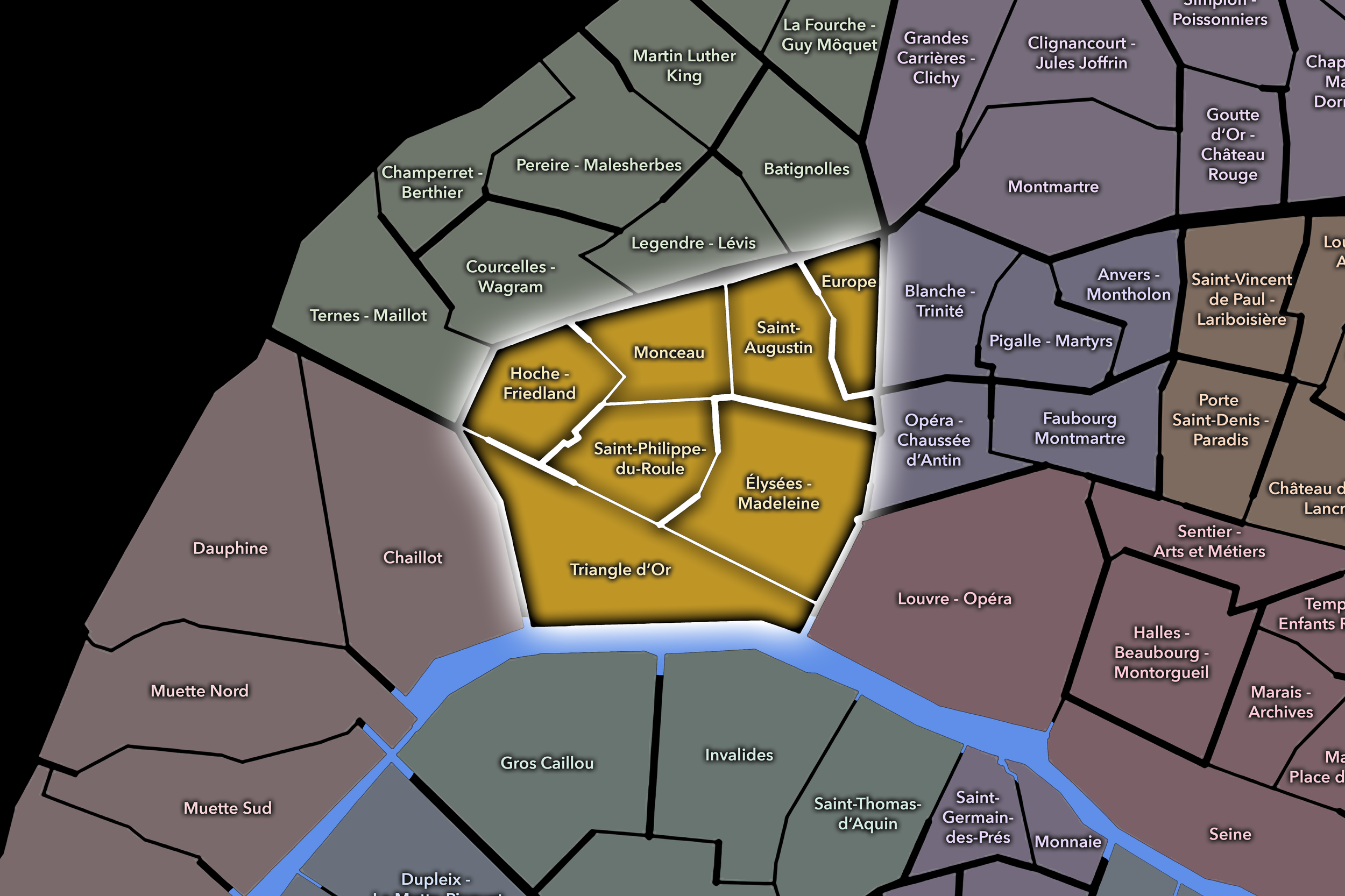
Grand avenues, luxury corridors, diplomatic institutions, office districts, historic parks, and monumental vistas give the 8e its reputation for power and prestige. The Conseils de Quartier translate that imposing image into smaller civic territories, tracing the residential streets, business districts, cultural landmarks, transit hubs, and public spaces surrounding the Champs-Élysées, Madeleine, Europe, and Monceau.
-
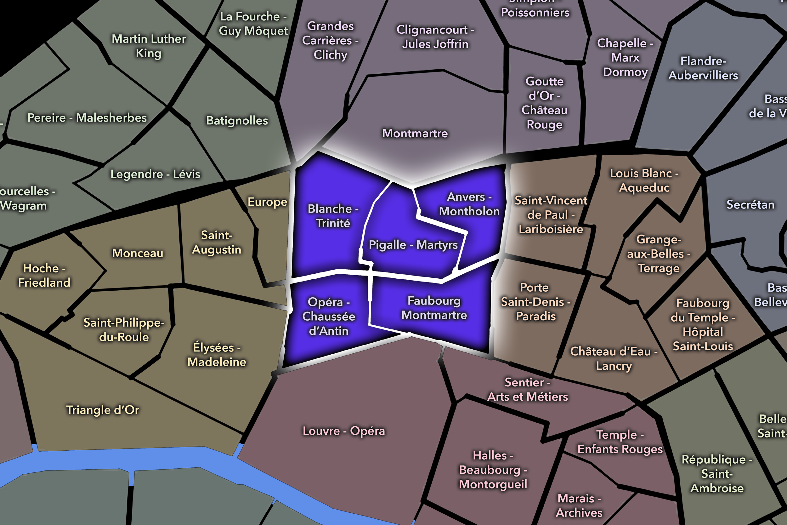
The 9e lives in the meeting place between spectacle and routine. Theaters, department stores, banking streets, covered passages, Opéra-adjacent institutions, residential slopes, market streets, schools, and the lower approaches to Montmartre create a district where commercial Paris and domestic Paris continually cross paths, and where the Conseils de Quartier help distinguish the civic variety behind the movement.
-
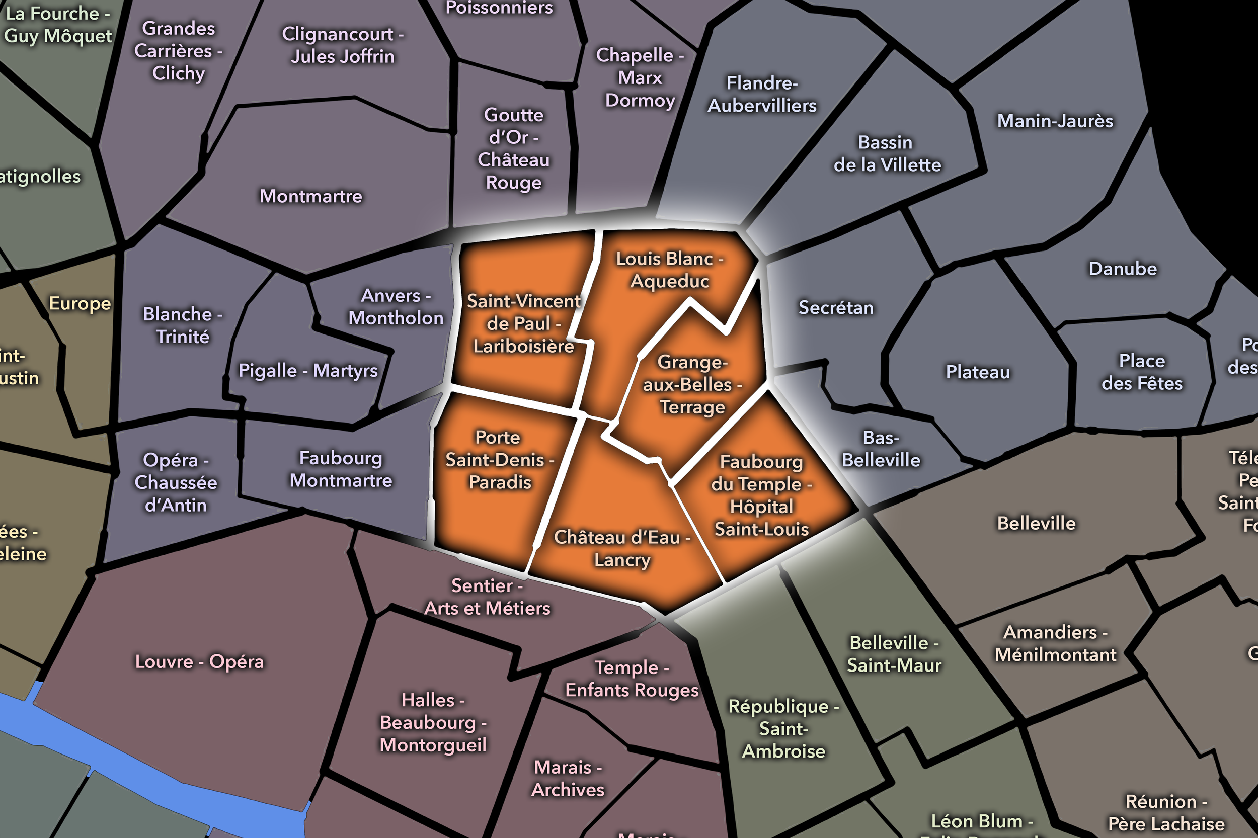
Canals, railway stations, immigrant histories, hospitals, market streets, dense residential blocks, and lively commercial corridors make the 10e one of Paris’s great urban crossroads. Through its Conseils de Quartier, the arrondissement becomes legible as a geography of movement and proximity: Gare du Nord, Gare de l’Est, the Canal Saint-Martin, Faubourg Saint-Denis, local squares, and streets that connect Paris to itself and to the wider world.
-
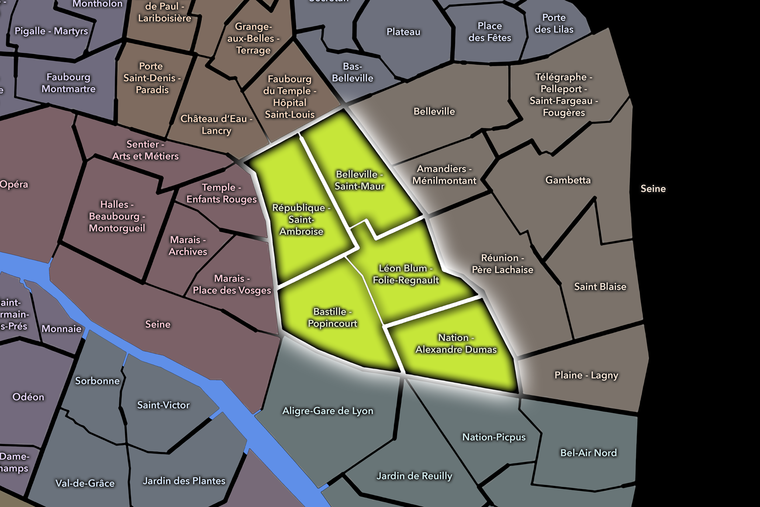
Few districts express eastern Paris’s neighborhood energy as forcefully as the 11e. Revolutionary memory, workshop traditions, nightlife, markets, residential streets, small businesses, and cultural corridors all converge here, while the Conseils de Quartier reveal the local civic fabric stretching from Bastille and Oberkampf to Charonne, Nation, and the faubourg streets between them.
-
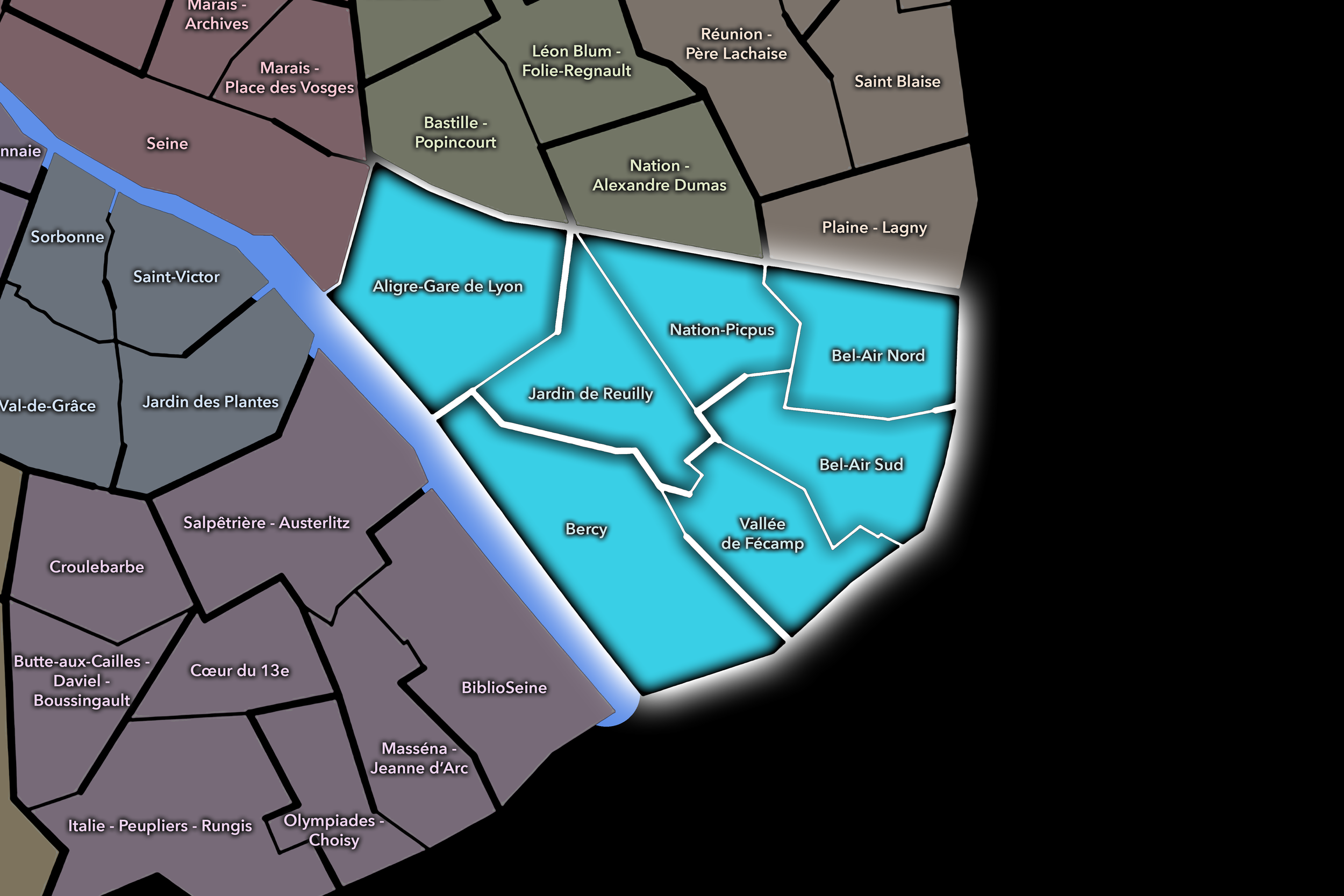
In the 12e, dense urban Paris gradually opens toward green corridors, broad avenues, and escape. The arrondissement’s Conseils de Quartier move from Bastille and Gare de Lyon toward residential districts, former rail and warehouse landscapes, the Coulée Verte, local markets, quieter neighborhood streets, and the Bois de Vincennes, giving the district its distinctive balance of city, movement, and refuge.
-
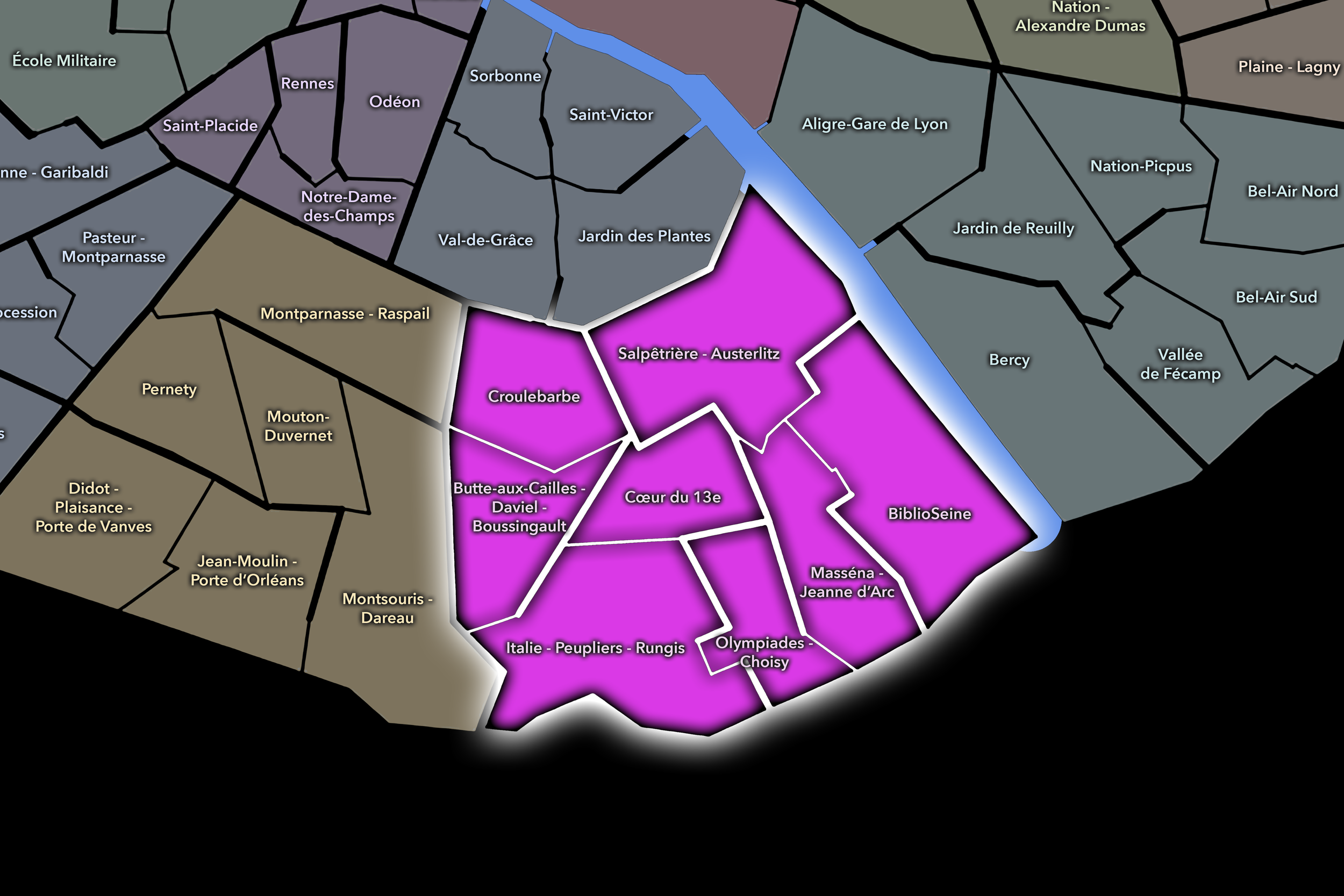
Old village traces, modern towers, Asian commercial corridors, university campuses, industrial memory, public art, and Seine-side redevelopment sit unusually close together in the 13e. Its Conseils de Quartier reveal a layered civic identity stretching from Butte-aux-Cailles and Place d’Italie to Chinatown, Paris Rive Gauche, the Bibliothèque François-Mitterrand area, residential high-rises, and streets where Paris’s past and future openly share space.
-
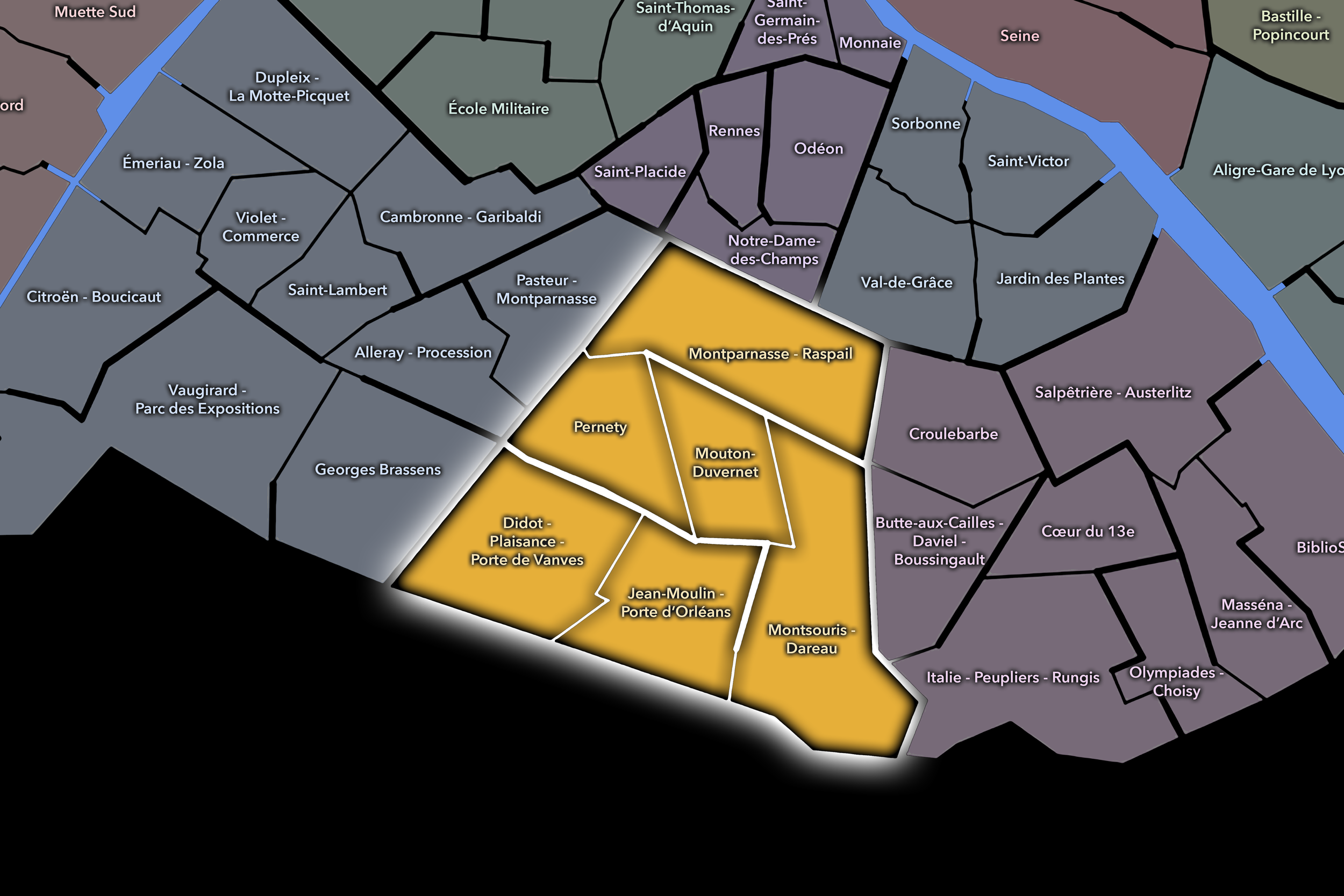
Quieter than many of its neighbors, the 14e rewards attention with a civic landscape of Montparnasse, village-like streets, cemeteries, hospitals, artists’ histories, rail edges, parks, markets, schools, and southern gateways. Its Conseils de Quartier bring that variety into focus, connecting everyday neighborhood life with the historic identities of Plaisance, Petit-Montrouge, Montsouris, and the broader southern edge of Paris.
-
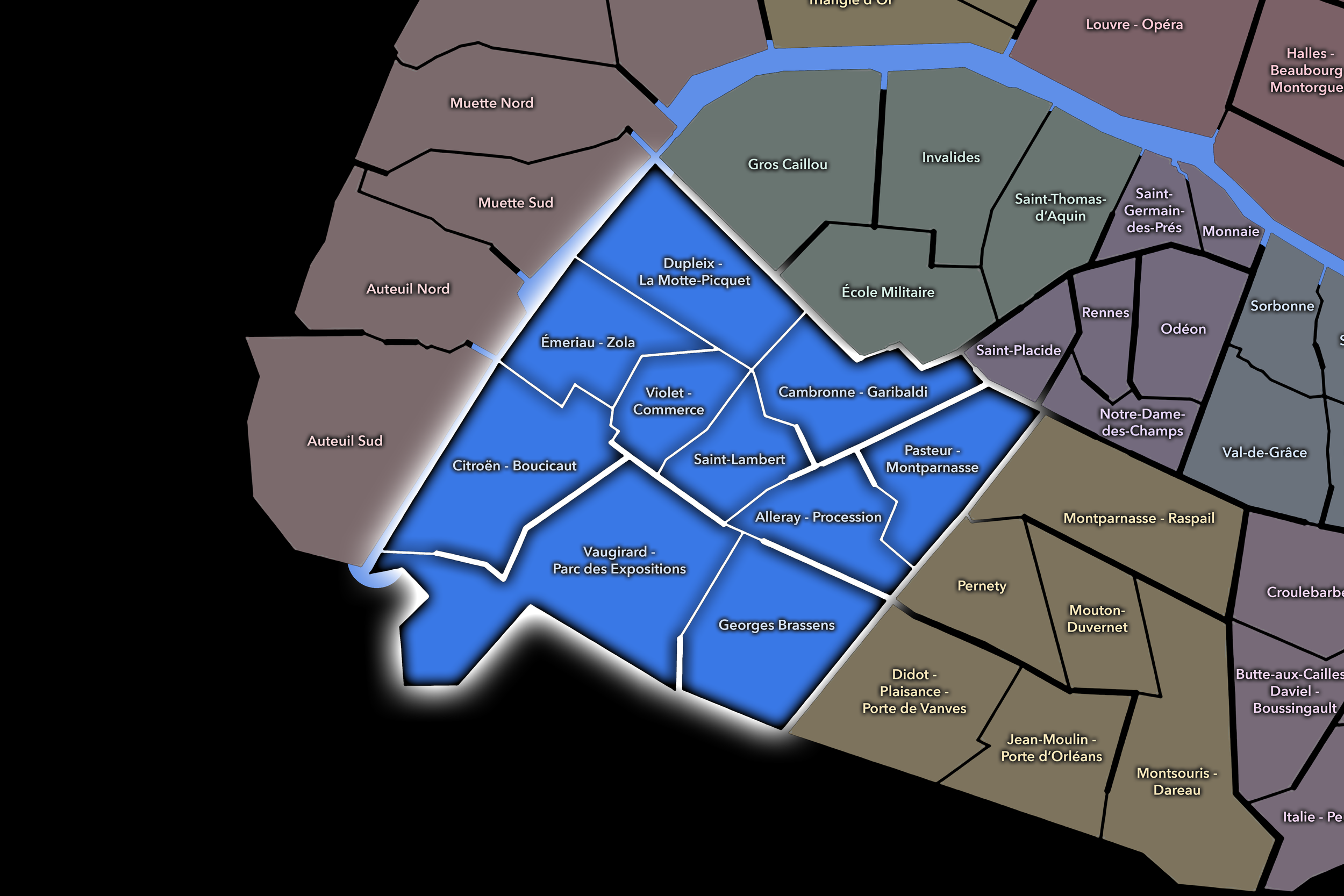
Paris’s most populous arrondissement is also one of its most domestically textured. Across Grenelle, Vaugirard, Javel, Convention, Beaugrenelle, and the Seine-side western edge, the Conseils de Quartier trace a civic landscape of apartment-lined avenues, shopping streets, schools, parks, transit corridors, modern towers, family neighborhoods, and the daily routines through which ordinary Paris quietly unfolds.
-
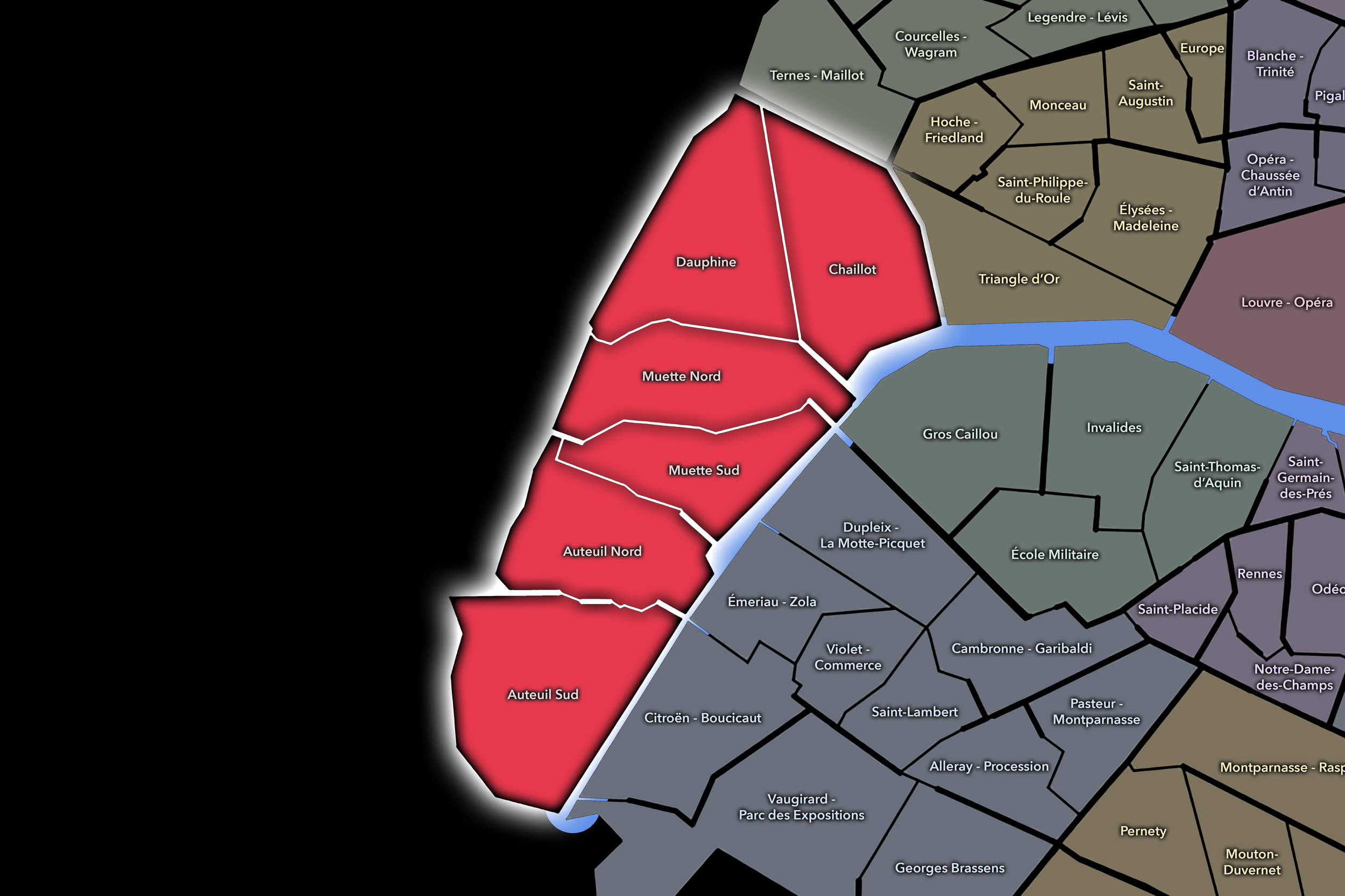
Elegance is only the surface story of the 16e. Its Conseils de Quartier distinguish a more varied civic landscape of Passy, Auteuil, Chaillot, Muette, Porte Dauphine, embassies, museums, gardens, village remnants, sports grounds, schools, the Bois de Boulogne, and the quieter forms of neighborhood life often hidden behind the arrondissement’s formal residential image.
-
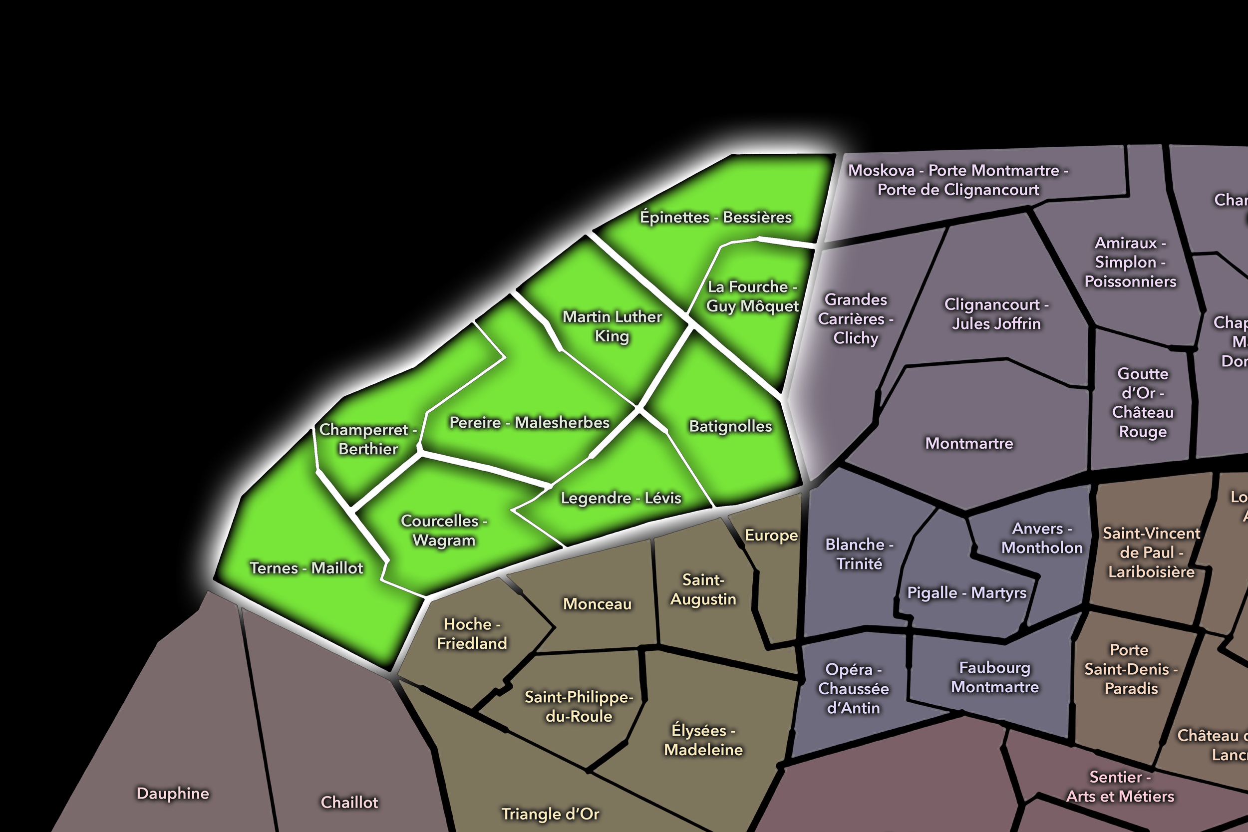
The 17e is built from contrasts: Batignolles and Épinettes, Plaine Monceau and Ternes, Haussmannian elegance and former industrial zones, village-like streets and new development, markets and rail corridors, established residential communities and a changing northwestern edge. Its Conseils de Quartier make those contrasts visible as a civic portrait of Paris moving between historic fabric and contemporary transformation.
-
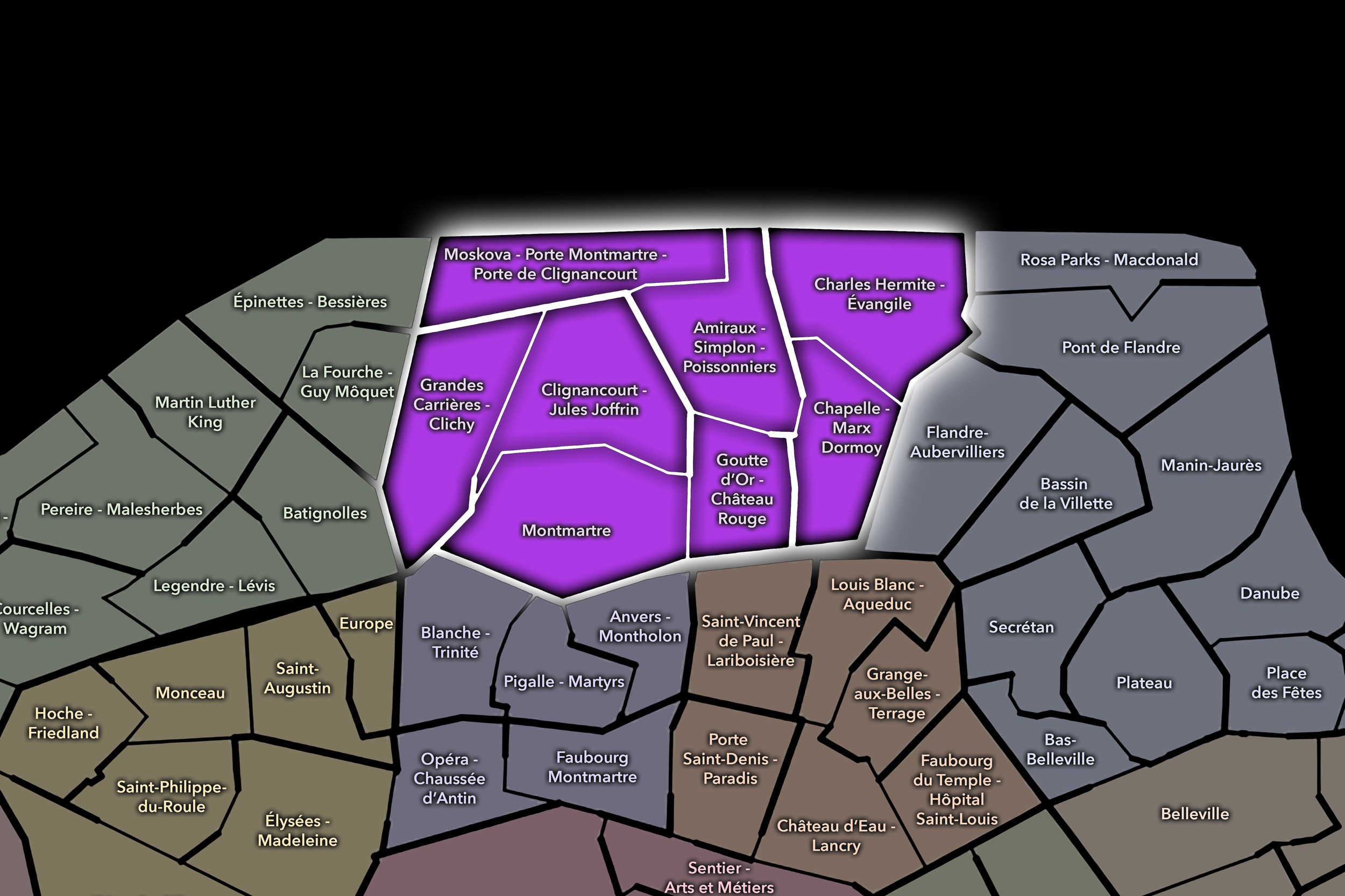
Montmartre may dominate the imagination, but the 18e is far more than its postcard silhouette. The arrondissement’s Conseils de Quartier move through working-class faubourgs, immigrant communities, hillside streets, market corridors, rail edges, northern gateways, Goutte d’Or, Clignancourt, Grandes-Carrières, La Chapelle, and the full local complexity of a district shaped by both deep history and contemporary diversity.
-
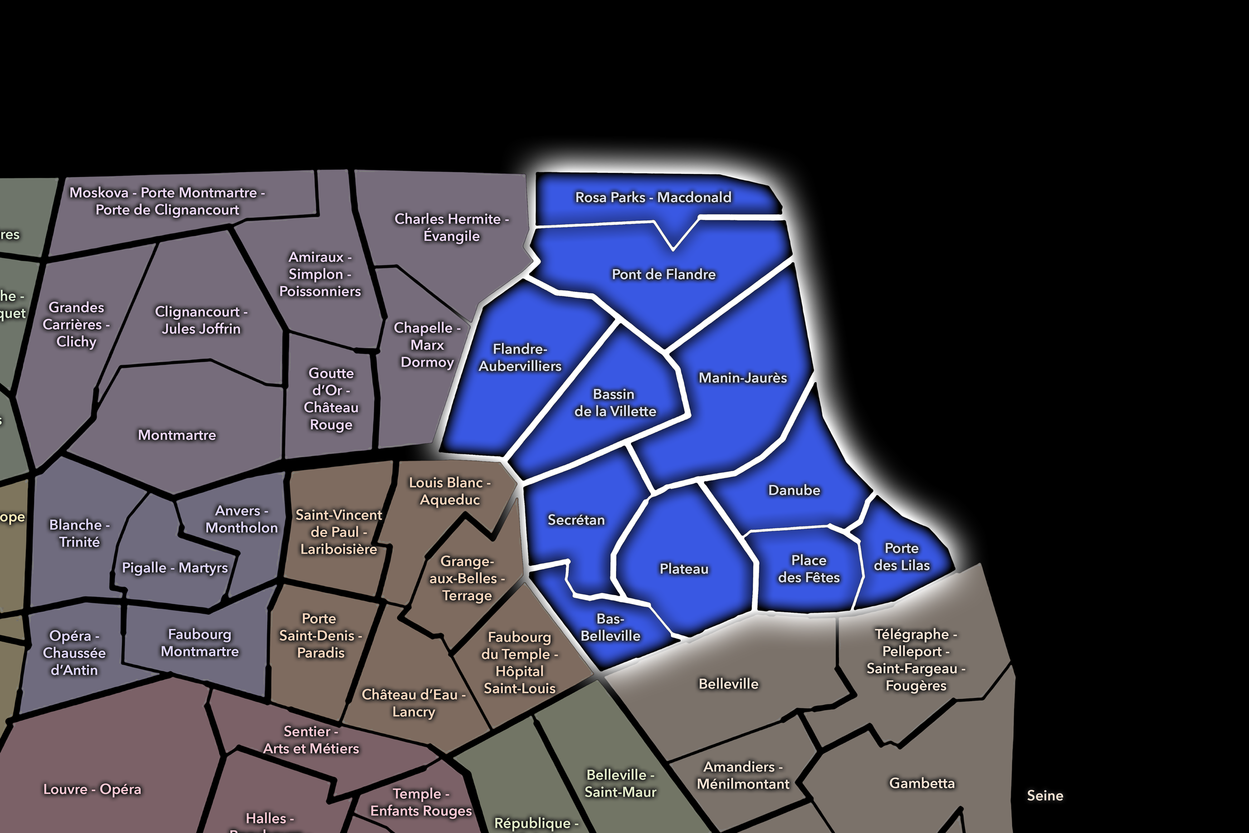
Water, height, infrastructure, public space, and community life define the civic drama of the 19e. From the Bassin de la Villette and Parc des Buttes-Chaumont to La Villette, Belleville’s edges, Danube, Rosa Parks, social housing landscapes, former industrial districts, and northeastern portes, its Conseils de Quartier reveal a Paris where the city’s everyday future is visibly being worked out.
-
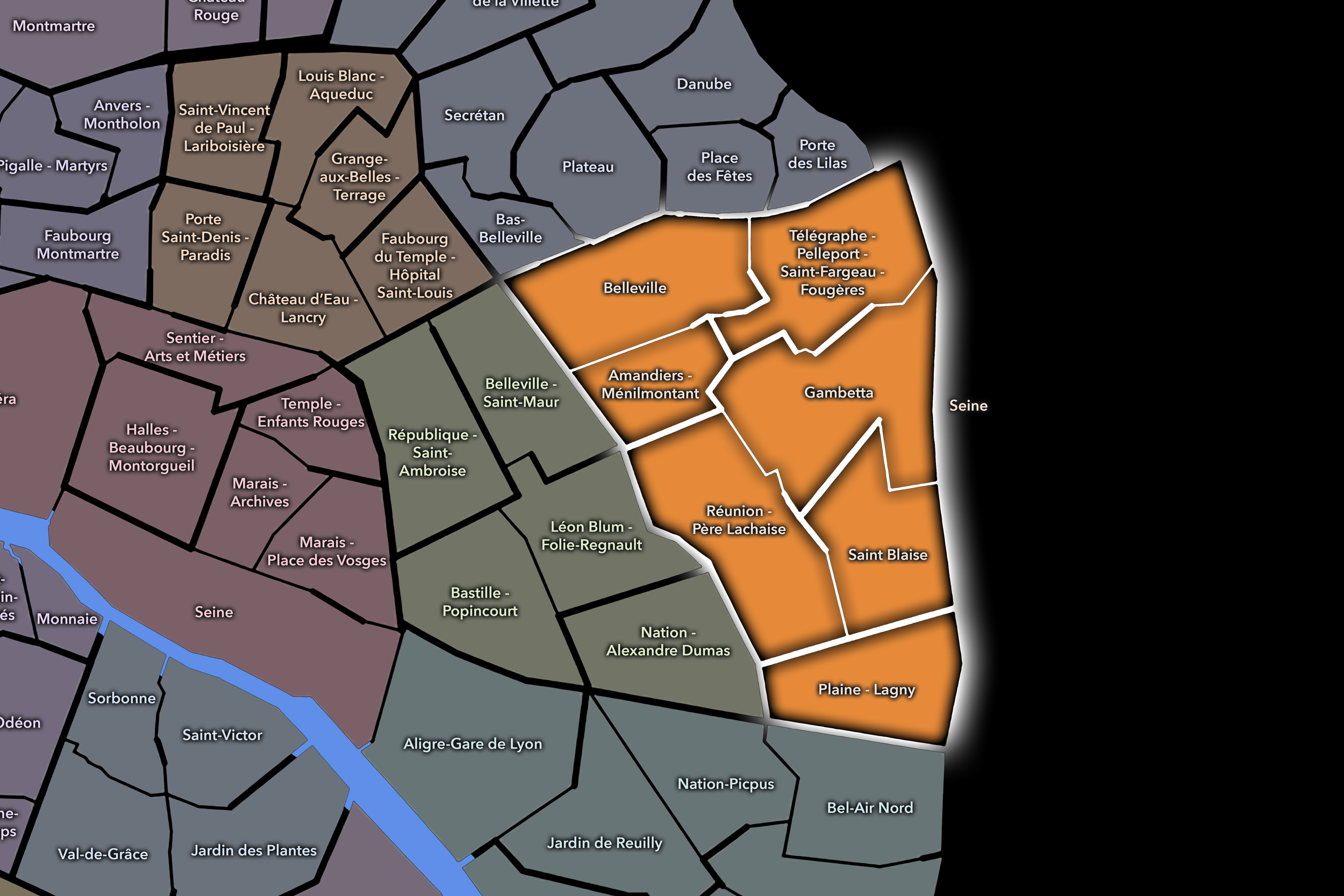
Former villages, cemetery landscapes, working-class history, immigrant communities, artistic life, steep streets, public housing, and powerful neighborhood identities give the 20e its enduring force. Its Conseils de Quartier trace the civic fabric of Belleville, Ménilmontant, Père Lachaise, Charonne, Saint-Fargeau, and the eastern portes, where local memory, political history, residential life, and contemporary community energy shape one of Paris’s most lived-in districts.
The History
Local Origins through the End of World War II

Long before the Conseils de Quartier existed, Paris was lived through local worlds. Medieval parishes, market streets, river crossings, trades, convent lands, aristocratic estates, village roads, and faubourgs gave the city a deeply localized structure. Even as Paris grew into the capital of France, its daily life remained tied to smaller territories of work, worship, commerce, residence, and memory.
The expansion of the city intensified this local complexity. Former villages and peripheral settlements were gradually drawn into the Parisian orbit, while the nineteenth century transformed the capital through annexation, infrastructure, and Haussmann’s reorganization of streets and public space. The modern arrondissement system gave Paris a new municipal frame, but it did not erase the older habits of neighborhood belonging. Beneath the official city remained a city of local attachments: market quarters, workshop districts, residential enclaves, religious centers, student streets, aristocratic corridors, popular faubourgs, and newly urbanized edges.
By the end of World War II, Paris had become a dense, centralized, historically layered capital. Its neighborhoods carried centuries of memory, but the mechanisms for local participation remained uneven. The city was deeply local in experience, but largely governed through broader administrative structures. The need for neighborhood voice had not yet become a formal civic system, but the conditions for it were already present in the lived geography of the city.
Mid–Late 20th Century
The decades after World War II brought new pressures to Paris. Reconstruction, modernization, automobile traffic, housing policy, urban renewal, preservation debates, demographic change, and the expansion of public services all reshaped the relationship between residents and the city around them. Paris remained historic, but it was also increasingly a modern metropolis facing questions of density, mobility, infrastructure, affordability, and local quality of life.
During this period, neighborhood concerns became more visible. Residents and associations responded to redevelopment projects, traffic changes, public-space transformations, heritage preservation, and the everyday conditions of urban life. Local identity was no longer only a matter of inherited names or historic memory; it became tied to advocacy, planning, and the desire to be heard in decisions affecting one’s immediate surroundings.
This mid-to-late twentieth-century context helps explain the eventual need for the Conseils de Quartier. The arrondissement scale was important, but often too broad to capture the fine grain of daily life. A resident’s experience of Paris might be shaped less by the entire arrondissement than by a handful of streets, a square, a school, a market, a transit stop, a public garden, or a local commercial corridor. The city needed a civic language for that smaller scale.
2002: The Democracy of Proximity

The year 2002 marks the formal turning point in the history of the Conseils de Quartier. France’s law on démocratie de proximité, passed on February 27, 2002, established the legal framework for neighborhood councils in large cities. In Paris, the municipal council, acting on proposals from the arrondissement councils, was responsible for fixing the perimeters of the local council areas. APUR records that 121 Conseils de Quartier were approved by the Paris municipal council on July 8, 2002.
This moment did not invent neighborhood life in Paris. Rather, it gave that life a new civic form. The Conseils de Quartier translated the long history of local belonging into a modern participatory structure, creating spaces where residents, associations, local users, and public officials could engage with the conditions of everyday urban life.
The phrase démocratie de proximité is central to understanding the councils. It suggests a democracy practiced not only through elections or citywide institutions, but through nearness: near one’s street, one’s square, one’s school, one’s market, one’s neighbors, one’s daily routes. In this sense, the Conseils de Quartier became a formal recognition that the life of Paris is shaped at the scale of proximity.
21st Century
In the twenty-first century, the Conseils de Quartier have become part of Paris’s broader participatory landscape. They sit within a civic ecosystem that includes arrondissement institutions, public meetings, local projects, participatory budgeting, resident initiatives, and neighborhood-level discussion. The City of Paris identifies the councils as participatory bodies and notes that each council has operating and investment-related funding attached to it, giving the local structure a practical as well as consultative dimension.
Their work belongs to the daily city. A Conseil de Quartier may concern itself with public space, traffic, greenery, safety, cleanliness, accessibility, events, local facilities, or neighborhood improvements. Some actions are modest; others become part of larger urban conversations. What matters is the scale of attention. The councils offer a way for the city to be discussed not only as an administrative whole, but as a collection of lived places.
As Paris continues to change — through climate adaptation, mobility transitions, public-space redesign, tourism pressures, housing challenges, and evolving neighborhood identities — the Conseils de Quartier remain one of the ways local experience enters civic life. They do not resolve every tension, nor do they replace other forms of political participation. But they keep alive the idea that residents should have a voice in the places they know most intimately.
Spirit and Legacy

The legacy of the Conseils de Quartier is not measured in ancient walls, royal monuments, or centuries-old boundaries. It is measured in the continuing belief that a city is shaped not only from above, but also from nearby. Paris may be administered through arrondissements, remembered through historic quarters, and celebrated through cultural districts, but it is also sustained through the local attention of those who inhabit it.
The Conseils de Quartier give civic form to that attention. They recognize the sidewalk as a political space, the square as a shared responsibility, the street as a place of memory and negotiation, and the neighborhood as something more than a name on a map. They remind us that proximity is not small. It is the scale at which urban life is most directly felt.
For CityNeighborhoods, the Conseils de Quartier reveal Paris as a living civic fabric. They are the city at the level of participation: residents gathering, concerns surfacing, projects forming, places being cared for, and the ordinary details of urban life becoming part of the public conversation. Their spirit is not the grandeur of Paris, but its stewardship — the quiet, necessary work of keeping the city shared.
The Photography
Visual Identity

The visual identity of each Paris district begins with its position in the city’s layered geography. Before the photographs arrive, the maps establish a first way of seeing: where the district sits, what civic layer it belongs to, which boundaries define it, and how it connects to the surrounding fabric of Paris. In CityNeighborhoods Paris, cartography is not merely orientation; it is part of the visual language of the project.
As the photographic archive grows, this section will continue to develop through images gathered on foot. Streets, façades, monuments, markets, parks, river edges, passages, signs, textures, and everyday details will gradually reveal how each district presents itself visually. The goal is not only to show what a place looks like, but to trace how its identity becomes visible through form, atmosphere, memory, and use.
Through The Lens

CityNeighborhoods Paris is built from walking, looking, and returning. Each district is approached through photography as a way of paying attention: to the obvious landmarks and the quieter details, to historic structures and ordinary streets, to the moments where civic geography becomes lived experience. The camera becomes a tool for noticing how Paris changes from one district to the next, and how each place holds its own relationship to the larger city.
As photographs are processed and added, this section will become a more specific visual record of the district. Future updates may include dated field notes, galleries, and reflections from individual walks. For now, the page remains part of the larger CityNeighborhoods effort to document every Paris neighborhood through maps, history, identity, and photography — one district, one walk, and one visual encounter at a time.
If you visit Paris, these ideas can help inspire your own photography.


Paris: J’Espere, Je Rêve, Je Vive
Paris Photo Gallery
Paris Flâneur Notes
Flâneur Notes document the walks, photographs, light, and street-level observations behind this neighborhood entry. Learn more about the Spirit of the Flâneur.


Explore Paris
-

The twenty arrondissements form the civic spiral of Paris, organizing the city into its broad local districts of government, identity, and daily life.
-

Each arrondissement is divided into four official administrative quarters, giving Paris a more precise civic and geographic framework.
-

The conseils de quartier bring participation to street level, giving residents a voice in neighborhood needs, public space, and local civic life.
-

Les Deux Rives trace Paris through the Seine’s two banks, revealing how the Rive Droite and Rive Gauche shaped the city’s civic power, commerce, learning, art, and cultural identity.
-

Cultural neighborhoods reveal the Paris people recognize through history, cafés, architecture, memory, atmosphere, and local belonging.