
HOW TO NAVIGATE THIS WEBSITE
Click here to learn more about CityNeighborhoods Paris
CityNeighborhoods Paris is packed with maps, photography, histories, neighborhood layers, and Flâneur Notes. This guide will help you find your way to the content you are most interested in. Click below to learn how to find what interests you the most about Paris.
What would you like to discover?


How Is Paris Organized?
What To Know
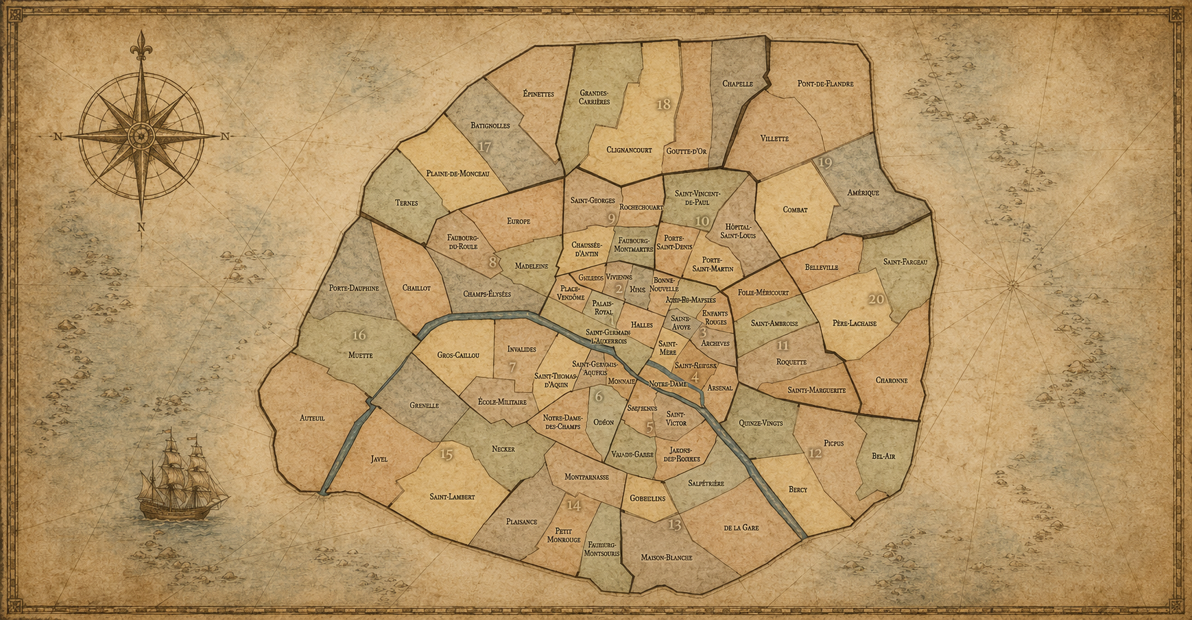
Paris can be explored through several overlapping neighborhood layers. Some are official, like the arrondissements and quartiers administratifs. Some are participatory, like the conseils de quartier. Others are cultural, historical, artistic, or lived, like Montmartre, Pigalle, Belleville, or Saint-Germain-des-Prés. CityNeighborhoods Paris brings these layers together because no single map can fully explain how Paris is experienced.
The broadest layer is the arrondissement. Each arrondissements is divided into four administrative quarters. Conseils de quartier show a more local civic layer. Cultural neighborhoods reveal the names and identities people often recognize through history, reputation, art, nightlife, religion, literature, commerce, or daily life. Together, these layers let visitors move from the citywide structure of Paris to the more intimate experience of its neighborhoods.
Where To Begin
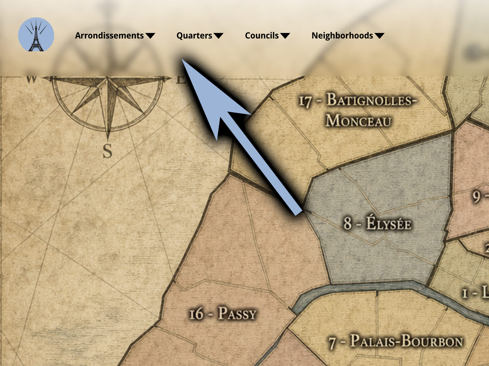
Start with Arrondissements if you want the broad overview of a major district. Choose Quarters if you want the most detailed official neighborhood profiles, including maps, history, photography, and Flâneur Notes. Choose Councils if you are interested in local civic geography and participatory neighborhood identity. Choose Neighborhoods if you want cultural districts, historical areas, or places whose identities may cross official boundaries.
On each neighborhood page, look for sections such as Geographic Setting, Civic Framework, Parisian Identity, Neighborhood Distinction, History, Photography, and Flâneur Notes. You do not need to read every page from top to bottom. Choose the layer or section that matches what you are trying to understand. For quick navigation across the full site, use the Chronicles section, especially the Index, Cartographies, and Flâneur Journal.
What Is Each Neighborhood Like?
What To Know
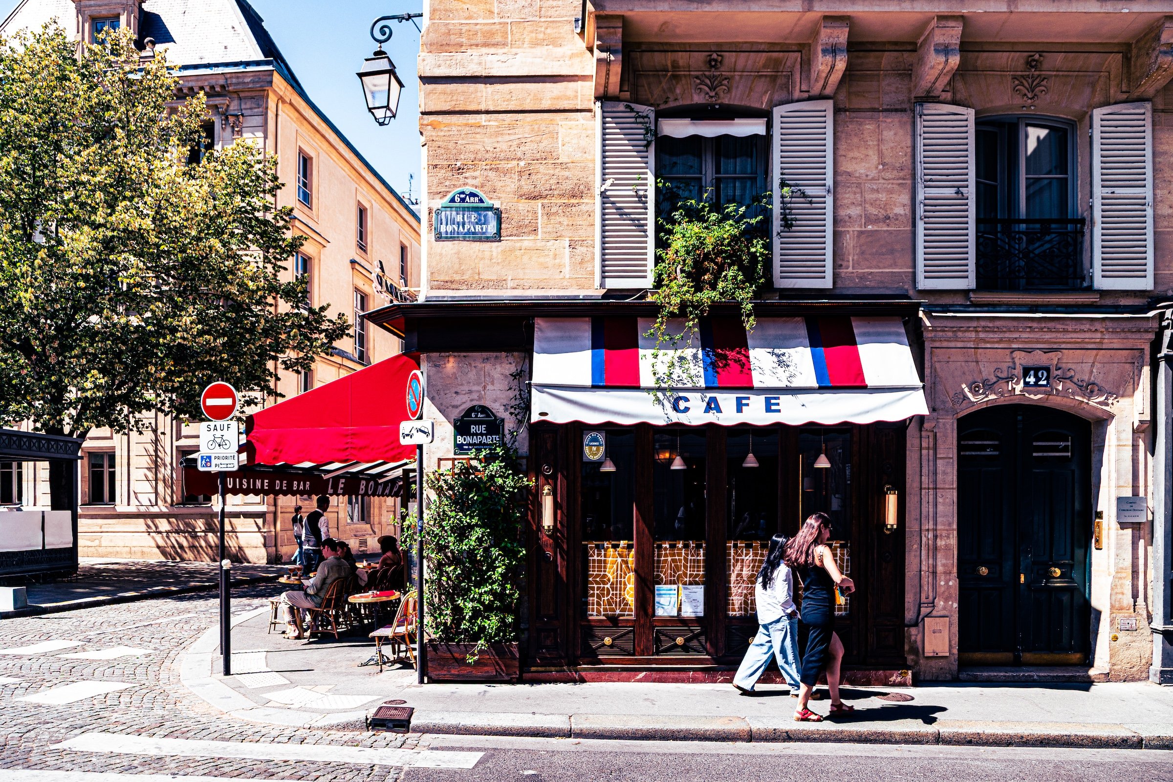
Each neighborhood in Paris has its own character. Some are shaped by monuments, cafés, markets, gardens, museums, or major avenues. Others are defined by quieter details: residential streets, architecture, shopfronts, street art, courtyards, schools, churches, transit stations, or the rhythm of everyday life. CityNeighborhoods Paris looks at each district as more than a location on a map. It asks what gives the place its identity.
On individual pages, this question is explored through sections such as Geographic Setting, Civic Framework, Parisian Identity, Neighborhood Distinction, Visual Identity, Through the Lens, and Flâneur Notes. Together, these sections describe where a neighborhood is, how it fits into Paris, what makes it distinct, how it appears visually, and how it was experienced through photography and walking.
Where To Begin
To learn what a neighborhood is like, open any Arrondissement, Quarter, Council, or Neighborhood page and use the section buttons near the top of the page. Choose Identity if you want the clearest written overview of the place. On Administrative Quarter pages, this will bring you to sections such as Etymology and Origins, Civic Framework, Parisian Identity, and Neighborhood Distinction. These sections explain the name, boundaries, civic role, local character, and how the neighborhood differs from nearby districts.
For a quicker visual path, use the image-and-button row beneath the main introduction. The Identity button leads to the written identity sections, while Photography leads to Visual Identity, Through the Lens, Flâneur Notes, galleries, slideshows, and print links. If you want to compare related places, look for Neighborhood Connections, which links the page to its arrondissement, administrative quarters, conseils de quartier, and cultural neighborhoods.
What Is The History Of Each Neighborhood?
What To Know

CityNeighborhoods Paris approaches history at the neighborhood scale. Instead of treating Paris only as one citywide timeline, each page looks at how a specific district developed over time: its origins, older place-names, civic boundaries, religious institutions, streets, markets, industries, monuments, cultural roles, and changing relationship to the wider city.
The history sections are meant to show how each neighborhood became itself. Some places are shaped by medieval streets or former villages. Others by royal institutions, Haussmannian planning, industrial growth, modern redevelopment, artistic movements, immigration, commerce, or civic reorganization. Together, these histories reveal Paris as a layered city where the past remains visible in names, streets, buildings, boundaries, and everyday neighborhood identity.
Where To Begin
To find a neighborhood’s history, open an Arrondissement, Administrative Quarter, Council, or Cultural Neighborhood page and use the section buttons near the top of the page. Click History if you want to jump directly to the historical timeline. On Arrondissement and Administrative Quarter pages, the History section is usually organized by era, beginning with Origins and continuing through major periods such as the 16th–17th Century, 18th Century, 19th Century, Early–Mid 20th Century, Late 20th Century, 21st Century, and Spirit and Legacy.
If you want the broad historical context, start with an Arrondissement page. If you want the most detailed local history, choose an Administrative Quarter page. If you are exploring a well-known cultural area, use a Cultural Neighborhood page to understand the history, reputation, and lived identity of that district. For quick navigation, use the Index in the Chronicles section to find the arrondissement, administrative quarter, conseil de quartier, or cultural neighborhood you want, then scroll or click to History.
How Do I Explore The Maps?
What To Know
Maps are one of the central ways CityNeighborhoods Paris explains the city. They show where each district is, how it fits into surrounding neighborhoods, and how different layers of Paris overlap. Some maps focus on official boundaries, such as arrondissements, administrative quarters, and conseils de quartier. Others help show cultural neighborhoods, river geographies, walking routes, or the broader visual structure of the city.
The maps are not only decorative. They are part of how the site makes Paris legible. A neighborhood can be understood through its history, identity, photography, and field notes, but its map gives those ideas shape. It shows whether a place is central or peripheral, compact or expansive, riverside or inland, isolated or connected to nearby districts.
Where To Begin
On any individual Arrondissement, Administrative Quarter, Council, or Cultural Neighborhood page, use the section buttons near the top of the page and click Map. This will take you to the page’s map section, where you can see that specific place in relation to the rest of Paris. On many pages, the Photography section may also include route maps, Flâneur Notes, galleries, or visual material connected to the actual day the neighborhood was photographed.
For the full map archive, open Chronicles and choose Cartographies. The Cartographies page gathers the major CityNeighborhoods Paris maps in one place, including maps of arrondissements, administrative quarters, conseils de quartier, cultural neighborhoods, and other ways of seeing the city. Use individual pages when you want a map for one specific place. Use Cartographies when you want to compare layers, browse the city visually, or understand how the different neighborhood systems fit together.
What Is It Like To Walk Paris?
What To Know
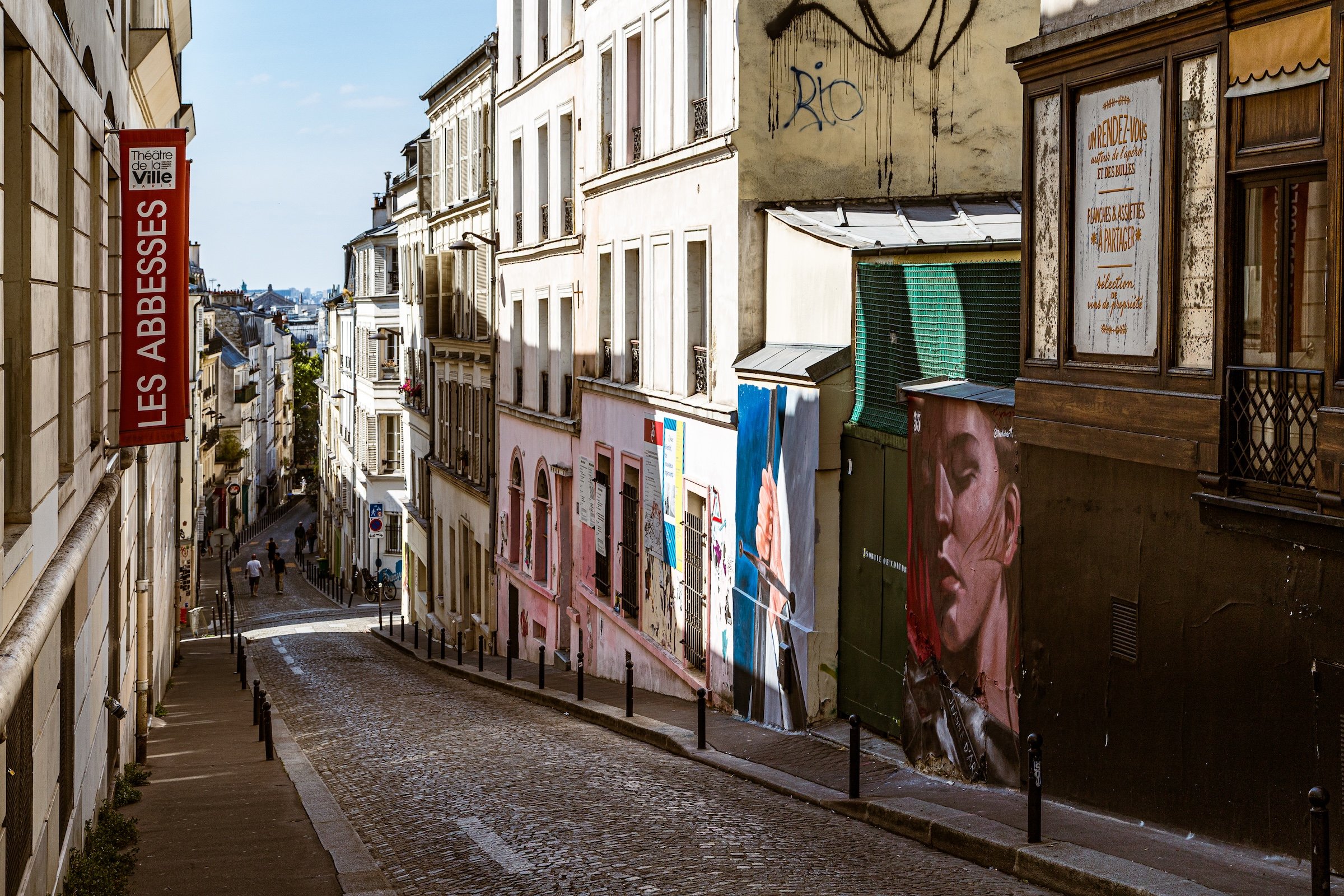
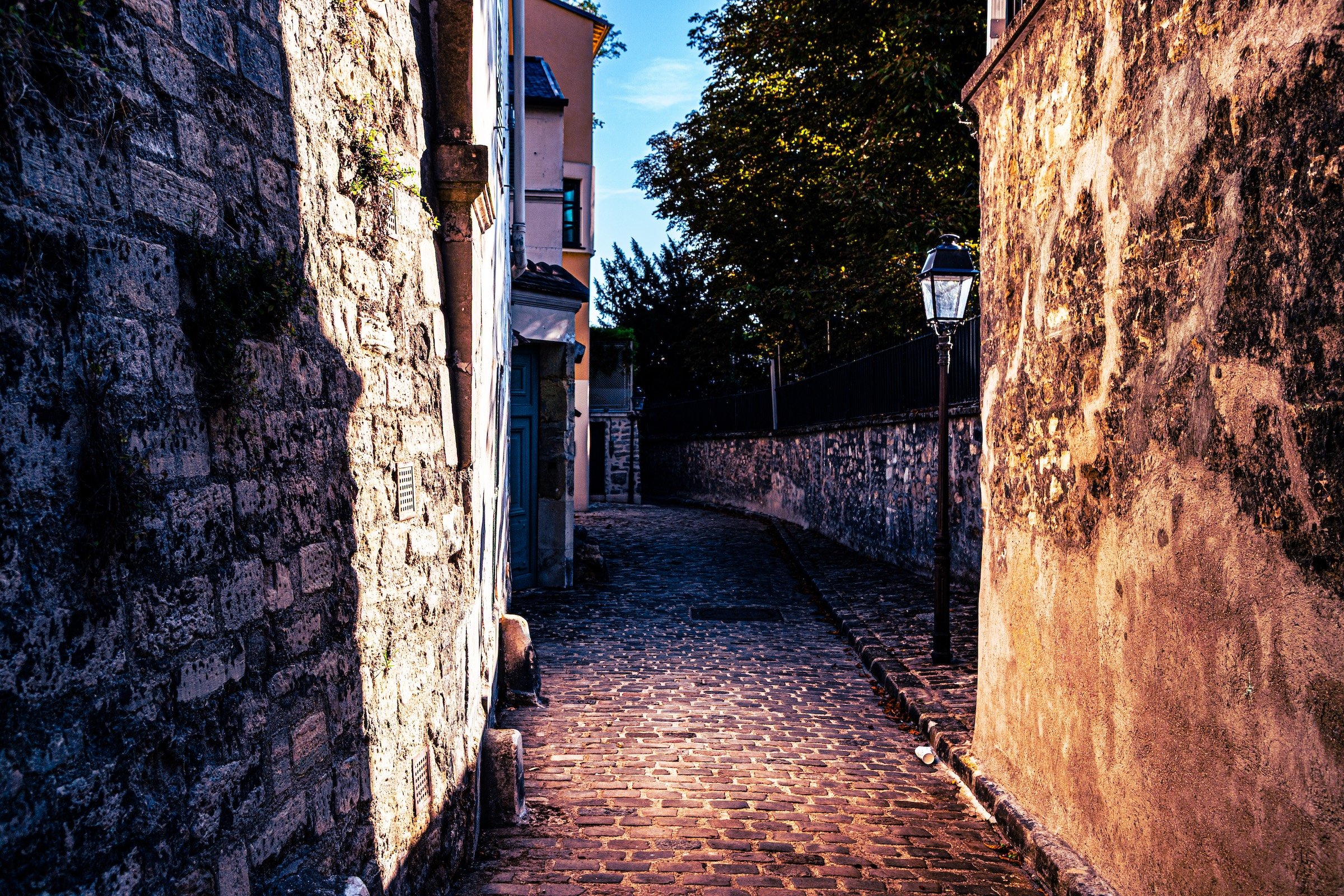
CityNeighborhoods Paris is built from walking, photographing, observing, and returning later to reflect on what was encountered. The idea of the flâneur is central to that process: moving through the city with attention, curiosity, and openness to what the streets reveal. A walk may begin with a route or destination, but its meaning often comes from the unexpected details along the way — light, architecture, signs, cafés, side streets, people, weather, texture, and the rhythm of the neighborhood itself.
Walking Paris is not only about reaching landmarks. It is about letting the city unfold at street level. The Flâneur Notes document how each place was experienced during an actual visit: what the light was like, what streets were followed, what stood out, what felt surprising, and how the neighborhood imprinted itself on the walker and the camera. These notes help connect the site’s maps, histories, and identities to the lived experience of moving through Paris.
Where To Begin
On any individual Arrondissement, Administrative Quarter, Council, or Cultural Neighborhood page, scroll to the Photography section and look for Flâneur Notes. These entries are organized by date when a place has been visited more than once. They describe the actual walk or encounter behind that page, often including the time of day, route, weather, impressions, and how the neighborhood appeared through photography.
For the larger walking archive, open Chronicles and choose the Flâneur Journal. That page organizes the photographed days and routes behind CityNeighborhoods Paris, including trip summaries, Lightroom route maps, photo counts, places visited, and links to fuller entries. Use the Flâneur Notes on individual pages when you want to understand one specific neighborhood. Use the Flâneur Journal when you want to follow the larger journey through Paris by day, route, and photographic encounter.
Where Can I See The Photography?
What To Know
Photography is the heart of CityNeighborhoods Paris. The maps, histories, and neighborhood structures provide context, but the photographs are the encounters themselves: the streets walked, the light observed, the buildings framed, the details noticed, and the moments preserved. Each image is part of the larger effort to document Paris through its districts, not only as a city of famous landmarks, but as a city of lived places.
The photography sections help visitors see how each neighborhood was experienced visually. Visual Identity describes how a place presents itself through architecture, streets, light, scale, texture, and atmosphere. Through the Lens reflects on what the camera revealed during a specific visit. Galleries, slideshows, videos, and print links then provide the fuller visual record behind the written entries.
Where To Begin
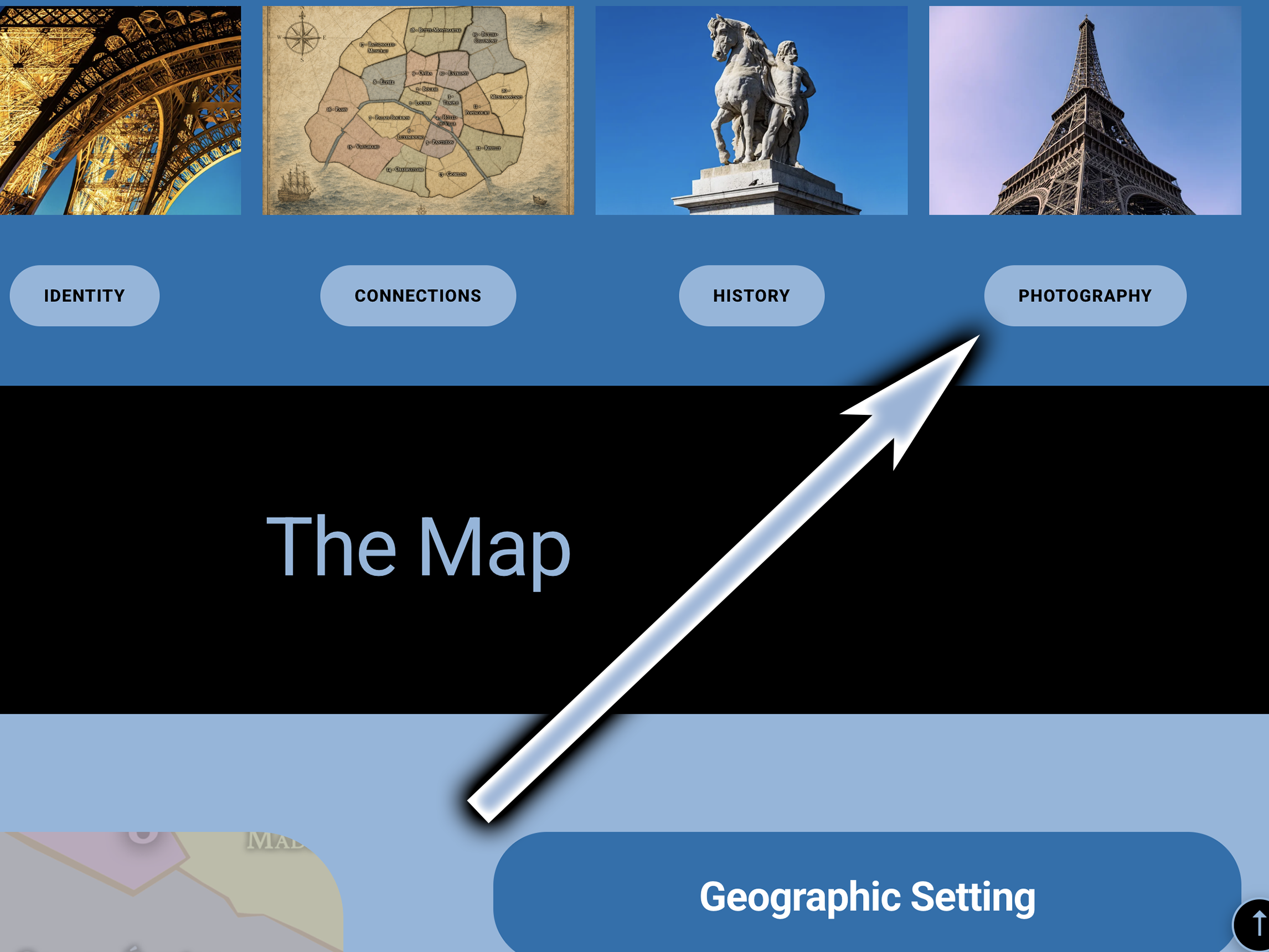
On any individual Arrondissement, Administrative Quarter, Council, or Cultural Neighborhood page, scroll to the Photography section. There you may find Visual Identity, Through the Lens, Flâneur Notes, selected image galleries, embedded slideshows, YouTube videos, and links to view full galleries or purchase prints. If a place has been visited more than once, some entries may be organized by date so you can see how different visits revealed different versions of the same neighborhood.
For a broader guide to the photographic side of the project, open Chronicles and choose the Photography Guide. That page explains how photography works across CityNeighborhoods Paris, including Visual Identity, Through the Lens, Flâneur Notes, galleries, slideshows, videos, prints, and the Flâneur Journal. Use the Photography section on individual pages when you want to see one specific place. Use the Photography page when you want to understand how the whole visual archive fits together.
What Are The Paris Chronicles?
What To Know
The Paris Chronicles are the guide, archive, and reflection section of CityNeighborhoods Paris. While the main navigation organizes the city through Arrondissements, Quarters, Councils, and Neighborhoods, the Chronicles section helps explain how to move through the project itself. It gathers the pages that make the site easier to explore: maps, indexes, photography guides, walking records, project updates, and explanations of how the city’s layers fit together.
Think of the Paris Chronicles as the orientation wing of the website. It is where visitors can step back from one specific neighborhood and see the larger project: how Paris is mapped, how the photographs were made, how the walks unfolded, how the site is organized, and how the different official, civic, cultural, historical, and visual layers connect.
Where To Begin
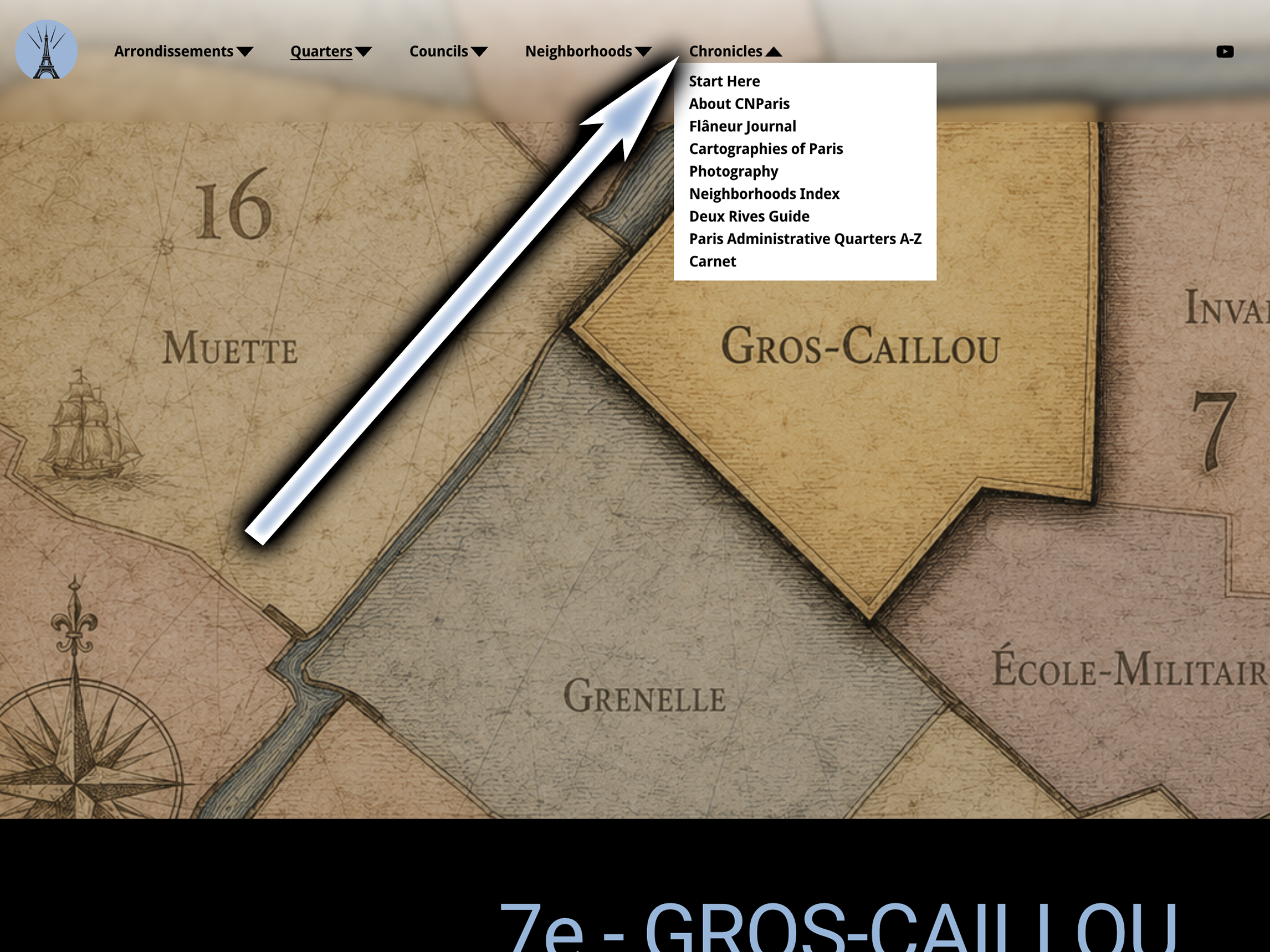
Use the Chronicles dropdown in the main header navigation. Choose Start Here if you want help using the website. Choose Index if you want a quick arrondissement-by-arrondissement directory of pages. Choose Cartographies if you want the full map archive. Choose Flâneur Journal if you want to follow the photographed days, routes, and fieldwork behind the project.
Choose Photography if you want to understand where to find galleries, slideshows, videos, prints, Visual Identity, Through the Lens, and Flâneur Notes. Choose Carnet de Paris for site updates, announcements, reflections, and longer posts. If the main neighborhood pages are the places themselves, the Paris Chronicles are the guides that help you understand how to enter, read, and explore them.
Explore Paris
-

The twenty arrondissements form the civic spiral of Paris, organizing the city into its broad local districts of government, identity, and daily life.
-

Each arrondissement is divided into four official administrative quarters, giving Paris a more precise civic and geographic framework.
-

The conseils de quartier bring participation to street level, giving residents a voice in neighborhood needs, public space, and local civic life.
-

Les Deux Rives trace Paris through the Seine’s two banks, revealing how the Rive Droite and Rive Gauche shaped the city’s civic power, commerce, learning, art, and cultural identity.
-

Cultural neighborhoods reveal the Paris people recognize through history, cafés, architecture, memory, atmosphere, and local belonging.